KofA Thunderhead Picture of the Week

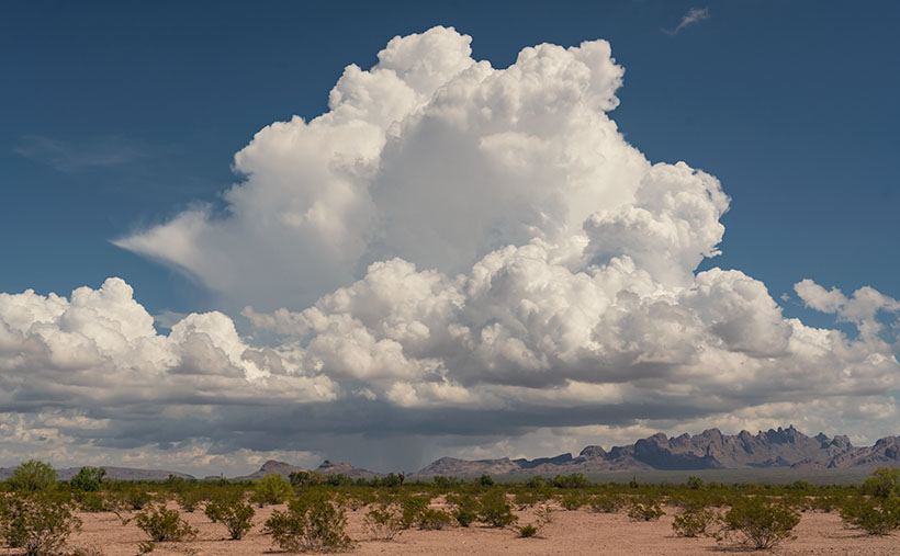
KofA Thunderhead - An autumn thunderhead builds over the KofA Mountains in western Arizona.
KofA Thunderhead – An autumn thunderhead builds over the KofA Mountains in western Arizona.

Each time Queen Anne and I jump into the car; I pack a camera in the back seat. I don’t mean on local errands like a trip to the grocery store but on drives longer than an hour. Rarely do I stop to take a picture, but should one of those once-in-a-lifetime moments happens, I’m ready.

If I capture some unique photographs, they don’t fit our usual workflow. We usually pick a location as a month-long project and photograph enough shots for a month of articles (or even a book). My one-of-shots along the highway traditionally become forgotten orphans. No one gets to see them—until now.

For December, I decided to make this month’s project out of the non-project shots I collected this year. With these four pictures, a special moment made me pull over and stop the car. That’s pretty hard to do because once I have a destination set in my mind, I only stop for gas, a candy bar, and bladder relief.

Anne and I run to Mexico about four times a year. We go to Algodones to see our dentist and buy 90 days worth of prescriptions. We’re on Medicare, and we have a gap plan that pays for most of the pills we take, but some of the select drugs (hint: you see them advertised on TV) are so much cheaper in Mexico that it pays for the drive. If we don’t have to wait on the dentist, we can make a drug run in a day. We leave here at 8:00 am, walk two blocks across the border, stop at Mickey D’s for lunch, and get home by 5:00 pm.

That was our itinerary on September 22—the first fall day. As we drove home on Highway US 93, I watched a single thunderhead building thirty miles north over the KofA Mountains. I thought it unusual to have monsoon activity in autumn and a single storm cell develop so far west in Arizona. I spent the next half hour arguing with myself.

“That will be a great shot if the clouds hold together until we get there.”

“If we stop, we’ll get home after dark.”

“It’s an isolated cell, and it’s posing like a runway model.”

“It’s the wrong time of day, and the light is wrong.”

Just after passing the Border Patrol station that marks halfway between Yuma and Quartzsite, I noticed that the cloud was beginning to tear apart (the wispy part on the tower’s left side). It was time to stop the car. I reached back for my camera and hiked a few steps off the highway. I set the zoom-lens as wide as possible before framing and then snapping a couple of shots. I call this week’s featured image KofA Thunderhead.

The spot where I stopped was several miles away, and for perspective, the jagged KofA peaks rise a couple of thousand feet above the 500-foot high basin. That makes the billowing cumulus top nearly 40,000 feet in the air. Unfortunately, I didn’t capture any lightning strikes beneath the storm.

We returned to the road and continued the drive, watching the storm evolve. The upper winds blew the clouds apart by the time we were due east of it. That’s when we saw a funnel cloud drop below the ceiling. The tornado briefly touched the ground near Crystal Hill Road before it disappeared.

We weren’t done with it yet. After stopping for gas in Quartzsite, the storm ambushed us on the pass at Guadalupe Mountain. As it moved north over Interstate 10, it dumped rain so hard that the wipers couldn’t keep up, and traffic slowed to a crawl. We hoped we wouldn’t be surprised by a second tornado, but after a mile or so, we broke into the clear, and the deluge was only an image in the mirror.

You can see a larger version of KofA Thunderhead on its Webpage by clicking here. Next week, I’ll drag out another orphan photo for show and tell. We’ll see you then.

Till next time
jw

BTW:

Anne and I are negotiating next year’s schedule, so there will be a lot of yelling and screaming around here during the holidays. Pay no attention to the man behind the curtains.

Dune Moon Picture of the Week

When Queen Anne and I make our quarterly medical run-to-the-border, the drive is usually three-hours each way. Most of the time, we leave at dawn, see our dentist, buy prescriptions, and then come home. For me, those are long days behind the wheel; for Anne, not so much. She’s usually asleep in the passenger seat until her snoring wakes her up.

Occasionally when we have lab work done, or the customs line is three-hours long because the snow-birds have arrived, we’ll get a room in the elegant east-side Motel 6 and dine at the swanky four-star Denney’s. Our December visit was one of those occasions. Since I needed a topic for January’s posts anyway, we spent an extra night and took a circuitous route home—we’d go up to Blyth to work the Algodones Sand Dunes for this month’s project.

The great swath of sand starts about three miles south of the border outside of Los Algodones, Baja. It continues 45 miles northwest into the Coachella Valley (California’s Imperial Valley). They’re the most extensive contiguous dune system in the U.S. The dunes are also called the Imperial Dunes, Glamis Dunes, and Gordon’s Well. The name varies with location and the leisure activity you’re doing. Still, the entire system is officially named Algodones Dunes (in Spanish, it means cotton plant—the predominant crop grown on both sides of the border along the Colorado River). This week, we’ll start west of Yuma at the Mexican border—at Gordon’s Well.

Imagine it’s 1850, and you’ve traveled by wagon hundreds of miles across the scorching Sonoran Desert, forded a raging Colorado River, and finally crossed into California. You’d think your hardships are behind, but then, you’re greeted with 6 miles of Sahara-like sand to cross. With each step, you sink up to your knees. Even in 1926, when the nation’s first Ocean to Ocean highway was built (U.S. Route 80), the shifting sand was an engineering nightmare. They couldn’t simply scrape the sand away because the prevailing wind constantly covered it up again. Even today, if you’re caught in a windstorm along this section of road, you’ll risk a chance that the sand will blast the paint off your car.

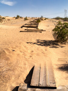
Plank Road - You can see what's left of the old plank road on display at Gordon's Well.
Plank Road – You can see what’s left of the old plank road on display at Gordon’s Well.

The road builder’s solution for getting across was to build a plank road—movable wood sections on railroad-lie ties that floated on the sand’s top. It turned out to be challenging to maintain, but it drastically cut the crossing time when it was clear. Eventually, the planks were replaced with new and expensive asphalt, and eventually, it became Interstate 8. There is a section of the original plank road at Gordon’s Well on display. When you grow tired of looking at the old wood road, you can walk over to the border wall and lean on it.

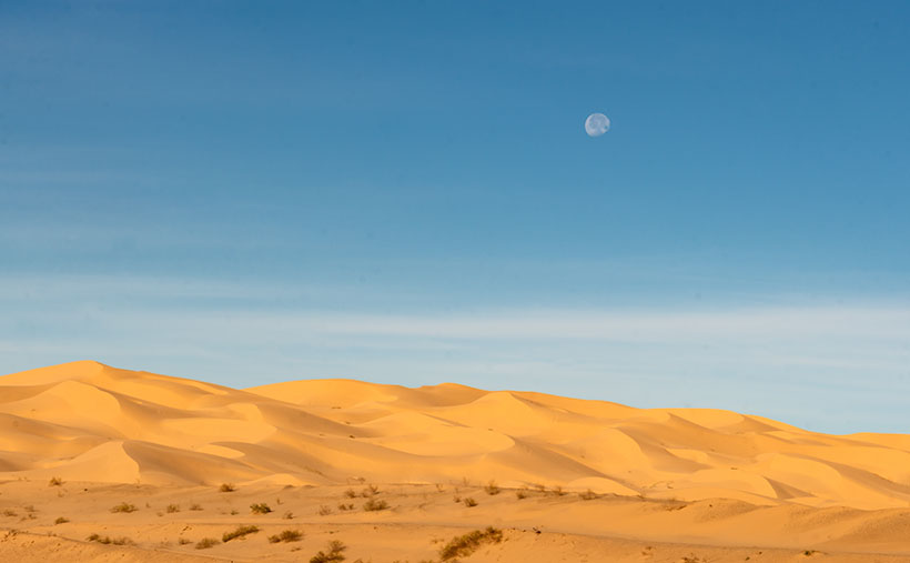
Dune Moon - A waning gibbons moon setting over the Algodones Dunes west of Winterhaven, California.
Dune Moon – A waning gibbons moon sets over the Algodones Dunes west of Winterhaven, California.

As Anne and I drove west on the freeway, we spotted a waning moon setting on the dunes, so we looked for a place to stop. We’ve got stuck in these sands once before, so we were careful not to drive off the blacktop. I didn’t want to pay for another hook to come to yank us out. As you can see, we found a good spot and took this week’s picture called Dune Moon. The name could have been funnier if I had shot it during a particular summer month. Se la vie.

You can see a larger version of Dune Moon on its Web Page by clicking here. Next week we drive north up the Imperial Valley to visit the northern dune crossing. Be sure to come back and see what we found.

Until next time — jw

Local News At Its Best

Breakfast at Brownie's
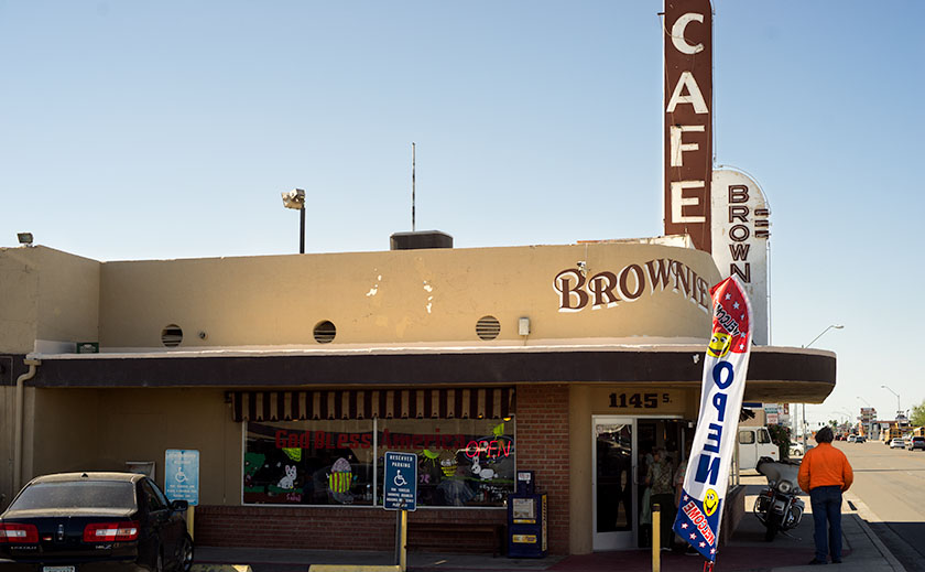
A local Yuma favorite since 1946, Brownie’s is on my list when I’m in town.

We’re back this evening from an overnight Yuma trip where I was reminded of what is essential in local news. We had the TV on while we were getting ready to leave the motel. Like most local stations throughout the country, Yuma’s local broadcast talent was on doling out the news, weather, and traffic. I know, it’s good to know how long it will take to get to work. But in this case, instead of helping the viewers avoid the freeway bottlenecks, Channel 11 reported how long the lines were at the Customs and Immigration inspection stations. And you thought your daily commute was silly.

Till then … jw

Yuma Again

Queen and I did our quarterly dentist run early this week. I’ve already talked about Algodones, so I don’t want to discuss the border town again, except to say that the weather has grown much warmer and the snowbirds that flock to the western Arizona counties have grown thin. The lines at the Customs Station are nil. We were able to get on the road home by 2:30 yesterday.

Today I want to talk about a couple of Yuma bright spots. There aren’t many, so when I find one, it’s a pleasant surprise. Yuma has a Marine base and in winter when the snowbirds arrive, its population triples . Other than that, most people only get off the interstate to top off the gas tank on their way to San Diego (or back).

If our dental visits call for lab work, we’ll book a room in a chain motel. Most of them include a (so-called) breakfast. Generally the fare consists of packaged microwave rubber omelets, assorted cold cereal, fruit, waffles (if you’re lucky) and/or toast and bagels. At best, it’s airline food, but it saves having to walk across the street to Mickey D’s. That’s what we did until our last trip when I convinced Anne to forgo the buffet for Brownie’s Café.

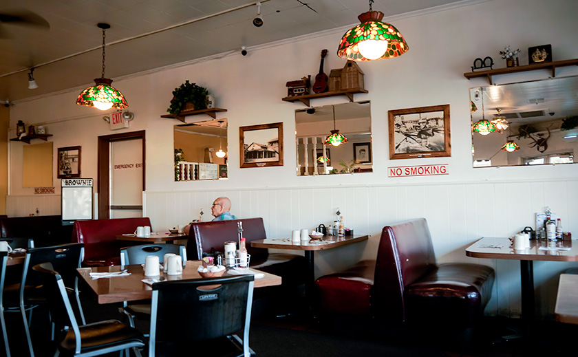
Browies Cafe
The place ain’t swank, but the place is always crowed and the food is old-fashioned good. Locate on South 4th Avenue off Interstate 8.

My first meal at Brownie’s was on a solo trip to Yuma. While exploring south 4th Avenue one morning, I spotted the large Café sign and thought that it would be really good or really bad, so I stopped to find out. The packed parking lot is usually a good sign. I stopped again with Jeff on our photo trip to the Salton Sea a couple of years later. After two more meals with Anne, I’m convinced it’s a gem right out of The Twilight Zone.

It’s a counter diner from the 1950s. The back dining area, crowed with tables and booths, is always filled with patrons, but on weekdays, you can usually find an open table. As you look around the room, you’re assured that this isn’t a campy place nostalgically decorated; this is the real thing and has probably been this way for thirty years. The building and the decor have been there for a while and they show wear. To put it bluntly; this is not a shiny new place. If that’s a key point of yours, go somewhere else.

In the table’s center are four beige half-inch thick industrial ceramic coffee cups. When you turn one right-side-up, the wait-staff instantly fills it without asking as they deliver the menus. The menu nothing fancy on it; instead there are all the items you’d expect. The plates are not large, but the food is properly cooked, just as you ordered.

My favorite is the Walt Kammann Sausage and eggs. The sausage is from a local butcher that has made it for over fifty years. It’s similar to a brat but spicier with flavors like linguica (Portuguese sausage) and lots of  fennel like you find in Italian sausage. The sausage is a point of pride in Yuma.

Yuma Mural
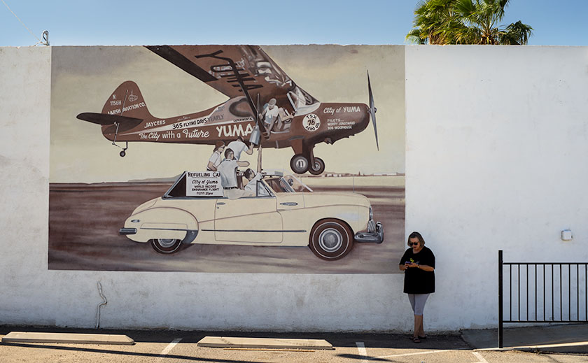
Anne checks her cell phone by one of the murals at Yuma Landing.

North of Brownie’s on 4th Avenue is a place called Yuma Landing with a Restaurant of the same name. I had always assumed that the name came from nautical origins, probably from Colorado Steamboats or something of that sort. I was mistaken. When we stopped to look at a monument, I found out the name comes from early aviation. In 1911, pilot Robert Fowler landed the first airplane ever in Arizona on that site. He was on a cross country trip flying a Wright Model B biplane which he completed in Florida forty-nine days later. The place has a plaque, a statue of Mr. Fowler and a couple of cool murals. It’s a big deal for Yumans . . . probably because nothing else interesting has happened in Yuma since.

Till then . . . jw