Bonanza Creek – Yukon

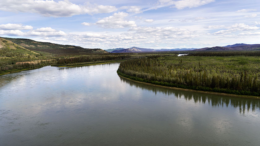
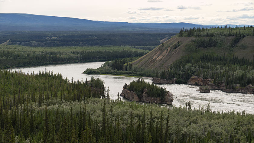
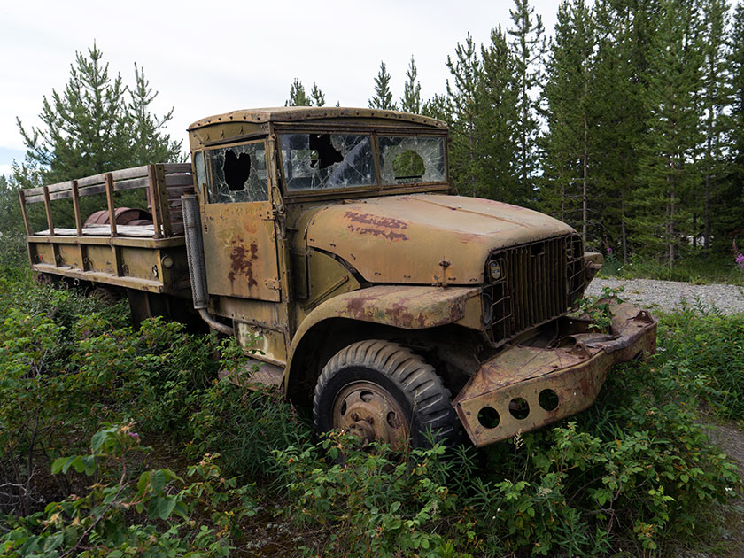
A couple of days ago, my friend Jeff wrote in a post comment that he had noticed strange snake-like formations along each side of the road near Dawson City, and he wondered if I could find out what they were. As you drive into Dawson, it’s obvious what he was talking about, because they’re everywhere. When he asked, I thought I would just reply with an answer, but since these ‘strange’ formation are an interesting part of the Yukon history, I’ll turn it into a full post.

The formations that he noticed are huge piles of river rock and they make ten foot mounds. The tops of the piles have and undulating pattern and they sweep back and forth. Some of them are newer with no vegetation growing, while others are already covered with trees.

Dredge Piles
The piles of river rocks are the tailing of a placer mining dredge.

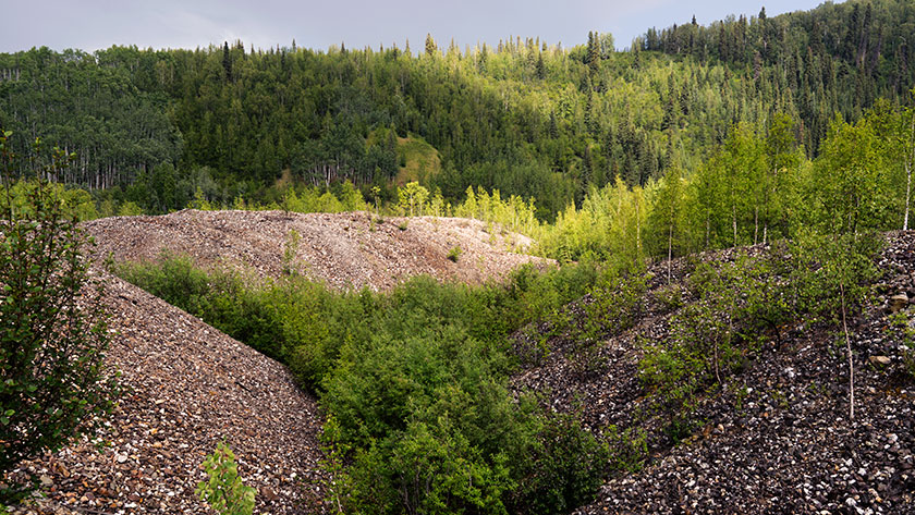
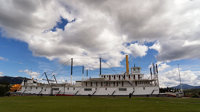
The piles are simply river bottom dredged from the creek bottom and piled along the bank. It was one of these contraptions that made these piles:

Dredge No. 4
Dredge No. 4 worked the Bonanza Creek until operations stopped. It’s now undergoing full restoration at its last place.

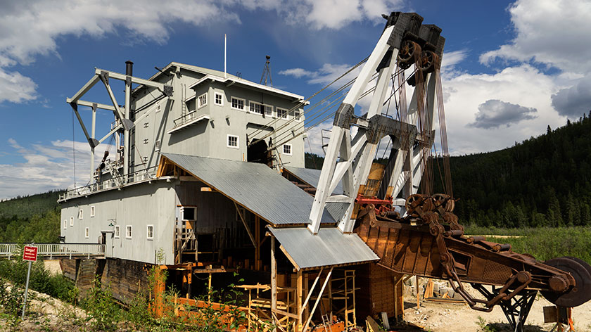
This is the No. 4 Dredge on Bonanza Creek and is under going full  restoration. During the short placer mining season a crew of four would run one of these babies twenty-four hours a day. The would dredge up the bottom and sides of rivers, process the load on board, then dump the tailing out the other side. When they ran, they could fill up a normal dump truck every three seconds. At the height of the gold rush, there were twenty-seven of these eight story monsters running at the same time.

Crews positioned them at the mouth of a water-way and they would work their way upstream. Before they could start work, all the vegetation was stripped from the land. If you lived in the way, you were out of luck, because mineral rights trumped property rights. Then the permafrost had to me melted, by pumping steam into the ground. Finally the dredge would crawl its way up the creek at a rate of a foot a day.

Strip mining at it’s best, Ah? The units were 95% efficient, so the area is still crawling with miners working active claims. Fred and I visited the original claim today, which is a park called the Discover Claim, and wondered if any gold was left. We both doubted it, but picked up a shiny rock in the creek anyway.

jw

Carmacks – Yukon Terratories

Our drive to Carmacks today was an easy one. It wasn’t too far, the roads were all in good shape and there weren’t any steep passes. As it happens, we were in our camp and setting up in time for lunch.

There isn’t much of a town, a couple of stores and a gas station along with the RV Park we’re in. There is a bit of history about the town and the person it was named after. George Washington Carmack was a miner who explored the Yukon and found a vein of coal near here. His great fame came later when he discovered the gold nugget that set off the Klondike Gold Rush and the Klondike Gold Field between here and Dawson.

The Yukon River Above Carmacks
The Yukon River makes a sweeping S curve through the town of Carmacks.

The country is beautiful and the Yukon River flows north until it makes a couple of sweeping bends around the town before heading north again. We had time to stop and read the roadside information signs and they explained that the mountains are formed from conglomerate rock. Like concrete it’s made up of smaller rock glued together with mud (instead of cement). Part of the mountains sloughed off creating a formation called the Whitehorse Trough and the highway runs its length.

Downstream from here is a rapids called Five Finger Rapids. There are four large formations of these conglomerate rock in the river and since they’re more resistant to erosion, they’ve created a fall in the river. To get the steamboats  through the rapids, engineers had to build a cable and wench system to haul the boats up and down.

Five Finger Rapids
Four formations made up of conglomerate rock create a rapids below the town of Carmacks.

Since our back door is on the Yukon, Fred and I got in some fishing before dinner. We finally landed something. I caught an Arctic Grayling and a White Fish, while Fred landed two more Grayling. I feel a lot better about all the new fishing equipment now that we’ve actually caught something.

jw

Yukon River – Yukon Terratories

This was our last full day in Whitehorse. Fred and I tried to fish the Yukon River and got skunked again this morning, but we each had a strike, or at least that’s what we told each other. The rest of the day we stocked up with needed staples then did a little sightseeing.

While we played tourist yesterday, we never got to the town’s biggest museum piece, so we made a point to stop at the paddle-wheeler Klondike in the afternoon. It is the riverboat hauled ore and supplies between Dawson City and Whitehorse on the Yukon River. It’s a huge ship with two 450hp steam engines and it took half of a forest to fuel the boiler.

The Klondike Paddle-wheeler.
Anne checks out the Klondike paddle wheel riverboat.

Going down stream it took more than a day with one stop for wood, but coming back to Whitehorse against the current the trip was over four days with as many refueling stops. As you would expect the ship is in mint condition with era specific supply boxes and simulated bags of silver stacked neatly in the cargo hold. Since we were second class passengers we didn’t get to see the first class cabins or the wheelhouse. That would have interested me.

The Klondike Galley
The galley of the Klondike is stocked with plates and cookware from its era.

Back at camp, I had to go look at the WWII era military vehicles lined up beside the entrance. I’m not certain if these were used for the construction of the Alaska/Canada Highway or not, but as with Route 66 kitsch at home, any memorabilia that can tie in with the theme is helpful. There are about five on display and although they’re not restored, they really aren’t in bad shape. I’m sure they could be used in a collection somewhere instead of yard art along the road.

WWII Trucks as Yard Art
Our campgrounds has five different 40s era military vehicles lining the driveway for decoration.

Tomorrow, we’re going to make a side trip off of the Alaska Highway and head north to Dawson City. That’s the other big town in the Yukon and it is highly recommended. It’s also the home of author Jack London, whom I read as a lad. On the same street is the cabin of Robert Service, Yukon’s  famous poet.

We’re going to break the trip up by making a stop midway in a town called Carmacks, a small town on the banks of the Yukon River. Then on to Dawson City for a couple of days. After that we will be in . . . (ta-DA!) Alaska after almost a month of traveling.

jw

Yukon Territories

We’ve arrived in the Yukon and <best pirate voice> least ye be warned mates, pirates in these waters be </pirate voice>. More about that later, but first I want to talk about the trip.

For those of you interested in maps, here’s a fun fact for you. The British Columbia/Yukon border is the 60th parallel. We made the 320 mile trip from Fort Nelson to Watson Lake and we are now in the Yukon Territories. That means we’re less than seven degrees from the Arctic Circle; land of the midnight sun.

The Alaskand Highway
The Alaska – Canada Highway as it passes through the northern Rockies.

Today’s drive was long and complicated by several road construction crews along the way. The worst held us up for over forty-five minutes. I know that the roads have to be repaired, but why couldn’t you have done all of this work last year. Didn’t you know that Queen Anne was touring?

The highway led in a northwest direction and the snow capped peaks of the northern Rockies looming on our distant left, became a maze that the road traversed. It rained, the temperature dropped and that was were the worst construction was. Once we made it through the passes all was well again and the temperature on arrival was in the low 80s.

Stone Sheep On The Road
Stone sheep, a type of Big Horn, find salt and minerals along the roadside.

We saw a lot of game along the road. There were two or three small groups of Stone Sheep (a subset of Big Horns), two black bear, a small brown bear and numerous bison. The bison are so numerous that we don’t even count them anymore. We do slow down when they’re on the road like today.

Wye Lake
Wye Lake is across the street from our campsite.

Because the construction put us behind, we got into Watson Lake late, so we haven’t checked the town out yet. We’re going to spend three days here so I’m sure there will be updates.

Oh! The Pirates? That was the news we got at our campgrounds, which I consider the least attractive of our trip so far. It seems that up here, the Internet is considered a novel frill. All RV parks provide free service as part of your stay. In the Yukon, you also get free WiFi . . . for an hour. After that it’s $10.00 (CDN) for each additional half hour. We also get another hour on each day we stay, but have to go to the office to pick up a new user name and password.

I was upset enough that I fruitlessly protested to the inn keeper and for a brief moment thought of moving on. We’re tired however and need the rest. Besides, I have to catch a fish before Fred does.

jw