Silverton – Oregon

Capital Theater
Sunday evening, we went to Yakima’s old town to find a place for dinner. As we sat at our table, I noticed this theater across the street and went outside to shoot it and particularly, the restored painted sign on its side. Since it was cloudy out, the shot came out OK, but bland. When we finished dinner, the sun dropped below the cloud’s edge and lit the place up, so I decided to re-shoot the scene. However this time there was a group of young women doing a photo shoot of their own, so I included them into my composition.

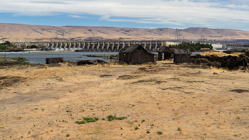
After a wonderful day of sampling Washington wines yesterday, we continued on our journey south this morning. Our route took us down the east side of the Cascades till we reached the Columbia River. After crossing the bridge into Oregon, we drove through the ever windy Columbia Gorge, where even on a Monday, there were plenty of wind surfers skimming the white-capped river. Then, just short of Portland we turned south through the Willamette Valley.

Hydro-Electrical Dam on the Columbia River.
There are several dams along the Columbia River that produce gobs of electricity. Although they cause their fair share of ecological problems, it was the power these dams generated that made it possible to produce aluminum on an industrial scale. Aircraft industry used that aluminum to build the planes that helped the allies win WWII.

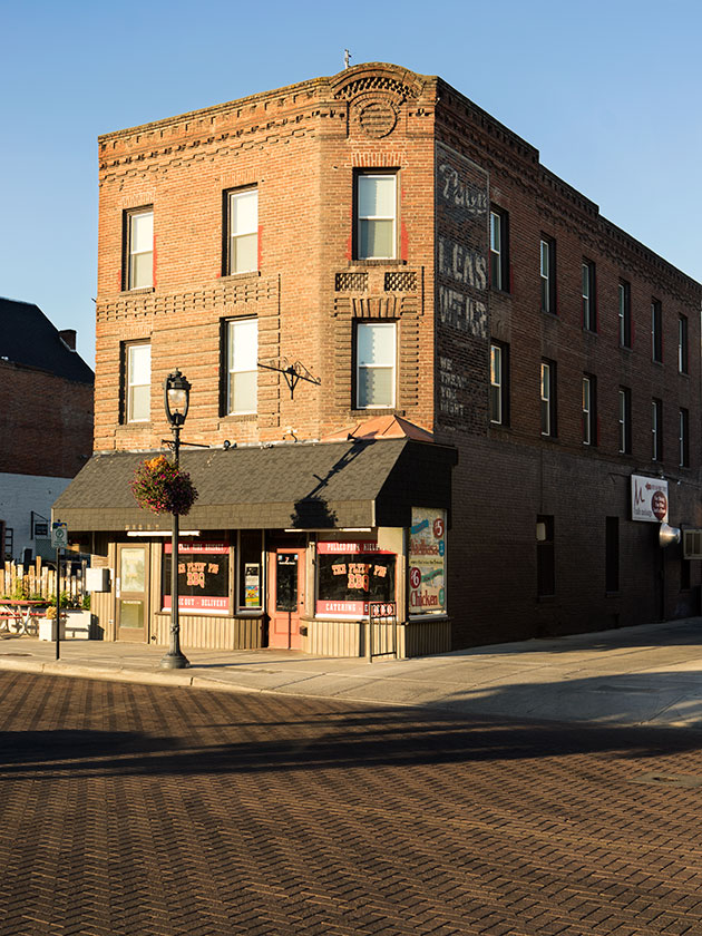
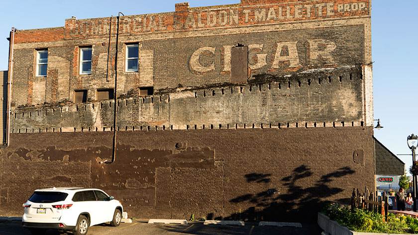
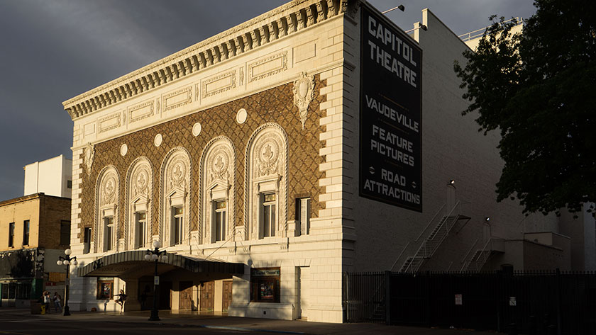
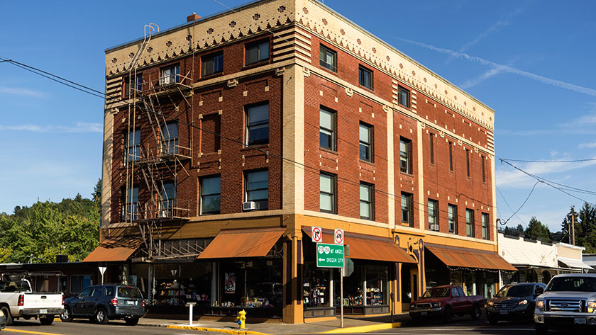
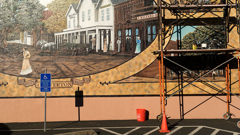
We’ve stopped in Silverton, a place we’ve visited before more than a fifteen years ago. It’s a couple of miles north of the 45th Parallel; the halfway line between the north pole and the equator. When we were last here, Silverton’s downtown was a cluster of empty historic buildings waiting for re-purposing. Now, they’re filled with boutiques, restaurants, and antique shops. It was fun to walk the couple of blocks trying to find someplace for dinner, but it was Monday, and most of the businesses were closed.

Downtown Silverton
An example of the carefully restored buildings in Silverton.

We chose Silverton because it’s a convenient base for exploring the vineyards of the Willamette Valley, Oregon’s wine country. It’s going to be a rough day tomorrow, because we have to sit down and whittle the list of stops down to six. That seems a good number for us to taste without getting our taste buds confused.

Sllverton Mural
A new mural is being painted on a blank wall of a Silverton Building.

After we leave here on Wednesday, we’ll head toward south Oregon then make our way over to the Pacific Coast. We want to spend some time along the coast before we go through the Sonoma/Napa Valleys. As much as we’d like to add some of those bottles to our collection, they may be out of our budget. There’s no harm in finding out, is there?

jw

Yakima – Washington

It felt good to leave the Seattle noise and traffic behind today. The weather was sunny and dry with highs near 90, but the evenings cooled down enough to sleep with the windows open. If you like to have background noise while falling asleep, the Seattle freeways do a great job of providing that.

This morning we climbed over the Cascades to get to Yakima. This section of road kept confusing my senses. It never felt like we were going up a steep grade. Several times, I thought we were going downhill, but the big trucks were lumbering in the slow lane and my mileage gauge kept going down.

The west side has dense forest with lots of lakes and streams. The tall trees on either side of the highway acted like horse blinders hiding everything behind them. The only clue that we were in the mountains was what little we could see of them through the front window.

Finally we reached the pass at West Summit, and began descending into the Columbia Basin and the northern reaches of the Great Basin Desert. Instead of dark green conifer trees, tawny low sage brush the terrain cover the terrain, and the views open in all directions.

As we drove through one curve, a great snow-capped volcano crowning the Cascades appeared in front of us. “Is that Rainier?” “No it can’t be, because it should be to the east of us.” Then a second one came into view to the right, “Which is that one?” “Don’t know!” Just then we passed a sign with two arrows and mountain names. It was like they knew what we were talking about. Rainier was on the right and Mount Adams was in front of us.

We left Interstate 90 at Ellensburg and picked up 82 south. We crossed another range of low hills that would make any Nevadan or Arizonan feel at home. After reaching the top, the road dropped into the Columbia Basin and Yakima. I wondered how they could grow crops here until we crossed the Yakima River. Duh! Apple orchards, hop vines and row after row of grape vines lined each side of the road.

Yakima Barn
An old barn along the Yakima Highway

The agriculture corridor runs along the Yakima River for about sixty miles and there are maybe a hundred wineries we could try if we wanted to go blind. We got into camp early enough that we had time to stop at a couple of nearby tasting rooms. I’m pleasantly surprised at how nice their red wines taste. We picked up a couple of bottles and got some recommendations for tomorrow. It’s been our experience that stopping at each vineyard along the road isn’t productive, because our taste buds get confused.

Yakima BBQ
A historic downtown Yakima building is a place for local BBQ.

On the way back to camp, we drove through old town. As you know, I love to shoot historic old buildings and I suspected that I might find some here. I was right, and I may have to get out early to shoot more in the morning. Some of the buildings have trendy restaurants, so it looks like coming here was a good choice all around.

Commercial Saloon
I love finding old painted signs on brick buildings and I think they should be preserved.

jw