We had to break from the heat last month, so we drug the trailer up to Flagstaff. We didn’t escape the humidity, though. Since it’s the height of the monsoon season, the weather in the high country was the same as at home—only 30°cooler. There’s been a lot of news earlier this summer about the Flagstaff fires, so we found an RV park on the west side of town—right where Old Route 66 merges with Interstate 40. When we got there, the seasonal rains had already quenched the burn. U.S. 89, which both fires crossed, had reopened, but Sunset Crater National Monument is still closed. It suffered extensive damage to the campgrounds and buildings (otherwise, the cinder cone and Bonita Lava Flow were unharmed).
Our trip served a couple of purposes. First, I needed topics to get this publication through the balance of the hot summer months. Second, we wanted to take Ritz (our trailer) on a shakedown cruise to see how well it and the Jeep played together. Finally, we longed to sleep under the covers with open windows in air, not contaminated with that old-person smell—we accomplished all of that. It’s hard to describe how wonderful it felt to enjoy a glass of wine outside and listen to the sound of rain on the awning. Besides, there’s no more fabulous evening entertainment than watching a newbie learn how to do their first black-tank dump (go back and watch the 2006 movie RV again).
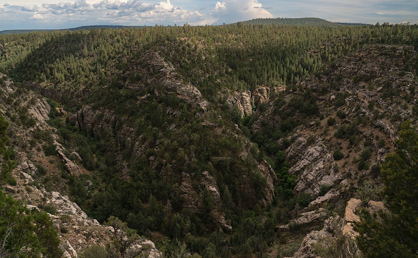
This month’s project is one of the excursions we made to a place that neither Queen Anne nor I have ever been to—Walnut Canyon National Monument. I’m not sure why we missed it. It’s only a couple of miles south of I-40 on Flagstaff’s east side. As you drive the road south, it transitions from Ponderosa Pine to Juniper, so the elevation is lower than the town. The monument is primarily known for the Sinagua cliff dwellings—which I’ll discuss in the upcoming weeks, but it’s the creek we’re interested in today.
On the Colorado Plateau, water generally flows to the Colorado River. In Flagstaff, however, someone put our state’s tallest mountain in the way, so water has to drain around the San Francisco Peaks. A couple of miles west of town, you cross the Flag Divide, where streams flow west of the mountains. East of the divide is the Rio Flag and Walnut Creek Drainage system. Here the streams flow east of the volcanoes into the Little Colorado River. Walnut Creek drains Mormon Lake, Upper Lake Mary, and Lower Lake Mary. You can count Arizona’s natural lakes with one hand, and this little creek drains three of them. Perhaps that explains how an ordinarily dry creek could carve a deep channel into the limestone. Of course, all of that happened before our 22-year drought. Today, Mormon Lake is a broad, shallow dry lake with a mud puddle marking its deep spot, and both Mary Lakes are similarly low.
In this week’s picture, we’re standing at a spot that overlooks a horseshoe bend in the creek. I took this photo from the north side of the canyon facing south. In the distance is Mormon Mountain, some 16 miles south. The lake is located on the left flank of the mountain. When the creek is wet, water flows from right to left and empties into Rio Flag several miles downstream. Then the river turns north and flows under I-40 until it reaches the Little Colorado River, about a mile east of the Grand Falls (sometimes called Chocolate Falls).
I hope you enjoy discovering Walnut Canyon and seeing this week’s image. You can view the Web version of Walnut Creek Bend on its page by clicking here. Next week, we’ll hike one of the trails and poke around some ruins displayed in the national monument. I hope you’ll join us.
Till next time
jw
