Chasing Sunrises and Freight Trains on Route 66 Pictures of the Month - Hackberry, Ariozna

A full moon setting over the Cerbat Mountains at dawn, with pastel desert hues, captured from Route 66 near Kingman, Arizona.
Kingman’s Desert Dawn – Moonset Over the Cerbat Range – As we left on historic Route 66, the full moon slowly descended behind the rugged Cerbat Mountains, casting a soft glow over the pastel-colored desert. Sub-freezing temperatures couldn’t stop me from capturing this serene moment after walking a quarter mile to avoid power lines.

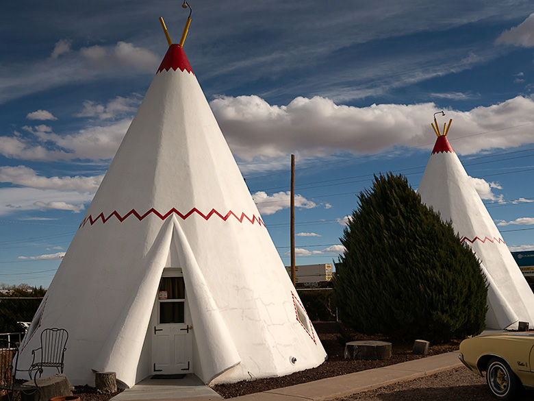
Last month, we wrapped up a late shoot in Chloride, and instead of making the long haul home, I had a brilliant idea: stay in Kingman and take the scenic route back through Hackberry, Truxton, and Seligman. That way, we’d get two stories for the price of one—and a night in a classic Route 66 motel. The neon glow of the old motor court signs flickered against the desert sky, whispering echoes of a bygone era when weary travelers pulled off the Mother Road for a night’s rest.

A second advantage to a night in Kingman was more selfish. I love Chinese food and’ll go out of my way for even a mediocre plate of Moo Shu Pork. Since Queen Anne agrees to accompany me on these shoots if I dine with her, I figured the two places in Kingman were better than what we have at home. Although the food was good and plentiful, she was miffed that they didn’t have her wine. She wouldn’t be able to have her guilt-free, cut-loose-on-the-bar kind of evening. But that’s alright because, unbeknownst to her, we had an early morning ahead—and you can’t Go-go dance to Chinese music.

The Great Hackberry Jewelry Heist (That Never Happened)


I wanted to shoot Hackberry in the rising sun, and since the famous Route 66 stop was a 30-minute drive from Kingman, I planned for us to leave in the dark. But convincing Anne to wake up before dawn takes either divine intervention or a well-crafted lie. I went with the latter.

“Did you know the Hackberry General Store has a hidden estate jewelry section?” I asked. “And the best deals are right when they open?”

The bait was set.

We were up before sunrise. Anne may never trust me again, but sacrifices must be made. She mumbled something about the unholiness of pre-dawn hours as she sleepwalked to the car, clutching her Diet Coke like a life preserver.

Beakfast Burritos and a Moonset


We left so early that even the motel’s complimentary continental breakfast wasn’t awake yet. So, we made a pit stop at Maverik because nothing says “fuel for adventure” like a gas station, breakfast burrito, or coffee strong enough to remove paint.

The scent of sizzling eggs and chorizo mingled with gasoline fumes as I fueled up the Turd (our trusty RAV4). The heater started working around the Kingman Airport, just after Andy Devine Avenue fades into Old Route 66. That’s also when the dashboard began flashing “Icy Road Warning.” The ever-dramatic car decided to alert us that we had ventured into the Arctic. It was in the 20s, and we were suddenly on an expedition neither of us signed up for.

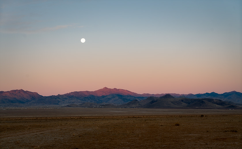
Then I saw it—a full moon setting over the Cerbat Range. The lunar glow bathed the craggy peaks in an ethereal silver light. It was the kind of scene that makes photographers pull over on a whim. But there were power lines. Ugly, unavoidable power lines. I fought with myself about stopping, but in the end, I found a gate and stopped the truck. Walking up to it, I bent over and shoved my body through the opening as gracefully as a fat man wearing two sweaters and an insulated jacket could, then walked another eighth of a mile to get the shot. Anne, meanwhile, stayed in the car, watching me with a smirk.

“I was just waiting for you to get stuck,” she admitted.

“Why, did you think you’d need to go get help?”

“No, I was going to head back to the motel and finish my night’s sleep.”

Freedom on the Open Road


There’s a reason I prefer taking back roads. It’s not about getting there faster but about being free to drive the way you want. Out here, the road stretches for miles, uninterrupted. There is no wall of semis, no impatient tailgaters, and no high-speed herd mentality.

I was reminded of this on the Alcan Highway in the Yukon, driving my old Mercedes ML 350 diesel. On those endless roads, you didn’t just have a passing lane—you had the whole countryside. You could gradually pull into the other lane, ease past a slower car, and merge back without drama.
That’s the beauty of this section of Route 66—one of the few long, well-maintained stretches left. The others have faded into history, lost to time and neglect. You’re not in a rush—you’re just enjoying the drive.

A Golden Sunrise and a Locked Door in Hackberry


Rustic Hackberry General Store at sunrise with a weathered patrol car and classic gas station signs, capturing Route 66 nostalgia in Arizona.
Rust and History: Sunrise at Hackberry General Store – Arriving at sunrise, we caught Hackberry General Store bathed in golden light, its rusted cop car gleaming like a relic from a bygone era of Route 66. Trading shopping for perfect lighting, we captured this slice of Americana before the world woke up.

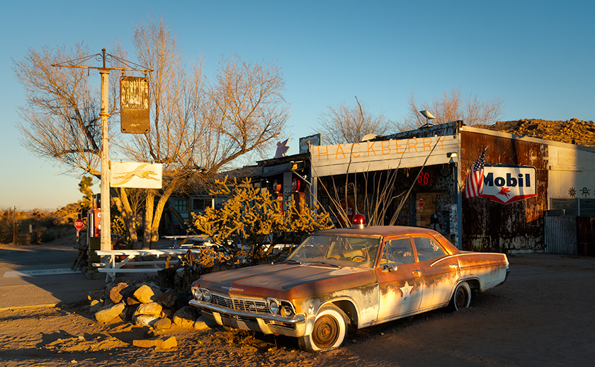
We arrived in Hackberry just as the sun cleared the horizon, spilling golden light over the cracked pavement and rusted relics. The timing was perfect. The store, however, was closed for another three hours. Anne was less than pleased.

Anne scowled at the locked door.

“Oh, honey,” I consoled, trying to sound convincing, “I wanted you to see all their fabulous antique jewelry. I’m so sorry. We’ll have to come back another time.”

Her silence was deafening.

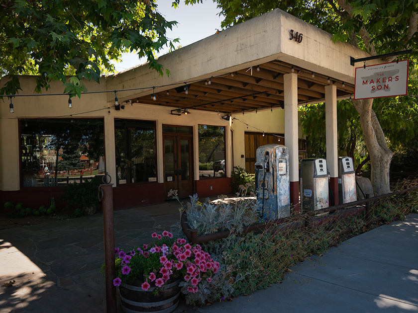
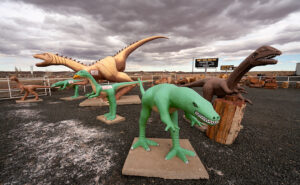
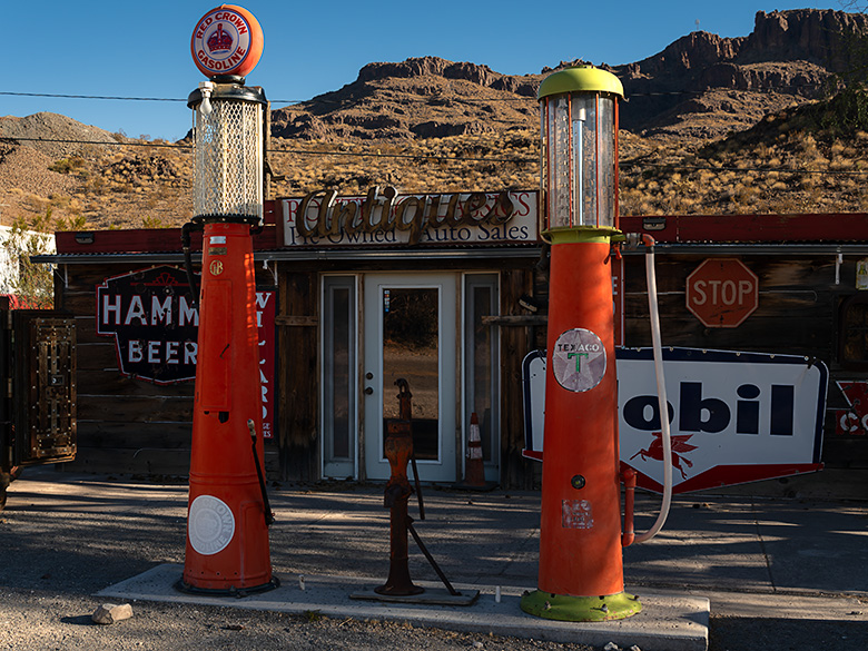
Meanwhile, I got my shots—rusted gas pumps, vintage signs, an old patrol car straight out of a noir film. Hackberry General Store isn’t just a shop; it’s a time capsule of Route 66, stuffed to the rafters with kitsch. Route 66 place mats, belt buckles, neon clocks, and car posters—most likely all made in China. If you ever needed a flaming skull ashtray or a bottle opener shaped like a ’57 Chevy, this would be the place to find it.

Racing a Freight Train Across the Desert


Vintage gas station with faded signage and classic Route 66 fuel pumps in Truxton, Arizona, bathed in morning sunlight.
Timeless Gas Stop – Truxton Service Station in Morning Light – The Truxton Service Station still stands on the south side of Route 66, a rare remnant of a bygone era where travelers stopped for fuel and conversation. The sun casts warm morning light on its weathered sign and vintage gas pumps, keeping history alive in the Arizona desert.

As we rolled east, we picked up a new travel companion—an eastbound freight train. It became a game of leapfrog. We’d catch up to the lead engine, pass it, stop ahead to grab another shot, then watch as it rumbled by again—only to start the chase all over. Wash, rinse, repeat, like having John Henry as a sidekick. Anne was convinced she knew the engineer’s kids’ names when we reached Ash Fork. Probably their dog’s name, too. Any longer, and we’d have been invited to Thanksgiving.

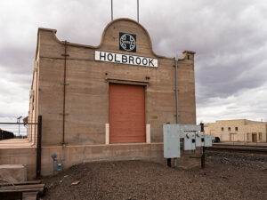
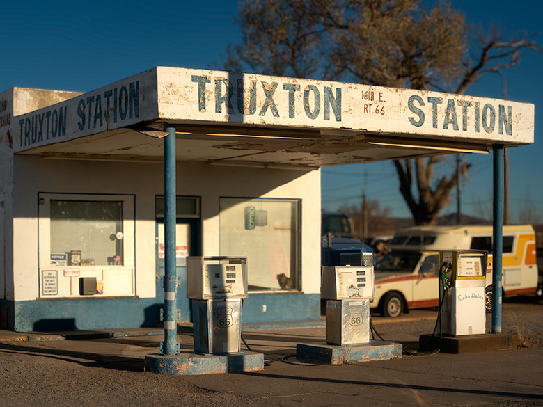
Lost History Along Route 66: Truxton to Peach Springs


Faded blue Frontier Motel sign with peeling paint and a vintage café mural in Truxton, Arizona, along Route 66.
Neon Nostalgia – Frontier Motel’s Faded Glory on Route 66 – The weathered Frontier Motel sign is a faded reminder of Truxton’s Route 66 heyday, its peeling blue paint a testament to decades of sun and wind. A small sign nearby marks the Beale Wagon Road—an unexpected historical twist I never knew existed, but now I want one for myself.
Beale Wagon Road sign with Route 66 and Will Rogers Highway street signs in a rural Arizona setting
Tracing the Old West: Beale Wagon Road’s Legacy

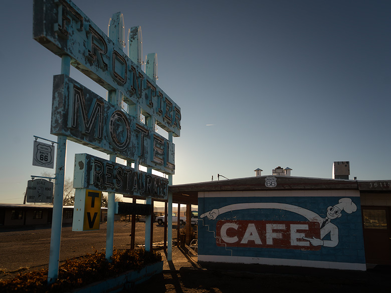
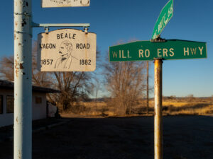
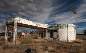
Next up, Truxton. We shot the Truxton Gas Station (still open occasionally) and the Frontier Motel, one of the larger lodgings from Route 66’s heyday. A smaller placard marking the Beale Wagon Road was hanging below the motel’s sign. I had written about Edward Beale’s adventures before, but I never knew there were actual signs marking his route. And now that I do? I want one.

We continued east, hoping to photograph two buildings listed on the National Register of Historic Places—the Indian school west of Peach Springs and the historic Shell Station in Peach Springs with its distinct rock-wall façade. The school, a stark reminder of an era when Native children were removed from their families, stands as an important, if painful, piece of history. The Hualapai Tribe recently received grant money to restore both sites, but when we arrived, they were surrounded by construction equipment—not exactly photogenic. Oddly, there wasn’t a worker in sight. Whether it was a funding delay, a supply chain holdup, or just the usual bureaucratic red tape, we couldn’t say. We know that it gives us another excuse to return to the Mother Road (as if we need one).

Between Peach Springs and Seligman, we passed a stretch of restored Burma Shave signs, their playful rhymes adding a touch of nostalgia to the drive. We couldn’t resist reading them aloud in unison as we came across them, like a couple of hopeless jerks, laughing at every corny punchline.

Why You Should Take This Route 66 Road Trip


If you’ve never driven this stretch of Route 66, you should. And if you need an excuse, there’s no better time than the annual Hot Rod show. This rolling event brings classic cars to Seligman, Kingman, Oatman, and Needles, turning each town into a pop-up car show. (The Route 66 Fun Run will occur May 2–4, 2025. This 35th annual event covers a 140-mile drive from Seligman to Topock/Golden Shores, featuring events in nearly every community along the way, a car show in downtown Kingman on Saturday, and an award ceremony in Topock/Golden Shores. More details can be found on the Historic Route 66 Association of Arizona’s website: Route 66 Fun Run.

Even if you don’t go for the cars, go for the drive. Route 66 is a road worth slowing down for.

Final Thoughts


Thanks for riding along with us on this Route 66 adventure! As always, larger versions of these photos are in the New Work collection on our website: www.jimwitkowski.com/newWork.

We’d love to hear your thoughts, so feel free to leave a comment—but be quick, as comments close after five days (thanks to the bad guys).

Be sure to join us next month when we dash to the coast for another adventure—you won’t want to miss it!

Until then, keep your spirits high and your humor dry.
jw

The Long Way Home: Three Routes, One Corolla, and a Little Adventure Pictures of the Month: California Coastal Towns

“So when the day comes to settle down,
Who’s to blame if you’re not around?
You take the long way home,
Take the long way home.”—Supertramp
Vintage gas station repurposed as Makers Son venue in Los Alamos, California with rustic charm
Exploring Los Alamos: Makers Son Event Space in a Former Gas Station—The Makers Son, a vintage gas station in Los Alamos, California, now serves as a charming venue for weddings and events.

Like every good fairytale, the good times eventually come to an end. Too soon, we found ourselves facing that tedious drive home. But instead of a simple choice, we had three different ways to go—our own version of ‘The Three Little Piggies.’ Only this time, there were three little routes: the quick and efficient one, the scenic and leisurely one, and the ‘I don’t really want to go home’ route.

The Fast Way (All Freeway—All The Time)

The first little piggy is all about speed—no frills, no fuss. It’s I-5 or US 99 south to Bakersfield, then a quick jog over to I-40 through Barstow, cruising along Route 66 nostalgia until Kingman, and finally, the home stretch to Congress. There is not much scenery, but it’ll get you there faster than you can say. ‘Are we there yet?’ It’s our choice for days when the destination matters more than the journey. This is also our go-to route when we’re in a hurry or carrying precious cargo—like a couple of cases of wine. We can make this trip in about 14 hours, provided I make the necessary stops for Queen Anne’s bathroom breaks.

St. Teresa of Avila Church in Bodega, California, iconic landmark photographed by Ansel Adams
St. Teresa of Avila Church in Bodega, California—a spot where Ansel Adams stopped in 1953 when this drive was just a dirt road. Anytime I get within range of an Adams subject, I make it my mission to stop and capture my own take. Queen Anne was more than willing to tag along—Bodega was the filming site for Hitchcock’s The Birds, and she didn’t pass up the chance to channel her inner Tippi Hedren, posing dramatically on the schoolhouse steps nearby.

The Leisurely Way (Santa Paula Route)

The second little piggy prefers a scenic detour. This route winds down California’s Highway 101 through coastal towns and charming spots like San Luis Obispo, Santa Barbara, Santa Paula, and Fillmore. Fillmore holds a particular place for me—it’s where I take a moment to visit my sister’s grave, reminding me that every journey has meaning beyond the miles. And then, with a clearer head, we pick up the drive home.

From there, the road takes us through Los Angeles, where we must be mindful of our timing and stay as far away from downtown as possible. Even in the middle of the night, we expect traffic, but if we time it right—threading the freeways between morning and evening rush hours—we can glide through with minimal stop-and-go. Our preferred route through LA is the I-210, which runs along the base of the San Gabriel Mountains and offers a spectacular view…on the one day a year when they’re actually visible through the smog.”

Pico Wine Tasting and Restaurant in a historic general store building in Los Alamos, California
Pico Wine Shop and Restaurant in Los Alamos: A Culinary Landmark – Pico, a historic general store turned wine-tasting venue and restaurant in Los Alamos, California, offers a high-end culinary experience.

The “I Don’t Really Want to Go Home” Way

And then there’s the third little piggy, the route for when you’re in no rush. This path hugs the coast down the Pacific Coast Highway, SR1, taking the long, winding road past Big Sur, through postcard-perfect towns, and across landscapes that demand photo stops every few miles. It’s the scenic route to end all scenic routes—a journey for those who want to stretch the fairytale a little bit longer.

Once we reach San Luis Obispo, we merge onto the 101 until Ventura. From Oxnard to Santa Monica, we’re back on the PCH with plenty of chances to spot a pod of dolphins, a whale, or seals if we’re lucky and observant. Since we have all the time in the world, we make it a point to stop, walk all the piers, and grab a bite at a couple of seafood shacks along the way.

When it’s time to leave Santa Monica, we jump on I-10 straight into the city’s heart-stopping freeway traffic. But instead of fighting it, we go with the flow—windows down, wind in our faces, and Randy Newman’s ‘I Love L.A.‘ blaring on the stereo. For a moment, we’re part of the LA rhythm, dodging in and out of lanes with all the other dreamers. Eventually, US 60 guides us through Riverside and into the wide-open desert, where the road stretches out, and the only traffic is the tumbleweeds. If done correctly, we measure our progress in miles per week.

A Corolla with Attitude

The real surprise on this trip was discovering our trusty Corolla IM’s hidden ‘Sport’ mode button. I’ve dubbed it the ‘Gutless Wonder,’ but with Sport mode engaged, it gave me more spirit than expected. The button sharpened the transmission shifts and tightened the power steering, making each corner feel just right. For a moment, I almost felt like I was driving an old British sports car—minus the manual gearbox and with the comfort of roll-up windows and a top. And thanks to the IM’s independent rear suspension, it didn’t just handle the winding roads—it made them fun. Who knew our little econobox had it in her?

Rustic white barns in a scenic countryside landscape on the road from Sonoma to Calaveras, California
Historic White Barns: A Serene Stop Near Highway 101 – A pair of white barns along the scenic Sonoma to Calaveras route, capturing the rustic charm of California’s countryside.

Our Extended Fairytale Ending

Since it was still August and we weren’t in a hurry to get back to our cottage at the base of the Weaver Mountains, we opted for the middle route with a twist: four days, with overnight stops in places we’d never explored. Our usual all-day ‘Bataan March’ became a leisurely four-day journey of discovery, and—true to form—Anne and I conveniently planned our stops around California’s Central Coast wine regions. Now, we have at least four new destinations for future trips.

Each route home has its own quirks and charms, but this time, taking the scenic way back reminded me that the journey can be as memorable as the destination. Sometimes, the right choice isn’t the fastest or most convenient—it’s the one that lets you hold on to the experience just a little longer.

Till next time, keep your spirits high and your humor dry.
jw


BTW, 2024 Wall Calendar Orders are Open!

It’s that time of year again—calendar season! If you’d like to grab one of my personal wall calendars for 2024, now’s the time to let me know. The calendars are 8.5 x 10 inches, spiral-bound, and printed on high-quality card stock, perfect for showcasing a year’s worth of my favorite shots.

A heads-up on pricing: VistaPrint’s prices are always high initially, but they usually offer great discounts as the holidays approach. Last year, they dropped to around $11 plus shipping after Thanksgiving, but they could be as high as $20 if I go by their price list today. Whatever my printing and shipping costs are, that’s what I charge—no markup.

If you’re interested, please let me know by November 15. That way, I can organize everything, and we can take advantage of post-Thanksgiving sales! Delivery is usually at the beginning of December, so they make great stocking stuffers.

Holbrook Chronicles: A Quirky Journey Through Time and Asphalt Picture of the Month - Holbrook, Arizona

White tee pee-shaped motel rooms with classic car parked outside on Route 66 in Holbrook, Arizona
Nostalgic Nights: The Historic Tee Pee Motel of Route 66 – Step back in time with a glimpse of the historic TeePee Motel on Route 66 in Holbrook, Arizona—where classic cars and unique accommodations summon the spirit of America’s golden age of road travel.

Earlier this year, in a fit of cartographic embarrassment, I noticed my Arizona map was as barren in the northeast corner as my understanding of quantum physics. We use the map to bookmark locations we’ve visited and shared with you. “We must address this travesty,” I declared, or perhaps just thought loudly. Thus, Queen Anne and I embarked on an expedition to Holbrook, a place as famed for its petrified wood as my living room is for lost remote controls.

Upon our grand arrival in Holbrook, it became immediately clear how the town’s history was as layered as my attempt at a seven-layer dip, which never made it past layer three. From the ancient trading routes that seemed slightly busier than my last garage sale to the modern buzz of I-40, which promised the thrill of gas stations and fast food, Holbrook whispered tales of change. And by whispered, I mean it mumbled incoherently, much like Uncle Ray after his third Thanksgiving cocktail.

Wide-angle photo of playful dinosaur sculptures in a rock shop yard in Holbrook, Arizona, with petrified wood for sale
Petrified Pals: The Dinosaur Ambassadors of Holbrook’s Rock Shop – Encounter the past in a playful panorama with Holbrook’s roadside dinosaurs, a nod to the rich paleontological history unearthed at the nearby Petrified Forest National Park.

Diving into the town’s lore, we uncovered tales of early Pueblo peoples, whose idea of commuting was traipsing along the Little Colorado River. They traded goods with the enthusiasm I reserved for exchanging unwanted Christmas gifts. Picture them, settling down by the river’s edge, not to snap sunset selfies, but to swap stories of Coyote, the original trickster who probably invented the concept of “fake news,” and Spider-Woman, the ancient weaver who, unlike me, never blamed her tools for a botched job.

Then came the white men, striding into the horizon with all the subtlety of a brass band in a library. With their grand plans to connect coasts, Lieutenant Whipple and Edward Beale undoubtedly paused to ponder, “Will there be sufficient parking?” Their surveying tales were likely less about the awe of uncharted lands and more about the days when their socks stayed dry.

Early Settlement

In 1876, Mormons fleeing the excitement of Utah found solace in what would become Holbrook, a place that made their former home seem positively Las Vegas-esque in comparison. By then, the town had started to take shape, much like my attempt at sourdough during lockdown—full of hope but ultimately flat.

Our foray into this historical mosaic first led us to the part of town that had seen better days. “I’m not getting out of the car,” declared Queen Anne, with the determination of someone guarding the last slice of pizza. And who could blame her? The charm of the Arizona Rancho and the Bucket of Blood Saloon was as evident as the potential in my high school yearbook photo—present, but requiring a generous imagination.

Pedro Montaño built the Arizona Rancho home here between 1881 and 1883. It started as a single-story plastered adobe building with a high-pitched roof and dormer windows. After it was sold to the Higgins family, it became the Higgins House—a boarding house with a two-story addition. Next, it became the Brunswick Hotel. In the 30s, the west wing was used for Holbrook’s hospital, and during World War II, the Navy leased it to house pilots training at the airfield north of town. Now, it’s listed on the National Historic Registry and appears to be undergoing renovation.

Crossing the street from the train depot is another historic building in decay. It was initially called Terrell’s Cottage Saloon, and it was popular with cowboys and ruffians. After a violent gunfight in 1866 that ended up with two men dead, the street was described as if someone had poured a bucket of blood on it. The name stuck, and the saloon and street name bear the moniker. When we visited, a prominent sign urged people to contribute to saving The Bucket of Blood Saloon.

Imagine Holbrook as the Wild West’s version of a reality TV show, complete with outlaw gangs and cattle thieves vying for the title of Most Wanted, starring the Hashknife Gang and the Blevins Brothers, with special guest appearances by the Clantons, who thought the Earps’ version of justice was a tad too personal. Enter Sheriff Commodore Perry Owens, Holbrook’s answer to a sheriff who didn’t just wear a badge but practically invented the law enforcement genre with flair. His Wikipedia page? It’s the binge-worthy history lesson you never knew you needed.

Traffic Increases On Route 66

Faded green signage on an abandoned gas station under dramatic sky in Holbrook, Arizona
Deserted Drive-Up: The Withered Gas Station under Holbrook’s Sky – Behind a chain-link time capsule, the remains of what could be a Sinclair station stand sentinel under the vast skies of Holbrook, a mute testimony to the bustling days of Route 66.

Holbrook thrived on a cattle economy akin to a bovine social club for decades until 1926 rolled around with Route 66, flipping the script. Suddenly, Americans, intoxicated by the freedom of their Model Ts, were gallivanting across the country, pioneering the original road trip minus the luxury of air conditioning or reliable GPS. The Dust Bowl era added a gritty reality show twist, turning Route 66 into the “Mother Road” of all escape routes. By 1938, the road’s complete paving made cross-country jaunts less of a teeth-rattling affair, shifting Holbrook’s social scene north of the tracks. The town’s once-thriving pit stops turned into a ghostly strip of nostalgia, save for the Tee Pee Motel, now a restored relic where vintage cars outnumber guests—missing the chance to sleep in a concrete teepee? Now, that’s a modern regret.

Post Interstate 40

As Holbrook entered the fast lane of the Interstate 40 era, it seems the town, like a bewildered tortoise at a Formula 1 race, was sidelined by the rush towards efficiency. Where once adventurers might pause to marvel at the local color, they now zoom towards the neon glow of franchise signs, seduced by the siren call of combo meals and loyalty points. It’s as if America’s highways have become conveyor belts, whisking travelers from Point A to B with little regard for the stories and spectacles they blur past.

Amidst this homogenized landscape, Holbrook is a defiant reminder that sometimes the best part of the journey is the quirky diner you didn’t expect to love, not the time shaved off your ETA. In rediscovering Holbrook, we find not just a town but a treasure trove of tales begging us to slow down, look around, and maybe, just maybe, find a piece of ourselves among the echoes of Main Street. So, let’s take that exit ramp less traveled; who knows what stories await among the faded signs and whispers of yesteryear?

Old Holbrook train station sign with Santa Fe logo on a building repurposed as a warehouse along the railroad tracks
Tracks to the Past: Warehouse Days at Holbrook’s Old Depot—Standing with silent stories, the repurposed Holbrook train station along the SP tracks endures as a storied warehouse among the town’s architectural relics.

I hope you enjoyed our Holbrook tale and viewing the new photos. If Queen Anne and I have piqued your interest, you can see larger versions of this month’s adventure in my New Work collection <Link> and Fine Art America page <FAA Link>. They’ll be there for the next three months before they make way for a new adventure. Be sure to return next month when we stop at the Painted Desert and Petrified Forest.

Until our next detour, may your travels be full of discovery and stories as rich as Holbrook’s past.
jw

Vintage Red Crown Gas Pumps: Oatman’s Route 66 Treasures Pictrure of the Week - Oatman, Arizona

Vintage Red Crown gas pumps in Oatman, Arizona, along the famed Route 66, evoking the golden era of American road travel.
Time-Standing Still: Vintage Gas Pumps of Oatman – Step back in time with these meticulously preserved ‘Red Crown’ gasoline pumps, a vibrant reminder of Route 66’s golden era, now standing proudly outside Oatman’s antique store — a treasure trove awaiting its next collector.

Let’s talk about a little thing called ROI, or return on investment. In layperson’s terms, it’s like this: if your piggy bank’s diet consists more of withdrawals than deposits, it’s time to put that cash-chewing pastime on a strict no-spend regimen. It’s a handy rule of thumb for deciding whether that avocado toast obsession is a splurge too far and for the bigwigs running the corporate circus. They don’t just steer the company ship; they’re the jugglers, tightrope walkers, and lion tamers tasked with keeping the ROI roaring so the shareholders don’t start looking for a tamer’s head to put in the lion’s mouth.

In the harsh and unforgiving world of mining towns like Oatman, hitting the ROI redline means ‘game over’ for the local economy. The investors pack up their checkbooks, the mines shutter faster than a camera at a ghost sighting, and the workers scatter like tumbleweeds in a dust storm. The town’s pulse slows, and those left behind are like the band on the Titanic—playing on bravely, knowing the finale is nigh.

The tale of Oatman follows a script as predictable as the instructions on a shampoo bottle—minus the rejuvenating wash. It’s a cycle as old as time: boom, bust, and echo. The brightest stars eventually fizzle out, and Oatman’s star, once a beacon of the Gold Rush, was no exception. And just like a one-two punch in a heavyweight bout, Oatman’s knockout came swiftly. First, the mines dried up, and then Route 66 got a face-lift that sidestepped the town altogether. Modern progress, they said, but for Oatman, it was more like a step into obscurity.

The new road followed the railroad’s less adventurous path, leaving Oatman off the beaten path and out of the family vacation route. From the Clampetts to the Griswolds, no one was clamoring to visit an old shanty town at that time—and the Department of Transportation—forgot. Oatman became the town overlooking Mohave Valley with a ‘Do Not Disturb’ sign hung on its door.

As the rest of the world hurtled forward into the mid-20th century, Oatman seemed to hit the pause button. The once frenetic streets, echoing with the din of prosperity, fell silent, leaving only the whispering desert winds to tell their tales. For the few who chose to stay, life became a study of survival and simplicity. Oatman’s dwindling population, a patchwork of tenacious old-timers and resourceful souls, found a way to eke out a living from the sparse offerings of a town that had given its all to the golden days of yore.

The rustic sign of Judy's Saloon and Pool Hall under a wall-mounted American flag on the historic Main Street of Oatman, Arizona.
Judy’s Saloon: Echoes of Oatman’s Vibrant Past – Under Oatman’s azure skies, the worn sign of Judy’s Saloon points the way, juxtaposed with a rustic American flag, to a place where the spirit of the West is not just remembered but still lives on.

The rhythm of life here was no longer dictated by the pulsing promise of gold but by the sun’s arc across the sky. The remaining residents turned to the land, coaxing modest gardens from the arid soil, trading with neighbors, and gathering at Judy’s Saloon for some, reliving the glory days in stories told and retold like cherished family heirlooms. They adapted, repurposing old mining tools for mundane tasks and transforming abandoned structures into homes and makeshift businesses that catered to the occasional traveler, lost or adventurous enough to stray from the new Route 66.

In this era, Oatman’s heartbeat was a subtle one, felt rather than heard, in the stoic persistence of its people and the silent dignity of its weathered buildings. The community’s fabric was tightly knit, each person a thread bound to the other by shared history and collective tenacity. Life in Oatman wasn’t about thriving; it was about enduring, about preserving the essence of a town too proud to fade away.

The gasoline pumps featured in this week’s picture tell a story that’s as much about progress as it is about preservation. Red Crown gas, a blend marketed by Standard Oil (now Chevron), was the fuel of choice during the era these pumps would have served. Picture this: classic cars now wear the badge of ‘vintage’ had a dial for drivers to adjust the timing advance. A tank full of high-octane Red Crown meant more zip without the dreaded engine knock. Nowadays, that’s a job delegated to the computers in our cars.

But take a closer look at these gravity-feed pumps. Their pristine condition raises a question—have they stood the test of time, or are they beautifully restored pieces of history? It’s a bit of a mystery, much like the stories they hold. And for my eagle-eyed followers, yes, you’ve already noticed the white roof of the Diner Car peeking out on the left.

I hope you enjoyed this stroll down the quieter lanes of Oatman’s history, but don’t pack away your walking shoes just yet. Next week, we’re dusting off the fairy tale books for Oatman’s own Cinderella story—a happy ending sure to sparkle. If your curiosity about those Red Crown pumps is ticking like a Geiger counter in a gold mine, here’s your treasure map: links to my web page < Jim’s Site> and the Fine Art America page <FAA Link>. And hey, if you find yourself meandering through Oatman in the next few months, pop into that antique store and snoop around for the price tag on those pumps. Don’t forget to spill the beans in the comments below—I think they’d make a lovely gate for the end of my driveway.

Till our next adventure, keep your spirits high and your humor dry.
jw

Techniques: Mastering the Art of Symmetrical Composition

This week’s photo ventures into symmetrical composition, a method that, admittedly, I usually give a wide berth. Symmetry in photography is all about balance, akin to placing two candles at either end of a mantle for that classic, mirror-image elegance. But who says rules can’t be bent for a bit of creative flair?

Regarding the Red Crown gas pumps, symmetry was the starting point, not the destination. I aimed to capture both pumps in a single frame, spaced evenly from the frame’s edges to create a sense of balance. However, I opted for a slight twist rather than a straight-on, textbook symmetric shot. By shifting my position to the right, the pumps became natural frames for the ‘Antiques’ sign in the background, adding layers and depth to the image. It’s like setting those candles at different heights on the mantle; it catches the eye, creates tension, and makes you look twice.

The result? A photo that adheres to symmetry principles while stepping out of the conventional bounds, making for a more intriguing and dynamic composition. Sometimes, bending the rules just a little can lead to a more compelling story being told through the lens. What’s your take on it? Traditional symmetry or a dash of asymmetrical intrigue?

Hidden Americana: Oatman’s Retro Diner Discovery Picture of the Week - Oatman, Arizona

Vintage red and white diner trailer tucked away in an alley of Oatman, Arizona, along historic Route 66.
Retro Diner Charm in Oatman’s Alley – Discover the charm of a hidden vintage diner trailer in Oatman, AZ, a nostalgic slice of Americana nestled in the heart of historic Route 66.

Let’s embark on a journey back to school for a moment. Picture yourself seated in an Arizona grade-school classroom, pencil in hand and a fresh sheet of paper on your desk. Today’s lesson begins with a pop quiz, a staple of any Arizona curriculum. The question: What are the ‘5 Cs’ of Arizona? If you’re rattling off Copper, Cotton, Cattle, Citrus, and Climate, you’ve hit the nail on the head. But let’s add a twist for the history buffs among us. How about substituting with these: Cactus, Canyons, Crackpots, Computer-Chips, Construction, or Canadians?

The original five Cs were, of course, the most significant revenue producers in the state. But that was so 1950s. Although they still bring substantial money into Arizona, they’re a fraction of their past in the new millennium. For example, when I moved to Phoenix in 1972, the Valley of the Sun was wall-to-wall orange groves. Today, they’ve been replaced by tract homes with a token grapefruit tree in the backyard. The cotton fields stretching from Tolleson to Buckeye have suffered the same fate. The stockyards that fowled the air at the east end of Sky Harbor’s runways are now a parade of gleaming corporate offices.

That leaves climate as the surviving C-word, which brings in the Canadians, and we need to build something to keep them occupied while we crackpots are hard at work making computer chips and constructing new houses. This shift from the agricultural and raw materials of yesteryears to the high-tech and tourist-oriented economy of today mirrors the transformational stories of many Arizona towns. Among these tales of change, one town stands out as a vivid illustration of the state’s rich history and relentless march into the future: Oatman.

This once-thriving gold rush town, nestled in the Black Mountains of Arizona, is a relic of an era that defined the state and the American West. The story of Oatman begins with glittering prospects and dreams of fortune as miners flocked to its hills spurred by the promise of gold. The narrative takes us through the wild roller coaster of economic booms and crushing busts. It paints a picture of the indomitable spirit that characterizes so much of Arizona’s history.

As we dive into the tale of Oatman, we find not just a story of a mining town but a reflection of the more extensive American experience—one marked by hope, struggle, and resilience. So, let’s leave the modern suburbs of Phoenix behind for a moment and journey back to when gold was the C-word that captured everyone’s imagination and set the wheels of destiny in motion for places like Oatman.

In the early 20th century, Oatman was awakened from its sleepy existence by a glint of gold, setting the stage for transforming into one of Arizona’s most prosperous boom towns. It all began with prospector Johnny Moss, who first mined the area in the 1860s, staking claims to two mines, one of which bore his name and the other named after Olive Oatman, a young girl with a dramatic story of survival in the Wild West. However, it wasn’t until the early 1900s that Oatman’s destiny as a gold rush town was firmly sealed. The Vivian Mining Company started operations around 1904, and the discovery of significant gold deposits at the Tom Reed Mine in 1908 led to a frenzy of activity. By 1909, the once modest mining camp officially adopted the name Oatman, and the town was on its way to becoming a symbol of the American dream.

Oatman’s heyday spanned the 1910s and 1920s, marked by bustling streets, saloons filled with hopeful miners, and the constant clatter of activity. The town’s population swelled, and the promise of fortune lured people from all walks of life. The construction of Route 66 through Sitgreaves Pass in 1926 further cemented Oatman’s status. The new highway brought a steady stream of travelers, enhancing the town’s prosperity. During these golden years, Oatman was more than a mere mining town; it was a community brimming with hope and vibrancy, where the American spirit of adventure and pursuit of fortune shone brightest. But as with many boom towns, this period of prosperity would not last, setting the stage for the eventual decline that would transform Oatman into a poignant symbol of the transient nature of boom and bust cycles.

An abandoned house with broken windows, standing desolate along Route 66, symbolizing the unfulfilled dreams of past migrants.
Deserted Dreams: The Abandoned Houses of Route 66 – Amidst the whispers of the desert wind, this abandoned homestead on Route 66 stands as a stark reminder that not all journeys along the famed road lead to a promised land.

Each visit to a town steeped in history like Oatman becomes a treasure hunt for me, a quest for the extraordinary hidden amidst the ordinary. It’s not the overt that catches my eye—the comical store signs and typical tourist fare—but rather the subtle whispers of history that resonate most. This penchant for the historically authentic led me down an unassuming alley in Oatman, where the unexpected sight of a diner trailer captured my curiosity. At first glance, its vintage charm made it resemble a repurposed streetcar, but the presence of a hitch told a different story.

This intriguing relic was shrouded in mystery, nestled quietly away from the main thoroughfare. Questions swirled in my mind: When had this diner seen its heyday? Was it a festive cornerstone during Oatman’s booming past, rolled out for special occasions to serve hungry miners and travelers? Or perhaps it’s a more recent addition, a nostalgic nod to the town’s storied history? And who were the faces behind its service window? I could only hope this article might reach someone holding the keys to its past, someone who could unravel the tales this diner trailer has to tell.

Thanks for stopping by and visiting this week. If your curiosity has the better of you (and you’re not a cat), I have larger versions on my site < Jim’s Web Page> and a page on Fine Art America <FAA Link> for closer examination. We’d love your comments about the dinner or other Oatman experiences in the section below. Come back next week when we discuss what happens at the end of good times.

Till next time, keep your spirits high and your humor dry.
jw

Techniques: The Wide-Angle Lens or How to Save a Marriage

Picture this: there I am in Oatman, trying to frame the perfect shot of the diner, and suddenly, I’m playing a game of sardines with my camera. I’m backed up as far as I can go without turning into a human pretzel, and still, the ‘Diner’ sign is playing hard to get with my lens. At that moment, I realized that my lens wasn’t just wide; it was a regular Houdini, adept at escaping tight spots. However, even Houdini met his match, and so did my lens.

Here’s a secret between us (and please, if you ever meet Anne, mum’s the word): I’ve got my eye on a new-to-me wide-zoom lens. How, you ask? Let’s say I’ve recently saved someone from the clutches of the Maytag Man’s bill. My heroic washing machine repair has earned me some unspoken brownie points, which I intend to cash in for a shiny, used lens. My plan? To casually drop hints about this fantastic eBay find, nudging Anne into believing it’s her brilliant idea for my birthday gift. Genius, right?

With this new addition, my camera bag will boast a triumphant trio of lenses stretching from 16 to 200 millimeters, ready to tackle anything from ant-sized armadillos to gargantuan giraffes. So, stay tuned for my next eBay adventure, where I’ll be the stealthy bidder in the shadows, armed with a pocketful of washing machine savings and a dream.