Backroad Gold: The Art and Abandoned Mines of Chloride Pictures of the Month - Chloride, Arizona

Chloride Downtown Historic Buildings Post Office and Antique Store
Chloride’s Last Standing Originals: A Post Office and Antique Store – Three historic survivors of Chloride’s fiery past mark the heart of the small town’s original downtown. The white structure serves as the town’s active post office, while the other two—an antique store and an unused building—stand as quiet reminders of a resilient history.

We’re always looking for fresh material to share with you, so I turned to my trusty wall map and noticed a glaring gap in our travels—Mohave County. Curious, I paired my map-gazing with a quick Google search and a nudge from my AI brainstorming partner, ChatGPT.

“Besides Bullhead City—which, let’s face it, is mostly about gambling—what’s worth exploring in Mohave County?” I asked.

The response? “Chloride.”

“Chloride? Why Chloride?” I countered.

The answer? “Get off your duff and go find out yourself.”

Suddenly, it felt like I was stuck between two Queen Annes, demanding action and sass in equal measure. With that, the adventure began.

The Road to Chloride.

Thinking about the journey to Chloride made me shudder. Traffic at the I-40 and US 93 junction is always a nightmare, with semis and cars lined up for miles waiting to transition. And there’s always that one clown in a big rig who turns right onto 93, then immediately swings left to reach the Flying J. It’s like a slow-motion ballet of bad decisions.

Surprisingly, when I braced for the worst, the roadwork wasn’t as bad as I’d imagined. They’re already building a bypass around town, going to Coyote Pass, where the freeway picks up north of Kingman. For once, progress felt like it was helping.

Back then, US 93 was a rutted, narrow, two-lane road where only the brave dared pass. Now, it’s a rutted, crowded four-lane highway with so many potholes that you must dodge; you’d be foolish to speed down it. Even my trusty Turd struggles to keep up with the mad rush to throw money away in Vegas. Semi-trucks blink their headlights at me as if to say, “Move it, grandpa!”

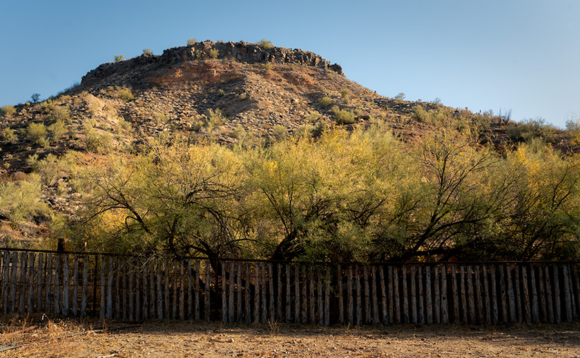
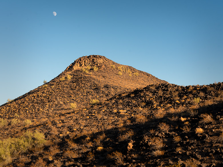
US 93 cuts through a vast desert basin known as Golden Valley, flanked by the Cerbat Mountains to the east and one of Arizona’s many Black Ranges to the west. The valley’s name hints at riches, but today, it’s primarily low-density sprawl—cheap land attracting slow but steady growth. However, this is still the Mohave Desert, and with limited rainfall, water is a growing concern for the area’s future.
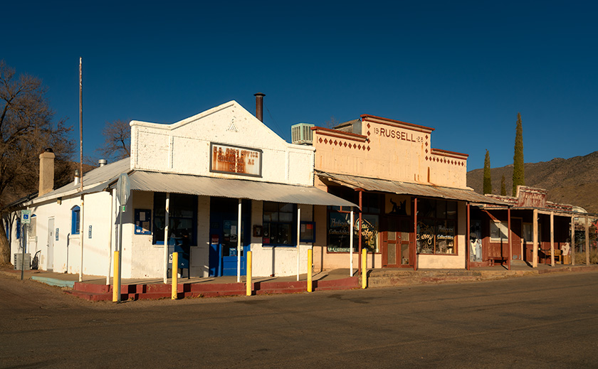
An alpine-style gas station in Chloride, Arizona, with vintage gas pumps, narrow-gauge tracks, and nostalgic yard art under a decorative portico.
Alpine Gas Pumps: A Nostalgic Stop in Chloride’s History—This alpine-style gas station in Chloride, Arizona, is staged with nostalgic yard art and vintage gas pumps to recreate its historic glory. Narrow-gauge tracks circle the building, possibly repurposed from ore cars, adding to the building’s unique character and charm.

Chloride the Town.

Chloride proudly claims to be Arizona’s oldest continuously inhabited mining town, with roots dating back to 1863. However, mining didn’t boom until the 1870s, when a treaty was signed with the Hualapai Indians, allowing for more significant expansion. By 1917, the town’s population peaked at around 2,000, but by 1944, mining had declined, and Chloride teetered on the edge of becoming a ghost town.

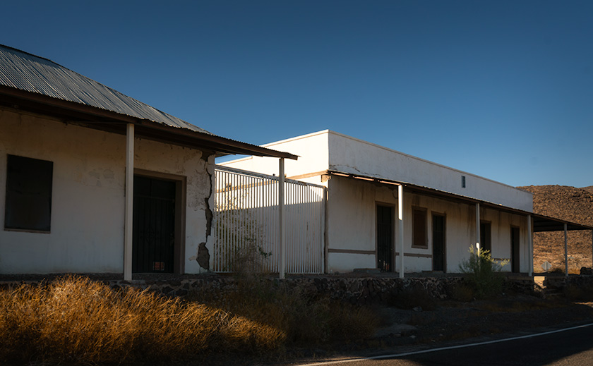
Not that the current residents see it that way. Unlike places like Jerome or Oatman, which fully embrace their ghost town status, Chloride’s locals still treat it as a living, breathing community—even if it’s quieter these days.

Chloride gets its name from the chloride compounds mined here, which have historically been used in chemical warfare, medical applications, and industrial processing. Various chloride forms have been used for everything from hospital disinfectants and intravenous solutions to de-icing roads and manufacturing plastics. The US military even experimented with chloride-based compounds for early chemical warfare research.

When the first mine played out, a more extensive operation opened several miles south, and many of the original miners commuted rather than relocated. Today, the new mine still creates rush-hour traffic jams during shift changes.

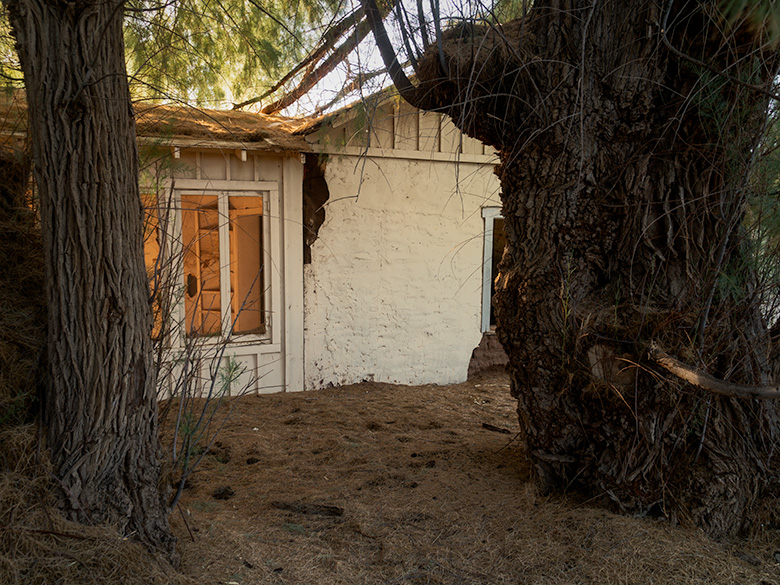
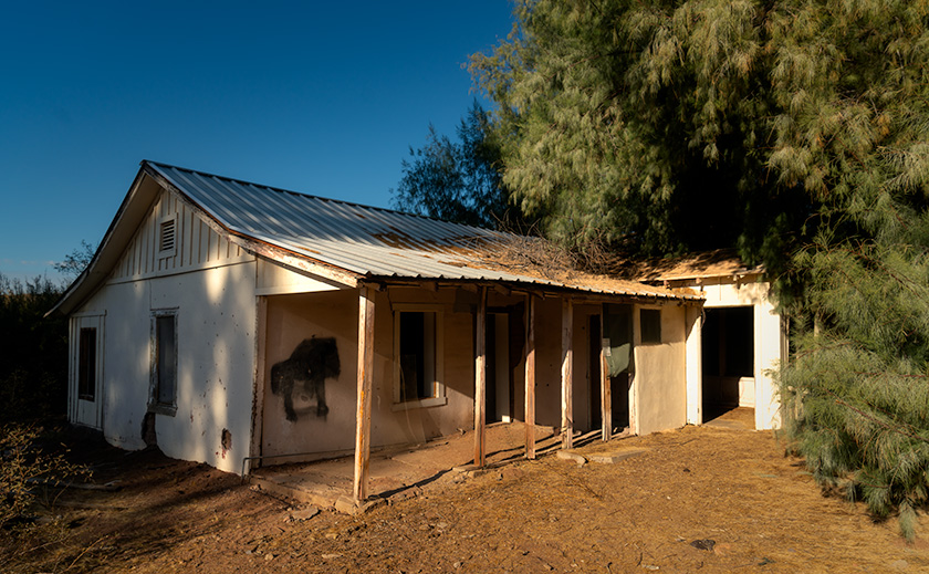
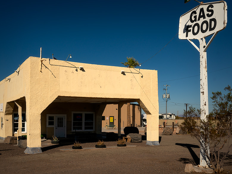
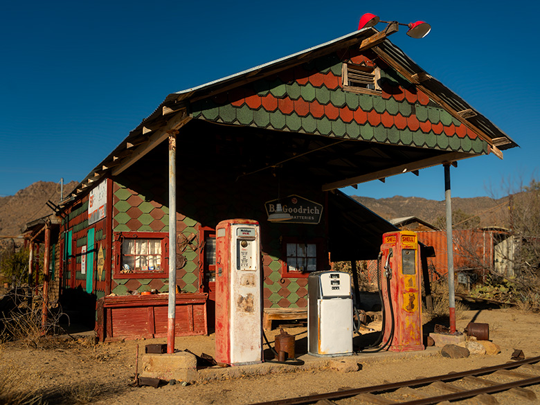
Much like my hometown of Congress, the town’s population is aging, and there’s no new construction. The nearest grocery store is 35 miles away in Kingman, and the closest Costco requires a road trip to Las Vegas. Local businesses include a restaurant, a B&B, and a gas station, where the prices are as inflated as a carnival balloon.

Antique stores dot the town, though most wares are old mining relics rather than fine china. And while the air is fresh, thanks to constant winds, the lack of rainfall in this part of the Mohave Desert makes long-term growth challenging.

Overview of Roy Purcell’s murals in Chloride, Arizona, showcasing a central cosmic-themed mural surrounded by smaller painted rocks in the Cerbat foothills.
Roy Purcell’s Milky Way of Art: Chloride’s Largest Mural Panel – An expansive overview of Roy Purcell’s murals in the Cerbat Mountain foothills near Chloride, Arizona. The central mural, bursting with vibrant colors and cosmic imagery, is surrounded by smaller painted rocks, creating a visual galaxy that echoes Purcell’s vision of interconnectedness between humanity, nature, and the cosmos.

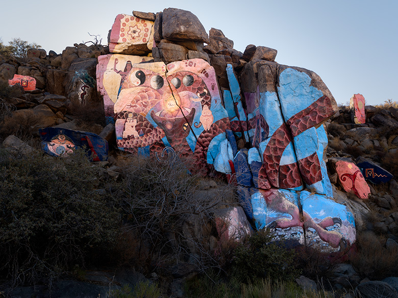
The Murals: The Secret Reason to Visit Chloride.

The murals are the real reason to detour off the highway and visit Chloride. Yet, the locals don’t seem to market them at all. There’s no sign on US 93 pointing the way, and if it weren’t for a few boulders painted with rough directions, you might never find them.

Just before stepping into the Chloride visitor center—which also happens to be the town store—we crossed paths with a man straight out of a ZZ Top album cover.

He had a grizzled white beard that tumbled past his chest, sunglasses that hid whatever stories his eyes might tell, and a dusty black cowboy hat that had seen some miles. His Dickies overalls were well-worn, and his plaid shirt looked like it had survived a hundred desert suns. He leaned against the store’s porch railing like he had all the time in the world.

We asked about the murals.

“Oh, yeah. Those things,” he said, shifting his toothpick from one side of his mouth to the other. “Just go up this road until it turns to dirt. Follow it through the wash if it ain’t flooded, then head up the hill.”

Not exactly GPS coordinates, but we made do.

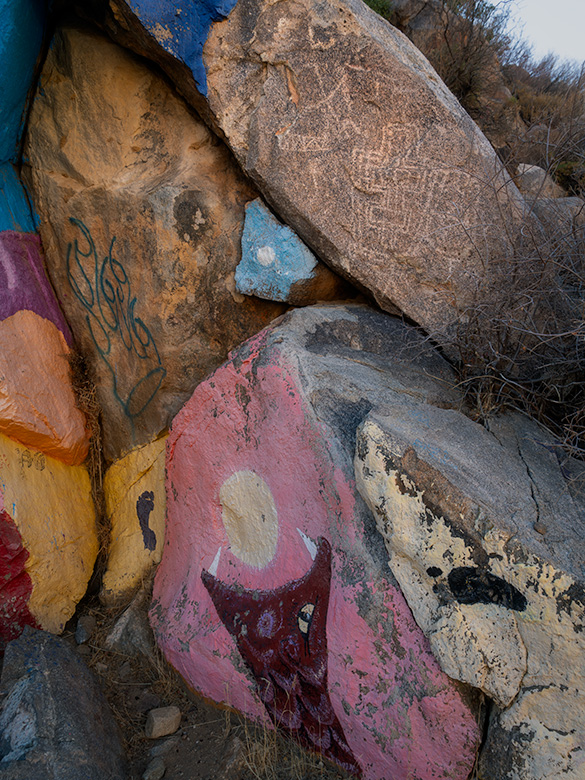
The murals were first painted in 1966 by Roy Purcell, an artist working in the mines while taking a break from his MFA studies. With little more than house paint and a grand vision, he covered massive boulders with bold colors, cosmic symbols, and surreal imagery, turning the desolate mountainside into an outdoor gallery. In 2006, Purcell returned to restore the murals, brightening them back to their original vibrancy.

After almost 20 years of exposure to the brutal desert sun, wind, and sand, the colors remain as vivid as if they were painted yesterday—a testament to Purcell’s craftsmanship and the enduring magic of this hidden treasure.

The first thing that goes through your mind when you see them is: How did he get up there? Was this guy part goat? The murals span multiple rock faces, tied together by a serpent winding its way up the mountainside. Around the central panels, smaller satellite paintings orbit like star clusters hanging at the edge of the Milky Way.

You can’t stand in one place and take it all in simultaneously. The murals demand movement—walking the viewing area reveals new details from every angle, unfolding like a slow-motion kaleidoscope of color and meaning. In that way, Purcell’s work feels almost Dali-esque; its surreal and shifting forms reveal something different depending on where you stand. Like Picasso’s cubist portraits, each fragment works as part of a greater whole, forcing you to engage with it rather than passively observe.

Roy Purcell described his work as a visual philosophy, blending Eastern and Western ideas into something profoundly personal and universal. In his own words:

“I painted these images as an expression of self-discovery, a synthesis of my studies in Eastern philosophy and Jungian psychology, and an exploration of humankind’s place in the vast order of things.”

A word of warning: Wear good shoes. Trying to scramble over the rocks in Top-Siders, like I did, is a bad idea. Those slick-soled boat shoes might be great for gripping a yacht deck, but they turn you into a human tumbleweed out here. The terrain is steep, uneven, and unforgiving—so unless you have goat-like climbing skills or an excellent sense of balance, plan accordingly.

If rusty yard art and ghost towns are your thing, visit Chloride.
If art and hidden gems are your thing, visit the murals—you’ll be one of Arizona’s insiders.

And if you’re the kind of person who ignores all advice and climbs rocks in boat shoes? Well… at least you’ll have a good story to tell.

Close-up of Roy Purcell’s mural in the Cerbat Mountain foothills, painted adjacent to ancient petroglyphs, respecting historical rock art in Chloride, Arizona.
Respecting History: Roy Purcell’s Mural Adjacent to Ancient Petroglyphs—This is a close-up of Roy Purcell’s mural in the Cerbat Mountain foothills, carefully painted adjacent to ancient petroglyphs. This juxtaposition highlights contemporary artists like Purcell’s respect for historical art, creating a fascinating intersection of cultural expression spanning centuries.

Final Thoughts.

Thanks for joining us on this mountainside adventure and enjoying this two-for-one special on ghost towns and hidden art. If you’d like a closer look at the murals and the town, larger versions of these photos are now posted in my New Work portfolio. They’ll stay there for three months—until something better comes along.

We’d love to hear your thoughts on Chloride, Roy Purcell’s murals, or anything near and dear to your heart—so drop a comment below. But do it soon! We close comments after five days, or we’ll be buried in Cyrillic spam up to our eyeballs.

Come back next month when we take another back road home.

Until then, keep your eyes on the road and your humor dry.
jw

Tires, Trails, and Tamarisks: Adventures at Palmerita Ranch Pictures of the Month: Along the Santa Maria River, Arizona

Rustic corral fence with desert bluff and trees at Palmerita Ranch in Arizona.
Corral Fence at Palmerita Ranch Bluff – This rustic corral fence, silhouetted against the rugged bluff of Palmerita Ranch, captures the spirit of Arizona’s ranching legacy. Framed by desert vegetation and illuminated by the warm light of the setting sun, the scene speaks to the enduring harmony between nature and history along the Santa Maria River.

Nearly three years after limping the Turd home from a Las Vegas dealer, it finally earned a new set of shoes. The Turd—our trusty but unglamorous RAV4—had been rolling around on a mismatched set of tires so cheap they probably doubled as floaties in their previous life. The dealer, ever the bargain artist, slapped two new tires on the front and waved off the rears, claiming they were “good enough.” Good enough for what? Ice skating?

Now, I’ll admit, I’m a cheapskate. No, wait—cheapskate is too generous. I’m a cheap-sketeer, proudly waving my coupon flag while riding into battle on a discounted steed. Queen Anne was already less than thrilled about buying an SUV in the first place, so I figured, why spend a penny more than necessary? Besides, I was sure those dealer-installed tires would wear out faster than flip-flops at the Grand Canyon. But to my surprise—and annoyance—they wouldn’t die. One year went by, then another, and finally, this fall, I noticed the wear bars creeping up between the treads like a slow elevator. “Yes!” I cheered. It was finally time.

I took the Turd straight to Tony’s Tire-O-Rama, where Tony recommended a set of beefier tires tough enough for Arizona’s backroads. I didn’t want anything flashy—no oversized doughnuts that scream, “Look at me, I’m compensating!” They’re a smidge wider and taller for an extra half-inch of clearance. The result? It’s subtle but satisfying. The Turd now stands a bit prouder, like a French maître d’ with a slight bow, murmuring, “Ho ho, monsieur, you mistake my purpose.” With these new shoes, I finally have the confidence to tackle sandy washes, rocky trails, and all the Arizona backroads where secret treasures are hidden.


East side of historic adobe homestead at Palmerita Ranch shaded by two large tamarisk trees.
Palmerita Ranch Homestead Shaded by Tamarisk Trees – The east side of the Palmerita Ranch homestead rests in the protective embrace of two towering tamarisk trees, their thick trunks and sprawling branches casting a cooling shadow over the adobe walls. These massive salt cedars, among the largest in the area, tell a quiet tale of resilience, thriving in the arid desert alongside the ranch’s enduring legacy.

Shakedown Cruise to Arizona’s Secret Lake

When I first heard about Palmerita Ranch, a historic homestead nestled in the Alamo Lake area, I knew it was the perfect destination for the Turd’s inaugural off-road adventure on its new tires. Alamo Lake, often called Arizona’s “secret lake” (or perhaps “secret park,” depending on who you ask), sits so far off the beaten path that it feels more like a treasure hunt than a road trip.

The journey began with a drive halfway to Quartzsite, where we turned right at a wide spot in the road named Wenden. From there, we headed north on Alamo Road, threading the Harcuvar Mountains through Cunningham Pass and descending into Butler Valley. I’d only been out this way once before—to photograph a hike in the Mud Cliffs—and I remembered the dirt roads being manageable enough that I didn’t need a tank to navigate them. My main concern this time was the deep sand in the dry washes.

Sure enough, the Date Creek Wash gave us our first test. As the Turd climbed the sandy bank on the far side, I felt a surge of confidence—no need for 4WD here. The extra width and chunky tread on the new tires made light work of the loose sand, even if Queen Anne didn’t quite share my enthusiasm. She grumbled through every bump and rut, reminding me why we call this a “shakedown cruise.”

The real challenge came when we reached the Santa Maria River. The ranch was on the same side of the River as us, but the high bank demanded an entry road that plunged sharply down a rocky, narrow cow path carved into the hillside. The grade was so steep that we couldn’t see the abandoned buildings until we were two-thirds down. Gravel and loose rocks made the descent feel like riding a controlled avalanche. By the time we reached the bottom and prepared for the climb back up, the sun was setting, Anne’s stomach was growling in duet with her commentary, and I decided it was time to engage 4WD to assist. Was it overkill? Maybe. But it got us up the hill faster, and sometimes, survival means knowing when to appease your passengers.

Of course, the entire trip from our house in Congress to the ranch measured precisely 100 miles. Had I been feeling adventurous (read: foolish), I could’ve driven up US 93 for 33 miles and hiked 14 miles down the Santa Maria Riverbed through the Arrastra Mountain Wilderness. But let’s be honest—you know how I feel about hiking.


Back door of Palmerita Ranch house with falling plaster revealing adobe block walls.
Back Door of Palmerita Ranch Exposing Adobe Walls—The back door of the Palmerita Ranch house offers a candid glimpse into the home’s construction, where time and weather have peeled away layers of plaster to expose the raw adobe blocks beneath. This weathered detail tells the story of the ranch’s enduring architecture, built to withstand the harsh desert environment and reflect a bygone era of resourceful craftsmanship.

The Hidden Legacy of Palmerita Ranch

The Valenzuela family, who founded Palmerita Ranch in the 1860s, were a remarkable lineage with roots stretching back to Spanish settlers who arrived in California in the late 1500s. Their eastward migration brought them to the Arizona wilderness, where they built a life of resilience and resourcefulness. As ranchers and homesteaders, the Valenzuelas thrived despite the isolation and arid conditions, raising livestock and cultivating the land with ingenuity and determination. Their story is one of courage, perseverance, and a deep connection to the land that still echoes through the ruins of Palmerita Ranch.

Palmerita Ranch sits quietly along the ordinarily dry Santa Maria River, where the water table isn’t far below the surface—a fact betrayed by the towering trees that shade the property. We discovered two homes nestled within a forest of giants during our visit. To the west, Red Gum and White Bark Eucalyptus trees soared over 100 feet, their stature a testament to the River’s hidden life. On the east side, the second house stood under the watchful guard of two colossal tamarisk trees, the largest I’ve ever seen.

A short walk along the riverbank brought us to a small cemetery, now overgrown and untended. Whatever names and dates once adorned the graves have been erased by time and the elements. Still, the site evoked a quiet reverence, hinting at the lives and stories that played out here. A visitor from the 1920s once described fields of alfalfa thriving in the riverbed, used to sustain livestock—hogs, cattle, and goats—that kept the ranch alive.

Though stripped of its comforts, the large adobe house revealed hints of its former grandeur. Its south wall featured large windows framed in flagstone, centered around a fireplace stained with years of smoke, and through the windows stretched a stunning view of the Santa Maria River and the Arrastra Mountains in the distance—a panorama that must have provided solace during the ranch’s more isolated days. Standing within those walls, I could almost imagine living there—if only it had electricity, city water, Wi-Fi, and a grocery store that wasn’t 100 miles away.

Palmerita Ranch may no longer be a working homestead, but its history and place in the Arizona wilderness endure. The soaring trees and sturdy adobe structures stand as monuments to the resilience of the people who once built a life here despite the challenges of isolation and harsh desert conditions. Walking its grounds, it was easy to feel connected to the past and to the enduring spirit of the land itself.


Backside of Palmerita Ranch house with porch and late afternoon sunlight, surrounded by eucalyptus and tamarisk trees.
The backside of Palmerita Ranch House in Afternoon Light – The backside of the Palmerita Ranch house basks in the golden glow of late afternoon sunlight, its rustic charm accentuated by the surrounding eucalyptus and tamarisk trees. This open section of the home offers a rare glimpse of the structure unobstructed by the dense greenery, with long shadows stretching across the weathered porch—a tranquil moment preserved in the Arizona desert.

A Pit Stop for Burgers and Brew

The sun sank low as we started back up the embankment from Palmerita Ranch. By the time we reached the top—after listening to Queen Anne grumble about the constant need to adjust her tiara—I knew we wouldn’t make it home before evening. I stopped the Turd so she could use the mirror to perfect her royal accessories.

“How long’s the drive back?” she asked, still fussing with her reflection.

“Well,” I said, calculating the distance, “long enough to work up an appetite. How about we stop at that bar on the way back and grab a burger for dinner?”

She huffed something indistinct, which I took as an enthusiastic “yes,” so we began the dusty trek toward civilization. Oddly enough, the drive back always feels shorter than the trip out, and before we knew it, we pulled into the Wayside Bar.

Holding the door for Anne to make her grand entrance, I followed her inside and let my eyes adjust to the dim light. The decor was exactly what you’d expect: rusted road trash nailed to the walls, a few highway signs, animated beer lights flickering halfheartedly, and dollar bills covering the ceiling like a green constellation. It reminded me of the Pinnacle Peak Patio at Riata Pass, the first place I’d ever seen that particular motif.

At the far end of the room sat a row of cowboys, their white hats lined up brim to brim along the bar. It felt like a scene straight out of Charlie Daniels’ Uneasy Rider. We grabbed a couple of stools at the other end, strategically positioned with a clear view of the door—just in case.

The barkeep came over and asked what we’d like. Anne ordered a Chardonnay, and I went for the only beer on the list that didn’t have “lite” tacked on it. When it arrived, Anne’s wine was served in a Welch’s grape-jelly glass. She was just about to object when I quickly clamped my hand over her mouth, sparing us both a lecture about proper stemware. My beer followed in—what else?—a frosty mason jar. High-class all the way.

We ordered a burger to split, piled high with jalapeños and enough sauce to make it slide apart at first bite. And fries. Lots of fries. Out there in the dirt, even a roadside burger tastes gourmet. We devoured it like we hadn’t eaten in days, which was a slight exaggeration but not by much. Naturally, I ended up with all of Anne’s peppers, so my half of the burger packed more punch.

When the barkeep returned to ask about dessert, I opened my mouth to remind Anne of the fresh-baked goodies at home. But before I could say anything, she politely declined, asked for the check, and whipped out her credit card to settle up. You could practically hear a record scratch. All along the bar, cowboy hats tilted slightly as they saw Anne paying. I was too busy mentally rehearsing my next line to notice the collective eyebrow lift.

As the bartender returned the card, I leaned over, channeling my manliest voice. “Are you ready to go…cupcake?”

The reaction was immediate. At the far end of the bar, the cowboys snapped their heads around so fast their hats created a breeze. Silence followed, then synchronized laughter erupted like a perfectly timed punchline. The catcalls started as we slinked toward the door, Anne’s tiara slightly askew. The long, quiet ride home was all the sweeter for the fresh-baked dessert waiting for us—though the real treat might have been the memory of that moment.


Final Thoughts

Thanks for coming along on our journey to Palmerita Ranch! We’d love to hear your thoughts—whether it’s about the ranch’s history, your own funny bar story, or anything else you’d like to share. Your comments always make these adventures more fun and meaningful.

If you’d like to see larger versions of the images from this trip, please stop by the New Work section of our website. They’ll be there for the next three months until fresh troops take their place. And don’t forget to join us next month as we set off on another dusty trail, chasing adventure, stories, and, of course, more unforgettable moments.

Until then, may your roads be smooth, your tires chunky, and your humor as dry as the Santa Maria River.
jw

Hot Springs, Dusty Trails, and Desert Tales: The Story of Agua Caliente Pictures of the Month - Agua Caliente, Arizona

1940s vintage gas station in Agua Caliente, now operating as an ice cream shop under a clear blue sky.
Historic Stop: Old Gas Station Turned Ice Cream Store – Perched near the edge of a dormant shield volcano’s western plain, this charming 1940s gas station is a window into Agua Caliente’s storied past. Once serving travelers as a vital fueling point, the “Sentinel Station” now delights visitors with sweet treats as an ice cream shop. Though replaced by a modern Chevron station nearby, its enduring presence marks the starting point for our journey to the historic resort town of Agua Caliente.

If you thought Arizona’s summer heat this year was terrible, you should have been here a couple of epochs ago. In the Miocene epoch, around 20 million years ago, molten lava wasn’t just rolling—it was stampeding across this landscape like spilled coffee on a countertop, much hotter and far less forgiving. Why? Because this corner of the Earth sat atop one of the most geologically active regions on the planet. Tectonic plates jitterbugged and collided, cracking the Earth’s crust like a fragile eggshell. Faults yawned open, releasing fiery rivers of lava, and the Earth wasn’t just warm—it was downright boiling.


Arizona’s Volcanic Past

Volcanoes were breaking out all over Arizona like pimples on a teenager’s face—a geological puberty that stretched for millions of years. It all started in the Miocene Epoch, about 20 million years ago, when the Earth’s crust stretched like an old pair of jeans across the Basin and Range Province. Magma bubbled through the cracks, spilling to form shield volcanoes and sprawling lava fields. One of the grandest results was the White Mountains, whose towering peaks and vast basalt flows gave the landscape a bold, volcanic makeover.

Arizona’s volcanic party got going by the Pleistocene Epoch around 2.8 million years ago. In the San Francisco Volcanic Field, stratovolcanoes like Humphreys Peak erupted with flair, spewing ash and lava while smaller cinder cones popped up like freckles across the northern plains. Bill Williams Mountain joined the festivities later, its viscous dome adding another dramatic feature to the state’s volcanic portfolio.

The evidence of all this geological chaos is still visible today. Any hill, mountain, or plain covered in black basalt is a telltale sign of volcanic activity. You can spot these dark, rocky remnants from your car as you cruise Arizona’s desert highways, head toward California, or explore the state’s backroads. These basaltic leftovers aren’t just eye-catching—like a giant road map to the state’s fiery past.

All this volcanic activity didn’t just leave behind rugged peaks and lava fields; it also created geothermal hotspots. When groundwater seeps deep into the Earth, it brushes against rocks still warm from ancient magma chambers and rises to the surface as hot springs. While Arizona isn’t as famous for these thermal features as neighboring Nevada, it still boasts a few noteworthy examples. Tonopah and Castle Hot Springs offer glimpses of this natural phenomenon. Still, one of the most intriguing is the spring at Agua Caliente—a warm oasis that once lured travelers seeking rest and rejuvenation in the heart of the desert.


Indigenous and Early History

Long before stagecoaches rattled across Arizona’s rugged terrain or settlers carved dusty trails, the hot springs at Agua Caliente were a haven for Indigenous peoples. Tribes such as the Hohokam and later the Tohono O’odham and Apache revered the springs as sacred ground. Their mineral-rich waters weren’t just warm—they were believed to heal both body and spirit, offering relief from ailments and a deeper connection to the land. The springs were more than just a practical resource for these early inhabitants—they were a spiritual touchstone, humming with the Earth’s energy.

When Spanish explorers ventured into the region in the 16th and 17th centuries, they encountered these springs and called them Agua Caliente—”hot water.” To the Indigenous peoples, however, the springs were simply part of a greater whole called Tonopah, meaning “hot water place.” Though the Spanish expeditions were brief, their naming left a lasting imprint on the area’s history.

By the mid-19th century, Agua Caliente was at the crossroads of history as westward expansion swept through the region. The Butterfield Overland Mail stage line, operating from 1858 to 1861, threaded its way across the Arizona desert, linking the eastern United States with the golden promises of California. While Agua Caliente may not have been an official stop, its reputation as a reliable water source made it a lifeline for travelers braving the relentless sun and parched soil. To a stagecoach driver, spotting those steaming springs must have been like finding an oasis in a sea of dust.

Later, the Oatman Route brought settlers, traders, and wagons rolling through the area, further cementing Agua Caliente’s importance. Named after the harrowing story of the Oatman family’s capture by the Yavapai, the trail became a crucial passage for pioneers navigating Arizona’s unforgiving wilderness. Even the Yavapai and Apache, who knew this land better than anyone, often stopped at the springs during their movements. Agua Caliente stood where cultures intersected—a desert crossroads where survival trumped divisions.

Before the railroads ironed their way through Arizona’s vast deserts, Agua Caliente was a beacon for anyone bold enough to journey through southern Arizona. From Indigenous healers seeking spiritual renewal to stagecoach passengers desperate for a drink, its waters sustained weary travelers across centuries. Every ripple in its springs carried a story, each as rich as the minerals bubbling up from the depths.

Basalt-covered mountain peak in Agua Caliente, likely formed by volcanic fissure eruptions, with the moon rising above.
Volcanic Legacy: The Basalt-Covered Mountains of Agua Caliente – This rugged peak in the Agua Caliente mountain cluster offers a glimpse into the region’s volcanic past. Likely formed by a fissure eruption, the hill is cloaked in black basalt, and the cooled remains of the ancient lava flow. These mountains once served as the underground furnace that heated the famous hot springs, drawing settlers and visitors to the area. With the moon overhead, this image highlights the geological forces that shaped the desert landscape.

Agua Caliente’s Heyday

By the late 19th and early 20th centuries, Agua Caliente had transformed from a dusty desert waypoint into a sought-after retreat. The adobe guest quarters, built in the 1870s and expanded over the following decades, were simple yet inviting, nestled among the desert plains. Their charm matched the bubbling pools of mineral-rich water, which promised relief from aching joints to mysterious ailments doctors couldn’t quite name. Agua Caliente was Arizona’s answer to high society’s spas for a taste of rustic charm with the allure of healing waters.

The Southern Pacific Railroad played a crucial role in the resort’s rise, mainly after Arizona achieved statehood in 1912. Railcars carried passengers from the soot-stained cities of the East, eager to trade Wall Street stress for desert serenity. Lured by tales of magical waters, visitors—many dismissive of Indigenous traditions—were quick to embrace the springs’ purported healing powers. After all, if hot water could fix a stiff back, gout, or “nerves,” it was worth a shot.

Agua Caliente thrived in a world that was rapidly modernizing. As Arizona became the nation’s youngest state, the resort became a beacon for weary travelers and health seekers. The adobe lodges buzzed with activity. Guests soaked in the steaming pools daily, claiming the mineral waters melted away ailments and sour moods. By evening, laughter spilled from the adobe walls as card games and tall tales of desert adventures echoed into the night. It was a perfect mix of elegance and frontier spirit—where boots met parasols, and everyone left with a story.

Agua Caliente Pioneer Cemetery with American flags flying over graves on Veterans Day, restored with white crosses for unidentified graves.
Flags of Honor: Agua Caliente Pioneer Cemetery on Veterans Day – As you approach Agua Caliente, the Pioneer Cemetery comes into view, a poignant reminder of the lives that once thrived here. Visiting on Veterans Day, I found flags proudly waving over the graves of veterans, paying tribute to their service. Once neglected, with missing headstones and anonymous graves, this cemetery has been given new dignity by an anonymous caretaker who placed white crosses on each grave, ensuring no one rests unremembered in the desert sun.

Agricultural Development and Water Table Decline

As the 20th century progressed, the once-thriving oasis of Agua Caliente began to wither—fade from neglect but from the insatiable demands of agriculture. For much of the early 1900s, Arizona’s deserts were seen as vast, useless expanses. But farmers soon discovered a transformative truth: add water, and the barren soil could burst into life. With the promise of productivity on the horizon, the surrounding plains transformed into a patchwork of cotton fields and other thirsty crops stretching to the horizon. Wells were drilled, pumps roared, and groundwater flowed like there was no tomorrow—all to sustain an agricultural empire that would help feed the growing demands of a nation.

The boom wasn’t just about local ambition. As the country mobilized for two World Wars, cotton and other desert crops became vital resources for military use, from clothing to tents and more. The fields didn’t just symbolize progress—they represented patriotism and the belief that even the desert could serve a higher purpose. But with this progress came a cost.

Farmers likely dismissed the first murmurs of trouble. After all, how could a few wells harm a spring bubbling faithfully for centuries? To them, the water table was like the change jar on the kitchen counter—always there when you needed it. But the Earth, it turned out, had a different balance sheet. As the water table sank lower and lower, the hot springs that had sustained Agua Caliente faltered. Once-vibrant pools turned to muddy trickles, and the resort’s lifeblood evaporated into the desert air.

The decline of the springs was more than just a geological shift—it marked the end of an era. Without the water, the allure of Agua Caliente faded, leaving the adobe walls to stand as silent witnesses to what was lost. The same farmers who benefited from the booming fields likely drove past the resort ruins, perhaps scratching their heads and wondering what went wrong. Few, if any, ever connected the dots between their pumps and the death of the springs, a quiet casualty of human ambition.

Plaster-covered adobe buildings in Agua Caliente, the former reception and guest quarters of a hot springs resort, with basalt ruins nearby.
Resort Ruins: Adobe Structures of Agua Caliente – Standing as silent witnesses to the past, these adobe buildings once served as the Agua Caliente Resort’s reception area and guest quarters. Their plaster-covered walls hint at a time when visitors came to enjoy the region’s therapeutic hot springs. Behind these two main structures lies a cluster of unmarked buildings, their purpose lost to time. North of the complex, basalt stone ruins crumbles in isolation, with decay more pronounced the farther they sit from the heart of the resort. These remnants evoke a haunting beauty, narrating the gradual fading of a once-thriving retreat.

Decay and Urgency to Visit

Once a bustling oasis, the Agua Caliente resort now teeters on the edge of oblivion. The adobe structures, including the reception area and guest quarters, slowly succumb to time, their plaster peeling like sunburnt skin and walls crumbling into dusty heaps. Surrounding buildings, some made from rugged black basalt, are in various states of disrepair—especially those farther from the leading club central, where collapse seems not just likely but inevitable.

Ownership of the site remains a mystery, shrouded as much in obscurity as the ruins themselves. Nearby, a covered structure housing hay and equipment hints at a private owner, though specifics are hard to come by. What is clear, however, is the lack of preservation efforts. With no markers, informational signs, or protective measures, Agua Caliente’s historical significance seems to hang by a thread, leaving the remaining structures at the mercy of the relentless desert sun.

For those intrigued by its haunting beauty, visiting Agua Caliente sooner rather than later is not just a suggestion—it’s a ticking clock. The adobe walls and basalt stones are steadily losing their battle against gravity and heat, while the surrounding grounds are a minefield of rusted roof timbers, ancient nails, and the odd relic of its former life. Add to that the possibility of encountering a rattlesnake seeking shade during summer, and it becomes clear: caution is your best companion.

But tread lightly, both literally and figuratively. These ruins are more than just crumbling buildings; they are fragile echoes of Arizona’s past. The desert reclaims a little more sand each year, and time erases what remains. If you’re tempted to take a souvenir or leave your marks, resist the urge. Respecting the past means preserving it for others to experience its quiet, crumbling beauty—just as you have.

Agua Caliente is a place where history whispers, not shouts. Visit while you still can. Move carefully, look closely, and honor the stories etched into the adobe and basalt. They won’t linger forever.


Final Thoughts

Thank you for joining me on this journey through time to the once-thriving resort of Agua Caliente. From its fiery volcanic beginnings to its heyday as a desert retreat and, finally, to its quiet decline, this place stands as a testament to the resilience of nature and history. It’s a story of survival, ambition, and the delicate balance between progress and preservation. I hope you’ve enjoyed exploring its layers as much as I’ve enjoyed sharing them.

Be sure to visit the gallery on my website for larger photos of the ruins and the surrounding desert landscape. These images, featured in the New Work portfolio for the next three months, capture this unforgettable place’s haunting beauty, quiet mystery, and inevitable decay—and they might inspire your own adventures.

Next month, we’ll hit the road again to uncover another abandoned spot steeped in history and intrigue. Where will the road take us? That’s a story for another time—you must stay tuned to find out!

Until then, keep exploring, respect the places you visit, and remember to bring water—especially if your journey takes you to Agua Caliente.

jw