Red Toadstool Picture of the Week

There’s a place on US 89 about halfway between Page, Arizona and Kanab, Utah where the road gets lost. As you know, odd-numbered routes run north-south, but this section of 89 goes east-west for 60 miles between the two towns and right in the middle the road hits all the compass points. There’s a perfectly logical reason they built the road this way. This is where US 89 cuts through the southern part of the Grand Staircase Escalante National Monument, and with three cliff tiers in front of you, it’s just easier to go around them.

The explanation for the five-mile section of looping road is the same. This is when the highway crosses a rift valley and climbs around to the north side of Buckskin Mountain. This is also the spot on the map that is a landscape photographer’s Mecca. You have probably seen photos of exotic geological features and wondered where they were taken. Places like The Wave, White Outcrops, Paria Canyon, Buckskin Canyon, Calico Mountain, and The Toadstools are all within fifteen miles from the road. The bad part of that—for us geezers—is that you must hike that distance to get to them.

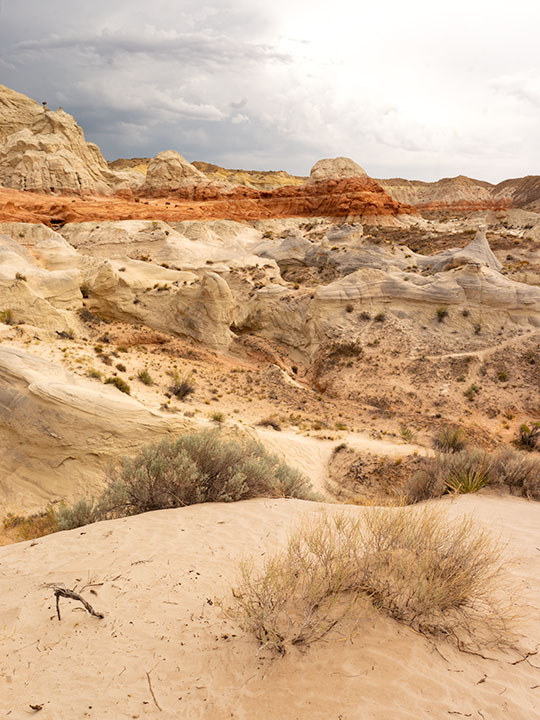
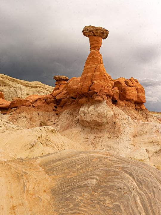
This week’s featured image only required a jone-mile hike, but it involved a climb to a shelf 300 feet above the road. Once you make it, you’ll find a group of toadstools—columns of sandstone supporting a protective capstone. Although the trail up there isn’t flat, you don’t need to be an élite climber to make it. Queen Anne got far enough that she was able to watch her hero snap this photo, which filled her with so much emotion that she had to return to the car and do her nails.
Red Toadstool
Red Toadstool – A protective capstone is supported by a column of red sandstone near Kanab Utah.

I shot this toadstool from a couple of angles and after viewing the test strips back at camp, I preferred this version even though it’s smaller within the frame. The composition is stronger, and the image is uncluttered, so the formation becomes a stronger subject. The light wasn’t what I envisioned when I planned this trip, but the thunder clouds are kind-of cool. I call this image Red Toadstool and I’m pleased to start a month of Utah photos with it.

You can see a larger version of Red Toadstool on its Web Page by clicking here. I hope you enjoy viewing this week’s post and come back next week when we present another image from a different Utah site.

Until next time — jw

Kanab Overnight 2018 Utah Photo Shoot

We stopped short of our target destination—Panguitch—by a hundred miles because I wanted to shoot along the lower Paria River. I was hoping to shoot a couple of areas that I previously visited bathed in a late afternoon sun. Instead, it rained. I captured some nice images anyway and Queen Anne followed me most of the way up the trail—including a bit of the climb. That was a miracle unto itself.

Dune at the Toadstools
Dune at the Toadstools – This is one of the images taken at the Toadstool stop along US 89. It was the first time I hiked up to them. To her credit, Anne followed me most of the way.

Our temporary site is in Kanab and the RV Park we originally stayed in during our Alaska adventure. New owners bought the place a couple of years ago and have made improvements. I’d have to rate it as one of my favorites—although truck traffic still starts early. Last night we enjoyed a fine meal at the Rocking V Cafe. It’s the fourth time we’ve stopped there without disappointment. Anne was perturbed that they didn’t serve their macaroni and cheese for dinner. She had been going on about it all day and nearly beat up the poor waitress when they wouldn’t make some especially for her. Instead, Anne wound up enjoying the curry dish that she ordered.

We’re packing up this morning and making the pull up to Panguitch. It’s another thousand feet higher and ten degrees cooler so that suits Anne’s prerequisite. It’s also centrally located to the areas that I want to shoot. We will be pulling The Ritz for a couple of hours so we’re not in a rush this morning. As a matter of fact, it just turned 8 am and I rousted her highness from the sack. If she stays in character, she’ll dawdle all morning so that we’ll have to stop at the Rocking V for a lunch of Mac ‘n cheese.

Until next time — jw

Welcome to Utah On Location

Welcome to Utah
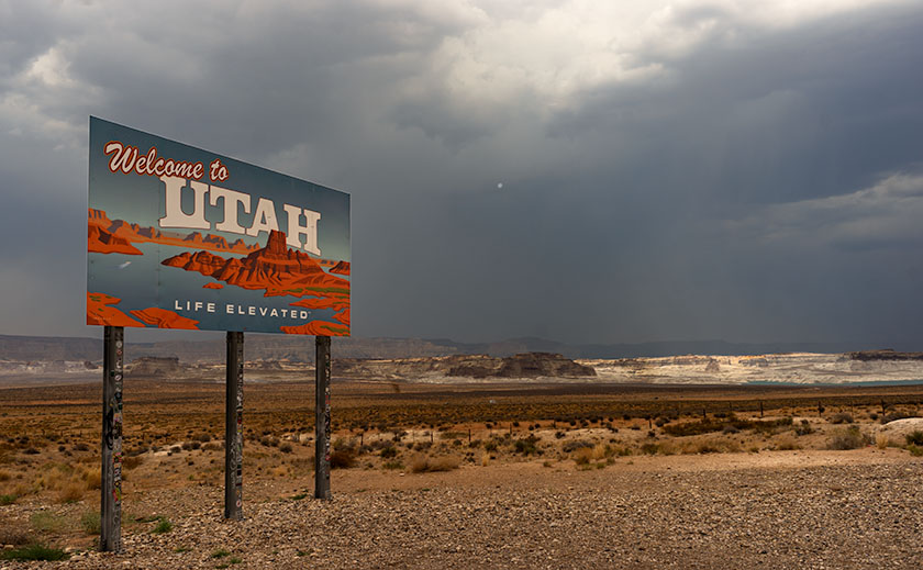
Welcome to Utah – With rain cells all around, we stopped to memorialize the state change.

We made it to Utah in spite of getting lost in Williamson Valley because we missed the turn off for Chino. We had to back-track fifteen miles. We finally rolled into Kanab at 5pm and after setting up camp, we relaxed in Ritz’s air-conditioning. The temperature is in the 80’s but it’s really humid.

It’s been a while since we did any shooting in the Beehive State and I’m excited to revisit the National Parks along US 89. It seems like Utah has more National Parks than the other states. We plan on visiting three of them at least. I also want to check out other sites that I’ve heard about. We’re going to be here for a couple of weeks—at least.

It’s been a long day behind the wheel, so we’re making an early evening, but I wanted to get this post out before we crash. I plan on writing more about the things we see and do much like I did during last years Springerville trip, so be ready for more blog posts this month.

Until next time — jw

Timberline Picture of the Week

Timberline
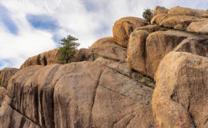
Timberline – The subjects of this image suggest that it is on a scale larger than it really is.

The wind was warmer than I expected at this altitude. Blowing on my back, it seemed to help push me along the John Muir Trail in California’s High Sierra’s. The Mt. Whitney Trail was only a half mile further when I stopped to snap this photo of massive granite formations along the tree line.

I just made all of that up. My chances of hiking those famous trails have long vanished, but this week’s photo has a sense of scale that could work with a fictitious story like that. I took this photo I call Timberline at the Granite Dells along with the others featured this month. It’s the angle that fools the eye so that you think you’re looking at a craggy mountaintop. The trees also play tricks with your sense of scale. They’re actually shrub-size like they were scale models of ones that are much taller—bonsai versions if you will, and the sheer drop in the lower left isn’t the hundreds of feet that it seems. It’s only a dozen feet over your head as you hike the Flume Trail to the park’s northern boundary.

The reason I included Timberline in this month’s set is that it distills the Granite Dells into three simple elements; massive rocks, trees eking a living in hostile conditions, and the changing sky over them. The photo speaks of weight—or mass—and it shows a time contrast of a changing sky and momentary life against the permanence of the weathered granite. The sky changes hourly while the trees will be different in a century, but the granite will survive the next millennia unaltered.

You can see a larger version of Timberline on its Web Page by clicking here. I hope you enjoy viewing this week’s post and come back next week when we start a new set of images from a new location.

Until next time — jw

Lime Lichen Picture of the Week

Lime Lichen
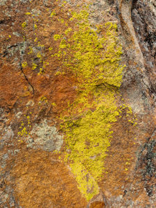
Lime Lichen – The main lichen growing in the Granite Dells is either orange or a pale green. Every so often, you’ll find a bright green patch such as this.

In last week’s post, I wrote how the Granite Dells boulders weren’t just bare rock, but they’re covered with living organisms which gives them color and texture. As you hike along the trails and take a closer look, you’ll find lichen, moss, fungi, and things that only a botanist could name growing there. Although they resemble a plant, lichen is a relitive of algae. They don’t put down roots, but instead, they get water and nutrients from the air. Lichen has a surprisingly long lifespan, but they don’t handle pollution well. When we were landscaping our Goodyear home, Anne and I specifically picked out some boulders that had a green specimen growing on them. Within six months, all the growth vanished.

There are two predominate colors of lichen in the Dells, an orange and another that is light green—seafoam if you will. Occasionally there’s a patch of a bright green specimen that catches the eye, and that’s how I happened upon this shot. The green was a small part on the larger rock surface, so to make it stand out, I moved in close enough and made it the subject of this photo. I like the way the bright green dominates the other muted colors. In all, I count four species growing in this shot. Because there’s not a structure in it, the abstract image is about color and texture. I call it Lime Lichen.

You can see a larger version of Lime Lichen on its Web Page by clicking here. I hope you enjoy viewing this week’s post and come back next week and see more from the Granite Dells.

Until next time — jw

Dells Scrub Oak Picture of the Week

Dells Scrub Oak
Dells Scrub Oak – The green of a mature scrub oak stands out against the Granite Dells boulders.

This week’s featured image is one that I took while exploring the Flume trail that parallels Granite Creek below the Watson Lake dam. State Route  89 divides Granite Dells Park as it heads north out-of-town, with the Willow Lake complex on the west side and the Watson Lake facilities on the east. Each division has trails that meander through the maze of boulders. The main series of trails around Willow Lake is called the Constellation Trails. I’ve only had a taste of that trail system, but I want to hike there some more. I have hiked a couple of the trails around Watson Lake and I’ve completed the Flume Trail twice.

The trailhead is located along the north park boundary. Access to the parking area is via East Granite Dells Road. The trail is almost a mile long in each direction and has a couple of moderate climbs over a couple of ridges, but a lot of it is flat. At its start, it runs between private properties so you’ll see signs warning you to stay on the path. After the first hill, the trail drops into a wide grassy area where you walk creekside under a growth of Cottonwoods. There is a second ridge you must traverse before the trail returns to Granite Creek and stays there up to the dam. When water is high, excess water rushes out of a flume—sort of an artificial waterfall. The water has been low for several years, so the flume is rarely used.

We visited the Dells on our June Costco run, but I wasn’t ready and made a stupid mistake. We left home early so I could go shooting before the warehouse opened. I wanted to photograph with a low sun for the color and it was around half past eight when we got to the parking area, but the day was going to be hot—even in Prescott. While Anne waited in the shade, I grabbed my camera and a second lens and then headed up the trail without water. It was going to be a hit-and-run shoot lasting an hour, tops. I hiked this trail five years ago without problem when we spent the 4th in Prescott. This time I underestimated the strenuousness of the climb, the morning’s heat, and the extra two-thousand feet of altitude. By the time I stumbled back to the car, I was in such bad shape that I made Anne drive us to breakfast while I downed a quart of water. When we got to Costco, we bought a small backpack that I can carry camera equipment and a couple of bottles of water in. Live and learn, eh?

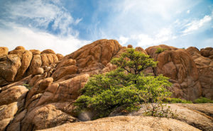
I came upon this scene at the trail’s beginning. After leaving the parking area and making my way over the first hill, I saw this scrub oak—a rather large and nicely shaped one at that—growing in the rock cracks. The green of its leaves stood out against the tan of the granite boulders towering over it. The wispy clouds made the blue sky interesting, so I included them in my composition.

You can see a larger version of Dells Scrub Oak on its Web Page by clicking here. I hope you enjoy viewing my newest entry and come back next week when we present another photo of the Granite Dells.

Until next time — jw

Granite Dells Sunset Picture of the Week

Granite Dells Sunset
Granite Dells Sunset – Prescott’s city park has two creeks, two lakes, and a bunch of rocks to climb. It’s a playground for adults and a wilderness experience inside city limits.

Welcome to July—the start of the year’s second half and when our nation comes together to celebrate Queen Anne’s birthday. Time flies when you’re having fun … and evidently, even when you’re not. As we tear another month from this year’s calendar, it’s also time to introduce the place we’ll visit: Prescott’s Granite Dells City Park. We were here five years ago during the tragic Yarnell fire, but this time, we came better prepared with experience and a real camera.

Granite Dells—or The Dells—is a “McDonalds’ playground” for adults. The park’s trails take you through or around the rock maze. There are secret rooms to discover, rocks to climb, narrow passageways to squeeze through, and creeks to ford. The only thing missing is the restaurant’s ball pit, where kids pee. The trail lengths vary so that you can spend an hour or an afternoon wandering among the giant boulders all day.

A million and a half years ago, a magma pluton—a six square-mile glob of molten lava shaped like a giant balloon—tried to force its way to the surface as the eruptions in Hawaii have done. Instead, because it didn’t have enough energy to bust through the rocks above, it was trapped and cooled slowly and crystallized into granite. Another famous example of a pluton is Yosemite’s Half Dome. As millennia passed and the forces of erosion and plate tectonics shaped the earth, the pluton eventually made its way to the surface. It has been exposed there long enough for the formation to fracture and undergo spheroidal weathering—the erosion that rounds the rock’s edges. Yavapai County has two other places where you can see these kinds of rock formations: the town of Yarnell along SR 89 and the hilltop where the truck stop of Nothing once was on Route US 93.

The two creeks that drain through the Dells, Granite and Willow, were dammed in the early 1900s as irrigation reservoirs by Chino Valley farm co-operatives. In 1998, Prescott acquired a chunk of Granite Dells, including the lakes, and has set aside the area as an open-space park. The usual picnic areas and sports fields are there, but the backcountry trails lead into parts of the park where you get a taste of wilderness experience. That illusion is occasionally broken when the trail passes a No Trespassing sign along the periphery.

When we visited the park in June, we saw new home developments on its northern flank and another proposed on the east side along the Peavine Trail near Point of Rocks. The development was met with community outcry and packed meetings at city hall. Concerned citizens worry that the new developments will irreparably change Dell’s character by blocking wildlife movements and introducing a sea of roofs to the landscape. It’s another example of a good thing being loved to death. I guess it’s true what they say, “You can’t have your Kate and Edith, too.”

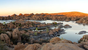
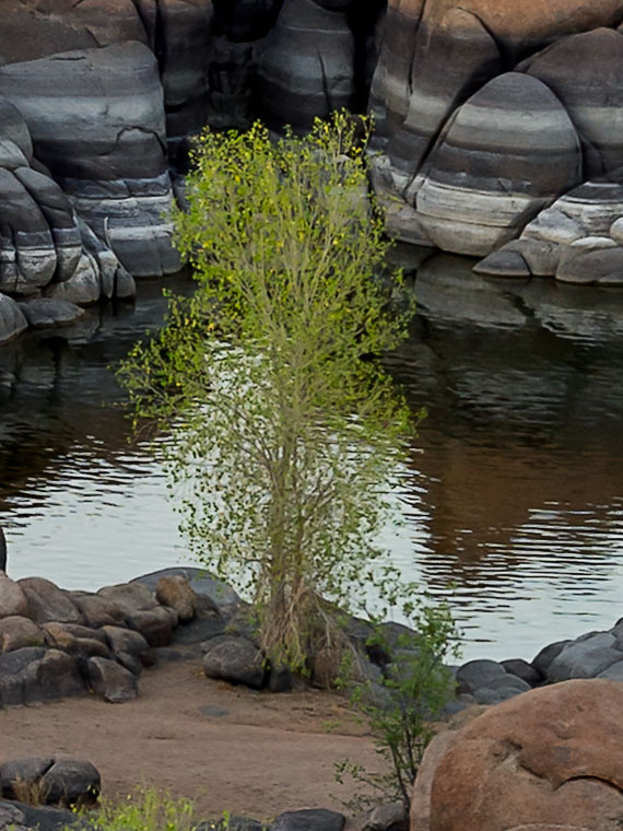
I took this week’s image after a Prescott meeting—not at city hall—that I attended. The sun was about to set, so I rushed to the Dells to get this shot. When I got to the Watson Lake overlook, I knew I wanted to capture this sweeping scene with the most detail. The format is a little different for me because this is a four-shot panorama. I took four shots and stitched them together in PhotoShop. The resulting file size is four times larger than my usual shots, and I can make a print thirty-six inches wide at full resolution. I made a crop of the shoreline tree in actual size to show how much detail I got using this method. This image is called Granite Dells Sunset.

Tree Detail
A full-size crop of the shoreline tree in this week’s image shows how much detail is in this image.

Click here to see a larger version of Granite Dell’s Sunset on its Web Page. It’s easier to find the tree in the larger version. I hope you enjoy viewing my newest entry and return next week when I post shots I took while hiking the park’s trails.

Until next time — jw