Our little town is not so different from yours. We have crime here too. That’s why the county sends a couple of deputies down from Prescott to patrol our streets and keep us safe. Most of the time, they drive around the empty streets, but there are moments where a rush of adrenalin flows through their veins—like last Friday night.
As most cops do, deputies Starsky and Hutch parked their cruisers on the dead-end street between the Dollar Store and the Quickie-Mart in such a way that they could drink coffee, chat across their door windows while keeping an eye on the only traffic control sign in southern Yavapai County. The night had been rainy but peaceful up till then.
Shortly after Congress’s only cowboy gay-bar closed, a pair of suspicious cars rolled up to the stop sign before turning south on Highway 89. Starsky noticed that a woman with long blond hair was driving the lead exotic Italian sports car (Around these parts, a Fiat 500 stretch limo is considered exotic) in the din of the sodium-vapor street lights. “I have to check this out,” Starsky yelled out his window, stowed the coffee in a cup-holder, put his cruiser in gear, and drove off in chase.
As he perused the little import through downtown Congress, he crossed over the double yellow lines, raced around the second vehicle before cutting in front of it. Then he lit up his lights and pulled the Fiat over. As he called in the plates for wants-and-warrants, he noticed that the sinister black Buick had pulled in behind. Sensing a threat, he radioed Hutch for back up. When he finally saw the second set of emergency lights in his mirror, he felt that he could safely get out of his cruiser.
Hutch had already climbed out of his truck behind him with a Maglite in his left hand while resting his right hand on his holster. He walked up to the second suspect’s vehicle and heard the last remaining Jennifer Rush Disco CD blaring through the stereo. The woman behind the wheel sat motionless with her hands in the air. “Mam, can you tell me why you pulled off the road behind my partner?” (OK, to protect the innocent, I have to change some names. Donna is the floozy driving the Fiat because Donnas always drive convertible sports cars. The gangsta-girl in the second car I’ll call Princess Margaret. Yeah, that works. No one will ever guess their real names.)
“That’s my friend, Donna,” Margaret replies. “I just want to make sure she gets home alright.”
“Well, this is a dangerous place to park. You’ll be safer if you pull in front of the other vehicles.”
With that, Margaret put her hands down, put on the left blinker to signal the empty highway that she was pulling out. Slowly she drove around the other cars, signaled that she was pulling back off the road, she put the car into park, and—once again—raised her hands over her head.
As Starsky strutted toward the hottie in the little white Italian Job, he practiced his best, “So, how you doin?” But when he got to her open window, the flashlight glare revealed far more lines of wisdom on her face than he expected, and her long tresses weren’t blond; they were pewter. His training and quick thinking let him instantly change tact. Instead, he asked, “Do you know why I pulled you over?”
“No, I don’t.”
“You didn’t come to a complete stop at the sign on 71.”
“Yes. I believe that I did.”
“That’s OK; I’m going to let you off with a warning,” which is what cops do when they can’t prove something in court. It also leaves a paper trail that shows they were working.
Donna—the consummate socialite—tried to get on the deputy’s good side, “I understand. My first husband was a Highway Patrol Officer.”
“When was that,” Starsky asked.
“During the late sixties and seventies,” she replied.
“That was long before I was born,” he gasped.
After Starsky filled out the form, he handed it to Donna and watched her drive off. Margaret finally put her hands down and followed into the darkness. As he walked back to his Tahoe, it finally sunk in that he almost hit on his grandma; he doubled over and blew donut chunks onto the front tire. From the other cruiser, he could hear Hutch’s giggling float across the damp night air.
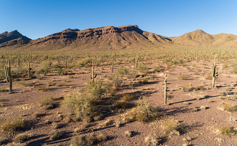
You may be wondering what this story has to do with this week’s picture. Well, actually, nothing other than our town’s stop sign is on Highway 71, and at the other end of that road—near Aguila—is where Santa rests, and there is a large grove of saguaros growing along the eastern flank of the Harcuvar Mountains. That’s where I took this week’s picture, which I call Harcuvar Forest. When I drove home from that shooting, I stopped at that very intersection—without getting arrested. I guess that I’m not cute enough.
You can see a larger version of Harcuvar Forest on its Web Page by clicking here. Next week, I’ll bring you another image from around our house.
Until next time — jw

