Resting Santa Picture of the Week

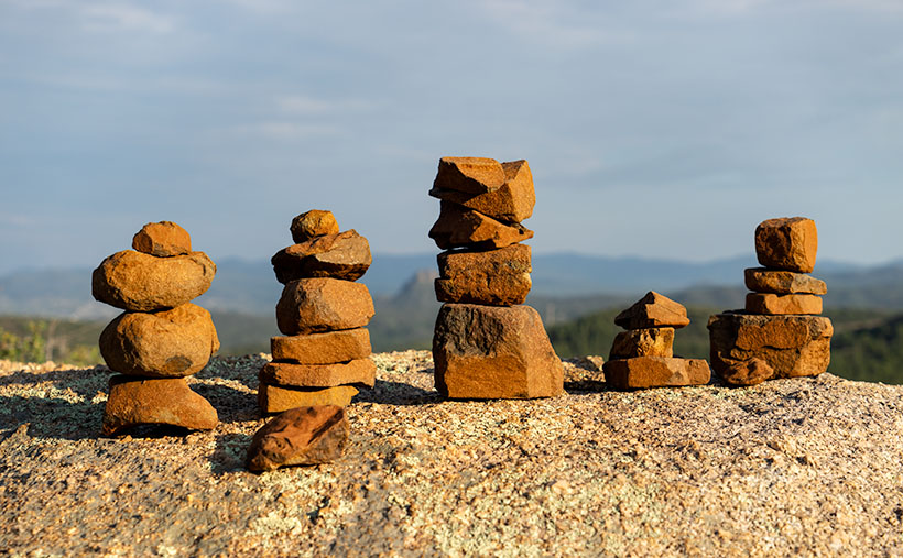
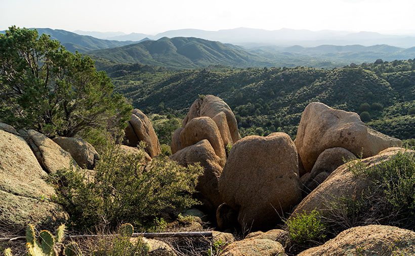
Gather around children because Uncle Jim has some sad news to tell. As you know, my job is to wander the countryside searching for pretty things to photograph, so I’m always on the hunt for interesting subjects along the roadsides. After Christmas, I was out with my camera, and I came across something that shocked me. Out in the desert west of Congress, I found a man—passed out—covered from head to toe in soot. This wasn’t the run of the mill derelict. No, he was our beloved Santa Clause flat on his back among the McMullen Valley creosote.

I don’t know what happened. I rushed to help, but I couldn’t wake him. He smelled of rum-spiked eggnog. There were cookie crumbs in his dirty mustache, and he was heading north judging from the trail of broken candy canes he left behind. I assumed that y’all left him one too many treats, and as he stumbled around in the dark, he tripped over the Harcuvar Mountains, and while he lay there, he slipped into a sugar coma.

A rescue was too daunting for me alone, so I drove home for more help. Queen Anne always knows what to do. As we drove back to the scene, I tried to explain what I’d found. Her typically skeptical response was, “Yeah—right.” (BTW, that’s an example of double positives making a negative. Take that, Mr. Horowitz) When we returned to the field north of Aguila, I pointed and smugly said that I was right, “… as you can see with your own eyes.” She shook her head, gave me one of her patented ESAD looks, and snapped, “Put on your glasses.”

I frowned, then walked back to the truck and grabbed my readers. When I took a second look, I was humiliated—again—and quietly thought, “Oh no, it’s just a big rock pile.” I turned towards she-who-knows-all, and in a voice that would have made Emily Litella proud, I mumbled, “Never mind.”

Resting Santa - After a night of carousing, Santa tripped over the Harcuvar Mountains and passed out in the McMullen Valley.
Resting Santa – After a night of carousing, Santa tripped over the Harcuvar Mountains and passed out in the McMullen Valley.

And so begins the New Year. Santa was obviously too indisposed to bring worldwide immunity from Covid 19. We still have to cope with the virus by ourselves, as we did last year. Since Queen Anne and I aren’t old enough and are not front-line workers, we’re considered part of the Useless Third that Douglas Adams describes in his book, The Hitchhikers Guide to the Galaxy. So, we have to wait patiently for our turn with that oversized needle. It could be anywhere from two to six months before we get our vaccines.

Until then, we’ll keep on keeping on—as they say—which means staying close to home and away from crowds. I’m ok with that because I’ve seen some things I want to show you from around our neighborhood. For January—at least—I’m going to catch up with some of these odds and ends. As soon as it’s safe, we’ll be exploring new highways with our usual cast of ne’er-do-wells. Here’s hoping that it will be soon.

You can see a larger version of Resting Santa on its Web Page by clicking here. Next week, I’ll show you another interesting shot from around the neighborhood.

Until next time — jw

New Water Black Mesa Picture of the Week

My first Phoenix visit was during the summer of my high school junior year. It wasn’t much of a visit. Dave and Edith—my mom’s niece and her husband lived here. They moved here from Michigan, and he hadn’t been able to find steady work as a mechanic, so my dad offered him a job maintaining his debilitated fleet of Corvair vans. They accepted and immediately packed up to move to the coast. Since I was on summer vacation and my wallet had that new-drivers-license smell, dad volunteered me to drive one of their trucks.

My father put me on an early flight out of the tiny Burbank Airport, and I arrived at an even smaller terminal where Dave met me. Parked at the curb outside was his white El Camino. I don’t remember the year, but it was loaded with toolboxes and the rest of his shop equipment. I didn’t question if it was overloaded because that was above my pay grade and comprehension at the time. I was only impressed that it had a four-on-the-floor, and it made a rumble when he started it.

We drove straight to their home, where a moving van was packed and ready for the trip. The only things that I got to see in Phoenix were the airport, the freeway, his house, and the biggest Goodyear Tire sign in the world. Even Hollywood didn’t have a sign that big and bright. I do remember that it was only mid-morning, and it was already hot. Automotive air conditioning was an exotic thing back then, so we drove with the windows down.

We didn’t spend much time at the house because everything was packed and ready. I was assigned to drive the El Camino, and he would follow in the U-Haul (or whatever brand he had rented). Both vehicles were packed to the gills, but Dave still had loads of unpacked clothes and threw them on my passenger seat before heading west on Highway 60.

Not many cars had air conditioning in 1963, but they all had wind-wings, little adjustable windows at the front of the door windows. They were useful for defogging the windshield, sucking out cigarette smoke, and when driving across the desert, they would divert the scorching wind from your face. By noon we were driving across the open desert west of Wickenburg, and my wind-wings were wide open.

Cars also had temperature gauges then because they frequently overheated. Nothing was broken; they just did that. While you drove, you watched your speed, the gas gauge, and the water temperature. You planned your stops by what the gauges said. As the day grew hotter, and the overloaded little El Camino began to run hot, and I pulled over to let Dave know. We began stopping at gas stations in each of the little towns we passed in an abundance of caution. There we would hose down the truck’s radiator and then continue on our way.

That was until we stopped at a place in the middle of nowhere. As I looked around, all I could see was the barren desert surrounded by dry, jagged mountains. The water spigot had a lock on it and a sign that read, “Water 1.00 a gallon.” That was five times the price of his gas; it was outrageous. The man behind the cash register justified the cost by saying, “Look around you, kid. Do you see any water? I have to pay to have this trucked in.” We gave in and bought a couple of gallons and slowly poured it over the gurgling radiator.

We drove another 200 miles without another incident, all the while the expensive water ate at my brain. Once we reached the cooler air in San Bernardino, the little truck behaved itself. As we drove the two-lane road crossing the lower Mohave Desert, we saw hundreds of freeway miles under construction off to the right. Interstate 10 was finished from L.A. to the Colorado River when I moved to Phoenix a decade later. In Arizona, it stopped at a place they called The Brenda Cutoff. For years I wondered who Brenda was. After moving to Congress, I realized that Brenda was the town where that infamous gas station was, and I finally put two and two together.

New Water Black Mesa - The early morning sun highlights the cliffs of Black Mesa overlooking Interstate 10 in western Arizona.
New Water Black Mesa – The early morning sun highlights Black Mesa’s cliffs overlooking Interstate 10 in western Arizona.

Last Tuesday, I pointed out the old station’s ruins and told Fred this story—well, an abridged version—as we drove back from our photo-shoot. We went there to photograph this week’s featured image of the Black Mesa in the New Water Wilderness Area. The Ramsey Mine Road approaches the wilderness, and it starts in Brenda. The lava-rock covered mesa cliffs are another of my favorite Interstate 10 landmarks. When I see them on the south side, I know that we’re almost to Quartzite, and the Colorado River is soon after. I’ve admired these formations each time I pass under them, and it’s taken me decades to figure out how to get closer. I called this shot New Water Black Mesa because there are dozens of Black Mesas throughout Arizona, so I have to start including which mesa I’m talking about.

You can see a larger version of New Water Black Mesa on its Web Page by clicking here. Next week we start a new monthly project as well as a new year. Queen Anne and I will still need to keep close to home, so come back next week and see what subject we chose.

Until next time — jw

Saddle Mountain Picture of the Week

I have mixed feelings about this week’s landmark that depend on which side I see it from. Saddle Mountain is located on the south side of Interstate 10 at Tonopah. When I used to ride the shuttle vans to the Wintersburg power plant, seeing the mountain meant that I had to wake up and go to work. But, whenever we returned from an extended California trip, I was always on the lookout for that distinctive saddle. When it came into view, it meant that we’d crossed into Maricopa County, and we were almost home. Phoenix was still an hour away, but at least we were on home turf.

Saddle Mountain is easiest to recognize when traveling east on the freeway. It’s the big birthday cake that a telephone pole fell on. It’s the dent in the middle that describes it, although you’d have to have pretty long legs to ride it. As you get closer, you’ll see many blocks and spires rising from its base. It has a lot of the same characteristics as the Superstition Mountains east of Phoenix. It’s said that the Flatiron face of the Superstitions is an ancient volcanic plug. On the other hand, Saddle Mountain—like its neighboring ranges—was formed by our old friends, rhyolite and tuff.

Being a couple of miles outside of Tonopah, it’s an easy place to get to. It’s not a wilderness area, so dirt roads are crisscrossing the surrounding land. In winter, snow-birds frequently dry camp in the flats. Signs say that the camping limit is 10 days, but I wonder if anyone enforces that.

Saddle Mountain - Blocks and spires adorn Saddle Mountain's north face.
Saddle Mountain – Blocks and spires adorn Saddle Mountain’s north face.

I’ve tried to photograph the mountain several times, but I never came away satisfied. It’s one of those places where you want to get in close to show the details, but you lose its distinctive overall shape when you do. This week’s featured image is an example of what I mean. I wanted to show the blocks and spires that adorn the mountain’s north face, but the saddle’s trough was hidden behind the ridge when I did. I’m pleased with this image, but there’s so much more to shoot that it frustrates me. Perhaps Queen Anne and I could drag the trailer down there for a camping trip later this spring.

You can see a larger version of Saddle Mountain on its Web Page by clicking here. Come back next week when we present our final December landmark. Both Queen Anne and I are wishing you a happy and safe holiday season.


Until next time — jw

Courthouse Rock Picture of the Week

After five years of retirement, I realize I slowly get things done by putzing. As I grow older, I don’t have a young person’s stamina, so I limit how much time I work in my shop or office. I am organized about it. I have certain days that I do things. There’s wood-Monday where I work in the shop; music is when I manage my music catalog; web- Saturday is when I update my website; and today—blog- Sunday—I write my posts. Each week’s highlight is dump-Thursday when Queen Anne rewards me for taking out the trash by treating me to Eggs Benedict at Nichols.

The remaining days are our weekend. Like the rest of America, we go shopping, on photo outings, visit our ever-growing list of doctors, and do chores around the house—if I must. I can also appropriate these days if I need more time for another priority. So, I’ve organized my interests into neat little day-packets. That way, I get to play with all of my toys. That’s important because if I don’t use them, Anne has threatened to haul them off to Goodwill. My system keeps me busy, yet there’s plenty of time for naps.

Imagine how frustrated I get when a week—like this one—comes along and upsets my routine. With this month’s I-10 project, I must go out each week to get a new shot. I planned to go out on Tuesday, but afternoon clouds moved in. Wednesday, it rained, so I swapped it with music Friday because Anne wasn’t here to gripe. The clouds remained on Thursday, but that didn’t stop me from going to the dump and buying my breakfast (there was hell to pay when the restaurant staff wanted to know what I’d done to Anne). Friday was still dull and gray, and I’d already done music Friday on Tuesday, so I had to sit on my hands. I needed a picture for Saturday’s update.

Yesterday, I set the alarm for 5:00 a.m. and drove down to Courthouse Rock in the dark. I repeated a mantra as I went, “Please let there be good light. Please let there be good light.” When I arrived, I was rewarded with high clouds, but the eastern horizon was clear. I only had about an hour to shoot as clouds were already gathering. This is the shot that I liked the best; I call it Courthouse Rock.

Courthouse Rock - Located in the north-east corner of the Eagletail Mountains Wilderness Area, Courthouse attracts rock climbers across the globe.
Courthouse Rock – Located in the northeast corner of the Eagletail Mountains Wilderness Area, the Courthouse attracts rock climbers across the globe.

The rock is the northeast corner of the Eagletail Mountains Wilderness west of Tonopah. You can see it on the south side of Interstate 10, less than a half-hour drive from the truck stop. If you take the dirt roads—as I did—the time doubles. The road in the lower right section of the photo gets closer, but I was running out of the golden light. I was still a mile away from the rock when I took this photo.

Courthouse Rock is well known to rock climbers, so it gets a lot of worldly visitors. As I left, at least a half-dozen SUVs loaded with people were on their way to the Courthouse. The vertical wall that looks like a curl from a Dairy Queen machine presents a challenge similar to Yosemite’s El Capitan. Besides the height, the most remarkable difference is that California’s is granite (lava that cools slowly underground). At the same time, ours is Rhyolite (thick air-cooled lava squirted out of an ice cream machine).

You can see a larger version of Courthouse Rock on its Web Page by clicking here. Next week, I’ll present another of my favorite I-10 landmarks. Because it’s sunny and clear today, I’m going out to shoot it this afternoon—none of this last-minute panic for me. Of course, it will have to wait until after my nap.

Until next time — jw

Big Horn Tank Picture of the Week

We’re down to the final month of this gawd awful year. For one, I will be happy to get my vaccination and venture back out into the world again—well, right after you get yours, and I see that you don’t get sick and die from it. I’m afraid that it’ll be months before it’s my turn because I’m too young and pretty. So, because it’s a short month, and Queen Anne has abandoned me, we’re going to explore a road that’s both close by but too expansive to cover in one day.

This month’s focus will be on a road, unlike what we’ve covered on this platform before. It’s not even dirt. It’s a road that stretches from Jacksonville, Florida to Santa Monica, California. It’s also the longest possible way to cross Texas. When Anne and I visited Deb and Fred in Austin several years ago, I was dismayed to see a highway sign that said our destination was further off than the two states through which we’d already driven. I’m, of course, talking about Interstate 10.

Calm down, we’re not going to do the whole thing in one month, and I’m not ready for a lifetime commitment (ask Anne). For December, we’re going to point out the landmarks that I enjoy seeing between Phoenix and the Colorado River. Even with that limitation, there are too many to fit into four Sundays. We’re not even heading in a particular direction; we’ll talk about each place as I get to it.

If you’re like me, you loath driving cross country on the Interstates, but they are the most efficient route when your time is limited. I’ve made countless trips between Los Angeles and Phoenix since moving here a half-century ago, and the flat desert always was the worst grind—river, flat, mountain, flat, mountain, flat, town. After I learned some about the mountain ranges, it was more enjoyable to know that Courthouse Rock was coming up on the south side or that I could spot the abandoned solar observatory on top of Harquahala Mountain. It was like saying, “Hi” to old friends as we passed.

This week’s featured image was taken in the Tonopah area. From east to west, you’ll pass the Palo Verde Nuclear Generating Station, stop at Tonopah Joe’s for gas and heartburn, then on the north side of the highway—where Salome Road crosses—there’s a prominent horn mountain, called Big Horn Mountain. It’s the centerpiece of a wilderness area that’s the same name. Actually, there are two wilderness areas separated by a dirt road that I’ve yet to discover. These are the Big Horn Mountains Wilderness and the Hummingbird Springs Wilderness across the street. You can do backflips across the road from one to the other.

On the plains south of Big Horn Mountain Wilderness Area, is a rusty tank meant to provide water to cattle on the open range.
Big Horn Tank – On the plains south of Big Horn Mountain Wilderness Area is a rusty tank meant to provide water to cattle on the open range.

This week’s featured image that I called Big Horn Tank was taken from the Harquahala Plain off of the Salome Road. There on the open range, I found a rusty water tank for an interesting foreground. I think that rust is a photographer’s favorite color, and I like how the white PVC pipe accents the tank. The other thing I see is how little vegetation cattle have for grazing. They don’t eat creosote (would you), so they only munch on the yellow grass.

You can see a larger version of Big Horn Tank on its Web Page by clicking here. Be sure to come back next week for another roadside landmark from Interstate 10. Tomorrow, I have to phone the Queen to see where I’m allowed to go. Wait till I tell her what happened to me as I was leaving Algodones yesterday—she’ll never let me out of the house again.

Until next time — jw

Fish-Hook Barrel Cactus Picture of the Week

When you hear someone talk about a desert, what image pops into your mind? Is it the endless Sahara dunes where Bedouins in keffiyeh headdress travel by camels? Maybe it’s the barren, dry lakes of Death Valley, or perhaps your go-to desert is in Mongolia. By definition, a desert is any place receiving less than 20 inches of annual precipitation. That makes most of the Great Plains, most of Southern California, and the Antarctic deserts.

My desert is the one that I’ve called home for almost 50 years; the Sonoran Desert. In the last half-century, I’ve traveled most of its parts within Arizona and California. I can attest that it’s not a flat, uniform wasteland—as some people think. It has mountains, canyons, plains, dry washes, and an exotic river or two. Its span ranges between Arizona and the Mexican State of Sonora. If you see a map of it (and you have to squint real hard), it’s jellyfish shaped—starting at the north (where I live), the half-circle body covers Arizona, and the tentacles reach south to either side of the Sea of Cortez. Its width covers from El Centro to Tucson.

The signpost that says, “This is the Sonoran Desert,” is the saguaro cactus. It thrives here because of the four major western deserts; the Sonoran is the only one with two rainy seasons; winter rains and summer monsoons. In winter, the rains nourish the cactus to flower and bloom, while the monsoons provide water for the dispersed seeds to germinate. Isn’t nature swell?

Although the saguaro may be the Sonora’s big-ticket item, it isn’t the only thing here to see. That’s evident when you visit the desert’s reserves like Saguaro National Park, Organ Pipe Cactus National Monument, KOFA Wildlife Preserve, or several wilderness areas in southern Arizona. The biodiversity of these places will keep you on your toes—“Watch out! There’s a snake over there.”

Fish-hook Barrel Cactus - a couple of succulents nuzzle in the late afternoon sun.
Fish-hook Barrel Cactus – a couple of succulents nuzzle in the late afternoon sun.

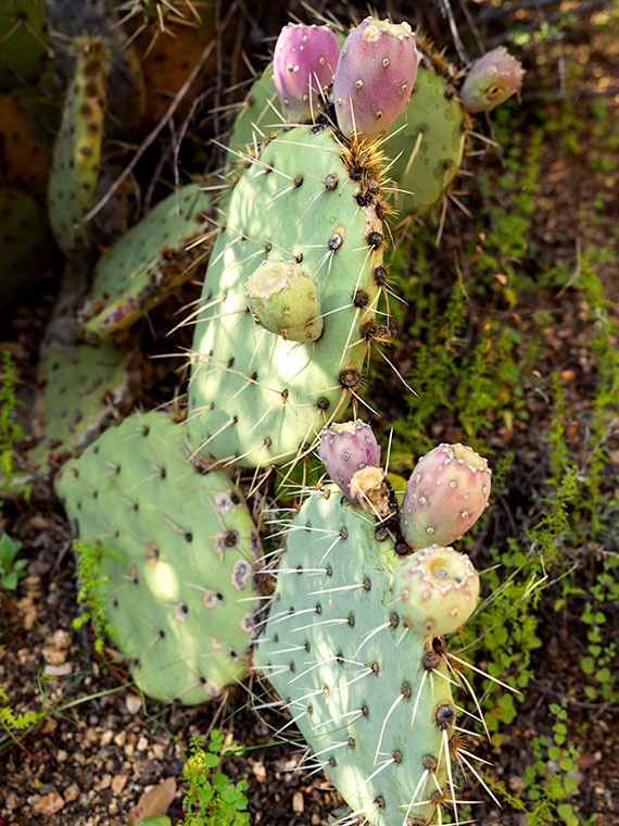
That’s how I thought I’d end our one-day tour of Saguaro National Park. While exploring the park’s dirt road loop, I spotted a couple of succulents nuzzling one another, so I went in and grabbed a shot. I call this picture Fish-hook Barrel Cactus. It shows a couple of common cacti—a fish-hook barrel and prickly pear—glowing in the evening sun. The barrel cactus is the one you’re supposed to cut open if you need water—it’s not hollow, so you have to wring the pulp if you’re desperate for a bad tasting drink. Prickly Pear grows everywhere and has even overrun Australia after it was illegally transplanted there.

You can see a larger version of Fish-hook on its Web Page by clicking here. For December, we have an idea for a completely different type of monthly project. We had to. I’ll be spending time with my Mexican dentist—oh joy—and Anne is risking her life to visit her family. She’s shortening my leash while she’s away, so I won’t be able to roam very far from home. If I do, my electronic collar will shock me.

Until next time — jw

Arm Pits Picture of the Week

When we visit national parks, Queen Anne and I like to spend time at the visitor’s center. We study the 3D display map and look through all the books. It gives us an idea of what to expect. Unfortunately, one of the regrettable effects that COVID 19 has brought is that the centers are closed. Even so, we stopped at the one in Saguaro National Park because they leave literature outside for crazy folks like us. That’s where the story of this week’s picture begins.

After picking up a map, I wandered the grounds looking for a shot of the mountains outback. I took several shots, but I knew they weren’t keepers. We got back in the truck, intending to explore the open roads, but we never left the parking lot. I spotted a possibility and immediately parked. As I hiked up the hill, I spotted a unique saguaro, and I forgot all about what I was after. Ooh, squirrel.

Arm Pits - A close-up photo of a cactus that refused to shave found in Saguaro National Park, Arizona.
Arm Pits – A close-up photo of a cactus that refused to shave found in Saguaro National Park, Arizona.

Like people, saguaros are all different. Young ones have no arms; some have one arm, others two or more. Someone could publish a book of saguaro portraits—it’s probably already done. The specimen that caught my eye had multiple arms, and they were pretty much at the same level. It reminded me of the Hindu goddess Durga—the woman seated with a gold headdress and many arms. As I approached the cactus, I noticed that it hadn’t been marred with woodpecker holes, so I spent some time trying to get a memorable photograph.

When I first reviewed this shot on my computer, I came up with a litany of Queen Anne jokes about shaving her legs. They involved ruined pantyhose, scratching posts, bear fur, velcro, and things along those lines. But, this morning, I thought better and decided not to go there. It’s better not to squander what little life I have left. I didn’t want to let the humor go to waste, though, so I titled this shot Arm Pits.

You can see a larger version of Arm Pits on its Web Page by clicking here. Next week, our day in Saguaro National Park turns to late afternoon, so be sure to come back and see what we found.

Until next time — jw