By now, you know that I’m a history buff—or perhaps I’m only interested in trivia. I don’t see the distinction, but I know I’m not cut out to be a scholar. I don’t have the patience to spend months in the Vatican Library tracing the origins of … anything. If Google or Wikipedia doesn’t explain, I move on. However, if someone mentions Hannibal, I think of elephants, not fava beans. I even watched all the James Burke’s Connections series—twice. I’m the only person that I know who has a personal copy of Arizona Place Names—and uses it. This probably explains why I write blog posts instead of novels, and it is the reason behind this thought I had when I published this week’s image—I wonder how many young people know the history of the sidewalk’s stamp.
While scurrying up and down Jerome’s hilly streets last week, I went into the Holy Family Catholic Church on Country Road for an interior shot. After that, because the day was late and I was out of breath, I returned to Main Street, where Queen Anne awaited me. A few stairs were at the end of the street, so I looked down to prevent falling. That’s when I first saw the stamping and decided that I needed to take another photograph. I call it WPA Sidewalk.
This is only the second existing example of a Works Progress Administration—renamed in 1939 as the Works Project Administration; it was the depression era program that employed people for public works projects—that I have cataloged in my brain’s world map. The other is a bridge on the US89 north of Flagstaff. (Maybe finding and shooting WPA sites would be a book-worthy photography project.) Jerome has already replaced many of its walkways with ADA-compliant versions. They had to because of age, winter freezing, and earth movement, but this one is still in good shape and used daily. With the hand-scribed lines (for better footing?), it’s certainly different from the sterile versions that machines spit out today. Since it’s over fifty years old, it probably qualifies for protection under the American Antiquities Act. This sidewalk is the only museum piece I know you can stroll down.
You can see a larger version of WPA Sidewalk on its Web Page by clicking here. I hope you enjoy viewing my newest entry and return next week when I post another Jerome photograph.
When I first moved to Arizona in 1972, I hung out at a certain Scottsdale Restaurant. It was a trendy steakhouse that had a minimalist décor of white walls with dark wood trim and original oil paintings—on loan from a gallery—decorated the walls. One painting in particular that impressed me was of an eagle emblem with a broken wing positioned over the word Liberty. The design was simple enough to be a graphic poster, but the style was photorealistic and it looked as though it could be a building sign. This was back when we all had long hair and wore bellbottom pants, so I thought it was a political statement when I first saw it.
“Oh no, that’s the Liberty Theater in Jerome,” my waitress corrected.
“Jerome, what’s that?” I asked.
“It’s the ghost town near Sedona. You’ll have to go there sometime.”
So I did, and as I wandered the streets of the old copper mine town, I felt strangely comfortable—like I had always known this place. There was something familiar about its terraced streets lined with white clapboard row-houses. Jerome reminded me of the Pittsburgh neighborhood where my great-grandmother’s—Busha—apartment house was, and where my family lived until I was in the first grade. I remember it was on Bigelow Boulevard—a wide thoroughfare that ran east from downtown up a long grade onto Pollock-Hill—the local slur for the neighborhood. Just like Jerome, laborers built our community on a mountainside on unsuitable plots and walked to work up and down endless staircases. Our apartment at Busha’s was on the second floor if you came through the front entry, but from the backyard, we were on the fourth floor of a five-story building.
Growing up in neighborhoods like these isn’t for the feeble. My preschool playmates and I would test our balance by walking along the top of the retaining wall supporting the boulevard. It was a couple of feet wide, but the sheer drops would have killed us had we fallen. Another example of peril was in our apartment’s backyard. It was paved with bricks and the neighbor’s yard was low enough that we could jump from our fence rail, over a three-foot gap, and onto the neighbor’s wood-shed roof, which—as kids always do—we double-dog dared each other to do. The jump to the roof was easy. Just climb to the top of the railing and leap onto the roof. However, the return flight required clearing the four-foot rail. I mastered the jump several times before I missed and crashed head-on into the guardrail. As gravity drug me down, I saved myself by grabbing and holding onto the railing’s bottom pipe. I hung on for dear life above the abyss and started screaming so loud that my mother could hear me four flights away. I almost lost my grip when she finally came to my rescue and as she started to pull me up, she couldn’t hold on and I became a human pachinko ball as I ricocheted between the concrete retaining wall and the shed siding. I survived the fall but not without a slight scar under my right eye that is only noticeable as a bag under my eye when I’m tired. Then, my eye has a noticeable bag under it. I don’t know what hurt worse, the bloody cut or the beating I got when my dad got home.
It’s been more than ten years since we’ve been to Jerome, and a couple of things struck me when Queen Anne and I visited last week. I didn’t understand at first, but there is a sense of openness now. Most of the abandoned homes have been torn down. Jerome was full of decaying houses that had crumbling foundations, sagging roofs, and signs on them that said, “Condemned – Danger – Keep Out.” Those are gone now. The buildings that remain have been extensively restored and reinforced. There are a few new homes built on the vacant lots, and that’s good to see.
The other big change is disappointing to me. It’s the closing of the House of Joy. The historic brothel was once one of Arizona’s première restaurants but it’s closed now and the building is for sale. Eating at the House of Joy was a big occasion and a good reason for spending a night in Jerome. I’m sad that I missed the chance to dine there. Most of the current eateries are open only for breakfast and lunch, so except for the geezer cover-bands playing at the Spirit Room, evenings in town must be quiet.
Jerome is still a great place to spend a day out of the valley. There are plenty of stores on Main Street to buy a tee-shirt, try on jewelry, admire local art, enjoy an ice cream cone, or relax with a cold beer. There are more haunted buildings than ever, and the museums and mine are worth visiting. Jerome, as always, is one of the spots that you take your eastern relatives so they’ll get an idea of Arizona’s history and geographical diversity. It’s just … the old ghost town is more refined now and not the rough and tumble kind of place I first knew.
It’s June already and our wall thermometer is reading over 100º so it’s time to shoot somewhere a little cooler. Queen Anne and I racked our brains to come up with a scene close enough for day trips, and we decided to focus on Jerome this month. It’s a ghost town close by, it is a mile high clinging to the side of Mingus Mountain, and it is cooler than here. I have personal recollections about Jerome that I plan on sharing later this week, but Sunday’s are reserved for new picture announcements, so let’s get on with it.
I’ve photographed Jerome several times over previous decades and I already have a library of the town’s familiar buildings, so on this trip, I wanted to look for details that give Jerome character—you know—the artsy pictures. I got some shots that fit that bill, but to set the stage for Jerome Month, I wanted to start with an image that would give people who have never visited the town an idea of its geographical placement, and I think this week’s featured image does that.
I call this image House with a View and it is one of the few private residences that has survived intact. It’s a modest home that is one story on the street but has three levels at the back. It’s a brick building indicating that it was home to a family of means—like a mine manager. To me, it shows how steep the slope of the lot it’s on and how much engineering it took to keep the house from sliding into Clarkdale below. Conversely, the upside of being tethered to a mountainside is the million dollar view of the Verde Valley two-thousand feet below—and to the north, the red rocks of Sedona. Can you imagine having cocktails on that veranda while watching the sunset on the southern edge of the Colorado Plateau?
You can see a larger version of House with a View on its Web Page by clicking here. I hope you enjoy viewing my newest entry and join Queen Anne and I as we show off Jerome this month.
This week’s featured photo concludes our May adventure to Alamo Lake’s mud cliffs. I have another couple of detail shots that would fit nicely into this grouping, but I’ve run out of weeks this month and we have other places to go. I suppose I could put together a set of six and make up a folio like Santa Lucia Fog, or maybe I’ll go back and shoot enough images to complete a portfolio. I’ll have to think about that—what do you think?
May’s final image looks like I shot the mouth of a shallow cave with—if you squint and let your imagination go wild—a pair of cherub heads as keystones, and that’s exactly what it looks like when you approach this structure in the field. But there’s something in the photo that gives a clue that this isn’t a cave. It’s the light shining on the floor past the opening. If you crawled into the cave where that light area is, you could stand up—or you could just walk around the pile of mud to the left, and come back down the stream bed. This is actually a low arch that is torso high. If I had a model, her legs would show in the lower opening while her head and shoulders would be visible on top. It would make a unique open shower design—like you would have poolside.
In all honesty, I wasn’t creative enough to come up with that idea. The woman in spring’s photo class, whose images inspired me to visit this place, came here with a group, and one of her friends posed behind the arch. Except he was a guy and he wasn’t naked. When I walked up to this spot, I wasn’t sure it was the same because it’s so well camouflaged. If I do go back for a reshoot, I’ll need to have a model join me. What are the odds of that happening: me—a toothless old geezer—convincing an attractive woman to go with me to this barren wasteland so that we could shoot that picture? Yeah, I didn’t think so either.
You can see a larger version of False Cave on its Web page by clicking here. I hope you enjoy viewing my newest entry and join Queen Anne and I as we present new photos from a different location—this time in Yavapai County.
This week’s featured image is the third of my Mud Cliffs series that I’ve written about for the last couple of weeks (here’s the original). In the first post, I started at the mouth of the slot canyon and last week, we got to the narrow passageway’s end—or the head. Today, we begin filling the spaces between.
I shot today’s photo, like the first, late in the day on the outbound hike—after the light turned to gold. The low sun adds a warm color to the mud and, in this case, really shows the pillar structure in the sediment. All though, I wouldn’t want to put myself in that kind of danger, I can imagine a temporary waterfall pouring over the spout between the mounds during a summer monsoon. I’ve seen it happen at Lake Powell. We were exploring a similar canyon by boat when an afternoon deluge hit us. It was a Disneyland ride with waterfalls all around. Fortunately, we weren’t hiking and need to worry about escaping a flash flood.
You can see a larger version of The Spout on its Web page by clicking here. I hope you enjoy viewing my newest entry and tag along as we look at the canyon walls for the next couple of weeks.
There’s a thing about living in a rural Arizona town that is lacking in big cities. It’s the small town block parties. It’s where the town celebrates an obscure but important community event. Wickenburg has Gold Rush Days that coincide with the Senior Pro Rodeo each winter. Our town celebrates Congress Day. I don’t know who sponsors our event since we don’t have a city hall, but in the dirt lot in front of the library, our firemen line up their shiny truck beside a half-dozen citizens sitting at card tables hawking arts and crafts or shiny boxes of rocks. This year, organizers omitted the bouncy castle because last year, none of my fellow septuagenarians were able to get out of it.
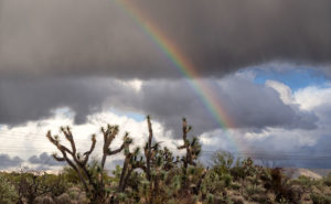
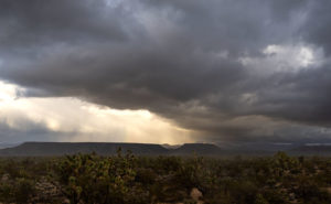
This Saturday, ten miles up the highway, the town of Yarnell will be having a block party that they call Yarnell Daze Mountaintop Festival. The celebration on the hilltop is bigger than ours because they have a chamber of commerce. There is a parade, live music, and different activities scheduled all day, but the one thing that warrants me writing about the festival is the art show. The organizers have invited artists from Wilhoit to Wickenburg to show samples of their work and I have submitted these three pictures from my cloud series for the show.
The festival starts off with a pancake breakfast at 7:00 am, hosted by the Yarnell Fire Department. The parade begins at 10:00 am (remind me to tell you the story about the parade in Kanab sometime). The art show is inside the Big Blue Barn on AZ-89—it’s the only two-story blue building in town and it’s on the east side of the street. If you go, there are also a couple of good cafes to eat at if you don’t want pancakes and besides the art show, there are a myriad of antique stores to peruse.
Unfortunately, Queen Anne extends her regrets. It seems that her posse is gathering at Yaz’s house for The Wedding. If you can believe this, they will be getting up at 2:00 am to watch TV while wearing tiaras and consuming high tea. Right now she’s busy in the kitchen making cucumber and egg salad sandwiches. She’s already cursing about the nail she broke while trimming the bread crust. Knowing that group, I bet they oversleep and miss it.
Continuing last week’s adventure to the mud cliffs at Alamo Lake, I took this week’s picture at the other end of the slot canyon. It’s not a very long hike—maybe fifteen minutes if you don’t dawdle—but I was exploring with a camera and stopped to take pictures often along the route. The reward waiting for you at the canyon’s head is this mudstone arch carved by rushing water draining from the surrounding mesa. If you hike a few yards beyond the arc, the canyon ends, and you’re on the mud flats between Date Creek and the Santa Maria River. The water is runoff from the Black Mountains in the north that has carved the canyon from the flats.
Since I’m not a geologist, I can’t tell you how old the arch is, but because the surrounding soil quickly erodes and because I slept in a Holiday Inn Express once, I assume that it hasn’t been there for very long—geologically speaking—and it may soon crumble. You’ll notice that the arch’s shape isn’t smooth and rounded like the sandstone arches in Utah, which tells me it hasn’t been polished by blowing wind. That’s another clue to its relatively young age. I won’t be surprised if it disappears in less than a decade.
When I arrived at this scene, the sun was low enough that it didn’t shine onto the canyon walls, but it did add that late afternoon glow to the mound behind it and separated the arch from the background—sort of a spotlight, as it were. With streaky clouds in the sky … what more could a photographer ask for?
You can see a larger version of Mud Arch on its Web page by clicking here. I hope you enjoy viewing my newest entry and tagging along for the other canyon shots I’m revealing this month.