My friend Fred got a new toy for his birthday. For the last couple of years he’s been lusting for a SUV (Sport Utility Vehicle). If you’re not familiar, those are off-road buggies powered by snowmobile engines. In Congress, they’re all the rage and have all but replaced golf carts.
Last month some folks in the park sold their home and advertised their SUV on the local bulletin board. It was just the one he was hankering for, so he kilt it and brought it home for Deb. Her only comment was the smoke coming out of her ears. She looked like her power supply burnt up. It’s bright yellow Can-Am, so I tagged it Tweety, after the villainous cartoon canary that brought grief to Sylvester the cat.
Fred was all excited when he brought it over to show me. The first words that came out of my mouth were about him being forced to sleep in their trailer. After a ride around the block, we concluded that it needed a shake-down cruse. After comparing honey-do lists, our first common free day was last Thursday. We decided on a route that circled the house and would never be more than ten miles away. We were going to drive up to Stanton (a mining ghost town that is now an RV Park) then stop at the old Octave mine and finally drive the back roads home. I could bring my camera and get some shots along the way. The whole trip would take about three hours and we’d be home by dinner.
On Thursday, I cleaned my camera, charged up spare batteries and noticed that the memory card door was open, so I made a mental note to put a fresh SD card into the camera and pack a couple of spares. Fred showed up right on time at half past two. After some last-minute adjustments, including a heavy sweater and packing water, we set off.
Along the sides of US-89 there are trails that people use for SUVs and ATVs. That way they aren’t obstructing highway traffic. We drove the north-bound trail to the gas station to top off the tank. By the time we reached the station, the novelty of riding in the open and jostled about had already grown thin. There’s no heater, no doors and the only thing keeping you inside are the seat belts and a couple of strategically placed grab bars. After getting gas we had to drive the highway for another couple of miles before turning onto the dirt road that goes to Stanton. We watched the mirrors carefully for traffic and pulled to the shoulder to let cars go by.
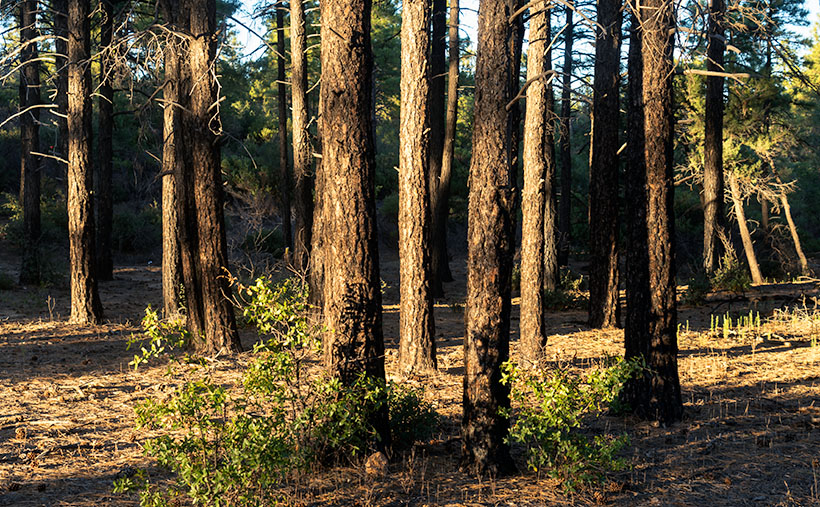
When we reached the Stanton road, Tweety was in her element and we sailed along at a decent clip. It’s only a half-dozen miles to the ghost town and I worried that we were too early for the ‘magic light’, but we pulled into the RV Park to check it out. There are a few dwellings remaining, surrounding a Saloon (serving as an office), hotel and the remains of the old brick opera house. I wandered off to reconnoiter the buildings while Fred stopped at the office. He found out that it isn’t a park at all, it’s a mining association. Like a timeshare, you buy into the place and in return you can park your RV and work any of the claims that the association owns. Because he registered as a guest, they gave us permission to hang around and shoot some pictures, so I went for my camera and when I pulled it out of the bag; I saw that the card door was still open. I forgot to pack film; so much for the photo shoot.
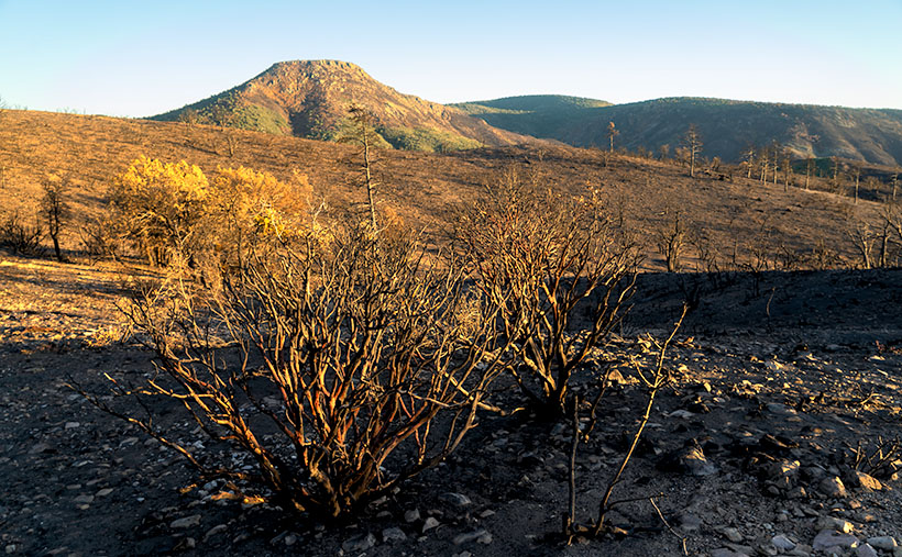
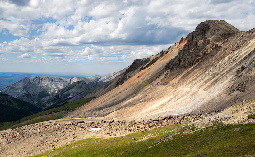
We soon were off to the Octave Mine. As we drove, I made mental notes of photo locations. I also noticed that the area was crawling with prospectors working active claims. The area along the Weaver Range had several productive gold mines in the 19th Century, but they had all played out by the 1920s. Even so, along the road were gates with “No Trespassing” signs. Being very protective, when a miner’s sign says “violators will be prosecuted,” that usually means shot.
Since we didn’t have to stop for photographs we set out to find the road that would lead us home. To keep us from getting lost, I brought a topographical map and my GPS. We used them to navigate the maze of trails that crisscross the area. We would go till we found an intersection, take a reading from the GPS and find our place on the map. We sort of could figure where we were but the map and GPS seemed to disagree by about a thousand yards. By using our heading and the terrain, we could interpret our site on the map. We drove by a windmill and cattle tank (a lovely shot), we used as proof that we knew we weren’t lost.
According to the map, all we had to do was go north from the windmill a hundred yards, turn west on a jeep trail, drive south through Antelope Creek for a quarter-mile and the road we were looking for would be on the right. We’d be home early.
We quickly found the trail which led down a steep bank into a creek bed. As you’d expect, there wasn’t much of a road down there. Just intermittent tire tracks along the boulder strewn ravine. Tweety’s ease in traversing the rocky path impressed us. We concluded that this thing would go anywhere. About a mile later the trail climbed up the bank heading south and skirting a low hill. We’d missed our road, so we turned off and headed back north only to find ourselves back at the windmill.
Fred drove around for another hour searching for a way out of the maze. We were losing light and the temperature began to drop. I was glad I’d put on a heavy sweater under my jacket. When we drove by the windmill for the fourth time, the sun was almost down and we stopped to check the map. We conceded and gave up our search. The map showed that the road north would take us directly to the main Stanton road, so we decided to go home that way. Although the map said this was a major trail, it was just a couple of ruts that wove between the creosote and cactus. We could at least follow it even after we had to turn the headlights on. We dodged some cattle along the way and passed an occupied trailer.
It was dark when we drove up to the fence clearly marked “No Trespassing.” The road had come to a dead-end. We got out and looked around. Beyond the house in front of us, we could see Stanton and our road home. We backtracked a bit and discovered that the real road turned to the right which we missed in the dark. It led down a steep hill so I took the flashlight and walked in front of the buggy. At the bottom were two concrete pillars with a padlocked cable stretching between them. A sign hung in the middle which said “No Trespassing,” but that was on the other side. Aargh, somehow we had gotten on private property and it was dark in mining country.
Fred turned Tweety around and we drove back over the hill and then descended the other side. I’m not sure we were on a road, but we saw tracks which led to another locked gate and warning sign. We tried to find another way but instead just drove in circles. We couldn’t find the way in. We stopped for a while to strategize. My GPS lays cookie crumbs so we used that to retrace our steps. We decided that we had to return to the windmill and take the long way back. Fred suggested that we stop at the trailer we passed and ask for help. With that, we started re-tracking the GPS dots.
When we reached the trailer it was dark, but there were dim lights coming from inside. Fred stopped the buggy and I got out. I didn’t want to frighten anyone so as I approached the home, I held the flashlight on myself. Ten yards away I stopped and yelled, “Hello! Hello! Is anyone home in there? We need some help. Hello!”
A dog barked and that’s always a bad sign. I repeated my cry. Then Stephen stumbled out of the front door followed by a black and white puppy. “Yes officer, how can I help you?” he slurred. Were he driving, he would never have passed a breathalyzer test. Though he was fully clothed, judging from his tossed hair and disheveled clothing, we must have woken him. I moved closer to avoid having to yell. I introduced ourselves and explained our plight.
“I am a retired Air Force Commander,” he started then veered off into a paragraph of disjointed sentences. “I’m here to help you. Are you military?”
I explained that Fred was an Air Force veteran and I was in the Army, but that was long ago. “No matter,” he went on, “once military always military.” Then he let out another batch of seemingly unrelated sentences. Fred walked back to the buggy and started it.
“You said you could help,” I almost pleaded.
“I can, but your friend is rude,” he observed.
“He’s tired and frustrated, as I am. How can you help us?”
“Come inside where it’s warmer,” he said picking up the pup then stepping back into the trailer and although Dueling Banjos played in my head, I followed.
The inside of the trailer was only a bit wider than our Casita, but longer. A galley was on the left and a mattress filled the right. Neither had been recently cleaned. On the counter were two open cans of beer; a brand that hasn’t been sold in Phoenix for decades. Dishes piled up in the sink next to a rusty stove. There was a neat pile of roaches (the joint kind) in a saucer next to the door.
He tried to start another round of military conversation, but I was getting frustrated by then. I was about to give up, but instead, I cut him short. “Look, I’m tired, hungry and, frankly, a bit scared. You said you could help, but you’re not. How can we get to the Stanton Road and go home?”
“Where did you come from?” he asked.
“Congress,” I replied.
“No. I mean, how did you get here?” He was trying to analyze.
I again explained how we had taken his road, but when we went further, it was a dead-end.
“You see,” he started, “you take this road all the way and it makes a right turn down the hill.”
“Yes, but there’s a locked cable across the road,” I responded.
“I’m a retired Air Force commander and my job is to look after this land for the mining company,” he explained.
“How does that help?”
“I have the key!”
“Oh great,” I thought. How are we ever going to pile him into his truck and get him to unlock the chain? He could barely stand, let alone drive. Meanwhile Fred had shut off Tweety’s engine and was now standing behind me. “Can you come and unlock the cable for us?”
“No.”
I started again to beg his mercy, but he cut me short. “I’ll draw a map and give you the secret.” He got a sheet of paper out and began a loose interpretation of a map. I watched as he drew the road, the curve, the concrete and wire. When finished he explained, “From this pillar, about ten steps due north, is a tree stump. On the east side there is a rock at the base that covers a hole. Inside the hole is a chew tobacco tin with the key inside.”
I reached inside my pocket but couldn’t find my money clip, so I turned to Fred and gestured that I wanted some money. He handed me a five dollar bill and I turned and pressed it into Steve’s palm while shaking it. We expressed our gratitude and nearly tripped over the puppy as we ran out of the trailer.
Once we started the three-mile journey, I yelled to Fred, “If we don’t find this key, we are not stopping back at his trailer.”
He yelled back, “If we don’t find a key, we’re driving through the gate.”
Once the cable was in sight, I got out and walked to the pillar. I looked to the sky for the North Star and began to step off; one, two, three, four, five . . . OMG there was actually a stump, and the described rock. I pointed the flashlight on the rock and moved it revealing a hidden hole. In the desert, you never stick your hand into someplace you can’t see, so I pointed the light and saw the green Copenhagen tin and took it out. Inside was a little brass key. Allll-right Stevie!
I opened the padlock and dropped the cable so Fred could drive over it. After locking the cable and putting everything back in its rightful place, I jumped into Tweety and we drove twenty-five yards to what now had become the Greater Stanton Freeway. We stopped so Fred could call Deb and give her the good news. “How long will it take to get home?”
We didn’t talk much on the half-hour drive home. I noticed that I had gotten cold, so I buried my hands into my jacket pockets and tucked my nose into my collar. There wasn’t any traffic on the highway, so Fred coaxed every mile-per-hour that Tweety would go on the paved road. The knobby tires screeched at a pitch that sounded like constant phone ringing.
It was 9:15 when we arrived at my house and after unpacking my gear, Fred drove off. From what I hear, Fred can keep his toy. He just can’t go out with me ever again. Oh well; such is life.
Till then . . . jw