San Jacinto Field Temecula, California

San Jacinto Field - The snow covered San Jacinto Peak dominates the skyline near Temecula, California.
San Jacinto Field – The snow-covered San Jacinto Peak dominates the skyline near Temecula, California.

Long before I moved to Arizona—before my time in the Army—I used to enter rallies driving my 64 Ford Falcon. For my non-gearhead readers, a car rally is a competition where the hosting club plans a pleasant drive through the countryside. A driver’s job is to follow directions at a given speed and arrive at checkpoints on time. At the same time, the event chairperson purposefully writes the instructions as vague as possible for back roads that are impossible to drive at the speed they’re talking about. Each team is scored by how many seconds off you arrive at checkpoints behind schedule—if you can even stay on course.

I mention this because, in last week’s comments, our friend Gary brought up an “uphill-in-both-directions-in-the-snow” moment—in other words, his later recollections of Temecula Valley. It reminded me of the only previous time I visited the farms and fields of Riverside County was during one of these rallies.

In the October between high school graduation and joining the Army, we’d pilgrimage to the legendary Riverside International Raceway to attend the annual Can-Am race sponsored by the Los Angeles Times. In those days, Can-Am cars were the cutting edge of racing technology, having big brutish American engines shoehorned into tiny European chassis. I was an apostle. I didn’t know it then, but in 1969 Uncle Sam was reaching for my shirt collar, so my teenage days were numbered.

As that summer ended, I was already planning a long October weekend at the racetrack. The So-Cal Sports Car Club was staging a pre-race time-distance rally in Riverside, culminating with two laps around the track. I don’t remember why my usual navigator wasn’t available, but I recruited the older brother of one of my friends because he wanted to see the race and said he could read directions.

For brevity’s sake, all I will say about that event was that it started in the Shakey’s Pizza parking lot across the street from Riverside’s stunning Mission Inn on a cool, damp, and foggy Sunday morning. The course layout took us past Hemet, Moreno Valley, and Perris towns. We couldn’t see more than a thousand feet of road through the grey murk. We missed the mountains, fields, and trees dotting the countryside, but we did pass cherry stands that I was sure I’d return to someday. My navigator and I got hopelessly lost and behind schedule, so we threw in the towel and drove to the last known checkpoint with our tails between our legs. We rejoined the group at an infield staging area and thought, “At least we’d get a couple of timed laps around the track.”

You already know what’s next, don’t you? The laps weren’t time trials as I had imagined. It was a painful parade of rally drivers behind a slow pace car at 25 mph. Everyone was holding back to get a run at the turns by the second lap. The pack of cars looked like a hobbled caterpillar trying to make its way along a cherry tree branch. At the time, it was genuinely humiliating. I wanted to show Jim, Dan, Mark, Bruce, and Roger how good I was. Now, it’s amusing.

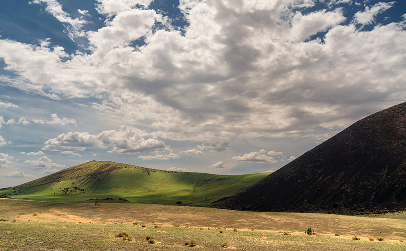
As Gary mentioned last week, that part of California is different now. The two-lane back roads we sped down are now eight-lane freeways with crowded off-ramps. The rural fruit stands have been replaced with Costco, CVS, LA Fitness, and car dealerships. The pristine mountain ridges are lined with rows of McMansions that look like pop-up targets at a rifle range. With clusters of boxy tract homes, Temecula Valley has become another typical So-Cal suburb.

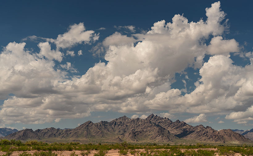
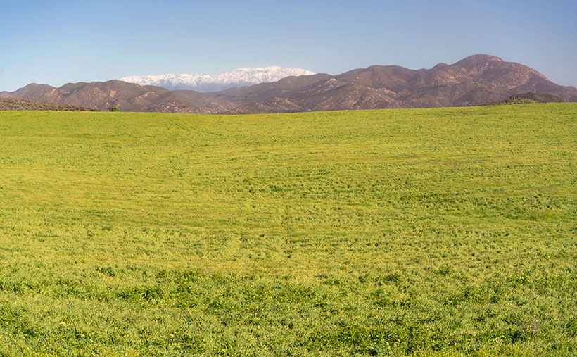
Queen Anne and I spent time driving between housing developments during our January visit and saw a glimpse of the past. In this week’s photo, you can see the open spaces we found by Lake Skinner. In the shot that I call San Jacinto Field, the foreground is dominated by a field left fallow this season. In the near background, you see low-elevation mountains—Bachelor Mountain (2470) on the left and Black Mountain (3051) on the right. Covered in the snow in the far distance is San Jacinto Peak (10,834), which is over 50 miles as the crow flies. It’s much further if you walk. This photo was taken a month before California recently got slammed with two heavy snowfalls. I’m sure the top is even brighter white at this writing.

Wine Glasses - A sample of red and white wines while enjoying lunch at one of Temecula's Vineyards.
Wine Glasses – A sample of red and white wines while enjoying lunch at one of Temecula’s Vineyards.

Like always, you can see a larger version of San Jacinto Field on its web page by clicking here. Be sure to return next week when we drive up the wine-country valleys and visit some vineyards.

Till next time
jw

Dragon Backs Picture of the Week

Dragon Backs - A pair of peaks in the Dome Rock Mountains that look like spiny back dragons.
Dragon Backs – A pair of peaks in the Dome Rock Mountains that look like spiny back dragons.

The drive between Quartzsite and Yuma on Highway US 95 has two parts. Driving in either direction, it’s thirty miles of gentle uphill grade and then downhill for the other thirty. The mid-point is at Stone Cabin (now an empty building shell), where the Border Patrol checkpoint is.

From Quartzsite, the road is dead straight, and your line of sight is limited only by the whoop-de-woos (wash dips) and the earth’s curvature. The 800-foot climb is barely noticeable, and the road is flanked on the east by the KofA Mountains (named for the King of Arizona mine), and to the west are the Dome Rock Mountains (the dome you see west of downtown Quartzsite).

The south half of the trip has a steeper grade—most of which is in the first mile, where the highway drops off a hill. The scenery changes too. There’s a different mountain range far off to the east—the Castle Dome Mountains, but you’re surrounded by the Yuma Proving Grounds, where the military plays with its new toys. Instead of a pleasant drive through the wilderness, you begin searching for things like the down-looking radar dirigible, a Bradley tank using your car for target practice, or the C-130 that just took off and climbed to 10,000 feet before troopers shove something big out of the back—I sure hope that chute opens.

Whenever Queen Anne and I travel this road, I look for these landmarks to help pass the time. I’d rather have a stimulating conversation about physics with her, but she usually has her head pressed against the headrest, her eyes closed, and her mouth open. She stays that way until one of her snorts wakes her.

On the drive home, one of the landmarks I look for is a pair of unnamed mountains in the Dome Rock Range. When I pass them, we’re nearing the Quartzsite city limits. The twin peaks look like a pair of dragons sunning themselves on a rock. I’ve often thought I’d like to get their portrait, but no matter how much map scouring I do, I’m unable to find a way to get closer—short of hiking two and a half miles across the open Mohave Desert.

The spiny back of the dragons climbs from the desert to their west-facing heads—where they watch the Colorado River flow south. As with last week’s shot, we always drive by them right after lunch. That’s the absolute worst light in the desert. I keep swearing on a stack of Ansel Adams books that I will shoot them when the light is correct, but it’s yet to happen.

On our last drug run—when last week’s photo was taken—clouds were gathering over the Dome Rock Range, so instead of a uniform blue sky, there was texture over the mountains. After I took the KofA Thunderhead shot, I walked across the highway and pointed my camera at the dragons. This time I twisted the zoom to telephoto and framed the monsoon clouds. The result is this week’s featured image, which I call Dragon Backs.

You can see a larger version of Dragon Backs on its Webpage by clicking here. Next week, I have pictures to show from a different place for show-and-tell. I hope you can take a break from your Christmas shopping and take a look. We’ll see you then.

Till next time
jw

BTW:

Flagstaff Book - A collection of photographs and musings from our summer trip to Flagstaff.
Flagstaff Book – A collection of photographs and musings from our summer trip to Flagstaff.

Oops, I Did It Again (Britney Spears song written by Richard Thompson). I published another book. This one covers all of the places we visited in and around Flagstaff. As usual, it’s available in two versions. You can see and buy the hardback on Blurb.com—which you won’t do because it’s too expensive—and the free PDF version you can download, view, and print from your computer. There are additional photos in each of the four chapters, so I’m hoping you take a look. You can get to its Web Page by clicking here.

KofA Thunderhead Picture of the Week

KofA Thunderhead - An autumn thunderhead builds over the KofA Mountains in western Arizona.
KofA Thunderhead – An autumn thunderhead builds over the KofA Mountains in western Arizona.

Each time Queen Anne and I jump into the car; I pack a camera in the back seat. I don’t mean on local errands like a trip to the grocery store but on drives longer than an hour. Rarely do I stop to take a picture, but should one of those once-in-a-lifetime moments happens, I’m ready.

If I capture some unique photographs, they don’t fit our usual workflow. We usually pick a location as a month-long project and photograph enough shots for a month of articles (or even a book). My one-of-shots along the highway traditionally become forgotten orphans. No one gets to see them—until now.

For December, I decided to make this month’s project out of the non-project shots I collected this year. With these four pictures, a special moment made me pull over and stop the car. That’s pretty hard to do because once I have a destination set in my mind, I only stop for gas, a candy bar, and bladder relief.

Anne and I run to Mexico about four times a year. We go to Algodones to see our dentist and buy 90 days worth of prescriptions. We’re on Medicare, and we have a gap plan that pays for most of the pills we take, but some of the select drugs (hint: you see them advertised on TV) are so much cheaper in Mexico that it pays for the drive. If we don’t have to wait on the dentist, we can make a drug run in a day. We leave here at 8:00 am, walk two blocks across the border, stop at Mickey D’s for lunch, and get home by 5:00 pm.

That was our itinerary on September 22—the first fall day. As we drove home on Highway US 93, I watched a single thunderhead building thirty miles north over the KofA Mountains. I thought it unusual to have monsoon activity in autumn and a single storm cell develop so far west in Arizona. I spent the next half hour arguing with myself.

“That will be a great shot if the clouds hold together until we get there.”

“If we stop, we’ll get home after dark.”

“It’s an isolated cell, and it’s posing like a runway model.”

“It’s the wrong time of day, and the light is wrong.”

Just after passing the Border Patrol station that marks halfway between Yuma and Quartzsite, I noticed that the cloud was beginning to tear apart (the wispy part on the tower’s left side). It was time to stop the car. I reached back for my camera and hiked a few steps off the highway. I set the zoom-lens as wide as possible before framing and then snapping a couple of shots. I call this week’s featured image KofA Thunderhead.

The spot where I stopped was several miles away, and for perspective, the jagged KofA peaks rise a couple of thousand feet above the 500-foot high basin. That makes the billowing cumulus top nearly 40,000 feet in the air. Unfortunately, I didn’t capture any lightning strikes beneath the storm.

We returned to the road and continued the drive, watching the storm evolve. The upper winds blew the clouds apart by the time we were due east of it. That’s when we saw a funnel cloud drop below the ceiling. The tornado briefly touched the ground near Crystal Hill Road before it disappeared.

We weren’t done with it yet. After stopping for gas in Quartzsite, the storm ambushed us on the pass at Guadalupe Mountain. As it moved north over Interstate 10, it dumped rain so hard that the wipers couldn’t keep up, and traffic slowed to a crawl. We hoped we wouldn’t be surprised by a second tornado, but after a mile or so, we broke into the clear, and the deluge was only an image in the mirror.

You can see a larger version of KofA Thunderhead on its Webpage by clicking here. Next week, I’ll drag out another orphan photo for show and tell. We’ll see you then.

Till next time
jw

BTW:

Anne and I are negotiating next year’s schedule, so there will be a lot of yelling and screaming around here during the holidays. Pay no attention to the man behind the curtains.

Box Canyon Picture of the Week

A pair of Pueblo ruins adorn the cliff tops on either side of Box Canyon in Wupatki National Monument.

It’s November already. Time passes so fast that the remaining hair on my head flutters behind me like a streamer in the wind. To make things worse, the landlord turned off the heat. Here in the foothills, we had a couple of mornings in the high 30s, and Queen Anne insisted on sleeping with the bedroom window open. When I got up, I was invisible, standing in front of the blue accent wall—nothing but a pair of whitey tighties and chattering teeth floating through space. This cold front is supposed to move out later this week, so I’ve resisted turning on the heater. Instead, we throw back the curtains, put on heavier sweaters, and shiver till noon.

With the new month, we started a new project and didn’t have to travel far to get to it. It’s the housing development across the street. The street is Highway U.S. 89, and the development is Wupatki National Monument. Wupatki shares the access road and visitor’s center with Sunset Crater National Monument—they’re conjoined twins. During this year’s fire season, the fires closed the 35-mile park road at the crater, but Wupatki remained open because it’s north and out of danger.

Wupatki is at the base of one of the Navajo’s four sacred mountains: Flagstaff’s San Francisco Peaks, Mount Taylor in New Mexico, Hesperus Mountain near Durango, and Blanca Peak outside of Alamosa. The Dine’ considers the area with these mountains their home. But, long before the tribe moved from central Canada, Pueblo Indians lived here. They left behind stone homes along the Colorado Plateau: from Wupatki to Chaco Canyon and Mesa Verde south to Walnut Canyon.

Most Americans consider Mesa Verde National Park the most extensive collection of pueblo ruins, but Wupatki is its match. In some areas, our National Monument exceeds the Colorado Park in the number of dwellings per square mile. When you visit the monument, the maps direct you to displays unearthed and restored by archeologists that you can walk through and hear thousand-year-old ghosts. As you drive to these exhibits, keep your eyes peeled because you’ll see piles of rocks in the fields and on hilltops. These are not natural clumps of stones but more ruins that the scientists haven’t yet examined. These areas are set aside for future paleontologists to examine using more advanced tools.

There are so many ruins in Wupatki to enjoy I can’t cover them all in one month. For November, we’re only covering a half-mile hike called Box Canyon. In that short distance, you pass three ruins along the way to the main exhibit—Lomaki. This week’s picture is of a pair of stone buildings standing on the cliffs of Box Canyon. As I walked along the paved trail on a warm summer afternoon, I stopped at each ruin, photographing what I saw. The path led up a gentle slope from the parking area, past the first ruin. From there, I could see the second dwelling on the other side of the canyon, so I continued along the trail. I could have spent the rest of my time shooting these two, but when I reached this spot, I could see Lomaki, which is more prominent with even more rooms. I quickly framed this scene and moved on to the big show.

I chose this image to start this month’s project because it shows the proximity of the two ruins along the canyon walls and how they rise above the grasslands. I assume different families occupied them. There’s enough space for privacy, but they’re close enough to provide mutual protection and borrow the neighbor’s lawn mower.

You can see a larger version of Box Canyon on its Webpage by clicking here. Next week, we’ll walk up to Lomaki and spend some time there. Come back then for another episode of This Old House. I’ll leave the light on for you.

Till next time
Jw

BTW:

Don’t forget to get your calendar order in before the cut-off on the 15th.

Clouds Over Craters Picture of the Week

Clouds Over Craters - Monsoon clouds fill the sky over a pair of volcanic craters at the San Francisco Lava Field in northern Arizona.
Clouds Over Craters – Monsoon clouds fill the sky over a pair of volcanic craters at the San Francisco Lava Field in northern Arizona.

Tomorrow is Halloween, and the east coast has already had its first dusting of snow. Only last week, I had to switch from my daily summer uniform (t-shirt and shorts) into my winter outfit (t-shirt and jeans). I only wear long pants because my feet get cold with poor blood circulation. Otherwise, I’d wear shorts throughout the year—as men do in New Zealand. The last time we went to their islands, we saw road crews dressed in down parkas, shorts, and flip-flops.

I’m not boasting about our two seasons here in the desert; hot and less hot. Everybody back east already knows about our climate. In a couple of weeks, they’ll be camping in RV Parks throughout our state. This week’s rant is about why good things always come with baggage (this isn’t about Queen Anne either—stop that, you’re nasty). For example, as a kid, do you remember stretching out on a freshly cut lawn on a breezy summer’s eve so you could stare into the black sky and count shooting stars—only to be eaten alive by chiggers? Right there, that’s what I’m talking about.

Sitting at my computer, enjoying my first sweater of the season, and processing this week’s photo, I liked how lovely the monsoon clouds were. In Navajo lore, the gathering of puffy sheep in the sky foretells the coming summer rains. Our summer clouds are dynamic. They form over the mountains in the morning. They build and tower into the stratosphere and then charge into the desert with a triple fury of wind, dust, and frog-choking rain. By midnight, they disappear, and stars come out of hiding. It’s the opposite of the winter clouds that travel down the coast. They’re a homogenized grey sky, hanging around for days like a bowl of lumpy oatmeal. As I closely studied this week’s picture, I realized that the monsoon season might be my favorite time of the year—if it wasn’t so damn hot and muggy.

I named this week’s image Clouds Over Craters, and I took it at the S.P. Crater location I featured a couple of weeks ago. The dark blob on the right side is S.P. Crater, and the lesser volcano in the distance is unnamed. The grass growing on its slopes indicates that it’s rainy season. The crater’s shape and color remind me of Hawaii’s Diamond Head in a mirror. The diagonal scratches are from ATVs digging up the soil as they claw their way to the top. I could have Photoshopped the scars, but I wouldn’t say I like that. Besides, the clouds are the star of this show, both in the sky and the shadows they cast on the craters.

You can see a larger version of Clouds Over Craters on its Webpage by clicking here. It’s the finale of the San Francisco Lava Field project, and next week we’re at a new location. Here’s a clue—it’s across the street. Want to take a guess? We’ll see you when you return next Sunday to find out if you’re right.

Till next time
jw

BTW:

Since November is next week, it’s time for me to lay out my 2023 calendar. I make at least one for myself each year, but I’ll happily print another copy for you. Because I order them in low numbers, they’re an expensive wall calendar. When hanging, they’re the size of a copy paper sheet—they fit nicely between my desktop and cabinets. VistaPrint has dropped the small-middle-binding option this year so that they will be coil-bound along the top. When I add the shipping cost, they cost me $18.00 each, which is what I charge for them. I want to have them for Christmas, so if you want to be included, let me know by the 15th of November. That way, I’ll expect them after Thanksgiving. You can email me directly, leave a message on my Contact Page, or if I already have your email address (you’re a subscriber), you can order in the comments below (I’ll strip your email address from public comments).