Coastal Serenity: A Tranquil Afternoon at Spooner’s Cove Picture of the Week - Morro Bay, California

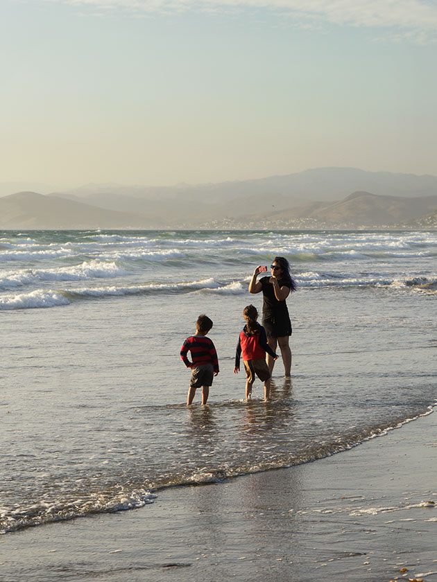
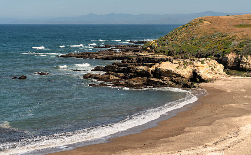
A serene view of Spooner's Cove beach and the hazy Santa Lucia Range in the distance.
Coastal Serenity: A Tranquil Afternoon at Spooner’s Cove – Experience the tranquil beauty of Spooner’s Cove, where gentle waves kiss the sandy beach under the hazy skies. The distant Santa Lucia Range adds a touch of mystique to this serene coastal scene. #Spooner’sCove #MorroBay #CoastalBeauty

I want to provide some relief from the daytime temperatures clawing past the century mark this week. Let me transport you to a secluded beach, where cool sea breezes caress your skin and the rhythmic sound of waves lapping against golden sand will lull your senses. In this week’s photo, we find ourselves just a stone’s throw away from our previous location, Montaña de Oro State Park, south of Morro Bay, where a picturesque cove straight out of the movies awaits your exploration.

This lovely piece of real estate is Spooner’s Cove, and I know how your mind works. You’re thinking, “It got that name because horny lovers come here to be alone and watch the offshore submarine races.” Well, you’re wrong. This gem, nestled along the coastline, derives its name from Captain Spooner, an early settler in the region. While historical records and accounts don’t offer many details, the Cove’s designation pays homage to Captain Spooner’s presence or influence in this coastal region.

Spooner’s Cove is an ideal spot for nature lovers and outdoor enthusiasts. The surrounding area offers various hiking trails, allowing visitors to explore the coastal bluffs and enjoy panoramic vistas of the Pacific Ocean. It is a paradise for photographers, with its breathtaking coastal scenery and opportunities to capture the interplay of light, water, and land. Whether you’re seeking solitude, a romantic outing, or a peaceful day by the beach, Spooner’s Cove offers a serene and captivating experience that showcases the beauty of California’s coastline.

In this photo titled Coastal Serenity, we are presented with a secluded beach gently kissed by the receding tide. As your gaze extends beyond the sandy shore, the town of Morro Bay discreetly hides behind the bluff, concealing its iconic rock that typically graces the horizon. Across the hazy backdrop, the majestic Santa Lucia Range emerges—the coastal mountains that stretch from Morro Bay to Carmel. Serenely tracing the base of these mountains lies the Pacific Coast Highway, a dream route for sports car enthusiasts seeking the thrill of a scenic afternoon drive.

I regret that Queen Anne and I didn’t have more time at the Cove. It would have been nice to bring a food basket and a bottle of wine for a romantic picnic on the beach. Who knows, that secluded moment may have resurrected our libidos, and we’d be carried away—perhaps channeling the legendary scene enacted by Burt Lancaster and Deborah Kerr in the 1953 film From Here to Eternity (YouTube clip: https://www.youtube.com/watch?v=Uzu_LezGQYQ ). But then, for the rest of the trip, I’d have had to hear her griping about all that sand in her bloomers—so, maybe not.

You have a couple of options to view a larger version of Coastal Serenity. Visit its dedicated webpage by clicking this link: (Webpage link: https://www.jimwitkowski.com/newWork/coastalSerenity.html). For a more detailed image examination, head to my posting on Fine Art America: (FAA link: https://fineartamerica.com/featured/coastal-serenity-jim-witkowski.html ). On the Fine Art America page, hover over the image to reveal a green square; clicking inside the square will grant you a one-to-one preview, allowing you to explore the intricate details of the photograph—an indulgence we photographers often call “pixel-peeping.”

We are delighted you joined us on this journey to Spooner’s Cove and hope you find solace in its beauty and tranquility. Stay tuned for next week’s installment as we draw our June project on San Luis Obispo County to a close. Keep your camera ready; the next breathtaking moment awaits your lens.

Till next time
jw

Techniques: Creating Depth with Atmospherics: Suggesting Distance in Your Photographs

Have you ever come across a photograph of mountains where the details appear to fade into the distance? Despite the lack of intricate features, the image still conveys a remarkable depth. This optical illusion is achieved through a technique known as atmospherics. The front mountains are rendered darker by utilizing varying tones and colors, while each subsequent layer of mountains behind gradually becomes lighter. This interplay of light and shadow creates a visual depth that immerses viewers in the expansive landscape.

Atmospherics, such as haze, fog, or mist, can be powerful tools in photography, enhancing the depth and suggesting distance within your images. This technique finds its roots in the works of impressionist painters, who often employed it to create a sense of three-dimensionality.

To maximize atmospherics, focus on weather conditions that offer the desired effects, such as misty mornings or hazy afternoons. These conditions can add a subtle veil to your photographs, softening distant elements and creating a gradual transition from foreground to background. The haze layers can suggest depth, guiding the viewer’s eye through the scene and immersing them in its captivating atmosphere.

When composing your image, consider how the atmosphere interacts with the elements in your frame. The distant mountains or shoreline can appear more subdued due to the atmospheric effects, creating a sense of distance and vastness. Leading lines or prominent foreground elements can further enhance the depth perception, drawing the viewer into the image and inviting exploration.

Experiment with different compositions and perspectives to emphasize the effects of atmospherics. Capture scenes where elements gradually fade into the distance, highlighting the layers of mist or haze. By balancing the interplay of light, shadow, and atmospheric conditions, you can create evocative photographs that transport viewers into a world of serene beauty.

Tres Eucalyptus Picture of the Week

Eucalyptus trees along California’s coast are so pervasive that you’d think they were an indigenous species. They’re not—Australian miners brought them during the ’49 Gold Rush. As a kid growing up in Southern California, the tall trees were always a part of the landscape. One of my fondest memories was how the eucalyptus scent in the air announced the coming rain—much like the creosote does in Arizona. Can you imagine visiting San Diego without eucalyptus? It would look like the coastal desert that it really is.

There are many good reasons why these trees are popular. For one thing, they’re fast-growing, and that’s why they’re planted in new subdivisions. If you wanted a tree to dominate your backyard, you’d have to wait a couple of hundred years for a live oak to mature. If you stick a 15-gallon eucalyptus in the ground, it will reach 20-30 feet into the air in five years. Depending on the variety, these trees can grow to 200 feet into the air.

The fast growth of these trees is why farmers plant them on the windward side of their fields. They make great windbreaks. And because they are drought-tolerant, they don’t require a lot of water, even here in Arizona. Decades ago, when Phoenix’s west side was mostly farmland, I would detour off I-10 onto Cotton Lane. It avoided the congestion closer to town. I remember driving past the rows of towering eucalyptus and enjoying the flickering shadows on the windshield in the afternoons. Even during temperatures of 110°, it seemed cooler, if only psychologically. Sadly, those farms have given way to housing developments and warehouses along the loop 303 corridor.

I had always believed that these trees produced trash wood, but—while doing my research—I watched a YouTube video on how to harvest one type of eucalyptus to produce 16 foot long clear white planks suitable for flooring. The wood is quite hard and rivals bamboo in durability. I may have to consider using it on one of my wood projects.

On the other hand, eucalyptus trees have drawbacks. Although they are evergreens, they shed leaves and bark all year round, fueling fires. So, you constantly have to “rake the forest.” Like cottonwood trees, they’re lepers. Infected limbs tend to fall off—onto your head unexpectedly. Unfortunately—like tumbleweed, tamarisk, and kudzu—one of its varietals (Tasmanian blue gum) has escaped and is considered invasive. It doesn’t do well in drier parts of California, but it’s become a nuisance along the foggy coast.

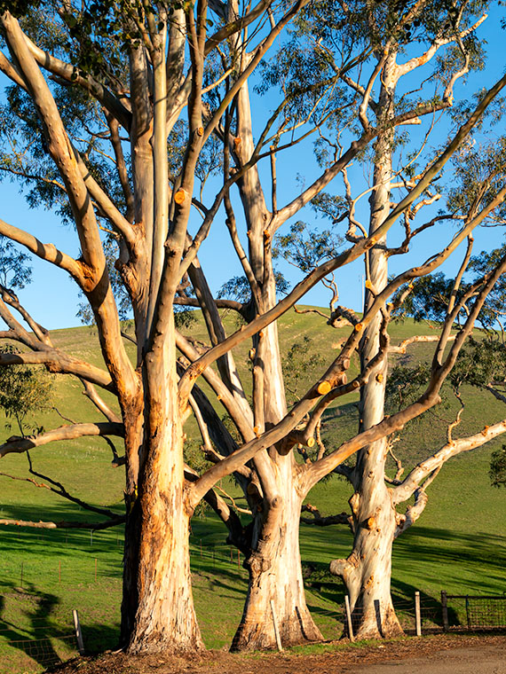
Tres Eucalyptus -A trio of white bark eucalyptus growing along the SR-46 roadside near Morro Bay, California.
Tres Eucalyptus -A trio of whitebark eucalyptus growing along the SR-46 roadside near Morro Bay, California.

I found this trio of eucalyptus—featured in this week’s image—during my morning drive on California’s SR-46. They were only a couple of hundred yards down from the Yucca Hedge that I wrote about last week. At first, it was the light golden bark that caught my eye, but when I began processing this image, I was really pleased to find that there are only three colors in the picture; white, green, and blue (which happen to be the colors of the Sierra Leon flag, but that’s not important here). The simple colors here suggest a graphic photo. I’ll take it, even if it wasn’t planned.

I called this photo Tres Eucalyptus, and you can see a larger version on its Web Page by clicking here. Be sure to come back next week when we add another picture from our time along California’s central coast.

Until next time — jw

Yucca Hedge Picture of the Week

I’m a morning person. I wake up at dawn’s first light. If I try sleeping in, I just lay in bed with my eyes open until I give in and get up. Then, I work a few hours (writing blog posts, for example) before we have breakfast, and then it’s time for my morning nap. I haven’t needed an alarm since retirement. In fact, when I need to get up early and set a time on my clock, I wake up before it goes off. That’s the story of this week’s picture.

When Queen Anne and I traveled to California a couple of weeks ago, we only had four days, so that’s two days of driving and two days for play. Since I like photographing in the early morning and late afternoon, I planned to be shooting during those times, even if it meant getting up in the dark.

One of the subjects that I wanted to take pictures of was the Santa Lucia Range’s rolling foothills at sunrise. At home, the sun’s been coming up before 7 am, and since California goes on Daylight Savings Time (whatever for?), I should be good if I hit the road by then, so I set the alarm for 6:30.

During the night, I woke at 12:15, again at 1:37, and yet again at 3:30. By the time 5:45 came, I gave up. I got up and dressed in the dark so I wouldn’t disturb Her Majesty. I grabbed my gear and went out to the car only to remember that I forgot my mask, so I snuck back into the room to retrieve it. Getting up earlier than I expected meant that at least I had time to get a Quickie Mart cup of coffee.

Armed with a fresh hot cup of French Roast, I started driving up to the mountain pass. The amount of traffic that I encountered during the fifteen-minute drive surprised me. But then I realized that I was the one on vacation, and other people were going to work. When I reached the top, I found a safe place to park and waited for sunrise, but the sky was awfully dark still.

It took another hour for the sun to break the horizon. I completely misjudged the effects of the time change, and I didn’t take into account that Cambria is about 200 miles further west than San Diego. When the sun finally came up, I began to slowly make my way back down to the ocean stopping and shooting along the way.

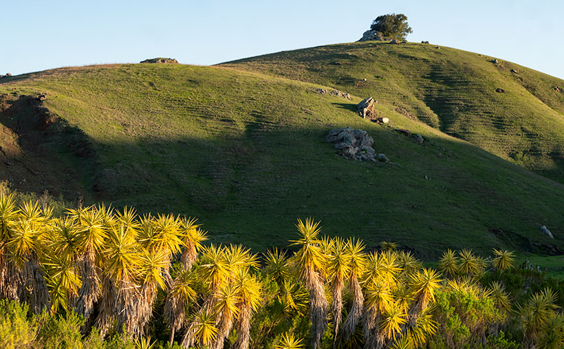
Yucca Hedge - The morning sun highlights a hedge of Yucca while shadows remain on the background hills.
Yucca Hedge – The morning sun highlights a hedge of Yucca while shadows remain on the background hills.

This week’s featured image was taken at a ranch only a few miles inland of the Pacific Coast Highway. The owners had planted a hedge comprised of Yucca plants along their drive. They were in full sun while shadows played on the hills behind them. The contrast in light is interesting, and how the spikey Yucca leaves contrast with the rounded hills. The soft morning light also brings out how years of grazing cattle have created terraces in the hills. That’s good because the cattle would otherwise fall over and roll to the bottom. This terracing reminded me of New Zealand, where sheep have changed the landscape in the same way.

I called this photo Yucca Hedge, and you can see a larger version on its Web Page by clicking here. Be sure to come back next week when we add another picture from our time along California’s central coast.

Until next time — jw

Morro Bay Harbor Picture of the Week

The grass is always greener. People who live by the beach travel to the mountains for skiing. Others living in snowy climates come to the deserts to dry out and get warm. What do we desert dwellers do for a change of pace? We go to the beach of course.

After being cooped up in Arizona for the last year, when Queen Anne and I finally got our vaccine shots, we headed off to the left coast for a couple of days. It’s the anti-desert if you will. We drove an extra distance to our favorite part of California because we don’t care much for the giant megalopolis of San Die-Angeles-Barbara. There are too many people there, and they’re all out driving on the freeways.

We drove to what we call—the central coast—the Morro Bay area, and the little hamlet of Cambria. I love the place so much that two out of my three wives spent their first honeymoon there—and the third would’ve preferred it over Utah.

We spent three nights sleeping to the sound of crashing waves on the beach while a fireplace warmed the room. During the days, we put our masks on and enjoyed meals at our favorite diners and discovered new cafes (did you know that there are only four restaurants in the US with a Michelin star?). We strolled along the beach until my calves hurt, drove up to the Big Sur landslide, and peered into the windows of boutiques and galleries. Most importantly—we tasted wines at open vineyards—something we haven’t done since our 2016 Alaska trip. Let me tell you, our local Safeway gets really testy when we set up tables and start uncorking wine bottles for sampling.

But I also needed to photograph something fresh. Last month, I looked at the thumbnails on my New Work index page and realized that everything was brown. No matter how green the saguaros are, the Desert Mountains are brown. Aargh, I’m drowning in the dust. I need water. While Anne was snoring, I snuck out of the room to capture the sunrise, or after dinner, I’d plant her on a bench (she can’t walk when she’s full, so there isn’t much chance that she’d run off) while I walked around the harbor and snapped pictures as I did for this week’s featured image.

I consider Morro Bay’s town to be the southern edge of the famous drive through Big Sur. The Pacific Coast Highway (California 1) returns to the sea here and then continues up through the world’s best coastal scenery section. Here the Santa Lucia Range plunges 2,000 feet into the Pacific Ocean. The highway is temporary here because rock-slides frequently rip the road away from its precarious perch, like this year.

Morro Rock is the stump of a grand old Santa Lucia mountain that time and the sea have worn away. The rock and four neighboring smokestacks are a landmark that you can see from the mountain passes miles away. Morro Bay’s town used to be renowned for the abalone, but that delicacy has been fished out and is now protected. The commercial fishermen have moved on, so mostly private yachts are moored in the town’s harbor.

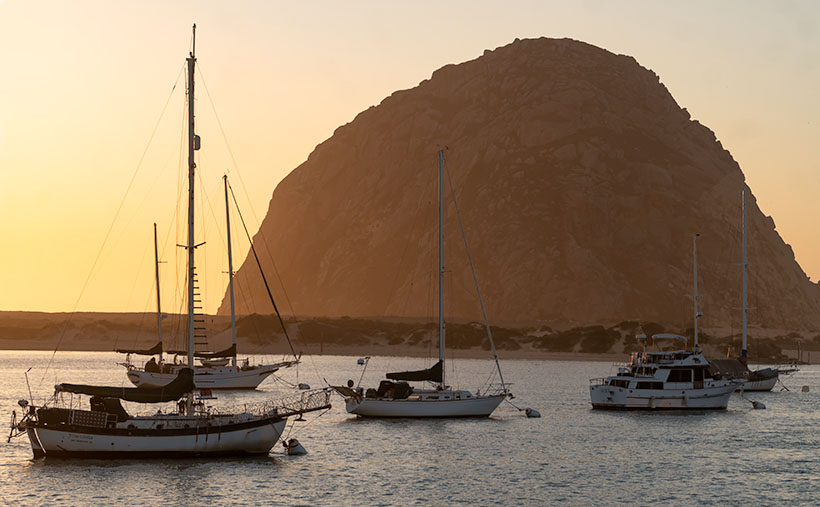
Morro Bay Harbor - private sail boats and cruisers during a calm spring sunset in Morro Bay, California.
Morro Bay Harbor – private sailboats and cruisers during a calm spring sunset in Morro Bay, California.

In this week’s featured image—Morro Bay Harbor—I tried to capture part of the local fleet using the big rock as an anchor. The setting sun made the cool, moist air glow gold. There’s an unexpected extra between the two boat groupings. In the water near the far shore is a sea otter floating on its back. Only his feet and head sticking above the water. You’ll never see it in these photos or on the Web Site. He’s there, at least I think he’s there . . . well I’m saying he’s there, and you’ll have to take my word for it.

I hope you enjoy April’s change of scenery. You can see a larger version of this week’s picture on its Web Page by clicking here, but if you want to find Waldo—the sea otter—you’ll have to buy an enlargement. Be sure to come back next week for another shot from the Big Sur coast and more fish tales.

Until next time — jw

Morro Bay – California

So I lied about today’s destination. This morning when we planned out our day, someone on this bus whined about staying at the beach. We checked our RV Park resource guide and the cost was less here than in Paso Robles. Besides, as we drove down the 101, the temperature there was over a hundred. It was thirty degrees cooler when we arrived at the beach.

I didn’t get to play Steve McQueen in downtown San Francisco, but I do think I launched the truck and trailer a couple of times today. To bypass bay area traffic, we took the I 680 along the east side of town. Boy, does that road need some repair. The truck traffic has crushed the pavement in the right lane, and in California, the law restricts trucks and cars pulling trailers to the slow lanes. We hit some bumps so bad that Anne woke up and asked if we were back in Alaska. It wasn’t till we made it past San José that the road improved.

We were in Salinas by lunchtime, so we stopped at the Costco for a hot dog lunch. While we were there I picked up another bag-o-socks so Queen Anne won’t have to do laundry till we get home. There’s enough of everything else in the closet to get us through to the weekend.

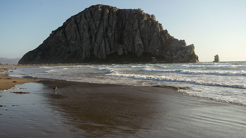
Morro Rock
Morro Rock is the icon that marks the southern terminus of the central California coast.

When I talked the other day about Mendocino being our favorite place north of San Francisco, this stretch of coast is my absolute favorite. Maybe that’s why I’ve returned so often over the past fifty years. I think this is where the Pacific Coast Highway is at it’s best, and I believe that William Randolph Hearst, Ansel Adams, and Edward Weston would agree with me (were they alive to do so). They all had homes here.

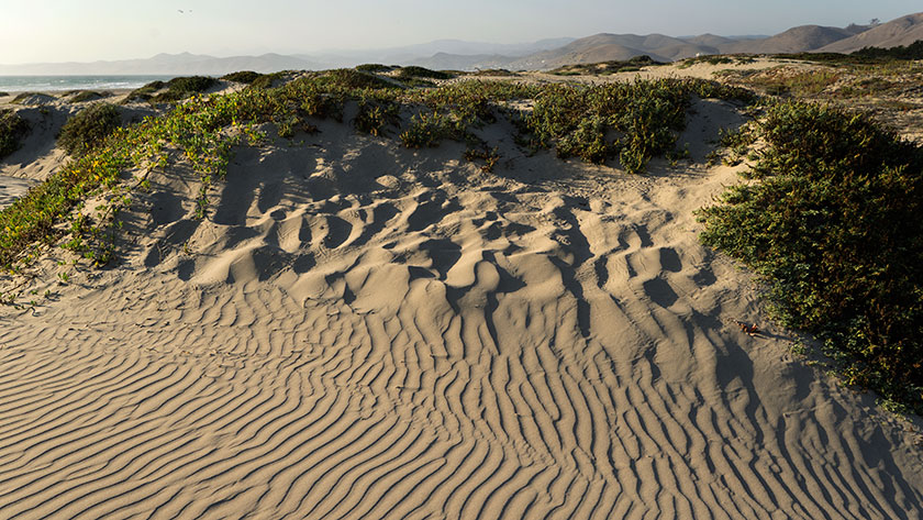
The Dunes at Morro Bay
Wind patterns in the Morro Bay Sand Dunes.

PCH turns west at San Louis Obispo and picks up the coast here at Morro Bay. It provides some of the most beautiful coastal scenery as it passes through, Cambria, San Simeon, Big Sur before it reaches Carmel. It’s 120 miles of breathtaking scenery without a stop light. You should experience the drive once in your life, and drive it in a convertible, not your fifty foot motor-home.

Mom Wants Yet Another Picture.
While out for a beach walk, a young mother tries to get her kids to pose in front of Morro Rock.

We’re going to avoid going home for a couple of days. We have a couple of nostalgic restaurants we want to visit again. I never grow tired of photographing this place and I never seem to do a good enough job at it. Then of course, there’s the central coast wineries that we love so much. We’re not in a rush and we’ll be home soon enough.

jw