Eagle Eye Peak Picture of the Week

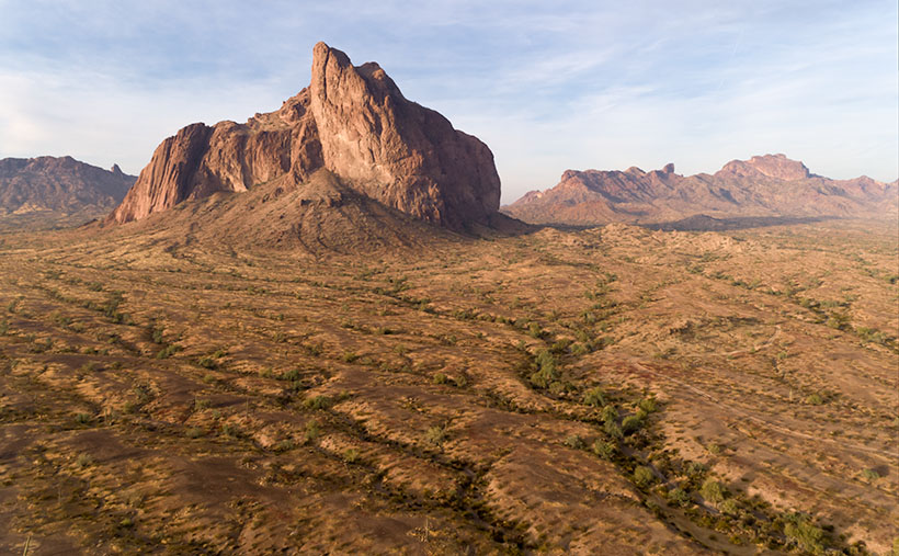
The last time I wrote about Aquila’s Eagle Eye was in 2018, and I didn’t have much to say about it—other than it was there. That post included a photo I shot with a telephoto lens from miles away. I had to do that because much of the land around the peak is posted as private. There were two comments in that column. The first was from Fred, who thanked me for pointing the bridge to him, and the second was from my old friend Gary, who chastised me for not getting closer.

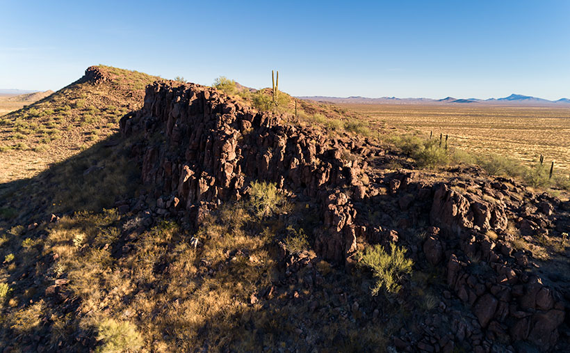
Since I’ve been hanging around Aguila this month anyway, I thought I’d try to make Gary happy. About three miles south of Aguila are mountains on the east flank of the Harquahala range. They almost have the same name; Eagle Eye Mountain is on the west, while Eagle Eye Peak is the lump of lava to the east (they touch one another). The latter peak is the one with the window on top.

Eagle Eye Peak - A natural arch on top of a peak several miles south of Aguila, Arizona
Eagle Eye Peak – A natural arch on top of a peak several miles south of Aguila, Arizona. Behind Eagle Eye is the Harquahala Plain, which stretches south to the Big Horn Range on the horizon.

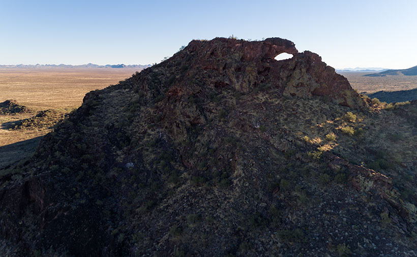
You can get very close to the arch if you drive to the old cemetery where Eagle Eye Road bends around the mountains. The bad news is that you can’t see the arch from there because it faces east, and all you see are the rocks from the edge. There’s a better view if you scramble up an 800′ cactus-infested lava hill like an insane person, but I did the lazy thing. I brought my drone, and I flew it to the mountaintop. Once it got up there, I rotated it to the right and composed this shot.

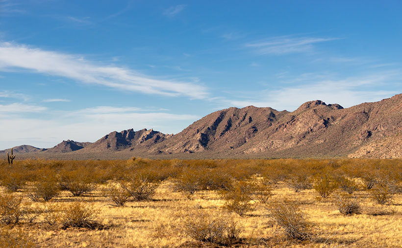
The Eagle Eyes, like a lot of low desert mountains, were formed from volcanic activity. This particular pair of mountains is basalt-covered limestone. The rocks are much darker than the rest of the Harquahala Range. They appear as shadows on the horizon. Their surface is rough and pockmarked, like they had a bad case of acne. They are riddled with caves formed by air pockets in the lava.

I didn’t find an article that explains how this arch was formed. I don’t think it was formed from wind erosion. The rocks aren’t polished. It could be from one of those air voids in the thin-walled lava collapsing. My favorite guess is this: If this is Rhyolite—slow-moving lava common to peak formation—then maybe a cone of lava formed vertically, and as it cooled, it slumped over and froze in place. At least, that’s what it looks like to me. What do you think?

Well, Gary, I hope you’re happy. Click here to see a larger version of Eagle Eye Peak on its Web Page. Be sure to return next week when I’ll show you the arch from a different perspective.

Until next time — jw

Foothill Uplift Picture of the Week

It’s already the last day of January. Where does the time go? After looking at this month’s photos, it seems that I spent a lot of my time around Aguila—with good reason. That’s the route that Queen Anne and I take when we travel west, so I knew there was stuff to shoot, and it’s close by—well if you consider an hour close.

Foothill Uplift - A pair of hills thrust into the air by plate tectonics.
Foothill Uplift – A pair of hills thrust into the air by plate tectonics.

This week’s featured image comes from the same area. I didn’t have to travel far after I captured last week’s picture—Harcuvar Forest. In fact, all that I needed to do was turn around. OK, let me explain. I wanted to shoot the saguaro forest ever since I first saw it on a trip to Robson’s Mining World, but it’s miles north of the highway and tucked under the cliffs of the  Harcuvar Mountains. My topo map shows a jeep road that runs behind a couple of hills situated between the highway and the forest. The hills screen the cactus patch from the highway. So, me and Archie did a little four-wheelin’.

After I had finished shooting the saguaros, I noticed that the north side of the hilltops behind me weren’t rounded as they appear on the south. Instead, they had a ridge of broken rocks—plate tectonics fractured them and pushed them towards the sky. Since I find edges like these interesting, I decided to waste some time photographing them.

This week’s featured image is the result of my curiosity. I call this photo Foothill Uplift. There are a couple of things that I like about this image. I like how the second hill repeats the pattern of the foreground one. It’s like they’re lined up for presentation. The same wedge shape shows up again on the photo’s right side. Along the horizon and on the far side of the Aguila Valley is our old friend Black Mesa. It’s the western high peak of the Vulture Mountain Range that stretches all of the ways back to Wickenburg. Finally, I love the double-headed saguaro, which I couldn’t see from the trail. It’s the garnish that completes the cocktail.

You can see a larger version of Foothill Uplift on its Web Page by clicking here. Be sure to come back next week, and I’ll see what I can scrounge up from around the neighborhood.

Until next time — jw

Resting Santa Picture of the Week

Gather around children because Uncle Jim has some sad news to tell. As you know, my job is to wander the countryside searching for pretty things to photograph, so I’m always on the hunt for interesting subjects along the roadsides. After Christmas, I was out with my camera, and I came across something that shocked me. Out in the desert west of Congress, I found a man—passed out—covered from head to toe in soot. This wasn’t the run of the mill derelict. No, he was our beloved Santa Clause flat on his back among the McMullen Valley creosote.

I don’t know what happened. I rushed to help, but I couldn’t wake him. He smelled of rum-spiked eggnog. There were cookie crumbs in his dirty mustache, and he was heading north judging from the trail of broken candy canes he left behind. I assumed that y’all left him one too many treats, and as he stumbled around in the dark, he tripped over the Harcuvar Mountains, and while he lay there, he slipped into a sugar coma.

A rescue was too daunting for me alone, so I drove home for more help. Queen Anne always knows what to do. As we drove back to the scene, I tried to explain what I’d found. Her typically skeptical response was, “Yeah—right.” (BTW, that’s an example of double positives making a negative. Take that, Mr. Horowitz) When we returned to the field north of Aguila, I pointed and smugly said that I was right, “… as you can see with your own eyes.” She shook her head, gave me one of her patented ESAD looks, and snapped, “Put on your glasses.”

I frowned, then walked back to the truck and grabbed my readers. When I took a second look, I was humiliated—again—and quietly thought, “Oh no, it’s just a big rock pile.” I turned towards she-who-knows-all, and in a voice that would have made Emily Litella proud, I mumbled, “Never mind.”

Resting Santa - After a night of carousing, Santa tripped over the Harcuvar Mountains and passed out in the McMullen Valley.
Resting Santa – After a night of carousing, Santa tripped over the Harcuvar Mountains and passed out in the McMullen Valley.

And so begins the New Year. Santa was obviously too indisposed to bring worldwide immunity from Covid 19. We still have to cope with the virus by ourselves, as we did last year. Since Queen Anne and I aren’t old enough and are not front-line workers, we’re considered part of the Useless Third that Douglas Adams describes in his book, The Hitchhikers Guide to the Galaxy. So, we have to wait patiently for our turn with that oversized needle. It could be anywhere from two to six months before we get our vaccines.

Until then, we’ll keep on keeping on—as they say—which means staying close to home and away from crowds. I’m ok with that because I’ve seen some things I want to show you from around our neighborhood. For January—at least—I’m going to catch up with some of these odds and ends. As soon as it’s safe, we’ll be exploring new highways with our usual cast of ne’er-do-wells. Here’s hoping that it will be soon.

You can see a larger version of Resting Santa on its Web Page by clicking here. Next week, I’ll show you another interesting shot from around the neighborhood.

Until next time — jw

Courthouse Rock Picture of the Week

After five years of retirement, I realize I slowly get things done by putzing. As I grow older, I don’t have a young person’s stamina, so I limit how much time I work in my shop or office. I am organized about it. I have certain days that I do things. There’s wood-Monday where I work in the shop; music is when I manage my music catalog; web- Saturday is when I update my website; and today—blog- Sunday—I write my posts. Each week’s highlight is dump-Thursday when Queen Anne rewards me for taking out the trash by treating me to Eggs Benedict at Nichols.

The remaining days are our weekend. Like the rest of America, we go shopping, on photo outings, visit our ever-growing list of doctors, and do chores around the house—if I must. I can also appropriate these days if I need more time for another priority. So, I’ve organized my interests into neat little day-packets. That way, I get to play with all of my toys. That’s important because if I don’t use them, Anne has threatened to haul them off to Goodwill. My system keeps me busy, yet there’s plenty of time for naps.

Imagine how frustrated I get when a week—like this one—comes along and upsets my routine. With this month’s I-10 project, I must go out each week to get a new shot. I planned to go out on Tuesday, but afternoon clouds moved in. Wednesday, it rained, so I swapped it with music Friday because Anne wasn’t here to gripe. The clouds remained on Thursday, but that didn’t stop me from going to the dump and buying my breakfast (there was hell to pay when the restaurant staff wanted to know what I’d done to Anne). Friday was still dull and gray, and I’d already done music Friday on Tuesday, so I had to sit on my hands. I needed a picture for Saturday’s update.

Yesterday, I set the alarm for 5:00 a.m. and drove down to Courthouse Rock in the dark. I repeated a mantra as I went, “Please let there be good light. Please let there be good light.” When I arrived, I was rewarded with high clouds, but the eastern horizon was clear. I only had about an hour to shoot as clouds were already gathering. This is the shot that I liked the best; I call it Courthouse Rock.

Courthouse Rock - Located in the north-east corner of the Eagletail Mountains Wilderness Area, Courthouse attracts rock climbers across the globe.
Courthouse Rock – Located in the northeast corner of the Eagletail Mountains Wilderness Area, the Courthouse attracts rock climbers across the globe.

The rock is the northeast corner of the Eagletail Mountains Wilderness west of Tonopah. You can see it on the south side of Interstate 10, less than a half-hour drive from the truck stop. If you take the dirt roads—as I did—the time doubles. The road in the lower right section of the photo gets closer, but I was running out of the golden light. I was still a mile away from the rock when I took this photo.

Courthouse Rock is well known to rock climbers, so it gets a lot of worldly visitors. As I left, at least a half-dozen SUVs loaded with people were on their way to the Courthouse. The vertical wall that looks like a curl from a Dairy Queen machine presents a challenge similar to Yosemite’s El Capitan. Besides the height, the most remarkable difference is that California’s is granite (lava that cools slowly underground). At the same time, ours is Rhyolite (thick air-cooled lava squirted out of an ice cream machine).

You can see a larger version of Courthouse Rock on its Web Page by clicking here. Next week, I’ll present another of my favorite I-10 landmarks. Because it’s sunny and clear today, I’m going out to shoot it this afternoon—none of this last-minute panic for me. Of course, it will have to wait until after my nap.

Until next time — jw

Big Horn Tank Picture of the Week

We’re down to the final month of this gawd awful year. For one, I will be happy to get my vaccination and venture back out into the world again—well, right after you get yours, and I see that you don’t get sick and die from it. I’m afraid that it’ll be months before it’s my turn because I’m too young and pretty. So, because it’s a short month, and Queen Anne has abandoned me, we’re going to explore a road that’s both close by but too expansive to cover in one day.

This month’s focus will be on a road, unlike what we’ve covered on this platform before. It’s not even dirt. It’s a road that stretches from Jacksonville, Florida to Santa Monica, California. It’s also the longest possible way to cross Texas. When Anne and I visited Deb and Fred in Austin several years ago, I was dismayed to see a highway sign that said our destination was further off than the two states through which we’d already driven. I’m, of course, talking about Interstate 10.

Calm down, we’re not going to do the whole thing in one month, and I’m not ready for a lifetime commitment (ask Anne). For December, we’re going to point out the landmarks that I enjoy seeing between Phoenix and the Colorado River. Even with that limitation, there are too many to fit into four Sundays. We’re not even heading in a particular direction; we’ll talk about each place as I get to it.

If you’re like me, you loath driving cross country on the Interstates, but they are the most efficient route when your time is limited. I’ve made countless trips between Los Angeles and Phoenix since moving here a half-century ago, and the flat desert always was the worst grind—river, flat, mountain, flat, mountain, flat, town. After I learned some about the mountain ranges, it was more enjoyable to know that Courthouse Rock was coming up on the south side or that I could spot the abandoned solar observatory on top of Harquahala Mountain. It was like saying, “Hi” to old friends as we passed.

This week’s featured image was taken in the Tonopah area. From east to west, you’ll pass the Palo Verde Nuclear Generating Station, stop at Tonopah Joe’s for gas and heartburn, then on the north side of the highway—where Salome Road crosses—there’s a prominent horn mountain, called Big Horn Mountain. It’s the centerpiece of a wilderness area that’s the same name. Actually, there are two wilderness areas separated by a dirt road that I’ve yet to discover. These are the Big Horn Mountains Wilderness and the Hummingbird Springs Wilderness across the street. You can do backflips across the road from one to the other.

On the plains south of Big Horn Mountain Wilderness Area, is a rusty tank meant to provide water to cattle on the open range.
Big Horn Tank – On the plains south of Big Horn Mountain Wilderness Area is a rusty tank meant to provide water to cattle on the open range.

This week’s featured image that I called Big Horn Tank was taken from the Harquahala Plain off of the Salome Road. There on the open range, I found a rusty water tank for an interesting foreground. I think that rust is a photographer’s favorite color, and I like how the white PVC pipe accents the tank. The other thing I see is how little vegetation cattle have for grazing. They don’t eat creosote (would you), so they only munch on the yellow grass.

You can see a larger version of Big Horn Tank on its Web Page by clicking here. Be sure to come back next week for another roadside landmark from Interstate 10. Tomorrow, I have to phone the Queen to see where I’m allowed to go. Wait till I tell her what happened to me as I was leaving Algodones yesterday—she’ll never let me out of the house again.

Until next time — jw