Thumb Butte Picture of the Week

Arizona State Route 68 in Mohave County has substantially improved since I first visited Bullhead City decades ago. It was a two-lane back road with faded markings and crumbling tarmac. When it rained, it was impassable because the highway ran through the flooded wash bottoms. These days, it’s a mini-interstate with four lanes and no lights or signs along its 28-mile length. It’s impressive how infrastructure improves when it involves getting people into casinos.

SR 68 also has one of the best views of all the roads I’ve traveled. That vista comes just west of Union Pass in the Black Mountain Range. When you see the Union Pass elevation sign (3570 feet), you can tell it’s coming. There is a wide shoulder here to enable truckers to safety-check their brakes. Immediately after you clear the mountains on either side of the highway, you can see a panoramic view of the Colorado River 3000′ below. Beyond the blue water ribbon, you can see into the Nevada Desert going on forever—especially now that APS has dismantled the coal-fired Mohave Power Station. You don’t have long to enjoy the view because suddenly you’re on the downhill side of the roller coaster, and just for giggles, the highway department put a stoplight at the bottom of the 11 miles of 7% grade.
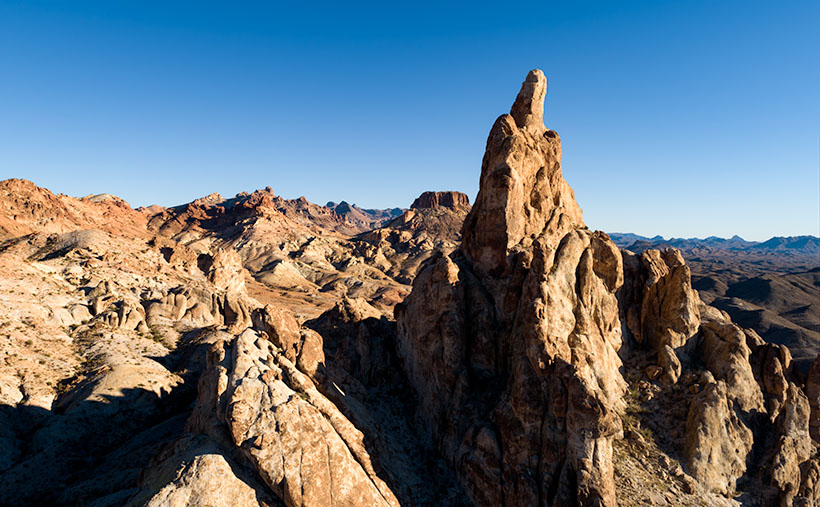
Thumb Butte - An 800' tall granite monolith overlooking the Colorado River above Bullhead City.
Thumb Butte – An 800′ tall granite monolith overlooking the Colorado River above Bullhead City.

As you descend into the river valley, a thing that jumps out at you is an 800′ tall granite monolith on the left side of the road. It’s called Thumb Butte on the maps, but many locals call it Finger Rock. It’s visible in both towns—Bullhead City and Laughlin—and from there, it looks like the universal gesture of ill will, the big bird, the highway salute, or whatever your favorite euphemism for the middle finger is. (There is another landmark a couple of miles south officially named Finger Butte—don’t confuse the two.)

I have wanted to photograph the rock before, but my schedule prevented me from stopping. On this year’s trip, I decided to make time. I watched videos, poured over the Topo maps, and found a Jeep Trail that goes right by the tower. So, late afternoon, Archie and I drove the dirt trail and took this week’s photo, which I call Thumb Butte.

I wanted to capture some depth and texture, so I shot the rock from the north side, looking into the Mount Nutt Wilderness Area. I’m happy with how this image captures the rugged terrain of the Black Mountains—if only a tiny sample. Maybe I should regularly go back and work the entire range—from Needles to Hoover Dam. What do you think?

You can see a larger version of Thumb Butte on its Web Page by clicking here. Please return next week when I will show another photo from Union Pass and SR 68.

Until next time — jw

Laughlin, Nevada

Every once in a great while, I’m allowed out of the house on my own. I know that’s a surprise to you, but there are times when the Queen has friends over and she wants a presentable house. That means I have to go away while her company is here. Since I’m doing Anne a ‘favor’, I can usually parlay it into an overnight trip that I call a photo shoot. One of these freedom nights was last Tuesday, but at the last-minute, her friends had to postpone, and she was already in the truck before I could get out of the driveway . . . Doh!

My friend Deb asked if this was an anniversary trip to which I replied, “What? When is our anniversary? Yeah, that’s it! It’s for our anniversary.” So, it was something I had planned all along.

Whenever I have a chance to get away, my first thought is to head for a body of water. After all, that is what we miss in the desert. I’d hop on the first plane to New Zealand if I could afford it, but that’s out of our budget. What we can afford is a cot at the YMCA . . . or something close to that. With those constraints, there’s always Laughlin, Nevada.

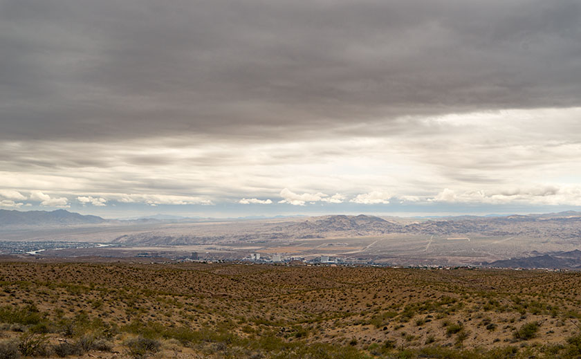
Colorado River Valley from the Black Mountains.
On a rare rainy day, the lower Colorado River Valley holds the communities of Bullhead City in Arizona, and Laughlin on the Nevada side of the river.

My parents were the ones that introduced me to Laughlin. In the late ‘70s, they had a second home in Bullhead City, the town on the Arizona side of the Colorado River. My dad kept his boat there for a while, and we would manage to ‘drop in’ while they were in town. We’d spend days fishing and water skiing on Lake Mohave, and in the evenings, we would take the water taxi across the river to one of the three casinos on the Nevada side. I have fond memories of those times. Good times never last however, and my parents eventually got rid of the house and boat.

There are several reasons for me to make a quick trip to Laughlin. As a fisherman, both Lake Mohave and the river below Davis Dam offer good angling. However, I never remember to pack my gear for a one night trip. Although I like the craps table, I am averse to wasting money. It used to take twenty bets to lose my bankroll, but now that the tables have a five buck minimum bet, I’m done in four rolls. So, I don’t spend much time in the casinos. There are the buffets with rows and rows of various foods, with people who make you look skinny by comparison. However I favor quality over quantity, so we avoid them. I guess the best reason for Laughlin is that now that the Queen and I retired, we can take advantage of the twenty-five buck midweek hotel rooms. You can’t stay at the YMCA for that price.

The cheap rooms have a downside too. As we strolled along The River-walk connecting the casinos, we noticed that most of the patrons were at least our age; silver-haired seniors and an abundance of canes, walkers and wheelchairs. All of the casino floors were empty with many of the tables covered. The prime restaurants only open on the weekends. The hustle, bustle and excitement you would expect from a gambling hall was missing. Then, it dawned on me that the only people who had time for a casino on Tuesday were retirees; everyone else had to go to work . . . duh!

Thumb Butte
In the Black Mountains above Bullhead City, Thumb Butte looks like the universal indignant gesture of ill-will.

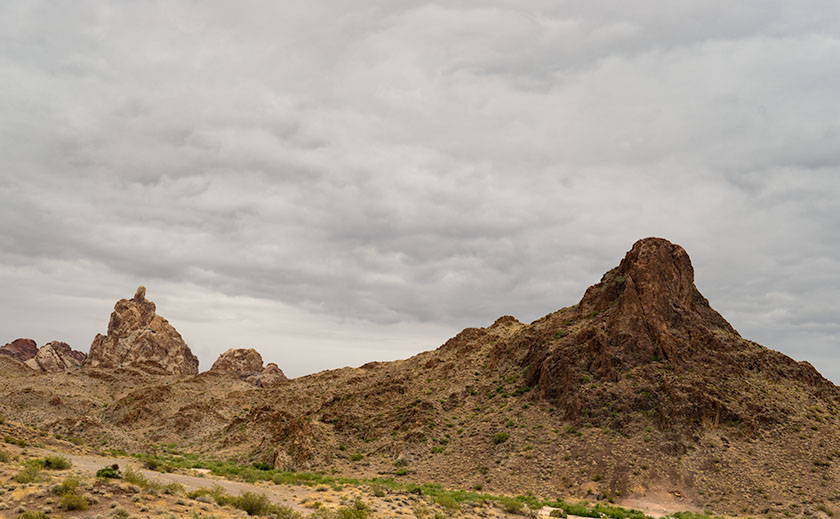
There’s one last thing that fascinates me about the area; it’s the geography. That section of the Colorado River Valley runs between the Black Mountains in Arizona and Nevada’s Eldorado Mountains. Neither range I consider tall, but they’re at the north-eastern reach of the Mojave Desert and get very little rainfall. That means they are subject to wind and temperature erosion. They are rocky, jagged and very rugged. Almost impenetrable.  As a matter of fact, Interstate 40 makes a 20 mile detour along the Santa Fé railroad tracks, around the Black Mountains between Needles and Kingman. The next upstream river crossing is 60 miles north at Hoover Dam and then its 180 miles more to the bridge at Marble Canyon. At the turn of the 20th Century travel was even worse. There were no bridges between Needles, California and Moab, Utah. Everything in between is hostile, desolate and in my opinion, the most beautiful terrain on earth.

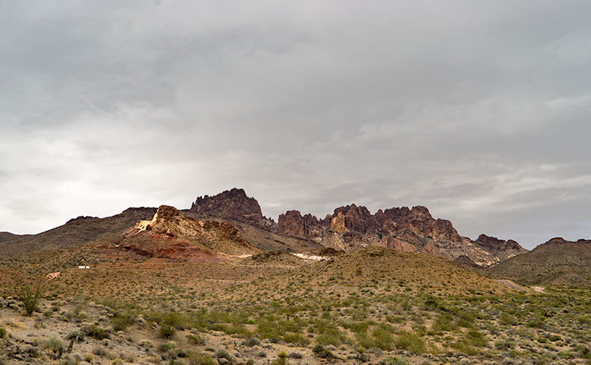
Black Mountain MIne
An old mining claim near Union Pass in the Black Mountains.

As a photographer, I see the Black Mountains as a choice place to shoot pictures. It has ragged peaks, soaring spires and interesting shapes. They’re passed by in favor of the more famous canyons the Colorado cuts through. Because of its relative closeness, I’m intrigued at its beauty and if I can figure out how to best capture that ruggedness, I may have to take it on as a future project. Hey, it’s an excuse to get out of the house.

Till next time . . . jw