Chena River Crossing – Alaska

Last evening Anne and I drove to a river crossing our map said was a good place to fish. It was around six in the evening and we figured there would be another ten hours of daylight left. When we got there, Anne sat in the car reading her Kindle book while I assembled my fly rod.

I had started casting along the shore to the right of the car then, not having any luck, moved upstream to the left of the parking area. I made a couple of casts when I heard a car door close. I glanced back to the car, thinking Anne had gotten bored and wanted to go back to camp.

It wasn’t. Instead it was a young slender woman about medium height with long black hair walking towards me. She wore a smoke blue silk blouse over black skinny jeans tucked into shiny black boots. Then I noticed her dark brown eyes as they looked directly at me and she smiled. She seemed familiar, like Janet Lee; the pool player.

She carried something in her hand and it took me a moment to realize it was a fly rod case, large enough for a two piece rod and reel. When she stood next to me, I’d lost track of my cast and hit the back of my head with my wadded up fly line.

“Do you mind if I fish the bank below you?” she asked with a deep sultry voice. My mind tried to respond with something like “If it pleases you, my dear,” but I swear it came out as <curly> “Why sointley”</curly>. She then gracefully descended the muddy slope to the river’s edge. She remarked how she had caught two graylings the other night. Then she looked puzzled and told me that this wasn’t her spot, because it was closer to the downed log upstream and began to climb back up. I offered my hand in help, but she refused and walked up the bank as if there were stairs. When she stood on the grass, her boots still shined without a trace of mud.

She looked for a path through, and then around the aspens blocking her way. Then she slipped around the end one, and then . . . disappeared; vanishing without a trace. I looked for her for maybe a minute before realizing the Goddess of Fly Fishing visited me. After exhaling and releasing my gut, I began reeling in my limp fly line from the grass, then slowly walked back to Fritz . . . and Anne.

I put away my rod and reel and sat in the driver’s seat letting out a huge sigh as the door closed.

“What was that all about?” Anne asked.

I turned to her and excitedly blurted, “Oh thank God you saw that. I was afraid that I was hallucinating.”

jw

Fairbanks – Alaska

We’ve spent the last three nights in the Fairbanks area and I’ve needed it as I’ve become road weary and needed the rest. During that time we’ve visited with Santa, got Fred’s truck serviced, fixed the inverter on Fred and Deb’s trailer, I scrubbed down Fritz, and I slept in for a couple of mornings. Tomorrow, we leave the Alaska Highway and head south for our ultimate destination; Denali National Park.

Cheena River in Fairbanks
The Chena River runs through the heart of Fairbanks and has a great river walk along its banks.

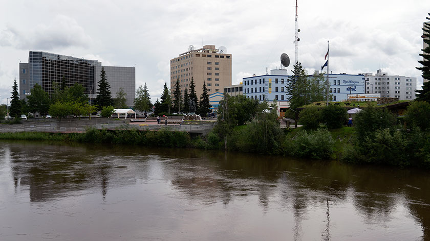
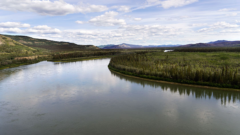
Fairbanks is not the large city I imagined. It’s a little town of thirty thousand encircled with expressways. Those are freeways with stoplights every other street. The University of Alaska is on the north-west corner of town while old town is centered like a bulls eye. The Chena River runs east to west through the center of town.

Ice Museum
One of the stranger museums that I’ve run into is Fairbanks’ Ice Museum. I suppose you can learn a lot from ice cubes.

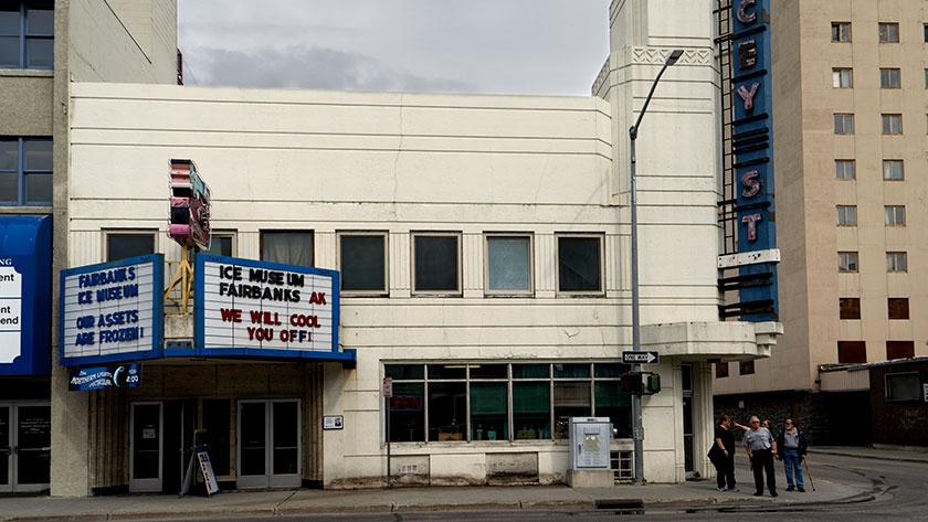
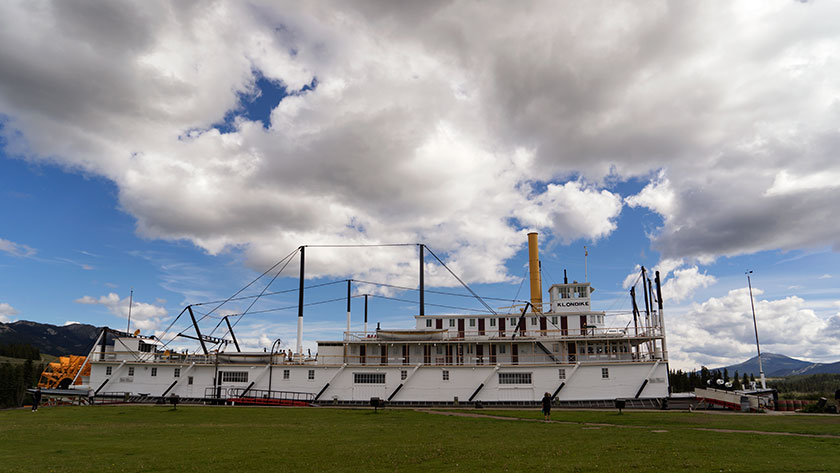
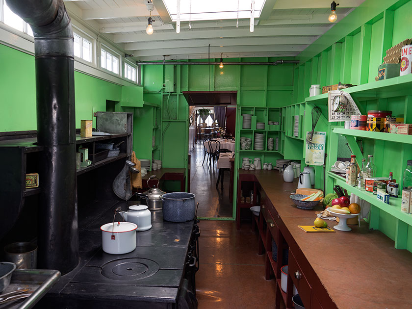
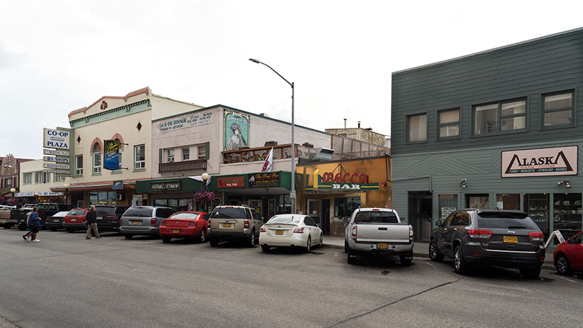
The gang went out today to Pioneer Park, an outdoor museum with lots of displays and information, but I wasn’t up for it. Instead I went down to old town, or as they’re called these days, “The Historic District.” Don’t get me wrong, I’m a history buff, but I also like to see what’s happening today. I spent a couple of hours wandering around the shops, restaurants, and museums before checking out the river walk for a couple of blocks.

Fairbanks Downtown
In downtown Fairbanks, there are bars, restaurants, shops, galleries and museums to visit. Almost all of the people parked on this street are from . . . Alaska.

When I came back to camp, I scouted a fishing location indicated on our Gazetteer, and it took a while to find it. It’s been raining on and off for the last couple of days, so the river is high and running muddy. I may still try my luck later today because I need the practice before we get to Denali. Wish me luck.

jw

Carmacks – Yukon Terratories

Our drive to Carmacks today was an easy one. It wasn’t too far, the roads were all in good shape and there weren’t any steep passes. As it happens, we were in our camp and setting up in time for lunch.

There isn’t much of a town, a couple of stores and a gas station along with the RV Park we’re in. There is a bit of history about the town and the person it was named after. George Washington Carmack was a miner who explored the Yukon and found a vein of coal near here. His great fame came later when he discovered the gold nugget that set off the Klondike Gold Rush and the Klondike Gold Field between here and Dawson.

The Yukon River Above Carmacks
The Yukon River makes a sweeping S curve through the town of Carmacks.

The country is beautiful and the Yukon River flows north until it makes a couple of sweeping bends around the town before heading north again. We had time to stop and read the roadside information signs and they explained that the mountains are formed from conglomerate rock. Like concrete it’s made up of smaller rock glued together with mud (instead of cement). Part of the mountains sloughed off creating a formation called the Whitehorse Trough and the highway runs its length.

Downstream from here is a rapids called Five Finger Rapids. There are four large formations of these conglomerate rock in the river and since they’re more resistant to erosion, they’ve created a fall in the river. To get the steamboatsĀ  through the rapids, engineers had to build a cable and wench system to haul the boats up and down.

Five Finger Rapids
Four formations made up of conglomerate rock create a rapids below the town of Carmacks.

Since our back door is on the Yukon, Fred and I got in some fishing before dinner. We finally landed something. I caught an Arctic Grayling and a White Fish, while Fred landed two more Grayling. I feel a lot better about all the new fishing equipment now that we’ve actually caught something.

jw

Yukon River – Yukon Terratories

This was our last full day in Whitehorse. Fred and I tried to fish the Yukon River and got skunked again this morning, but we each had a strike, or at least that’s what we told each other. The rest of the day we stocked up with needed staples then did a little sightseeing.

While we played tourist yesterday, we never got to the town’s biggest museum piece, so we made a point to stop at the paddle-wheeler Klondike in the afternoon. It is the riverboat hauled ore and supplies between Dawson City and Whitehorse on the Yukon River. It’s a huge ship with two 450hp steam engines and it took half of a forest to fuel the boiler.

The Klondike Paddle-wheeler.
Anne checks out the Klondike paddle wheel riverboat.

Going down stream it took more than a day with one stop for wood, but coming back to Whitehorse against the current the trip was over four days with as many refueling stops. As you would expect the ship is in mint condition with era specific supply boxes and simulated bags of silver stacked neatly in the cargo hold. Since we were second class passengers we didn’t get to see the first class cabins or the wheelhouse. That would have interested me.

The Klondike Galley
The galley of the Klondike is stocked with plates and cookware from its era.

Back at camp, I had to go look at the WWII era military vehicles lined up beside the entrance. I’m not certain if these were used for the construction of the Alaska/Canada Highway or not, but as with Route 66 kitsch at home, any memorabilia that can tie in with the theme is helpful. There are about five on display and although they’re not restored, they really aren’t in bad shape. I’m sure they could be used in a collection somewhere instead of yard art along the road.

WWII Trucks as Yard Art
Our campgrounds has five different 40s era military vehicles lining the driveway for decoration.

Tomorrow, we’re going to make a side trip off of the Alaska Highway and head north to Dawson City. That’s the other big town in the Yukon and it is highly recommended. It’s also the home of author Jack London, whom I read as a lad. On the same street is the cabin of Robert Service, Yukon’sĀ  famous poet.

We’re going to break the trip up by making a stop midway in a town called Carmacks, a small town on the banks of the Yukon River. Then on to Dawson City for a couple of days. After that we will be in . . . (ta-DA!) Alaska after almost a month of traveling.

jw

Yukon Territories

We’ve arrived in the Yukon and <best pirate voice> least ye be warned mates, pirates in these waters be </pirate voice>. More about that later, but first I want to talk about the trip.

For those of you interested in maps, here’s a fun fact for you. The British Columbia/Yukon border is the 60th parallel. We made the 320 mile trip from Fort Nelson to Watson Lake and we are now in the Yukon Territories. That means we’re less than seven degrees from the Arctic Circle; land of the midnight sun.

The Alaskand Highway
The Alaska – Canada Highway as it passes through the northern Rockies.

Today’s drive was long and complicated by several road construction crews along the way. The worst held us up for over forty-five minutes. I know that the roads have to be repaired, but why couldn’t you have done all of this work last year. Didn’t you know that Queen Anne was touring?

The highway led in a northwest direction and the snow capped peaks of the northern Rockies looming on our distant left, became a maze that the road traversed. It rained, the temperature dropped and that was were the worst construction was. Once we made it through the passes all was well again and the temperature on arrival was in the low 80s.

Stone Sheep On The Road
Stone sheep, a type of Big Horn, find salt and minerals along the roadside.

We saw a lot of game along the road. There were two or three small groups of Stone Sheep (a subset of Big Horns), two black bear, a small brown bear and numerous bison. The bison are so numerous that we don’t even count them anymore. We do slow down when they’re on the road like today.

Wye Lake
Wye Lake is across the street from our campsite.

Because the construction put us behind, we got into Watson Lake late, so we haven’t checked the town out yet. We’re going to spend three days here so I’m sure there will be updates.

Oh! The Pirates? That was the news we got at our campgrounds, which I consider the least attractive of our trip so far. It seems that up here, the Internet is considered a novel frill. All RV parks provide free service as part of your stay. In the Yukon, you also get free WiFi . . . for an hour. After that it’s $10.00 (CDN) for each additional half hour. We also get another hour on each day we stay, but have to go to the office to pick up a new user name and password.

I was upset enough that I fruitlessly protested to the inn keeper and for a brief moment thought of moving on. We’re tired however and need the rest. Besides, I have to catch a fish before Fred does.

jw