Memorial Day has snuck up on us already. The unofficial summer season begins today. Back east, our friends and family have opened swimming pools, drug their Webber grills out of the garage, and finally put on shorts—with white belts and black socks. Meanwhile, here in the desert, we’re beginning to think of clever ways to stay cool for the next three months. This year, Queen Anne and I have come up with some new places to visit, but we have to stop buying food to have gas money.
Before worrying about surviving June and its 110º temperatures, we need to finish May. So, let’s return to our Cochise County Road 186 project, jump into the car, and find one last shot. Then we can drive into Willcox, where I know of a decent Mexican restaurant for dinner.
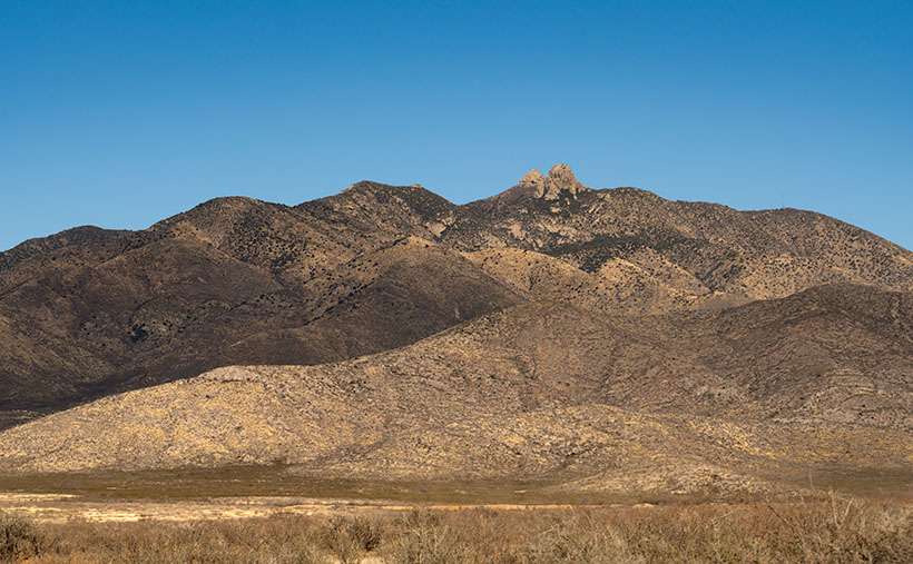
With the ghost town of Dos Cabezas in the rearview mirror, the county road begins to drop from the foothills into the Sulphur Springs Valley. All of the time, the ‘two-headed’ mountain range looms in the east. The south head blocks its northern twin brother from town, so we will drive several miles until both outcrops are visible. That turned out to be a spot where I could hike past a ranch gate and get this week’s picture.
At first glance, the range resembles a two-headed giant with 15-mile broad shoulders that I’ve seen in cartoons. The twin heads are weathered granite, and the highest one (the south) is 8,354 feet in elevation. That’s not as impressive as it sounds because the valley floor has an average height of 4,000 feet above sea level, but Interstate 10 still detours several miles north of the left shoulder to get around the range. A dirt road on the range’s south side divides the Dos Cabezas and Chiricahua ranges. That road goes to the historic site of Fort Bowie through the ominous Apache Pass. Since that road served as the main trail from New Mexico into Southern Arizona, the Cavalry built the old fort to quell the frequent ambushes by renegade Apaches.
I call this photo Dos Cabezas Mountains because I have a vivid imagination. The sky looked clear and blue, but a few clouds to the south cast shadows over the range. Fortunately, that saved this image from being flat and lifeless. The dark-green patches near the mountain top are tall ponderosa pines. In this picture, the land traverses three climate zones, and that’s an example of why the patches of Coronado National Forest are called Sky Islands. Finally, the San Simon Valley and New Mexico are on the other side of these mountains.
You can see a larger version of Dos Cabezas Mountain on its Web Page by clicking here. Next week, we begin searching for summer refuges, but before we load the Jeep, I will return to a previous location as promised earlier this year. Be sure to come back and see what I’m talking about.
Till Next Time
jw


