Fort Nelson – British Columbia

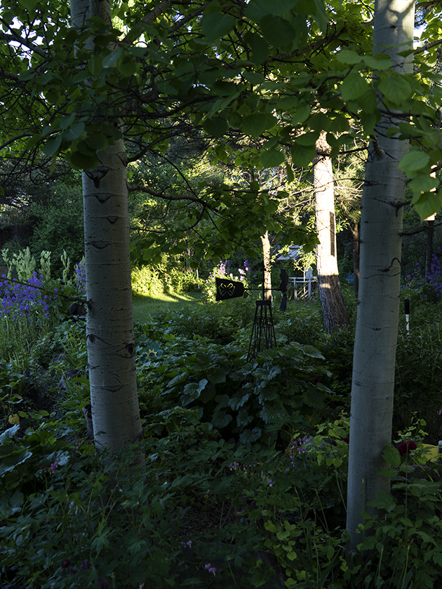
Summer Solstice; the longest day of the year and we celebrated it here in Fort Nelson, or mile 300 on the Alaskan/Canadian highway. At 58.81 degrees north, we’re only five degrees south of the Arctic Circle and night is a constantly dusk. It’s not getting dark and the queen’s eye masks aren’t enough to let her sleep comfortably. She had to make a set of dark curtains to make it through the night lack of night.

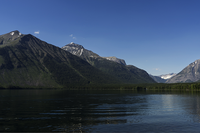
The road yesterday turned westerly again towards the Canadian Rockies. We haven’t gotten to the big craggy mountains yet. The geography is more like the Appalachians, low-lying mountains with an occasional cliff and river canyon. The oil industry is very much present in this area of British Columbia and most of the trades support either that or tourists like us.

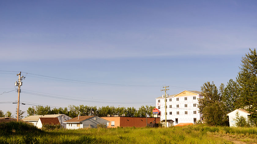
Fort Nelson is a smaller community than Dawson Creek. Our official and highly accurate census is taken from whether there’s a Wall-Mart, Safeway or Costco. None of them are here. There are several liquor stores here however, for which we’re grateful.

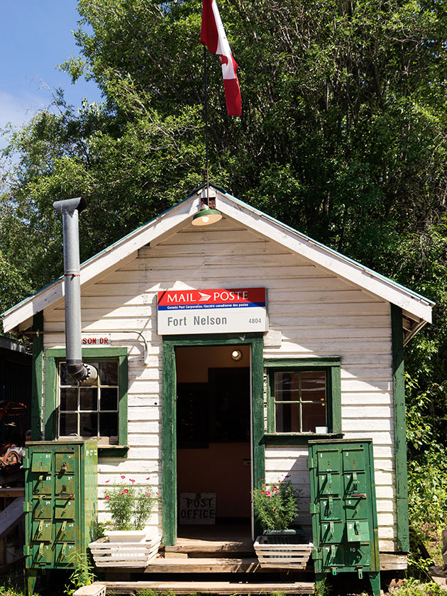
Since there is so much daylight, I got up early to explore the town and try to find something interesting to shoot. After an hour and a half I gave up and came back to the trailer and crawled back in bed. Most of the architecture is metal buildings that are so practical for a place like this, but so boring when they’re all you can find.

Main Street Fort Nelson from a back street.
Except for a new Ramada Hotel, most of the commercial buildings are prefabricated.

Later in the morning Fred and I went out to a local fishing store that I found, to see about a set of waders for me (No, I am not going to walk the catwalk like Fred did. How could I possibly top that act?). But we also had to pick up a battery for my car remote, a swivel for his trailer sink and a new jar of trailer hitch grease (and while we were at it, we hit one of the liquor stores). The women, wanted to visit a quilt shop at the edge of town but it’s closed on Monday’s.

Fred and I ran into them at the Ft. Nelson Museum, one of the recommendations in the guide books. That changed my view of the town. That’s because, this isn’t the first Ft. Nelson site. I don’t know if fires, floods or some other disaster was the reason to move the town, but all of that interesting stuff is in this museum; even some of the original buildings.

Original Ft. Nelson Post Office
The post office from the original site of Ft. Nelson is located in the Historical Ft. Nelson Museum.

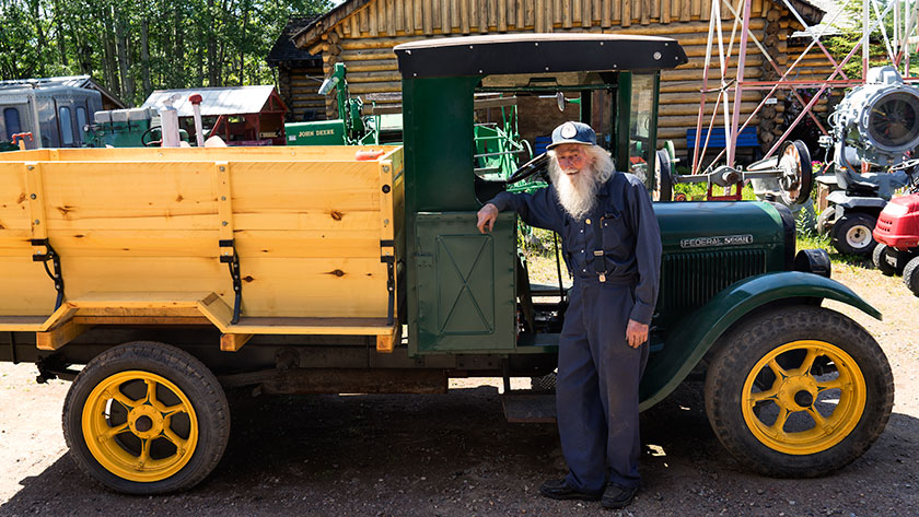
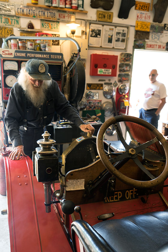
We met the owner/curator, a wonderful codger named Marl Brown in the auto building. At 87 years, he loves to show off his toy’s if you ask the right questions. He keeps about a dozen automobiles of different vintages in the building and none of them were restored, but they all run! One of them is a century old Buick that Marl told us that he drove round trip to Watson Lake and back on its birthday. That is just over 600 miles. He parades them on Canada’s National Day. They’re not mint, but he keeps them running.

Marl in front of truck.
Curator, Marl Brown, in front of a running Federal truck.

I have a friend, Paul Speer, that collects ‘Hit and Miss’ engines (a motor with a flywheel used to pump irrigation water), so I asked Marl if he had one. Yes he did and proceeded to put a thimble of gasoline in it, then started it for us. Marl jury-rigged a Coke and Pepsi can on the exhaust ports and they randomly popped up when the alternating cylinders fired.

Marl starts antique car.
As a visitor watches, Marl Brown prepares to start one of his antique cars; an open one cylinder roadster that I’ve never heard of before.

We spent a bit of time perusing the treasures that were in Marl’s collection. Surveying equipment, bulldozers used in for building the road, assay scales, rotary airplane motors (and an Alison engine from a Spitfire), and daily stuff that people used during the road construction.

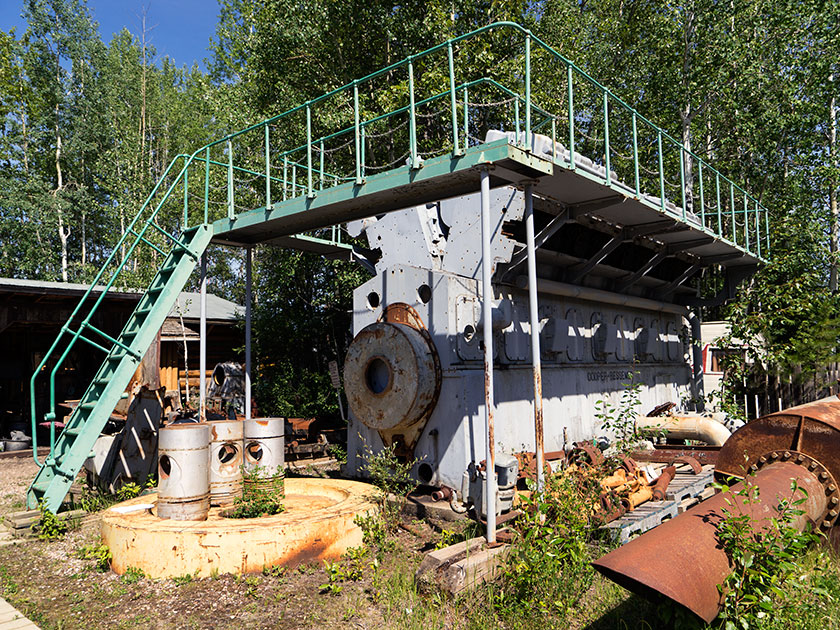
There was even something that was close to home for Fred and I. In the early years of the town, electricity was provided by five generators driven by large diesel engines. They’ve been replaced by gas-powered turbines. The diesel engines are the same that we had at the power plant that we worked at. Marl had one of these two-story monsters sitting in the yard.

Diesel generator engine.
A sixteen cylinder engine, similar to those used at the power plant used to supply the power for Fort Nelson.

A day that started off as a bust turned into a highlight on the trip. Even though, I appreciate looking at historical artifacts, what made this special was that I got a chance to meet Marl Brown and watch the sparkle in his eye as he showed off something in his collection.

Highly recommended.

jw

Dawson Creek – British Columbia

We’ve been on the road seventeen days with 2600 miles on the odometer when we arrived at Dawson Creek yesterday (Friday; it’s scotch night). Dawson Creek is an important stop on our trip.

  • It’s our first stop in British Columbia.
  • The weather is warmer than we’ve had the last few days.
  • This completes the first section of Fred’s itinerary.

The most important reason though, is that Dawson Creek is where we pick up the famous Alaska Highway. As Fred said this afternoon, “We’ve come all this way just to get to the start.”  If you want to drive to Alaska, this is the road that will get you there. Fairbanks is at the other end of this road, only 1500 miles away.

Gang under ALCAN Highway sign,
Fred, Sally, Deb, Anne and Jim take a moment to pose for photos under the highway banner.

The Army Corps of Engineers built the road in 1942 in eight months for military purposes during the second world war. The public didn’t have access to the road until 1948 and it wasn’t paved until the Alaska pipeline was built. Now the road’s covered with RVs. There’s a thriving cottage industry shepherding caravans of RVs on the same route that we’re taking.

Class A motoromes from a guided caravan.
A small part of a RV Caravan sharing the same campsite with us. Our paths cross often as we move from park to park.

A couple of days ago, I was afraid that we wouldn’t get into Dawson Creek. Last week they had torrential rains that dumped over four inches of rain in the area. The creek that runs through the middle of town (surprise, it’s also called Dawson Creek) cut the town in half by washing out the main road. Within three days, crews patched the roads enough to get traffic flowing again.

Damage on the Dawson Creek Broidge.
Only a couple of days before we arrived in Dawson Creek, over four inches of rain caused flooding on Dawson Creek and closed the major road through town.

We’ve now cleared the Canadian Rockies and the countryside is flatter, with farms and lots of timber. The towns are further apart, but they have all the franchises you’d expect at home. We even passed a Costco yesterday in Grand Prairie, which is something that we rarely do.

The geography of our route has changed from mountains to prairie as we pick up the ALCAN Highway.

Tomorrow morning we strike out for Fort Nelson. A leg that’s close to three hundred miles or 450km. Although the road is famous, it gets bad reviews for its condition. We’ll batten down the hatches and suffer through it, because now we’ve made a turn and are on our way to Alaska.

jw

Columbia Falls, Montana

We arrived in Columbia Falls yesterday. Fred needs to get his stitches out (see the earlier post about pending disasters), and after five days of driving we scheduled time for a break. In addition to the medical concerns, we’ll restock some supplies and explore Glacier National Park so we can shoot some pictures and get in some fishing.

McDonald Lake tucked in glacial valley
McDonald Lake fills the glacial valley along the Going to the Sun Road in West Glacier National Park

Glacier is my favorite park (of the ones I’ve visited). It spans the border with Canada and their side is called Waterton Lakes National Park. Glacier is relatively small but has spectacular glacial mountains stacked one after another. I’ve joked before that it’s hard to photograph because to get one mountain completely framed, you back into another mountain.

Fred shooting waterfall
Fred composes a shot at McDonald Creek Falls in Glacier National Park

Going to the Sun road is the only road that traverses the park, and it crosses the Continental Divide at Logan Pass. At 6600 feet elevation, it is the best view of the park. Unfortunately, the road was closed every time we’ve visited and this year the snow won’t be cleared until mid July.

If you visit the park early in the season, you can cheat the snow plows by driving around the park on Highway US 2 to visit the other side, and that’s what we will do on Wednesday. We will spend a couple of days in Saint Mary before we finally cross the Canadian border.

jw

Butte Montana

There’s a pattern developing with our campsites. After driving a couple hundred miles each day, we pull into an RV park to get an evening’s rest. We’ve planned these stops and reserved our spaces before we left. RV Parks have become the motels of our generation. Each of the parks that we’ve stayed at have amenities that make life on the road more pleasant. One of those things is a WiFi connection that makes it possible to communicate with you while on the road.

Of the four places we’ve stayed in, three were really accessible from the highway, while last night’s was . . . well, out-of-the-way. It was in Thornton, Idaho. I know! Where the heck is that? It’s a wide spot in the road north of Idaho Falls and it was a detour from Interstate 15.

The pattern I’m referring to is this. The more convenient a park is to the highway, the more the highway conveniently runs through your bedroom. So far we’ve had semi trucks, trains, freeway noise and industrial sites as our ambient background noise throughout the evening. We dismissed it as part of being on the road, until last night.

Thornton Mercantile
The abandoned Thornton Mercantile and Cafe sits empty along the east side of the street.

When we pulled up to the park in Thornton, we all thought we’d made a big mistake. This wasn’t a big city or quaint little town. It was a spot on a side road with a couple of abandoned grain elevators, a row of closed businesses on the east side of the road and a potato shipping plant across the street. We could easily see the railroad tracks running along the road. It was the train blaring that got us up early in Provo and we thought here we go again. With some apprehension, we turned into the driveway of the Thompson RV Park.

Potato Packing Plant
Potato shipping plants on Thornton’ s west side

When we parked inside of the gate and went to the office to register, we were surprised to find a lovely park with gardens, fish pond, mature trees and lots of space to spread out. After setting up, we had a chance to wander the gardens where Linda Thompson joined us and pointed out all the flower variety growing. “You should have been here when the tulips were growing.” We could imagine what we missed because everything else was still in bloom.

She proudly pointed to a willow tree that she had planted nearly 50 years ago. “It was a twig in one of my mother’s funeral arrangements and when the flowers faded, I stuck it in the ground. I call it the Mom tree.” The house was over a hundred years old and they’ve run the park for about half that time. She explained that she and her husband want to retire and sell the place. They want to move to someplace warmer.

Thompson Gardens
The gardens at the Thompson RV Park have been lovingly cared for by the owners for fifty years.

How was our stay? Dead quiet except for the occasional peacock call in the distance. We could hear that because it was remarkably quiet otherwise. We even talked in hushed tones around our gathering. It will be a shame when the Thompson’s leave. I can’t imagine Corporate America giving the love and care to keep the place the same.

jw

Provo Utah

We put another 250 miles on today, and we arrived at Provo, an hour and a half south of Salt Lake City. Today’s route is one of my all time favorite drives. Head north out of Kanab following US Route 89. It provides access to Zion and Bryce Canyons, and a handful of State Parks too. Traffic was light, so we had time to look at the scenery. Unfortunately, not enough time to get any shots (Besides, the light is never perfect during the day).

When asked tonight, someone said that lunch was the highlight of the day. It was pretty good. We stopped again at Big Daddy’s Deli on a side street in Richfield. Anne, Sally and I ate there on a trip to Yellowstone a few years ago. Food is still good, and I’d recommend it for lunch if you’re in the area.

Tomorrow, we will be in Idaho. However, we will be traveling on I15 and through Salt Lake City. I  don’t consider it a day of oo’s and ah’s. I must admit that the Wasatch Range is a pretty backdrop for the town.

jw