Four Ponderosa Picture of the Week

When an Arizonan talks about a pine tree, the red barked ponderosa is most likely what they’re referencing. It’s the common pine tree in Arizona. We have so many of them that our grove grows like a slash across the state’s middle, like a belt, and they continue east into New Mexico. It’s the world’s longest contiguous ponderosa forest in the U.S. Sadly, some of our brightest citizens try to burn them all down each fire season.

It’s a happy tree for me because it means that I’m in the high country when they’re around. Most likely, I’ve traveled to escape the desert heat and spend some time in the shade of the tall pines napping with a bit of fishing line tied around my toe. I have a fond memory of getting up early on a fall morning to drive up to Hawley Lake, and as the sun came up, we were on the Rim Road. The morning sunlight flickered between the tall trees, and I felt like I was driving through the Black Forest in Germany. Although I’ve driven that road hundreds of times since then, I’ve never had the same feeling.
Four Ponderosa
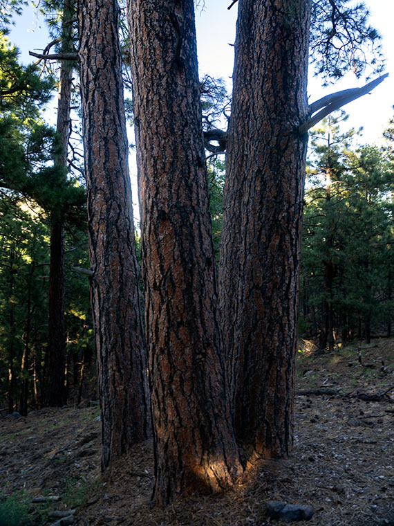
Four Ponderosa – Growing in a grouping that reminded me of a four-poster bed. Maybe I thought that after my long hike and I was tired (and don’t forget, tired).

During my visit to the Hualapai Range outside of Kingman, I was surprised to see ponderosa growing. In the Desert Southwest, they only grow at higher elevations. On the road, I rely on the trees to estimate my height. First, come the pinion pine at around 5,500’, then the ponderosa starts at 6,500’, and then the aspen show up at over 7,500’. The mountain island on top of the Hualapai’s probably is most likely the western edge of our grove. Only the Black Mountains are west of here, and they’re not high enough to support the big trees.

I walked by the ponderosa’s in this weeks image on my way back to Archie after a hike up the mountain. My legs were already sore, and this four-tree grouping reminded me of a four-poster bed. The spacing between them was ideal for hanging a hammock. It’s a good thing I don’t carry one because I would have spent the night, or even worse, I would have rolled over and fallen out onto the ground. That would be just my luck.

I call this week’s image Four Ponderosa, and you can see a larger version of it on its Web Page by clicking here. Be sure to come back next week when we show another photograph from the Hualapai Mountains.

Until next time — jw

Sleeping Under the Stars Picture of the Week

There’s something wonderfully romantic about how cowboys spent evenings eating beans around a fire before laying out their bedrolls and sleeping under the stars. It makes me wonder if I would have been any good riding a fence line. I love the outdoors, campfires, looking at the stars, and dreaming of the ladies back in town (sigh). I can assure you that I could never do that because the last horse I got on said, “oof” and sleeping on the ground has rocks, snakes, spiders, scorpions, skunks, and rabid chipmunks—not to mention the inclement weather.

Queen Anne and I still enjoy getting out in the wilderness; we just bring half of the house with us. For some reason, I sleep very well in our little Casita trailer. She has two layers of foam over the cushions that make into a full-size bed, and when I crawl under our down coverlet, my eyes slam shut faster than a mouse trap. As I lie next to my love and wrestle for more space, I listen to her rhythmic breathing. The hypnotic cadence is a mantra luring me to dreamland—until she misses a gear and sounds like a manual transmission exploding. But, she stops as soon as I nudge her to roll over.

All of this is fresh in my mind because we’re recently back from spending the week in the KofA Wildlife Refuge with The Ritz—our trailer. We succeeded in getting more images to finish up with this month’s topic but concluded that there is a lot more to the KofA range than a couple of blog posts. I think it may need to be a long-term project.

This tip was the first time we used the trailer in winter, and although the days were sunny, the wind blew, and the nights were colder than our Alaska trip. We had to use its heater at night. Even though we set the thermostat to 58º, it still came on often and blared at 85dB. The first time it came on, it made that burning dust smell and I thought we were going to die of carbon monoxide poising, so I opened the windows, which was counterproductive. Like all furnaces, the smell cleared eventually and we stopped jumping every time it started. Even with that racket, I slept until sun up.

We spent two days exploring and shooting photos at the refuge, and on the last day, the wind died, so we were able to use a week’s worth of wood for a fire. We ate brats, drank rich cocoa, and roasted marshmallows for jimmyums over the burning logs. Its warmth kept us outside long enough that the stars came out—all of them. We stared at Mars so hard that it began darting across the sky until we looked through binoculars and proved it wasn’t doing that. Finally, the creamy streak of the Milky Way began to reveal itself and forced me to set up my camera.

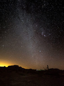
KofA Milky Way
KofA Milky Way – Campers enjoy the KofA mountain range-in silhouette against the Phoenix lights-under the Milky Way and Orion early in the January evening.

This week’s featured image is the result of that effort. It’s called KofA Milky Way, and I shot it from our campsite. The bright spots on the ground are from the next camp. The mountain is Signal Peak silhouetted against the lights of Phoenix—150 miles to the east. The constellation Orion is center-right, and Pegasus with the Andromeda galaxy would be overhead, but the fire died, and the cold chased us inside before we could find it.

As usual, you can see a larger version of KofA Milky Way on its Web Page by clicking here. I hope you enjoy viewing this week’s post and next week; we’ll show another featured image from Arizona.

Until next time — jw

Winter Castle Picture of the Week

The KofA Wildlife Refuge takes up a good chunk of land. It covers a megabyte—or 1040 square miles if you’re not a computer nerd and don’t get the joke—nearly the size of Rhode Island. The topography is Basin and Range, which is standard for western Arizona, Nevada, and California’s Mohave Desert. Finally—one last bit of trivia before I move on from statistics—the wildlife range spans three mountain ranges (that’s three more than in Rhode Island).

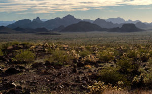
Winter Castle
Winter Castle – The Castle Dome Range, south of King Valley, is back-lit by a low winter sun.

The reason for so much space is to support herds of desert bighorn and antelope. Fifty years ago, both of these large animals were almost gone. Like bison, the sheep were plentiful in western Arizona, but a century of overhunting took its toll. It’s actually the sheep’s fault. They walk to the edge of a precipice then strike a magnificent pose saying, “Go on and shoot. I won’t move, and I’ll bet you’ll miss.” It was a living shooting gallery. By the time Arizona was a state, they were effectively wiped out.

Things started to change in 1933 when the Boy Scouts worked to get a game range established. Although the idea seems convoluted, you can’t hunt big horn without having sheep—the very logic that started the conservation movement. The game management people augmented the herds with transplants from other areas—including Mexico, but there was too much inbreeding. To successfully reintroduce them, they needed a broader gene base with multiple herds. Wildlife scientists established a crowd in the KofA and a southern pack in the Castle Domes and another in the New Water range to the north. To make this system work young males need to migrate across the open desert between ranges and breed with a different stock. Sheep can’t move freely across an Interstate Highway. Now you know why the KofA management area is so large. We like sheep, however rattlesnakes are a different thing.

When I set up to photograph this week’s featured image, none of what I told you was in my head. I thought it was pretty. That’s all I need to take a picture. I made it late in the day while driving away from Palm Canyon looking south. On the far side of King Valley, the Castle Dome Mountains are back-lit from the low winter sun. The atmospherics show off the range’s depth, as the peaks progressively get lighter in the distance, with Castle Dome Peak rising to 3788 feet. As I processed this image, I began to understand its story. I called it Winter Castle, and I hope you like it.

As usual, you can see a larger version of Winter Castle on its Web Page by clicking here. I hope you enjoy viewing this week’s post and return next week when we’ll show another featured image from the KofA Wildlife Refuge.

Until next time — jw

Embarrassment Pie 2018 Utah Photo Shoot

On the road, you’re forced to try new restaurants. Some of them are good, a few are poor, but most of them are blah. Most restaurant owners don’t have an interest in food and they have little imagination. They are just trying to make a buck and so the profit and loss statement dictates the menu. I mean, my mom used to put more lunch meat on our peanut butter and jelly sandwiches when she packed our school lunches than they serve at roadside dives. That’s why, when I find a place that has great food, I like to tell you about it.

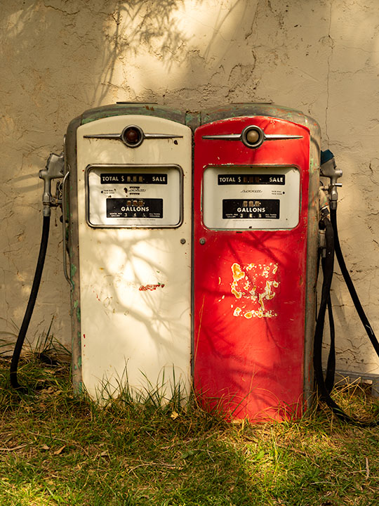
Happy Couple
Happy Couple – On the grounds of the Burr Trail Grill are a pair of gas pumps as yard-art. They’re of little use for anything else now because the largest price is 99 cents.

There are eight little communities along Utah’s State Route 12. Most of them barely have a post office much less a coffee shop. Boulder is one of those small towns. It’s wedged between the—terrifying to drive over—petrified sand dunes and Boulder Mountain. If you’re not going to see the ruins at the Anasazi State Park or to drive the Burr Trail, there’s no good reason to visit Boulder … other than they—inexplicably—have two outstanding restaurants, the Hell’s Backbone Grill and—our favorite—the Burr Trail Grill. Truthfully, we don’t know about Hell’s Backbone because we stopped at Burr Trail first and keep returning each time we pass this way.

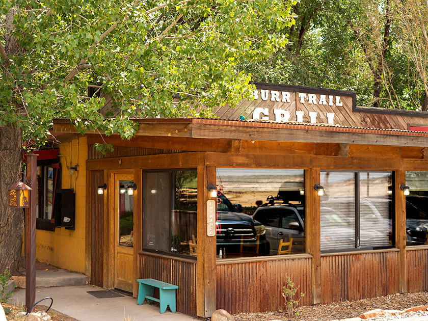
Burr Trail Grill
Burr Trail Grill – Located at the intersection of SR 12 and Burr Trail the grill is only open during the season but the food is good.

The grill is on SR 12, right at the Burr Trail—an interesting side trip that we’ll talk about another time. It’s a small wooden shack-like building that has more seating outside than in, which is good because the parking lot is usually full at lunch. It is only open during the summer—May to October—after which, the staff return to their day jobs at the ski resorts near Salt Lake City. The menu features burgers and sandwiches which doesn’t sound exotic, but I’ve had the Thai Burger and their Ruben. Each of my choices favorably impressed me. The food at the Burr Grill is good, but we dream of their pies.

Mixed-Berry-Ginger Pie
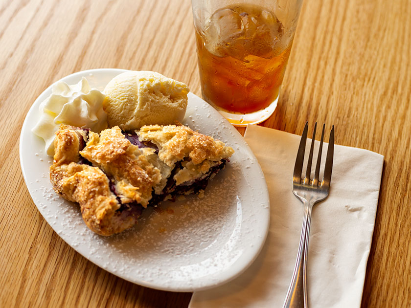
Mixed-Berry-Ginger Pie – Warm from the oven with a scoop of home-made ice cream and fresh whipped cream is guaranteed to make you forget about decorum.

This pie will embarrass you. It has the kind of crust that explodes all over the table when you put a fork to it, just like Aunt Clara made. After your first taste, you scoop up the table-crumbs and eat them. Pies are baked fresh each day and served with home-made vanilla ice cream and fresh whipped cream. There’s a changing variety each day. Anne loved the chocolate-bourbon and she had to settle for peach on our second visit.  When you order a slice, it takes a minute because they warm it in the oven. I ordered a slice of cherry-cayenne, which sounds weird, but was tangy and not hot—like a sour cherry. On our second visit, I went for the mixed-berry-ginger and that made my taste buds explode. It was the taste of berry tartness at the beginning followed by a bright splash of ginger. As you dig in, the warm pie melts the ice cream resulting in a pool of fruit-cream on the saucer. As I devoured mine, I looked across the table and saw Anne’s eyes peering over her plate while she licked it. “What!” was all she had to say for herself—queen indeed. I told you it was embarrassing pie.

When you come to explore SR 12, be sure to plan a stop in Boulder for at least a slice of pie. You may come away embarrassed, but you’ll be better off for it—recommended.

Until next time — jw

Bryce Canyon 2018 Utah Photo Shoot

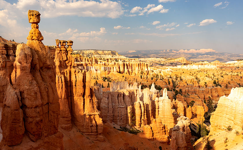
Thor's Hammer And Sunset Point
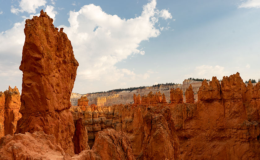
Thor’s Hammer And Sunset Point – As the Navajo Trail descends, it passes by Thor’s Hammer, Bryce Canyon’s most iconic hoodoo.

Of all the sights to see along Utah’s State Route 12, Bryce Canyon is the crown jewel. All of the other stops along the way are sideshows. The park draws people worldwide and they have to use SR 12 to get to it. I, however, am a weirdo that stops at Bryce because it’s part of the highway. Interestingly, Route 12 cuts through Bryce’s north-east corner, so you get a taste of the Bryce Canyon without leaving your car.

We’ve been to Bryce a handful of times and it’s one of our favorite national parks. With elevations exceeding 9,000 ft, it’s always cooler than home. It has alpine meadows and forests of spruce, fir, and aspen, which are a definite change from cacti. There are great views from the overlooks dotting its 38-mile road and you get an understanding of the Escalante Grand Staircase when you look down from the top. Finally, there’s wildlife—if you don’t see at least one deer while in the park, well … you’re just asleep at the wheel.

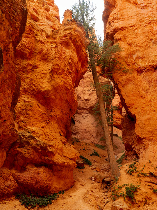
Leaning Tree
Leaning Tree – At the canyon’s bottom are amazingly tall fir trees growing between formations like they were stretching to reach the light.

Like most visitors, Anne and I stopped at the overlooks on our previous visits, but I wanted to do something different this time. While we were in the visitor’s center, I asked the ranger about the trails and she recommended the Navajo Trail to get the photographs that I was looking for. It’s a loop trail that’s less than a mile and a half long. On their chart, it was a moderate hike because of its 500 ft elevation change. I thought to myself, “Piece of cake, sign me up.”

Before tackling the Navajo, Anne and I drove to the road’s end—Rainbow Point. That’s the park’s highest elevation, and in addition to the great view, there’s a flat trail—for Bryce Canyon—that loops through a grove of bristlecone pines. After completing the loop, we concluded that the bristlecone grove at Cedar Breaks was healthier, larger, and a better experience if you like walking among these ancient trees.

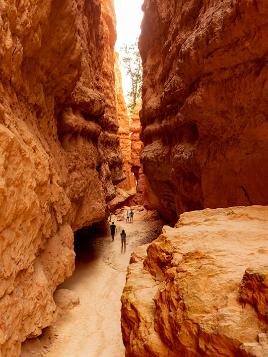
Wall Street
Wall Street – The Navajo Trail passes through a section called Wall Street where you’re dwarfed by the cliffs like a ‘Lord of the Rings’ setting.

As we drove back to Sunset Point where the Navajo Trail is, Anne called our insurance agent and demanded that he increase my life insurance policy—she of so little faith. When we arrived, we couldn’t find a parking space and I questioned if anyone was still at home in Europe. All of the spaces were full and a queue of three cars waited for each potential empty spot. We decided that I should go and Anne would circle the parking lot—like you do at the airport—until she found an open parking spot. With a kiss for good luck, I grabbed my camera and backpack—with water—which burst open and emptied before I made it to the rim—and set off on my great adventure.

Let me describe the Navajo Trail. On the map, it’s a 1.3-mile loop with a 500 ft elevation change. I hiked down 500 ft on switchbacks for three-quarters of a mile. At the bottom was a log-bench that felt good to sit on. Then I walked around a column and began the trek up another set of switchbacks climbing 2,000 ft in under three miles. If I went in the other direction, the numbers would have been the same. It was one of the most exhilarating things I have done in my life. I didn’t understand Bryce Canyon until it swallowed me.

Navajo Emerging
Navajo Emerging – As the trail begins to emerge, it feels like breaking the water surface after a dive.

I made my journey in 1½ hours, but I was taking photos as I plodded along the trail. I resented the kids and a young man who ran up the hill wearing flip-flops. George Bernard Shaw was right when he observed, “Youth is wasted on the young.” I’m glad that I made the effort because I got a different perspective of Bryce Canyon in a mental sense and in my work, which I hope you enjoy viewing.

Until next time — jw