Walnut Creek Bend Picture of the Week

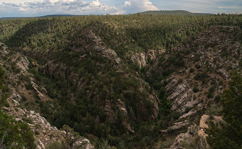
Walnut Creek Bend - It's perplexing to understand how a normally dry creek could carve a deep gorge into the surrounding limestone.
Walnut Creek Bend – It’s perplexing how a usually dry creek could carve a deep gorge into the surrounding limestone.

We had to break from the heat last month, so we drug the trailer up to Flagstaff. We didn’t escape the humidity, though. Since it’s the height of the monsoon season, the weather in the high country was the same as at home—only 30°cooler. There’s been a lot of news earlier this summer about the Flagstaff fires, so we found an RV park on the west side of town—right where Old Route 66 merges with Interstate 40. When we got there, the seasonal rains had already quenched the burn. U.S. 89, which both fires crossed, had reopened, but Sunset Crater National Monument is still closed. It suffered extensive damage to the campgrounds and buildings (otherwise, the cinder cone and Bonita Lava Flow were unharmed).

Our trip served a couple of purposes. First, I needed topics to get this publication through the balance of the hot summer months. Second, we wanted to take Ritz (our trailer) on a shakedown cruise to see how well it and the Jeep played together. Finally, we longed to sleep under the covers with open windows in air, not contaminated with that old-person smell—we accomplished all of that. It’s hard to describe how wonderful it felt to enjoy a glass of wine outside and listen to the sound of rain on the awning. Besides, there’s no more fabulous evening entertainment than watching a newbie learn how to do their first black-tank dump (go back and watch the 2006 movie RV again).

This month’s project is one of the excursions we made to a place that neither Queen Anne nor I have ever been to—Walnut Canyon National Monument. I’m not sure why we missed it. It’s only a couple of miles south of I-40 on Flagstaff’s east side. As you drive the road south, it transitions from Ponderosa Pine to Juniper, so the elevation is lower than the town. The monument is primarily known for the Sinagua cliff dwellings—which I’ll discuss in the upcoming weeks, but it’s the creek we’re interested in today.

On the Colorado Plateau, water generally flows to the Colorado River. In Flagstaff, however, someone put our state’s tallest mountain in the way, so water has to drain around the San Francisco Peaks. A couple of miles west of town, you cross the Flag Divide, where streams flow west of the mountains. East of the divide is the Rio Flag and Walnut Creek Drainage system. Here the streams flow east of the volcanoes into the Little Colorado River. Walnut Creek drains Mormon Lake, Upper Lake Mary, and Lower Lake Mary. You can count Arizona’s natural lakes with one hand, and this little creek drains three of them. Perhaps that explains how an ordinarily dry creek could carve a deep channel into the limestone. Of course, all of that happened before our 22-year drought. Today, Mormon Lake is a broad, shallow dry lake with a mud puddle marking its deep spot, and both Mary Lakes are similarly low.

In this week’s picture, we’re standing at a spot that overlooks a horseshoe bend in the creek. I took this photo from the north side of the canyon facing south. In the distance is Mormon Mountain, some 16 miles south. The lake is located on the left flank of the mountain. When the creek is wet, water flows from right to left and empties into Rio Flag several miles downstream. Then the river turns north and flows under I-40 until it reaches the Little Colorado River, about a mile east of the Grand Falls (sometimes called Chocolate Falls).

I hope you enjoy discovering Walnut Canyon and seeing this week’s image. You can view the Web version of Walnut Creek Bend on its page by clicking here. Next week, we’ll hike one of the trails and poke around some ruins displayed in the national monument. I hope you’ll join us.

Till next time
jw

What’s The Point  Picture of the Week

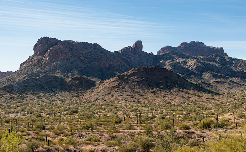
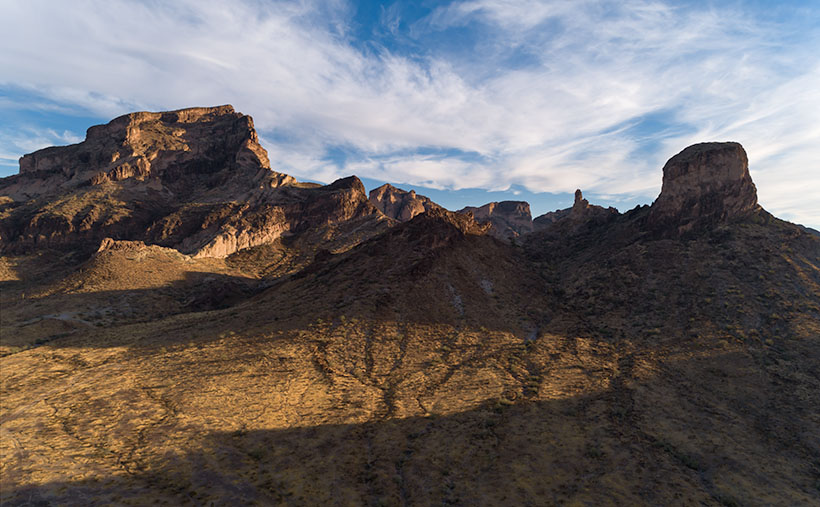
The Point - Afternoon shadows grow long on a portion of the Eagletail Mountains.
The Point – Afternoon shadows grow long on a portion of the Eagletail Mountains.

After last week’s rant about the failed hike Fred and I attempted in the Eagletail Wilderness Area, some of you have probably concluded that I’ll never do that again. I understand; I had those feelings too. After all, why attempt a 7-mile hike when a) I don’t enjoy hiking, and b) I’m not good at it? Well, it’s because I love being in the wild, and I find it revitalizes my soul.

I didn’t become a nature-lover from my father. He was born and raised in Pittsburgh, Pennsylvania, and grew up in a neighborhood derogatorily called Polack Hill—now Polish Hill. There wasn’t room for nature in the middle of Pittsburgh’s industrial district. I remember seeing the Allegany River between the warehouses from my great-grandmother’s back porch, but no one fished it. The steel mills polluted it so much that the catfish were discolored and had three eyes—like the fish in The Simpsons. Dad didn’t hunt, and the fishing trips he took me on were to fish farms.

It was Ansel Adams that sparked my interest in the natural world. As an impressionable young photographer, I was awed by his works. I wanted to see and shoot all the beautiful places in his pictures. It wasn’t until I moved to Phoenix and joined my brother-in-law on camping trips that ignited my love of the outdoors. He and his friends had the right gear to live well in the wild. That gang taught me that everything tastes better in the dirt. There was something out there that made me feel alive, even if we only swapped Jack Daniels flavored lies in the searing heat of a roaring cowboy fire.

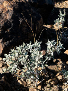
Eagletail Brittlebush - A sure sign that spring is near in the Sonoran Desert, is when the Brittle Bush sprouts new blue-gray leaves.
Eagletail Brittlebush – A sure sign in the Sonoran Desert that spring is near is when the Brittle Bush sprouts new blue-gray leaves. Yellow flowers will soon cover the desert floor.

That feeling of adventure is addictive. I need a regular fix. Although I’m happy to roll down my car window and shoot mountains through it, the thrill is more significant when I know that I’m seeing something most people haven’t. Even though Fred and I failed to find the petroglyphs, we filled our memory basket with petrified wood, rose quartz, and signs of wildlife. I’m not sure if or when I’ll go back to the Eagletails. Other places sing the Sirens song for me.

This year is the beginning of my fourth quarter. Although I can’t see it from here, the end of the road is waiting. With every passing year, I better appreciate nature’s importance. That’s why I’ve joked with Queen Anne to place my ashes on Utah’s Powell Peak—but save my eyes. Like that weird little Microsoft Word assistant—Clippy—put them in a formaldehyde-filled jar so I can still look around. I can hardly wait to see the look on some poor camper’s face when they discover me watching them set up their tents.

This week’s picture is of a mountain ridge inside the Eagletail Mountains. I named it The Point for the granite dome at the center. It’s smaller than Courthouse Rock I showed last week. I shot this image after Fred got back from his reconnoitering trip. While I waited, I watched the afternoon shadows grow into a pleasing composition. You can also see the Ben Avery trail that we meant to hike. The flat Jeep trail near the bottom runs from left to right.

You can see a larger version of The Point on its Web Page by clicking here. Next week, Queen Anne and I begin a new adventure. I’ll give you a hint; it’s someplace in Arizona that I’ve never visited. Come back then and see what we’ve discovered.

Until next time — jw

Sycamore Canyon Picture of the Week

As you would expect, the edge of the Colorado Plateau isn’t smooth and polished. It’s quite the opposite. Over eons, the streams that drain the plateau have eaten away the walls and carved a series of steep canyons. These parallel canyons look like an evil witch with rheumatoid arthritis pressed her fingers into a curb of wet cement.

Capitol Butte and Sedona - a place of natural beauty overrun with loving fans.
Capitol Butte and Sedona – a place of natural beauty overrun with adoring fans.

Oak Creek Canyon—and the village of Sedona—is probably the most famous example that I can name. The creek has cut into the iron-rich sandstone leaving behind beautiful red-rock formations that attract visitors from the four corners of the globe. And why not? There’s a lot to see and do here. Magazines have called Slide Rock one of the ten best swimming holes in the country (Havasupai Falls also made that list, not bad for a desert state, eh). Sedona always makes the top of the list for romantic getaways for Valentine’s Day, Thanksgiving, Christmas, and on and on and on. If you want to be romantic in Sedona these days, you have to be careful not to bump the couple making out next to you.

When people visit Oak Creek Canyon and Sedona, they understandably fall in love and don’t want to leave. Over the past 50 years, I’ve seen Sedona grow from a gas station intersection to a resort town that’s on a par with Aspen, Telluride, or Santa Fe. The catch is that there’s not enough water to support all of the rich people building second homes there. We all visit to see nature at its best, but now the McMansions are in the way. We love it to death.

But there’s hope for us tree-huggers. Less than 17 miles northwest of downtown Sedona is Oak Creek Canyon’s sister—Sycamore Canyon. Here there are no McMansions, Gucci Stores, or Whole Foods because, in 1972, the Feds set it aside as a Wilderness Area. While standing on the rim at Sycamore Point, you can begin to imagine what Oak Creek Canyon was like before the mobs got there. Imagine a time when a campfire was the only tell of humans in the area.

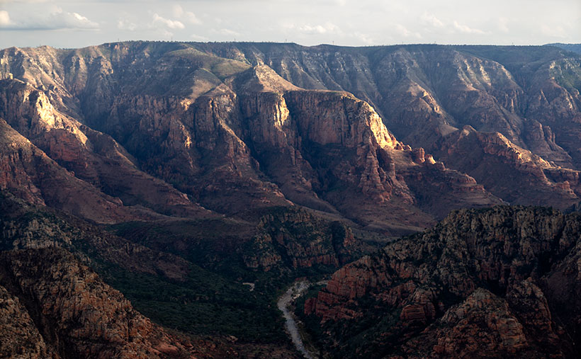
Sycamore Canyon - Oak Creek Canyon's twin sister was set aside in 1972 as a Wilderness Area so we can remember what nature looks like without people.
Sycamore Canyon – Oak Creek Canyon’s twin sister, was set aside in 1972 as a Wilderness Area to remember what nature looks like without people.

My friend Deb and I camped here before Queen Anne ever arrived on the scene. When she finally did, this was the first place Deb and I took her camping. As we ate a dinner of grilled stuffed pork chops and watched the sun go down, she was hooked. That’s when we convinced her that everything tastes a little better with dirt on it.

I wanted to come back this year after watching the fire news early this summer. One fire had ripped through here, and I wanted to see how much damage it caused. Queen Anne and I found black scars on the ridge on the canyon’s far side, but only a couple of pinions had burned on the edge where we stood. Overall, the canyon fared well, except years of drought have left Sycamore Creek dry. We didn’t see any remaining pools of water from our vantage point.

The BLM has moved camping back a half mile now. They’ve removed all of the rock fire rings and built a parking area. If you want to come here, your best camp is at one of the small lakes up the road. Since Sycamore Point is less than twenty miles from Williams, it’s an easy drive from town and back in one afternoon.

As the sun got low, it reached a crack in the clouds and lit the cliffs while I had my camera in hand. I snapped a couple of shots, and this is the version I preferred. I named the photo Sycamore Canyon. I like how the setting sun makes the cliff faces glow, but you can still see the dry creek bed below. Along the rim in the center-left, you can make out the black scar left by this summer’s fire. That’s ok though, unlike a McMansion, it’ll heal soon.

You can see a larger version of Sycamore Canyon on its Web Page by clicking here. Next week, we return to the bright lights of Williams. Come back then and see what we found.

Until next time — jw

Saddle Mountain Picture of the Week

I have mixed feelings about this week’s landmark that depend on which side I see it from. Saddle Mountain is located on the south side of Interstate 10 at Tonopah. When I used to ride the shuttle vans to the Wintersburg power plant, seeing the mountain meant that I had to wake up and go to work. But, whenever we returned from an extended California trip, I was always on the lookout for that distinctive saddle. When it came into view, it meant that we’d crossed into Maricopa County, and we were almost home. Phoenix was still an hour away, but at least we were on home turf.

Saddle Mountain is easiest to recognize when traveling east on the freeway. It’s the big birthday cake that a telephone pole fell on. It’s the dent in the middle that describes it, although you’d have to have pretty long legs to ride it. As you get closer, you’ll see many blocks and spires rising from its base. It has a lot of the same characteristics as the Superstition Mountains east of Phoenix. It’s said that the Flatiron face of the Superstitions is an ancient volcanic plug. On the other hand, Saddle Mountain—like its neighboring ranges—was formed by our old friends, rhyolite and tuff.

Being a couple of miles outside of Tonopah, it’s an easy place to get to. It’s not a wilderness area, so dirt roads are crisscrossing the surrounding land. In winter, snow-birds frequently dry camp in the flats. Signs say that the camping limit is 10 days, but I wonder if anyone enforces that.

Saddle Mountain - Blocks and spires adorn Saddle Mountain's north face.
Saddle Mountain – Blocks and spires adorn Saddle Mountain’s north face.

I’ve tried to photograph the mountain several times, but I never came away satisfied. It’s one of those places where you want to get in close to show the details, but you lose its distinctive overall shape when you do. This week’s featured image is an example of what I mean. I wanted to show the blocks and spires that adorn the mountain’s north face, but the saddle’s trough was hidden behind the ridge when I did. I’m pleased with this image, but there’s so much more to shoot that it frustrates me. Perhaps Queen Anne and I could drag the trailer down there for a camping trip later this spring.

You can see a larger version of Saddle Mountain on its Web Page by clicking here. Come back next week when we present our final December landmark. Both Queen Anne and I are wishing you a happy and safe holiday season.


Until next time — jw

The Boulders Picture of the Week

As we continue our journey east along the Florence-Kelvin Highway, we leave behind the dry washes and haunted valleys of the Tortilla Mountains. We reach a crest where the land becomes a flat plain of sorts. There are small mountain peaks—big hills really—dotting the countryside here and there, but the view is more open, and it seems less appealing now.

Without the mountains and gulleys, the road has long straight sections, and although it appears to be flat, it’s a long downhill slope into Florence. The elevation drops almost a thousand feet over the next ten miles. Just after passing the Tea Cup cattle ranch on the road’s north side, we spot a field of granite boulders that Google Maps identifies—oddly enough—as The Boulders.

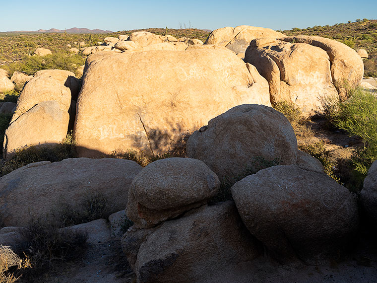
The Boulders-Another outcrop of granite deposit found throughout the state of Arizona.

The boulders that you find at The Boulders are the same pile of granite rocks found in Prescott, up the hill from here in Yarnell, Kingman, or any other place throughout Arizona. They’re everywhere. Instead of turquoise, the state legislature should have designated these granite deposits as the state gemstone, but, like Ben Franklin’s idea of making the turkey the national bird, granite just lacks pizzazz—except on your kitchen countertops.

Because the rocks stand out like a sore thumb along the road, I had to stop to take some more rock pictures. There are a couple of good campsites here. In fact, on our visit, a motor-house and fifth-wheel were doing just that nearby, so The Boulders is a popular place. As I clambered in, on, and among the rocks, I looked for a composition that distinguished this outcrop. The image that I chose to present this week was one that was covered with graffiti. I’m always flabbergasted how some people love to get out in the wild and are then compelled to mark it up with spray paint.

I call this week’s featured image The Boulders, and I like it for a couple of reasons. One is the contrast of small against the big; the other is the shadow against the light. I’ll throw in the wall-art at no additional charge. Another thing in this image that I find interesting is the Tortilla Mountains barely visible on the horizon. It shows the amount of distance Queen Anne and I have traveled.

You can see a larger version of The Boulders on its Web Page by clicking here. I hope you enjoy viewing it. Next week, we’ll finish up our trip along the Florence-Kelvin Highway and I have a surprise to show you—something I’ve seen in pictures, but never in person.

Until next time — jw

Four Ponderosa Picture of the Week

When an Arizonan talks about a pine tree, the red barked ponderosa is most likely what they’re referencing. It’s the common pine tree in Arizona. We have so many of them that our grove grows like a slash across the state’s middle, like a belt, and they continue east into New Mexico. It’s the world’s longest contiguous ponderosa forest in the U.S. Sadly, some of our brightest citizens try to burn them all down each fire season.

It’s a happy tree for me because it means that I’m in the high country when they’re around. Most likely, I’ve traveled to escape the desert heat and spend some time in the shade of the tall pines napping with a bit of fishing line tied around my toe. I have a fond memory of getting up early on a fall morning to drive up to Hawley Lake, and as the sun came up, we were on the Rim Road. The morning sunlight flickered between the tall trees, and I felt like I was driving through the Black Forest in Germany. Although I’ve driven that road hundreds of times since then, I’ve never had the same feeling.

Four Ponderosa
Four Ponderosa – Growing in a grouping that reminded me of a four-poster bed. Maybe I thought that after my long hike and I was tired (and don’t forget, tired).

During my visit to the Hualapai Range outside of Kingman, I was surprised to see ponderosa growing. In the Desert Southwest, they only grow at higher elevations. On the road, I rely on the trees to estimate my height. First, come the pinion pine at around 5,500’, then the ponderosa starts at 6,500’, and then the aspen show up at over 7,500’. The mountain island on top of the Hualapai’s probably is most likely the western edge of our grove. Only the Black Mountains are west of here, and they’re not high enough to support the big trees.

I walked by the ponderosa’s in this weeks image on my way back to Archie after a hike up the mountain. My legs were already sore, and this four-tree grouping reminded me of a four-poster bed. The spacing between them was ideal for hanging a hammock. It’s a good thing I don’t carry one because I would have spent the night, or even worse, I would have rolled over and fallen out onto the ground. That would be just my luck.

I call this week’s image Four Ponderosa, and you can see a larger version of it on its Web Page by clicking here. Be sure to come back next week when we show another photograph from the Hualapai Mountains.

Until next time — jw

Sleeping Under the Stars Picture of the Week

There’s something wonderfully romantic about how cowboys spent evenings eating beans around a fire before laying out their bedrolls and sleeping under the stars. It makes me wonder if I would have been any good riding a fence line. I love the outdoors, campfires, looking at the stars, and dreaming of the ladies back in town (sigh). I can assure you that I could never do that because the last horse I got on said, “oof” and sleeping on the ground has rocks, snakes, spiders, scorpions, skunks, and rabid chipmunks—not to mention the inclement weather.

Queen Anne and I still enjoy getting out in the wilderness; we just bring half of the house with us. For some reason, I sleep very well in our little Casita trailer. She has two layers of foam over the cushions that make into a full-size bed, and when I crawl under our down coverlet, my eyes slam shut faster than a mouse trap. As I lie next to my love and wrestle for more space, I listen to her rhythmic breathing. The hypnotic cadence is a mantra luring me to dreamland—until she misses a gear and sounds like a manual transmission exploding. But, she stops as soon as I nudge her to roll over.

All of this is fresh in my mind because we’re recently back from spending the week in the KofA Wildlife Refuge with The Ritz—our trailer. We succeeded in getting more images to finish up with this month’s topic but concluded that there is a lot more to the KofA range than a couple of blog posts. I think it may need to be a long-term project.

This tip was the first time we used the trailer in winter, and although the days were sunny, the wind blew, and the nights were colder than our Alaska trip. We had to use its heater at night. Even though we set the thermostat to 58º, it still came on often and blared at 85dB. The first time it came on, it made that burning dust smell and I thought we were going to die of carbon monoxide poising, so I opened the windows, which was counterproductive. Like all furnaces, the smell cleared eventually and we stopped jumping every time it started. Even with that racket, I slept until sun up.

We spent two days exploring and shooting photos at the refuge, and on the last day, the wind died, so we were able to use a week’s worth of wood for a fire. We ate brats, drank rich cocoa, and roasted marshmallows for jimmyums over the burning logs. Its warmth kept us outside long enough that the stars came out—all of them. We stared at Mars so hard that it began darting across the sky until we looked through binoculars and proved it wasn’t doing that. Finally, the creamy streak of the Milky Way began to reveal itself and forced me to set up my camera.

KofA Milky Way
KofA Milky Way – Campers enjoy the KofA mountain range-in silhouette against the Phoenix lights-under the Milky Way and Orion early in the January evening.

This week’s featured image is the result of that effort. It’s called KofA Milky Way, and I shot it from our campsite. The bright spots on the ground are from the next camp. The mountain is Signal Peak silhouetted against the lights of Phoenix—150 miles to the east. The constellation Orion is center-right, and Pegasus with the Andromeda galaxy would be overhead, but the fire died, and the cold chased us inside before we could find it.

As usual, you can see a larger version of KofA Milky Way on its Web Page by clicking here. I hope you enjoy viewing this week’s post and next week; we’ll show another featured image from Arizona.

Until next time — jw