Motel Downtowner Picture of the Week

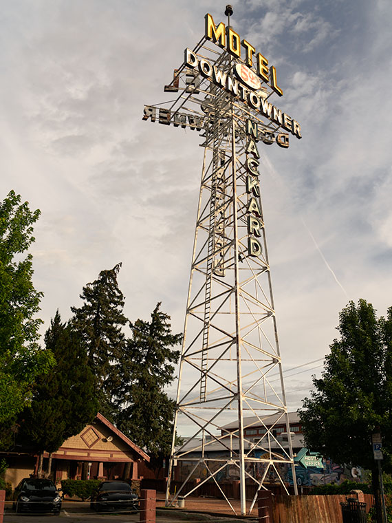
Motel Downtowner - The 1930's sign was built on a tower to lure tourists off of Route 66.
Motel Downtowner – Nackard built the 1930’s sign on a tower to lure tourists off Route 66.

Tourism is Flagstaff’s biggest money maker. According to one ASU study, tourism accounts for 84% of the town’s employment. Some of our non-Zonie friends may wonder what the attraction is; most out-of-state people don’t know much about our state and can only name two Arizona cities. Every season has a reason to visit the town at the bottom of the mountains. As I said at the beginning of this project, its 6,909-foot elevation (1,600 feet higher than Denver), mild weather is an excuse for valley lowlifes to visit and escape the heat. Fall ushers in colorful aspen trees that the annual fires haven’t burnt—both of them. Then, in winter, some people like to strap planks to their feet and slide down the big hill out of town. Finally, everybody goes to Flagstaff to toast marshmallows during the spring fires.

In the above list, I didn’t mention the daily traffic on Beal’s Road—Route 66—now Interstate 40. It’s an excellent place to stop for a meal or to get some sleep. And—oh yeah, I forgot—it’s how you get to the Grand Canyon.

It’s no wonder overnight lodging shaped and dominated Flagstaff architecture—from abandoned stone ruins to tacky Route 66 motels to today’s boring corporate three-story shoeboxes lining I-40. I think it’s understandable but sad that, as highways evolve, the old buildings and signs are disappearing. I get a big grin when I see one standing and add it to my collection. It must be the same thrill a hunter gets when shooting a Moose, Elk, or Kiwanis.
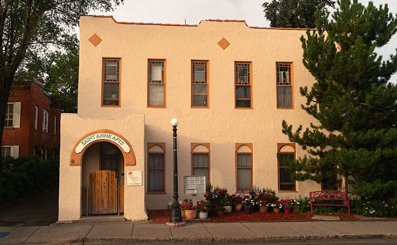
Apartment House - I shot this down the street from the Downtowner sign. I'm positive that if my wife ever set foot in this building, it would rip a hole in the space-time continuum.
Apartment House – I shot this down the street from the Downtowner sign. I’m positive that if my wife ever set foot in this building, it would rip a hole in the space-time continuum.

Last week, I wrote about Du Beau’s novelty concept—lodging catering to the motor car traveler. His motel was the second of its kind in the country—the first was in San Louis Obispo, California (that one burnt down, which makes Du Beau’s the oldest survivor). The buildings in this week’s image are ten years older but were initially used for other purposes. According to one account, it was a brothel. How scandalous. There were whore houses in the west—who knew? It wasn’t until the 1930s that K. J. Nackard bought the place and turned it into a motel. At the time of its opening, the main road through town was on the south side of the tracks. Later, the highway department realigned Route 66 to the north side. That’s when the sign wars began.

If you’re fishing for customers and they drive by your door, you can hook customers on a bamboo pole, but when the traffic is on the far side of the train station, it’s time to break out the surfcasting tackle. Both motels began building bigger and brighter signs to lure travelers to the Bohemian side of Flagstaff. These signs make today’s city planners shudder.

I took this week’s photo, which I call Motel Downtowner, with the rising sun. I had been walking around town in the twilight, and the tower was one of the last places I shot. It was after 7:00 by then, and I needed a cup of coffee (Macy’s European Coffeehouse—he’s also a fellow photographer). I have tried to get a shot of this tower for years, but I’ve never been happy with my results.
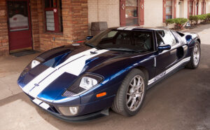
Ford GT40 - Evidently, not all residents at the Motel Downtowner are lowlifes. I found this car parked in the motel's portico, and is rare, even for Route 66.
Ford GT40 – Evidently, not all residents at the Motel Downtowner are lowlifes. I found this car parked at the motel’s entrance ten years ago, and it is rare, even for Route 66.

You’ll notice that the characters are angled to be readable while driving the Mother Road, and that angle points to Route 66. The motel is no longer open. Another type of business has taken over the buildings, but the sign remains; somebody in Flagstaff appreciates good kitsch and history as much as I do.

You can view my Motel Downtowner web version on its page by clicking here. Next week, we have another historic Flagstaff hotel sign to show, so be sure to join us then.

Till next time
Jw

BTW:

Oh, you’re still here even though the show is over. You must read to the end of the article. Good on you, mate. You’re probably wondering what’s down here in the basement. This is my new ongoing section with announcements, follow-ups, answers, etc. I intend it to be a paragraph long (my fingers are numb) so I don’t have to clutter your inbox with extra mailings. I hope you find it helpful.

Broken Crown Picture of the Week

It takes a lot of space to jam a four-lane freeway through a mountain pass. If you have a horse-drawn wagon, you can squeeze through some tight spots, but with a Peterbilt 579—not so much. You have a couple of options to get that extra width—cut back the mountains or raise the road over them. A more practical approach is to do a little of each. Cut into the hills some and use that fill to raise the road—like how we build today’s modern highways.

The reason I bothered with this engineering exercise is that there are segments of the old Union Pass two-lane road that you can still explore, but they’re maybe 50 feet below the current grade. The more extensive section is on the west side of the Black Mountains crest, which we’ll talk about next week. On the east side, less than a mile of Old SR 68 remains. It’s behind an unlocked ADOT gate meant to keep livestock off of the highway, so be sure to close it after you. The road-gate is the public access to the old Richardson Homestead—a one-family ghost town.

The Richardsons were a family of five who settled the homestead in 1897. When they claimed the 160 acres, it had spring water, enough flat land for an orchard, vegetable garden, and a horse barn left behind by Union Troops stationed there to protect travelers from hostile Indian tribes. In summer, they made the journey from Los Angeles in a covered wagon pulled by a pair of horses.

They moved after John’s doctor told him to “go live in the desert.” I didn’t find a reference to John’s ailments, but that was a standard remedy for tuberculosis back then. The clear desert air undoubtedly helped him because John and his wife, Victoria, built a two-story home, root-cellar, planted trees, and raised livestock using only their sweat and simple hand tools. After establishing their home, Mohave County paid them a monthly allowance to maintain—what was then known as Beal’s Wagon Road—three miles in each direction. For thirty-eight years, they welcomed weary travelers with fresh fruits, preserves, vegetables, cold water, and a place to spend a night.

Victoria succumbed to cancer in 1935—four years after their fiftieth wedding anniversary. John followed five years later. Today they rest side by side in Kingman’s Mountain View Cemetery on Stockton Hill Road.

If you can call middle-aged adults kids, they managed the ranch and changed to keep up with the times. They added guest cabins, a small store, and a gas station. The family enterprise lasted until 1984. We, like our parents before us, didn’t have time to stop at some old place along the road. We had places to go. Shortly after that, the last of the family gave up the land, and the BLM took back ownership.

I remember the Richardson Homestead as a shady oasis on the drive between Kingman and Bullhead City. We would do the long climb from the river, and soon after cresting the hill, tall trees shaded the old road. The collection of rock-wall buildings and weathered metal roofs were always a  blur as we sped past. I vividly recall one early morning return trip. I remember the time because of the golden light. After we passed the old gas station, we saw real-live cowboys on horses driving cattle down the hill on the roadside. My companion and I laughed out loud because we had never seen working cowboys in Arizona—just the plastic ones that hang out in Scottsdale.

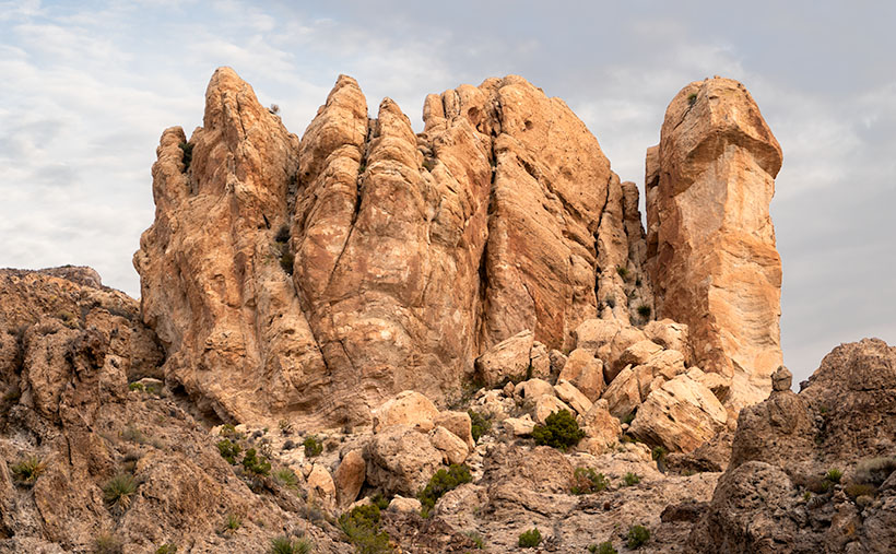
Broken Crown - A crown of tuff rests on a layer of basalt in Union Pass.
Broken Crown – A crown of tuff rests on a layer of basalt in Union Pass.

When I pulled over and stopped Archie to shoot this week’s picture, it was beside the homestead. Before I ran across four lanes of traffic (it was very early sun-up and no one was on the road yet), I looked over the guardrail at the remaining ruins and blew them off. I wasn’t out house hunting. Instead, I opted to focus on rocks (pun intended). This large outcrop of tuff on top of a basalt layer was just the ticket. I call this image, Broken Crown because of the fresh rock-fall and truck-sized boulders on the right. But, now that I know about the Richardson family, I want to return soon and wander among the remaining ruins with my camera.

You can see a larger version of Broken Crown on its Web Page by clicking here. Please come back next for our final image in this series and the story that goes with it.

Until next time — jw