On Display at National Bank

I’m pleased to announce that my premier print Mt. Hayden is on display in the lobby of Wickenburg’s branch of the National Bank of Arizona. At 24 x 30 inches, it’s the largest framed print in my collection. It’s also notable because it’s entirely analog. That’s right, it was shot on film and printed the old fashion way; in a darkroom.

Mt. Hayden
Taken from the Grand Canyon’s North Rim, Mt. Hayden, at over 8000 feet in elevation, is one of the most recognizable canyon subjects.

I’d be pleased if you’d stop by National Bank and tell the folks that you came to see the Mt. Hayden print. The bank is at 540 West Wickenburg Way; just west of the railroad bridge, and they’re open normal banking hours. The print will remain on display until September 1st. Just for fun, ask if you get a free toaster with a new account.

Till then … jw

Lunch on the Front Porch

It’s raining this morning, a steady gentle shower that’s driven the outside temperature down to 73°. That’s the lowest reading I’ve seen on our outside thermometer all month. The rain postponed our morning walk until it let up. We made it through most of our route before Queen Anne felt a couple of drops and began screeching, “I’m melting.” By the time we made it back to the house, the point on her black hat flopped over into her face. I’m afraid that she looked like a bit of a cartoon.

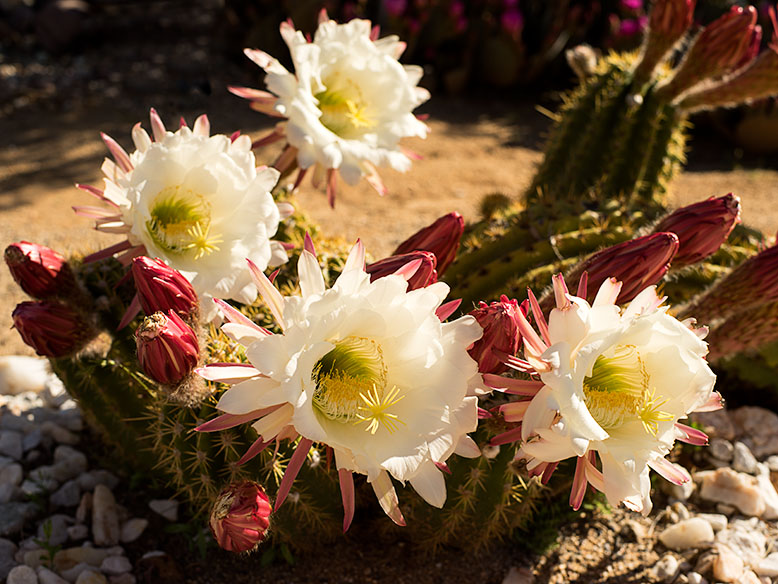
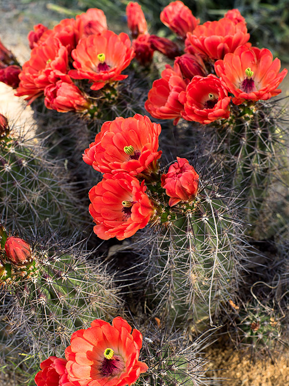
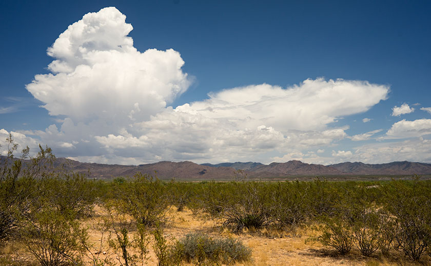
It’s been a decent monsoon season so far. We’re getting rain every other day. There’s enough to fill Lake What-A-Muck-A until the waters lap onto the pavers out back. The ground is damp, the saguaros have plumped again and some of the cacti have begun to bloom for the second time.

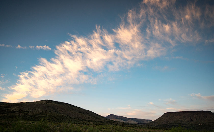
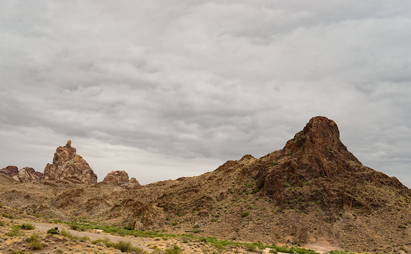
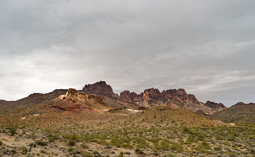
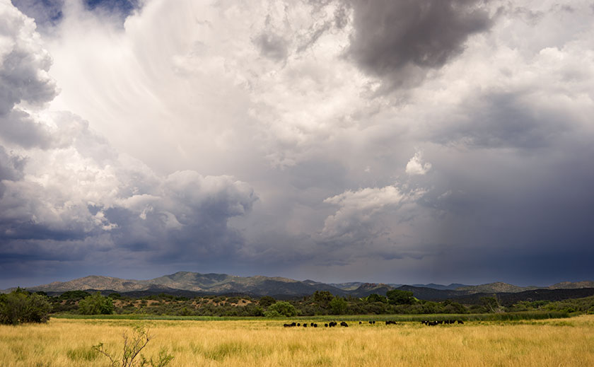
There’s enough moisture coming up from Mexico that the thunderheads form over the plateau behind the Weaver Range each afternoon. We watch them as they boil in slow motion until they anvil out and spread in their direction of travel. As the hot air rises down here on the desert basin, it acts like a vacuum, sucking the thunderstorms off of the mountain. Here at the house, with our views to the horizon, we watch as the lightning and rain cells pass to the north and south of us. But sometimes, we’re in the path. It’s like playing dodgeball while standing still.

Thunderhead Over the Weaver Range
Each afternoon, thunderheads form above the plateau behind the Weaver Range.

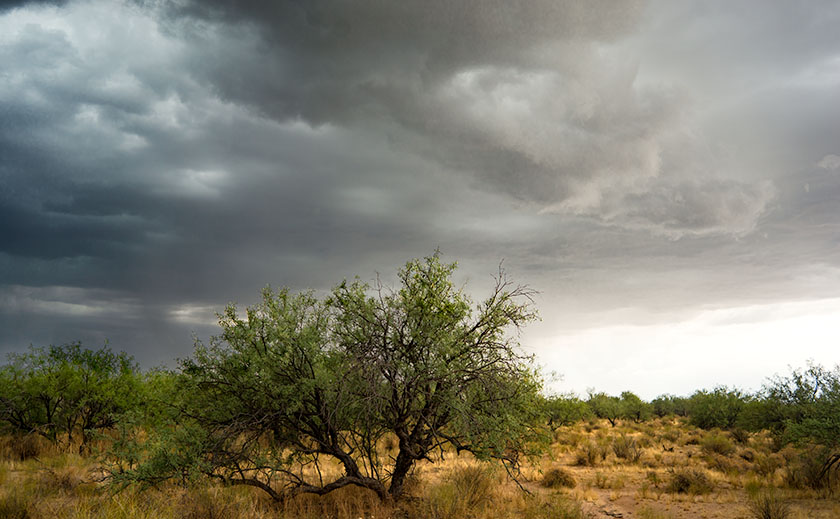
First, come the outflow winds which can gust over 60 mph. That’s why we keep the tree out front trimmed up, so the wind can blow through the top canopy instead of breaking off limbs or blowing the tree over. In the neighborhood, we’ve had nearly a half-dozen century agaves bloom, with a 20-30 foot phallic center shoot. The Christmas tree like stalk gives the wind enough leverage to rip the roots of the four-foot blue agaves right out of the ground.

Skull Valley Monsoon
Monsoon clouds move down from the Bradshaw Range in Skull Valley.

Following the wind is rain. Sometimes it’s only a drop or two that leave spots on your dust-covered car. Other times it’s a gully washer and the streets fill like rivers. Out on the desert floor, the washes run with fast-flowing muddy red water; those are the flash floods that are dangerous even if your miles downstream. Every once in a great while, Mexico sends up enough moisture that you get a long-lasting gentle rain, like today. It’s slow enough that the ground has time to absorb it.

Mesquite Pods
Ripe pods on a mesquite tree will be dispersed in the winds of a monsoon storm.

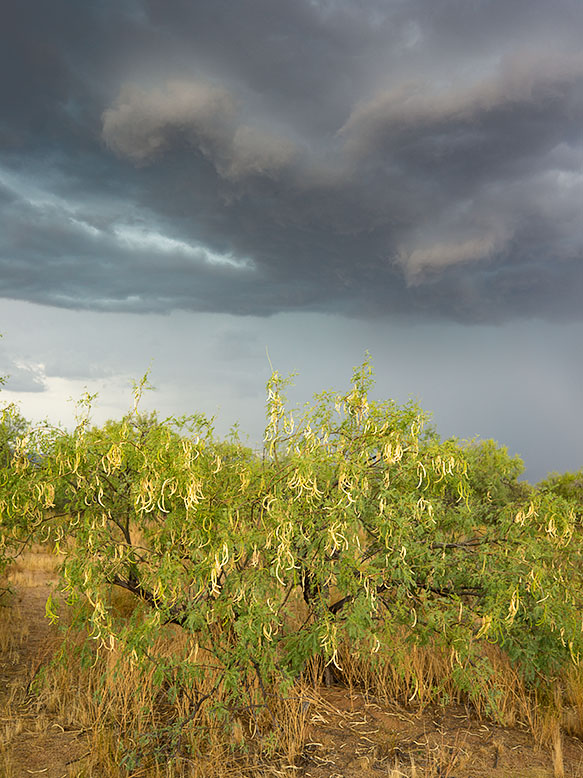
Conveniently, the rains usually arrive in time for sunset cocktails, and we sit out on one of the covered porches while enjoying a glass of wine. It’s a popular summer past time in Arizona. The temperature drops 10 to 20 degrees below the century mark. The lightning show is always spectacular and can last for hours. With a stiff breeze and the moisture; it’s pleasant outside, besides you have to hold down the furniture somehow.

Mesquite and Monsoon
A mesquite grove is about to get drenched in an afternoon thunderstorm.

It ends abruptly. Shortly after the rain stops, the sweltering black top evaporates the last of the street’s water like hot sauna rocks. The wind dies and the humidity closes in. When it becomes intolerable, you retreat back into the air conditioning, if the power’s still on. There’s time for a TV show before watching the weather. It’s important to find out how the rest of the valley fared before calling it a night.

Till then … jw

West of Center Art Show

It’s the eve of the national celebration of Queen Anne’s birthday and I’d like to interrupt your celebrations preparations for an announcement. Two out of a half-dozen submissions were accepted to be part of the West of Center art show at the town museum this summer. This is Wickenburg’s big summer art show at the Desert Caballeros Western Museum’s Cultural Crossroads Learning Center in downtown Wickenburg.

Airstream For Sale
One of my images selected for the show is an early model of an Airstream Trailer sits on a lot in Congress, Arizona.

The show runs from Saturday July 29th thru Sunday October 29th. There will be an opening reception at the Learning Center on Friday the 28th from 5:00 – 7:00 pm, which the Queen and I will attend. I am also hosting the show at least once each month on Fridays/Saturdays (depending when I’m scheduled) during the duration.

Whitman Store Front
The second image selected for the show is of the old Whitman Store that I shot along US 60.

The art show features  the works of Wickenburg’s local artists. There will be a variety of paintings, water colors, sculptures, weaving, and photography from the town’s local artists.

I hope you get a chance to visit our little hamlet and enjoy the art. The Learning Center is located at the Northwest corner of Tegner and US 60 (if you go under the railroad tracks, you’ve gone too far). Here’s hoping to see you at the reception or on one of my working days.

Till then . . . jw

Summer Solstice 2017

Today is summer solstice at 9:24 PM (MST); summer’s official start. Temperatures in Phoenix are forecast to reach near 120°, making it the hottest day of the year (so far). The Queen and I are celebrating the end of spring like a couple of mushrooms hiding in the dark while hoping the air conditioner doesn’t fail.

To cope with the increased temperature, we’ve changed our daily routines. We go on our morning walk at 6:30 to take advantage of the cooler morning temperature; although this morning’s low was still 83°. With 20% humidity, eighty degrees should be comfortable and it is in the shade, but this being desert, there’s little shade. There’s something about an oppressive high barometric pressure that intensifies the Sun’s radiant heat, so along our route, we divert to every patch of shade we find like lizards darting between rocks.

I limit my time out in the shop now. Instead of waiting most of the morning for the garage to warm up, I only work the hour before breakfast and I break my chores into chunks to fit the time. At least with that schedule, I get more computer work done in the afternoons.

There are other clues that our exceptional spring is being pushed aside. The roadside flowers I featured in earlier posts, have withered into dried grasses. The stately saguaro, one gluttonously plump with winter rain are undergoing transition to their impression of The Thin Man with their accordion folds compressing together. I wonder if the birds living in the giant cactus’ apartments notice their shrinking floor space.

Prickly Pear and Bagdad Hills
The setting sun shines on a prickly pear cactus and hills near Bagdad, Arizona.

Even the creosote is changing. A month ago they were full of yellow buds and the open spaces between washes were fields of light green resembling dense crops. Their flowers have turned into tiny gray fuzz-balls and the bush begins shedding leaves. They’re conserving water so they can survive out in the summer sun.

Kirkland Valley Sky
The setting sun lights up a line of clouds over Kirkland Valley.

I see out of my window that clouds are gathering above the Weaver Mountain Range. There will be no welcome rain from them today. There isn’t enough moisture in the air for them to swell into magnificent thunderheads. That will come in a couple of weeks when the winds change and bring humid air from the south, and that will be the real monsoon season start. Today’s clouds are just a promise of things to come.

Till then . . . jw

Laughlin, Nevada

Every once in a great while, I’m allowed out of the house on my own. I know that’s a surprise to you, but there are times when the Queen has friends over and she wants a presentable house. That means I have to go away while her company is here. Since I’m doing Anne a ‘favor’, I can usually parlay it into an overnight trip that I call a photo shoot. One of these freedom nights was last Tuesday, but at the last-minute, her friends had to postpone, and she was already in the truck before I could get out of the driveway . . . Doh!

My friend Deb asked if this was an anniversary trip to which I replied, “What? When is our anniversary? Yeah, that’s it! It’s for our anniversary.” So, it was something I had planned all along.

Whenever I have a chance to get away, my first thought is to head for a body of water. After all, that is what we miss in the desert. I’d hop on the first plane to New Zealand if I could afford it, but that’s out of our budget. What we can afford is a cot at the YMCA . . . or something close to that. With those constraints, there’s always Laughlin, Nevada.

Colorado River Valley from the Black Mountains.
On a rare rainy day, the lower Colorado River Valley holds the communities of Bullhead City in Arizona, and Laughlin on the Nevada side of the river.

My parents were the ones that introduced me to Laughlin. In the late ‘70s, they had a second home in Bullhead City, the town on the Arizona side of the Colorado River. My dad kept his boat there for a while, and we would manage to ‘drop in’ while they were in town. We’d spend days fishing and water skiing on Lake Mohave, and in the evenings, we would take the water taxi across the river to one of the three casinos on the Nevada side. I have fond memories of those times. Good times never last however, and my parents eventually got rid of the house and boat.

There are several reasons for me to make a quick trip to Laughlin. As a fisherman, both Lake Mohave and the river below Davis Dam offer good angling. However, I never remember to pack my gear for a one night trip. Although I like the craps table, I am averse to wasting money. It used to take twenty bets to lose my bankroll, but now that the tables have a five buck minimum bet, I’m done in four rolls. So, I don’t spend much time in the casinos. There are the buffets with rows and rows of various foods, with people who make you look skinny by comparison. However I favor quality over quantity, so we avoid them. I guess the best reason for Laughlin is that now that the Queen and I retired, we can take advantage of the twenty-five buck midweek hotel rooms. You can’t stay at the YMCA for that price.

The cheap rooms have a downside too. As we strolled along The River-walk connecting the casinos, we noticed that most of the patrons were at least our age; silver-haired seniors and an abundance of canes, walkers and wheelchairs. All of the casino floors were empty with many of the tables covered. The prime restaurants only open on the weekends. The hustle, bustle and excitement you would expect from a gambling hall was missing. Then, it dawned on me that the only people who had time for a casino on Tuesday were retirees; everyone else had to go to work . . . duh!

Thumb Butte
In the Black Mountains above Bullhead City, Thumb Butte looks like the universal indignant gesture of ill-will.

There’s one last thing that fascinates me about the area; it’s the geography. That section of the Colorado River Valley runs between the Black Mountains in Arizona and Nevada’s Eldorado Mountains. Neither range I consider tall, but they’re at the north-eastern reach of the Mojave Desert and get very little rainfall. That means they are subject to wind and temperature erosion. They are rocky, jagged and very rugged. Almost impenetrable.  As a matter of fact, Interstate 40 makes a 20 mile detour along the Santa Fé railroad tracks, around the Black Mountains between Needles and Kingman. The next upstream river crossing is 60 miles north at Hoover Dam and then its 180 miles more to the bridge at Marble Canyon. At the turn of the 20th Century travel was even worse. There were no bridges between Needles, California and Moab, Utah. Everything in between is hostile, desolate and in my opinion, the most beautiful terrain on earth.

Black Mountain MIne
An old mining claim near Union Pass in the Black Mountains.

As a photographer, I see the Black Mountains as a choice place to shoot pictures. It has ragged peaks, soaring spires and interesting shapes. They’re passed by in favor of the more famous canyons the Colorado cuts through. Because of its relative closeness, I’m intrigued at its beauty and if I can figure out how to best capture that ruggedness, I may have to take it on as a future project. Hey, it’s an excuse to get out of the house.

Till next time . . . jw