We need to drive an hour to show you a different part of the Algodones Dunes. I hope you had breakfast because we’re not stopping. There are only two roads that cross the dunes, Interstate 8—east of Yuma and California State Highway 78. We’ll hop onto I-8 and head west to Holtville, then north to Brawley.
Most of this drive is flat and dull except for the towering green John Deere tractors that take up three lanes of the two-lane road. The farmers drive them on public roads to remind you that if you eat steak and salad in winter, this is where they were likely grown—either here in the Imperial Valley or Yuma.
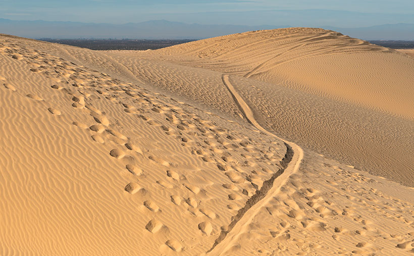
Once we get to Brawley (there’s a bypass, so thankfully, we don’t have to go into town), we’ll turn west onto S.R. 78—the road to Blyth (boy, it keeps getting worse, doesn’t it). It isn’t far out of town that you see a cloud bank on the horizon—or at least that’s what it appears to be. The sand reflects light on a bright day, and the detail gets lost. The shapes and color begin to resolve in another mile, and the windshield fills with an overwhelming sea of golden sand.
We have arrived. This area of the dunes is the home base for So Cal dune-buggy enthusiasts. As soon as the highway starts up the sand, you’ll see Gecko Road on the right. It’s a paved street loaded with vendors, campers, and rangers. This road is a fee area, so we may have to buy a permit if the rangers come to work today. There are several designated camping areas along the road, and they’re full of R.V.s and trailers—even in the middle of the week. Judging from the size and luxury of these rigs, they’ve come from the L.A. Basin—and they’re richer than anyone from Arizona. There must be a thrill racing up and down dunes; otherwise, what’s the point? I wouldn’t try it in Archie, but with Bluto, I might. It could be fun.
Predator Tracks – An innocent victim was snatched from her friends by a giant sandworm in California’s Imperial Dunes.
It can also be dangerous. Some creatures live in the sand that nobody’s seen—their tracks are the only evidence that they’re real. They’re called sandworms, and they feed on unsuspecting victims as they try to cross. It’s true; they were in the ’90s movie Tremors, and you can see for yourself in this week’s picture called Predator Tracks. In it, you see footprints from a herd of bikini-clad tawny blond valley girls, moving north across the sand while staring at their phones. They were defenseless because they ignored their parent’s warning to take a chainsaw.
As they incessantly chattered about their Instagram likes, they overlooked the sandworm lurking behind a distant mound. Like dolphins feeding on a school of mackerel, the sandworm blindsided the girls. From their midst, it snatched Cassie in its massive jaws and drug her under as she complained about losing all her bars. None of the others noticed. They continued to the snack truck making snide remarks about how Cassie had just ghosted them. The only record of this tragedy is the tracks in the sand in my photo. Within a couple of days, even those will blow away.
You can see a larger version of Predator Tracks on its Web Page by clicking here. Next week we’ll hang around the Imperial Dunes and see what other sand tracks we can find.
When Queen Anne and I make our quarterly medical run-to-the-border, the drive is usually three-hours each way. Most of the time, we leave at dawn, see our dentist, buy prescriptions, and then come home. For me, those are long days behind the wheel; for Anne, not so much. She’s usually asleep in the passenger seat until her snoring wakes her up.
Occasionally when we have lab work done, or the customs line is three-hours long because the snow-birds have arrived, we’ll get a room in the elegant east-side Motel 6 and dine at the swanky four-star Denney’s. Our December visit was one of those occasions. Since I needed a topic for January’s posts anyway, we spent an extra night and took a circuitous route home—we’d go up to Blyth to work the Algodones Sand Dunes for this month’s project.
The great swath of sand starts about three miles south of the border outside of Los Algodones, Baja. It continues 45 miles northwest into the Coachella Valley (California’s Imperial Valley). They’re the most extensive contiguous dune system in the U.S. The dunes are also called the Imperial Dunes, Glamis Dunes, and Gordon’s Well. The name varies with location and the leisure activity you’re doing. Still, the entire system is officially named Algodones Dunes (in Spanish, it means cotton plant—the predominant crop grown on both sides of the border along the Colorado River). This week, we’ll start west of Yuma at the Mexican border—at Gordon’s Well.
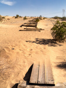
Imagine it’s 1850, and you’ve traveled by wagon hundreds of miles across the scorching Sonoran Desert, forded a raging Colorado River, and finally crossed into California. You’d think your hardships are behind, but then, you’re greeted with 6 miles of Sahara-like sand to cross. With each step, you sink up to your knees. Even in 1926, when the nation’s first Ocean to Ocean highway was built (U.S. Route 80), the shifting sand was an engineering nightmare. They couldn’t simply scrape the sand away because the prevailing wind constantly covered it up again. Even today, if you’re caught in a windstorm along this section of road, you’ll risk a chance that the sand will blast the paint off your car.
Plank Road – You can see what’s left of the old plank road on display at Gordon’s Well.
The road builder’s solution for getting across was to build a plank road—movable wood sections on railroad-lie ties that floated on the sand’s top. It turned out to be challenging to maintain, but it drastically cut the crossing time when it was clear. Eventually, the planks were replaced with new and expensive asphalt, and eventually, it became Interstate 8. There is a section of the original plank road at Gordon’s Well on display. When you grow tired of looking at the old wood road, you can walk over to the border wall and lean on it.
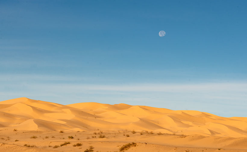
Dune Moon – A waning gibbons moon sets over the Algodones Dunes west of Winterhaven, California.
As Anne and I drove west on the freeway, we spotted a waning moon setting on the dunes, so we looked for a place to stop. We’ve got stuck in these sands once before, so we were careful not to drive off the blacktop. I didn’t want to pay for another hook to come to yank us out. As you can see, we found a good spot and took this week’s picture called Dune Moon. The name could have been funnier if I had shot it during a particular summer month. Se la vie.
You can see a larger version of Dune Moon on its Web Page by clicking here. Next week we drive north up the Imperial Valley to visit the northern dune crossing. Be sure to come back and see what we found.
The Queen and I took time out of our busy schedule to make our quarterly dentist visit this week. Usually, you’d think that would take maybe an hour or two. For us, it’s more of a commitment than that. As seniors, our dental insurance is nil to none, so upon the recommendation of a couple of friends, we found a good dentist in Algodones, Mexico—which means an overnight journey to Yuma. We got an add-a-tooth-to-me, so the first appointment was for a root canal and an impression to send to the lab overnight. The next day, the crown was fitted.
It’s been an abnormally wet year for us here in the desert, so when we left Monday at daybreak under a cloudless blue sky, we felt like we were wasting a good work day. The rains kept us cooped up all weekend while we had outside projects we’d put off for dry weather. Instead, we were on the road for three hours for an 11:00 am appointment.
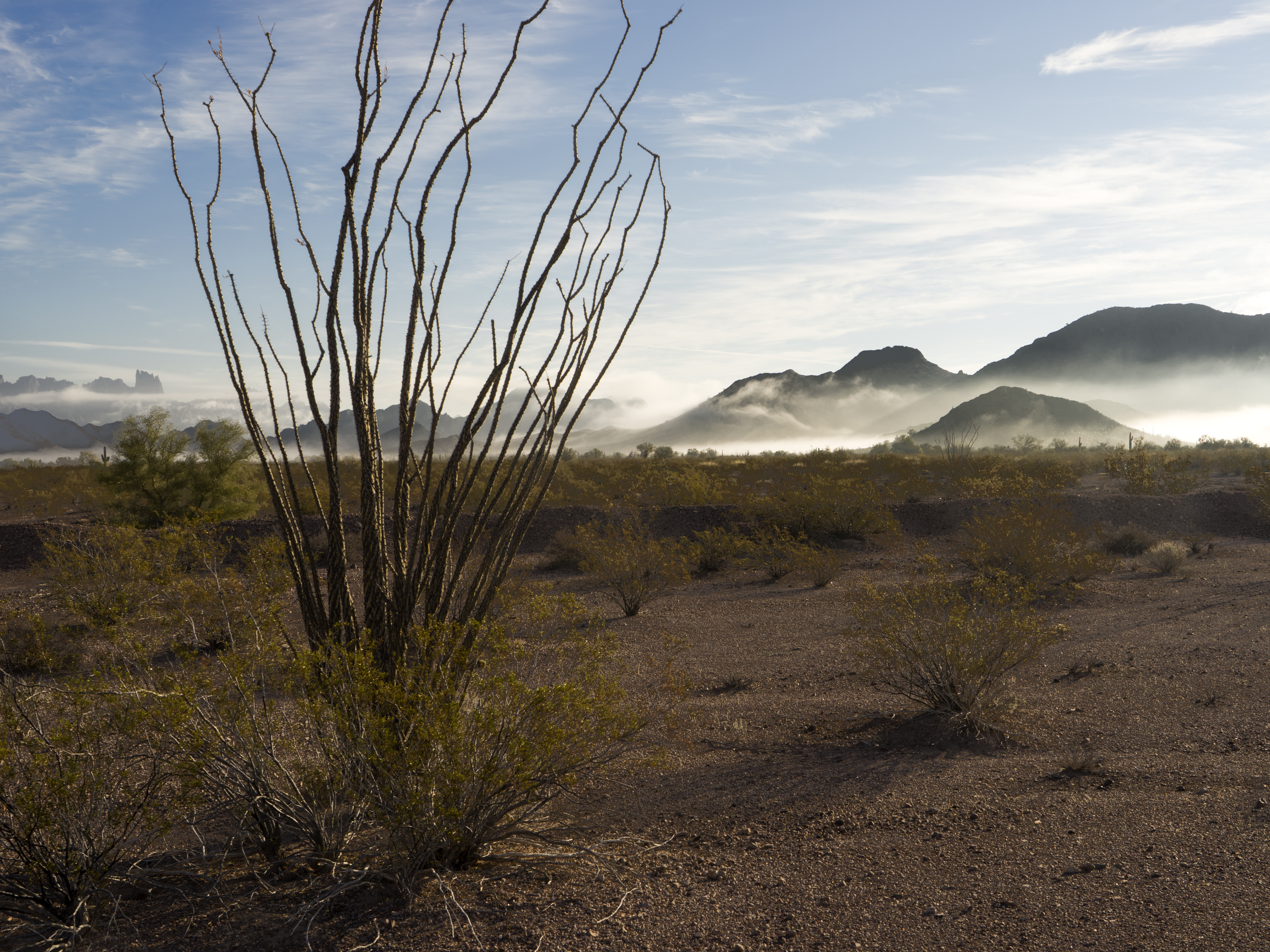
As the sun rose, we saw fog patches, something we rarely get. The evening breeze pushed the ground fog to the base of the low ranges like door-stops. The dark hills popped out of the strands of white. South of Quartzsite, I couldn’t take it anymore and pulled off the road to snap a shot as we passed through the KOFA (King of Arizona) Wildlife Refuge. Even so, we made it with time for breakfast before our appointments.
Ground fog is a rare sight in the desert, but after a cold rain, it collects at the feet of the low ranges. Here, ocotillo is the foreground of the fog at the KOFA Range.
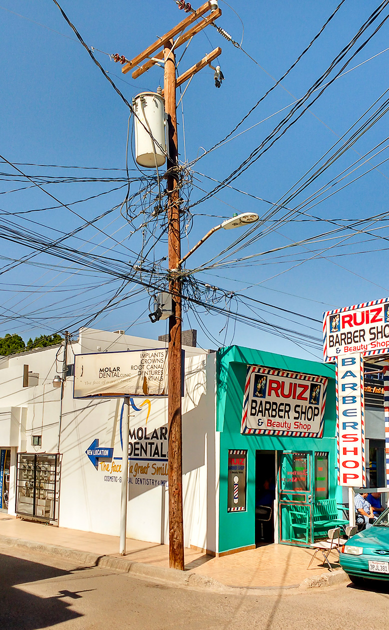
Los Algodones is a retirees’ equivalent of Disneyland. The downtown commerce area is an eight-block square along the east bank of the Colorado River. It’s a tiny border town compared to Juarez, Nogales, Tijuana, or even Mexicali; it’s sixty miles to the west, yet it’s still a Class A border crossing. That’s because of the large amount of foot traffic. There is some vehicular traffic crossing there, but most people pay six dollars to the Quechan tribe to park in their vast parking lot and walk across.
The dominant feature is a multi-story steel beam structure like an unfinished building. It’s been unfinished since we first visited some twenty-five years ago and will likely not be different in the next twenty-five years. Then there are the hustlers. Unlike Tijuana, they’re not trying to get you into one of the girly clubs (of which there are none); they’re working for dentists, eye doctors, pharmacies, or liquor stores. That’s right; the doctors got pimps. After you wander the town a bit, you realize the city is a medical amusement park. Within a block, you can get glasses, a tooth implant, new hearing aids, and a sombrero, and you can have a margarita for lunch while you’re waiting for the lab.
As a younger man, I never would have gone to a doctor in Mexico. I had heard the horror stories of shoddy work and surgery disasters, so why the change of heart now? It’s a combination of economics, referral, and desperation. We need dental work but couldn’t pay what the local dentists were charging . . . even with insurance. So, if I had a problem with a tooth, out it came. After retiring and hanging out with other like-minded geezers, we heard some good stories and got some strong referrals.
On our summer trip, I broke two crowns, so when we got back, we scheduled an appointment to investigate. Sitting in the tiny waiting room, people our age surrounded us, claiming our dentist was the best. The first exam was simple, consisting of digital X-rays, little cameras, and some poking and prodding. Within fifteen minutes, they printed out a chart of my mouth showing the work I needed, including the cost by tooth. Then, they went over the X-rays and photos so I could see what they were talking about. After that, they cleaned my teeth, and then I was done . . . $25.00. When we left the office, we both had our charts, and it was our decision about which teeth to work on and when. All of the prices were less than what our co-pay would be in the States.
As always, the devil must have his due. What you save in money, you pay with time. I have already pointed out that the waiting room is crowded with loyal patients. It is to a fault. Your 11:00 am appointment only means you’ll be seen sometime after that. If you need to see a specialist, they call an escort to take you there, where you can sit in another waiting room that always has one less chair than people. If you’re lucky, the TV has a Discovery Channel in Spanish. Otherwise, it will be CNN. If your visit requires replacement parts, the lab will always have them ready tomorrow. Give it up if you count on returning to the road at a decent hour. You will only have enough time to grab a Big Mac at the Yuma Mickey D’s before the three-hour drive home in the dark.
Western Arizona is one of the weirdest places on earth. It’s all low-lying Sonoran Desert dominated by creosote bushes, Palo Verde trees, and an odd saguaro here and there. It also gently slopes downhill towards Yuma, the lowest place in the state. It’s also the warmest and driest part of the state, both winter and summer. No one lives there.
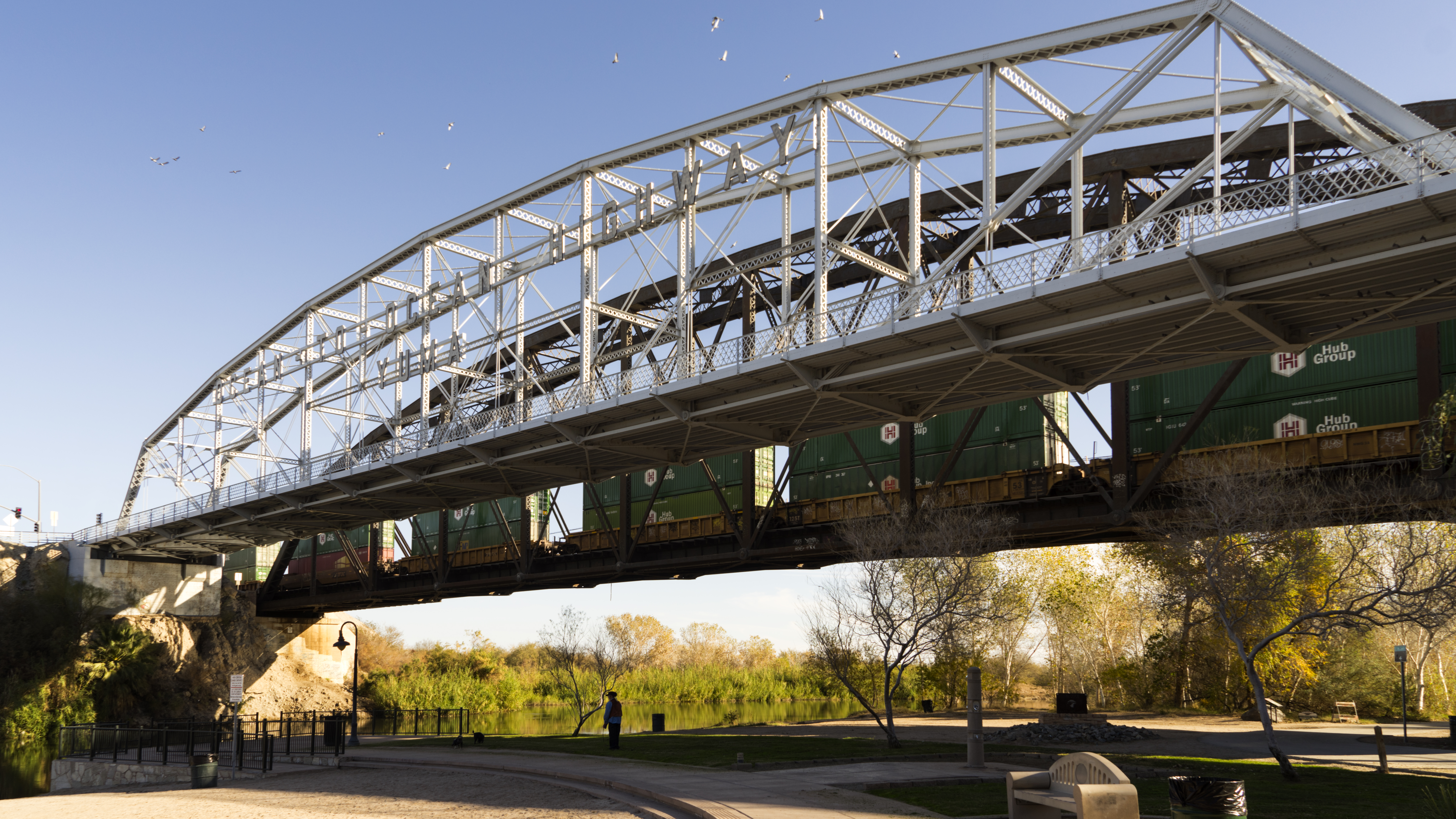
All the historical travel routes crossed the Colorado River within 300 yards of this spot. That includes the ferry, railroad, the first Ocean to Ocean Highway (US 80), and the current freeway (Interstate 8).
While driving to Yuma in September, we counted twenty-five empty RV parks along the road. Quartzsite, the halfway point of the trip, was a ghost town with most stores closed. On Monday’s trip, they were packed with people from Montana, Alberta, Idaho, Saskatchewan, Washington, and British Columbia. They all come down to the warm desert and camp under the stars. Except for an occasional Costco run, they never go into Phoenix, and the Phoenicians aren’t aware that these people are out there. After all, who goes to Quartzsite? The campers also go to Algodones for doctors, prescriptions, and booze.
On the Immigration Service Website, it says that the Algodones Customs Station averages over two thousand pedestrians a day. I’ve been there on days when you could walk right into the customs house and be on your way two minutes later. Over four thousand people were waiting in line this week to cross the border. The line curled back from the custom house and several blocks down the street. For over an hour, we marched a step or two at a time while chatting with our neighbors and carrying one bag of prescriptions and another containing one bottle of Kahlua or tequila.
Towards day’s end, the street vendors grab an armload of goods, abandon their stalls, and make their way to the line waiting at customs. They form a gauntlet imploring you to buy a poncho, sombrero, or a giant carved wooden turtle. On your other side, older women dressed in black hold a swaddled infant and offer Chiclets for spare change. They move on if you smile and softly say, “No. Thank you.” If you dare feel the lace or try on a hat, you’re dead meat until you agree on a price. Being a Baby Boomer, I can tell you that they’d make a fortune selling street tacos and Margaritas to-go along that exit line.