We Arizonans have it easy these days. Within a matter of hours, we can drive from the beaches of Yuma to the Flagstaff snowfields. We’re able to do that because of our modern cars and roads. With their bridges and gentle slopes, we forget how rugged our State’s terrain is. We sit in our air-conditioned cocoons and watch the scenery pass, without having to wonder, “How the hell am I going to get over that?” And the closest we ever come to getting scalped is from the guy selling souvenirs at The Thing.
Arizona was a different place when Martha Summerhayes arrived at Ehrenburg Landing via paddle-wheel steamer in the summer of 1874. She accompanied her husband—Jack, a Lieutenant—when the Army assigned him to the territory. She writes in her now-famous book—Vanished Arizona, Recollections of the Army Life of a New England Woman—about their travels to posts within our state, including her story of being the first woman to travel the subject of this month’s photo essay—The General Crook Trail.
George Crook was a Civil War officer who was assigned to Arizona to put a stop to Apache raids. Now, I fully appreciate the new awakening in our country about racial injustice, but that’s not the point of my story. I’m merely trying to explain, in my words, the trail’s history. George’s job of managing the Apaches wasn’t easy. They’re not a single people. There are the Chiricahuas, Yavapai, Mescalero, Tonto, and several more in Arizona alone. The tribe’s traditional homes were spread along the Mogollon Rim—the southern escarpment of the Colorado Plateau that slashes across the midsection of our state. It was like playing Whack-A-Mole; he’d quash one uprising only to have another pop-up 50 miles away. It didn’t take long for General Crook to understand that he had a logistics problem. He needed to move troops and supplies quickly from Fort Whipple (Prescott) to Camp Verde, and Fort Apache (near Show Low).
In August of 1871, the General took a company of men to mark out a trail between Fort Whipple and Fort Apache. It took over a month just to get that much done. His route hugs the edge of the Rim because if he went too far north or south, he had to navigate steep canyons. His men took another year to build a trail good enough for pack mules, and another couple of years to make it suitable for wagons.
Today, the General Crook Trail has morphed into a combination of Arizona Highway 260 and the Rim Road (Forest Road 300). The Rim Road is unpaved, and if you travel it, you’ll come across markers for Crook’s original pack trail. You can hike those sections, but a lot of the trail reviews say it’s easier just to walk along the dirt road.

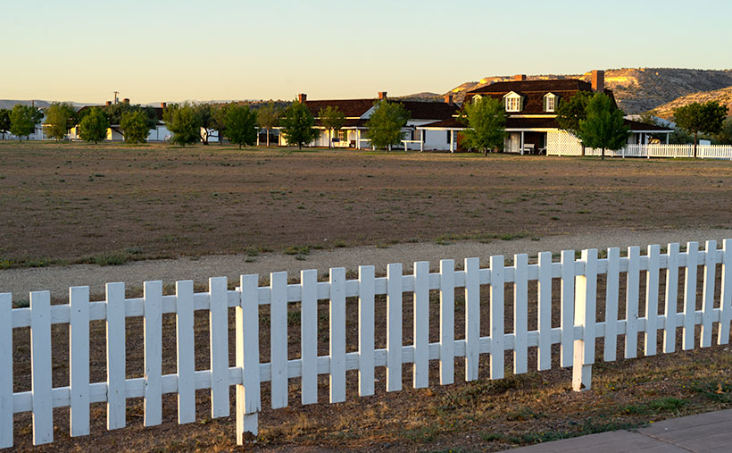
For September’s project, I’m only going to cover the section of A.Z. 260 from Camp Verde to the intersection with A.Z. 77 north of Strawberry. This week’s featured image is from Camp Verde, where they’ve turned the old post into a historical site. The Camp Verde Historical Society has preserved the buildings, built museums, and maintains the parade grounds within the State Park. It’s a great way to spend a day wallowing in history. This week’s image—called Parade Grounds—shows the parade grounds and the surrounding picket fence, with what I suspect is the Commanding Officer’s Quarters behind. How’s that for a back yard?
You can see a larger version of Front Parade Yard on its Web Page by clicking here. Be sure to come back and see our next stop along the General Crook Trail.
Until next time — jw
P.S. Martha’s book, Vanished Arizona, is not just a chick-book. It’s got cowboys, Indians, horses, rattlesnakes, and cactus in it. What more can a boy want? I smiled when she lamented how much Arizona had changed from her 1874 arrival to her 1911 death. It is the same feeling that most Arizonan have even today.

You should have taught history.
I love all the stories that you come up with.
Nice photo too!