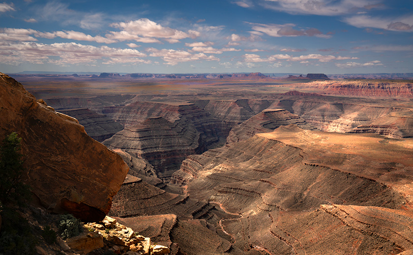
I can count on one hand the number of times I’ve been utterly captivated by a view during my days as a photographer. I’m talking about scenes that felt like they encompassed the entire world, vistas so mesmerizing that they made it nearly impossible to walk away. Places like the Summit Road on the Banks Peninsula in New Zealand, the patio of the North Rim Lodge at the Grand Canyon, Horseshoe Bend outside of Page, Arizona, and Bryce Canyon from Powell Point in Utah. These weren’t just beautiful landscapes but revelations that deepened my understanding of geography. During my May visit to the Bears Ears area, I discovered another such place—Muley Point on Cedar Mesa.
Why I Stopped at Muley Point:
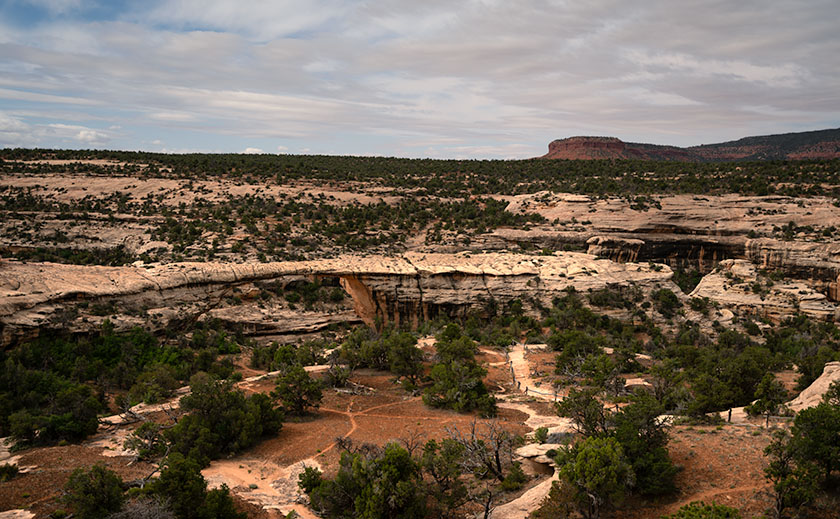
From last month’s article, I drove to Utah intending to spend several days photographing various areas on the south side of Bears Ears National Monument. However, my trip was cut short when I threw out my back. After packing up and heading home from Natural Bridges, my back felt better within the supportive confines of the Turd’s captain chair. With some relief, I decided to stop and inspect the Muley Point overlook for future trips.
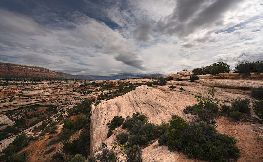
The three-mile dirt road to Muley Point was easy to traverse. When I arrived, I exited the truck, wandered the area, and took in the sights. I was immediately impressed. So much so that I decided to take some photographs, which meant returning to the SUV to fetch my camera and retracing the loop I had already hiked. Despite my initial setback, I’m glad to say that in the short time I was there, I managed to capture enough images to support this post.
Geological Marvel:
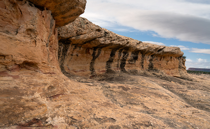
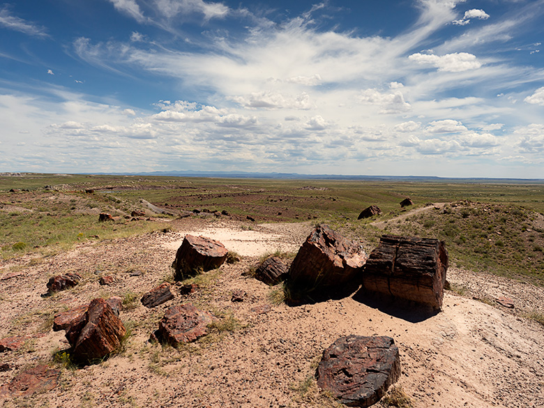
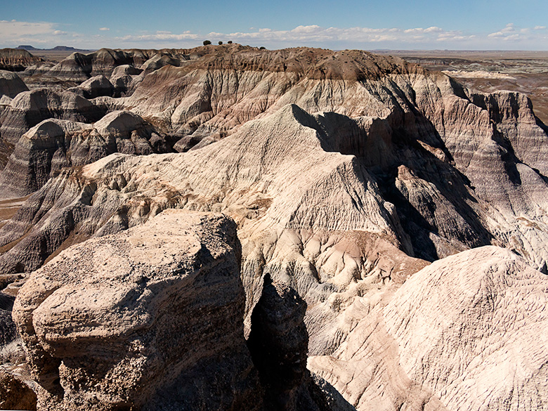
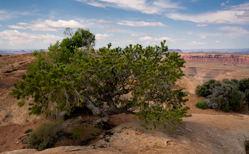
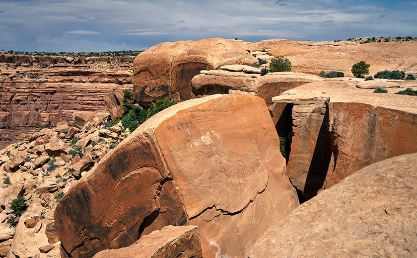
Cedar Mesa, a striking landscape in southeastern Utah, is a geological marvel shaped by millions of years of natural forces. The mesa is primarily composed of Cedar Mesa Sandstone, a distinct formation different from the more well-known Navajo Sandstone. While Navajo Sandstone is renowned for its sweeping, cross-bedded dunes indicative of ancient desert environments, Cedar Mesa Sandstone is characterized by its horizontal layers, formed from sediment deposits in ancient coastal environments during the Pennsylvanian period, roughly 300 million years ago. These layers of sand and silt were compressed and cemented over time, creating the durable rock formations that define the mesa today.
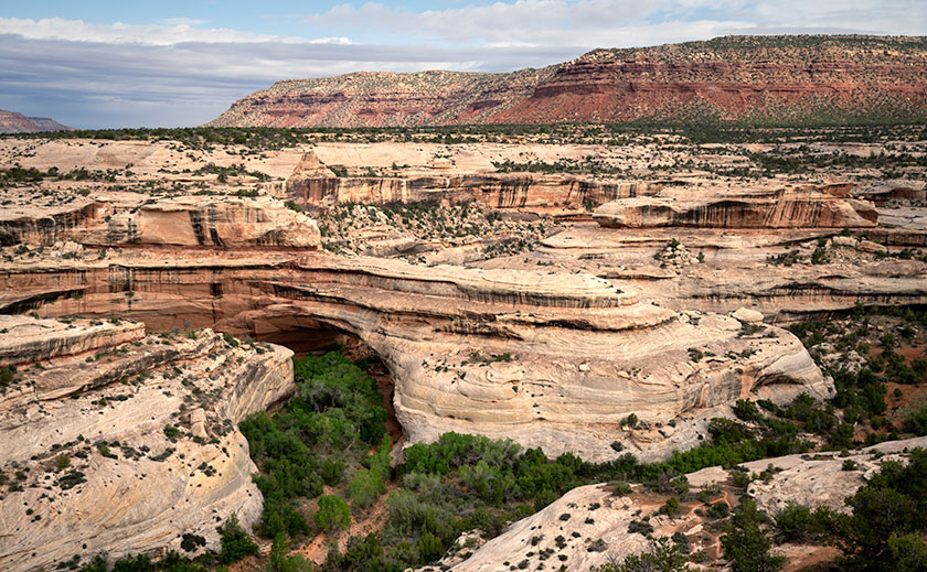
The San Juan River, which carves its way through Cedar Mesa, has shaped one of the most dramatic landscapes in the region—the Goosenecks. These deep, serpentine bends result from a complex interplay between the uplift of the Colorado Plateau and the river’s erosive power. As the plateau slowly rose over millions of years, the San Juan River cut into the rock, deepening its channel. The combination of vertical uplift and horizontal river erosion created the meandering goosenecks, considered the deepest on the planet. These geological features provide a breathtaking testament to the relentless and patient forces of nature that sculpt our world.
Cultural Significance:
Cedar Mesa and the surrounding Four Corners area are rich with traces of ancient cultures that once thrived here. The earliest known inhabitants were the Basketmaker people, who lived in the region from around 1500 BC to 500 AD. These early agricultural societies were named for their exceptional skill in weaving baskets, which they used for storing food and other essentials. The Basketmakers lived in semi-subterranean pit houses and were among the first to cultivate maize, beans, and squash in this arid landscape. Their success in agriculture, hunting, and gathering allowed them to establish relatively stable communities.
Following the Basketmakers, the Ancestral Puebloans, often called the Anasazi, inhabited the region from approximately 500 CE until the late 1200s. This period saw the construction of elaborate cliff dwellings and multi-room stone structures, many of which still dot the landscape of Cedar Mesa and Bears Ears today. The climate during the 12th century was somewhat wetter, supporting agricultural practices and allowing these communities to flourish. However, prolonged droughts in the late 13th century, along with social and possibly environmental pressures, led to the eventual migration of these people. They moved south and east, eventually becoming the Hopi, Zuni, and other Pueblo tribes of today. These migrations were driven by the need for more reliable water sources and agricultural land, leading to the dispersion and evolution of their cultures into the tribes we recognize today.
Final Thoughts:
If you’re a desert lover like me, prepare to fall head over heels for Cedar Mesa. This place is a treasure trove of breathtaking vistas and rich subject matter, perfect for photographers and artists alike. It’s hard not to be captivated by the sheer beauty and history of the landscape. I plan to return here often. With the wonders of Bears Ears and the Grand Staircase nearby, it’s challenging to justify going anywhere else—except for the occasional indulgence in wine and coastal views to shake things up. If you visit, please be mindful to preserve this natural wonder for future generations.
Thank you for visiting and joining me on this journey. Head to my website or Fine Art America for larger versions of these images. These new photos will be featured for three months before they’re refreshed with new adventures. Since it’s August and we’re escaping the sweltering heat, stay tuned for next month’s article, where we’ll share our adventures on the Pacific coast. Until then, I’d love to hear your favorite views or stories from the Four Corners in the comments.
Until then, keep your humor dry and your eyes on the road.
jw