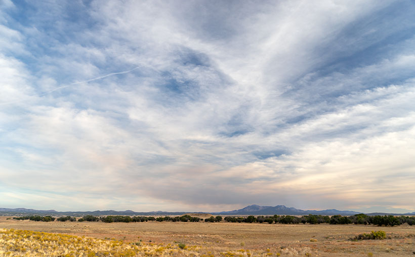
This week’s featured image (below) is the last from our Camp Wood Road excursion. It was taken a few miles from the route’s junction with Williamson Valley Road—also known as Yavapai County Route 5. You’re still in the middle of nowhere when you arrive at that intersection. Iron Springs is 22 miles south, Seligman is 30 miles north, and all dirt roads. I’ve already made a note of it for a possible future trip.
From the Sheridan Fire area, I talked about last week, Camp Wood Road descends from the pine-covered hills and mountains into Prescott’s flat grasslands. It’s a natural location for the sprawling cattle ranches of the past, and now it’s the target of developers selling one-acre McMansions. When I traveled to this area as a younger man, I could frequently spot grazing antelope. They’re a rare sight these days, and that makes me sad.
When Queen Anne and I set off on this photoshoot, we spent more time getting to Camp Wood than I estimated. It was already after sunset by the time we reached the road’s end. As we drove in the dim light, I knew I wanted to include the open grassland in the Camp Wood story, so we made a second trip. This time, we drove counter-clockwise—which is more accessible and a much faster way to get there. However, on the second drive, the sky was overcast, and someone had set the Bradshaw Mountains ablaze, which filled the air with smoke. I wasn’t optimistic about getting good shots. As it turns out, the fire was only a controlled burn, and the fire crews had it out by the afternoon.
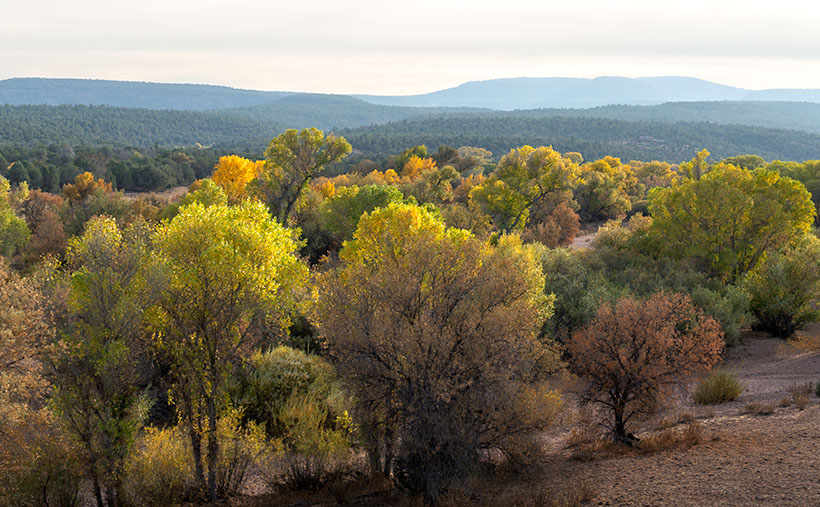
We found another change when we reached an area called Humphrey Wash on my maps. The broadleaf trees started turning color in the intervening weeks between our visits. Of course, this is Arizona, so they weren’t the bright colors you’d see in New England, but they were still worth getting out of the truck and getting them on film.

Further east on Camp Wood Road is a large ranch with two driveways. It’s the Las Vegas Ranch, and one of the entrances is along Camp Wood Road, while the other connects to the Williamson Valley Road—a dozen miles away. When we arrived, the sun was low, the overcast began breaking, and Granite Mountain was predominant on the southern horizon. I took two versions of that scene, but I think the second was better because of the cottonwood trees lining an unnamed wash. I called it Granite Mountain, and I wanted to show the Prescott grassland’s open space. Just as it is in real life, the sky dominates everything. In this photograph are all of the elements of that visit: the broken clouds, lingering fire smoke, Granite Mountain, and the vast open plain. I hope you enjoy it.
Click here to see a larger version of Granite Mountain on its Web Page. I hope you enjoy viewing it. It’s the start of a new month next week, so we’re off to explore a different Arizona back road, so be sure to come back and see what we’ve discovered.
Until next time — jw

Hi Jim, Please keep up the good work. It’s an uplifting way to stay connected to old friends and meet new ones, doncha think?
Gary Wheeler,
(Your old slalom pal from fifty years ago when we were beating Corvettes with our Camaros…)
It’s good to hear from you too Gary -jw