At the intersection in Glennallen, you have two choices. To the right the road leads south to Valdez. A left turn will take you north back to the Alaska Highway. Other than that, there isn’t a reason to come to Glennallen which is an unincorporated community consisted of an overpriced gas station, an RV park and a Laundromat. So why did we spend five days here?

Let’s back up and start with the Glenn Highway, the road we took to get here. Mile for mile, it was the most scenic road we’ve traveled in Alaska. Starting in Palmer it’s an easy three-hour drive, climbing from near sea level to a pass almost four thousand feet before descending into the Copper River Valley.

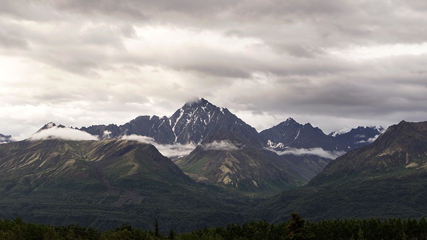
The climb out of Palmer follows the Matanuska River as it cuts a path between the Talkeena Range to the north and the Chugach Range on the south side. It’s hard to see much of the Talkeenas, but the wide river basin really makes it perfect to see the mountains and glaciers lining the south side of the road; each more photogenic than the last.
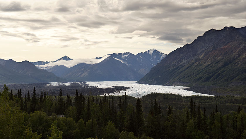
Then at the head of the climb is the Matanuska Glacier, the river’s source. It’s bright white ice flows north from the mountain for miles before curving west at its moraine. The massive ice structure is easily visible from the highway and if you take the time, you can get access to the glacier from the side roads.

Anne and I got an early start, thinking we’d stop for breakfast at the first café we found. There wasn’t one open until we reached the Eureka Lodge on the high pass. When we stopped we had to put jackets on to ward off the chilly wind. After enjoying ham and eggs the way God intended, It shocked me to find that the price of my coffee was only a quarter, and our meals were equally reasonable.

That brings us back to the choices at the Glennallen intersection. While you make a decision, you may want to look straight ahead. In front of you are three snow-capped mountains. The apparent tallest is Mt. Drum, but it’s only 12,011 feet tall. To it’s left is Mt. Sanford (16,237), and a bit south is the much broader active volcano, Mt. Wrangell (14,163). It’s then you’ll know that you’re at the western border of the Wrangell – Saint Elias National Park. It starts on the other side of the Copper River below you. It is the largest National Park in the US. At over thirteen million acres, it’s the same size as Yellowstone National Park . . . and Switzerland combined. It’s elevation ranges from the sea-shore on its south side to Mount Saint Elias which is over eighteen thousand feet. It is the largest concentration of plus fourteen thousand foot mountains in North America.
Enough statistics for now. Let me sit here for five days and see how much of it I can shoot. There are only two roads that cross the park’s boundary. Both of them are bad, but one I plan to take this week.
jw

Love the photos, Jim. Thanks.
Thank You Sharon for the nice comment and for being such an active contributor.
jw
The first photo of this post, in particular, is stunning … when you get home, print it large and hang it with pride!
JG
Wow, thanks Jeff. And as I mentioned to Sharon, thanks for making the blog multi-dimensional.