
August is the month that finally gets to us. Queen Anne and I reach our breaking point after three months of relentless summer heat, with days growing shorter and the charm of monsoons wearing thinner than a Hollywood plotline. By mid-August, we exchange that familiar look—the one that says, “If we don’t get out of here soon, we might melt into the porch.” So, we pack the car with our essentials (camera gear for me, a library’s worth of books for Anne) and head for cooler climes—if only for a week.
For the past several years, this has meant a drive to the coast, where we can swap out the smell of sunscreen for salty sea air, eat food we didn’t have to grill ourselves, and maybe visit a winery or two. It’s our way of escaping our summertime cabin fever without burning through the air conditioner budget. We like to mix new destinations with old favorites, planning a route that balances the thrill of discovery with the comfort of the familiar.
This year, we set our sights on Point Reyes, north of San Francisco. After watching another photographer’s video—who made it look like a slice of heaven—I thought, “Ooo, I’ve got to go there.” Instead of the usual route through LA and up Interstate 5 (yawn), we decided to take the scenic path—up one side of California and down the other. We followed US 395 along the eastern edge of the Sierra Nevada Mountains to Reno, then cut across to the coast on I-80. This route also allowed us to stop in Gardnerville, Nevada, for some Basque food. It’s been over a decade since we indulged in one of those six-course, garlic-laden, home-style meals—the kind that makes you wish you’d packed a bigger pair of pants.
Lone Pine
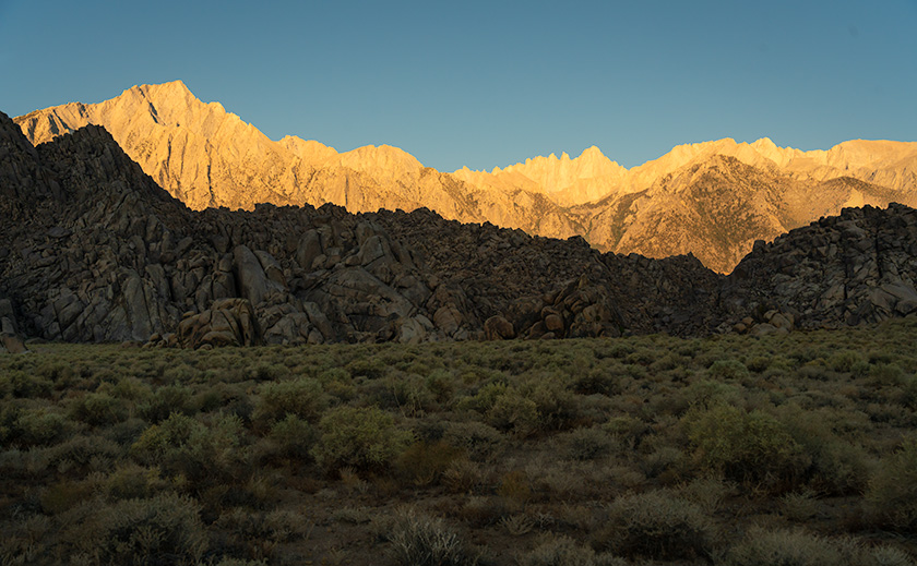
Our first night’s stop was in Lone Pine, nestled in the heart of Owens Valley, directly below the highest peak in the lower 48—Mt. Whitney. I was drawn here by my collection of Ansel Adams books, which feature several of his photographs from the area taken in the 1940s. Naturally, I thought, “If it’s good enough for Ansel, it’s good enough for me.” Although we only stayed one night, I had plenty of time to shoot after dinner—as the evening light lingered—and again at dawn while Anne composed herself for three hours—because no one should face a photographer before their first cup of coffee. The best moments behind the camera are presented in this post—from south to north.
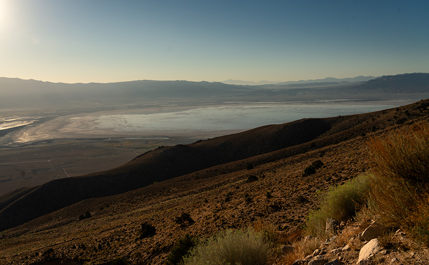
Owens Valley Geography
The Owens Valley isn’t your typical valley—it’s more like Mother Nature’s way of showing off her tectonic plate artistry. Picture this: the Sierra Nevada mountains, towering like the tallest kids on the playground, form the western wall. These rugged peaks aren’t just the highest range in California; they’re the tallest in the lower 48 states. Then, over on the east side, you have the Inyo Mountains—California’s second-highest range—standing as the equally impressive sibling, albeit with a bit more weathered charm. So, on the left, you have a punk-rock band wearing liberty spikes, and the Beatles are on the right.
So, how did this grand setup come to be? Well, it all started with the North American plate deciding it would be fun to crash into the Pacific plate under immense compression. This geological game of bumper cars resulted in the dramatic uplift of the Sierra Nevada, giving it that jagged, freshly-chiseled look as it slopes down to the west. Meanwhile, the Inyos, being on the leeward side, have been more gently rounded over the millennia by erosion, courtesy of the weather systems that roll in from the Pacific.
And what about the valley floor? That’s where things get interesting. As the North American plate expanded, chunks of the earth’s crust—known as fault blocks—began to drop, creating the basin we see today. The exact process formed Death Valley on the other side of the Inyos. But here’s the kicker: because Owens Valley is a basin, what little water does run off from the two ranges doesn’t make it back to the sea. Instead, it collects in Owens Lake, which today is more of a dry, salty bed than a proper lake, thanks to the ongoing water diversion. The only way water leaves here is through evaporation, making the valley a natural trap for any moisture that dares to stick around.
Liquid Assets: The Great Owens Valley Heist
One thing we couldn’t help but notice in Lone Pine was the sheer number of utility trucks and fence signs with “LAWP” splashed across them. At first, we scratched our heads, but then it dawned on me—LAWP stands for Los Angeles Water and Power. Seeing those letters everywhere was a bit like spotting the fingerprints of a master thief who’d made off with the valley’s most precious resource.
In the early 1900s, Los Angeles was a city on the rise but was as thirsty as a lizard in the desert. So, the city’s leaders pulled off a water heist that would make any film noir fan proud. Through a series of backroom deals and a fair bit of deception, they managed to snag the water rights from the unsuspecting farmers of Owens Valley. That water—once destined for Owens Lake—was instead funneled down a 200-mile aqueduct to quench LA’s growing thirst. If this plot sounds familiar, it inspired the classic film Chinatown, where corruption and double-crossing were the order of the day.
But as dramatic as the movie was, the real story is even more tragic. By the mid-1920s, Owens Lake, which used to be a sprawling 110-square-mile oasis, had all but disappeared, leaving behind a dusty, salt-crusted ghost of its former self. Once a thriving agricultural hub, the valley was left dry and desolate. These days, the only signs of life are those LAWP trucks cruising the valley like sentinels, ensuring LA’s water supply keeps flowing. As Marc Reisner put it in Cadillac Desert, the story of Owens Valley is a powerful lesson in how the quest for growth can sometimes leave nothing but dust in its wake.
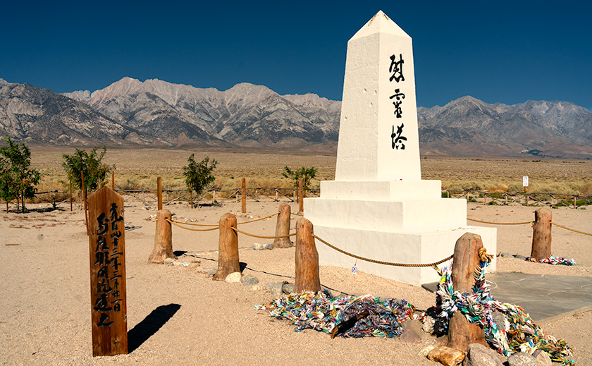
Manzanar: Shadows of the Past
As we drove north, we stopped at Manzanar, and the weight of history settled over us like the mountains looming in the distance. This was one of the internment camps where, during World War II, over 10,000 Japanese Americans were forcibly relocated—men, women, and children, torn from their homes because of the color of their skin and the shape of their eyes. The blatant racism that fueled this dark chapter in our nation’s history is hard to comprehend, yet it’s crucial to confront.
One grave marker we encountered brought this harsh reality into sharp focus. It was for a day-old infant girl who died on August 14, 1944—exactly 80 years before our visit. The thought of a life cut so tragically short under such unjust circumstances is profoundly moving. It reminded me of the film Snow Falling on Cedars, which beautifully and poignantly captures the tension and pain of that era. Like Manzanar, the movie is a powerful reminder of the consequences of allowing fear and prejudice to dictate our actions.
As we stood there, reflecting on this painful history, it was clear that we’ve come a long way as a nation since those dark days. But it’s also evident that the journey isn’t over. The echoes of the past still resonate, and there’s still work to ensure that such injustices are never repeated. Manzanar is a memorial to those who suffered and a stark reminder of the vigilance required to safeguard our principles of equality and justice for all.
Bread Heaven in Bishop: A Culinary Pilgrimage to Schat’s Bakery
The drive to Bishop was solemn, our thoughts lingering on the history we’d just witnessed until the town’s lively buzz jolted us back to the present. We had one thing on our minds—lunch at Schat’s Bakery. Renowned worldwide for its Shepard’s Bread, Schat’s is impossible to miss. Nestled at the north end of town, the bakery’s ornate Danish-style building draws in crowds like bees to honey, leaving the poor Carl’s Jr. across the street looking like a ghost town. Whoever considered placing a fast-food joint there must have been shown the door.
As soon as we stepped inside, the intoxicating aroma of freshly baked bread mingled with the sweet scent of cookies, hitting us like an aphrodisiac. The place was packed—racks overflowing with loaves of bread, cookies, and pastries while people squeezed past each other, turning sideways to navigate the rooms. This isn’t your typical restaurant; it’s more of a bakery on steroids. But they have a Seinfeld-worthy Soup Nazi-style order station where you can score one of their half-dozen legendary sandwiches if you’re on your best behavior.
We ordered roast beef on sourdough, tucked neatly into a paper bag with a dill pickle wedge, a cookie, and whatever sides we’d pulled from the fridge. Sandwich in hand, we snagged one of the coveted sidewalk tables outside and dug in. With my first bite, I threw back my head and moaned, “Oh, my,” to the heavens. The protein didn’t matter—this sandwich was all about the bread. The yeasty, umami-rich flavor was pure heaven on earth, so good that anyone with gluten intolerance should probably head straight to Carl’s Jr. As we savored each bite, we noticed that lunchtime in Bishop meant sharing tables with strangers, much like the communal vibe at Costco’s food court. But with a sandwich this divine, who’s complaining?
Further Thoughts
With our bellies full and two tubs of cookies stashed in the back seat (which, I’m not ashamed to admit, didn’t make it home), we felt ready to tackle the rest of our journey to Nevada. As we drove, two things stood out. First, it seemed like half the highways were under repair, and the other half were overdue. Second, unlike the lipstick-red Lamborghini Revuelto and the robin-egg blue McLaren Artura Spider we drooled on, we couldn’t help but notice that Teslas come in the most uninspired colors—except, of course, for the bright pink one we spotted, undoubtedly driven by the local Mary Kay star. There’s clearly good money in face paint.
As we continued north out of Bishop, the Owens Valley gradually faded behind us, giving way to a climb in elevation. This marked another step up on the block-fault staircase, where the earth hasn’t sunk as dramatically. The valley floor yielded to a new terrain level, shaped by the same powerful geological forces but expressed differently as we made our way toward Crowley Lake and beyond.
Queen Anne and I thank you for joining us on this leg of our journey. In the comments section below, we’d love to hear your thoughts and memories of Owens Valley—or perhaps your favorite bakery. As always, larger versions of this month’s photos are available on my (Jim’s) website and Fine Art America (FAA). I hope you’ll take a moment to check them out.
Be sure to stop by next month when I share why I was so excited to visit Point Reyes.
Until then, keep your humor dry and the cookie crumbs off the sheets.
jw
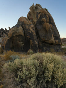
Alabama Hills reminds me of an Orangutan. You usually tells us how or why it got it’s name. I am curious.
The Japanese Memoral is certainly a thought provoking and sad reminder of history. Great photo though.
How did you learn about the bakery?
Two tubs of cookie…what kind? No bread?
So next month Point Reyes.
Thanks for commenting, Deb. I didn’t even think about explaining the naming of the Alabama Hills. The article was already long, and my Place Names book is for Arizona. But, after you questioned it, I found this:
“The Alabama Hills, located outside of Lone Pine, California, were named in the mid-19th century during the American Civil War. The name was chosen by Southern sympathizers living in the Owens Valley who admired the Confederate warship, the CSS Alabama. This ship was notorious for its success in disrupting Union shipping, and its fame led these Confederate supporters to name the picturesque hills after it as a gesture of support for the Confederacy.
Interestingly, Union supporters in the region later named nearby geographical features, such as Mount Whitney, after Union generals and victories, leading to a landscape that reflects the divided loyalties of the time. The Alabama Hills have since become famous for their unique rock formations and as a popular filming location for Westerns and other movies.”
As for the bread, we were traveling in Anne’s car and weren’t preparing food on the road, so the first time we would have had a chance to use it would have been after we got home. The Schat’s bakery doesn’t use a lot of preservatives, so it would have been an awful waste of good bread. Besides, there’s an excuse for a Bishop run. Want to go to Death Valley?
jw