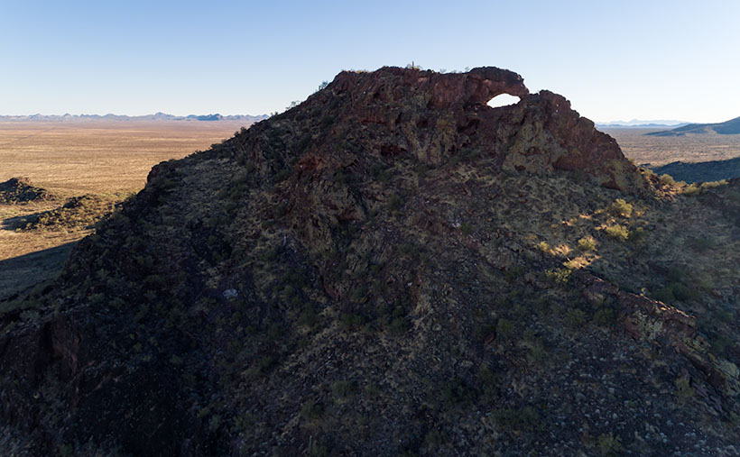
The last time I wrote about Aquila’s Eagle Eye was in 2018, and I didn’t have much to say about it—other than it was there. That post included a photo I shot with a telephoto lens from miles away. I had to do that because much of the land around the peak is posted as private. There were two comments in that column. The first was from Fred, who thanked me for pointing the bridge to him, and the second was from my old friend Gary, who chastised me for not getting closer.
Since I’ve been hanging around Aguila this month anyway, I thought I’d try to make Gary happy. About three miles south of Aguila are mountains on the east flank of the Harquahala range. They almost have the same name; Eagle Eye Mountain is on the west, while Eagle Eye Peak is the lump of lava to the east (they touch one another). The latter peak is the one with the window on top.

You can get very close to the arch if you drive to the old cemetery where Eagle Eye Road bends around the mountains. The bad news is that you can’t see the arch from there because it faces east, and all you see are the rocks from the edge. There’s a better view if you scramble up an 800′ cactus-infested lava hill like an insane person, but I did the lazy thing. I brought my drone, and I flew it to the mountaintop. Once it got up there, I rotated it to the right and composed this shot.
The Eagle Eyes, like a lot of low desert mountains, were formed from volcanic activity. This particular pair of mountains is basalt-covered limestone. The rocks are much darker than the rest of the Harquahala Range. They appear as shadows on the horizon. Their surface is rough and pockmarked, like they had a bad case of acne. They are riddled with caves formed by air pockets in the lava.
I didn’t find an article that explains how this arch was formed. I don’t think it was formed from wind erosion. The rocks aren’t polished. It could be from one of those air voids in the thin-walled lava collapsing. My favorite guess is this: If this is Rhyolite—slow-moving lava common to peak formation—then maybe a cone of lava formed vertically, and as it cooled, it slumped over and froze in place. At least, that’s what it looks like to me. What do you think?
Well, Gary, I hope you’re happy. Click here to see a larger version of Eagle Eye Peak on its Web Page. Be sure to return next week when I’ll show you the arch from a different perspective.
Until next time — jw

Yes, I think you’re right. I can’t imagine that any kind of erosion caused the center to collapse on top of a mountain.
Cone falling over does sound passable. Can you get closer with your drone to get a close up look of the arch?
That could be done by someone more competent than me. You could even fly it through the arch. Maybe I’ll teach Fred how to do that when he gets his drone. – jw