“283 steps” were the first words out of the park ranger’s mouth when I asked about the Island Trail. “It’s 283 steps down to the loop, and there are 67 steps around the island,” (that number could be wrong—I stopped listening after 283), “and then back up those sane 283 steps.” I thought, “It’s the cool of the morning, it’s cloudy, I’ve got water, I need pictures from the trail, so let’s do this.” Then I walked over to the top of the staircase.
Although the Island Trail is less than a mile, it’s the harder of the two in Walnut Canyon National Monument. You’d be correct to believe it went down to the creek with that name. Instead, it drops 185′ to a land bridge where you cross to an unnamed promontory that you circle counterclockwise. The trail is asphalt paved except for the sandstone steps.
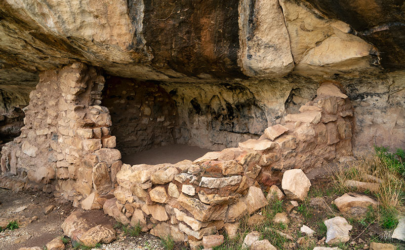
The path is on a shelf where the limestone sits above white sandstone, like found in Zion National Park. The limestone erodes faster than its foundation, and like an ice-cream scooper, that erosion has gouged shallow caves into the white stone. Here is where the Sinagua built their homes. While descending the stairs, I could see dwellings on the opposite side of the creek. They’re spaced apart, so I thought that I get to shoot one or two of the rock dwellings. I was wrong. The canyon’s far side faces north—not the ideal winter location. On the island, the homes were south-facing, which helps keep them warm. As soon as I rounded the first bend, rows of rock dwellings were there for me to explore and photograph. But, I had to sit down first and rest a while—I was still shaking from coming down the stairs.
Before I got to the pictures, I had another interesting observation. I thought that since I had made it a third of the way down the canyon’s bottom, I would be able to catch a glimpse of the creek. With the heavy monsoon we’ve enjoyed this summer (yey), the foliage growing on the canyon floor was so thick it completely obscured the creek bed.
I took this week’s picture—that I call Corner Unit—at the end of several homes. Since they run into one another, they usually share a common wall—like our modern apartments. So, this one has two exterior walls, which is unusual for this neighborhood. Since the Park Service didn’t fully restore the walls, you can see the cave’s overhang and back wall. With it being open to the outside, you can get an idea of its area. The Sinagua people must have felt comfortable with this size because it’s representative of them all. If you think about it, this is a perfect size for a man cave. There’s room for a corner TV, and you can grab a brewski without getting out of the Barkalounger. Once again, however, you’d be stuck at home all day waiting for Larry to show up.
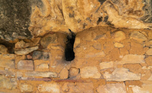
The problem with the man-cave theory is that the women built them and were primarily concerned with keeping in the warmth. In the second image, you can see where they left a vent near the ceiling. These vents allowed them to have small fires inside and let the smoke out. They were their chimneys. The families could survive the high-altitude winters by draping an animal skin or rug over the door and building a small fire.

The second picture also shows another innovation the women used to make winter life bearable. They hiked to a place up the creek where they could dig gold-colored clay (the color’s not essential—this isn’t The Real Housewives of Beverly Hills), then they packed it in baskets, lugged it back, and smeared it over the rock walls—inside and outside. Like caulk, the clay sealed the wall gaps and stopped drafts. The women put a lot of thought and work into their homes—the men were too lazy to take down the Christmas decorations.
After I finished my tour of the loop and got the needed photos, I was back at the foot of the stairs leading to the visitor’s center. I found out that the ranger lied. Somehow while I was out of sight exploring ruins and taking pictures, the park service snuck in and doubled the stair count. How do I know; math, simple math. I knew I would have a tough time with the climb, so I devised a system where I would climb 50 stairs at a time—then stop for water and catch my breath. Instead of five rest stops, I made 10, and I drank both of my water bottles dry. Near the top, where I could finally see the building, I made one last effort; one, two, three, four, twelve, fifteen, thirty-five, fifty. I need another rest.
I hope you enjoy seeing the ruins in Walnut Canyon. You can view the Web version of Corner Unit on its page by clicking here. Next week, I’ll have another shot from the Island Trail for you to see, but please don’t make me go down there again.
Till next time
jw

I am very proud of you and all your stepping! Think the photos were worth the hike.