Cup Holders Picture of the Week

I will pause our Snow Canyon State Park tour for a couple of paragraphs so we can run over to the coast. Don’t worry; we won’t have to put up with any of those weird Californians. Where we’re going, they don’t exist yet. We’re not traveling far—maybe a foot or two. However, we are breaking every law in physics to travel back one-hundred-eight million years ago—to the Jurassic era. You can turn around now and take in the Sundance Sea, right here in southern Utah (how old is Robert Redford anyway). Don’t go in the water. Big things in there will eat you like you’re a gummy bear.

Turn back this way and look down the shoreline. Massive dunes—hundreds of feet high—go on for hundreds of miles. Until now, it’s been hot and dry here along the Equator, but the climate is changing. It’s becoming muggier and swamp-like. The oceans are rising, and soon (in geological time), the water will cover the sand and pile more sediment. The pressure on the dunes will bind them into stone—never to be seen again.

Things would have stayed that way, except our stupid captain rammed the North American plate into the Pacific Plate, and there goes the neighborhood. The crash spun us around and raised the Rockies, the Sierra Nevada, and all the other little wrinkles in between. The resulting damage cracked the mantle so badly that volcanoes could form, raising the Colorado Plateau. Then the Californians move in—can it get any worse?

The crash shoved our peaceful little seaside village up a hillside. We no longer live in a basin where sediments collect. Now, our water flows to a place far away. It peels back layers of rock—like an onion when it does. After erosion uncovers parts of the great dunes, we’ll see them again here in St. George, Zion, and north of Escalante. Now they’re as hard as a rock.

Dune Walkers - About the only way you can stay on the Petrified Dune Trail is to go on a guided hike, like these people.
Dune Walkers—The only way to stay on the Petrified Dune Trail is to go on a guided hike like these eight people.

You can snap out of it now and return to reality, where we’re standing on the Petrified Dunes Trail. Because it’s all rock, the only clue you have to follow is the path worn smooth from countless boots. It’s easy to leave it, but that’s fine because you won’t damage anything. The rock grips like sandpaper, making it easy to scramble up and down the slopes. As you wander across the uniformly fractured rock, you examine the exceptions.

Cup Holders - Freezing water bores into the sand stone and will over time reduce the rock to sand grains.
Cup Holders – Freezing water bores into the sandstone and reducing the rock to sand grains over time.

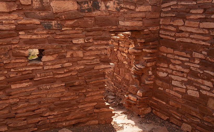
That’s how I found this week’s picture. The round wells in the picture are places where water is collected and has a chance to freeze. As the ice expanded, it fractured the sandstone and chipped it. These spots get deeper; they’ll hold more water and bore into the stone faster. Eventually, they’ll be so deep that they’ll split the block until it reverts to sand grains. I think the shapes of the cups are fantastic, but I like the rich and varied colors in the stone. When you look closely at this, sandstone has a lot of depth and texture.

Click here to see a larger version of Cup Holders on its Web Page. Come back next week when I’ll tell you about how the stupid captain left the kettle on too long and spilled hot lava all over the park.

Until next time — jw

Thumb Butte Picture of the Week

Arizona State Route 68 in Mohave County has substantially improved since I first visited Bullhead City decades ago. It was a two-lane back road with faded markings and crumbling tarmac. When it rained, it was impassable because the highway ran through the flooded wash bottoms. These days, it’s a mini-interstate with four lanes and no lights or signs along its 28-mile length. It’s impressive how infrastructure improves when it involves getting people into casinos.

SR 68 also has one of the best views of all the roads I’ve traveled. That vista comes just west of Union Pass in the Black Mountain Range. When you see the Union Pass elevation sign (3570 feet), you can tell it’s coming. There is a wide shoulder here to enable truckers to safety-check their brakes. Immediately after you clear the mountains on either side of the highway, you can see a panoramic view of the Colorado River 3000′ below. Beyond the blue water ribbon, you can see into the Nevada Desert going on forever—especially now that APS has dismantled the coal-fired Mohave Power Station. You don’t have long to enjoy the view because suddenly you’re on the downhill side of the roller coaster, and just for giggles, the highway department put a stoplight at the bottom of the 11 miles of 7% grade.

Thumb Butte - An 800' tall granite monolith overlooking the Colorado River above Bullhead City.
Thumb Butte – An 800′ tall granite monolith overlooking the Colorado River above Bullhead City.

As you descend into the river valley, a thing that jumps out at you is an 800′ tall granite monolith on the left side of the road. It’s called Thumb Butte on the maps, but many locals call it Finger Rock. It’s visible in both towns—Bullhead City and Laughlin—and from there, it looks like the universal gesture of ill will, the big bird, the highway salute, or whatever your favorite euphemism for the middle finger is. (There is another landmark a couple of miles south officially named Finger Butte—don’t confuse the two.)

I have wanted to photograph the rock before, but my schedule prevented me from stopping. On this year’s trip, I decided to make time. I watched videos, poured over the Topo maps, and found a Jeep Trail that goes right by the tower. So, late afternoon, Archie and I drove the dirt trail and took this week’s photo, which I call Thumb Butte.

I wanted to capture some depth and texture, so I shot the rock from the north side, looking into the Mount Nutt Wilderness Area. I’m happy with how this image captures the rugged terrain of the Black Mountains—if only a tiny sample. Maybe I should regularly go back and work the entire range—from Needles to Hoover Dam. What do you think?

You can see a larger version of Thumb Butte on its Web Page by clicking here. Please return next week when I will show another photo from Union Pass and SR 68.

Until next time — jw

Sycamore Point – and – Calendars     Picture of the Week

Trick or Treat
smell my feet
give us something good to eat

Since this is my first-ever Halloween post, I couldn’t pass that up.

So, where were we? Oh yes—Queen Anne and I spent an afternoon exploring and photographing along the back roads to Sycamore Point. The sun was going down, and we wanted to get back to Williams to have a nice dinner at The Red Raven Restaurant.  Before we leave, let me get in one more shot.

Sycamore Point - From Sycamore Point, looking back over Thumb Flat to Bill Williams Mountain.
Sycamore Point – From Sycamore Point, looking back over Thumb Flat to Bill Williams Mountain.

I call this week’s photo Sycamore Point. If it isn’t apparent, I took it with my drone. Unlike a normal camera, you can’t spontaneously whip it out and start flying about—well, not if you want to keep your license. You have to file a flight plan, conduct a pre-flight check, and there are no fly areas. In this case, I couldn’t fly it past the wilderness boundary (you can get an exception from the BLM—but that takes weeks).

The truth is that I took several drone shots of the canyon, but because the drone’s camera lens is ultra wide, the images from my Sony were better, so I used those. Since the drone had battery time left, I turned it around and pointed the camera toward the road we traveled. From an altitude of two-hundred feet, this is the image that I got.

When I started processing this photo, I realized that it has everything that we’ve been talking about during October. In one image I see Alligator Juniper, patches of yellow wildflowers, Thumb Flat, the edges of Sycamore Canyon, burn scars, the back road, shafts of sunlight, and in the distance, the Northern Arizona Volcanic Field—including Bill Williams Mountain (center left) and The San Francisco Peaks (far right). It’s like you’re back in school, and here’s the chapter review before the test—but from a different perspective.

You can see a larger version of Sycamore Point on its Web Page by clicking here. Next week, it’s time for a new project from a different location. You’ll want to come back and see what trouble I got myself into this time.

Calendars

This year is hurtling to an end already, so it’s time for me to make new calendars. In spite of the extra cost last year we got a nice response. Inflation has taken a toll again this year. After reviewing my printer’s price list and post office shipping costs, I need to charge $20.00 for them. I know that cost is prohibitive to most of you, but they’re a limited item. I need to get one for myself and if you’re interested, I’ll print a copy for you.

The pictures for the 2022 edition are from this year’s outings. The size remains the same—6 ½ inches high (each half—about the size of a sheet of paper folded in half) and 8 ½ inches wide, and they have holidays noted on the dates. They’re printed on card stock—which is part of the expense.

In order to get them to you for Christmas (and we’re cutting it close according to the Post Office), I need to know by November 10th. If you’d like one, you can leave a comment in this post, use the contact form on my website (https://www.jimwitkowski.com/junk/index.php), or email me directly. Don’t forget to leave your contact information if I don’t already have it.

Until next time — jw

Sycamore Canyon Picture of the Week

As you would expect, the edge of the Colorado Plateau isn’t smooth and polished. It’s quite the opposite. Over eons, the streams that drain the plateau have eaten away the walls and carved a series of steep canyons. These parallel canyons look like an evil witch with rheumatoid arthritis pressed her fingers into a curb of wet cement.

Capitol Butte and Sedona - a place of natural beauty overrun with loving fans.
Capitol Butte and Sedona – a place of natural beauty overrun with adoring fans.

Oak Creek Canyon—and the village of Sedona—is probably the most famous example that I can name. The creek has cut into the iron-rich sandstone leaving behind beautiful red-rock formations that attract visitors from the four corners of the globe. And why not? There’s a lot to see and do here. Magazines have called Slide Rock one of the ten best swimming holes in the country (Havasupai Falls also made that list, not bad for a desert state, eh). Sedona always makes the top of the list for romantic getaways for Valentine’s Day, Thanksgiving, Christmas, and on and on and on. If you want to be romantic in Sedona these days, you have to be careful not to bump the couple making out next to you.

When people visit Oak Creek Canyon and Sedona, they understandably fall in love and don’t want to leave. Over the past 50 years, I’ve seen Sedona grow from a gas station intersection to a resort town that’s on a par with Aspen, Telluride, or Santa Fe. The catch is that there’s not enough water to support all of the rich people building second homes there. We all visit to see nature at its best, but now the McMansions are in the way. We love it to death.

But there’s hope for us tree-huggers. Less than 17 miles northwest of downtown Sedona is Oak Creek Canyon’s sister—Sycamore Canyon. Here there are no McMansions, Gucci Stores, or Whole Foods because, in 1972, the Feds set it aside as a Wilderness Area. While standing on the rim at Sycamore Point, you can begin to imagine what Oak Creek Canyon was like before the mobs got there. Imagine a time when a campfire was the only tell of humans in the area.

Sycamore Canyon - Oak Creek Canyon's twin sister was set aside in 1972 as a Wilderness Area so we can remember what nature looks like without people.
Sycamore Canyon – Oak Creek Canyon’s twin sister, was set aside in 1972 as a Wilderness Area to remember what nature looks like without people.

My friend Deb and I camped here before Queen Anne ever arrived on the scene. When she finally did, this was the first place Deb and I took her camping. As we ate a dinner of grilled stuffed pork chops and watched the sun go down, she was hooked. That’s when we convinced her that everything tastes a little better with dirt on it.

I wanted to come back this year after watching the fire news early this summer. One fire had ripped through here, and I wanted to see how much damage it caused. Queen Anne and I found black scars on the ridge on the canyon’s far side, but only a couple of pinions had burned on the edge where we stood. Overall, the canyon fared well, except years of drought have left Sycamore Creek dry. We didn’t see any remaining pools of water from our vantage point.

The BLM has moved camping back a half mile now. They’ve removed all of the rock fire rings and built a parking area. If you want to come here, your best camp is at one of the small lakes up the road. Since Sycamore Point is less than twenty miles from Williams, it’s an easy drive from town and back in one afternoon.

As the sun got low, it reached a crack in the clouds and lit the cliffs while I had my camera in hand. I snapped a couple of shots, and this is the version I preferred. I named the photo Sycamore Canyon. I like how the setting sun makes the cliff faces glow, but you can still see the dry creek bed below. Along the rim in the center-left, you can make out the black scar left by this summer’s fire. That’s ok though, unlike a McMansion, it’ll heal soon.

You can see a larger version of Sycamore Canyon on its Web Page by clicking here. Next week, we return to the bright lights of Williams. Come back then and see what we found.

Until next time — jw

Thumb Flat   Picture of the Week

With a basic knowledge of native Arizona plants and observational skills, it’s easy to tell what elevation you’re at in our state. Maybe only Florida is easier because the entire state is below 350′. I’ve written before about how State 48 has all but two of the world’s climate zones; sub-tropic and tundra permafrost. So all you have to do is look at the bush you’re standing next to you for a clue.

For example, compare last week’s picture to the one that I posted today. The tall ponderosa pines you see in Yellow Field thrive at altitudes over 6,500 feet. While the pinion pine in this week’s image—Thumb Flat—is the dominant plant between 5,000 and the appearance of tall pines. My rule is only a rough generalization because there are microclimate pockets all across the state. I can name two places off the top of my head as examples; Palm Canyon in the KOFA Range south of Quartzite and the east slope of the Poachie Range south of Wikiup. The state’s only native palms grow in a mountainside crevice at the first location, and the latter has saguaro and pinion pine intermingling on its slopes.

When Queen Anne and I visited Williams, it was only natural as we drove down the south slope of the dormant volcano to see ponderosa pine replaced with stands of juniper. As the White Horse Lake Road descended even lower, the juniper became sparser. By the time we reached Thumb Flat—as it’s called on the map—individual trees had stood alone in the wildflower-covered fields.

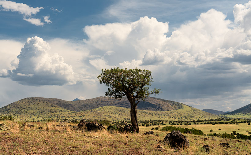
Thumb Flat - A beautiful alligator juniper stands in a wildflower covered field.
Thumb Flat – A beautiful alligator juniper stands in a wildflower-covered field.

Here I spotted this beautiful alligator juniper, which made me stop Archie and get its portrait. I think this specimen would be a prized possession in anyone’s garden. Probably the only reason this tree isn’t already in somebody’s front yard is that it’s in the middle of the Kaibab National Forest.

In this week’s featured image that I call Thumb Flat, I like how the foreground is darker in color from being in the shade of a cloud. It contrasts nicely against the bright white background cumulus clouds. The wildflowers are the same as in last week’s image, but you can see how much more dull they are when they’re not in direct sunlight. In this case that’s OK because they’re not the subject here—this week, they’re only playing a ‘walk-on’ part.

You can see a larger version of Thumb Flat on its Web Page by clicking here. Next week, we turn onto another side road, so come back and see where that road ends.

Until next time — jw

P.S. If the picture is not showing up in your email version of this post, you can click on the article title (Thumb Flat) to open the Web version of this post.

Yellow Field Picture of the Week

The four roads out of Williams, Arizona, point to the four compass directions. To the east and west is Interstate 40—the modern-day version of Route 66 and even older trails that the First Nation People used. To the north is Arizona Route 64—the busiest route to the Grand Canyon. The least traveled road goes south and is Coconino County Route 73, or Perkinsville Road. This is the back road that we’re using for this month’s project.

If you’ve never heard of the town of Perkinsville, it’s understandable. It’s been a ghost town ever since its lime quarry shut down in the 1950s. Several families still live in the Perkinsville area, but its biggest claim to fame is the Verde Canyon Railroad stop, where they turn the train around. Also, if you’ve ever bought Arizona red flagstone, it comes from neighboring quarries between Drake and here.

To get to our road, you take 4th Street south from downtown Williams, to where it changes name at the town’s edge. The paved two-lane road winds through Cataract Canyon past a handsome masonry dam and reservoir. The railroad built it to supply water for the steam trains, and the name, Santa Fe Reservoir, has stuck. Shortly after, the road climbs up and over the east shoulder of Bill Williams Mountain, and you’re quickly in a ponderosa pine forest.

Within minutes you reach the road’s crest, and open pastures appear. Here you’ll see hiking trail signs that direct you to a trail that climbs to the mountain’s 9253-foot summit—should that be something on your bucket list. Further along, there’s another side road that goes to the Williams Ski Area. I didn’t even know that Williams had a ski area.

As Anne and I drove along the downhill slope, juniper replaced the tall pines, and large fields of yellow wildflowers were all around us. The good rains that we’ve had this summer have been beneficial for the flowers. We continued south on CR 73 until we turned east onto White Horse Lake Road. We were out after a weekend of rain, and although its surface is packed gravel, it’s navigable even for a 2wd sedan.

Yellow Field - The abundant monsoon rains that we've had have been especially good for the wildflowers.
Yellow Field – The abundant monsoon rains that we’ve had have been perfect for the wildflowers.

Since the flowers were so profuse, I wanted to take their picture with the sunlight beaming down on them, but a cumulus cloud got in the way every time I stopped Archie. I played this cat-and-mouse game several times before I captured this week’s featured image. I call it Yellow Field. I don’t know the flower’s actual name, but it’s the same weed we’ve been spraying for the past month in our yard. Wildflowers is weeds—who’d have thunk?

You can see a larger version of Yellow Field on its Web Page by clicking here. Next week, we’ll show more of the scenery we found on White Horse Lake Road. Come back then.

Until next time — jw

Prescott Basin Picture of the Week

There’s a growing trend in the comedy routines that Queen Anne and I watch on YouTube’s Dry Bar channel. The bits poke fun at young people for not knowing about obsolete things my generation regularly used. I’m not sure if the joke is at the youth’s expense or if it’s simply us old farts complaining about change again.

To give you an example, one performer asked a teen in the audience to explain the relationship between a pencil and a cassette tape (the kid didn’t know what the tape was). Another was about the phone books we used to get each year. The fact that we had to look numbers up on our own was mind-boggling enough, but they couldn’t comprehend that the books were primarily used at grandma’s house as a booster seat. Finally, hold up a 10’ curly phone cord and ask a young person why it existed.

I uncovered another lost phone tradition this week after talking to a particularly annoying salesman. It’s known as the old 40mph-hangup. I learned it from my dad back in the age of unenlightenment. It has Zen-like qualities and resembles a marshal-arts move, but it more closely mimics the grace of a baseball pitch. I’ll try my best to describe it. After you’ve had your fill with the person at the other end of the line, you scream a final taunt—after all, you must have the last word—then as you lift your left leg, you begin to swing your right arm in a full roundhouse motion and slam the handset onto the cradle. It should bounce at least once. I saw my father shatter an old black Bakelite phone we were renting from Ma Bell. Although this hang-up never accomplished anything productive, it always put a satisfying exclamation point on your lunacy.

With remote handsets these days, they took away that small joy of life. No matter how hard you mash the End button, it’s silent. Your adversary doesn’t know if you hung up or the phone dropped the connection. I don’t own a smartphone, but vigorously swiping at the screen can’t be any better. Maybe someone could write an app that plays a recording of a loud car crash before disconnecting. That would come close. Kids don’t know what they’re missing.

Now we have to find another channel to drain all that excess adrenalin. I could have run up and down the Little Granite Mountain Trail a couple of times with that pent-up anger. I wouldn’t have even broken into a sweat by the time I reached upper flats. Instead, I had to stop constantly until the pounding in my ears subsided.

Prescott Basin - You can see miles in any direction from the flats on the Little Granite Mountain Trail, like this view of Prescott to the east.
Prescott Basin – You can see miles in any direction from the flats on the Little Granite Mountain Trail, like this view of Prescott to the east.

It was at one of those rest stops that I got this week’s featured image. Close to the trail’s top, it begins to flatten, and you can finally see above the trees. After I passed this Alligator Juniper, I stopped for a rest. Here, I could see Prescott in the distance below, so I couldn’t resist snapping a photo. The view was hazy from the humidity, so I’m sure it would be spectacular on a clear winter afternoon. I call this photo Prescott Basin. I hope you enjoy seeing it.

You can see a larger version of Prescott Basin on its Web Page by clicking here. Next week, we’ll walk around and take in more views from the top of the trail, so I hope to see you then.

Until next time — jw