White House Picture of the Week

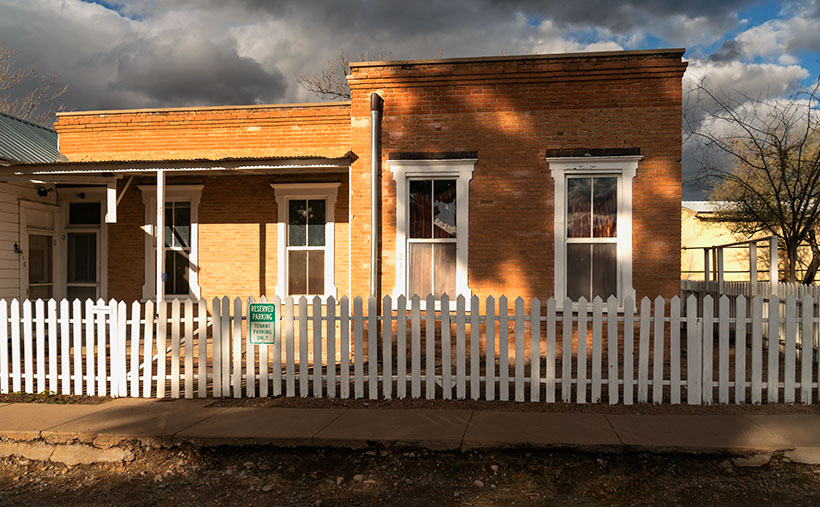
White House - An abandoned dwelling of some sort in the ghost town of Dos Cabezas.
White House – An abandoned dwelling of some sort in the ghost town of Dos Cabezas.

Ghost towns are a big business in Arizona. That’s good because we have our fair share, and a few of them attract many tourists. They’re our Disneyland. As soon as your relatives hit the tarmac and demand to see the state, the first suggestion out of your mouth is, “Let’s go to Jerome (Bisbee-Oatman-Tombstone-etc.).” You’d think that, by definition, ghost towns are abandoned places—they had their heyday long ago, but the residents left when things went south. But, that’s not necessarily true. The population count in some of our mining towns rivals the numbers they had in their prime. Our hometown of Congress is an example. People move here to get away from Phoenix’s smog and traffic—or the Minnesota snow—and they’re all on the road and in my way.

I’ve concluded that somebody loves it and wants to live there no matter how remote one of these places is. Take the town I introduced last week—Dos Cabezas. Among the derelict buildings, there are two surviving businesses. One is an art studio/gallery (Dos Cabezas Art Gallery), and the other is a bed and breakfast (Dos Cabezas Retreat Bed and Breakfast). At least those are the two places that advertise their presence. There are several cattle ranches in the area, and there is an emerging wine presence, but not within the town limits.

I don’t know anything about the gallery, but enjoying a glass of local wine while staring at the stars on the B&B patio would be a treat. Since it’s closer to the Chiricahua National Monument, it’s an alternative to the chain hotels or downtown dives in Willcox. The two guest rooms are in an adobe walled casita, and as the name implies, the hosts include breakfast. A drawback for Queen Anne and I would be dinners. The nearest restaurants are 15 miles away in Willcox or Douglas, over an hour’s drive south. If you’re a person that needs bright lights and noise to sleep, the retreat wouldn’t be your cup of tea—the nights in the middle of Sulphur Springs Valley are exceptionally dark and silent.

As you can tell from this week’s picture, the little ghost town is at the foot of the Dos Cabezas Mountains. It’s near the range’s southern reach, so you can only see the south head (Cabeza). There’s a road and trails that will get you to the top, where I imagine the view of the valley and Willcox Playa is spectacular. You need permission to cross a locked gate, and the top is steep, so why bother?

In this image that I call White House, I assume it was a dwelling. It’s a palace compared to some of the miner’s shacks I’ve seen. Unlike the other buildings in Dos Cabezas, this one is a fixer-upper. You have affordable housing with a bit of paint, a few shingles, and a yard clean-up. But there’s probably a community historical committee that needs appeasement, so you can’t paint it purple.

Unlike last week’s photo, the white stucco pops against the brown mountain and clear blue sky, and I like that. There’s plenty of side yard where I visualize Queen Anne hanging laundry on a solar drier. Then, this would be a picture that Norman Rockwell or Andrew Wyeth would envy. Where’s the Saturday Evening Post when you need them?

You can see a larger version of White House on its Web Page by clicking here. Next week, we continue down County Highway 186 in search of an image worthy of another car stop. Please join us.

Till Next Time
jw

Adobe Ruin Picture of the Week

Adobe Ruins - In the ghost town of Dos Cabezas, most of the remaining buildings are severely decayed.
Adobe Ruins – In the ghost town of Dos Cabezas, most of the remaining buildings are in a severe state of decay.

Roughly midway between Willcox and the Chiricahua National Monument, the county highway’s speed limit drops to 45 mph. At first, there’s no clue about the slowdown until a small sign announces that you’re entering the town of Dos Cabezas. Only three of its dozen or so buildings are worthy of occupancy. The rest are in various states of decay. It’s only a city block long, and you soon return to an empty country road, where you can reset the cruise control.

After driving through Dos Cabezas three times, I insisted on stopping on our fourth pass. As regular readers know, I’m a sucker for historic buildings, whether they’re restored or about to be blown down by the wind. I’m glad that I did, and this week’s featured shot is one of several that I captured during that afternoon.

As with most Arizona ghost towns, Dos Cabezas’s history is a flash of glory followed by a long decay period. The town is located at the southeastern reach of the mountain range, which shares the same name. When word came out that prospectors discovered gold and silver on the mountain, miners swooped in like hungry vultures to feed on a carcass. The Feds opened a Post Office in 1878, which served a population of 300 that eventually swelled to over 4000. They found little gold in the Elma mine, but there were some copper deposits. Investment capital dried up when investors discovered that the mine was a scam and part of stock fraud. People left to find work elsewhere. As the town dwindled, the Post Office finally closed its branch in 1960. I guess that you could count today’s Dos Cabezas citizens on one of your hands.

In this picture that I call Adobe Ruin, you see the remains of a large building constructed using adobe bricks and stucco. The town once had a hotel, and these sections may be all that’s left of it. Adobe was a common building material throughout the old southwest because it was simple to make. All you need is to combine mud and straw and let it dry in the sun. The thick bricks provide plenty of protection from the desert heat and cold winters, but they quickly erode once water enters them.

I took several variations of the building, but I favored this one because I liked the mud stains streaking down the wall, and I liked the wall’s placement before the background’s two-headed mountain. The desert willow and hackberry show how soon nature reclaims her own. Ashes to ashes, as it were.

You can see a larger version of Adobe Ruin on its Web Page by clicking here. Next week, we’ll walk down the street to look at another of the Dos Cabezas ruins. Come back then and have a look.

Till Next Time
jw

The Grotto Picture of the Week

Grotto Interior - From the outside, the Grotto looks like a secluded place to hide from the world.
Grotto Interior – The Grotto looks like a secluded place to hide.

Over the past couple of weeks, we’ve been hiking and photographing the Grotto Trail in the Chiricahua National Monument. I know that seems like a long time for a one-mile trail, but I’m old and quickly fall. As you’ve seen in previous photos, massive rock formations that sometimes resemble sculptures line the track. That’s another reason the hike takes me so long—I can’t pass up these shots.

As I walked through the towering erosion formations, I wondered how the grotto would look. By definition, they’re a ‘picturesque cave,’ so I wasn’t sure what I was looking for. I shouldn’t have worried because, as that old proverb goes, “You’ll know it when you see it.” That’s precisely what happened. When I first peeked through a side window, I shouted, “Eureka, I’ve found it.”

It’s a cool room with light filtering in from outside. Four pillars line the room and hold up a slab of stone that fell on top. If you aren’t my size, you can crawl up inside and take a nap or play tea-time should you happen to bring your Barbie set. Because it’s open to the sky, you wouldn’t be able to take shelter from a storm like you’d be able to do in an actual cave.

Grotto From the Trail - When I looked back at the Grotto from the trail, I could see how it was assembled.
Grotto From the Trail – I could see how it is assembled when I looked back at the Grotto from the trail.

After catching my breath for a minute, I started back to the parking area. I was only a few steps down the road when I turned around and shot this second image. It gives you a better idea of how the Grotto is assembled, and quite frankly, it doesn’t seem to be a secret room—just an interesting pile of rocks. You can see a larger version of The Grotto on its Web Page by clicking here.

Since today is the last Sunday of the month, this is the end of April’s Chiricahua project. I took many more pictures, but I couldn’t show you all of them in only four weeks. If only there were another way for you to see them. Oh wait, there is.

Wrote a book about it—wanna see it?—here it is.

Chiricahua National Monument – My new photo essay of our trip to Cochise County will be available on Amazon, but you get a free preview because you’re a subscriber.


I’ve been working on a book while talking with you to prove that I can walk and chew gum. It’s the second in my sampler photo essay series. This one is called Chiricahua National Monument, and it includes the photos I’ve shown this month, plus a couple dozen more. Chapters in the book cover the Faraway Ranch, the hiking trails, and the landscapes surrounding the park.

It isn’t listed yet, but like my last book—Snow Canyon—it will be sold exclusively on Amazon at a ridiculous price of $68.00—unless you want to order a half-dozen or more, I can get a discount for you. Otherwise, no one will pay that price. But because you’re loyal readers, I devised a way for you to read the book and see my other photos—for free. I ordered a PDF version that you can open and download using this link: Chiricahua National Monument. PDF. You’re welcome to download it, print it, and toss it in the garbage when you’re done. I hope you enjoy it.

Next week is a new month, and we’re not entirely done with Cochise County. I found some pretty things to show you outside of the park, so come back next week when we begin May’s project.

Till Next Time

jw

Past and Future Picture of the Week

Past and Future - Along Willcox's historic Railroad Avenue, there are business that pay homage to the town's past and its future.
Past and Future – Along Willcox’s historic Railroad Avenue, some businesses pay homage to the town’s past and others to its future.

My dad bought our first television the week they hit the stores from stories that my mom told. I don’t remember because I was an infant at the time. The screen was small; you could cover it with your hand. She said that news of our new set spread fast, and the entire neighborhood crowded into our two-room apartment to watch shows on it. The crowd size amazes me because my great-grandmother’s apartment building didn’t have indoor plumbing, but it must have had electricity.

We didn’t need a TV Guide. We memorized the program schedule and could rattle off the shows for any given evening. The best night was Sunday. That was the night that Walt Disney’s Disneyland came on. They called it that between 1954 and 1958, it had various names after that. The gist of the show was always the same. Us kids loved that we could stay up an extra hour to see it—and maybe some of the Ed Sullivan Show if Topo Gigio was a guest.

The Disney show had four rotating themes. My siblings and I liked the cartoon week the best, but my dad enjoyed the westerns. They were either cowboy stories or a smooth-talking narrator explaining the west. He spoke differently from us. He didn’t have an accent as such—he had a drawl. He hung on to words so long they curled at the end—like the top of a Dairy Queen cone. His calm voice was soothing, and even at our young age, we knew that he wasn’t from Pittsburgh.

As I got older, I learned that the narrator’s name was Rex Allen. In addition to the Disney shows, he was an actor, songwriter, and singing cowboy. You may remember seeing his movies on Saturday morning cowboy shows if you’re as old as I am. (I don’t see a lot of hands out there in the peanut gallery, so you’ll have to take my word for it.)

After seeing this week’s picture, many of you have already guessed that he was born and raised in Willcox. I suspect that he’s their most famous native, and that’s why there is a museum for him along Railroad Avenue, across the street from a park with his statue. I can’t imagine anyone loitering in that park because the busy railroad tracks bisect it. It’s no place for a drunken hobo.

The tan building in the photo wasn’t built to house the Rex Allen Museum—it was initially the Schley Saloon. Sound familiar? It was the bar where Joseph Schwertner made his money—go back a read last week’s story. Two doors down, the building with the blue awnings is the Marty Robbins Gift Shop. You’re asking, “What’s he got to do with Willcox?” If you’re a boomer like me, you’ll remember the hit song Streets of Laredo that Robbins sang. Rex Allen wrote it. I think another Allen song that Arthur Godfrey recorded in 1948 is pretty catchy. It’s titled Slap Her Down Again Paw. It’s true; I couldn’t make this one up.

The grand white building between the museum and gift shop was a bank. It’s currently the Keeling Schaefer wine tasting room. One of at least three that Queen Anne and I saw on the avenue, and they may be the future of Willcox tourism. While the memory of Rex Allen and Marty Robbins appeals to my generation, there is no context for those that follow. So, the old cowboys’ draw may be on the wane.

However, wine is another story. A couple of decades ago, some adventurous vintners settled into the high grasslands of southeast Arizona. They saw that the conditions here would be an excellent place to plant vines—especially the well-drained soils of the foothills. The climate and geography are similar to parts of California’s central valley. New wineries are blooming from the little town of Elgin east to New Mexico.

Anne and I spent a couple of hours in Keeling Schaefer sampling and talking with the hostess. We found their offerings to be young and a little rough, but we did like a couple of whites and reds enough to purchase. There is an essence of the local soil in the wine—like the peat in a highland scotch. It’s a characteristic that you like or not. A word of advice if you go; sample at the tasting rooms and note your likes. Then stop at Safeway and buy the bottles at a more reasonable price.

You can see a larger version of Past and Future on its Web Page by clicking here. Next week we move on to a new project. Come back and see our next project.

Until next time — jw

Schwertner House Picture of the Week

Schwertner House - Built as an overnight barracks for Army officers during the Apache Wars, the Schwertner family bought and lived in the house until 1980.
Schwertner House – Built as an overnight barracks for Army officers during the Apache Wars, the Schwertner family bought and lived in the house until 1980.

In 1880, when Southern Pacific established a whistle-stop in Willcox, there was peace everywhere in the country except in Cochise County. Here the Army was busy battling Cochise and Geronimo in the Chiricahuas. Stupid decisions made by Army officers prolonged the Apache Wars, but that’s another day’s story.

The U.S. Army operated from several forts in the southeast corner of the Arizona Territory, and the newly built railroad was an efficient way to get officers into Arizona. So, the Army immediately paid to have a boarding house built within walking distance of the Willcox train station. The green officers had a place to stay until troops escorted them to Fort Bowie, Fort Grant, or Fort Thomas.

After hostilities ended, Joseph Schwertner bought the barracks for his family’s home. Joe was a well-off Schley saloon owner, one of several that lined Railroad Avenue at the turn of the century. After Joe died in 1929, his heirs continued to live in the house until 1980, when they gifted it to the local historical society. Today, the pretty little yellow house with green shutters is one of several buildings in Willcox on the National Registry list and is open for tours.

In this week’s picture, I shot the historic home at dawn just after I got my first cup of coffee and my eyes finally opened. I called the shot Schwertner House—its proper name. In addition to the lovely morning light on its yellow front and new metal roof, I like the picket fence (I’m a sucker for picket fences because they’re rare in Arizona). The dark green shutters should be next on the TLC list.

What if you’re not into history and old buildings? What else is in Willcox that makes it worth a visit? A mile or so east of the railroad crossing is the town’s golf course. It’s not fancy, and it will never be on the PGA tour, but that’s not important to most golfers. I’ve never been good at stick-and-ball sports, so I’m not keen on golf. However, on the road and just past the course is something that I do find exciting.

Willcox Playa Sandhills - Sandhill Cranes stop at the Wilcox Playa on their way to Canada.
Willcox Playa Sandhills – Sandhill Cranes, stop at the Wilcox Playa to rest and feed on their way to Canada.

We started our Willcox story a couple of weeks ago by explaining why Southern Pacific picked this spot for a stop. The railroad located the town along the northeast part of the Willcox Playa. Usually a dry lakebed, there is enough seasonal water to fill the low spots. Because these shallow pools are dependable year after year, migrating waterfowl stop for food and rest.

The most notable flock of birds is the Sandhill Cranes. The large stilt-legged gray birds are in the ponds late winter until the weather warms enough to continue to Canada. The playa is the best place to watch the red-faced birds this side of New Mexico’s Bosque del Apache preserve.

Since the access road encircles the ponds, you can watch the cranes from your car. In freezing mornings, the birds cluster in tight groups, communicating with trills, clucking, and squawks. Before they take to the air, their cacophony gets louder and the pace quicker. Then a half dozen take a couple of steps and flap their long broad wings rising gracefully above the pond. In winter, the air in Sulfur Springs Valley has temperature inversions, so the birds fly up to where the air is warmer and soar over town. The locals proudly call the phenomena Wings over Willcox, or WOW.

You can see a larger version of Schwertner House on its Web Page by clicking here. Next week, I have a final shot of historical Willcox, so come back and see what we’ve dug up.

Until next time — jw

Mack’s Bar Picture of the Week

Mack's Bar - Something that its patrons may never see is the early morning sun shining on Mack's Bar in Willcox, Arizona.
Mack’s Bar – Something that its patrons may never see is the early morning sun shining on Mack’s Bar in Willcox, Arizona.

“Gee, had I only known …” I don’t know about you, but I’ve uttered that phrase a lot. I shouldn’t be surprised because my mom always told me that I “was a day late and a dollar short.” And, I always thought she called me sun because I was so bright.

This time I whispered the idiom to myself after getting back from our Cochise County trip. As I always do, I began looking for stories that complement my pictures. I found a great story about another Earp shooting. Not Wyatt. That would have been too good. This incident involved the shooting death of Warren Earp—Wyatt’s youngest brother—at 1:30 am July 6th, 1900, in the Headquarters Saloon.

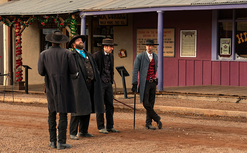
If you’re not familiar with the controversial Earp brothers (where have you been), they were supposedly the good guys at the OK Corral shootout in 1881—even though they wore the black hats and black dusters. I don’t want to dwell on the Tombstone incident, but the short version is that Wyatt, two of his brothers Virgil and Morgan, and their friend—Doc Holiday went to the corral to disarm four Clanton Gang cowboys. The confrontation erupted in a 30-second gunfight where the Earp’s killed Tom and Frank McLaury and Billy Clanton while Ike Clanton managed to run away. (In this video, Bob Boze Bell—former DJ, artist, and publisher of True West magazine—explains the shootout’s story better. It’s longish but interesting.)

Warren wasn’t in Tombstone at that time because he was too young and lived with his parents in California, but he later got entangled in the subsequent vendetta that lasted another year. By 1900, Warren had settled in Willcox, a mountain range east of Tombstone. He worked as a stage driver for the mail and a Sierra Bonita Ranch hand. It was at the ranch where he and Johnny Boyett became close.

On the fateful night, Warren and Johnny got into a shouting match in the saloon on the northeast corner of Maley Street and Railroad Avenue (diagonally across the street from last week’s train station). As their argument heated, they threatened to kill one another, although neither was armed. Short-tempered Warren and Boyett left the bar separately. Earp wanted to cool off, and Johnny went to get a gun. When Warren returned through the back door, Boyett shot at him four times. He seemingly missed on purpose. Earp taunted the ranch foreman and opened his duster to prove he didn’t have a gun. “Don’t come an inch closer,” Johnny shouted, but Warren continued. Johnny fired another round sending a bullet through Earp’s heart. Warren fell foreword, dead onto the floor. Then things got weird.

Between the 1:00 am shooting, and sunrise, Earp’s body was dragged to the cemetery and buried in an unmarked grave. Meanwhile, the Sheriff arrested Johnny. Then he got the local judge out of bed. They held a trial, where the witnesses testified. Finally, the judge determined the shooting was justified and freed Johnny Boyett. The incident was closed and sealed forever.

There is a tantalizing clue, however. In the 1930s, a reporter interviewed a woman living in Prescott’s Pioneer Home. Her name was Mary Cummings—she was also called Kate Elder, but she was best known as Big Nose Kate. She worked as a prostitute in Tombstone and was Doc Holiday’s common-law wife. During that interview, she recounted her memories of the Earp brothers and said Warren’s death “… was the result of an altercation between two individuals involved in an unnatural male relationship.”

How does this week’s picture fit into this story? It doesn’t. The Headquarter Saloon burned to the ground sometime after the shooting, but the builders used the foundations to rebuild an identical structure. It’s repurposed now—ironically as a wine-tasting room. While I was shooting in Willcox, I didn’t feel it worthy because it has a tacky sign painted on the white stucco. This week’s photo—Mack’s Bar—is also on Maley Street, a block west of where our story took place. So, it’s a bar, it’s on the same street, and that’s as close as I got.

You can see a larger version of Mack’s Bar on its Web Page by clicking here. Next week, I have another picture from Willcox, and maybe I can find a story that goes with it.

Until next time — jw

Willcox Depot       Picture of the Week

Willcox Depot - The old train depot in Willcox is now used as the town's city hall.
Willcox Depot – The old train depot in Willcox. The local government now uses it for city hall.

Queen Anne and I traveled to Arizona’s southeast corner this week. One of my future projects is in Cochise County, so we spent a couple of nights in Willcox. The eastern half of the state is unlike where we live. That desert has little cactus. Instead, you see blue mountain ranges rising from the 4000′ elevated broad yellow grass-covered valleys and a couple of dry lakes—or Playas, as the Spanish-speaking people call them. This area shows the geographic diversity of Arizona.

It’s almost over, but it’s still winter, which means it’s still snowbird season, so we skipped seasonal rates at the chain motels near Interstate 10 and opted for a cheaper inn closer to town. The original builders probably built it in the 60-70s, but the current owners work hard to keep it clean and contemporary. Our room had a fresh coat of white paint, new blond fake-wood floors, and a useless bright red sash across the foot of the bed. We could watch long freight trains race past on the Southern Pacific tracks from our window. Three or maybe four of them an hour.

Although the throbbing bass from its five engines was enough to vibrate the bed across the linoleum, the trains didn’t keep us awake. That’s because they never slowed or blasted their horns at the town’s only track-crossing. However, we did have an issue with the new stylish duvet cover. It wasn’t like the plush down-comforter that we have at home. We hit town in-between storms, so the nights were clear and cold—below freezing. We tried to heat the room using the window-air conditioner, but every time it cycled on, it was the equivalent of a DC3 engine starting next to the bed. We finally shut it off and slept closer to one another.

Another amenity missing in little places like these was in-room coffee. I can’t function without my morning java. So, I’d get dressed and venture out to secure my fix at first light. In the golden light, I searched the town for a coffee house. Not only did I find one, but I also discovered a neat little mom-and-pop bakery and the Willcox historic district. Since I had hours to kill while I waited for Her Majesty to prepare herself for public viewing, I wandered the eight blocks with coffee in one hand and camera in the other. After a couple of mornings, I had enough images to decide that March’s project would be about Willcox.

If you drive through Willcox on Interstate 10, you won’t see much—only the usual chain motels and burger joints located at the mid-town exit. Even if you drive through town on the freeway bypass, you’ll pass some old motels, a couple of RV parks, and a gas station or two. There are many closed businesses along the road. The exciting stuff is on Railroad Avenue—next to the tracks because Willcox was built by and for the Southern Pacific Railroad.

Long-time readers may recall that the early steam engines ran on fuel and water. Willcox Playa—a seasonal lakebed—is conveniently located midway between El Paso and Phoenix, so Southern Pacific built a whistle-stop there in 1880. The company dubbed the town Maley. It was a single-purpose town for nine years when a guy, General Orlando B. Willcox, got off to stretch his legs and realized that it would be a fabulous place to raise cattle.

Willcox wasn’t even on a significant highway until the Feds completed Interstate 10 in 1960. Before that, the southern Coast-to-Coast highway was US 80. It went south around the Chiricahuas to Douglas and then Tombstone.

This week’s picture directly relates to the railroad birth of Willcox. It’s a shot of the train depot located at the heart of old-town. It’s a large building for a small town and in pretty good shape, considering the railroad closed the depot years ago. Today the trains race past at full speed and don’t even blow their horn. It’s now the town’s city hall. I liked how the pyramid pattern repeats from the turret to the roof peaks. I called this image Willcox Depot.

You can see a larger version of Willcox Depot on its Web Page by clicking here. Next week, I’ll show you another location I shot during my Willcox wanderings.

Until next time — jw