Hot Springs, Dusty Trails, and Desert Tales: The Story of Agua Caliente Pictures of the Month - Agua Caliente, Arizona

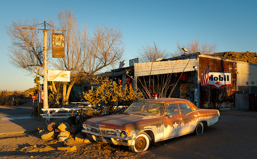
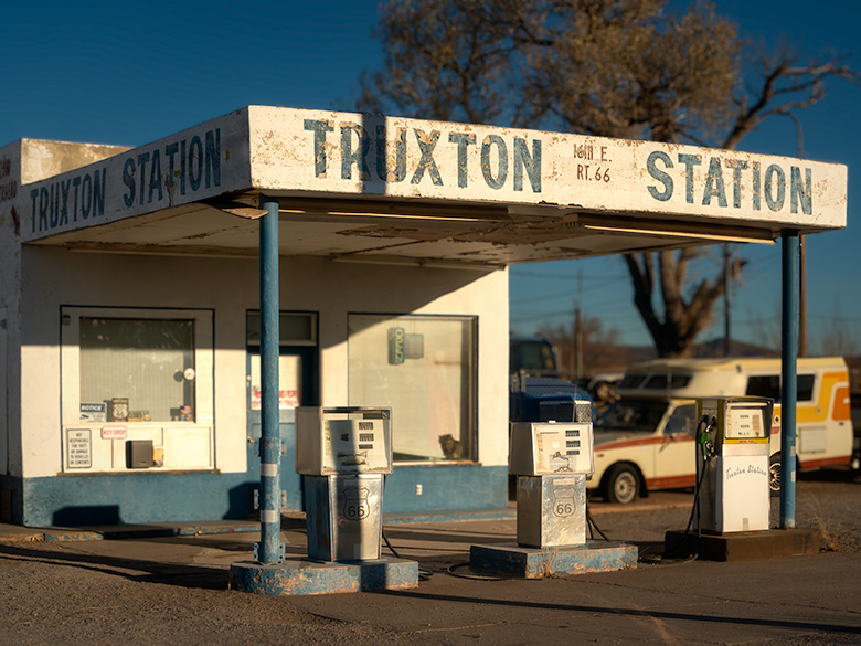
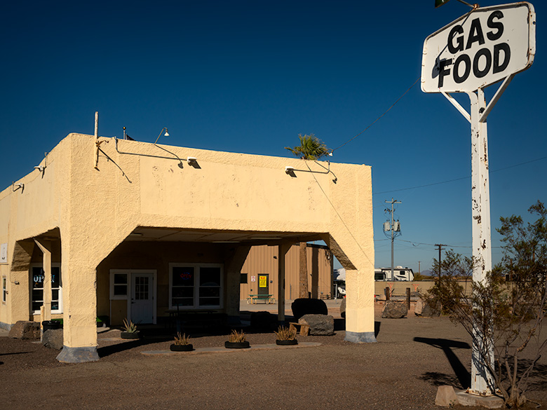
1940s vintage gas station in Agua Caliente, now operating as an ice cream shop under a clear blue sky.
Historic Stop: Old Gas Station Turned Ice Cream Store – Perched near the edge of a dormant shield volcano’s western plain, this charming 1940s gas station is a window into Agua Caliente’s storied past. Once serving travelers as a vital fueling point, the “Sentinel Station” now delights visitors with sweet treats as an ice cream shop. Though replaced by a modern Chevron station nearby, its enduring presence marks the starting point for our journey to the historic resort town of Agua Caliente.

If you thought Arizona’s summer heat this year was terrible, you should have been here a couple of epochs ago. In the Miocene epoch, around 20 million years ago, molten lava wasn’t just rolling—it was stampeding across this landscape like spilled coffee on a countertop, much hotter and far less forgiving. Why? Because this corner of the Earth sat atop one of the most geologically active regions on the planet. Tectonic plates jitterbugged and collided, cracking the Earth’s crust like a fragile eggshell. Faults yawned open, releasing fiery rivers of lava, and the Earth wasn’t just warm—it was downright boiling.


Arizona’s Volcanic Past

Volcanoes were breaking out all over Arizona like pimples on a teenager’s face—a geological puberty that stretched for millions of years. It all started in the Miocene Epoch, about 20 million years ago, when the Earth’s crust stretched like an old pair of jeans across the Basin and Range Province. Magma bubbled through the cracks, spilling to form shield volcanoes and sprawling lava fields. One of the grandest results was the White Mountains, whose towering peaks and vast basalt flows gave the landscape a bold, volcanic makeover.

Arizona’s volcanic party got going by the Pleistocene Epoch around 2.8 million years ago. In the San Francisco Volcanic Field, stratovolcanoes like Humphreys Peak erupted with flair, spewing ash and lava while smaller cinder cones popped up like freckles across the northern plains. Bill Williams Mountain joined the festivities later, its viscous dome adding another dramatic feature to the state’s volcanic portfolio.

The evidence of all this geological chaos is still visible today. Any hill, mountain, or plain covered in black basalt is a telltale sign of volcanic activity. You can spot these dark, rocky remnants from your car as you cruise Arizona’s desert highways, head toward California, or explore the state’s backroads. These basaltic leftovers aren’t just eye-catching—like a giant road map to the state’s fiery past.

All this volcanic activity didn’t just leave behind rugged peaks and lava fields; it also created geothermal hotspots. When groundwater seeps deep into the Earth, it brushes against rocks still warm from ancient magma chambers and rises to the surface as hot springs. While Arizona isn’t as famous for these thermal features as neighboring Nevada, it still boasts a few noteworthy examples. Tonopah and Castle Hot Springs offer glimpses of this natural phenomenon. Still, one of the most intriguing is the spring at Agua Caliente—a warm oasis that once lured travelers seeking rest and rejuvenation in the heart of the desert.


Indigenous and Early History

Long before stagecoaches rattled across Arizona’s rugged terrain or settlers carved dusty trails, the hot springs at Agua Caliente were a haven for Indigenous peoples. Tribes such as the Hohokam and later the Tohono O’odham and Apache revered the springs as sacred ground. Their mineral-rich waters weren’t just warm—they were believed to heal both body and spirit, offering relief from ailments and a deeper connection to the land. The springs were more than just a practical resource for these early inhabitants—they were a spiritual touchstone, humming with the Earth’s energy.

When Spanish explorers ventured into the region in the 16th and 17th centuries, they encountered these springs and called them Agua Caliente—”hot water.” To the Indigenous peoples, however, the springs were simply part of a greater whole called Tonopah, meaning “hot water place.” Though the Spanish expeditions were brief, their naming left a lasting imprint on the area’s history.

By the mid-19th century, Agua Caliente was at the crossroads of history as westward expansion swept through the region. The Butterfield Overland Mail stage line, operating from 1858 to 1861, threaded its way across the Arizona desert, linking the eastern United States with the golden promises of California. While Agua Caliente may not have been an official stop, its reputation as a reliable water source made it a lifeline for travelers braving the relentless sun and parched soil. To a stagecoach driver, spotting those steaming springs must have been like finding an oasis in a sea of dust.

Later, the Oatman Route brought settlers, traders, and wagons rolling through the area, further cementing Agua Caliente’s importance. Named after the harrowing story of the Oatman family’s capture by the Yavapai, the trail became a crucial passage for pioneers navigating Arizona’s unforgiving wilderness. Even the Yavapai and Apache, who knew this land better than anyone, often stopped at the springs during their movements. Agua Caliente stood where cultures intersected—a desert crossroads where survival trumped divisions.

Before the railroads ironed their way through Arizona’s vast deserts, Agua Caliente was a beacon for anyone bold enough to journey through southern Arizona. From Indigenous healers seeking spiritual renewal to stagecoach passengers desperate for a drink, its waters sustained weary travelers across centuries. Every ripple in its springs carried a story, each as rich as the minerals bubbling up from the depths.

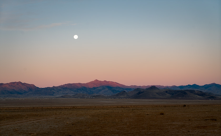
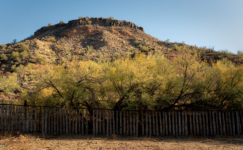
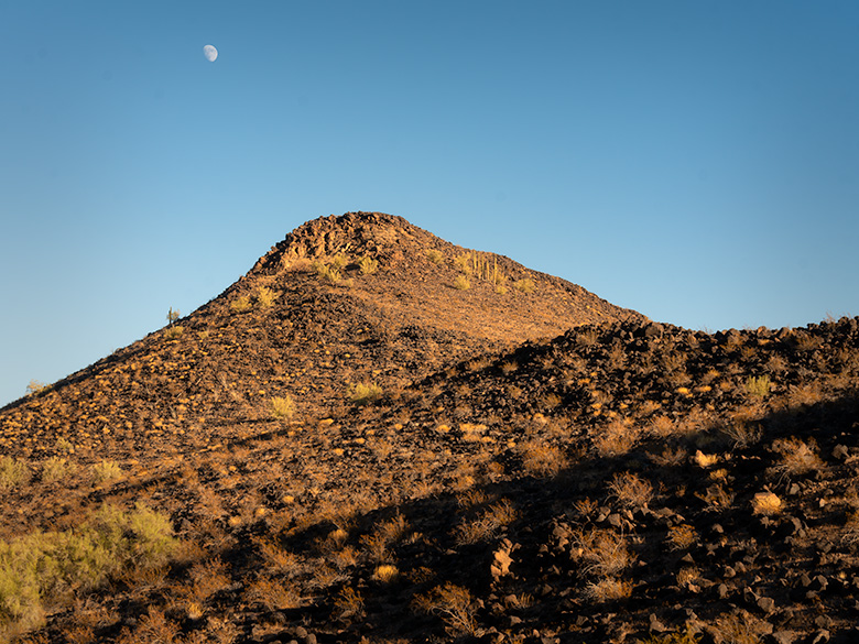
Basalt-covered mountain peak in Agua Caliente, likely formed by volcanic fissure eruptions, with the moon rising above.
Volcanic Legacy: The Basalt-Covered Mountains of Agua Caliente – This rugged peak in the Agua Caliente mountain cluster offers a glimpse into the region’s volcanic past. Likely formed by a fissure eruption, the hill is cloaked in black basalt, and the cooled remains of the ancient lava flow. These mountains once served as the underground furnace that heated the famous hot springs, drawing settlers and visitors to the area. With the moon overhead, this image highlights the geological forces that shaped the desert landscape.

Agua Caliente’s Heyday

By the late 19th and early 20th centuries, Agua Caliente had transformed from a dusty desert waypoint into a sought-after retreat. The adobe guest quarters, built in the 1870s and expanded over the following decades, were simple yet inviting, nestled among the desert plains. Their charm matched the bubbling pools of mineral-rich water, which promised relief from aching joints to mysterious ailments doctors couldn’t quite name. Agua Caliente was Arizona’s answer to high society’s spas for a taste of rustic charm with the allure of healing waters.

The Southern Pacific Railroad played a crucial role in the resort’s rise, mainly after Arizona achieved statehood in 1912. Railcars carried passengers from the soot-stained cities of the East, eager to trade Wall Street stress for desert serenity. Lured by tales of magical waters, visitors—many dismissive of Indigenous traditions—were quick to embrace the springs’ purported healing powers. After all, if hot water could fix a stiff back, gout, or “nerves,” it was worth a shot.

Agua Caliente thrived in a world that was rapidly modernizing. As Arizona became the nation’s youngest state, the resort became a beacon for weary travelers and health seekers. The adobe lodges buzzed with activity. Guests soaked in the steaming pools daily, claiming the mineral waters melted away ailments and sour moods. By evening, laughter spilled from the adobe walls as card games and tall tales of desert adventures echoed into the night. It was a perfect mix of elegance and frontier spirit—where boots met parasols, and everyone left with a story.

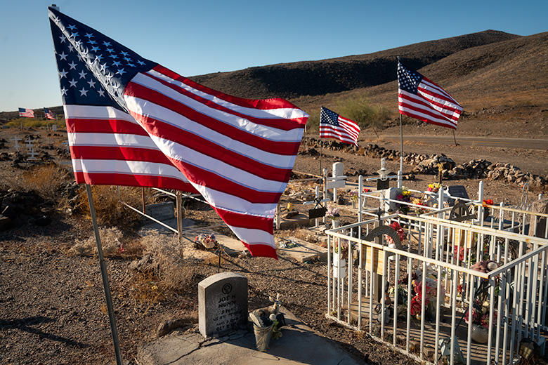
Agua Caliente Pioneer Cemetery with American flags flying over graves on Veterans Day, restored with white crosses for unidentified graves.
Flags of Honor: Agua Caliente Pioneer Cemetery on Veterans Day – As you approach Agua Caliente, the Pioneer Cemetery comes into view, a poignant reminder of the lives that once thrived here. Visiting on Veterans Day, I found flags proudly waving over the graves of veterans, paying tribute to their service. Once neglected, with missing headstones and anonymous graves, this cemetery has been given new dignity by an anonymous caretaker who placed white crosses on each grave, ensuring no one rests unremembered in the desert sun.

Agricultural Development and Water Table Decline

As the 20th century progressed, the once-thriving oasis of Agua Caliente began to wither—fade from neglect but from the insatiable demands of agriculture. For much of the early 1900s, Arizona’s deserts were seen as vast, useless expanses. But farmers soon discovered a transformative truth: add water, and the barren soil could burst into life. With the promise of productivity on the horizon, the surrounding plains transformed into a patchwork of cotton fields and other thirsty crops stretching to the horizon. Wells were drilled, pumps roared, and groundwater flowed like there was no tomorrow—all to sustain an agricultural empire that would help feed the growing demands of a nation.

The boom wasn’t just about local ambition. As the country mobilized for two World Wars, cotton and other desert crops became vital resources for military use, from clothing to tents and more. The fields didn’t just symbolize progress—they represented patriotism and the belief that even the desert could serve a higher purpose. But with this progress came a cost.

Farmers likely dismissed the first murmurs of trouble. After all, how could a few wells harm a spring bubbling faithfully for centuries? To them, the water table was like the change jar on the kitchen counter—always there when you needed it. But the Earth, it turned out, had a different balance sheet. As the water table sank lower and lower, the hot springs that had sustained Agua Caliente faltered. Once-vibrant pools turned to muddy trickles, and the resort’s lifeblood evaporated into the desert air.

The decline of the springs was more than just a geological shift—it marked the end of an era. Without the water, the allure of Agua Caliente faded, leaving the adobe walls to stand as silent witnesses to what was lost. The same farmers who benefited from the booming fields likely drove past the resort ruins, perhaps scratching their heads and wondering what went wrong. Few, if any, ever connected the dots between their pumps and the death of the springs, a quiet casualty of human ambition.

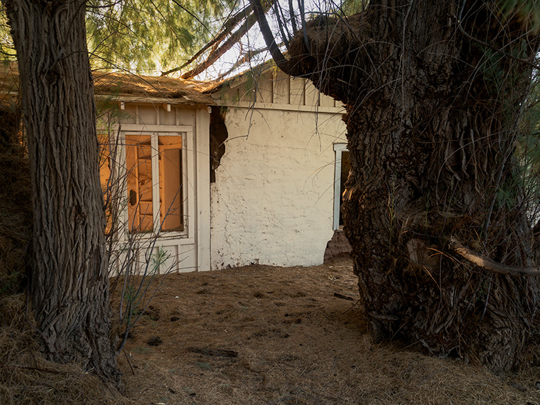
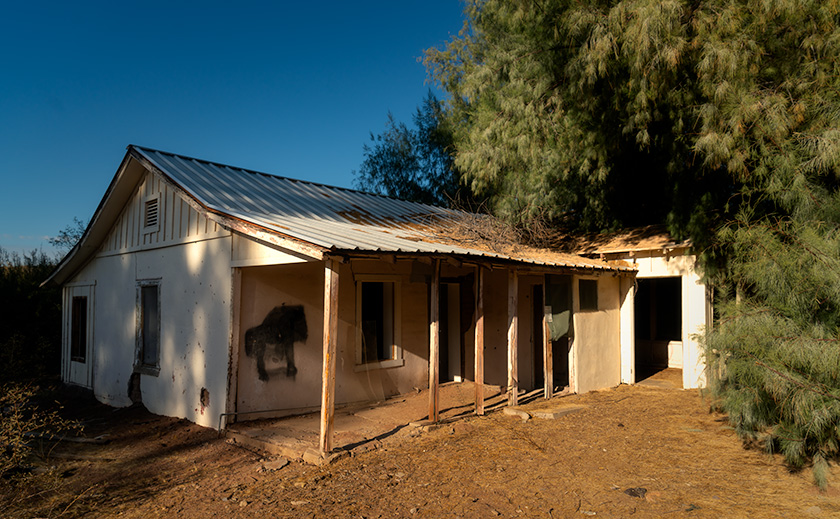
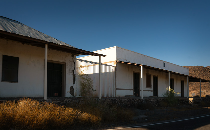
Plaster-covered adobe buildings in Agua Caliente, the former reception and guest quarters of a hot springs resort, with basalt ruins nearby.
Resort Ruins: Adobe Structures of Agua Caliente – Standing as silent witnesses to the past, these adobe buildings once served as the Agua Caliente Resort’s reception area and guest quarters. Their plaster-covered walls hint at a time when visitors came to enjoy the region’s therapeutic hot springs. Behind these two main structures lies a cluster of unmarked buildings, their purpose lost to time. North of the complex, basalt stone ruins crumbles in isolation, with decay more pronounced the farther they sit from the heart of the resort. These remnants evoke a haunting beauty, narrating the gradual fading of a once-thriving retreat.

Decay and Urgency to Visit

Once a bustling oasis, the Agua Caliente resort now teeters on the edge of oblivion. The adobe structures, including the reception area and guest quarters, slowly succumb to time, their plaster peeling like sunburnt skin and walls crumbling into dusty heaps. Surrounding buildings, some made from rugged black basalt, are in various states of disrepair—especially those farther from the leading club central, where collapse seems not just likely but inevitable.

Ownership of the site remains a mystery, shrouded as much in obscurity as the ruins themselves. Nearby, a covered structure housing hay and equipment hints at a private owner, though specifics are hard to come by. What is clear, however, is the lack of preservation efforts. With no markers, informational signs, or protective measures, Agua Caliente’s historical significance seems to hang by a thread, leaving the remaining structures at the mercy of the relentless desert sun.

For those intrigued by its haunting beauty, visiting Agua Caliente sooner rather than later is not just a suggestion—it’s a ticking clock. The adobe walls and basalt stones are steadily losing their battle against gravity and heat, while the surrounding grounds are a minefield of rusted roof timbers, ancient nails, and the odd relic of its former life. Add to that the possibility of encountering a rattlesnake seeking shade during summer, and it becomes clear: caution is your best companion.

But tread lightly, both literally and figuratively. These ruins are more than just crumbling buildings; they are fragile echoes of Arizona’s past. The desert reclaims a little more sand each year, and time erases what remains. If you’re tempted to take a souvenir or leave your marks, resist the urge. Respecting the past means preserving it for others to experience its quiet, crumbling beauty—just as you have.

Agua Caliente is a place where history whispers, not shouts. Visit while you still can. Move carefully, look closely, and honor the stories etched into the adobe and basalt. They won’t linger forever.


Final Thoughts

Thank you for joining me on this journey through time to the once-thriving resort of Agua Caliente. From its fiery volcanic beginnings to its heyday as a desert retreat and, finally, to its quiet decline, this place stands as a testament to the resilience of nature and history. It’s a story of survival, ambition, and the delicate balance between progress and preservation. I hope you’ve enjoyed exploring its layers as much as I’ve enjoyed sharing them.

Be sure to visit the gallery on my website for larger photos of the ruins and the surrounding desert landscape. These images, featured in the New Work portfolio for the next three months, capture this unforgettable place’s haunting beauty, quiet mystery, and inevitable decay—and they might inspire your own adventures.

Next month, we’ll hit the road again to uncover another abandoned spot steeped in history and intrigue. Where will the road take us? That’s a story for another time—you must stay tuned to find out!

Until then, keep exploring, respect the places you visit, and remember to bring water—especially if your journey takes you to Agua Caliente.

jw

The Long Way Home: Three Routes, One Corolla, and a Little Adventure Pictures of the Month: California Coastal Towns

“So when the day comes to settle down,
Who’s to blame if you’re not around?
You take the long way home,
Take the long way home.”—Supertramp
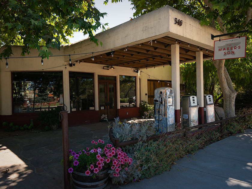
Vintage gas station repurposed as Makers Son venue in Los Alamos, California with rustic charm
Exploring Los Alamos: Makers Son Event Space in a Former Gas Station—The Makers Son, a vintage gas station in Los Alamos, California, now serves as a charming venue for weddings and events.

Like every good fairytale, the good times eventually come to an end. Too soon, we found ourselves facing that tedious drive home. But instead of a simple choice, we had three different ways to go—our own version of ‘The Three Little Piggies.’ Only this time, there were three little routes: the quick and efficient one, the scenic and leisurely one, and the ‘I don’t really want to go home’ route.

The Fast Way (All Freeway—All The Time)

The first little piggy is all about speed—no frills, no fuss. It’s I-5 or US 99 south to Bakersfield, then a quick jog over to I-40 through Barstow, cruising along Route 66 nostalgia until Kingman, and finally, the home stretch to Congress. There is not much scenery, but it’ll get you there faster than you can say. ‘Are we there yet?’ It’s our choice for days when the destination matters more than the journey. This is also our go-to route when we’re in a hurry or carrying precious cargo—like a couple of cases of wine. We can make this trip in about 14 hours, provided I make the necessary stops for Queen Anne’s bathroom breaks.

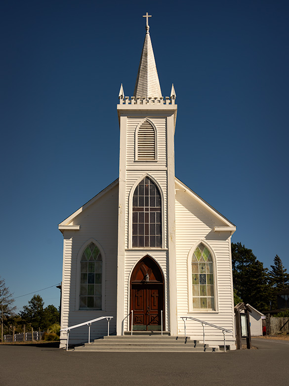
St. Teresa of Avila Church in Bodega, California, iconic landmark photographed by Ansel Adams
St. Teresa of Avila Church in Bodega, California—a spot where Ansel Adams stopped in 1953 when this drive was just a dirt road. Anytime I get within range of an Adams subject, I make it my mission to stop and capture my own take. Queen Anne was more than willing to tag along—Bodega was the filming site for Hitchcock’s The Birds, and she didn’t pass up the chance to channel her inner Tippi Hedren, posing dramatically on the schoolhouse steps nearby.

The Leisurely Way (Santa Paula Route)

The second little piggy prefers a scenic detour. This route winds down California’s Highway 101 through coastal towns and charming spots like San Luis Obispo, Santa Barbara, Santa Paula, and Fillmore. Fillmore holds a particular place for me—it’s where I take a moment to visit my sister’s grave, reminding me that every journey has meaning beyond the miles. And then, with a clearer head, we pick up the drive home.

From there, the road takes us through Los Angeles, where we must be mindful of our timing and stay as far away from downtown as possible. Even in the middle of the night, we expect traffic, but if we time it right—threading the freeways between morning and evening rush hours—we can glide through with minimal stop-and-go. Our preferred route through LA is the I-210, which runs along the base of the San Gabriel Mountains and offers a spectacular view…on the one day a year when they’re actually visible through the smog.”

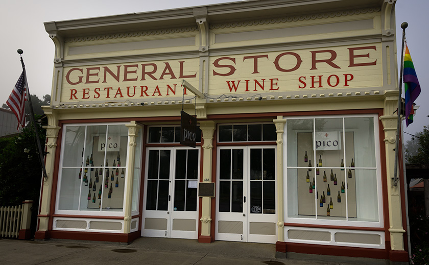
Pico Wine Tasting and Restaurant in a historic general store building in Los Alamos, California
Pico Wine Shop and Restaurant in Los Alamos: A Culinary Landmark – Pico, a historic general store turned wine-tasting venue and restaurant in Los Alamos, California, offers a high-end culinary experience.

The “I Don’t Really Want to Go Home” Way

And then there’s the third little piggy, the route for when you’re in no rush. This path hugs the coast down the Pacific Coast Highway, SR1, taking the long, winding road past Big Sur, through postcard-perfect towns, and across landscapes that demand photo stops every few miles. It’s the scenic route to end all scenic routes—a journey for those who want to stretch the fairytale a little bit longer.

Once we reach San Luis Obispo, we merge onto the 101 until Ventura. From Oxnard to Santa Monica, we’re back on the PCH with plenty of chances to spot a pod of dolphins, a whale, or seals if we’re lucky and observant. Since we have all the time in the world, we make it a point to stop, walk all the piers, and grab a bite at a couple of seafood shacks along the way.

When it’s time to leave Santa Monica, we jump on I-10 straight into the city’s heart-stopping freeway traffic. But instead of fighting it, we go with the flow—windows down, wind in our faces, and Randy Newman’s ‘I Love L.A.‘ blaring on the stereo. For a moment, we’re part of the LA rhythm, dodging in and out of lanes with all the other dreamers. Eventually, US 60 guides us through Riverside and into the wide-open desert, where the road stretches out, and the only traffic is the tumbleweeds. If done correctly, we measure our progress in miles per week.

A Corolla with Attitude

The real surprise on this trip was discovering our trusty Corolla IM’s hidden ‘Sport’ mode button. I’ve dubbed it the ‘Gutless Wonder,’ but with Sport mode engaged, it gave me more spirit than expected. The button sharpened the transmission shifts and tightened the power steering, making each corner feel just right. For a moment, I almost felt like I was driving an old British sports car—minus the manual gearbox and with the comfort of roll-up windows and a top. And thanks to the IM’s independent rear suspension, it didn’t just handle the winding roads—it made them fun. Who knew our little econobox had it in her?

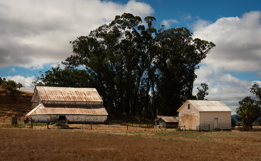
Rustic white barns in a scenic countryside landscape on the road from Sonoma to Calaveras, California
Historic White Barns: A Serene Stop Near Highway 101 – A pair of white barns along the scenic Sonoma to Calaveras route, capturing the rustic charm of California’s countryside.

Our Extended Fairytale Ending

Since it was still August and we weren’t in a hurry to get back to our cottage at the base of the Weaver Mountains, we opted for the middle route with a twist: four days, with overnight stops in places we’d never explored. Our usual all-day ‘Bataan March’ became a leisurely four-day journey of discovery, and—true to form—Anne and I conveniently planned our stops around California’s Central Coast wine regions. Now, we have at least four new destinations for future trips.

Each route home has its own quirks and charms, but this time, taking the scenic way back reminded me that the journey can be as memorable as the destination. Sometimes, the right choice isn’t the fastest or most convenient—it’s the one that lets you hold on to the experience just a little longer.

Till next time, keep your spirits high and your humor dry.
jw


BTW, 2024 Wall Calendar Orders are Open!

It’s that time of year again—calendar season! If you’d like to grab one of my personal wall calendars for 2024, now’s the time to let me know. The calendars are 8.5 x 10 inches, spiral-bound, and printed on high-quality card stock, perfect for showcasing a year’s worth of my favorite shots.

A heads-up on pricing: VistaPrint’s prices are always high initially, but they usually offer great discounts as the holidays approach. Last year, they dropped to around $11 plus shipping after Thanksgiving, but they could be as high as $20 if I go by their price list today. Whatever my printing and shipping costs are, that’s what I charge—no markup.

If you’re interested, please let me know by November 15. That way, I can organize everything, and we can take advantage of post-Thanksgiving sales! Delivery is usually at the beginning of December, so they make great stocking stuffers.

Where the Fog Refused to Roll: A Desert Rat’s Tale at Point Reyes Pictures of the Month - Point Reyes, California

White historical building with cupola at Pierce Point Ranch, Point Reyes, California
A Glimpse into History: The Schoolhouse at Point Reyes – A historical building at Pierce Point Ranch, Point Reyes, featuring a cupola that suggests it may have served as a schoolhouse in its heyday.

You might wonder why Queen Anne and I chose Point Reyes as our summer escape from the desert. The answer is simple: wasn’t it Mark Twain who famously quipped, “The coldest winter I ever spent was a summer in San Francisco?” Couple that with data I found from the Point Reyes lighthouse, which proudly claims to be the “foggiest and windiest place on the California coast,” and you’ve got a lure strong enough to reel in two desert rats like us faster than a piece of cheddar in a spring-trap.

Besides, I watched a Back Roads West YouTube video by Cliff and Ilene Bandringa last year that made Point Reyes look like a cool, misty oasis—a refreshing break from the sweltering Arizona sun. What could go wrong if we spent a week soaking in Frisco’s damp air without shelling out for those $300-a-night hotel rooms?

So, when the summer heat finally got to us, we stuffed Anne’s shoes, her mountain of books, and just enough room for my camera gear into her gutless little Corolla. Sure, it couldn’t pass a tumbleweed on the open highway, but with 35 miles to the gallon, who’s complaining? After all, we needed to save money for wine. And so, west we went, dreams of cool fog dancing in our heads.

White Dairy Buildings with Monterey Cypress at Pierce Point Ranch
A Quiet Moment: White Barns and Monterey Cypress at Pierce Point Ranch – Two white dairy buildings at Pierce Point Ranch, framed by the distinctive Monterey Cypress trees. A testament to the historical dairy farming era of Point Reyes.

Geology of Point Reyes

If you look at a map, Point Reyes juts out into the Pacific like an island tethered to the California coast—an island at dock. Geologically speaking, it nearly is an island, sitting on its own chunk of land on the Pacific Plate. The San Andreas Fault runs through Tomales Bay, separating Point Reyes from the mainland. It’s as if the Pacific and North American plates decided to part ways, leaving Point Reyes awkwardly perched on the edge.

The landscape here is a study in contrasts. The peninsula’s eastern side gently slopes up from the coast, eventually rising to a broad plateau that stretches across the western half. This plateau is a patchwork of windswept grasslands dotted with clusters of Monterey Cypres trees that stand out—gnarled, twisted, and pruned by the persistent winds that whip across the plateau. They seem to lean into the wind, shaped by years of relentless gusts that have carved their forms into something resilient and hauntingly beautiful. As you journey westward, the land meets the ocean in a dramatic drop-off, with cliffs that plunge into the Pacific, as though the land falls away into the sea.

Historically, the cool coastal climate and fertile soils made this plateau an ideal spot for dairy farming. In the late 1800s, families like the Pierce and McClure clans established sprawling dairy farms here. However, as with many land use stories, controversy followed. Over time, concerns about environmental degradation grew as the cattle impacted the fragile coastal ecosystem.

Eventually, the tide turned, and the land began to be reclaimed. Today, Point Reyes is home to a thriving Tule elk population, roaming freely across what was once pasture. The elk symbolizes the land’s restoration, while the weathered barns and ranch buildings, now abandoned, stand as silent reminders of a different era. But it wasn’t just the history that called me—the photos first made me drool.

Close-up of weathered upper windows on a rustic building at Pierce Point Ranch, Point Reyes, California
Weathered Wood and Windows: A Closer Look at Point Reyes’ Ranch Buildings – A close-up of the weathered wood and upper windows on an auxiliary building at Pierce Point Ranch showcasing the rustic charm and history of Point Reyes.

Pierce Point Dairy

As soon as I saw those weathered barns and fog-cloaked pastures, I could visualize myself working in the damp, misty air, capturing the kind of light Andrew Wyeth made famous in his iconic rural scenes of Maine. Photographing these barns and windswept trees with that soft, ethereal light seemed like the perfect opportunity to channel Wyeth’s muted tones and quiet beauty—not on canvas but through the lens.

Pierce Point Ranch is one of the oldest and most significant dairy farms on Point Reyes. Its weathered white barns are a testament to California’s agricultural past. Established by the Pierce family in the 1850s, the ranch was part of the Point Reyes dairy boom, when the cool coastal climate made this land perfect for dairy farming.

At its height, the ranch produced butter and cheese for San Francisco and beyond, shaping the region’s early economy. The Pierce family and others carved out a life here, managing their cattle amid some of California’s most stunning—yet harsh—landscapes.

But as time passed, so did the viability of dairy farming. Environmental concerns over the cattle’s impact on the land eventually led to the phasing out of ranching operations. Today, Pierce Point Ranch is preserved as part of Point Reyes National Seashore, a symbol of the area’s agricultural heritage. The ranch buildings remain their whitewashed walls standing in quiet contrast to the now-peaceful surroundings, save for the occasional Tule elk wandering nearby.

However, getting to the ranch is an adventure in itself. The road leading to Pierce Point is paved with just enough potholes to make you consider airing down the tires—something I usually reserve for off-roading with the Turd. It felt like I was off-roading on asphalt! As I carefully navigated each crater, I couldn’t help but think how this rugged drive suited the history of the place, where dairy farmers once worked the land in equally challenging conditions.

Close-up of a weathered door with a padlock, showing the rustic texture of a building at Pierce Point Ranch, Point Reyes, California
Rustic Charm in the Details: The Door of a Ranch Building at Pierce Point – A close-up of a weathered door with a padlock at Pierce Point Ranch, highlighting the rustic textures and historical wear of this Point Reyes building.

The Photographs

When we arrived at Pierce Point Ranch, I felt like I’d brought the brutally clear desert air. Not a single trace of fog was in sight. Standing in the crystal-clear air, we could see the fog banks hovering about three miles offshore as if they were paranoid of catching Valley Fever, our local desert respiratory disease unique to arid climates.

I envisioned working in the soft, diffused light made famous by Andrew Wyeth, but the fog had other ideas. It stayed away as if allergic to my presence. Faced with the harsh reality of bright sunlight and whitewashed buildings, I figured if I couldn’t be Wyeth, I’d channel my inner Pete Turner instead—leaning into the bright colors and sharp edges, capturing the contrast and crispness of the scene.

The ranch sprawled around me like a Hollywood set constructed by Cecil B. DeMille as my personal photography playground. I wandered around merrily, snapping away. The clear skies may not have given me the moody atmosphere I’d hoped for, but they offered a different kind of beauty—a bold, vibrant one. I was as happy as a kid at a drugstore soda fountain with a twenty-dollar bill to spend.

Wrap-up

Now, before we wrap things up, I’ve got to share a story my mother used to tell us about growing up on a farm in Kentucky. Believe it or not, one of her favorite things was feeling chicken and cow manure squishing between her toes. Aren’t you glad I left that part out of my story?

Thanks for coming along on our journey to Pierce Point Ranch—I hope you enjoyed the show! My website has larger versions of these photos [jw link]. They will remain online for three months before they are replaced or removed. Feel free to dive in and explore the details.

I’d love to hear from you! Do you have any thoughts about the photos, the story, or maybe some farm experiences of your own? Drop a comment—we enjoy hearing your stories and feedback. Be sure to return next month for our journey home—it’s bound to be just as exciting, if not a bit cleaner.

Keep your milk fresh and your cheddar sharp.
jw

BTW: As we began our journey south on the 101 early Sunday morning, the hilltops were shrouded in low clouds, and just before we crossed the San Mateo Bridge, I had to turn the windshield wipers on. The fog was that dense. I guess I finally got my foggy California experience after all. You bastards!

Cedar Mesa Chronicles: A Photographer’s Escape Picture of the Month - Bluff, Utah

View from Muley Point of the San Juan River goosenecks with Monument Valley in the distance and cloud shadows on the ground
Captivating Views: Goosenecks and Monument Valley from Muley Point – From Muley Point, the San Juan River’s goosenecks carve a winding path, with Monument Valley faintly visible on the horizon. Cloud shadows dance across the rugged terrain.

I can count on one hand the number of times I’ve been utterly captivated by a view during my days as a photographer. I’m talking about scenes that felt like they encompassed the entire world, vistas so mesmerizing that they made it nearly impossible to walk away. Places like the Summit Road on the Banks Peninsula in New Zealand, the patio of the North Rim Lodge at the Grand Canyon, Horseshoe Bend outside of Page, Arizona, and Bryce Canyon from Powell Point in Utah. These weren’t just beautiful landscapes but revelations that deepened my understanding of geography. During my May visit to the Bears Ears area, I discovered another such place—Muley Point on Cedar Mesa.

Why I Stopped at Muley Point:

From last month’s article, I drove to Utah intending to spend several days photographing various areas on the south side of Bears Ears National Monument. However, my trip was cut short when I threw out my back. After packing up and heading home from Natural Bridges, my back felt better within the supportive confines of the Turd’s captain chair. With some relief, I decided to stop and inspect the Muley Point overlook for future trips.

The three-mile dirt road to Muley Point was easy to traverse. When I arrived, I exited the truck, wandered the area, and took in the sights. I was immediately impressed. So much so that I decided to take some photographs, which meant returning to the SUV to fetch my camera and retracing the loop I had already hiked. Despite my initial setback, I’m glad to say that in the short time I was there, I managed to capture enough images to support this post.

iñon pine tree growing on the edge of Cedar Mesa in the Utah desert
Life on the Brink: Cedar at Cedar Mesa Edge – A cedar (piñon) tree clings to life along the edge of Cedar Mesa, demonstrating the incredible resilience of nature in the harsh Utah desert.

Geological Marvel:

Cedar Mesa, a striking landscape in southeastern Utah, is a geological marvel shaped by millions of years of natural forces. The mesa is primarily composed of Cedar Mesa Sandstone, a distinct formation different from the more well-known Navajo Sandstone. While Navajo Sandstone is renowned for its sweeping, cross-bedded dunes indicative of ancient desert environments, Cedar Mesa Sandstone is characterized by its horizontal layers, formed from sediment deposits in ancient coastal environments during the Pennsylvanian period, roughly 300 million years ago. These layers of sand and silt were compressed and cemented over time, creating the durable rock formations that define the mesa today.

The San Juan River, which carves its way through Cedar Mesa, has shaped one of the most dramatic landscapes in the region—the Goosenecks. These deep, serpentine bends result from a complex interplay between the uplift of the Colorado Plateau and the river’s erosive power. As the plateau slowly rose over millions of years, the San Juan River cut into the rock, deepening its channel. The combination of vertical uplift and horizontal river erosion created the meandering goosenecks, considered the deepest on the planet. These geological features provide a breathtaking testament to the relentless and patient forces of nature that sculpt our world.

Large fractured sandstone block perched on the edge of Cedar Mesa, shaped by natural erosion processes
Perched for a Fall: Cedar Mesa Sandstone Block – A fractured block of Cedar Mesa sandstone, shaped by wind, rain, and freezing temperatures, teeters on the mesa’s edge, ready to tumble down the cliff.

Cultural Significance:

Cedar Mesa and the surrounding Four Corners area are rich with traces of ancient cultures that once thrived here. The earliest known inhabitants were the Basketmaker people, who lived in the region from around 1500 BC to 500 AD. These early agricultural societies were named for their exceptional skill in weaving baskets, which they used for storing food and other essentials. The Basketmakers lived in semi-subterranean pit houses and were among the first to cultivate maize, beans, and squash in this arid landscape. Their success in agriculture, hunting, and gathering allowed them to establish relatively stable communities.

Following the Basketmakers, the Ancestral Puebloans, often called the Anasazi, inhabited the region from approximately 500 CE until the late 1200s. This period saw the construction of elaborate cliff dwellings and multi-room stone structures, many of which still dot the landscape of Cedar Mesa and Bears Ears today. The climate during the 12th century was somewhat wetter, supporting agricultural practices and allowing these communities to flourish. However, prolonged droughts in the late 13th century, along with social and possibly environmental pressures, led to the eventual migration of these people. They moved south and east, eventually becoming the Hopi, Zuni, and other Pueblo tribes of today. These migrations were driven by the need for more reliable water sources and agricultural land, leading to the dispersion and evolution of their cultures into the tribes we recognize today.

Twisted juniper tree growing out of sandstone rocks on Cedar Mesa, displaying an ancient and resilient nature
Twisted Roots: Cedar Mesa’s Resilient Juniper – A twisted juniper tree grows out of the sandstone rocks on Cedar Mesa. Despite its short height, the tree’s ancient trunk reveals its significant age and resilience.

Final Thoughts:

If you’re a desert lover like me, prepare to fall head over heels for Cedar Mesa. This place is a treasure trove of breathtaking vistas and rich subject matter, perfect for photographers and artists alike. It’s hard not to be captivated by the sheer beauty and history of the landscape. I plan to return here often. With the wonders of Bears Ears and the Grand Staircase nearby, it’s challenging to justify going anywhere else—except for the occasional indulgence in wine and coastal views to shake things up. If you visit, please be mindful to preserve this natural wonder for future generations.

Thank you for visiting and joining me on this journey. Head to my website or Fine Art America for larger versions of these images. These new photos will be featured for three months before they’re refreshed with new adventures. Since it’s August and we’re escaping the sweltering heat, stay tuned for next month’s article, where we’ll share our adventures on the Pacific coast. Until then, I’d love to hear your favorite views or stories from the Four Corners in the comments.

Until then, keep your humor dry and your eyes on the road.
jw

Gallup, New Mexico: The Heartbeat of Native American Culture Picture of the Month - Gallup, New Mexico

Arrowhead Lodge sign showcasing classic Route 66 Americana
The Retro Charm of The Arrowhead Lodge sign in Gallup—The sign features retro typography and design typical of historic Route 66.

Queen Anne and I recently traveled to Gallup, New Mexico, to film some b-roll footage of Route 66 across Arizona. We wanted to traverse the Grand Canyon State in a single day, so we spent the night in neighboring New Mexico to get those video clips and finish our latest Route 66 video. I’m excited to announce that the video has just been released on YouTube—be sure to check it out here.

Although we’ve driven through Gallup before, we decided to stick around and see what all the fuss was about. Spoiler alert: it’s more than just a pit stop for refueling the car and our caffeine levels. We discovered it’s much more than just a stop along the Mother Road. Gallup is a vibrant hub of Native American culture and history, and I think it would make an excellent topic for one of my monthly projects. I look forward to returning.

Founding and Early Development

Gallup, New Mexico, was established in 1881 as a headquarters for the southern transcontinental rail route by the Atlantic and Pacific Railroad, which later became part of the Burlington Northern Santa Fe Railroad. The town was named after David L. Gallup, a paymaster for the railroad. When workers went to collect their pay, they would say they were “going to Gallup,” which led to the town’s name. Imagine that: a city named after a guy who handed out paychecks. If only my old boss had been so popular—’Jim’s Paycheck Town’ does have a certain ring, though.

Gallup's deserted motel sign, a relic of Route 66 history
Gallup’s Deserted Motel: A Sign of Times Gone By – An old motel sign in Gallup, New Mexico, capturing the essence of deserted Americana.

Strategic Location and Growth

Gallup’s strategic location at the crossroads of several major rail lines and highways contributed to its growth as a trade and transportation hub. It became an essential center for the coal, timber, and livestock industries, which fueled its economy in the early years. Rich mineral deposits in the region also attracted various settlers and businesses. Coal, timber, livestock—Gallup had it all! It was the Amazon Prime of the 19th century.

Gallup’s proximity to the Navajo, Zuni, and Hopi reservations made it a significant trading post for Native American crafts and goods. This connection to Native American culture has been a defining characteristic of Gallup, earning it the nickname “Indian Capital of the World.” This diverse cultural heritage is vital to the town’s identity and economy.

Historical Events

One of the most impactful events in Gallup’s history was its major stop on Route 66, the iconic highway connecting Chicago to Los Angeles. This brought a steady flow of travelers and tourists through the town, further boosting its economic and cultural significance. The El Rancho Hotel hosted so many Hollywood stars that I half expected to see John Wayne himself checking in at the front desk. I had my autograph book ready, just in case.

Today, Gallup is known for its vibrant downtown, cultural events such as the Gallup Inter-Tribal Indian Ceremonial, and its decadent array of murals and historical markers celebrating its diverse heritage. The town remains a vital link between various cultures and continues to honor its historical roots by preserving and celebrating its unique past.

Gallup’s Role in Preserving and Promoting Native American Culture:
Gallup, often called the “Indian Capital of the World,” is crucial in preserving and promoting Native American culture. The town’s proximity to Navajo, Zuni, and Hopi reservations makes it a central hub for Native American arts, crafts, and traditions. Gallup’s cultural landscape is rich with influences from these tribes, visible in the town’s art, architecture, and daily life.

Vintage Blue Spruce Lodge sign in Gallup, New Mexico on Route 66
Blue Spruce Lodge: Retro Signage in Gallup—The iconic Blue Spruce Lodge sign in Gallup, New Mexico, is a reminder of the town’s historic past.

The annual Gallup Inter-Tribal Indian Ceremonial is a significant event that showcases Native American traditions, including dances, parades, and crafts. This event attracts visitors from around the world and helps promote the cultural heritage of the local tribes. Additionally, Gallup is home to several museums and cultural centers celebrating Native American history and contributions, further solidifying its role as a cultural preservationist. The Gallup Inter-Tribal Indian Ceremonial is a bigger deal than Anne’s annual shoe sale pilgrimage—and trust me, that’s saying something.

I know that there are many more Gallup stories to be told, and since its elevation is higher than Phoenix’s, we may turn it into an escape in the following summer or two. If we pique your curiosity with this month’s Route 66 photos, I invite you to explore larger versions of this month’s images on my New Work portfolio and the detailed pieces I’ve posted on Fine Art America. These photos will be displayed there for three months before being rotated.


Good Eats

Vintage neon sign of Jerry's Cafe in Gallup
Neon Nights: Jerry’s Cafe Sign on Route 66 – Gallup’s Jerry’s Cafe is known for its delicious Mexican-American food and classic neon signage.

As is our custom, we checked Trip Advisor for a nice dinner place. As you’re all aware, that’s the only way I can get Her Majesty into the car—as a repayment for “Gallup! You want me to go to Gallup with you?” At the top of the list was Jerry’s Cafe. It’s located near the municipality buildings downtown, a few blocks south of the railroad tracks.

Jerry’s is a no-frills dive with linoleum floors, a small counter along the left wall, a half-dozen tables in the center, and as many booths lining the right wall. The fare is American and Mexican dishes, and don’t even think of wishing for a beer or Margarita because they don’t have a liquor license. Since the place is so tiny and located in the business district, there’s usually a long line of locals trying to get in.

When we drove into town, I immediately spotted several closed motels that I wanted to photograph in the evening light. I suggested to the Queen that we get an early dinner and shoot our way back to the motel afterward. “Whatever,” was her reply. “When we got to Jerry’s, I couldn’t believe our luck—no line at 4 PM! It was as if the stars had aligned, or more likely, everyone else was still at work.

So, the place is a dive; they don’t serve alcohol, and it’s crowded. I was in heaven. Anne, not so much. There must be a reason to eat here—the food. Mine was so good that I don’t even remember what Anne ordered. They offer specials that are variations of what we call in Arizona a Navajo Taco, but they called them Stuffed Sopaipillas. Mine was stuffed with guacamole, carnitas, and jalapenos—not those sissy jalapenos from Texas, Arizona, and California. This is New Mexico, and these were proper Hatch Jalapenos, which bite back. I knew I was in trouble when this came out of the kitchen. The Sopaipilla was bigger than my head, and its plate was barely big enough to contain it. It was a golden color with red and green chili smothering the top. Each bite contained a mouthful of cool guac, contrasting the zing of peppers and the crunchy bits of pork within the deep-fried tortilla. The other customers kept giggling and pointing at me because I kept making Homer Simpson noises, but I didn’t care. It was the best Chimichanga I’ve ever had, and I would happily embarrass myself again for another bite. This dish was good enough to change Gallup from a gas stop to a destination. I highly recommend it.

Suspended in Time: Adventures Beyond the Petrified Forest Picture of the Month - Petrified Forest National Park

Colorful petrified wood logs under a dramatic sky at Petrified Forest's Rainbow Room with the White Mountains on the horizon
Clouds Over Color: A Journey Through Time: The Petrified Forest’s Rainbow Room captivates with its rich hues of fossilized logs, set against a backdrop of the White Mountains and a dramatic sky.

In the darkness of a new moon night, as the planets aligned in an alphabetical parade across the sky, a mysterious vortex reveals itself on the Petrified Forest’s Blue Mesa. During our March visit, this phenomenon descended upon the desert so abruptly that even the coyotes ceased their howlings and sought refuge. Emitting a strange, bluish light that paradoxically cast no shadows, the vortex resembled a serene tornado devoid of wind or dust.

Queen Anne implored me to remain safely in the truck, but driven by an irrepressible curiosity—and a touch of male recklessness—I approached the enigmatic glow. To my astonishment, the light seemed to emanate from an infinitely deep shaft that absorbed all light, a celestial anomaly that didn’t just block but swallowed the stars behind it, much like a black hole. The sheer impossibility of its physics beckoned me closer yet filled me with an instinctual dread.

Retreating momentarily, I fetched a new tee shirt from our recent gift shop visit, wadded it into a makeshift projectile, and lobbed it at the spectral phenomenon. On contact, the light flared like a campfire doused in brandy, the tee shirt evaporating into a blaze of unknown physics, replaced by a window into another era. What lay before me was alien and familiar—the same lands but from an unfathomably distant past.

As I peered through the temporal aperture, the vivid contrast between past and present became strikingly clear. Below me, the landscape stretched out at a significantly lower elevation, nowhere near the mile-high expanse of the contemporary Colorado Plateau. The sun blazed directly overhead, its position a stark reminder of our proximity to the equator in this ancient era. This verdant vista was a sharp departure from the blue-gray dust bowl that surrounded me in my own time. Volcanoes loomed in the distance, their eruptions feeding a robust river that sustained expansive forests of towering Norfolk Island Pines along its banks. The trees, resembling those I had seen in the South Pacific, rose majestically above broad meadows draped with lush ferns.

Two vibrant red petrified logs in the middle of Petrified Forest National Park against a desert backdrop
Timeless Twins: Petrified Logs Standing Sentinel in Arizona’s Heartland—Red Remnants of Prehistory: Twin logs of petrified wood stand in stark contrast to the barren terrain of Petrified Forest’s central expanse.

A sense of awe welled inside me as I realized I was witnessing the Triassic Period, gazing upon the supercontinent of Pangaea during the dawn of the dinosaurs. I was observing the initial deposition of what would become the Chinle Formation. I recalled from my readings that this geological stratum could reach staggering thicknesses of up to 1,000 feet in some areas, comprising mud, volcanic ash, and silt layers. Each layer, uniquely colored by the minerals brought by successive floods, painted a vivid rainbow across the landscape. This explains today’s mesmerizing array of colors in the petrified logs and strata. These layers were like pages in a book, each telling a story of ancient environmental changes and cataclysmic events that shaped this prehistoric world.

I wanted Anne to witness this extraordinary spectacle, so I glanced at the truck, hoping to catch her eye. However, Anne was deeply ensconced in her usual road trip posture: head wedged comfortably between the headrest and the door window, eyes closed, with a gentle series of snores that rhythmically fogged the glass. Outside, the coyotes, usually the desert’s nocturnal soundtrack, had retreated into a tense silence, perhaps unnerved by the vortex’s eerie presence. Anne’s sporadic snoring crescendoed to fill the void in their absence, unwittingly providing a somewhat incongruous lullaby for the mystical night.

Every so often, her snoring reached such a volume that it startled her awake, causing a brief moment of confused blinking before she settled back into her dreams, her snores resuming their irregular serenade. It seemed even the peculiar happenings of the universe couldn’t rouse her as effectively as her resonant outbursts.

As I turned my gaze back to the mystical landscape before me, movement along the tree line caught my attention. A herd of dinosaurs grazed contentedly on the lush ferns, presenting a sight as bizarre as it was fascinating. Standing about as tall as me at their shoulders, these creatures appeared as if someone had whimsically grafted a walrus’s head onto a hippo’s body—only, the resemblance ended there. Unlike the smooth, blubbery skin of a hippo, these dinosaurs were decked out in what looked like nature’s version of leather armor, tough and textured, designed for the rough-and-tumble lifestyle of the Triassic.

Several large pieces of petrified wood clustered together in Petrified Forest's agate section
Agate Assembly: Petrified Logs in Nature’s Mosaic at Petrified Forest – Scattered Legacy: A cluster of petrified logs in the agate-rich grounds of Petrified Forest, each piece a fragment of prehistoric life frozen in time.

Their grunts and murmurs filled the air, a primitive yet oddly harmonious symphony. They kept close contact, communicating in low rumbles that resonated through the ground, much like whales in an ocean vast with silence. Upon consulting my trusty Wikipedia back home, I confirmed these bizarre beasts were Placerias, herbivores of the Triassic who seemed to have missed the memo on needing fat ripples for insulation. Their skin, devoid of flabby undulations, clung to their frames, armored against predators and perhaps the occasional bad weather day.

Watching them, I couldn’t help but marvel at their comical appearance—imagine a group of dignitaries dressed in bulky, ill-fitting leather armor attending a gala where the dress code was strictly ‘prehistoric chic.’ Their grave, tusky faces and the earnest way they munched on ferns added an air of solemnity to their otherwise ludicrous ensemble.

As I continued observing this prehistoric tableau, I was drawn to another pair of Placerias further out in the meadow, engaged in a rather comical sport. These two weren’t simply grazing like their peers; instead, they were energetically flinging an orange Frisbee back and forth with surprising dexterity. Unlike dogs who catch with their mouths, these ancient athletes used their tusks to scoop the disk, then launched it with a practiced snap of their heads, turning a simple game into a spectacle of prehistoric lacrosse.

To my astonishment, one of them sported a familiar-looking tee shirt, now a makeshift jersey. Squinting for a better view, I couldn’t help but exclaim, “Hey, that’s my tee shirt!” Objects, too, could travel through time via the vortex. As I watched, they skillfully navigated their game of ‘Shirts and Skins,’ the tee shirt serving as a team uniform in this bizarre version of Jurassic Sports.

Their game was a peculiar sight—half-fetch, half-soccer, with all the earnestness of Olympic competitors. It was a scene of sporting prowess that would have baffled even the most imaginative sports commentator. Amid my amusement and disbelief, a part of me couldn’t help but feel a touch envious of their uninhibited joy—a stark contrast to my usual self-deprecation and haplessness, which at that moment seemed confined to the sidelines of time.

I dubbed the one sporting my shirt “Gonzo” for his daring antics, and the other I named “Norm” after his uncanny resemblance to the beloved barfly from Cheers with his leisurely demeanor and stout build. As Gonzo and Norm chased the Frisbee across the meadow, their surprising agility belied their substantial physiques; their scaly, armored skin showcased the muscle tone of seasoned athletes rather than any signs of bulk slowing them down. They weren’t the brightest crayons in the box, though. Their antics were a series of comedic missteps—tripping over their feet, tumbling in clumsy somersaults, wholly absorbed in their game.

Despite their athletic pursuits, they remained blissfully unaware of the brewing storm. Dark clouds rolled over the distant mountains, and thunder rumbled ominously, yet Gonzo and Norm continued their game undeterred. It was a stark reminder of their simple minds, focused solely on the moment’s joy, oblivious to the growing threat that gathered with each passing minute.

Even though this ancient land was far from the desert I call home, it shared one familiar trait: the occurrence of seasonal monsoons. The storms I observed gathered ferocity over the volcanic mountains, mirroring the summer storms of my own time. These prehistoric storms unleashed torrential flash floods that brought more rain in an hour than we see all year, transforming the tranquil scene into a landscape of chaos.

As I watched, a formidable wall of dark gray water mixed with ash and debris surged over the land. It moved with the relentless force of cement pouring from a mixer’s chute, snapping ancient trees as if they were mere twigs and sweeping them up in its muddy grasp. The deluge roared across the plains, an unstoppable force of nature.

The monstrous wave of mud and debris bore down on them, and Gonzo and Norm finally noticed the danger. There was a brief, comical attempt to outrun the flood—Norm’s legs churning comically fast, Gonzo awkwardly trying to scoop up the Frisbee with his tusks for one last throw. Perhaps they understood, in their simple way, that this was the end, but they faced it as they had lived: together, amid their favorite game. Their final squeals, a mixture of surprise and protest, were quickly silenced by the relentless flood as if the land wished to spare them any prolonged fear.

The spectacle I had witnessed was poignant, akin to losing friends in a sudden natural disaster, yet enlightening. It revealed how the distinctive popcorn-textured strata of the Chinle Formation were laid down and how the ancient trees and flora were interred within it. As the vortex gradually dimmed and vanished into the encroaching darkness of the night, I could hear coyotes yelping in the distance, perhaps sharing tales of the strange light show with their kin.

Deep erosional textures of the Chinle Formation seen from Blue Mesa walkway in Petrified Forest National Park
Blue Mesa’s Eroded Wonders: Textures of Time in Petrified Forest—Nature’s Sculpture: Blue Mesa’s eroded beauty unveils the Chinle Formation’s intricate textures, a testament to the relentless artistry of natural forces.

Lost in my reflections, I strolled back to the truck and gently nudged Anne awake. “Hey, ready to go back to the motel and get some sleep?” I asked, the irony not lost on me that I was interrupting her sleep to suggest we sleep. Her only response was a sleepy nod, barely comprehending the night’s extraordinary events.

Before leaving the Holbrook area the following day, we stopped at the park’s gift shop, hoping to replace the shirt I had lost to the vortex. I scanned the racks for something similar but found nothing. Seeing my frustration, the sales lady mentioned, “That style sold out yesterday, but a ranger brought in one just like it. Found it at a dig site, believe it or not. It’s in the lost and found. Would you like to see it?”

Curious, I nodded, and she fetched a bin from behind the counter. Inside was a stretched, soil-crusted shirt—remarkably similar to mine- with tags. My heart skipped a beat as I lifted it, revealing a beat-up orange Frisbee nestled underneath, riddled with puncture marks. “Looks like mine, alright,” I murmured, a chill running down my spine as the pieces of an impossible puzzle fell into place.

As Gonzo’s and Norm’s tale whimsically illustrates, the Petrified Forest National Park is not merely a portal to the past but a vibrant laboratory of ongoing discovery. Here, every visitor has the chance to tread amid echoes from millions of years ago, exploring the geological marvels of the Triassic period. Whether you’re an aspiring paleontologist, a lover of natural beauty, or a seeker of time-bound adventures, the Petrified Forest awaits to unfold its rich tapestry of tales. Plan your visit, and you might uncover a hidden chapter of Earth’s history, where the past and the present merge in the whispers of the stones.

Thank you for joining me on this incredible journey through Petrified Forest National Park. Suppose you’ve enjoyed this tale of prehistoric whimsy and modern-day mystery. In that case, I invite you to explore larger versions of this month’s images on my New Work portfolio and the detailed pieces I’ve posted on Fine Art America. These photos will be displayed there for three months before being rotated.

As the echoes of the ancient past slowly fade, let’s turn our gaze to a different historical exploration. Next month, join me for a night among the neon and nostalgia of Gallup’s abandoned motels. We’ll explore the haunting beauty of old motel signs, capturing the stories they whisper to the desert winds. Don’t miss this eerie yet visually captivating journey—subscribe now to get a reminder as soon as we go live.

Until then, keep exploring the layers of history around you, and perhaps you’ll discover your own story woven into the fabric of time.
jw

Holbrook Chronicles: A Quirky Journey Through Time and Asphalt Picture of the Month - Holbrook, Arizona

White tee pee-shaped motel rooms with classic car parked outside on Route 66 in Holbrook, Arizona
Nostalgic Nights: The Historic Tee Pee Motel of Route 66 – Step back in time with a glimpse of the historic TeePee Motel on Route 66 in Holbrook, Arizona—where classic cars and unique accommodations summon the spirit of America’s golden age of road travel.

Earlier this year, in a fit of cartographic embarrassment, I noticed my Arizona map was as barren in the northeast corner as my understanding of quantum physics. We use the map to bookmark locations we’ve visited and shared with you. “We must address this travesty,” I declared, or perhaps just thought loudly. Thus, Queen Anne and I embarked on an expedition to Holbrook, a place as famed for its petrified wood as my living room is for lost remote controls.

Upon our grand arrival in Holbrook, it became immediately clear how the town’s history was as layered as my attempt at a seven-layer dip, which never made it past layer three. From the ancient trading routes that seemed slightly busier than my last garage sale to the modern buzz of I-40, which promised the thrill of gas stations and fast food, Holbrook whispered tales of change. And by whispered, I mean it mumbled incoherently, much like Uncle Ray after his third Thanksgiving cocktail.

Wide-angle photo of playful dinosaur sculptures in a rock shop yard in Holbrook, Arizona, with petrified wood for sale
Petrified Pals: The Dinosaur Ambassadors of Holbrook’s Rock Shop – Encounter the past in a playful panorama with Holbrook’s roadside dinosaurs, a nod to the rich paleontological history unearthed at the nearby Petrified Forest National Park.

Diving into the town’s lore, we uncovered tales of early Pueblo peoples, whose idea of commuting was traipsing along the Little Colorado River. They traded goods with the enthusiasm I reserved for exchanging unwanted Christmas gifts. Picture them, settling down by the river’s edge, not to snap sunset selfies, but to swap stories of Coyote, the original trickster who probably invented the concept of “fake news,” and Spider-Woman, the ancient weaver who, unlike me, never blamed her tools for a botched job.

Then came the white men, striding into the horizon with all the subtlety of a brass band in a library. With their grand plans to connect coasts, Lieutenant Whipple and Edward Beale undoubtedly paused to ponder, “Will there be sufficient parking?” Their surveying tales were likely less about the awe of uncharted lands and more about the days when their socks stayed dry.

Early Settlement

In 1876, Mormons fleeing the excitement of Utah found solace in what would become Holbrook, a place that made their former home seem positively Las Vegas-esque in comparison. By then, the town had started to take shape, much like my attempt at sourdough during lockdown—full of hope but ultimately flat.

Our foray into this historical mosaic first led us to the part of town that had seen better days. “I’m not getting out of the car,” declared Queen Anne, with the determination of someone guarding the last slice of pizza. And who could blame her? The charm of the Arizona Rancho and the Bucket of Blood Saloon was as evident as the potential in my high school yearbook photo—present, but requiring a generous imagination.

Pedro Montaño built the Arizona Rancho home here between 1881 and 1883. It started as a single-story plastered adobe building with a high-pitched roof and dormer windows. After it was sold to the Higgins family, it became the Higgins House—a boarding house with a two-story addition. Next, it became the Brunswick Hotel. In the 30s, the west wing was used for Holbrook’s hospital, and during World War II, the Navy leased it to house pilots training at the airfield north of town. Now, it’s listed on the National Historic Registry and appears to be undergoing renovation.

Crossing the street from the train depot is another historic building in decay. It was initially called Terrell’s Cottage Saloon, and it was popular with cowboys and ruffians. After a violent gunfight in 1866 that ended up with two men dead, the street was described as if someone had poured a bucket of blood on it. The name stuck, and the saloon and street name bear the moniker. When we visited, a prominent sign urged people to contribute to saving The Bucket of Blood Saloon.

Imagine Holbrook as the Wild West’s version of a reality TV show, complete with outlaw gangs and cattle thieves vying for the title of Most Wanted, starring the Hashknife Gang and the Blevins Brothers, with special guest appearances by the Clantons, who thought the Earps’ version of justice was a tad too personal. Enter Sheriff Commodore Perry Owens, Holbrook’s answer to a sheriff who didn’t just wear a badge but practically invented the law enforcement genre with flair. His Wikipedia page? It’s the binge-worthy history lesson you never knew you needed.

Traffic Increases On Route 66

Faded green signage on an abandoned gas station under dramatic sky in Holbrook, Arizona
Deserted Drive-Up: The Withered Gas Station under Holbrook’s Sky – Behind a chain-link time capsule, the remains of what could be a Sinclair station stand sentinel under the vast skies of Holbrook, a mute testimony to the bustling days of Route 66.

Holbrook thrived on a cattle economy akin to a bovine social club for decades until 1926 rolled around with Route 66, flipping the script. Suddenly, Americans, intoxicated by the freedom of their Model Ts, were gallivanting across the country, pioneering the original road trip minus the luxury of air conditioning or reliable GPS. The Dust Bowl era added a gritty reality show twist, turning Route 66 into the “Mother Road” of all escape routes. By 1938, the road’s complete paving made cross-country jaunts less of a teeth-rattling affair, shifting Holbrook’s social scene north of the tracks. The town’s once-thriving pit stops turned into a ghostly strip of nostalgia, save for the Tee Pee Motel, now a restored relic where vintage cars outnumber guests—missing the chance to sleep in a concrete teepee? Now, that’s a modern regret.

Post Interstate 40

As Holbrook entered the fast lane of the Interstate 40 era, it seems the town, like a bewildered tortoise at a Formula 1 race, was sidelined by the rush towards efficiency. Where once adventurers might pause to marvel at the local color, they now zoom towards the neon glow of franchise signs, seduced by the siren call of combo meals and loyalty points. It’s as if America’s highways have become conveyor belts, whisking travelers from Point A to B with little regard for the stories and spectacles they blur past.

Amidst this homogenized landscape, Holbrook is a defiant reminder that sometimes the best part of the journey is the quirky diner you didn’t expect to love, not the time shaved off your ETA. In rediscovering Holbrook, we find not just a town but a treasure trove of tales begging us to slow down, look around, and maybe, just maybe, find a piece of ourselves among the echoes of Main Street. So, let’s take that exit ramp less traveled; who knows what stories await among the faded signs and whispers of yesteryear?

Old Holbrook train station sign with Santa Fe logo on a building repurposed as a warehouse along the railroad tracks
Tracks to the Past: Warehouse Days at Holbrook’s Old Depot—Standing with silent stories, the repurposed Holbrook train station along the SP tracks endures as a storied warehouse among the town’s architectural relics.

I hope you enjoyed our Holbrook tale and viewing the new photos. If Queen Anne and I have piqued your interest, you can see larger versions of this month’s adventure in my New Work collection <Link> and Fine Art America page <FAA Link>. They’ll be there for the next three months before they make way for a new adventure. Be sure to return next month when we stop at the Painted Desert and Petrified Forest.

Until our next detour, may your travels be full of discovery and stories as rich as Holbrook’s past.
jw