Sinagua Pueblo Picture of the Week

Sinagua Pueblo - A two room stacked-stone ruin that the Sinagua people used for ceremonial purposes.
Sinagua Pueblo – A two-room stacked-stone ruin that the Sinagua people used for ceremonial purposes.

When Queen Anne and I married, we lived most of a decade in a second-floor condo. Besides living in cramped quarters, the thing we most disdained was lugging groceries from the parking lot and up those stairs. My right knee cracked with each step. We swore then that we’d never live in a two-story house.

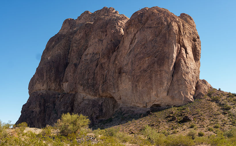
The Sinagua people would’ve considered us Snowflakes. Imagine your family living in a small cave with a plastered rock façade built on the side of Walnut Canyon. They scaled the canyon walls (without stairs) to get to work. Once on top, the men tended small patches of fertile soil along the edge. They grew drought-resistant crops because their name means Without Water. At least, the Spanish called them that when they first visited the canyon. For protein, they hunted deer, elk, and big horn sheep. After butchering the game, they stuffed the meat into Safeway plastic bags and lowered it on ropes.

Given my extreme age, my most significant anxiety would be getting up in the middle of the night for a glass of Water. As it is, I struggle to find our kitchen in the dark, much less climb down to the creek and back. Of course, their local wise man was in his thirties, and he knew when to stand up and declare, “Today is a good day to die.” Then as he tossed his blanket over his shoulder, he’d tromp out of the camp to the nearest mountaintop, where he’d sit for weeks until dying of starvation. Once again, I’ve proved that exercise is unsuitable for you.

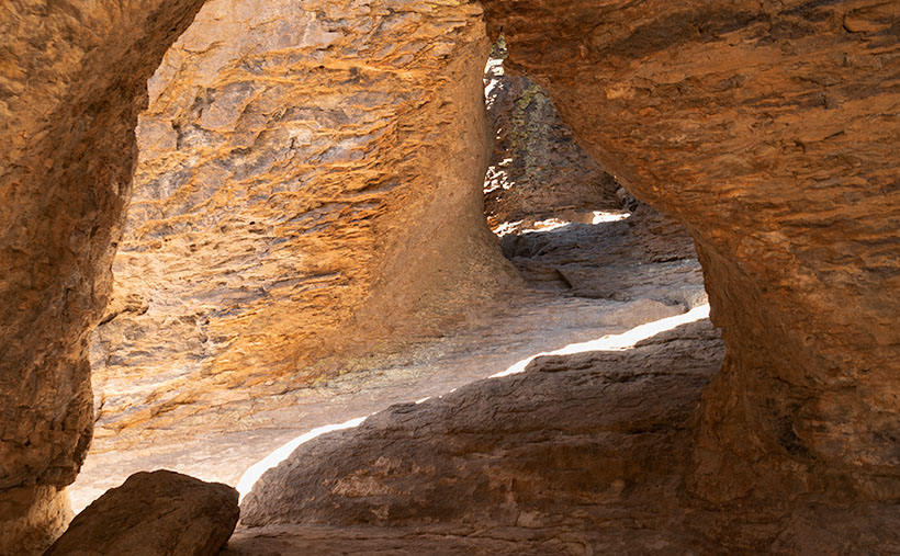
There are many disadvantages to living on a cliff-side cubby hole, but for me, it’s the TV reception. It’s lousy down there. You’d need to get cable or a satellite dish. Then you’d waste time waiting for the cable guy to show up.

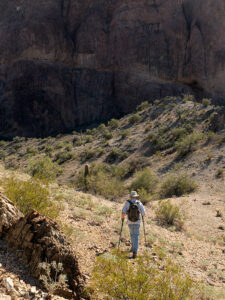
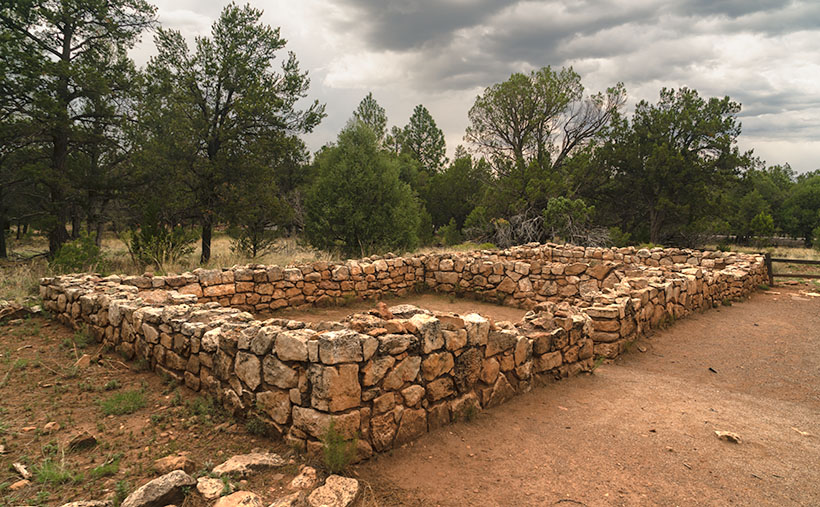
There are two trails for you to explore when you visit Walnut Canyon National Monument. Both are under a mile long. The Island Trail is a loop that drops into the canyon, past several dwellings, and then climbs back to the rim. We’ll explore it next week. The Rim Trail stays on top of the mesa and is easier to hike. It goes past some old crop fields and a couple of ruins. I took this week’s picture on the Rim Trail.

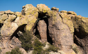
The image that I call Sinagua Pueblo shows a two-room stone building of generous size. This structure was probably a communal building for ceremonies and grain storage, like your condo’s community center. Here is where the Sinagua unloaded their trucks after a Costco run. Surely you realize that I’m joking. Flagstaff doesn’t have a Costco. Recovered artifacts show that the Sinagua traded with the villages at Eldon Mountain, Wupatki, and Homolovi—after a short train ride to Winslow.

As you quietly stand and admire the pueblo’s stonework, you can hear Sinagua ghosts laughing, smoking peyote, and chanting with the rhythm of deerskin drums late into the night—until the neighbors come by and yell, “turn down those damn drums.” More cowbell.

I hope you enjoy seeing the pueblo at Walnut Canyon. You can view the Web version of Sinagua Pueblo on its page by clicking here. Next week, we’ll explore the Island Trail and show those photos—if I can only make it up this last flight of stairs.

Till next time
jw

The Grotto Picture of the Week

Grotto Interior - From the outside, the Grotto looks like a secluded place to hide from the world.
Grotto Interior – The Grotto looks like a secluded place to hide.

Over the past couple of weeks, we’ve been hiking and photographing the Grotto Trail in the Chiricahua National Monument. I know that seems like a long time for a one-mile trail, but I’m old and quickly fall. As you’ve seen in previous photos, massive rock formations that sometimes resemble sculptures line the track. That’s another reason the hike takes me so long—I can’t pass up these shots.

As I walked through the towering erosion formations, I wondered how the grotto would look. By definition, they’re a ‘picturesque cave,’ so I wasn’t sure what I was looking for. I shouldn’t have worried because, as that old proverb goes, “You’ll know it when you see it.” That’s precisely what happened. When I first peeked through a side window, I shouted, “Eureka, I’ve found it.”

It’s a cool room with light filtering in from outside. Four pillars line the room and hold up a slab of stone that fell on top. If you aren’t my size, you can crawl up inside and take a nap or play tea-time should you happen to bring your Barbie set. Because it’s open to the sky, you wouldn’t be able to take shelter from a storm like you’d be able to do in an actual cave.

Grotto From the Trail - When I looked back at the Grotto from the trail, I could see how it was assembled.
Grotto From the Trail – I could see how it is assembled when I looked back at the Grotto from the trail.

After catching my breath for a minute, I started back to the parking area. I was only a few steps down the road when I turned around and shot this second image. It gives you a better idea of how the Grotto is assembled, and quite frankly, it doesn’t seem to be a secret room—just an interesting pile of rocks. You can see a larger version of The Grotto on its Web Page by clicking here.

Since today is the last Sunday of the month, this is the end of April’s Chiricahua project. I took many more pictures, but I couldn’t show you all of them in only four weeks. If only there were another way for you to see them. Oh wait, there is.

Wrote a book about it—wanna see it?—here it is.

Chiricahua National Monument – My new photo essay of our trip to Cochise County will be available on Amazon, but you get a free preview because you’re a subscriber.


I’ve been working on a book while talking with you to prove that I can walk and chew gum. It’s the second in my sampler photo essay series. This one is called Chiricahua National Monument, and it includes the photos I’ve shown this month, plus a couple dozen more. Chapters in the book cover the Faraway Ranch, the hiking trails, and the landscapes surrounding the park.

It isn’t listed yet, but like my last book—Snow Canyon—it will be sold exclusively on Amazon at a ridiculous price of $68.00—unless you want to order a half-dozen or more, I can get a discount for you. Otherwise, no one will pay that price. But because you’re loyal readers, I devised a way for you to read the book and see my other photos—for free. I ordered a PDF version that you can open and download using this link: Chiricahua National Monument. PDF. You’re welcome to download it, print it, and toss it in the garbage when you’re done. I hope you enjoy it.

Next week is a new month, and we’re not entirely done with Cochise County. I found some pretty things to show you outside of the park, so come back next week when we begin May’s project.

Till Next Time

jw

Tulip Rock Picture of the Week

Tulip Rock - A formation that I passed on the Grotto Trail that looks like a tulip to me.
Tulip Rock – A formation I passed on the Grotto Trail that looks like a tulip to me.

One of my loyal readers commented that she couldn’t see the rock creatures like me. If you’re like her, that’s ok. Maybe your mind isn’t wound up like mine, or you’re not on the same prescriptions. Whatever the difference is, I’m simply trying to show you the world as I see it.

This week, I have another Rorschach test for you. It’s a picture of a second remarkable formation I found while hiking the Grotto Trail. I call it Tulip Rock because I think it looks like a flower. It could be a rosebud, a daisy, or a dew-covered morning poppy. Don’t see it? As long as you don’t see the Prince of Darkness who’s come to cast humanity into eternal damnation, you’re alright. If that were the case, I’d suggest you consider a change of meds.

When I composed this image, I wanted to show a couple of things. The first is that most of the hoodoos in Chiricahua don’t look like sculptures; they’re ordinary. That uniqueness makes the formations like this and last week even more special. I found two examples (there are more) on my short hike on the Grotto Trail. Imagine the images I’d have if I had visited the Chiricahuas as a younger man.

The other thing that I wanted to show is the background. The higher peaks of this range are along the horizon, including the 9700-foot Chiricahua Peak. As you can see in this image taken in late March, they are still snow-covered. They’re part of the Coronado National Forest—sometimes called the Sky Islands. The forest isn’t contiguous—it includes several southeastern ranges separated by broad basins. I’m not aware of another forest like it in the United States. Feel free to correct me if I’m wrong.

You can see a larger version of Tulip Rock on its Web Page by clicking here. Come back next week when we finally make it to the Grotto—a four-pillar room with a rock roof.

Jeff Goggin

It’s painful to type these words. Jeff Goggin—the other half of the Ballast Brothers Racing Team—died Thursday a week ago (7 April 2022). He was the last surviving family member and lived alone in the family’s Scottsdale home. Jeff’s mother lost a long degenerative battle with Lou Gehrig’s disease. It’s still untreatable. Several years ago, he told me that he was starting to show the same symptoms. Being the insanely practical man we knew, he ended his life to spare himself further suffering while he could still make his own decisions. Jeff is survived by his estranged partner, Paula Hoff.

Jeff was a brilliant, caring, funny man who loved good music, sick jokes, fast cars, fine art, a good scotch, and pretty women. Queen Anne and I miss the jerk.

Till Next Time

jw

Courthouse Rock Picture of the Week

Courthouse Rock - The huge granite monolith that attracts climbers and base-jumpers to the Eagletail Wilderness Area.
Courthouse Rock – The massive granite monolith attracts climbers and base-jumpers to the Eagletail Wilderness Area.

When you were in school, did you learn about the Lewis and Clark expedition—the party that explored the Louisiana Purchase and discovered the first Starbucks in what’s now called Seattle? Sadly, when it comes to the outdoors, my buddy Fred and I will never rise to that level of notoriety. We’ll most likely go down in history more akin to Laurel and Hardy.

Fred and Jim's overlapping skill sets - When we get together, things don't always go as we plan.
Fred and Jim’s overlapping skill sets – Things don’t always go as we plan when we get together.

Don’t get me wrong, Fred is a brilliant man. After all, he is an engineer, and I can write complete sentences, so when apart, we can navigate the world and safely return home (to the amazement of our wives). But when we go out together, our skill sets overlap like in a Venn diagram, setting up a thinking interference pattern that causes things to go south.

To finish up this month’s project, the Eagletail Mountains, I needed a couple more photos that are close to the subject. Since it’s a wilderness area, that meant hiking. I spent time researching and found a perfect trail on AllTrails. It’s only 3 1/2  miles each way and goes to Indian Springs. There, we should see a spring and a rock wall of petroglyphs. They described the hike as “the easiest trail in the world. It’s an old mine road with little grade change. A baby can do it.”

I began calculating. I walk at 2.2 miles per hour (I measured it using my hand-held Garmin), so 2 hours in, snap a couple of shots, 2 hours out, and add four hours of drive time down and back. The outing should easily take an afternoon. I asked Fred if he would be interested (somebody needed to carry me out when I fell). He said, “Sure.”

Monday at noon, I tossed on some comfortable jeans, my whitest Tee shirt (so the rescue helicopter could spot me), and a baseball cap. I drove to Fred’s house to pick him up. He opened the front door dressed like an L.L. Bean model, with a freshly pressed ‘cool-shirt,’ safari hat, day pack, and walking sticks. He was gorgeous.

It was a beautiful day, and we spent the two-hour drive talking about the hike and sharing the maps we brought. Fred downloaded the AllTrails map onto his iPhone; I had printed the directions to the trailhead; we were ready.

Mistake #1: The easy part was getting to the Gas-Pipeline road, but we had to count the miles to the turnoff. As Fred read the instructions, I watched the odometer. When the instructions said, “At 1 ½ mile, turn onto an unmarked road,” a road appeared on the left. We turned, but the sign that they promised wasn’t there. We continued anyway and came upon a group of young men camped at its end. This place must be our spot, so we parked.

Mistake #2: The boys/men were friendly and were sitting around packing parachutes. If we were in California, I would have expected them to be waxing surfboards. They had come to Courthouse Rock to climb the monolith and then jump off with a parachute—even though the rock wasn’t in danger of crashing. They asked why we had come. They said we were on the wrong road when we told them about the trail. They said we needed to return to the pipeline road and go another mile. Fred and I looked at one another, the maps, and the app. Since the trail was just over the hill, we ignored their directions—like any person holding a man-card should.

Mistake #3: We started hiking cross-country diagonally toward the trail. “Surely, it must be over that low ridge, and we’ll see it from the top,” I told Fred. We hiked to the ridgeline and saw——another hill. We began the long trudge to its top. What we didn’t realize at the time was that we were climbing Courthouse Rock’s talus slope. The rock must have been significantly larger at one time because sharp granite chips covered the ground. They had flaked off the enormous tower, making the footing lose. Falling on them would hurt—a lot.

Fred the trailblazer - Fred hikes to another ridge to see if it's the last of our hike. It wasn't.
Fred the Trailblazer – Fred hikes to another ridge to see if it’s the last of our hike. It wasn’t.

After an hour of hiking uphills and over gullies, we reached a point where we could see the trail. It was on the other side of a deep wash. That meant we could get to it if we could cross the dry creek, but it was still a half-mile away. We only managed to cover less than a mile during the past hour. I was ready to quit but could see yet another ridge on the horizon. I hoped it was the last. Fred volunteered to continue seeing if it was our summit while I sat, drank water, and caught my breath. He confirmed that it wasn’t, so we started back when he returned.

Instead of retracing our steps, we went down into the wash, where we could walk the sandy bottom back to the Jeep in half the time. We had to explain our failure to the base-jumping dudes when we reached the camp. “Yeah, I thought you should drive to the other road,” one of them graciously taunted. Since we were in the area, we did. We found the second road with signs, parking, and an informational kiosk. At least we’ll know should we ever go back, but the two-hour drive home was nearly silent for now.

I shot this week’s picture that I call Courthouse Rock at the beginning of our hike. It’s of the enormous granite monolith from its west side. The 20-foot palo verde tree gives scale, so I’m glad the tree photo-bombed my shot.

Click here to see a larger version of Courthouse Rock on its Web Page. Next week, we’ll finish our Eagletail Mountain visit and move on to another project. Hopefully, somewhere I can drive.

Until next time — jw

Eagletail Peak  Picture of the Week

In last week’s article, I mentioned that the Eagletail Wilderness encompassed two desert mountain ranges and the Sonoran Desert basin that lies between them. The Eagletail Range was one, while the other is a chain known as Cemetery Ridge. After I gave you their name, I made an offhand remark about how they got that name. Well, I accepted that question as this week’s homework assignment, boys and girls. Here’s what I found—nothing.

Cemetery Ridge - A 16 mile-long chain of mountains that make up the southwest flank of the Eagletail Mountain Wilderness Area.
Cemetery Ridge – This is a 16 mile-long chain of mountains that make up the southwest flank of the Eagletail Mountain Wilderness Area.

Well, that’s not wholly true because, in my handy Arizona Place Names book, there is this entry:

“This sixteen-mile-long and two-mile-wide, low range was the scene of the killing of several prospectors in the 1870s, according to local stories. Their bodies are said to be buried on the ridge (sic), which is also known as Cemetery Hills.”

When I read that, I thought, “Alright, there’s an interesting historical story to tell my loyal readers.” So I, as the unofficial Marshall Trimble understudy, started a week of research that would have made Jimmy Olson proud. I wanted to find out what miners, who killed them, why, and where are they buried. I asked Alexa, Siri, Cortana, and Google’s unnamed assistant. None of them knew nothin’.

I did find out that I’m not the only person searching for those answers. Google referred me to the Desert Mountaineer blog. There I found the anonymous author had written a three-part journal covering Cemetery Ridge. The writer is a pretty good storyteller and photographer, but his passion is climbing mountains, and the photographs are incidental, kind of the opposite of what I do.

His three-part saga covers four days of driving the same roads I did, looking for graves. He travels with his dog, sleeps in his truck, and often stops to climb the mountains he passes—sometimes two or three in a day. I’m impressed! Anyway, after exploring the entire length of Cemetery Ridge, he didn’t find our legendary graves. He does mention the place where Deadman Wash crosses Cemetery Ridge on the west side. If ever there were a place to look, that would be where I’d start. It has all the intrigue of a pirate’s treasure map.

Framed between two of the Cemetery Ridge Mountains, Eagletail Peak's feathers lit by the sunrise.
Framed between two of the Cemetery Ridge Mountains, Eagletail Peak’s feathers lit by the sunrise.

I shot this week’s image along the Arlington-Clanton Well Road on the south side of Cemetery Ridge. The Ridge’s mountains (like hills really) appear and disappear in a straight line for 16 miles. At one of those places where they slip below the surface like a giant sea-serpent, I saw Eagletail Peak framed and lit by the sunrise. You can make out the ‘tail feathers’ sticking up at the top in the picture. I want to explain that the Eagletail Wilderness is directly under the Los Angeles-Phoenix flyway, so contrails are part of the natural landscape, but they won’t let me fly my drone there.

You can see a larger version of Eagletail Peak on its Web Page by clicking here. Next week we go hunting for more treasure in the Eagletail Range. Come back then and see if we were successful.

Until next time — jw