Top of the World Highway – Yukon

We left Dawson City via the Yukon Ferry. It runs 24 hours and is free, so how could we go wrong? If there are caravans on the road, it could take hours for all of them to cross, but we were fortunate that none were in town. The ride takes less than a half hour, but driving on and off the boat is tricky. There isn’t a permanent dock, so the ramps just let down on the dirt road and there’s a gap that can cause damage to the vehicles. Fred had to re-position his cargo box, Sally got some trim damage and our front trailer foot was slightly bent when we drove off the ferry.

Dawson Ferry
The ferry links Dawson with the Top of the World Highway; and their golf course evidently.

We took some time to fix things and then started up the Top of the World Highway. That’s the name for the road from Dawson to Chicken, Alaska. It got its moniker from the how the trail follows along the three thousand foot mountain ridges.

Dawson City from the Top of the World
In only a couple of miles, we were high in the mountains and got a last look back at Dawson City.
Top of the World View
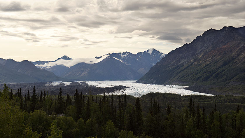
The views from the Top of the World Highway are spectacular on a clear day.

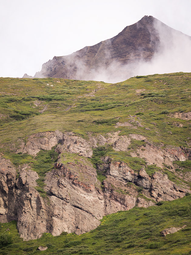
The road climbs steeply from the Yukon bank, past the golf course, and in our case, into the clouds. The views from the road I’m sure are both spectacular and scary at the same time. For us, it was raining, so we drove in and out of the clouds. Every once in a while, the clouds would lift revealing how steeply the mountains dropped into the valleys below us.

Another Highway View
As we drove along the road, we would drive in and out of the clouds.

Other people warned us that the road was not the best, but we decided to press on regardless. The rain made the gravel base even worse, filling the pot holes and washboard ruts with mud. We drove like it was a slalom course, trying to find a smoother section.

The Gang at the Border Crossing
This time it was the US Customs agent that volunteered to take our photo when we crossed into Alaska.

It was slow going, taking almost four hours to make the eighty mile journey to the border. After clearing customs, we started down the US side on brand new, shiny black pavement. It had bright yellow center lines with white lines down the edges. Our walkie-talkies were full of chatter about how much we loved this road, when about five miles later, it turned into . . . mud. Not gravel, just a plain old sloppy muddy road . . . with worse washboards and more pot holes.

Fritz Leaves Skid Marks
By the time we reached Chicken, the vehicles were caked in mud.

When we pulled into Chicken after another twenty miles, we got out of our vehicles and assessed the mess. The Ritz had two caked on mud stripes down the front that looked like skid marks. I had no idea how I was going to scrape that mess off, but by then, we just wanted to get in out of the rain and get something to eat.

jw

Dawson Creek – British Columbia

We’ve been on the road seventeen days with 2600 miles on the odometer when we arrived at Dawson Creek yesterday (Friday; it’s scotch night). Dawson Creek is an important stop on our trip.

  • It’s our first stop in British Columbia.
  • The weather is warmer than we’ve had the last few days.
  • This completes the first section of Fred’s itinerary.

The most important reason though, is that Dawson Creek is where we pick up the famous Alaska Highway. As Fred said this afternoon, “We’ve come all this way just to get to the start.”  If you want to drive to Alaska, this is the road that will get you there. Fairbanks is at the other end of this road, only 1500 miles away.

Gang under ALCAN Highway sign,
Fred, Sally, Deb, Anne and Jim take a moment to pose for photos under the highway banner.

The Army Corps of Engineers built the road in 1942 in eight months for military purposes during the second world war. The public didn’t have access to the road until 1948 and it wasn’t paved until the Alaska pipeline was built. Now the road’s covered with RVs. There’s a thriving cottage industry shepherding caravans of RVs on the same route that we’re taking.

Class A motoromes from a guided caravan.
A small part of a RV Caravan sharing the same campsite with us. Our paths cross often as we move from park to park.

A couple of days ago, I was afraid that we wouldn’t get into Dawson Creek. Last week they had torrential rains that dumped over four inches of rain in the area. The creek that runs through the middle of town (surprise, it’s also called Dawson Creek) cut the town in half by washing out the main road. Within three days, crews patched the roads enough to get traffic flowing again.

Damage on the Dawson Creek Broidge.
Only a couple of days before we arrived in Dawson Creek, over four inches of rain caused flooding on Dawson Creek and closed the major road through town.

We’ve now cleared the Canadian Rockies and the countryside is flatter, with farms and lots of timber. The towns are further apart, but they have all the franchises you’d expect at home. We even passed a Costco yesterday in Grand Prairie, which is something that we rarely do.

The geography of our route has changed from mountains to prairie as we pick up the ALCAN Highway.

Tomorrow morning we strike out for Fort Nelson. A leg that’s close to three hundred miles or 450km. Although the road is famous, it gets bad reviews for its condition. We’ll batten down the hatches and suffer through it, because now we’ve made a turn and are on our way to Alaska.

jw

Hinton – Alberta

At the end of each day, we normally relax around the campfire to unwind, review the day’s adventures and plan tomorrow’s events. So, what happens when the Alberta winds drive you inside? Simple . . . we gather five people into a trailer meant for two and have a happy hour. A candle is the token campfire.

The gang discusses pans durning happy hour.
Sally, Fred, Jim and Deb (Anne’s behind the camera) convene around the candle campfire to review tomorrow’s plans.

jw

Waterton Lakes NP, Alberta

I wanted to get off a short note this morning before we get on the road to Banff and show a couple of shots of yesterday’s park visit.

Waterton Lake and Rockies
From the Prince of Wales Hotel lawn, this is the view you enjoy of Waterton Lake and Canadian Rockies.

If you’ve never heard of the Alberta winds, here is your notice. The wind blows here most of the time. And I’m not talking puffy little breezes. The winds come down off of the mountains and on to the prairie and they really batter you. The last two nights in the Ritz felt like sleeping in a Lowe’s paint shaker. I’d compare them to our summer monsoons, but they last all day and night.

Lake Waterton and Mountains
This is the scenic view looking east from the Prince of Whales Hotel.

It’s time to start packing now, so I’ll close. As I said, we don’t expect WiFi for a couple of days, but I’ll post news if I’m wrong. On to Banff and Lake Louise.

jw

Butte Montana

There’s a pattern developing with our campsites. After driving a couple hundred miles each day, we pull into an RV park to get an evening’s rest. We’ve planned these stops and reserved our spaces before we left. RV Parks have become the motels of our generation. Each of the parks that we’ve stayed at have amenities that make life on the road more pleasant. One of those things is a WiFi connection that makes it possible to communicate with you while on the road.

Of the four places we’ve stayed in, three were really accessible from the highway, while last night’s was . . . well, out-of-the-way. It was in Thornton, Idaho. I know! Where the heck is that? It’s a wide spot in the road north of Idaho Falls and it was a detour from Interstate 15.

The pattern I’m referring to is this. The more convenient a park is to the highway, the more the highway conveniently runs through your bedroom. So far we’ve had semi trucks, trains, freeway noise and industrial sites as our ambient background noise throughout the evening. We dismissed it as part of being on the road, until last night.

Thornton Mercantile
The abandoned Thornton Mercantile and Cafe sits empty along the east side of the street.

When we pulled up to the park in Thornton, we all thought we’d made a big mistake. This wasn’t a big city or quaint little town. It was a spot on a side road with a couple of abandoned grain elevators, a row of closed businesses on the east side of the road and a potato shipping plant across the street. We could easily see the railroad tracks running along the road. It was the train blaring that got us up early in Provo and we thought here we go again. With some apprehension, we turned into the driveway of the Thompson RV Park.

Potato Packing Plant
Potato shipping plants on Thornton’ s west side

When we parked inside of the gate and went to the office to register, we were surprised to find a lovely park with gardens, fish pond, mature trees and lots of space to spread out. After setting up, we had a chance to wander the gardens where Linda Thompson joined us and pointed out all the flower variety growing. “You should have been here when the tulips were growing.” We could imagine what we missed because everything else was still in bloom.

She proudly pointed to a willow tree that she had planted nearly 50 years ago. “It was a twig in one of my mother’s funeral arrangements and when the flowers faded, I stuck it in the ground. I call it the Mom tree.” The house was over a hundred years old and they’ve run the park for about half that time. She explained that she and her husband want to retire and sell the place. They want to move to someplace warmer.

Thompson Gardens
The gardens at the Thompson RV Park have been lovingly cared for by the owners for fifty years.

How was our stay? Dead quiet except for the occasional peacock call in the distance. We could hear that because it was remarkably quiet otherwise. We even talked in hushed tones around our gathering. It will be a shame when the Thompson’s leave. I can’t imagine Corporate America giving the love and care to keep the place the same.

jw

Kanab Utah

It took longer than planned, but we made it to Kanab Utah, our toughest leg of our trip. I think we misjudged the time it would take to go through Prescott. A lot of traffic and a lot of twisty roads. We left Congress a little after seven in the morning and arrived at our camping site just before 5 PM. Since Kanab is on daylight savings time, we lost an hour and the trip took ten hours averaging 45 miles an hour. That’s including potty breaks, emergency stops, and lunch.

The girls stretch their legs
Deb, Sally and Anne stretch their legs in the shade of Sally’s RV.

We only made it to the top of Yarnell hill when Sally called on the walkie-talkie that one of her tire pressures was over 100 pounds. We pulled to the side of the road and sure enough, it was. After letting enough air out to match the others, we were back on the road.

Mickie D’s hosted lunch in Flagstaff. After taking four hours to get there, we were ready for the break. After that we made really good time as the roads and weather were good.

Picture of Kanab's main street.
Located on the southern border of Utah, Kanab hosts tourists visiting the Grand Canyon, Bryce, and Zion National Parks.

Kanab is a little tourist town in southern Utah. It’s only six miles across the border from Arizona situated between the Grand Canyon, Bryce and Zion. It’s loaded with tourists and has a couple of nice restaurants. It’s most striking feature is that it is nestled under the Vermilion Cliffs and the brilliant colors they have at the end of the day.

Tomorrow we strike out for Provo. It will be a better day as the distance isn’t as great and there aren’t as many long pulls we have to climb. And to think, we only have 89 more days like this.

jw

And so the adventure begins. The Alaska Journey

The gang poses for a portrait.
The gang takes a pack break to pose in front of the caravan. From left to right: Anne, Jim, Sally, Fred holding Gus and Deb.

Hold on to your hats, folks, because after a year of planning and packing, our road trip to Alaska and back to Arizona is finally kicking off tomorrow morning. We’ll be hitting the road from Congress, driving through Prescott, Verde Valley, and Flagstaff, and then spending the night in Kanab, Utah. I don’t know about you, but I won’t feel like I’m out of town until we’re on the other side of the San Francisco Peaks.

We’ve spent the last month getting our vehicles ready, but there’s always something else to pack. This morning, we had to make an emergency run to get longer chains because, of course, the hitch needed replacing. The pile of stuff in the dining room is smaller now, but I can’t shake this feeling that we’ve forgotten something… something important. But hey, at some point, you just have to get in the car and go. We’ll figure out what we forgot when it’s too late to turn back.

Our route will generally follow the I-15 corridor until we get to Montana, then we’ll cross the Continental Divide and head into Canada on the east side of the Rockies. From there, we’ll drive through the Canadian Rockies up to the Yukon Territory, and eventually reach Fairbanks.

We’ll make a loop through Alaska, hitting up Fairbanks, Denali, Anchorage, and the Kenai Peninsula before making our way back to Tok. And then, we’ll finally start the journey home. We plan to take a more scenic route on the way back, traveling along or near the coast until mid-California. But let’s not get too ahead of ourselves – who knows what kind of trouble we’ll run into along the way.

I’ll be posting updates from our journey, but it would take something pretty catastrophic to stop me from doing so (knock on wood). But hey, if something does happen, at least it’ll make for a good story, right? See you on the road!

jw