Skull Rock Picture of the Week

It’s the beginning of May, and right on cue, we reached temperatures in the triple digits. The heat immediately sparked an exodus of winter visitors out of our park. Even some of our full-time residents have already left for summer retreats. Queen Anne and I have been abandoned by our friends to deal alone with the pair of terrorists nesting in the trellis outside our bedroom window.

Since we moved into our Congress home, we’ve had all kinds of birds nest in our vines outside. We’ve had quail, dove, hummingbirds, verdin, and the usual assortment of sparrows—the low-life of the bird world. They’ve always been quiet and discrete and never called attention to themselves. This pair is an alumnus of the Delta Tau Chi.

In spring, we love sleeping with open windows. The fragrant fresh breezes keep the house cool, and there’s the occasional coyote howl, hooting owl, or the sound of a nighthawk we enjoy. As the sun begins to show light in the eastern sky each morning—the mornings are getting pretty early these days—Frank and Margaret celebrate surviving another night by perching on the trellis top and begin a sparrow’s equivalent of “Ode to Joy.”

Have you ever really listened to a sparrow’s song? It’s a flat, monotonous “chirp – chirp – chirp.” If left unattended, it can go on for hours. The Queen—who has disdain for anyone having pleasure—soon yells, “Off with their heads.” My obedience is blind, so I stumble out of bed, walk over to the window, throw back the sash, and scare the birds away with my ugly pre-coffee face. That chases them off, but it’s only a while before they’re back and at it again. Sing – scare – repeat.

When the sun does come up, their second act begins. With the new light, they see their reflections in the glass, and like the emu commercial on TV, they start defending their nest. They fly against the window, pecking at the reflection. They fly back and forth along the window top, fighting their perceived intruder. It’s a wonder that my window isn’t perforated. It doesn’t stop until I get up, walk over, pull down the blind, and show my face.

It’s gone too far, so I concocted an evil plan to get even. I went to Goodwill today and purchased an old-timey alarm clock—a bright yellow one. You know—the kind with two bells on top that dances around the end table until you smash it with a hammer. I set the timer for 2 am and hid it in the vines near their nest. I can’t wait for tomorrow when Frank makes a sparrow’s impression of Don Knotts. Meanwhile, I found an old English recipe for Sparrow Soup if it doesn’t work.

Skull Rock - People in Yavapai County love to paint rocks resembling objects to make it more obvious to other people.
Skull Rock – People in Yavapai County love to paint rocks resembling objects to make them more evident to other people.

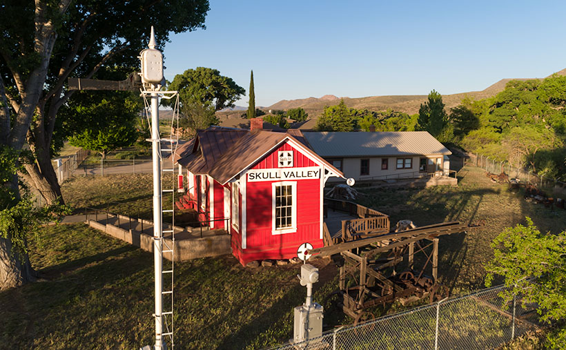
This week’s featured image is called Skull Rock. The people in Yavapai County have a thing about painting rocks that resemble things because people would never figure it out on their own. Unlike our frog, you have to search for the skull. It’s halfway up the Hillside dirt road. It’s hidden behind the elevated railroad tracks, so you have to do a bit of climbing to get a shot of it. One story I read said a Santa Fe engineer originally painted it to tell passengers that the Apaches killed a poacher and left his skull behind to warn others. Then he’d laugh when they reacted as the train rounded the bend and the rock came into view. I can’t vouch for the story’s validity, but it sounds reasonable. You can see a larger version on its Web Page by clicking here.

Until next time — jw

Harcuvar Forest Picture of the Week

Our little town is not so different from yours. We have crime here too. That’s why the county sends a couple of deputies down from Prescott to patrol our streets and keep us safe. Most of the time, they drive around the empty streets, but there are moments where a rush of adrenalin flows through their veins—like last Friday night.

As most cops do, deputies Starsky and Hutch parked their cruisers on the dead-end street between the Dollar Store and the Quickie-Mart in such a way that they could drink coffee, chat across their door windows while keeping an eye on the only traffic control sign in southern Yavapai County. The night had been rainy but peaceful up till then.

Shortly after Congress’s only cowboy gay-bar closed, a pair of suspicious cars rolled up to the stop sign before turning south on Highway 89. Starsky noticed that a woman with long blond hair was driving the lead exotic Italian sports car (Around these parts, a Fiat 500 stretch limo is considered exotic) in the din of the sodium-vapor street lights. “I have to check this out,” Starsky yelled out his window, stowed the coffee in a cup-holder, put his cruiser in gear, and drove off in chase.

As he perused the little import through downtown Congress, he crossed over the double yellow lines, raced around the second vehicle before cutting in front of it. Then he lit up his lights and pulled the Fiat over. As he called in the plates for wants-and-warrants, he noticed that the sinister black Buick had pulled in behind. Sensing a threat, he radioed Hutch for back up. When he finally saw the second set of emergency lights in his mirror, he felt that he could safely get out of his cruiser.

Hutch had already climbed out of his truck behind him with a Maglite in his left hand while resting his right hand on his holster. He walked up to the second suspect’s vehicle and heard the last remaining Jennifer Rush Disco CD blaring through the stereo. The woman behind the wheel sat motionless with her hands in the air. “Mam, can you tell me why you pulled off the road behind my partner?” (OK, to protect the innocent, I have to change some names. Donna is the floozy driving the Fiat because Donnas always drive convertible sports cars. The gangsta-girl in the second car I’ll call Princess Margaret. Yeah, that works. No one will ever guess their real names.)

“That’s my friend, Donna,” Margaret replies. “I just want to make sure she gets home alright.”

“Well, this is a dangerous place to park. You’ll be safer if you pull in front of the other vehicles.”

With that, Margaret put her hands down, put on the left blinker to signal the empty highway that she was pulling out. Slowly she drove around the other cars, signaled that she was pulling back off the road, she put the car into park, and—once again—raised her hands over her head.

As Starsky strutted toward the hottie in the little white Italian Job, he practiced his best, “So, how you doin?” But when he got to her open window, the flashlight glare revealed far more lines of wisdom on her face than he expected, and her long tresses weren’t blond; they were pewter. His training and quick thinking let him instantly change tact. Instead, he asked, “Do you know why I pulled you over?”

“No, I don’t.”

“You didn’t come to a complete stop at the sign on 71.”

“Yes. I believe that I did.”

“That’s OK; I’m going to let you off with a warning,” which is what cops do when they can’t prove something in court. It also leaves a paper trail that shows they were working.

Donna—the consummate socialite—tried to get on the deputy’s good side, “I understand. My first husband was a Highway Patrol Officer.”

“When was that,” Starsky asked.

“During the late sixties and seventies,” she replied.

“That was long before I was born,” he gasped.

After Starsky filled out the form, he handed it to Donna and watched her drive off. Margaret finally put her hands down and followed into the darkness. As he walked back to his Tahoe, it finally sunk in that he almost hit on his grandma; he doubled over and blew donut chunks onto the front tire. From the other cruiser, he could hear Hutch’s giggling float across the damp night air.

Harcuvar Forest - A large grove of Saguaro grow along the eastern flank of the Harcuvar Mountain Range.
Harcuvar Forest – A large grove of Saguaro grows along the eastern flank of the Harcuvar Mountain Range.

You may be wondering what this story has to do with this week’s picture. Well, actually, nothing other than our town’s stop sign is on Highway 71, and at the other end of that road—near Aguila—is where Santa rests, and there is a large grove of saguaros growing along the eastern flank of the Harcuvar Mountains. That’s where I took this week’s picture, which I call Harcuvar Forest. When I drove home from that shooting, I stopped at that very intersection—without getting arrested. I guess that I’m not cute enough.

You can see a larger version of Harcuvar Forest on its Web Page by clicking here. Next week, I’ll bring you another image from around our house.

Until next time — jw

Kirkland Peak Picture of the Week

Our home in Congress is on a scenic byway. Each weekend, there are lines of exotic sports cars and motorcycles that pass by our trailer park to prove it. There are several roads— like AZ 89—in our state that offer motorsports enthusiasts a venue to stretch the legs of their beloved machines. I’m sure that the other states have roads like ours. I’m surprised that someone hasn’t compiled an encyclopedia of “The World’s Great Weekend Roadtrips.”

The route passing our home is known as the back road to Prescott because it avoids the weekend traffic on Interstate 17. It’s a longer drive, but that’s not the point. I think this passion is best described in Queen’s song; I’m in love with my car. “. . . get a grip on my boy-racer roll bar . . .” (Yes Virginia, Queen recorded songs other than Bohemian Rhapsody). It’s customary to play this anthem at full volume with the top down and the sun flickering through the pines on to your Ray-Bans.

There are actually two ways to get to Prescott from here. The first is to stay on ’89 and drive between the Sierra Prieta and Bradshaw Mountains. The motor-heads like this way because they get to test those big Brembo brakes on their Lamborghinis. This way is challenging to keep up with the speed limit, your up in the pines quicker, and the road dumps you onto Whisky Row, where everyone parks around the courthouse for an impromptu car show.

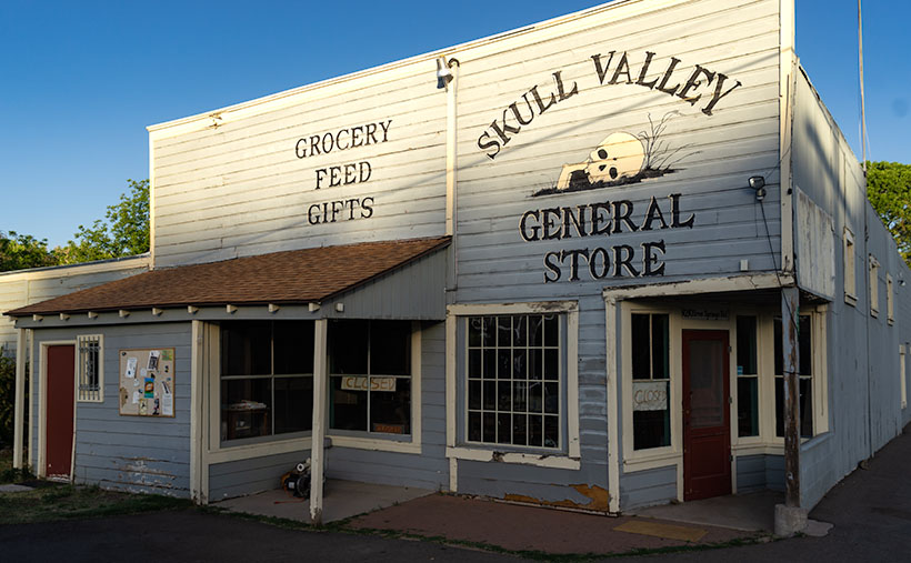
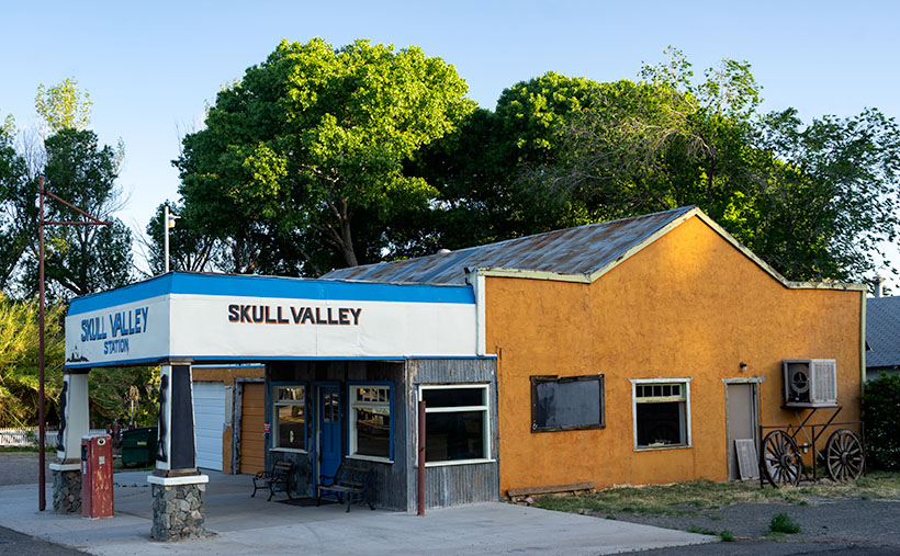
The second option is better if you’re towing a trailer, hauling a load of eggs from Costco, or you’re trying to keep Queen Anne from throwing up in your lap. To go this way, you turn off at Kirkland Junction and pick up Yavapai County Route 10—Iron Springs Road. This route is more docile, as you travel through Kirkland, Skull Valley, and Iron Springs, although it’s a bit trickier to find your way downtown once you get to Prescott.

Kirkland Peak - The run-off from the granite covered mountain has cut into a layer of limestone deposited on an old lake or sea bed.
Kirkland Peak – The run-off from the granite covered mountain has cut into a limestone layer deposited on an old lake or sea bed.

It’s on this second route that you’ll see the subject of this week’s featured image—Kirkland Peak. It will be the rocky mountain filling your windshield at the Kirkland stop sign. There’s even a better view if you drive straight and cross the tracks. But right now, we’re going to turn right onto Iron Springs Road toward Prescott because there’s something else I want you to see.

Soon after leaving the junction, CR 10 follows the railroad tracks and Skull Valley Wash filled with cottonwood trees. In this section—between Kirkland and Skull Valley—there is a cluster of limestone hoodoos where the granite top layer has been eroded. I’ve tried to photograph the outcrops on several occasions, but telephone lines and private property frustrated me. When I visited last week, a new mine has begun setting up operations, and they’ve scraped the land clean. There are two new five-story silos built beside the road, and I’m afraid that the remaining hoodoos will be gone shortly.

When I drove up to shoot Kirkland Peak this week, I was pleased to find a place where the mountain’s run-off has exposed more limestone, as seen in this week’s picture called Kirkland Peak. There are eons of geology exposed in this photo. The bottom layer is an ancient lake or sea bed, covered by granite (lava cooled slowly), and a mountain thrust above them. The evidence of up-thrust is in the grain of its rocks along the ridgeline (you can’t see that on your phone). As Kelly Bundy said, “The mind wobbles.”

You can see a larger version of Kirkland Peak on its Web Page by clicking here. Next week, I’ll bring you another image from our corner of the world.

Until next time — jw

Date Creek Clearing Picture of the Week

Sometimes you get lucky. As a photographer, I keep scenes in my head, so I can go back when the light is right when I want to capture them. That’s what happened for last week’s image, Resting Santa. We had a series of dry fronts move through Congress during the month, but the weather forecasts called for an afternoon where the sky would be clear so the evening sun would pleasantly light up the Harcuvars. I left the house at 3:30 and purposely drove out to get that shot. It was practically a product shot.

More often, I pass by beautiful once in a lifetime scenes that will never be replicated, and I chastise myself for not having a camera with me—or worse—not taking the time to stop. That’s almost what happened with this week’s featured image.

Date Creek Clearing - A clearing winter storm hangs over the Date Creek Range in the evening sun.
Date Creek Clearing – A clearing winter storm hangs over the Date Creek Range in the evening sun.

After I was finished shooting Resting Santa, I drove home on State Route 71. I was looking forward to getting back to a warm home, a nice glass of wine, and one of Queen Anne’s famous home-cooked Stouffer’s dinners. The sun was low on the horizon, and outside my window, a golden cloud hung over the Date Creek range. The conversation in my head went something like this.

“Oh my, that’s gorgeous. I should really come back with the camera sometime when the light is like this.”

“You idiot! Your camera is on the passenger seat, and the light is like this right now. Stop the truck, walk across the road, and take the picture.”

I was very convincing, so I did stop and take a shot—several of them to be exact. The version that I like most is called Date Creek Clearing. There are two prominent peaks in the Date Creek Range; both of them are unnamed. On the left is the rocky pinnacle that ate my first drone, so I call it Drone Eater Mountain. On the right side is the Range’s high point. They are only bit-players in this photo. The real stars here are the clouds caught in a moment that can never be duplicated. Those storm leftovers can never be the same.

I know that my work is considered trivial and will never warrant a Pulitzer Prize or other great awards. I shoot mostly meaningless pretty pictures, valued at a dime-a-dozen. But on a week such as the one we’ve experienced, I needed a bit of calmness and serenity. If you feel the same, then this is my gift to you.

You can see a larger version of Date Creek Clearing on its Web Page by clicking here. Next week, I’ll bring you another image from our small corner of the world. Stay safe.

Until next time — jw

White Barn Picture of the Week

I’ve been left home alone for almost a week now. Queen Anne had to fly halfway across the country to drag her friend back to the proper side of the Continental Divide. I keep telling you folks that nothing good ever happens on the other side of those mountains. She’s my editor, so if you find grammatical errors in this issue, you can blame her. Before she left, I told her that if she weren’t here, she wouldn’t get any press, so I’m not going even to mention her this week. It’s funny how you don’t understand how much you rely on someone until they’re gone. I miss her a lot—the sink is full of dishes, and I’m out of socks.

Smoky Sky - During the past few weeks, we've had atmospheric effects from the California fires. That smoke has drifted over our state and turned the sky white and given us red sunrises and sunsets.
Smoky Sky – During the past few weeks, we’ve had atmospheric effects from the California fires. That smoke has drifted over our state and turned the sky white and given us red sunrises and sunsets.

Another off-topic thing that I want to mention is how much the California fire smoke is making photography challenging. There’s a strange color cast, and it looks like it’s cloudy. The other morning, while I was riding my bike at sunrise, the sun was deep orange as it cleared the horizon. I grabbed my camera when I got home and tried to get that color on film. By the time I set up, the sun’s deep color had faded. You can see in this shot that the sun is exposed correctly, yet so are the houses. On a regular morning, that range of exposure would be more than my camera can record so that the buildings would be black from underexposure. You can’t escape the haze either. I was in Ajo this week, and the atmosphere was hazy there too.

Now, where were we—oh right, driving General Crook’s trail. In last week’s episode, we stopped at 13 Mile Butte, which is about halfway up the grade out of the Verde River Valley. The climb isn’t as bad as some other routes to the rim, and if I intend to head east on Interstate 40, I usually go this way to get to Winslow. It cuts off a couple of miles, the grade is better than going to Flagstaff, and there’s less traffic. Once you’re on top of the rim, the road runs straight and flat.

White Barn - On a ranch near the edge of the Mogollon Rim, they are building a new barn. Still in its white Tyvek wrapping, it stood out like a jewel on the prairie.
White Barn – On a ranch near the edge of the Mogollon Rim, they are building a new barn. Still, in its white Tyvek wrapping, it stood out like a jewel on the prairie.

I took this week’s featured image shortly after we reached the plateau. On the south side, I spotted a ranch with a building under construction—maybe a barn. I don’t think it’s supposed to end up white. It was wrapped in the Tyvek moisture barrier and didn’t have siding yet. But, it gleamed in the sun well enough for me to stop the truck for a photo. It gives scale to the scene. I also liked how you can see the edge of the Mogollon Rim behind the building as it undulates across Arizona. I called this photo White Barn.

In The Pines - Once the General Crook Trail reaches the elevation of 7,000', it is surrounded by our countries largest contiguous Ponderosa Pine forest.
In The Pines – Once the General Crook Trail reaches the elevation of 7,000′, it is surrounded by our countries largest contiguous Ponderosa Pine forest.

Since we don’t have a fifth Sunday this month, I’m including an extra photo, at no additional charge. I took this shot the road after Crook’s Trail enters the pine forest. When easterners think of Arizona, this is not the image that comes to mind. They believe we are one big desert with a great big ditch in the middle. But, this Ponderosa Pine forest is the largest contiguous stand in the country. It stretches across the state and into New Mexico. The plateau ranges from 7,000 to 9,000 feet, with a couple of 12,000 peaks on it. In summers, smart (or rich) Phoenicians either escape to San Diego or they have summer cabins up here. You can see why.

You can see a larger version of White Barn on its Web Page by clicking here. Next week we’ll begin a new journey somewhere in Arizona, so y’all come back and join us, ya hear? (Gawd, now I’m talking like the queen.)

Until next time — jw

13 Mile Rock Picture of the Week

Just thinking about road construction gives me a headache. I’ve had too many bad experiences traveling across the country. Don’t get me wrong; I know that roads need maintenance. Besides, I love driving on fresh pavement. It’s just that I’ve frequently gone across Arizona, New Mexico, and Texas in construction zones 10 or 20 miles long without any working crews. Inevitably, I’m stuck behind a Walter Mitty who’s afraid to drive over 25 when there are orange pylons on the road, and a close-up view of a Peterbilt 379 grill looming in my rearview mirror.

So, it’s hard for me to imagine a crew building a road—or in the case of General Crook, a trail—through pristine wilderness. It took them two summers to complete. During the first year, C.E. Cooley, Henry Dodd, and some troops from Fort Apache laid out the route to Fort Whipple. As a side note, this was the legendary trip where an Arizona town got its name. While camping in a White Mountain meadow, the men played a game of cards (I guess they couldn’t pick up a Wi-Fi connection for their iPhones), with the loser having to clean the evening’s dishes. The camp is now the town of Show Low, Arizona.

The second summer, a cadre of troops protected a construction team as they spent several months building a road wide enough to get wagons through. Imagine having to move rocks, clear downed logs, and building grades without a bulldozer. And even with all that hard work, their Yelp reviews sucked.

With each mile of progress complete, the construction crew left a marker, either carved into a tree or stone. Some of those markers are still there. The easiest to find is Mile 13 because the State has installed a historic plaque and turn-out on the south side. At mile 13, the road begins its ascent from the Verde Valley up the Mogollon Rim. It is east of the Fossil Creek road beside a large butte called 13 Mile Rock Butte.

13 Mile - From 13 Mile Rock Butte looking back down at the Verde River Valley, you can see all of the way to the Black Hills, which are on the far side of the river.
13 Mile – From 13 Mile Rock Butte, looking back down into the Verde River Valley, you can see all of the ways to the Black Hills, which are on the far side of the river.

This spot is where we stopped to take this week’s featured image. And I have to say that the view from there is pretty good. From above the Sycamore Canyon Ravine (5,000 ft elevation), you can see back down into the Verde River Valley. In the middle distance is about where the Fossil Creek Recreation Area is. Along the distant horizon is the Black Hills, which marks the Verde Valley’s south wall. Behind the knoll in the frame’s center, the Verde River turns south and becomes a designated Wild River from there until it empties into Horseshoe Lake near Carefree.

You can see a larger version of 13 Mile on its Web Page by clicking here. Be sure to come back next week and see where we stopped after reaching the top of the Rim.

Until next time — jw

Verde Limestone Picture of the Week

For centuries the Verde River Valley has been a peaceful home for many peoples. It makes sense because the Verde River flows year-round, even in times of drought—as we have now. The green waters of the Verde—Spanish for green—flow between the Black Hills (Mingus Mountain) on its south-west flank and the Mogollon Rim to the north-east. The river runs from Chino Valley to Fountain Hills—170 miles. It collects the runoff water from the rim via its tributaries like Sycamore Creek, Oak Creek, Beaver Creek, and West Clear Creek. Although the river bottom is a dense cottonwood forest, its flood plains are perfect for growing corn and squash.

There are many sites of early inhabitants along its length, but the best known is the pueblo of Tuzigoot—built by the Sinagua people in the 10th century. They only lived there for a couple of centuries before moving on. The next settlers to arrive were Apaches—Canadian migrants that were chased off the plains by the Sioux. The various bands of Apache established homes along the transition zones across Arizona and New Mexico. They weren’t aware that their new landlords were the Spanish, who were mostly interested in saving their souls and stealing their gold. For the next 300 years, life in the Verde River Valley was peaceful.

Then one day, in 1821, there was a knock on the door—er, teepee flap. It was a government man. He was there to inform one and all that they were Mexican citizens now and, by the way, do you have money to chip in for our new country?

After that, things began to happen fast, and life seemed to go downhill quickly. A mere 30 years went by when another man rode up on a horse, shook a bunch of hands, handed out flyers, and declared, “Welcome to America.” The very next year, Californians discovered gold, and easterners clogged up the trails rushing to get to it. Some got rich, but most of them didn’t get to the Golden State in time, so they made their way back and decided that our valley would be an excellent spot for a farm. There was a civil war going on back home anyway, so they moved into the neighborhood. The Apache’s homeland began to shrink.

In 1864, the Americans stuck a flag in the ground and called it Fort Whipple—the Arizona Territorial capital. The next year they moved the flag from Chino Valley to a mining camp on Granite Creek. The Army stationed cavalry troops to protect the miners, and that later became the town of Prescott.

Life was tense, but there was an uneasy truce between the tribes and the new settlers until those mangy miners started working the Verde Valley. They picked at the rocks, piled dirt everywhere, muddied the water, ate all the food, and drank all the whiskey. It was the straw that broke the Gila monster’s back, and the Apache tribes declared war—Yavapai War (1871-1875). That’s the precursor of General George Crook’s assignment to Fort Whipple and his trail to Fort Apache that we began exploring last week.

Verde Limestone - A limestone ledge in the Verde River Valley in the lovely light of the evening sun.
Verde Limestone – A limestone ledge in the Verde River Valley shines in the lovely light of the evening sun.

This week, we traveled east along the Verde River for a few miles and stopped near Dry Beaver Creek to photograph a limestone formation. They’re found throughout the valley and are most evident on the river’s north side. As you travel Interstate 17 towards Flagstaff, it’s the white layer between the Verde River and Sedona. Limestone forms in shallow seas from dead shells and bones. It’s a great place to look for fossils, and coincidently one of our planned stops was to be Fossil Creek, but it was closed due to COVID 19.

This week’s featured image—called Verde Limestone—shows a ledge exposed by years of erosion. For balance, I included the lower mound of the same compound shining in the lovely evening sunlight.

You can see a larger version of Verde Limestone on its Web Page by clicking here. Be sure to come back next week as we climb out of the Verde Valley and see what we found along the General Crook Trail.

Until next time — jw