Christmas, along with the rest of the solstice holidays, is almost over. I hope that Santa brought you something better than the lump of coal I got. Queen Anne is on the couch in her bathrobe and tiara with a box of Kleenex. She’ll be useless until Amazon Prime stops showing Christmas movies. Since we won’t be back before then, we’d like to wish you the best New Year in 2022. Things have got to turn around eventually, so let’s give it a go one more time.
Today, I will finish up the year, and our visit to Snow Canyon State Park by talking about the other rock found there—basalt from recent lava flows. If wind, water, and ice sculpt sandstone, the cooled magma is geology’s Etch-a-Sketch reset button. The black rock covers the softer sandstone and forces water to change course. The runoff carves different canyons, like in the park.
As you explore the park’s north side, you’ll see basalt-covered cliffs. They used to be the canyon floor, but 27,000 years ago, the lava forced the drainage west and carved a new floor—now a couple of hundred feet lower. Snow Canyon has a couple of trails that wander through the jagged black rocks; the Lava Tube and the Cinder Cone trails. The latter is interesting because you can hike to the cone’s rim and look into the extinct caldera. However, the track is uphill, and on the east side of State Route 18, so we skipped it.
The Lava Tube Trail is shorter, level, and leads to two lava tubes—which are places where the hardened surface fractures releasing the still molten magma inside to flow away. The remaining caves are sometimes big enough that you can crawl into and see where the bats and spiders live—I’ll pass. The above photo is the smaller tube, and visitors— braver than I—crawl into it.
I find basalt a challenging subject to photograph. It’s like taking a picture of a black cat in a coal mine. To get any detail, you need to over-expose, which washes out the rich depth. Fortunately, and is the case with this week’s picture that I call Lava Grass, there’s enough green lichen growing on the rock to prevent the shadows from completely blocking up.
I feel lucky to have spotted the tuft of dried grass surviving in the barren rock. I concentrated hard on staying upright as I hiked the trail in the early morning. The jagged basalt is not skin-friendly and will likely draw blood if you fall on it. And—silly me—I left my bicycle helmet at home.
You can see a larger version of Lava Grass on its Web Page by clicking here. Next week we start a new year, with a new project in a new location. Be sure to come back and see where the road takes us.
I will pause our Snow Canyon State Park tour for a couple of paragraphs so we can run over to the coast. Don’t worry; we won’t have to put up with any of those weird Californians. Where we’re going, they don’t exist yet. We’re not traveling far—maybe a foot or two. However, we are breaking every law in physics to travel back one-hundred-eight million years ago—to the Jurassic era. You can turn around now and take in the Sundance Sea, right here in southern Utah (how old is Robert Redford anyway). Don’t go in the water. Big things in there will eat you like you’re a gummy bear.
Turn back this way and look down the shoreline. Massive dunes—hundreds of feet high—go on for hundreds of miles. Until now, it’s been hot and dry here along the Equator, but the climate is changing. It’s becoming muggier and swamp-like. The oceans are rising, and soon (in geological time), the water will cover the sand and pile more sediment. The pressure on the dunes will bind them into stone—never to be seen again.
Things would have stayed that way, except our stupid captain rammed the North American plate into the Pacific Plate, and there goes the neighborhood. The crash spun us around and raised the Rockies, the Sierra Nevada, and all the other little wrinkles in between. The resulting damage cracked the mantle so badly that volcanoes could form, raising the Colorado Plateau. Then the Californians move in—can it get any worse?
The crash shoved our peaceful little seaside village up a hillside. We no longer live in a basin where sediments collect. Now, our water flows to a place far away. It peels back layers of rock—like an onion when it does. After erosion uncovers parts of the great dunes, we’ll see them again here in St. George, Zion, and north of Escalante. Now they’re as hard as a rock.
You can snap out of it now and return to reality, where we’re standing on the Petrified Dunes Trail. Because it’s all rock, the only clue you have to follow is the path worn smooth from countless boots. It’s easy to leave it, but that’s fine because you won’t damage anything. The rock grips like sandpaper, making it easy to scramble up and down the slopes. As you wander across the uniformly fractured rock, you examine the exceptions.
That’s how I found this week’s picture. The round wells in the picture are places where water is collected and has a chance to freeze. As the ice expanded, it fractured the sandstone and chipped it. These spots get deeper; they’ll hold more water and bore into the stone faster. Eventually, they’ll be so deep that they’ll split the block until it reverts to sand grains. I think the shapes of the cups are fantastic, but I like the rich and varied colors in the stone. When you look closely at this, sandstone has a lot of depth and texture.
Click here to see a larger version of Cup Holders on its Web Page. Come back next week when I’ll tell you about how the stupid captain left the kettle on too long and spilled hot lava all over the park.
When you were a child and thunder was new to you, did your mother try to console you by explaining that the noise was just God and the angels bowling in heaven? My mom did that. I believed her because she’d never lie to me, and she knew I’d catch her (although I don’t understand why Santa stopped sending me $20 at Christmas when she died). She always told people that I was their peer, although there may be more intelligent children. Well, what her exact words were is, “He sure ain’t the brightest kid in the class.”
This memory comes to mind because I think I’ve captured the scoreboard that the angels used. It’s visible in this week’s picture—the rows of distorted cribbage holes. If one of the bowlers threw a strike, a lightning bolt would cause a tree to burst into flames. Then they’d advance their marker into the next hole. The one that got their rock in the last spot won. It’s that simple.
I did a lot of online research to prove my thesis, but I found nothing. Instead, the experts call this kind of erosion honeycomb weathering. It’s not clearly understood, but it’s an alchemy of rock, salt, rain, freezing, and expansion. You also have to hold your tongue just right while you’re making it. I saw this type of erosion before in Canyonlands National Park when we visited too long ago, so I assume that it’s shared across Southern Utah’s sandstone formations.
This example of honeycomb weathering is in Utah’s Snow Canyon in a place they call Jenny’s Canyon. It’s at the end of a half-mile (round trip) trail near the park’s south entrance, and it was the shortest and the most rewarding of the side trips that we took. The trail leads to a slot canyon in the sandstone, but not the usual slot. Unlike Antelope Canyon near Page—where running water has cut a course into the sandstone—this is one of those stacked dunes (see last week’s picture) with a gap between the layers. Jenny’s Canyon begins as a typical slot, but dead ends in a short cave. I took my shot from inside the cave.
If you think some weird bacteria are growing on the cave walls, let me explain the color. Like wearing a pair of rose-colored glasses, when the sunlight bounces off the red sandstone, it adds that color to the reflected light, and that’s why the back wall seems to glow orange. Other photographers have successfully captured this phenomenon at Bryce Canyon, but I’ve been unlucky so far. “Damn you, Bryce. I’ll get you one day.”
The second image that I included to illustrate my post is the sky from Jenny’s slot canyon. I’ve seen photos like this, and I wanted one of my own. I think the blue against the glowing orange and dark walls look like torn craft paper glued on one another as a collage. I consider it an abstract because it has no story of its own.
You can see a larger version of Arch and Honeycomb Weathering on its Web Page by clicking here. Come back next week to see the next trail that we explored. It’s not far up the road.
It takes a lot of space to jam a four-lane freeway through a mountain pass. If you have a horse-drawn wagon, you can squeeze through some tight spots, but with a Peterbilt 579—not so much. You have a couple of options to get that extra width—cut back the mountains or raise the road over them. A more practical approach is to do a little of each. Cut into the hills some and use that fill to raise the road—like how we build today’s modern highways.
The reason I bothered with this engineering exercise is that there are segments of the old Union Pass two-lane road that you can still explore, but they’re maybe 50 feet below the current grade. The more extensive section is on the west side of the Black Mountains crest, which we’ll talk about next week. On the east side, less than a mile of Old SR 68 remains. It’s behind an unlocked ADOT gate meant to keep livestock off of the highway, so be sure to close it after you. The road-gate is the public access to the old Richardson Homestead—a one-family ghost town.
The Richardsons were a family of five who settled the homestead in 1897. When they claimed the 160 acres, it had spring water, enough flat land for an orchard, vegetable garden, and a horse barn left behind by Union Troops stationed there to protect travelers from hostile Indian tribes. In summer, they made the journey from Los Angeles in a covered wagon pulled by a pair of horses.
They moved after John’s doctor told him to “go live in the desert.” I didn’t find a reference to John’s ailments, but that was a standard remedy for tuberculosis back then. The clear desert air undoubtedly helped him because John and his wife, Victoria, built a two-story home, root-cellar, planted trees, and raised livestock using only their sweat and simple hand tools. After establishing their home, Mohave County paid them a monthly allowance to maintain—what was then known as Beal’s Wagon Road—three miles in each direction. For thirty-eight years, they welcomed weary travelers with fresh fruits, preserves, vegetables, cold water, and a place to spend a night.
Victoria succumbed to cancer in 1935—four years after their fiftieth wedding anniversary. John followed five years later. Today they rest side by side in Kingman’s Mountain View Cemetery on Stockton Hill Road.
If you can call middle-aged adults kids, they managed the ranch and changed to keep up with the times. They added guest cabins, a small store, and a gas station. The family enterprise lasted until 1984. We, like our parents before us, didn’t have time to stop at some old place along the road. We had places to go. Shortly after that, the last of the family gave up the land, and the BLM took back ownership.
I remember the Richardson Homestead as a shady oasis on the drive between Kingman and Bullhead City. We would do the long climb from the river, and soon after cresting the hill, tall trees shaded the old road. The collection of rock-wall buildings and weathered metal roofs were always a blur as we sped past. I vividly recall one early morning return trip. I remember the time because of the golden light. After we passed the old gas station, we saw real-live cowboys on horses driving cattle down the hill on the roadside. My companion and I laughed out loud because we had never seen working cowboys in Arizona—just the plastic ones that hang out in Scottsdale.
When I pulled over and stopped Archie to shoot this week’s picture, it was beside the homestead. Before I ran across four lanes of traffic (it was very early sun-up and no one was on the road yet), I looked over the guardrail at the remaining ruins and blew them off. I wasn’t out house hunting. Instead, I opted to focus on rocks (pun intended). This large outcrop of tuff on top of a basalt layer was just the ticket. I call this image, Broken Crown because of the fresh rock-fall and truck-sized boulders on the right. But, now that I know about the Richardson family, I want to return soon and wander among the remaining ruins with my camera.
You can see a larger version of Broken Crown on its Web Page by clicking here. Please come back next for our final image in this series and the story that goes with it.
Queen Anne, my darling wife, flew east last month to join her sisters for a week in New England. Supposedly, it was an Autumn-Leaves tour, but they went to Salem in October during a full moon. I’m no math whiz, but I know what you get when you combine four and ten. That’s right—WITCHES!
I’m a big boy, so I wasn’t about to spend my time alone sulking and drowning my sorrows in a tub of Cherry Garcia—I intended to treat myself to a night on the town—another town—in another state. Laughlin, Nevada, is an easy three-hour drive via Kingman, across Golden Valley, through the Black Mountains, and down to the river. I booked a cheap casino hotel room for Wednesday night and set off, determined to lose some money on a craps table.
The downside of weekdays in Laughlin is that it’s mostly closed. The big weekend crowds are working, so the remaining patrons are retirees like me. Half of the restaurants are dark, and some casinos don’t open the gambling tables. You have to search for a place to eat and find some action, so I ended up at the Riverside Casino. They had a couple of working Blackjack tables and one craps table. I think the staff outnumbered the players when I joined. Two people were on the right of the stickman, so I claimed an open spot on the left.
Trying to get a feel for the player’s moods, I looked at the faces around the table. Because masks were mandatory, it was hard to tell who was doing well. A woman across from me wasn’t even a whole face—only a pair of brown eyes behind jewel-rimed glasses and a silver-blue hairdo peering over the table’s edge. Like my mom, her short hair had enough hairspray to keep it in place between weekly salon visits. She had a few chips on the rail pushed to one side so they wouldn’t block her view of the playing field.
I placed my bet; someone threw the dice twice and lost. Then, we all took a turn bouncing the dice off of the far wall when the silver-haired lady stood up. Until then, I didn’t realize she was sitting. Even when she stood, she wasn’t much taller. She scooped up her remaining chips into a clutch. I thought she was leaving. Instead, she began pushing a walker towards my side of the stickman.
As she maneuvered her tricked-out lavender walker behind the dealer, I saw that she had dressed to party. She had on a very sparkly silver lame top and black spandex pants—which, quite frankly, bagged a bit. Weirdly, as I watched her, I suddenly heard Lenard Cohen singing his tune—Closing Time—in my head:
“…And the place is dead as Heaven on a Saturday night And my very close companion Gets me fumbling gets me laughing She’s a hundred, but she’s wearing Something tight…”
When she got close, she spoke through her mask in a voice from years of smoking Chesterfields, “Hey, big boy. You need a good luck charm.”
“Hi,” I smiled (a useless gesture behind my mask) and introduced myself, “I’m Jim.”
“Nat-ly,” she replied.
“It’s a pleasure to meet you, Natalie.”
“No. I’m from Flatbush. It’s Nat-ly,” she corrected with furrowed eyebrows.
“Sorry. What kind of good luck charm are you talking about?”
She explained, “Well, every high roller knows it’s good luck to have an attractive woman beside him while he rolls the dice. You’re alone, and I’m the best-looking dame in the joint.”
Just glancing around the room was enough to confirm that she was right. “What’s in it for you?”
“Well, you tip me each time I blow on your dice for good luck.”
I was curious, “Do you do this for everyone?”
“Na,” she blushed and went on, “The girls and I spotted you the minute you came through the door.”
“That was because of my dashing good looks and natty fashion sense, I bet.”
“No. You’re the only man in the casino standing upright without a cane. You know how cougars are; we like ’em young and stupid.”
With that, Nat-ly positioned her seat to my right and plopped herself down. On my roll, she blew on my dice for luck. I made my point once, so her luck wasn’t bad. “You’d do even better if I hung off your shoulder,” she offered, “It’s only $20 bucks.”
As she shuffled into position with her walker, I noticed it wasn’t just any old walker—oh no. This thing was tricked out. The wheels sparkled with silver hubcaps, and a small rearview mirror was angled just right so she could check her six. On the front, she had a basket full of essentials: a pack of Chesterfields, a rhinestone coin purse, and what I can only assume was a custom-made cup holder for her drink. This was a woman who came prepared.
Nat-ly caught me eyeballing her ride. “Yeah, pretty sweet, huh? Got it for a steal from that nice boy on Pawn Stars. Ain’t it somethin’?”
I nodded, impressed. “Must turn a few heads.”
“More than you, honey. But don’t worry, you’re cute for an amateur.” She gave me a wink that made me wonder just how deep this rabbit hole of flirtation was about to go.
After she blew on the dice and I made my point, she leaned in close—well, as close as someone who needs a walker can lean—and whispered, “You know, I used to be quite the looker back in my Mustang Ranch days. They called me the queen of the floor.”
I wasn’t sure if she was talking about the casino or…well. Either way, I kept my poker face on.
“I bet you were,” I replied, tiptoeing across a tightrope suspended over a canyon of uncomfortable truths.
Her eyes twinkled mischievously. “You ever been to Mustang Ranch, big boy?”
I coughed and pretended to study the felt of the table like it was the most exciting thing I’d ever seen. “Can’t say I have.”
“Pity,” she sighed, blowing more cigarette-scented luck across my dice. “But you can call me Queen Nat-ly tonight.”
“Right,” I mumbled, “Your Majesty.” I couldn’t help but picture her in some sparkly crown, probably with matching orthopedic shoes.
As I rolled again and somehow avoided crapping out, she started to hum, her raspy voice crackling like the old vinyl records my parents used to have. I strained to listen. Was that Frank Sinatra? No. Wait…Dean Martin? Then I caught the words. “Fly me to the moon…”
Of course, why wouldn’t the woman sitting next to me, flirting and stroking my arm with a cane, be serenading me with a Sinatra classic? This felt like a fever dream, yet I was a willing participant.
Given her stature, I couldn’t imagine how she could reach that high, so my curiosity bettered me. I handed her a couple of chips. She reached down and pulled a cane from the tool rack attached to the walker’s side. Then she raised it, hung the crook over my shoulder, and gently stroked it back and forth. I almost laughed, but she was so adept that it felt alright.
She said, “For $5 more, I’ll play with your ear.” When I turned, she held one of those trash-grabbers for me to examine. I declined, so she slipped it back into its rack spot.
The night passed, and the dice went clockwise around the table twice while we talked. She worked at the Mustang Ranch until the Feds seized it, and she retired. Since the Treasury Department managed the business, she got a federal employee pension. After she quit, she moved south from Reno to enjoy a warmer climate and affordable housing. Now, she spends her free time watching the tanned muscle boys ride jet skis up and down the river.
I managed to hold onto my bankroll an hour and a half before it ran out. As I packed my things, I saw Nat-ly slumped over—asleep. I knew the dealers wouldn’t let her stay at the table alone, and I didn’t want to wake her. So, I pushed her to the nearest quarter slot machine and parked her in front. I reached into my pocket and threw all but one of my quarters into the tray. The last, I stuck in the coin slot. I knew security wouldn’t bother her if a bet were on the table. With that, I left and went to my room. I have pictures to shoot tomorrow so that the day will begin early.
The last time I made it through the Black Mountains of Mohave County was during last year’s trip to Oatman, where I nearly lost my mind watching burros treat the town like it was their buffet. Every time I drive through these mountains, it’s like catching up with an old friend who’s always got a new trick up his sleeve. This time, Union Pass caught my attention—a stretch of road that, depending on the light, either looks like a peaceful desert oasis or the aftermath of a Hollywood disaster flick.
I decided to pull over at the hilltop on my way home, determined to capture the rugged beauty of this desert landscape. I mean, how could I resist? The morning sun played peek-a-boo through thin clouds, casting soft shadows across the rock formations. The kind of light makes photographers drool and desert rats scratch their heads, wondering what the fuss is about.
This week’s featured image comes from my morning scramble at Union Pass. I named it after the location because that’s where I parked the truck, hopped out, and started pacing up and down the highway with my camera like a man on a mission. The morning light, softened by a delicate veil of clouds, created a perfect mix of shadows—.just enough to make the rock layers stand out without giving it the overexposed look of a tacky postcard.
I’m sure these are the same Tuff layers we learned about during our Organ Pipe National Monument visit. Tuff is the aftermath of volcanic eruptions—a thick blanket of ash that hardens over time into solid rock. What makes Union Pass fascinating is how those layers have been cracked and thrust into the sky during the tectonic tantrum—a geological fit of rage—formed the Black Mountains. It’s like nature’s geology lesson, written across the landscape in jagged peaks and crumpled ridges.
If you’re curious about what else I captured at Union Pass, swing by next week. I’ve got another shot that showcases just how wild and beautiful this stretch of the Black Mountains can get. Trust me, you won’t want to miss it!
As you would expect, the edge of the Colorado Plateau isn’t smooth and polished. It’s quite the opposite. Over eons, the streams that drain the plateau have eaten away the walls and carved a series of steep canyons. These parallel canyons look like an evil witch with rheumatoid arthritis pressed her fingers into a curb of wet cement.
Oak Creek Canyon—and the village of Sedona—is probably the most famous example that I can name. The creek has cut into the iron-rich sandstone leaving behind beautiful red-rock formations that attract visitors from the four corners of the globe. And why not? There’s a lot to see and do here. Magazines have called Slide Rock one of the ten best swimming holes in the country (Havasupai Falls also made that list, not bad for a desert state, eh). Sedona always makes the top of the list for romantic getaways for Valentine’s Day, Thanksgiving, Christmas, and on and on and on. If you want to be romantic in Sedona these days, you have to be careful not to bump the couple making out next to you.
When people visit Oak Creek Canyon and Sedona, they understandably fall in love and don’t want to leave. Over the past 50 years, I’ve seen Sedona grow from a gas station intersection to a resort town that’s on a par with Aspen, Telluride, or Santa Fe. The catch is that there’s not enough water to support all of the rich people building second homes there. We all visit to see nature at its best, but now the McMansions are in the way. We love it to death.
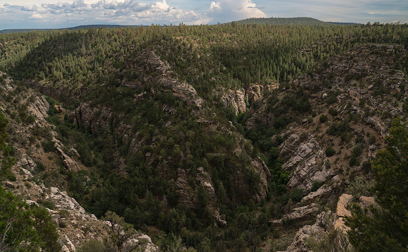
But there’s hope for us tree-huggers. Less than 17 miles northwest of downtown Sedona is Oak Creek Canyon’s sister—Sycamore Canyon. Here there are no McMansions, Gucci Stores, or Whole Foods because, in 1972, the Feds set it aside as a Wilderness Area. While standing on the rim at Sycamore Point, you can begin to imagine what Oak Creek Canyon was like before the mobs got there. Imagine a time when a campfire was the only tell of humans in the area.
My friend Deb and I camped here before Queen Anne ever arrived on the scene. When she finally did, this was the first place Deb and I took her camping. As we ate a dinner of grilled stuffed pork chops and watched the sun go down, she was hooked. That’s when we convinced her that everything tastes a little better with dirt on it.
I wanted to come back this year after watching the fire news early this summer. One fire had ripped through here, and I wanted to see how much damage it caused. Queen Anne and I found black scars on the ridge on the canyon’s far side, but only a couple of pinions had burned on the edge where we stood. Overall, the canyon fared well, except years of drought have left Sycamore Creek dry. We didn’t see any remaining pools of water from our vantage point.
The BLM has moved camping back a half mile now. They’ve removed all of the rock fire rings and built a parking area. If you want to come here, your best camp is at one of the small lakes up the road. Since Sycamore Point is less than twenty miles from Williams, it’s an easy drive from town and back in one afternoon.
As the sun got low, it reached a crack in the clouds and lit the cliffs while I had my camera in hand. I snapped a couple of shots, and this is the version I preferred. I named the photo Sycamore Canyon. I like how the setting sun makes the cliff faces glow, but you can still see the dry creek bed below. Along the rim in the center-left, you can make out the black scar left by this summer’s fire. That’s ok though, unlike a McMansion, it’ll heal soon.
You can see a larger version of Sycamore Canyon on its Web Page by clicking here. Next week, we return to the bright lights of Williams. Come back then and see what we found.
With a basic knowledge of native Arizona plants and observational skills, it’s easy to tell what elevation you’re at in our state. Maybe only Florida is easier because the entire state is below 350′. I’ve written before about how State 48 has all but two of the world’s climate zones; sub-tropic and tundra permafrost. So all you have to do is look at the bush you’re standing next to you for a clue.
For example, compare last week’s picture to the one that I posted today. The tall ponderosa pines you see in Yellow Field thrive at altitudes over 6,500 feet. While the pinion pine in this week’s image—Thumb Flat—is the dominant plant between 5,000 and the appearance of tall pines. My rule is only a rough generalization because there are microclimate pockets all across the state. I can name two places off the top of my head as examples; Palm Canyon in the KOFA Range south of Quartzite and the east slope of the Poachie Range south of Wikiup. The state’s only native palms grow in a mountainside crevice at the first location, and the latter has saguaro and pinion pine intermingling on its slopes.
When Queen Anne and I visited Williams, it was only natural as we drove down the south slope of the dormant volcano to see ponderosa pine replaced with stands of juniper. As the White Horse Lake Road descended even lower, the juniper became sparser. By the time we reached Thumb Flat—as it’s called on the map—individual trees had stood alone in the wildflower-covered fields.
Here I spotted this beautiful alligator juniper, which made me stop Archie and get its portrait. I think this specimen would be a prized possession in anyone’s garden. Probably the only reason this tree isn’t already in somebody’s front yard is that it’s in the middle of the Kaibab National Forest.
In this week’s featured image that I call Thumb Flat, I like how the foreground is darker in color from being in the shade of a cloud. It contrasts nicely against the bright white background cumulus clouds. The wildflowers are the same as in last week’s image, but you can see how much more dull they are when they’re not in direct sunlight. In this case that’s OK because they’re not the subject here—this week, they’re only playing a ‘walk-on’ part.
You can see a larger version of Thumb Flat on its Web Page by clicking here. Next week, we turn onto another side road, so come back and see where that road ends.
Until next time — jw
P.S. If the picture is not showing up in your email version of this post, you can click on the article title (Thumb Flat) to open the Web version of this post.