Placerita Post Office Picture of the Week

It was lust for gold that lured men to the Weaver Mountains in southern Yavapai County. They heard stories of miners plucking nuggets from the ground and, in just a day, returning to camp a wealthy man. The fever for gold outweighed the risks of hostile Indians, treacherous mountains, poisonous snakes, and oppressing heat from the relentless sun.

Prospectors discovered several veins of the precious mineral with Rich Hill at their center. Pauline Weaver’s party started the rush when they accidentally found placer gold on the hill’s top. Boomtowns sprung up surrounding Rich Hill. The camps in Stanton, Octave, and Yarnell all had ore-bearing mines. There were so many claims on the hill; it’s a wonder that prospectors didn’t dig into each other’s tunnels. But it only took 20 years for the gold to dry up; as a result, when Anson Wilbur Callen arrived in the 1880s, he decided to prospect somewhere else.

If you flew a small airplane due east of Yarnell, you’d see a geographic anomaly. Instead of the regular distribution of peaks and hills in the Weaver Range, there’s a 2-3 mile gash between Antelope Peak and Rich Hill. From Yarnell, it runs northeast, and it looks like a score on the top of a loaf of bread. It’s very evident on a topo map or Google Maps.

There’s a natural divide in the gap’s center, and Antelope Creek drains south along the east flank of Rich Hill. Arrastre Creek flows in the divide’s north side (Arrastre is the Spanish word for a drag, as used for mining). Anson set up his camp where Arrastre Creek flows out of the canyon.

By accounts, Anson Callen was a big man and weathered beyond his age. Locals called him Old Grizzly at the age of 40. When he set up camp, his initial task was to create a reliable water source, so he dammed up the creek. As he dug a five-mile water ditch to his base, he uncovered two pieces of gold that earned him $550. There are more stories of finding large gold nuggets in the area—one of which was four pounds that the assay office valued at $900 ($107,792 in today’s market). Before Anson knew what had happened, the town of Placerita sprung up around his claim.

On Tuesday morning, I dragged my friend—Fred—out of bed, and at 5 a.m., we drove his Toyota FJ into the sunrise to find the ghost town of Placerita. As I’ve written, real ghost towns rarely have any remaining artifacts. Maybe there’s a pile of timber or a concrete slab, but never an intact building. My research showed that Placerita had a standing stone cabin, and I needed to photograph it.

Ruins in the Woods - From the roadside, we could see the remains of one of the town buildings, but we couldn't see an easy way to get to it.
Ruins in the Woods – From the roadside, we could see the remains of one of the town buildings, but we couldn’t see an easy way to get to it.

When we got to the area, we drove by a shed with a collapsed roof, but the brush was so thick that we couldn’t find a path to it. Instead, Fred drove down to the creek crossing and parked in an apparent campsite. We intended to hike up the creek, find the buildings, and photograph the ruins. Indeed, they were built along the banks. We soon discovered that walking in a dry creek bed wasn’t the best thing a couple of septuagenarians should do—especially a pair that has a hard time walking on carpets. We struggled for what seemed like a couple of miles, occasionally falling on the rocks and swatting at attacking insects.

Placerita Post Office - The 30 townspeople were served by this Post Office from 1896 to 1910, when the gold ran out.
Placerita Post Office – The 30 townspeople were served by this Post Office from 1896 to 1910 when the gold ran out.

Finally, we gave up and started back to the truck, but instead of the creek, we found a cattle track that had boot prints. We followed it to a clearing where—you guessed it—we found the collapsed building. We spent some time shooting photographs from different angles, including this week’s featured image called Placerita Post Office. About half the walls were standing, but the timbers were full of termites, and that finally caused the roof to collapse.

We never found the stone cabin—or at least we thought we hadn’t—but after I got home and did some further research, I found a photo caption that said, “It has been reported that the roof has collapsed since this picture was taken.” We did reach our goal; it’s just ten years too late. I also found out that the stone building that we shot was the town’s Post Office—built in 1896 and closed in 1910. As a federal building, it was built more durable than the rickety shacks that the miners cobbled together. It makes sense that it outlasted the rest of the town.

You can see a larger version of the Placerita Post Office on its Web Page by clicking here. I hope you enjoy it. Come back next week to see the work I’ve shot along the road to Placerita.

Until next time — jw

Purple Owl’s Clover Picture of the Week

I’m amazed at how much things have changed in a month, and how current events are forcing me to find new ways to provide new content for you. Last month was Anne’s knee surgery, where I needed to stay close to home and care for her. Now that she’s on the mend, I thought I’d be able to go on one of my road trips and gather new subject matter, but that’s not happening. With the pandemic looming over us, our Governor has ordered us to “Stay At Home” unless it’s for essential services. His list of critical activities includes playing golf—as a form of exercise.

Those of you that know me well know that I’m not a rebel. I’m no James Dean, and I usually follow the rules. In other words, I’m a coward. I’ve spent the last week anxiously trying to figure a way to get new photographs for you. Should I go on my planned trip? Should I cancel my blog this month? My stomach was in knots, and I wasn’t sleeping well. I was only getting two naps a day instead of my usual three.

I spent the beginning of the week perusing the Governor’s proclamation, and I came up with an answer. Instead of taking a trip out of town, I’d pick an empty road in Wickenburg. That way, if the Gendarmes stopped us, I could say that we’d gotten lost on the way to the golf course, and we were only exercising.

The road we picked is called The Scenic Loop—seriously, that’s its name. It starts at US 93 north of town and goes past the Hassayampa River Box Canyon before it winds up at the Boyd Ranch. We had no problem keeping a safe distance from other people because we were alone. In the two hours we photographed, I got enough material to keep me locked in my office until June.

Another big difference is the contrast between March’s pictures and those I have for April. Last month was about winter and old gnarly cottonwood trees. This month’s series is about spring, color, and new growth. April is always the prettiest time to be in the Sonoran Desert.

Purple Owl's Clover - In the years when the winter is wet, the desert gets painted with wildflowers in spring.
Purple Owl’s Clover – In the years when the winter is wet, the desert gets painted with wildflowers in spring.

This week’s featured image is an example of what I mean. Usually, the desert floor between cacti is bare gravel, but not this week. It’s full of grass and wildflowers, and in this case, a patch of Purple Owl’s Clover. I don’t think it’s related to the tiny white flowers that get into your lawn; they just look the same. Patches such as these appear on flats where there’s Goldilocks water (just right).

You can see a larger version of Purple Owl’s Clover on its Web Page by clicking here. I hope you enjoy it. Come back next week when we continue with our illicit trip along Wickenburg’s Scenic Loop.

Until next time — jw

Garnet Mountain Picture of the Week

When I was a younger man, I had too many hobbies. Besides photography, I raced cars, fished, listened to music, and gorged on food and wine. Since retiring, we’ve downsized. I’ve given up cars, fishing, and expensive restaurants. We live on a pension now, so photography is my last indulgence—and it’s a good thing that I don’t have to buy film anymore, else I’d have to throw that out the window too.

It took a while to adapt to Arizona living. Sure, half the year is divine, but summers are hell—literally. So, as every good Zonie knows, you head for the hills to escape the heat and humidity of the monsoons. The other option is to close the drapes, lock the doors, and hibernate in front of the telly. As an aspiring angler, I bought a new edition of Bob Hirsch’s Best 100 Arizona Fishing Holes every year. They never changed, but I always read the ink off my copy by the time the Outdoors Show rolled around. I preferred fishing for trout instead of bass, so we’d make our pilgrimages to where the waters were cold: the Mogollon Rim, White Mountains, Lake Powell, or Lee’s Ferry—if the weather was good.

On the trip that Queen Anne and I made to Pierce Ferry for this month’s topic, I kept asking myself, “Why haven’t I been here before? This part of Arizona is beautiful and very photogenic.” I think the simple answer is that there are no trout here, so I didn’t care. Of course, there’s the Black Canyon below Hoover Dam, but it’s 675′ above sea level. That’s lower than Phoenix, and black rocks surround it. Besides, I got skunked on the one trip that we made, so I never went back.

Hualapai Valley, as I said, is Basin-and-Range topography—like Nevada. It’s flanked on the east by the southern end of the Grand Wash Cliffs, while the Cerbat Mountains line the west. The valley floor’s low spot is Red Lake—which is dry most of the year. Orchards surround the lake, but I don’t know how successful they are. Hualapai Valley is also home to a large grove of Joshua Trees, which fills an area about the same size as ours in Yavapai County.

It’s the Grand Wash Cliffs that caught my attention on the map. They’re a long string of mountains—above and below the Colorado River, forming the western edge of the Colorado Plateau. They’re the transition to the Great Basin Desert.

Garnet Mountain - Joshua and sage grow to the foot of snow-covered Garnet Mountain.
Garnet Mountain – Joshua and sage grow to the foot of snow-covered Garnet Mountain.

This week’s featured image, Garnet Mountain, shows Joshua Trees and sage growing to the mountain’s feet. The mountain is over 6,000 ft high and has snow from previous winter storms. The unnamed pointy peak is closer but a thousand feet shorter, so that’s why it’s not snow-capped. Together, they show two of the geological forces that shaped Arizona. Block shapes are generally uplifts caused by plate tectonics, while pointy mountains are usually volcanic. I like what we saw on this visit, so I’m planning a trip to the Colorado River’s north side later this year, but to do that, I’ll need to travel via Utah or Nevada, so I’ll need some slot machine money.

You can see a larger version of Garnet Mountain on its Web Page by clicking here. I hope you enjoy seeing it. Join us next week as we drive home and stop for more photos.

Until next time — jw

Poachie Yucca Bloom Picture of the Week

Sometimes it’s frustrating to talk to foreigners—that is, people that live outside of Arizona, especially someone that has never visited here. When they find out you’re a Zonie, they turn their noses up, and usually, something like this falls out of their mouth, “How can you tolerate that heat, sand, and barren desert?” To them, our state is one homogenous sandbox inside an oven. They never ask, “Where in Arizona do you live?” That’s because no one has educated them about how diverse the state is.

Arizona has every climate zone but two: the Tropic and the Arctic zones. If you want to freeze your butt off, you’re out of luck, but San Diego is a good enough substitute for the tropics—at least for us. If you need something more hot and sweaty, you can always rent Cannibal Women in the Avocado Jungle of Death from Amazon, but I digress. Seriously, we have snow-capped mountains, high plateaus, transition grasslands, and four kinds of deserts. What more do you need?

After making these back road junkets for over a year, I’m finding out that there are even pockets of places that are different than what I expected to find there. Locations with their micro-climate, because they get more or less sun, wind, or rain than their surroundings. That’s what I got from this month’s trip over the Poachie Mountains. We saw water in a dry river, and evergreens growing alongside tall saguaros.

Poachie Yucca Bloom - A yucca high in the Poachie Mountains that still has its flower stalk.
Poachie Yucca Bloom – A yucca high in the Poachie Mountains that still has its flower stalk.

That brings us to this week’s featured image. It’s a photo of the ubiquitous yucca, a plant found throughout the southwest. They’re most photogenic when in bloom, which is spring. The yucca sends out a shoot with white edible flowers (but not raw) that fall off after pollination, and the seeds disperse in the wind. After all of the sex part is done, the stalk dries and falls off. In this case, the stem is still there, long after I believed I could get a shot like this.

Another thing about photographing yucca, they are always too far of a hike, surrounded by other plants, or not as symmetrical as this specimen. Whoever planted this one put it in a spot specifically for lazy photographers. I tip my hat to you, Mister Gardener.

You can see a larger version of Poachie Yucca Bloom on its Web Page by clicking here. I hope you enjoy viewing it. Join us next week as we travel down another one of Arizona’s back roads.

Until next time — jw

Cholla Bay Picture of the Week

After being stopped by a river that rarely has flowing water, we spent some time along the bank of the Big Sandy, watching the calm, almost clear water flowing on its way to Alamo Lake. Queen Anne broke out a couple of water bottles, and we shared a trail bar while perusing the map to find our options.

This would have been a perfect picnic spot if we had packed a basket. Imagine sitting on a blanket in the middle of 17 Mile Drive, where it disappears beneath a river. We could see a couple of houses nearby, and later, I found out that we were in Greenwood—the site of yet another abandoned mining community. In its heyday, some three hundred souls lived and worked here. The town—named after the abundance of Palo Verde trees—didn’t last long because of its low-quality ore.

We turned around and started our journey home with the day getting late. We dallied along the way, making many stops for photos. Before the road began the ascent up the mountain, I spotted where the Big Sandy River had scoured 30-foot cliffs out of the mud banks. The formation was nearly circular, and you could imagine the raging water churning in a back eddy, a swirling whirlpool flowing against the river’s current. A large grove of Teddy Bear Cholla was growing inside the containment, so I grabbed my camera and hiked in for a shot.

Cholla Bay - The most dangerous cactus will attack you at the slightest provocation.
Cholla Bay – The most dangerous cactus will attack you at the slightest provocation.

I have a love/hate relationship with the cholla cactus. When backlit, it has a soft fuzzy look that makes you want to jump into it like a pile of autumn leaves. It’s also known as Jumping Cholla, but it doesn’t do that. Its outer joints are fragile—hair trigger, if you will—and the tips break off from the main plant with the slightest disturbance. The needles are barbed, so if you get some into your skin, you have to pull them out with pliers—one by one.

Whenever I’m near Cholla, I move slowly and cautiously. I watch the ground for snakes, cow pies, and cholla balls. It’s like walking a tight wire. I don’t look up until I stop walking. So imagine how startled I was in the middle of this field when a wild gray burro popped his head up and snorted. He was just as frightened as I was and quickly galloped off to the far side of the road, but it took all my self-control not to stumble back through the cactus patch. Once the two jackasses safely separated, I regained my composure and took this picture, which I called Cholla Bay.

You can see a larger version of Cholla Bay on its Web Page by clicking here. I hope you enjoy viewing it. Join us next week when we finish our trip to the Poachie Mountains.

Until next time — jw

Greenwood Peak Picture of the Week

I have two reasons for these monthly jaunts on Arizona roads I’ve never traveled. The first is to give me a reason to get out and shoot. The other purpose is to force me to explore places I haven’t seen, see what’s out there, and see what I haven’t seen.

What was new to me on this trip was seeing saguaro growing among the Juniper. Think about it. The mix of those two plants never happens. The saguaro stops growing at about 3000 feet because they don’t tolerate frost. To be in a field of Juniper, you’d have to travel to Sedona, Prescott, or Payson. I yammered on and on about this phenomenon, Anne, as 17 Mile Road twisted up into the Poachie Range. At one point, I was so confused that I stopped and pulled out my Garmin to check the elevation.

Greenwood Peak - One of the two prominent peaks in the Poachie Mountain Range. This one can be seen if you travel through Wikieup.
Greenwood Peak – One of the two prominent peaks in the Poachie Mountain Range. Greenwood Peak can be seen on the western horizon if you travel to Wikieup.

The Poachie Range is 30 miles long, and you see them west of U.S. 93 between Nothing and Wikieup. They’re not very tall, with its tallest peak being Arrastra Mountain at 4807 feet. So, I usually wouldn’t expect to see Juniper this low. When I checked my GPS, the elevation was 3600 Feet. All this leads me to believe that winters aren’t severe here, but more rain falls here than on the desert floors. Anyway, that’s my story, and I’m sticking to it.

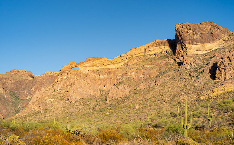
The road we traveled crossed the Poachie Range south of its prominent northern peak—Greenwood Peak. It’s the subject of this week’s featured image. It only rises to an altitude of 4300 feet, but it still provides a handsome backdrop for the unusual mixture of cactus and evergreens.

You can see a larger version of Greenwood Peak on its Web Page by clicking here. I hope you enjoy viewing it. Join us next week as we finish our trip to the Harquahala Mountains.

Until next time — jw

Big Wet Sandy Picture of the Week

“I know a shortcut.”

How many of you have heard those words and broken into a cold sweat? The road that Queen Anne and I decided to explore this month didn’t start as a shortcut. It was supposed to be a much longer trip, but it got cut short.

I had intended to drive to the north shore of Alamo Lake. There are a couple of exciting mountains I’ve seen from across the water when I last visited. The best road to get there starts in Wikieup. On my maps (including Google), there are two ways to get there. One is twenty miles south of Wikieup, and the other is about five miles south. Both roads go to the little town of Signal. I’m sure you spotted the signs on a drive to Las Vegas.

We decide to take 17 Mile Drive road. It’s the first left after the Nothing Gas Station. It’s a wide well-graded dirt road that climbs over a pass in the Poachie Mountains, then down into a valley where Signal is. The scenery at the pass is amazing—something we’ll get to later—and you can drive the route with your family station wagon. There’s one hitch along the way, and that’s crossing the Big Sandy River at Greenwood. Usually, crossing the river here could be tricky because—well, it’s deep sand, and you might get stuck without four-wheel drive.

Big Wet Sandy - The normally dry Big Sandy River flowing with water from recent rain.
Big Wet Sandy – The normally dry Big Sandy River was flowing with water from recent rain.

That wasn’t the case today. The Big Sandy was a real river and not in an ugly flash flood kind of way. Its waters flowed like it was an old river; clear and quiet. If I didn’t know better, I might have been tempted to pull out my waders and fly rod and make a few casts. It wouldn’t have been my worst day fishing, being the great angler that I am. There was no way to tell how deep the water was. It could have been two feet or a dozen, but it was not tempting enough for the police to cite me under the Stupid Motorist Law.

So, we’ll begin this month’s journey at the end and go backward. As I said, there was enough material to shoot in the mountains to fill a month, so we’ll save Alamo for another month, and we’ll start at the water’s edge.

I took this week’s featured image standing on the river’s bank. If I didn’t know, I would venture a guess that it was a photo of the Colorado River south of Bullhead City, and the mountains were in Nevada. Nope, it’s all Arizona. We’re looking north-east, and the peaks are actually on our side of the Big Sandy. The high point is Burro Peak. Although everything appears calm on this warm winter afternoon, the banks on each side of the water show erosion from raging water at some time. There are more cliff-banks like this—some higher—along the riverside past Wikieup that you can see from Highway 93. I wonder if I’ll ever again see a sight like this.

You can see a larger version of Big Wet Sandy on its Web Page by clicking here. I hope you enjoy viewing it. Join us next week as we start our return over the Poachie Mountains.

Until next time — jw