Arch Canyon Picture of the Week

Organ Pipe Cactus National Monument has two vehicle loops that allow visitors to explore the park beyond the visitor center. On the west side of Highway 85 is the Puerto Blanco Drive, which is over 40 miles long and has stretches that require four-wheel drive. East of the highway is the Ajo Mountain Loop Drive, which is half the length and can be navigated in your family sedan (in good weather). Since I was only there for an afternoon, I opted to take the latter route.

I suppose if you didn’t stop to look at anything, you could follow this route through the Ajo Mountain Foothills in less than an hour traveling at the posted speed, but I spent more than three hours on the 19-mile loop because I was constantly hopping out of the truck taking pictures and gawking. In all that time, not once did I see another person—not even a ranger.

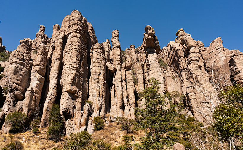
The road heads north-ish along the foothills’ west flank from the visitor’s center until it climbs over a pass at Arch Canyon. Then the road returns south through a valley between Ajo Mountain and its foothills. This week’s featured image was taken at the trail’s high point at Arch Canyon. There I was surprised to discover—an arch! Who knew? And it’s a good-sized one. I don’t recall seeing it in any of the park’s brochures, which I find odd.

Arch Canyon - At the north end of the Ajo Mountain Loop, you'll find the picnic grounds at Arch Canyon with an unnamed arch overlooking the area.
Arch Canyon – At the north end of the Ajo Mountain Loop, you’ll find the picnic grounds at Arch Canyon with an unnamed arch overlooking the area.

The arch doesn’t have a name on my topo maps. They only note the location of the natural arch. Maybe I could petition them to call it Queen Anne Arch. If the park service did that, maybe I could get her butt in the truck to see it. There is also a picnic area and campgrounds in Arch Canyon, but only tents are allowed. I guess that’s good because the camp would be packed with motor homes and fifth-wheels all year long.

This would have been a perfect opportunity to fly my drone so that I could get a shot that was closer and from a higher perspective. Alas—there’s a double drone prohibition in place here. Drones are not permitted to fly in National Park or National Monument airspace (although winged RC airplanes are permitted). Also, most of the Organ Pipe Cactus National Monument is designated as a wilderness area. Only a dozen yards on either side of the roads are the exception. All motorized vehicles are banned from wilderness areas.

While I was in the picnic area, I took some time to read the wonderful signs that the Park Service puts up to explain the views. I learned something that I’ve wondered about for years. The Ajo Mountain Range is part of the much larger ancient Pinacate volcanic field covering more than 1,900 square miles. The Pinacate Mountains are south of the border, about halfway to the Sea of Cortez. Over eons, this field had violent eruptions that spewed tons of magma, and alternately it had periods where the volcanoes spit out tons of ash and relatively little lava.

You can see a streak of light-colored rock near the ridge’s top in this week’s image. The darker rock is our old friend Rhyolite, the slow-moving magma found in the KOFA Range. The lighter streaks are from the ash falling from the sky and covering the ground. The ash layer is called Tuff, and I’ve seen it throughout Arizona—(and that’s the rest of the story, g’day – as Paul Harvey used to say).

You can see a larger version of Arch Canyon on its Web Page by clicking here. Come back next week to see the down hillside of the Ajo Mountain Loop.

Until next time — jw

Organ Pipe Cactus Picture of the Week

There’s nothing rare or unusual about the organ pipe cactus. They’re a common sight in the Mexican states of Sonora and Baja. I’m sure that the local folks view them the way Zonies do the saguaro; they’re just another part of the local landscape. But, the saguaro’s smaller cousin only reaches into the United States in the national monument that’s a half-hour south of Ajo, and that’s what makes them special to us.

Like the saguaro, the organ pipe grows best on south-facing rocky slopes of the Sonoran Desert. So why don’t they grow further north? Well, that’s because they’re less tolerant of frost and won’t survive a hard freeze. The specimens that we have in our cactus garden have to wear styrofoam cup hats to get through even our mild winter nights.

Another difference between the columnar cacti is obvious by looking at them. The giant saguaro grows with a single trunk and sprouts arms after it reaches 50 years—like a tree. On the other hand, the organ pipe’s arms sprout from a stem close to the ground resembling a bush. Internally, their structures are similar to porous skeletons that allow the flesh to expand and store water.

While the saguaro and organ pipe’s flower looks the same, the latter’s are only open at night and are pollinated by bats. The saguaro keeps its flowers open in the day, which lets bees and doves help the pollination. Like the saguaro, the organ pipes produce fruit during the rainy season about a tennis ball’s size. The flesh is bright red and supposedly tastes better than watermelon. After eating the sticky fruit, birds disperse the seeds by defecating from the branches of palo verde trees.

Organ Pipe Cactus - This cactus specimen commonly grows in the Mexican states of Sonora and Baja, but only crosses the border within the boundaries the Organ Pipe Cactus National Monument.
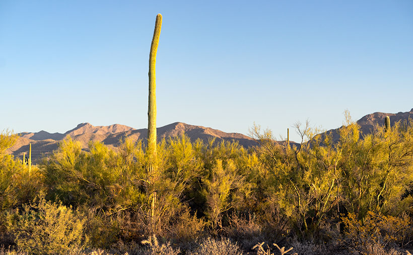
Organ Pipe Cactus – This cactus specimen commonly grows in the Mexican states of Sonora and Baja, but only crosses the border within the boundaries of the Organ Pipe Cactus National Monument.

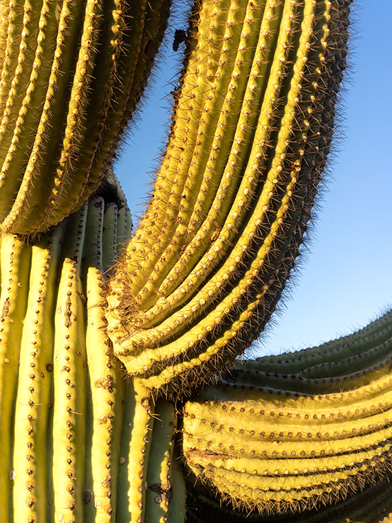
I drove a good distance on the Ajo Mountain Loop looking for a really nice organ pipe to photograph for this week’s featured image. The specimen in my image—called Organ Pipe Cactus—is a beaut, resembling an upside-down octopus on steroids. I’m a little upset that Ajo Mountain snuck in and photo-bombed my picture. At least you can see how far I traveled by how the mountain’s angel changed from last week’s photo. My references say that an organ pipe’s normal height is 10 to 16 feet, but this baby towered over my head and may have reached 20.

You can see a larger version of Organ Pipe Cactus on its Web Page by clicking here. Next week’s stop resulted in a surprise photo op. Be sure you come back and see what I found.

Until next time — jw

Ajo Mountain Picture of the Week

I turned my calendar over this week, and that means a couple of things to me; the best is that it’s the final quarter of 2020. In an average year, the hot weather finally breaks in a couple of weeks, because there’s an Arizona law that prohibits kids from Trick-or-Treating on a hot night. Of course, nothing about this year has been normal, so I’m not holding my breath. The Queen and I are looking forward to opening the house soon, and I’m anxious to take my drone out again and resume filming.

For October’s project, I drove south into the heart of the Sonoran Desert. As I said, we live along the northern edge of the saguaro country. We have a good population here in Congress and Wickenburg, but in other parts of the state, the giant cactus thrives. To show you, I traveled south of Ajo last week and drove the Ajo Mountain Drive loop in the Organ Pipe Cactus National Monument. The road is unpaved, but a sedan will make it as long as it’s not raining.

A couple of years ago, Anne and I visited the monument for the first time. I wanted to take this loop, but we didn’t bring an off-road truck. Plus, when she saw a sign warning of smugglers and illegal aliens, she said no. The park is 10 miles from the Mexican border, and 30 miles south of the old copper mining town of Ajo (evidently the Spanish found wild garlic growing in the area, so that’s how it got the name). The road passes through the middle of the Goldwater Bombing Range, so I’d recommend not stopping along the way to pick wildflowers.

The Monument is the only place where you can see large stands of Organ Pipe Cactus. They’re more common south of the border, but on this side—not so much. The two columnar cacti (saguaro and organ pipe) grow side-by-side throughout the park. With the dry summer that we’ve had this year, I was pleased to see that the specimens in the monument looked healthy and watered. The rain patterns in lower Pima County are different from home, and they had a better monsoon than we did. The cacti are packed in down there—if you could ever call a desert lush, Organ Pipe would be an example.

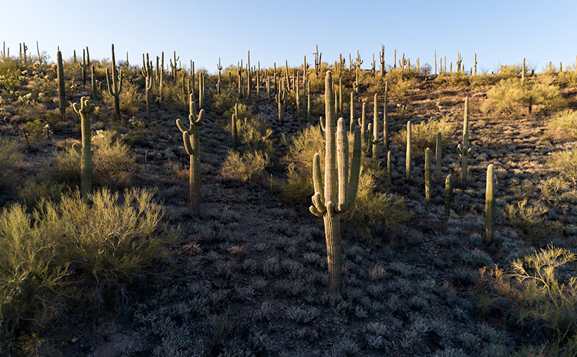
Ajo Mountain - The volcanic peak rises above its foothills in the Organ Pipe Cactus National Monument.
Ajo Mountain – The volcanic peak rises above its foothills in the Organ Pipe Cactus National Monument.

Ajo Mountain is the name of this week’s featured image, and in it, I was trying to show two things. They are the volcanic mountain—rising above its surrounding foothills—and how many saguaros are growing per square mile. These giants also seem significantly taller than our home-boys.

You can see a larger version of Ajo Mountain on its Web Page by clicking here. Next week we’ll stop further along the drive and show you the organ pipe cactus from which the monument gets its name.

Until next time — jw

Starring Queen Anne YouTube Video Announcement

As you all know by now, Queen Anne and I spent August last year so that I could photograph along Utah’s State Route 12 (wrote a book about it—wan’ a see it—here goes). What you didn’t know is that one morning we drive to Torrey for lunch, and we filmed a time-lapse video with a GoPro stuck to Archie’s roof. It took a while, but I finally assembled all the clips into a 14-minute video that I posted on YouTube this morning.

Thor's Hammer And Sunset Point
Thor’s Hammer And Sunset Point – Bryce Canyon is the reason most visitors ever drive SR 12, but the video shows what to see before and after Bryce Canyon.

The video shows all of SR12’s 122 miles, and I spliced in spots along the route that are waiting for you to see and photograph. Queen Anne stars in her YouTube debut that will most likely break the Internet. Finally let me say that although it looks like a mad man was driving, I can assure you that the cruise control was set to the speed limit—of course, that may not absolve me from being a crazy person.

You can see Utah’s State Route 12 on YouTube by clicking here. I hope you enjoy watching it and please share your comments or at least give it a thumb up or thumb down.

Until next time — jw

Sleeping Under the Stars Picture of the Week

There’s something wonderfully romantic about how cowboys spent evenings eating beans around a fire before laying out their bedrolls and sleeping under the stars. It makes me wonder if I would have been any good riding a fence line. I love the outdoors, campfires, looking at the stars, and dreaming of the ladies back in town (sigh). I can assure you that I could never do that because the last horse I got on said, “oof” and sleeping on the ground has rocks, snakes, spiders, scorpions, skunks, and rabid chipmunks—not to mention the inclement weather.

Queen Anne and I still enjoy getting out in the wilderness; we just bring half of the house with us. For some reason, I sleep very well in our little Casita trailer. She has two layers of foam over the cushions that make into a full-size bed, and when I crawl under our down coverlet, my eyes slam shut faster than a mouse trap. As I lie next to my love and wrestle for more space, I listen to her rhythmic breathing. The hypnotic cadence is a mantra luring me to dreamland—until she misses a gear and sounds like a manual transmission exploding. But, she stops as soon as I nudge her to roll over.

All of this is fresh in my mind because we’re recently back from spending the week in the KofA Wildlife Refuge with The Ritz—our trailer. We succeeded in getting more images to finish up with this month’s topic but concluded that there is a lot more to the KofA range than a couple of blog posts. I think it may need to be a long-term project.

This tip was the first time we used the trailer in winter, and although the days were sunny, the wind blew, and the nights were colder than our Alaska trip. We had to use its heater at night. Even though we set the thermostat to 58º, it still came on often and blared at 85dB. The first time it came on, it made that burning dust smell and I thought we were going to die of carbon monoxide poising, so I opened the windows, which was counterproductive. Like all furnaces, the smell cleared eventually and we stopped jumping every time it started. Even with that racket, I slept until sun up.

We spent two days exploring and shooting photos at the refuge, and on the last day, the wind died, so we were able to use a week’s worth of wood for a fire. We ate brats, drank rich cocoa, and roasted marshmallows for jimmyums over the burning logs. Its warmth kept us outside long enough that the stars came out—all of them. We stared at Mars so hard that it began darting across the sky until we looked through binoculars and proved it wasn’t doing that. Finally, the creamy streak of the Milky Way began to reveal itself and forced me to set up my camera.

KofA Milky Way
KofA Milky Way – Campers enjoy the KofA mountain range-in silhouette against the Phoenix lights-under the Milky Way and Orion early in the January evening.

This week’s featured image is the result of that effort. It’s called KofA Milky Way, and I shot it from our campsite. The bright spots on the ground are from the next camp. The mountain is Signal Peak silhouetted against the lights of Phoenix—150 miles to the east. The constellation Orion is center-right, and Pegasus with the Andromeda galaxy would be overhead, but the fire died, and the cold chased us inside before we could find it.

As usual, you can see a larger version of KofA Milky Way on its Web Page by clicking here. I hope you enjoy viewing this week’s post and next week; we’ll show another featured image from Arizona.

Until next time — jw

Saguaro Climbers Picture of the Week

You can tell a story in several ways. You can start with details and pull back to reveal the whole, you can take the long-shot and move in for the close-up, or you can jump back and forth. I find the third option hard to pull off well, so I avoid it. I see the skydiver method the easiest—jump out of the plane at 20 thousand feet and then move in closer for details. It’s self-limiting because I have to make my point before the ground interrupts my story.

When I visit a new place like this month’s topic—KofA Wildlife Refuge—it makes sense for me to take mountain pictures and then work closer, because a story isn’t complete without details. Interesting things are happening in the cracks. Literally, like in the case with this week’s featured image.

Saguaro Climbers
Saguaro Climbers – three saguaros slowly make their way to the summit.

I photographed this scene along the Palm Canyon Trail. Unlike the palms, this side canyon was better suited for the lens I was carrying, so it was easier to compose. Instead of the palms that I was after, it’s just three common (to the Sonoran Desert) saguaros in a steep ravine. It’s the light of sundown that makes the image work. It emphasizes the canyon’s depth without being so harsh that it blacks out details.

I usually title my photos with descriptive titles, so I don’t have to be imaginative, but in this case, I didn’t. While I processed it—with the aid of my Medicare supplied drugs—I visualized the saguaros as mountain climbers trudging their way to a summit. I called it Saguaro Climbers. That’s crazy because we all know that saguaros can’t climb—don’t we?

As usual, you can see a larger version of Saguaro Climbers on its Web Page by clicking here. I hope you enjoy viewing this week’s post and next week when we’ll show another featured image from the KofA Wildlife Refuge.

Until next time — jw

State Route 12 Project New Publication Announcement

Utah SR 12 Magazine
Utah SR 12 Magazine-84 pages of color photos and stories printed on premium paper and you can buy on its Blurb Page.

There’s exciting news this morning coming from the international headquarters of Jim Witkowski Photography, located in beautiful downtown Congress. You may have wondered why things have been quiet around here for the last six months, or that I didn’t post many photos from our Utah trip last summer. Well, I was busy using that time to compile years of photographs into my new 84-page magazine—Utah State Route 12, and I’m pleased to announce that it’s ready for début.

The project’s theme is about the beautiful places in the Escalante Grand Staircase National Monument. The monument is so vast that it has three management areas: the western Grand Staircase Region, Kaiparowits Region, and Escalante Canyon Region on the east flank. There is only one paved highway that spans them all—Utah’s State Route 12. In this project, I wanted to show that there are beautiful marvels to see along its length, and the road is more than just a gateway to Bryce Canyon.

I plan to release my work in four versions: PDF, Magazine, Book, and eBook. I have completed the first two, which—I believe—should get the most attention, and I’m still working on the second half. It looks like they will be ready by Valentines. (Are you in the dog house and need a gift?)

PDF—this version is best for viewing on your computer, and except for bandwidth, it’s free. It’s ideal for those of you that don’t need more clutter. You can open the file and begin browsing right away or save it to your hard drive for later.

Magazine—this is a 84-page hard copy of photos and text printed on premium stock paper. I’m delighted with how well the images reproduced. The magazine’s cost is $ 22.99 (plus shipping) is admittedly pricy for a periodical, but compared to the book, it’s a bargain. Blurb handles the sales on their secure Website because they print them to demand. That means that there won’t be surplus versions lining birdcage bottoms.

Book—the large (13 x 11) coffee table book is still in progress which sounds simple, but it’s in landscape orientation, so the layouts have to be adjusted. The photos are larger than the magazine’s, and I had more space to embellish the stories. It will be available in softcover, hardback image wrap, and hardback with dust jacket. The price of the book is expected to be under $ 200.00 at most, so I think there will only ever be one edition—my own if Her Highness lets me.

EBook—this will be the last version and will be easy to do because it’s the book reformatted to fit your Kindle. That’s all handled by the computers. I don’t know what it will cost, but it will be ready next month, so keep watching my Books sections. The downside is that with this version, you won’t get the privilege of collecting dust with it.

I’m planning on releasing a new project each year as Queen Anne, and I travel. For this first project, I had to learn the software and build the templates; something that took up development time. Future projects should go from camera to print quicker. Plans for next year’s project are in progress.

You can get your free PDF version and preview the magazine by visiting their Web Page by clicking here. I hope you enjoy viewing them and please leave your comments here and/or on their Blurb page.

Until next time — jw