The Long Way Home: Three Routes, One Corolla, and a Little Adventure Pictures of the Month: California Coastal Towns

“So when the day comes to settle down,
Who’s to blame if you’re not around?
You take the long way home,
Take the long way home.”—Supertramp
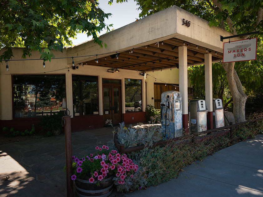
Vintage gas station repurposed as Makers Son venue in Los Alamos, California with rustic charm
Exploring Los Alamos: Makers Son Event Space in a Former Gas Station—The Makers Son, a vintage gas station in Los Alamos, California, now serves as a charming venue for weddings and events.

Like every good fairytale, the good times eventually come to an end. Too soon, we found ourselves facing that tedious drive home. But instead of a simple choice, we had three different ways to go—our own version of ‘The Three Little Piggies.’ Only this time, there were three little routes: the quick and efficient one, the scenic and leisurely one, and the ‘I don’t really want to go home’ route.

The Fast Way (All Freeway—All The Time)

The first little piggy is all about speed—no frills, no fuss. It’s I-5 or US 99 south to Bakersfield, then a quick jog over to I-40 through Barstow, cruising along Route 66 nostalgia until Kingman, and finally, the home stretch to Congress. There is not much scenery, but it’ll get you there faster than you can say. ‘Are we there yet?’ It’s our choice for days when the destination matters more than the journey. This is also our go-to route when we’re in a hurry or carrying precious cargo—like a couple of cases of wine. We can make this trip in about 14 hours, provided I make the necessary stops for Queen Anne’s bathroom breaks.
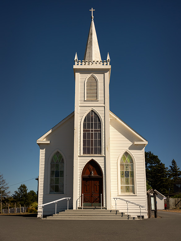
St. Teresa of Avila Church in Bodega, California, iconic landmark photographed by Ansel Adams
St. Teresa of Avila Church in Bodega, California—a spot where Ansel Adams stopped in 1953 when this drive was just a dirt road. Anytime I get within range of an Adams subject, I make it my mission to stop and capture my own take. Queen Anne was more than willing to tag along—Bodega was the filming site for Hitchcock’s The Birds, and she didn’t pass up the chance to channel her inner Tippi Hedren, posing dramatically on the schoolhouse steps nearby.

The Leisurely Way (Santa Paula Route)

The second little piggy prefers a scenic detour. This route winds down California’s Highway 101 through coastal towns and charming spots like San Luis Obispo, Santa Barbara, Santa Paula, and Fillmore. Fillmore holds a particular place for me—it’s where I take a moment to visit my sister’s grave, reminding me that every journey has meaning beyond the miles. And then, with a clearer head, we pick up the drive home.

From there, the road takes us through Los Angeles, where we must be mindful of our timing and stay as far away from downtown as possible. Even in the middle of the night, we expect traffic, but if we time it right—threading the freeways between morning and evening rush hours—we can glide through with minimal stop-and-go. Our preferred route through LA is the I-210, which runs along the base of the San Gabriel Mountains and offers a spectacular view…on the one day a year when they’re actually visible through the smog.”
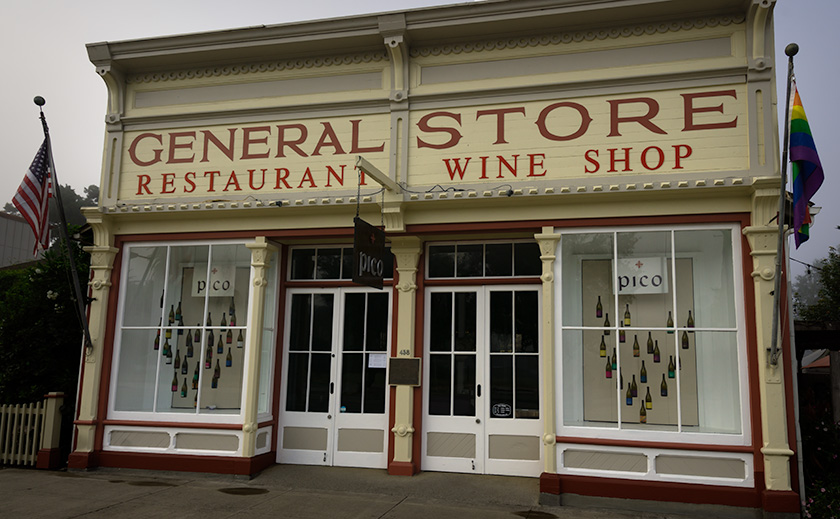
Pico Wine Tasting and Restaurant in a historic general store building in Los Alamos, California
Pico Wine Shop and Restaurant in Los Alamos: A Culinary Landmark – Pico, a historic general store turned wine-tasting venue and restaurant in Los Alamos, California, offers a high-end culinary experience.

The “I Don’t Really Want to Go Home” Way

And then there’s the third little piggy, the route for when you’re in no rush. This path hugs the coast down the Pacific Coast Highway, SR1, taking the long, winding road past Big Sur, through postcard-perfect towns, and across landscapes that demand photo stops every few miles. It’s the scenic route to end all scenic routes—a journey for those who want to stretch the fairytale a little bit longer.

Once we reach San Luis Obispo, we merge onto the 101 until Ventura. From Oxnard to Santa Monica, we’re back on the PCH with plenty of chances to spot a pod of dolphins, a whale, or seals if we’re lucky and observant. Since we have all the time in the world, we make it a point to stop, walk all the piers, and grab a bite at a couple of seafood shacks along the way.

When it’s time to leave Santa Monica, we jump on I-10 straight into the city’s heart-stopping freeway traffic. But instead of fighting it, we go with the flow—windows down, wind in our faces, and Randy Newman’s ‘I Love L.A.‘ blaring on the stereo. For a moment, we’re part of the LA rhythm, dodging in and out of lanes with all the other dreamers. Eventually, US 60 guides us through Riverside and into the wide-open desert, where the road stretches out, and the only traffic is the tumbleweeds. If done correctly, we measure our progress in miles per week.

A Corolla with Attitude

The real surprise on this trip was discovering our trusty Corolla IM’s hidden ‘Sport’ mode button. I’ve dubbed it the ‘Gutless Wonder,’ but with Sport mode engaged, it gave me more spirit than expected. The button sharpened the transmission shifts and tightened the power steering, making each corner feel just right. For a moment, I almost felt like I was driving an old British sports car—minus the manual gearbox and with the comfort of roll-up windows and a top. And thanks to the IM’s independent rear suspension, it didn’t just handle the winding roads—it made them fun. Who knew our little econobox had it in her?
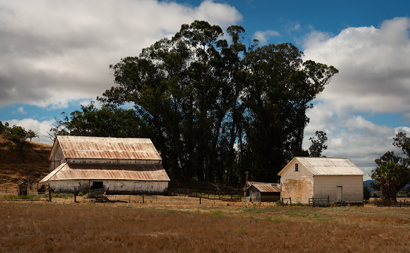
Rustic white barns in a scenic countryside landscape on the road from Sonoma to Calaveras, California
Historic White Barns: A Serene Stop Near Highway 101 – A pair of white barns along the scenic Sonoma to Calaveras route, capturing the rustic charm of California’s countryside.

Our Extended Fairytale Ending

Since it was still August and we weren’t in a hurry to get back to our cottage at the base of the Weaver Mountains, we opted for the middle route with a twist: four days, with overnight stops in places we’d never explored. Our usual all-day ‘Bataan March’ became a leisurely four-day journey of discovery, and—true to form—Anne and I conveniently planned our stops around California’s Central Coast wine regions. Now, we have at least four new destinations for future trips.

Each route home has its own quirks and charms, but this time, taking the scenic way back reminded me that the journey can be as memorable as the destination. Sometimes, the right choice isn’t the fastest or most convenient—it’s the one that lets you hold on to the experience just a little longer.

Till next time, keep your spirits high and your humor dry.
jw


BTW, 2024 Wall Calendar Orders are Open!

It’s that time of year again—calendar season! If you’d like to grab one of my personal wall calendars for 2024, now’s the time to let me know. The calendars are 8.5 x 10 inches, spiral-bound, and printed on high-quality card stock, perfect for showcasing a year’s worth of my favorite shots.

A heads-up on pricing: VistaPrint’s prices are always high initially, but they usually offer great discounts as the holidays approach. Last year, they dropped to around $11 plus shipping after Thanksgiving, but they could be as high as $20 if I go by their price list today. Whatever my printing and shipping costs are, that’s what I charge—no markup.

If you’re interested, please let me know by November 15. That way, I can organize everything, and we can take advantage of post-Thanksgiving sales! Delivery is usually at the beginning of December, so they make great stocking stuffers.

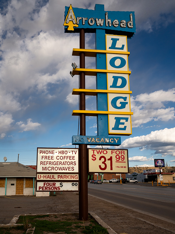
Gallup, New Mexico: The Heartbeat of Native American Culture Picture of the Month - Gallup, New Mexico

Arrowhead Lodge sign showcasing classic Route 66 Americana
The Retro Charm of The Arrowhead Lodge sign in Gallup—The sign features retro typography and design typical of historic Route 66.

Queen Anne and I recently traveled to Gallup, New Mexico, to film some b-roll footage of Route 66 across Arizona. We wanted to traverse the Grand Canyon State in a single day, so we spent the night in neighboring New Mexico to get those video clips and finish our latest Route 66 video. I’m excited to announce that the video has just been released on YouTube—be sure to check it out here.

Although we’ve driven through Gallup before, we decided to stick around and see what all the fuss was about. Spoiler alert: it’s more than just a pit stop for refueling the car and our caffeine levels. We discovered it’s much more than just a stop along the Mother Road. Gallup is a vibrant hub of Native American culture and history, and I think it would make an excellent topic for one of my monthly projects. I look forward to returning.

Founding and Early Development

Gallup, New Mexico, was established in 1881 as a headquarters for the southern transcontinental rail route by the Atlantic and Pacific Railroad, which later became part of the Burlington Northern Santa Fe Railroad. The town was named after David L. Gallup, a paymaster for the railroad. When workers went to collect their pay, they would say they were “going to Gallup,” which led to the town’s name. Imagine that: a city named after a guy who handed out paychecks. If only my old boss had been so popular—’Jim’s Paycheck Town’ does have a certain ring, though.

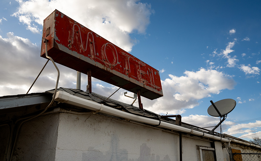
Gallup's deserted motel sign, a relic of Route 66 history
Gallup’s Deserted Motel: A Sign of Times Gone By – An old motel sign in Gallup, New Mexico, capturing the essence of deserted Americana.

Strategic Location and Growth

Gallup’s strategic location at the crossroads of several major rail lines and highways contributed to its growth as a trade and transportation hub. It became an essential center for the coal, timber, and livestock industries, which fueled its economy in the early years. Rich mineral deposits in the region also attracted various settlers and businesses. Coal, timber, livestock—Gallup had it all! It was the Amazon Prime of the 19th century.

Gallup’s proximity to the Navajo, Zuni, and Hopi reservations made it a significant trading post for Native American crafts and goods. This connection to Native American culture has been a defining characteristic of Gallup, earning it the nickname “Indian Capital of the World.” This diverse cultural heritage is vital to the town’s identity and economy.

Historical Events

One of the most impactful events in Gallup’s history was its major stop on Route 66, the iconic highway connecting Chicago to Los Angeles. This brought a steady flow of travelers and tourists through the town, further boosting its economic and cultural significance. The El Rancho Hotel hosted so many Hollywood stars that I half expected to see John Wayne himself checking in at the front desk. I had my autograph book ready, just in case.

Today, Gallup is known for its vibrant downtown, cultural events such as the Gallup Inter-Tribal Indian Ceremonial, and its decadent array of murals and historical markers celebrating its diverse heritage. The town remains a vital link between various cultures and continues to honor its historical roots by preserving and celebrating its unique past.

Gallup’s Role in Preserving and Promoting Native American Culture:
Gallup, often called the “Indian Capital of the World,” is crucial in preserving and promoting Native American culture. The town’s proximity to Navajo, Zuni, and Hopi reservations makes it a central hub for Native American arts, crafts, and traditions. Gallup’s cultural landscape is rich with influences from these tribes, visible in the town’s art, architecture, and daily life.

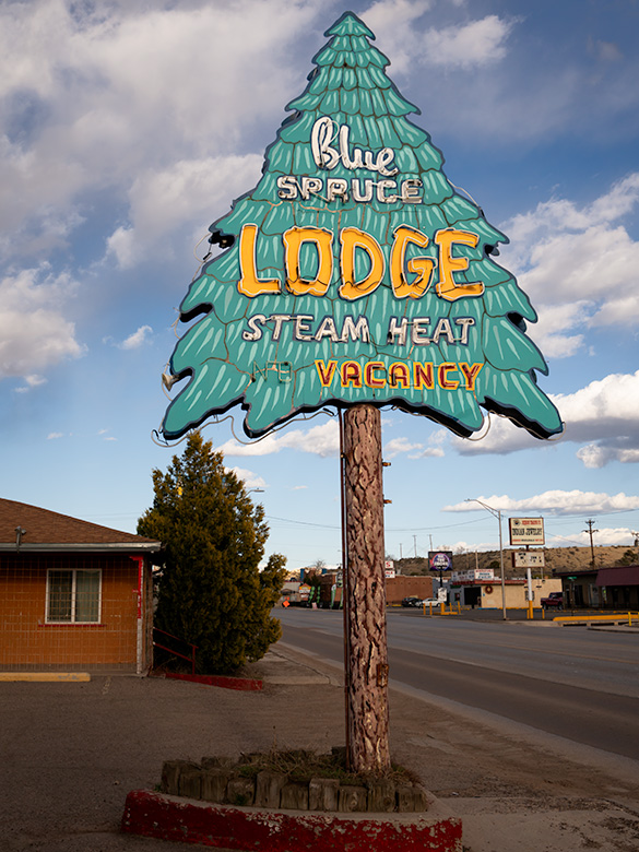
Vintage Blue Spruce Lodge sign in Gallup, New Mexico on Route 66
Blue Spruce Lodge: Retro Signage in Gallup—The iconic Blue Spruce Lodge sign in Gallup, New Mexico, is a reminder of the town’s historic past.

The annual Gallup Inter-Tribal Indian Ceremonial is a significant event that showcases Native American traditions, including dances, parades, and crafts. This event attracts visitors from around the world and helps promote the cultural heritage of the local tribes. Additionally, Gallup is home to several museums and cultural centers celebrating Native American history and contributions, further solidifying its role as a cultural preservationist. The Gallup Inter-Tribal Indian Ceremonial is a bigger deal than Anne’s annual shoe sale pilgrimage—and trust me, that’s saying something.

I know that there are many more Gallup stories to be told, and since its elevation is higher than Phoenix’s, we may turn it into an escape in the following summer or two. If we pique your curiosity with this month’s Route 66 photos, I invite you to explore larger versions of this month’s images on my New Work portfolio and the detailed pieces I’ve posted on Fine Art America. These photos will be displayed there for three months before being rotated.


Good Eats

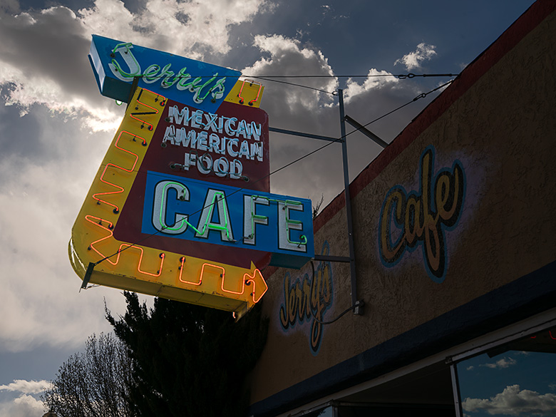
Vintage neon sign of Jerry's Cafe in Gallup
Neon Nights: Jerry’s Cafe Sign on Route 66 – Gallup’s Jerry’s Cafe is known for its delicious Mexican-American food and classic neon signage.

As is our custom, we checked Trip Advisor for a nice dinner place. As you’re all aware, that’s the only way I can get Her Majesty into the car—as a repayment for “Gallup! You want me to go to Gallup with you?” At the top of the list was Jerry’s Cafe. It’s located near the municipality buildings downtown, a few blocks south of the railroad tracks.

Jerry’s is a no-frills dive with linoleum floors, a small counter along the left wall, a half-dozen tables in the center, and as many booths lining the right wall. The fare is American and Mexican dishes, and don’t even think of wishing for a beer or Margarita because they don’t have a liquor license. Since the place is so tiny and located in the business district, there’s usually a long line of locals trying to get in.

When we drove into town, I immediately spotted several closed motels that I wanted to photograph in the evening light. I suggested to the Queen that we get an early dinner and shoot our way back to the motel afterward. “Whatever,” was her reply. “When we got to Jerry’s, I couldn’t believe our luck—no line at 4 PM! It was as if the stars had aligned, or more likely, everyone else was still at work.

So, the place is a dive; they don’t serve alcohol, and it’s crowded. I was in heaven. Anne, not so much. There must be a reason to eat here—the food. Mine was so good that I don’t even remember what Anne ordered. They offer specials that are variations of what we call in Arizona a Navajo Taco, but they called them Stuffed Sopaipillas. Mine was stuffed with guacamole, carnitas, and jalapenos—not those sissy jalapenos from Texas, Arizona, and California. This is New Mexico, and these were proper Hatch Jalapenos, which bite back. I knew I was in trouble when this came out of the kitchen. The Sopaipilla was bigger than my head, and its plate was barely big enough to contain it. It was a golden color with red and green chili smothering the top. Each bite contained a mouthful of cool guac, contrasting the zing of peppers and the crunchy bits of pork within the deep-fried tortilla. The other customers kept giggling and pointing at me because I kept making Homer Simpson noises, but I didn’t care. It was the best Chimichanga I’ve ever had, and I would happily embarrass myself again for another bite. This dish was good enough to change Gallup from a gas stop to a destination. I highly recommend it.

Holbrook Chronicles: A Quirky Journey Through Time and Asphalt Picture of the Month - Holbrook, Arizona

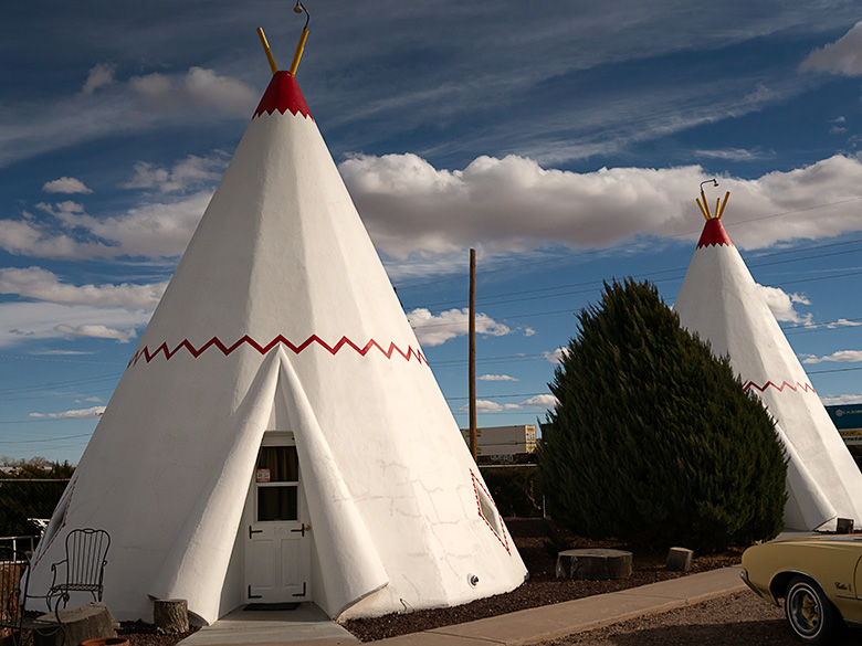
White tee pee-shaped motel rooms with classic car parked outside on Route 66 in Holbrook, Arizona
Nostalgic Nights: The Historic Tee Pee Motel of Route 66 – Step back in time with a glimpse of the historic TeePee Motel on Route 66 in Holbrook, Arizona—where classic cars and unique accommodations summon the spirit of America’s golden age of road travel.

Earlier this year, in a fit of cartographic embarrassment, I noticed my Arizona map was as barren in the northeast corner as my understanding of quantum physics. We use the map to bookmark locations we’ve visited and shared with you. “We must address this travesty,” I declared, or perhaps just thought loudly. Thus, Queen Anne and I embarked on an expedition to Holbrook, a place as famed for its petrified wood as my living room is for lost remote controls.

Upon our grand arrival in Holbrook, it became immediately clear how the town’s history was as layered as my attempt at a seven-layer dip, which never made it past layer three. From the ancient trading routes that seemed slightly busier than my last garage sale to the modern buzz of I-40, which promised the thrill of gas stations and fast food, Holbrook whispered tales of change. And by whispered, I mean it mumbled incoherently, much like Uncle Ray after his third Thanksgiving cocktail.

Wide-angle photo of playful dinosaur sculptures in a rock shop yard in Holbrook, Arizona, with petrified wood for sale
Petrified Pals: The Dinosaur Ambassadors of Holbrook’s Rock Shop – Encounter the past in a playful panorama with Holbrook’s roadside dinosaurs, a nod to the rich paleontological history unearthed at the nearby Petrified Forest National Park.

Diving into the town’s lore, we uncovered tales of early Pueblo peoples, whose idea of commuting was traipsing along the Little Colorado River. They traded goods with the enthusiasm I reserved for exchanging unwanted Christmas gifts. Picture them, settling down by the river’s edge, not to snap sunset selfies, but to swap stories of Coyote, the original trickster who probably invented the concept of “fake news,” and Spider-Woman, the ancient weaver who, unlike me, never blamed her tools for a botched job.

Then came the white men, striding into the horizon with all the subtlety of a brass band in a library. With their grand plans to connect coasts, Lieutenant Whipple and Edward Beale undoubtedly paused to ponder, “Will there be sufficient parking?” Their surveying tales were likely less about the awe of uncharted lands and more about the days when their socks stayed dry.

Early Settlement

In 1876, Mormons fleeing the excitement of Utah found solace in what would become Holbrook, a place that made their former home seem positively Las Vegas-esque in comparison. By then, the town had started to take shape, much like my attempt at sourdough during lockdown—full of hope but ultimately flat.

Our foray into this historical mosaic first led us to the part of town that had seen better days. “I’m not getting out of the car,” declared Queen Anne, with the determination of someone guarding the last slice of pizza. And who could blame her? The charm of the Arizona Rancho and the Bucket of Blood Saloon was as evident as the potential in my high school yearbook photo—present, but requiring a generous imagination.

Pedro Montaño built the Arizona Rancho home here between 1881 and 1883. It started as a single-story plastered adobe building with a high-pitched roof and dormer windows. After it was sold to the Higgins family, it became the Higgins House—a boarding house with a two-story addition. Next, it became the Brunswick Hotel. In the 30s, the west wing was used for Holbrook’s hospital, and during World War II, the Navy leased it to house pilots training at the airfield north of town. Now, it’s listed on the National Historic Registry and appears to be undergoing renovation.

Crossing the street from the train depot is another historic building in decay. It was initially called Terrell’s Cottage Saloon, and it was popular with cowboys and ruffians. After a violent gunfight in 1866 that ended up with two men dead, the street was described as if someone had poured a bucket of blood on it. The name stuck, and the saloon and street name bear the moniker. When we visited, a prominent sign urged people to contribute to saving The Bucket of Blood Saloon.

Imagine Holbrook as the Wild West’s version of a reality TV show, complete with outlaw gangs and cattle thieves vying for the title of Most Wanted, starring the Hashknife Gang and the Blevins Brothers, with special guest appearances by the Clantons, who thought the Earps’ version of justice was a tad too personal. Enter Sheriff Commodore Perry Owens, Holbrook’s answer to a sheriff who didn’t just wear a badge but practically invented the law enforcement genre with flair. His Wikipedia page? It’s the binge-worthy history lesson you never knew you needed.

Traffic Increases On Route 66

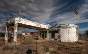
Faded green signage on an abandoned gas station under dramatic sky in Holbrook, Arizona
Deserted Drive-Up: The Withered Gas Station under Holbrook’s Sky – Behind a chain-link time capsule, the remains of what could be a Sinclair station stand sentinel under the vast skies of Holbrook, a mute testimony to the bustling days of Route 66.

Holbrook thrived on a cattle economy akin to a bovine social club for decades until 1926 rolled around with Route 66, flipping the script. Suddenly, Americans, intoxicated by the freedom of their Model Ts, were gallivanting across the country, pioneering the original road trip minus the luxury of air conditioning or reliable GPS. The Dust Bowl era added a gritty reality show twist, turning Route 66 into the “Mother Road” of all escape routes. By 1938, the road’s complete paving made cross-country jaunts less of a teeth-rattling affair, shifting Holbrook’s social scene north of the tracks. The town’s once-thriving pit stops turned into a ghostly strip of nostalgia, save for the Tee Pee Motel, now a restored relic where vintage cars outnumber guests—missing the chance to sleep in a concrete teepee? Now, that’s a modern regret.

Post Interstate 40

As Holbrook entered the fast lane of the Interstate 40 era, it seems the town, like a bewildered tortoise at a Formula 1 race, was sidelined by the rush towards efficiency. Where once adventurers might pause to marvel at the local color, they now zoom towards the neon glow of franchise signs, seduced by the siren call of combo meals and loyalty points. It’s as if America’s highways have become conveyor belts, whisking travelers from Point A to B with little regard for the stories and spectacles they blur past.

Amidst this homogenized landscape, Holbrook is a defiant reminder that sometimes the best part of the journey is the quirky diner you didn’t expect to love, not the time shaved off your ETA. In rediscovering Holbrook, we find not just a town but a treasure trove of tales begging us to slow down, look around, and maybe, just maybe, find a piece of ourselves among the echoes of Main Street. So, let’s take that exit ramp less traveled; who knows what stories await among the faded signs and whispers of yesteryear?

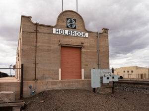
Old Holbrook train station sign with Santa Fe logo on a building repurposed as a warehouse along the railroad tracks
Tracks to the Past: Warehouse Days at Holbrook’s Old Depot—Standing with silent stories, the repurposed Holbrook train station along the SP tracks endures as a storied warehouse among the town’s architectural relics.

I hope you enjoyed our Holbrook tale and viewing the new photos. If Queen Anne and I have piqued your interest, you can see larger versions of this month’s adventure in my New Work collection <Link> and Fine Art America page <FAA Link>. They’ll be there for the next three months before they make way for a new adventure. Be sure to return next month when we stop at the Painted Desert and Petrified Forest.

Until our next detour, may your travels be full of discovery and stories as rich as Holbrook’s past.
jw

Sipping with a View: The Panorama at DAOU Vineyards Picture of the Week - Paso Robles, California

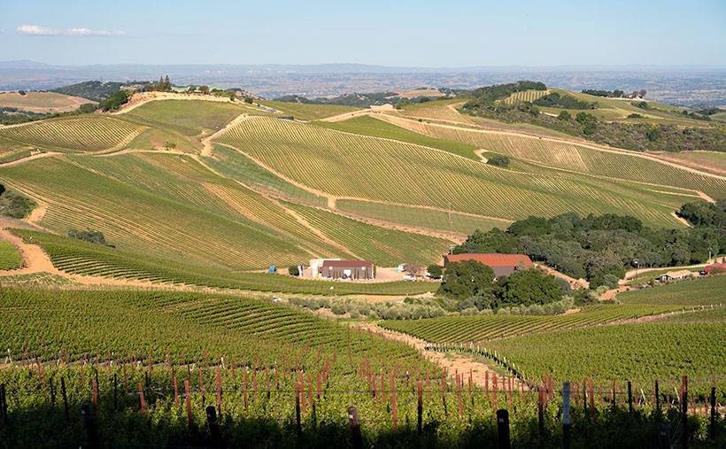
A panoramic view of rolling vineyard hills under a clear sky from the DAOU Vineyards tasting room in Paso Robles, photographed by Jim Witkowski.
Sipping with a View: The Panorama at DAOU Vineyards – Gaze over the lush expanses of DAOU Vineyards, where every turn offers a view more stunning than the last, inviting you to a tasting experience graced with natural splendor.

I bought our first bottle of DAOU wine by accident. While choosing from the Safeway shelf selection, I looked a row above the cheap stuff and spotted a bottle of their chardonnay. I immediately noticed that it came from Paso Robles—our favorite wine region. It was more pricey than our house brand but not by much, and since it had been a rough week, I thought, “What the heck?” I grabbed it by the neck and placed it in the cart.

That was a couple of years ago, and since—when we wanted something a little nicer—we splurge on a bottle of DAOU. That’s why we were so tickled that a stop at DAOU was on our wine-tasting recommendation list this spring. Indeed, I thought we wouldn’t come home without buying the place out.

Driving up to the tasting room reminded me of the Clifton Hillclimbs of days past. A castle-like building sits at the summit of the family-owned mountain. Instead of orange pylon cones, the narrow, twisting road is lined with lavender, making the mountain look like it’s wearing a purple crown. The finish line is under an ornate wrought-iron arch at the top—just after a sharp right turn. After I parked the truck, I let the engine idle for a few minutes to let it cool, which gave Queen Anne time to stop screaming and hyperventilating. Our breaths were removed again when we stepped out of the truck—this time from the view.

Stepping out onto the hilltop patio of DAOU Vineyards, one can’t help but feel as if they’ve entered an exclusive retreat, a day spa designed not just for relaxation but for the epicurean at heart. With panoramic views that command the senses and an ambiance that whispers of indulgence, it’s a place where time seems to stand still, encouraging you to savor every moment. With their attentive grace, the staff are like sommeliers of comfort, offering tastings and a complete escape from the ordinary.

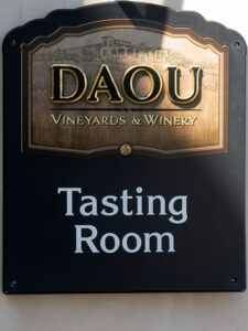
The distinguished sign marking the tasting room at DAOU Vineyards & Winery, inviting visitors to indulge in the art of wine, as photographed by Jim Witkowski.
Begin Your Journey: The Tasting Room at DAOU – The sign at DAOU Vineyards & Winery is not just a marker but an invitation to a world of exquisite tastes and shared stories.

For Queen Anne and me, this wasn’t just another stop on our wine trail; it was a moment of serendipity that had us seriously contemplating a permanent residence. The fusion of luxury and viticulture was intoxicating in its own right. And as the hot and cold running hostesses pampered us, each sip of DAOU’s exquisite wine seemed to erase any thought of a world beyond the vineyard’s embrace. It was here, amidst the laughter and clinking glasses, that we made our selections—wines that would forever remind us of the sun-drenched patio, the gentle breeze, and the feeling of absolute contentment.

A visit to DAOU Vineyards is essential to any wine lover’s journey through Paso Robles. It’s an experience that transcends the act of tasting into an art form, set against a canvas of sweeping hills and skies that stretch into infinity. DAOU is renowned not just for its wines but for its ability to transport you to a state of awe with its mountaintop location, offering a view that could rival any famed landscape painting. Here, each glass is complemented by the vast vistas of the valley below, the verdant rows of vines narrating the terroir’s tale. The tasting room, an epitome of elegance, invites guests to savor each note of their carefully crafted wines wrapped in Paso Robles’ natural grandeur. This harmonious blend of sensory pleasures positions DAOU as a destination of choice for those seeking to indulge in the grand symphony of winemaking.

At the heart of DAOU Vineyards stand the founders, brothers Georges and Daniel DAOU, whose journey in winemaking is as rich and compelling as the wines they create. Their foray into grape cultivation was born from a shared vision to produce Bordeaux-style wines that would rival the world’s best. With roots stretching back to the mountains of Lebanon, the DAOU brothers bring a unique fusion of old-world charm and new-world innovation to their craft. They are known for their exacting standards, from fastidious vineyard management to the precision of their cellar practices, constantly pushing the boundaries of what’s possible in Paso Robles. At DAOU, it’s not just about maintaining quality but elevating it, ensuring that every bottle tells a story of excellence and ambition, a narrative that honors their heritage and the land they’ve come to cherish.

DAOU Vineyards has etched its name in the annals of fine winemaking with a portfolio of wines that speaks to the discerning connoisseur’s heart and intellect. Their flagship offering, “Soul of a Lion,” is a testament to the DAOU brothers’ father and embodies the winery’s pursuit of uncompromised excellence—a Cabernet Sauvignon that commands attention with depth and complexity. The “Reserve Chardonnay” marries the richness of Paso Robles fruit with the finesse of French oak, creating a harmonious profile beloved by those who favor a fuller-bodied white. Not to be overlooked, their “Estate Cabernet Sauvignon” stands as a pillar of their red wine collection, showcasing the perfect balance of power and grace that the region’s unique climate and soils can instill. These wines, among others, have propelled DAOU to the forefront of Paso Robles wineries, each vintage crafted not only to impress but to leave a lasting impression of the terroir’s potential.

I would love to tell you what bottles we bought during our DAOU visit, but as you can see from the prices below, we were well out of our league. But throughout our discussion of whether we could get adopted by the DAOU family, we enjoyed each of the five samples our hostess selected for us. Unlike our introduction to wine tasting—when the Carlo Rossi Burgundy came from the very jug you bought—these days, the samples served at the vineyards are the creme de la creme—If the wine you buy in a retail store were an AC Bristol, they tempt you with a Shelby Cobra here at the ranch. Had we the budget, here are the bottles we would have brought home.

    • 2021 Estate Chardonnay–$100.00. We liked this chardonnay. It had the same characteristics as our Safeway version but more of everything. Unfortunately, it was clearly out of our price range, so we passed and bought four bottles of the normal chard from Total Wine instead.
    • 2020 Reserve Eye of the Falcon–$75.00. This Cabernet Sauvignon is made from a blend of Cabernet Sauvignon and Verdot grapes grown on the valley floor. It had excellent color and a great taste of black fruits and aromatics.
    • 2021 Cuvee Lizzy—$89.00. This was another Bordeaux-style wine using the estate-grown grapes. It’s a blend that starts with Malbec grapes and is then blended with Petite Verdot, Cabernet Franc, and Cabernet Sauvignon stock. This was our favorite of the flight. If possible, we’d buy a bottle, but we haven’t found one in our local stores. If we want to enjoy a bottle, we must win the lottery and return to Paso Robles.

Beyond enjoying DAOU’s wines, the experience at the vineyards was breathtaking. Sitting in those red patio chairs with attendants passing frequently with another offering was the definition of indulgence. We would have stayed the night if we’d brought our sleeping bags. At the end of our visit, our wine guide noticed that I was using my USAA credit card to pay the tab. She asked, “Oh, you’re a vet?” When I confirmed that I was, she waived the tasting fees. If I had known that was possible, we might have sprung for one of their Eye of the Falcons.

We hope you enjoyed our month of wine offerings as much as we did. If you’d like to pixel-peep this week’s Image, you can visit the larger version on my website < Jim’s Web> or its FAA page <FAA Link>. Be sure to put us on your holiday calendar next month because we’re going to a place where no man has gone before—well, not many have been there. Join us next week when we take you off the beaten path—it’ll be an adventure, I promise.

Till next time, keep your spirits high and your humor dry
jw

Techniques: Leveling the Horizon on Sweeping Vistas

A common pitfall I’ve noticed in many online landscape photos is a slightly tilted horizon, which can unintentionally give the impression that the scene is off-balance. Remember, even the Pilgrims relied on the horizon to align their buildings at Plymouth Rock. Getting this right in-camera is critical, as it preserves the natural balance of your shot.

For those looking to ensure a perfectly level horizon, modern technology offers a helping hand. My camera, for instance, comes equipped with an in-built level in the viewfinder. As you adjust the angle, the level’s indicators align, turning green at the perfect balance point. It’s a small step in the setup but makes a difference, especially for scenes like the one in this week’s photo where the horizon plays a starring role.

If you capture a slightly askew horizon, don’t fret—software like Photoshop can come to the rescue. Use the ruler tool to draw a line along the horizon, then select Image> Image Rotation > Arbitrary. Photoshop cleverly calculates the necessary adjustment, automatically realigning your Image. A quick crop to tidy up any resulting white edges, and your photo is ready to impress with a horizon that’s true to reality.

BTW:

I released the fourth video in my On the road with Jim on YouTube on Friday. This one covers the images in my Sonoran Desert portfolio. As a subscriber to this newsletter, you get a sneak preview before I add any links. If you want to view my latest effort, you can use this link to get to the video: https://youtu.be/QDc9fXnccy8

The Verdant Slopes of Paso Robles Picture of the Week - Paso Robles, California

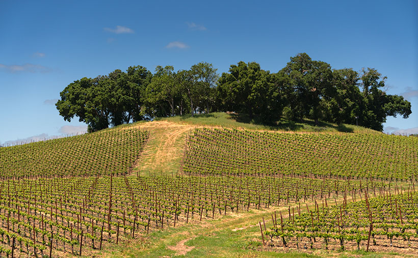
Vast vineyard in Paso Robles with rows of grapevines leading up to a tree-covered hill.
Nature’s Golden Arrow: Pointing to Paso Robles’ Treasures – Follow nature’s golden arrow, leading us to the crown jewels of this Paso Robles vineyard.

Thumb-deep in the pages of my trusted wall calendar (see more on calendars below)—a tome that’s seen more flips than a circus acrobat—I’m struck by the revelation that November has tiptoed in. This month, we salute not only the leafy tapestries of autumn but also indulge in the time-honored pursuit of pumpkin plundering. The ultimate spoils? Whisking those grim jack-o’-lanterns into pie perfection! And let’s not forget each stellar pie deserves a vinous virtuoso by its side. This month, our glasses are poised for just that.

Paso Robles beckons us back, teasing with three vineyards yet untouched by the footprints of Queen Anne and yours truly. San Luis Obispo County—our seaside serenade in Cambria—lures us with its labyrinthine backroads, rustic seafood haunts, and the siren call of Paso Robles’ vine-clad hills, a wooded sanctuary just a ten-hour drive away.

The “Pass of the Oaks” isn’t merely another dot on the wine map; it’s a chapter from an 18th-century vintner’s diary. With the Mission San Miguel’s historic tendrils, the grape gospel here has been preached for centuries. In this Edenic enclave, broiling daytime heat waltzes with the cool nocturnal breezes—a climatic duet the grapes practically waltz to solar caresses, coaxing ripeness, nightly whispers preserving zest.

But the tale doesn’t end with the meteorological. The Salinas River, a silent matriarch, cradles Paso in a diverse geological lullaby. It’s a mosaic of terroir, each parcel boasting its own soil story and climatic character. Amidst the hidden theatrics of the fault line beneath the 101 Freeway, a sanctuary for over 40 grape varietals thrives.

While the east side of the freeway is renowned for its sandy soils, giving birth to the robust flavors of well-known labels like Robert Hall and Tobin James, it’s also a chessboard of corporate plays. Giants like Julio and Ernesto have swept through, snapping up vineyards and shuttering public tasting rooms, sealing them away from the thirsty public. It’s a reminder that behind every serene row of vines lies the pulsing heart of business—sometimes nourishing, and sometimes, like a wise game of Monopoly, reshaping the very access to these bottled elixirs.

Our visual offering this week captures the ascending vines off Adelaida Road, cresting in an arboreal amphitheater of Live Oaks. Envision us there: Queen Anne and I, picnic basket in hand, seeking reprieve under those leafy sentinels, feasting simply yet sumptuously, all while the tapestry of Paso unfolds beneath us.

Curious about those precision-planted vineyard rows or the storied slope where Queen Anne played Jill—her hill-tumbling fame secured? Navigate to my website <Jim’s Web> or journey to the Fine Art America Page <FAA Page>. Prepare for our next vineyard chapter—it promises to be a symposium of the senses!

Until then, keep your spirits high and your humor dry;
jw

Techniques: The Subtle Art of Polarizing in Photography

In the sprawling vineyards of Paso Robles, a polarizing filter can be as crucial to a photographer as a corkscrew is to a wine enthusiast. It enhances the lush greens of the leaves and deepens the blues of the sky, much like a fine wine enriches a meal. However, the key to using this tool is subtlety, akin to adding just a pinch of spice to perfect a dish.

While a polarizing filter can dramatically reduce glare and enrich colors, the adage “less is more” applies beautifully here. After finding the point of maximum effect by rotating the filter, dial it back a touch. This ensures the scene retains its natural charm without oversaturated colors appearing and the sky unnaturally dark.

Authenticity: Over-polarization can make your images look artificial, robbing them of their authentic feel—something significant in landscape photography, where realism is often the goal.

Dynamic Range: Maintaining some natural light reflections helps preserve the image’s dynamic range, avoiding the ‘flat’ look that can come from over-polarization.

Viewer Connection: A scene that is too perfect can feel alienating. By keeping the location more natural, your audience can connect more deeply with the image, feeling like they could enter it.

As you stand amidst the rolling hills, let your polarizing filter accentuate the contrasts and textures gently. Allow the sky to retain some lightness and the leaves their natural sheen. This way, when you capture the essence of Paso Robles’ terroir, it’s not just the vibrant colors that speak to the viewer but also the nuanced dance of light and shadow that gives the landscape life.

Think of your polarizer not as a tool to transform the scene but to refine it—bringing out its character in a way that’s palpable but not overpowering. By mastering the subtle use of this filter, your images will hold truth to nature that’s as honest and inviting as the region itself.

BTW:

Since there’s only one month left on my wall calendar, I need to order a new one for next year. If you’d like me to print a copy for you, please let me know before Thanksgiving. They’re 8½ X 11 inches on sturdy stock with a spiral ring at the top. I have no idea how much they will cost. Currently, Vista Print wants $14 apiece plus shipping, but they often mark them down later in the month. If you’re willing to roll the dice, let me know (please don’t leave your email in the comments).

Coastal Serenity: A Tranquil Afternoon at Spooner’s Cove Picture of the Week - Morro Bay, California

A serene view of Spooner's Cove beach and the hazy Santa Lucia Range in the distance.
Coastal Serenity: A Tranquil Afternoon at Spooner’s Cove – Experience the tranquil beauty of Spooner’s Cove, where gentle waves kiss the sandy beach under the hazy skies. The distant Santa Lucia Range adds a touch of mystique to this serene coastal scene. #Spooner’sCove #MorroBay #CoastalBeauty

I want to provide some relief from the daytime temperatures clawing past the century mark this week. Let me transport you to a secluded beach, where cool sea breezes caress your skin and the rhythmic sound of waves lapping against golden sand will lull your senses. In this week’s photo, we find ourselves just a stone’s throw away from our previous location, Montaña de Oro State Park, south of Morro Bay, where a picturesque cove straight out of the movies awaits your exploration.

This lovely piece of real estate is Spooner’s Cove, and I know how your mind works. You’re thinking, “It got that name because horny lovers come here to be alone and watch the offshore submarine races.” Well, you’re wrong. This gem, nestled along the coastline, derives its name from Captain Spooner, an early settler in the region. While historical records and accounts don’t offer many details, the Cove’s designation pays homage to Captain Spooner’s presence or influence in this coastal region.

Spooner’s Cove is an ideal spot for nature lovers and outdoor enthusiasts. The surrounding area offers various hiking trails, allowing visitors to explore the coastal bluffs and enjoy panoramic vistas of the Pacific Ocean. It is a paradise for photographers, with its breathtaking coastal scenery and opportunities to capture the interplay of light, water, and land. Whether you’re seeking solitude, a romantic outing, or a peaceful day by the beach, Spooner’s Cove offers a serene and captivating experience that showcases the beauty of California’s coastline.

In this photo titled Coastal Serenity, we are presented with a secluded beach gently kissed by the receding tide. As your gaze extends beyond the sandy shore, the town of Morro Bay discreetly hides behind the bluff, concealing its iconic rock that typically graces the horizon. Across the hazy backdrop, the majestic Santa Lucia Range emerges—the coastal mountains that stretch from Morro Bay to Carmel. Serenely tracing the base of these mountains lies the Pacific Coast Highway, a dream route for sports car enthusiasts seeking the thrill of a scenic afternoon drive.

I regret that Queen Anne and I didn’t have more time at the Cove. It would have been nice to bring a food basket and a bottle of wine for a romantic picnic on the beach. Who knows, that secluded moment may have resurrected our libidos, and we’d be carried away—perhaps channeling the legendary scene enacted by Burt Lancaster and Deborah Kerr in the 1953 film From Here to Eternity (YouTube clip: https://www.youtube.com/watch?v=Uzu_LezGQYQ ). But then, for the rest of the trip, I’d have had to hear her griping about all that sand in her bloomers—so, maybe not.

You have a couple of options to view a larger version of Coastal Serenity. Visit its dedicated webpage by clicking this link: (Webpage link: https://www.jimwitkowski.com/newWork/coastalSerenity.html). For a more detailed image examination, head to my posting on Fine Art America: (FAA link: https://fineartamerica.com/featured/coastal-serenity-jim-witkowski.html ). On the Fine Art America page, hover over the image to reveal a green square; clicking inside the square will grant you a one-to-one preview, allowing you to explore the intricate details of the photograph—an indulgence we photographers often call “pixel-peeping.”

We are delighted you joined us on this journey to Spooner’s Cove and hope you find solace in its beauty and tranquility. Stay tuned for next week’s installment as we draw our June project on San Luis Obispo County to a close. Keep your camera ready; the next breathtaking moment awaits your lens.

Till next time
jw

Techniques: Creating Depth with Atmospherics: Suggesting Distance in Your Photographs

Have you ever come across a photograph of mountains where the details appear to fade into the distance? Despite the lack of intricate features, the image still conveys a remarkable depth. This optical illusion is achieved through a technique known as atmospherics. The front mountains are rendered darker by utilizing varying tones and colors, while each subsequent layer of mountains behind gradually becomes lighter. This interplay of light and shadow creates a visual depth that immerses viewers in the expansive landscape.

Atmospherics, such as haze, fog, or mist, can be powerful tools in photography, enhancing the depth and suggesting distance within your images. This technique finds its roots in the works of impressionist painters, who often employed it to create a sense of three-dimensionality.

To maximize atmospherics, focus on weather conditions that offer the desired effects, such as misty mornings or hazy afternoons. These conditions can add a subtle veil to your photographs, softening distant elements and creating a gradual transition from foreground to background. The haze layers can suggest depth, guiding the viewer’s eye through the scene and immersing them in its captivating atmosphere.

When composing your image, consider how the atmosphere interacts with the elements in your frame. The distant mountains or shoreline can appear more subdued due to the atmospheric effects, creating a sense of distance and vastness. Leading lines or prominent foreground elements can further enhance the depth perception, drawing the viewer into the image and inviting exploration.

Experiment with different compositions and perspectives to emphasize the effects of atmospherics. Capture scenes where elements gradually fade into the distance, highlighting the layers of mist or haze. By balancing the interplay of light, shadow, and atmospheric conditions, you can create evocative photographs that transport viewers into a world of serene beauty.

Valencia Peak Vista: Capturing the Essence of Montaña de Oro Picture of the Week - Morro Bay, California

Landscape view of Bluff trail winding through grassy field with majestic mountains in the background at Montaña de Oro State Park in California
Valencia Peak Vista: Capturing the Essence of Montaña de Oro – Immerse yourself in the breathtaking beauty of Montaña de Oro State Park as you follow the beautiful Bluff trail, surrounded by rolling grassy fields and towering mountains. Discover this hidden gem’s serenity and natural wonders on California’s central coast.

Welcome back to our San Luis Obispo County project. As I tried to explain last week, it’s one of our favorite spots on the planet. Usually, the purpose of our trips involves wine tasting, so we spend most of our time traveling the roads that run past the vineyards and traverse the coastal mountains—the Santa Lucia Range. With an extra day set aside for photography, Queen Anne and I made a pact to explore places in San Luis Obispo County that were new to us.

On the morning of our shoot—after I dragged her majesty out of bed while we ate breakfast—I showed her a road I found on our California Gazetteer. It began in Morro Bay and made its way along the coast on the Montaña de Oro headlands to Pismo Beach. I told her my plans to drive down to the resort town and then return via the 101 Freeway. She thought that was a great idea as long as there was a candlelight dinner and a glass of Chardonnay at the road’s end. However, halfway through the drive, we found a locked gate preventing us from going further. It turned out that someone built the Diablo Canyon Nuclear Generating Station in our way and closed the road—how inconsiderate.

Our day wasn’t a total loss because, between Morro Bay and the gate, we drove through three nature preserves: Morro Bay Estuary, El Morro Elfin Forest, and Montana de Oro State Park. Since we had to double back, I’d have to settle with subjects along our route—oh, pity the poor photographer because each place is worthy of an afternoon—if not longer.

Morro Bay Estuary: A coastal wetland teeming with diverse wildlife and stunning vistas. A network of trails to explore that wind through the estuary offers opportunities to spot various bird species, including majestic herons and graceful egrets. If you remember to bring your mukluks, you may even try digging for clams or annoying the critters you’ll find in the tidal pools.

El Morro Elfin Forest: Unique and magical woodland. Marvel at the twisted, dwarfed trees that named the forest, creating an ethereal atmosphere. Stroll along the well-maintained trails, enjoying the tranquil ambiance and the delicate balance between the forest and the surrounding coastal dunes. Keep your eyes peeled for rare plant species and enjoy the peaceful serenity of this hidden gem.

Montana de Oro State Park: A coastal paradise of rugged cliffs, golden beaches, and sweeping vistas. Hike along the stunning bluffs overlooking the Pacific Ocean, witnessing the power of crashing waves and the dramatic coastal scenery. Explore the tide pools, where you can encounter a fascinating array of marine life, and venture further into the park to discover hidden coves and secret beaches.

I took this week’s image at the Bluff trailhead in the State Park. From the parking area, we had a choice of taking the trail down to the ocean or venturing across the street to embark on the course that led us into the majestic mountains. As we made our way along the path, the peaks rising to Valencia Peak stood before us, their commanding presence adding a sense of grandeur to the surrounding landscape. Amidst this natural beauty, my attention was drawn to the display of a bright orange Indian paintbrush. I knew that capturing this scene would encapsulate the essence of Montaña de Oro’s breathtaking vistas.

We invite you to visit the web version of this image, where you can view a larger version of Valencia Peak Vista: Capturing the Essence of Montaña de Oro. Immerse yourself in the stunning scenery, the rich colors, and the sense of serenity captured in this image. It’s a visual testament to the beauty in San Luis Obispo County.

Mark your calendars, and come back next week for another captivating tale and image. Until then, keep exploring, keep capturing moments, and remember that every step you take can lead to new and remarkable discoveries.

Till next time
jw

Techniques: Utilizing Leading Lines in Your Photographs

Leading lines such as the trail, the line of peaks, and the swale in this week’s image are powerful compositional elements that add depth and guide the viewer’s eye through the image. They create a visual pathway, drawing attention and creating a sense of movement. Whether straight, diagonal, or curved lines enhance the overall composition and introduce a three-dimensional quality.

These lines don’t have to be literal; the arrangement of objects or elements can imply them. By utilizing leading lines effectively, you can elevate your images’ impact and storytelling potential, inviting viewers to explore and discover hidden depths within the frame.

You can transform a simple scene into a captivating visual story by incorporating leading lines into your photography. Experiment with different types of lines and their placement to create a dynamic narrative within your image. Consider how leading lines interact with other elements and the mood they evoke.