Technicolor Stroll Down Tombstone Canyon Bisbee, Arizona

Technicolor Stroll Down Tombstone Canyon - A group strolling down the sidewalk on Bisbee's colorful main street-Tombstone Canyon.
Technicolor Stroll Down Tombstone Canyon – A group strolling down the sidewalk on Bisbee’s colorful main street-Tombstone Canyon.

Welcome back to a new month and a new project! To play a joke on you, I almost sent out a blank post yesterday for April Fools. But, being the clever person you are, I deduced that you’d be too smart to fall for it. So then, I switched days on you and almost sent the prank out this morning, but I realized that you, a person of superior intelligence, wouldn’t be tricked by that ruse, either. Instead, I fooled you and wrote this new article, and you never saw it coming—HA! Inconceivable! Happy April Fools’ Day! – (thanks, Rob)

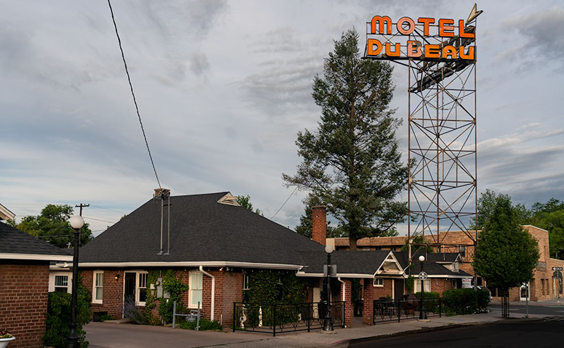
This month, Queen Anne and I will drag you back to Cochise County and Bisbee because we have a soft spot for this little mining town nestled in the Mule Mountains. Of all of Arizona’s ghost towns, Bisbee has been our favorite since our first visit, sticking with us like a catchy tune you can’t get out of your head. With its mile-high elevation, the weather’s usually pleasant, even in the hot summer months—as if Mother Nature herself turned down the thermostat. Instead of decaying wood shacks, Bisbee’s structures were built to last, and most of them are still standing, like proud survivors of a bygone era. The town boasts a thriving art community and a wide variety of shops, restaurants, and architecture. Oh, and let’s not forget the Copper Queen Hotel, once the poshest place to rest your head between St. Louis and San Francisco, where even its ghosts have high standards.

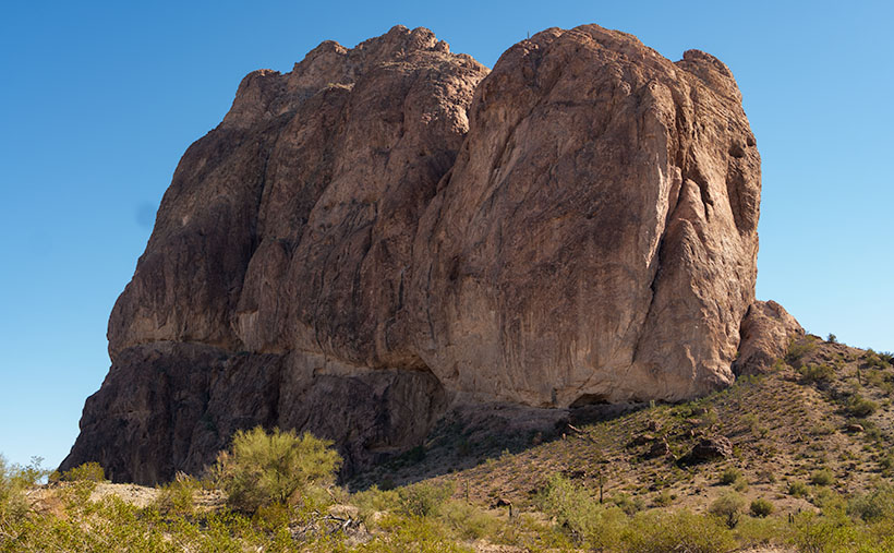
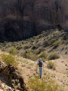
The Mule Mountains and Bisbee area have a rich natural and geological history. Millions of years ago, the mountains were formed through volcanic activity and shifting tectonic plates, resulting in deposits of copper and turquoise hidden beneath the surface—the juniper-covered Mule Mountains cradle Bisbee, nestled in the folds of its canyons. The region’s unique geological history has also led to the formation of these valuable deposits, shaping Bisbee’s identity as a mining hub. Anne and I enjoy capturing the breathtaking landscape and remnants of the town’s mining heritage. The area’s natural beauty and rich history have made it a true gem in the heart of the Southwest.

Long before the arrival of European settlers and the establishment of Bisbee, the Mule Mountains were already painting a masterpiece in vibrant hues of copper and turquoise, like a natural work of art that only the Hohokam, ancestors of today’s Tohono O’odham and Pima tribes, had the privilege of appreciating up close. These skilled farmers, traders, and artisans were the original caretakers of the land, leaving behind a legacy of pottery, petroglyphs, and other artifacts that offer a glimpse into their rich and colorful culture. The mountains were their muse, the copper and turquoise their paint, and the result is a stunning canvas that still takes our breath away today. The Mule Mountains had always held a special place in the hearts of those who called this land home long before Bisbee became the colorful town it is today.

Bisbee’s European history began in the late 19th century when prospectors discovered rich copper deposits in the Mule Mountains. The town proliferated, attracting miners, merchants, and entrepreneurs worldwide. By the turn of the century, Bisbee was a bustling hub of activity, with saloons, hotels, and shops lining its streets. Bisbee has had its fair share of both good times and bad. The town has a rich history, from its early days as a mining community to its recent incarnation as an artsy, quirky town. But with its history comes some dark moments, such as the Bisbee Deportation of 1917 and the Bisbee Massacre. These events left a lasting impact on the town and its residents, reminding us that Bisbee’s story is not just one of beauty and charm but also struggle and resilience.

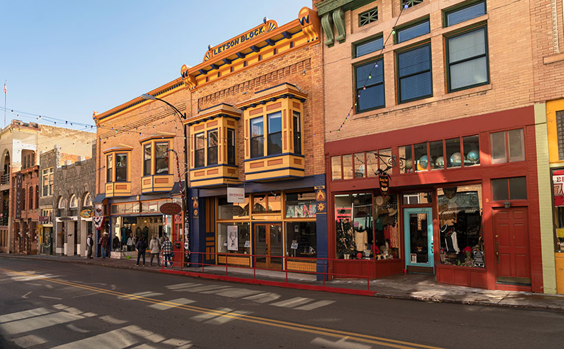
This week’s photo is a street scene of Bisbee’s main street—Tombstone Canyon—lined with a row of historic buildings painted in various colors reminiscent of San Francisco’s Painted Ladies. As was expected before WWII, the shops share a common wall to maximize their interior space. The most colorful building is topped with a plaque identifying it as the Letson Block. A small group of pedestrians is walking down the sidewalk; perhaps they’re window-shopping tourists. On the otherwise drab street, reflections of the sun off windows create interesting random rectangles.

Dot's Diner - Don't care to stay in a stuffy ghost-laden hotel. Then head down to the cemetery and stop at Dot's, where you can book a night in an Airstream, Airplane, or Yacht. Besides, it's an excellent place for breakfast in the morning.
Dot’s Diner – Don’t care to stay in a stuffy ghost-laden hotel. Then head down to the cemetery and stop at Dot’s, where you can book a night in an Airstream, Airplane, or Yacht. Besides, it’s an excellent place for breakfast in the morning.

We hope you’ve enjoyed this week’s photo of Bisbee’s Main Street, showcasing Bisbee’s charm. You can view a larger version of Technicolor Stroll Down Tombstone Canyon on the official website by clicking here. Join us next week for another exciting photo and tale from our favorite ghost town. We can’t wait to share our enthusiasm for this quirky, historic town.

Till next time
jw

BTW:

I told you so. If you haven’t gotten out yet, you need to get going. The fields are awash with flowers now. Grab your camera and get out there.

Spurs The Town Too Tough to Die

Spurs - Silver spurs on display in the window of a Tombstone boot shop.
Spurs – Silver spurs on display in the window of a Tombstone boot shop.

I got spurs that jingle jangle jingle, n’ I get so embarrassed at the movin’ picture show.”—John Wayne impersonation by Rich Little (I think).

Today is our final article about our Tombstone visit, and in the fine Disney tradition, we’ll exit through the gift shop. After all, that was the point of driving four hours to visit—overpriced beer, expensive burgers, tacky T-shirts, and a memento trinket that was most likely made in China.

Like most tourist towns, Tombstone has a variety of gift shops where you can buy anything your little heart desires—as long as your heart is lusting for cowboy stuff. Much like our hometown of Wickenburg, Tombstone is a one-trick pony. It’s all cowboy, all the time. It’s a formula that works for them. After all, they draw visitors from across the globe. Some fans regularly return for the OK Corral Shootout anniversaries—like Bob Boze Bell, noted Arizona illustrator and editor of True West Magazine. They go there to study the gunfight in painstaking detail for minute details that determine the outcome. So, why change a good thing? Me, I’m not that fascinated by gunfights.

Like most Arizonians, our first visit was enough. It’s not like we sit at home and suddenly drive four hours to discover what’s new in Tombstone. It’s always the same mediocre hamburgers in the same dives. The same good guys fight the same bad guys at the OK Corral, and the same people die. The same pink-rose patterned dishes are always collecting dust on antique store shelves. That’s why—for Queen Anne and me—a Tombstone trip is reserved for our out-of-town company or a lunch stop on the way to somewhere further along the road.

When we visit, however, we walk the boardwalks and window shop. On this most recent visit, I saw something unique. It was a display of silver spurs in the window of the boot shop. Since it was the week after Christmas, the store’s fully decorated tree was in the background. I thought, “What a perfect gift to give your favorite bull-rider.” Never before in my 75 years have I thought, “I wonder where I can buy a pair of spurs for my topsiders?” Now I know—in a Tombstone boot store.

I called this shot Spurs for apparent reasons. The actual display was much more comprehensive, but I had to move in close to cut the reflected window glare. This image is also a self-portrait—sort of. That’s me casting shade on the display. I might have gotten more spurs in the shot if I were a few pounds heavier.

You can see a larger version of Spurs on its Webpage by clicking here. Next week, we start a new project that’s thirty miles further on Old US 80. I’ll bet you it’s not the place you think it is. Come back next week and prove me wrong.

Till next time
jw

BTW:

Most importantly, Queen Anne is fine and recovering well. The emergency room doctor cleared the blockage with a can of Shasta Cola. I’m relieved that she’ll be around for a few more episodes.

Motel Du Beau Picture of the Week

Motel Du Beau - This 1929 establishment was one of the first to cater to tourists driving those new-fangled motor carriages.
Motel Du Beau – This 1929 establishment was one of the first to cater to tourists driving those new-fangled motor carriages.

When Queen Anne and I spent a week in Flagstaff last month, our primary goal was heat relief, but I was confident that I could snap a few shots of historic buildings and signs to add to my Route 66 collection. In this journal, I’ve written several times about my experiences traveling the Mother Road as a kid, so I’ll spare you from repeating them. Instead, I must say that I was disappointed at how hard it was to find kitschy motel and dinner signs along the main street. More profitable strip malls and professional offices are rapidly replacing them. Interstate 40 travelers prefer the newer hotels on Butler Street, where the Little America Hotel is. Nobody drives 66 anymore—too many lights and too much traffic.

John Steinbeck’s novel The Grapes of Wrath, the depressing story of dust bowl migrants, searching for survival, didn’t make Route 66 famous. Nor did that fame come from my father’s generation, who—like the Joad family—moved en masse to California after World War II. It came when Angel Delgadillo—the Seligman barber—pitched a historic highway idea to the State of Arizona. When that designation came through, tons of beer-guts had a play-pen to gather and drive their car toys. We’re dying off now, and like the coals in your Webber Grill, that passion is dying with us.

Master photographers Ansel Adam and Minor White influenced how I photograph the world. Still, in 1975, the George Eastman House showed a photo exhibition called The New Topographics: Photographs of a Man-Altered Landscape. The show still floats between museums today. It was a collection of ten photographs made by ten photographers that were opposite the landscapes I embraced. It was heresy. The photos are stark images of industrial buildings and houses devoid of people. I didn’t even think some of the artists printed very well. But I did kind of like the ones John Schott did. His pictures were of Route 66 motels. You can see where this led.

Flagstaff Train Depot - Either this is new or I've been blind, but the coolest Route 66 sign that I saw was the train station's address.
Flagstaff Train Depot – Either this is new, or I’ve been blind, but the coolest Route 66 sign I saw was the train station’s address.

I’ve considered compiling a book of my Route 66 photos. I have several, but most are from Arizona, with a couple from California and New Mexico, but nothing east of Texas. If this horse hadn’t been flogged to death, I still could work on my own Mother Road project. Now that I’m retired, I have time. I figure a month on the road should do it. To do it properly, I’d have to drive a classic car—something from the ’50s or ’60s. However, it needs air-conditioning, cruise control, and a good stereo (I won’t put up with AM radio stations dropping out under bridges). My ultimate ride would be a red ’62 Corvette—like the one Buzz and Todd drove—but hold the whitewalls. I could haul my camera equipment behind it in a small aluminum trailer like the autocross guys lug their race tires. October is a perfect month for a road trip, so if anyone out there wants to be my Angel investor, let me know. You’d get all the bills, half of the proceed, and a free book out of the deal.

This week’s featured image is of a prominent Flagstaff landmark. It’s called Motel du Beau, and the subject is the sign. It’s one of three hotel signs towering above the city (can you guess what this month’s project is). With the Lowell Observatory on top of the hill, Flagstaff has adopted a dark-sky policy, so the zoning people would never allow these enormous signs in town. If they weren’t historical landmarks, the city would tear them down.

In the late 1920s, Albert Eugene Du Beau vacationed in northern Arizona and envisioned a new way to make money. Instead of building a multi-story building for railroad and train travelers to stay, why not create a place for people traveling in these new-fangled motor cars? So, he designed and built a single-story motor-hotel (later shortened to motel) to be convenient to unload and load their vehicles in 1929. His design featured a U-shaped layout with steam-heated garages (they burned down in a 1970s fire) and indoor toilets. He built his motor court adjacent to downtown’s main street, which was brilliant because, in time, the busy highway became Route 66. The Motel Du Beau was one of the pioneering businesses to use neon signs and elevate them on towers.

In today’s modern world, the Motel Du Beau still looks like a nice place to stay, with rooms starting at $75—a far cry from the original price of $2.50 per night. Their website shows various room types, and they have a lovely little wine lounge called Nomads. I’d certainly be willing to try it after they reopen the bar.

I hope you enjoy seeing a part of Flagstaff’s history. You can view my Motel Du Beau web version on its page by clicking here. Next week, we’ll look at another historic Flagstaff motel sign, so be sure to join us then.

Till next time
jw

White House Picture of the Week

White House - An abandoned dwelling of some sort in the ghost town of Dos Cabezas.
White House – An abandoned dwelling of some sort in the ghost town of Dos Cabezas.

Ghost towns are a big business in Arizona. That’s good because we have our fair share, and a few of them attract many tourists. They’re our Disneyland. As soon as your relatives hit the tarmac and demand to see the state, the first suggestion out of your mouth is, “Let’s go to Jerome (Bisbee-Oatman-Tombstone-etc.).” You’d think that, by definition, ghost towns are abandoned places—they had their heyday long ago, but the residents left when things went south. But, that’s not necessarily true. The population count in some of our mining towns rivals the numbers they had in their prime. Our hometown of Congress is an example. People move here to get away from Phoenix’s smog and traffic—or the Minnesota snow—and they’re all on the road and in my way.

I’ve concluded that somebody loves it and wants to live there no matter how remote one of these places is. Take the town I introduced last week—Dos Cabezas. Among the derelict buildings, there are two surviving businesses. One is an art studio/gallery (Dos Cabezas Art Gallery), and the other is a bed and breakfast (Dos Cabezas Retreat Bed and Breakfast). At least those are the two places that advertise their presence. There are several cattle ranches in the area, and there is an emerging wine presence, but not within the town limits.

I don’t know anything about the gallery, but enjoying a glass of local wine while staring at the stars on the B&B patio would be a treat. Since it’s closer to the Chiricahua National Monument, it’s an alternative to the chain hotels or downtown dives in Willcox. The two guest rooms are in an adobe walled casita, and as the name implies, the hosts include breakfast. A drawback for Queen Anne and I would be dinners. The nearest restaurants are 15 miles away in Willcox or Douglas, over an hour’s drive south. If you’re a person that needs bright lights and noise to sleep, the retreat wouldn’t be your cup of tea—the nights in the middle of Sulphur Springs Valley are exceptionally dark and silent.

As you can tell from this week’s picture, the little ghost town is at the foot of the Dos Cabezas Mountains. It’s near the range’s southern reach, so you can only see the south head (Cabeza). There’s a road and trails that will get you to the top, where I imagine the view of the valley and Willcox Playa is spectacular. You need permission to cross a locked gate, and the top is steep, so why bother?

In this image that I call White House, I assume it was a dwelling. It’s a palace compared to some of the miner’s shacks I’ve seen. Unlike the other buildings in Dos Cabezas, this one is a fixer-upper. You have affordable housing with a bit of paint, a few shingles, and a yard clean-up. But there’s probably a community historical committee that needs appeasement, so you can’t paint it purple.

Unlike last week’s photo, the white stucco pops against the brown mountain and clear blue sky, and I like that. There’s plenty of side yard where I visualize Queen Anne hanging laundry on a solar drier. Then, this would be a picture that Norman Rockwell or Andrew Wyeth would envy. Where’s the Saturday Evening Post when you need them?

You can see a larger version of White House on its Web Page by clicking here. Next week, we continue down County Highway 186 in search of an image worthy of another car stop. Please join us.

Till Next Time
jw

Courthouse Rock Picture of the Week

Courthouse Rock - The huge granite monolith that attracts climbers and base-jumpers to the Eagletail Wilderness Area.
Courthouse Rock – The massive granite monolith attracts climbers and base-jumpers to the Eagletail Wilderness Area.

When you were in school, did you learn about the Lewis and Clark expedition—the party that explored the Louisiana Purchase and discovered the first Starbucks in what’s now called Seattle? Sadly, when it comes to the outdoors, my buddy Fred and I will never rise to that level of notoriety. We’ll most likely go down in history more akin to Laurel and Hardy.

Fred and Jim's overlapping skill sets - When we get together, things don't always go as we plan.
Fred and Jim’s overlapping skill sets – Things don’t always go as we plan when we get together.

Don’t get me wrong, Fred is a brilliant man. After all, he is an engineer, and I can write complete sentences, so when apart, we can navigate the world and safely return home (to the amazement of our wives). But when we go out together, our skill sets overlap like in a Venn diagram, setting up a thinking interference pattern that causes things to go south.

To finish up this month’s project, the Eagletail Mountains, I needed a couple more photos that are close to the subject. Since it’s a wilderness area, that meant hiking. I spent time researching and found a perfect trail on AllTrails. It’s only 3 1/2  miles each way and goes to Indian Springs. There, we should see a spring and a rock wall of petroglyphs. They described the hike as “the easiest trail in the world. It’s an old mine road with little grade change. A baby can do it.”

I began calculating. I walk at 2.2 miles per hour (I measured it using my hand-held Garmin), so 2 hours in, snap a couple of shots, 2 hours out, and add four hours of drive time down and back. The outing should easily take an afternoon. I asked Fred if he would be interested (somebody needed to carry me out when I fell). He said, “Sure.”

Monday at noon, I tossed on some comfortable jeans, my whitest Tee shirt (so the rescue helicopter could spot me), and a baseball cap. I drove to Fred’s house to pick him up. He opened the front door dressed like an L.L. Bean model, with a freshly pressed ‘cool-shirt,’ safari hat, day pack, and walking sticks. He was gorgeous.

It was a beautiful day, and we spent the two-hour drive talking about the hike and sharing the maps we brought. Fred downloaded the AllTrails map onto his iPhone; I had printed the directions to the trailhead; we were ready.

Mistake #1: The easy part was getting to the Gas-Pipeline road, but we had to count the miles to the turnoff. As Fred read the instructions, I watched the odometer. When the instructions said, “At 1 ½ mile, turn onto an unmarked road,” a road appeared on the left. We turned, but the sign that they promised wasn’t there. We continued anyway and came upon a group of young men camped at its end. This place must be our spot, so we parked.

Mistake #2: The boys/men were friendly and were sitting around packing parachutes. If we were in California, I would have expected them to be waxing surfboards. They had come to Courthouse Rock to climb the monolith and then jump off with a parachute—even though the rock wasn’t in danger of crashing. They asked why we had come. They said we were on the wrong road when we told them about the trail. They said we needed to return to the pipeline road and go another mile. Fred and I looked at one another, the maps, and the app. Since the trail was just over the hill, we ignored their directions—like any person holding a man-card should.

Mistake #3: We started hiking cross-country diagonally toward the trail. “Surely, it must be over that low ridge, and we’ll see it from the top,” I told Fred. We hiked to the ridgeline and saw——another hill. We began the long trudge to its top. What we didn’t realize at the time was that we were climbing Courthouse Rock’s talus slope. The rock must have been significantly larger at one time because sharp granite chips covered the ground. They had flaked off the enormous tower, making the footing lose. Falling on them would hurt—a lot.

Fred the trailblazer - Fred hikes to another ridge to see if it's the last of our hike. It wasn't.
Fred the Trailblazer – Fred hikes to another ridge to see if it’s the last of our hike. It wasn’t.

After an hour of hiking uphills and over gullies, we reached a point where we could see the trail. It was on the other side of a deep wash. That meant we could get to it if we could cross the dry creek, but it was still a half-mile away. We only managed to cover less than a mile during the past hour. I was ready to quit but could see yet another ridge on the horizon. I hoped it was the last. Fred volunteered to continue seeing if it was our summit while I sat, drank water, and caught my breath. He confirmed that it wasn’t, so we started back when he returned.

Instead of retracing our steps, we went down into the wash, where we could walk the sandy bottom back to the Jeep in half the time. We had to explain our failure to the base-jumping dudes when we reached the camp. “Yeah, I thought you should drive to the other road,” one of them graciously taunted. Since we were in the area, we did. We found the second road with signs, parking, and an informational kiosk. At least we’ll know should we ever go back, but the two-hour drive home was nearly silent for now.

I shot this week’s picture that I call Courthouse Rock at the beginning of our hike. It’s of the enormous granite monolith from its west side. The 20-foot palo verde tree gives scale, so I’m glad the tree photo-bombed my shot.

Click here to see a larger version of Courthouse Rock on its Web Page. Next week, we’ll finish our Eagletail Mountain visit and move on to another project. Hopefully, somewhere I can drive.

Until next time — jw