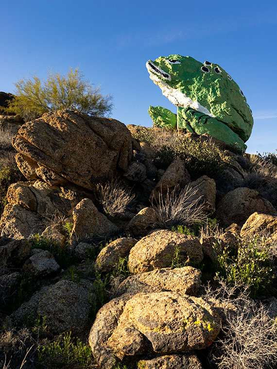
There are only a half-dozen places Queen Anne, and I frequent in our home town of Congress. There’s Nichol’s West—our favorite local restaurant, the Post Office, the clinic, the Kwikie Mart, and the Dollar Store. Oh, I forgot the dump. For anything else, we have to drive into town or—shudder—the big city. Half of those in-town destinations are on the west side of the railroad crossing, which never has a train—most of the time.
I wrote in a newsletter about our train when we first moved here. This section of track is called the Pea Vine Grade that follows Highway 60 out of Sun City till Wickenburg then continues north to Prescott and Ash Fork. The name is descriptive of the twists along the route.
The tracks aren’t busy like the southern route in Yuma, or the north through Flagstaff. This route isn’t bustling and only has four to six passing trains each day. They’re not on any schedule that I can discern and you don’t hear them go by as much as you feel their bass vibrations, especially the ones coming up the grade. The five engines work hard dragging loaded freight cars up the hill, while the ones headed south sound like a wooden roll-a-coaster as they effortlessly roll downhill. Their horns only blare in Wickenburg and the Congress crossings. That’s too far away to hear from the house unless we’re sitting on the back porch and there’s a north breeze coming off the mountains, but even that’s so faint that it’s like a scene from a Steinbeck novel.
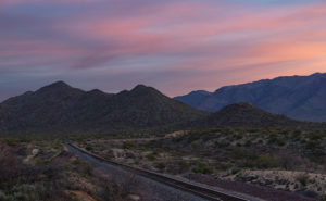
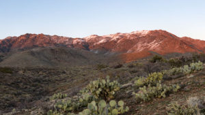
This week’s featured image turned out completely different from how I originally visualized it. I wanted to capture this shot with a train in it. The tracks come into Congress Junction from Hillside through the valley between the Date Creek Range and the Weaver Mountains. On most mornings, there’s an early southbound train. We’ve seen it while we’re out for our morning walks. To further set the scene, the Date Creek Range foothills at the crossing are prettiest at sunrise. The rest of the day, they’re flat and dull. So that’s what I had in my mind when I drove there in the dark.
I previously scouted out a lovely spot overlooking the tracks, and I set up my camera and waited for the characters to arrive. As the eastern sky got brighter, the clouds overhead turned red, and I thought, “Ooo shiny.” I fired off a couple of frames. As I waited, the fast-moving clouds moved east and began to block the sunrise removing any drama from my scene. Besides, no trains showed up. Disappointed, I packed up and drove around town looking for other subjects to shoot.
When I got home and reviewed my images, this was the shot that impressed me the most. Even without a train, the tracks are a leading line that moves your eye to the foothills. The light bouncing from the clouds tints the scene pink, and that light softly brings out the mountain’s cone shape. There is a feeling of tranquility in this shot. It’s a moment of quiet and calm.
You can see a larger version of Sunrise on Track on its Web Page by clicking here. I hope you enjoy viewing this week’s post and next week; we’ll show another featured image from Congress.
Until next time — jw