Purple Owl’s Clover Picture of the Week

I’m amazed at how much things have changed in a month, and how current events are forcing me to find new ways to provide new content for you. Last month was Anne’s knee surgery, where I needed to stay close to home and care for her. Now that she’s on the mend, I thought I’d be able to go on one of my road trips and gather new subject matter, but that’s not happening. With the pandemic looming over us, our Governor has ordered us to “Stay At Home” unless it’s for essential services. His list of critical activities includes playing golf—as a form of exercise.

Those of you that know me well know that I’m not a rebel. I’m no James Dean, and I usually follow the rules. In other words, I’m a coward. I’ve spent the last week anxiously trying to figure a way to get new photographs for you. Should I go on my planned trip? Should I cancel my blog this month? My stomach was in knots, and I wasn’t sleeping well. I was only getting two naps a day instead of my usual three.

I spent the beginning of the week perusing the Governor’s proclamation, and I came up with an answer. Instead of taking a trip out of town, I’d pick an empty road in Wickenburg. That way, if the Gendarmes stopped us, I could say that we’d gotten lost on the way to the golf course, and we were only exercising.

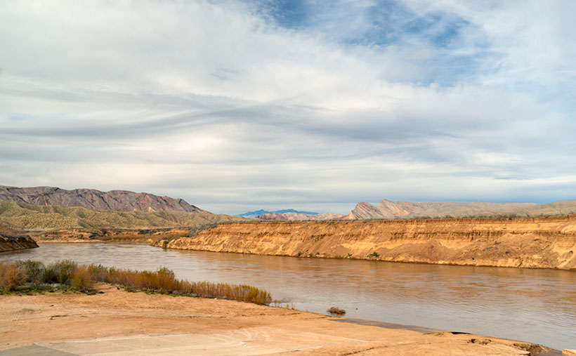
The road we picked is called The Scenic Loop—seriously, that’s its name. It starts at US 93 north of town and goes past the Hassayampa River Box Canyon before it winds up at the Boyd Ranch. We had no problem keeping a safe distance from other people because we were alone. In the two hours we photographed, I got enough material to keep me locked in my office until June.

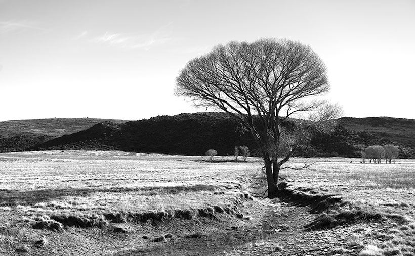
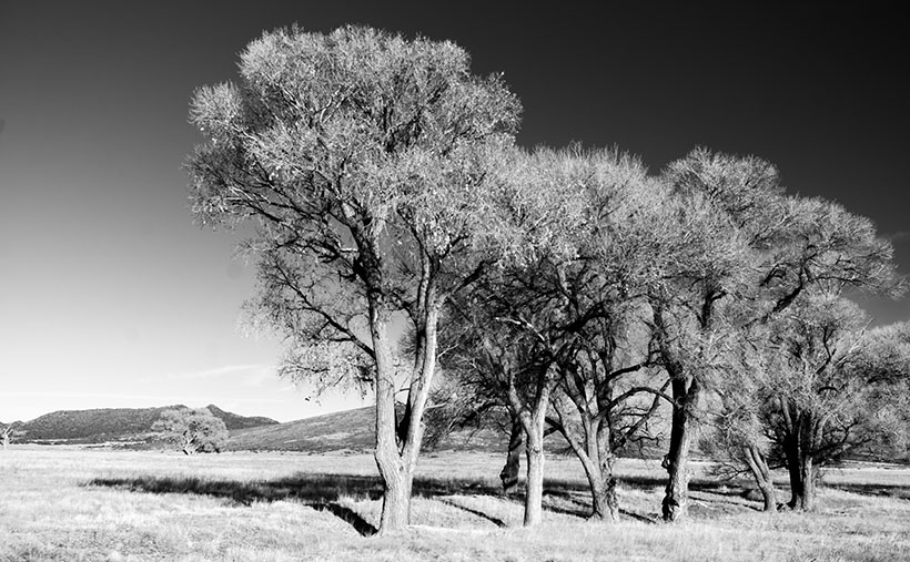
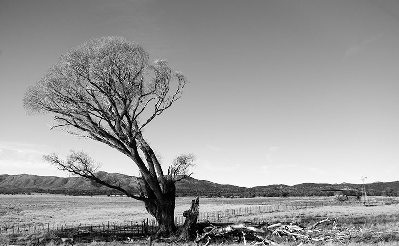
Another big difference is the contrast between March’s pictures and those I have for April. Last month was about winter and old gnarly cottonwood trees. This month’s series is about spring, color, and new growth. April is always the prettiest time to be in the Sonoran Desert.

Purple Owl's Clover - In the years when the winter is wet, the desert gets painted with wildflowers in spring.
Purple Owl’s Clover – In the years when the winter is wet, the desert gets painted with wildflowers in spring.

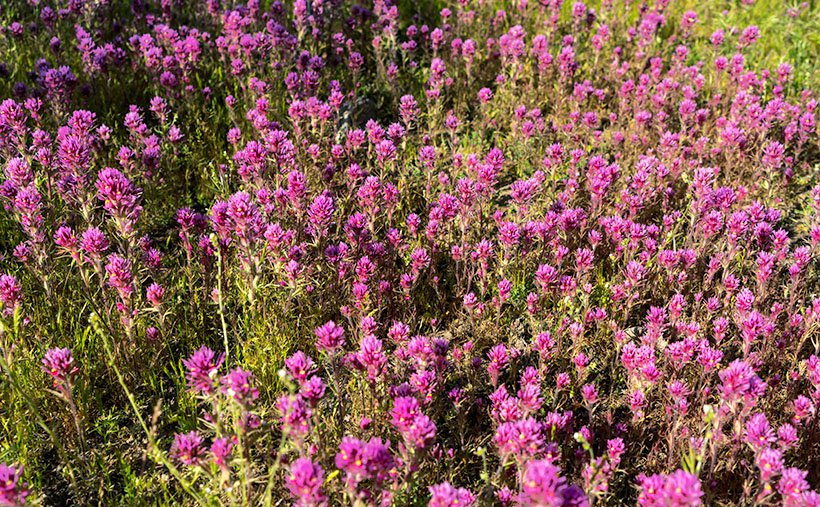
This week’s featured image is an example of what I mean. Usually, the desert floor between cacti is bare gravel, but not this week. It’s full of grass and wildflowers, and in this case, a patch of Purple Owl’s Clover. I don’t think it’s related to the tiny white flowers that get into your lawn; they just look the same. Patches such as these appear on flats where there’s Goldilocks water (just right).

You can see a larger version of Purple Owl’s Clover on its Web Page by clicking here. I hope you enjoy it. Come back next week when we continue with our illicit trip along Wickenburg’s Scenic Loop.

Until next time — jw

Meadow Cottonwood Picture of the Week

The part of Yavapai County where Queen Anne and I live is littered with the names of pioneers that came to Arizona looking for gold after the gold rush in California panned out. These places include the towns of Wickenburg, Yarnell, and Stanton—the Weaver Mountains—and Peeples Valley. I didn’t misspell the valley name. It’s not a great commune up there in the mountains, but a rather a lovely flat valley named after a prospector named A. H. Peeples.

I’ve mentioned him before in previous posts. With a set of initials like that, I was relieved (although disappointed) to find that his full name was Abraham Harlow Peeples. He was on an Army expedition lead by Captain Joseph Walker and guided by Pauline Weaver—who, despite the name, was a man. While camping along a creek, some horses (or mules, depending on which story you read) wandered off during the night. Walker sent a couple of wranglers to fetch the animals. When they returned to camp, they talked about gold on top of the hill and showed pockets full of nuggets. Peeples and the rest of the party went to see for themselves. Arizona Place Names said that Abraham picked up $7,000 in gold before breakfast—and that’s in 1863 money. Anyway, he used his new wealth to build a ranch in the valley that bears his name.

Before Anne and I settled in Congress, we looked at several homes up there. It has advantages. With a higher altitude, it has milder summers but doesn’t get snowed in during winter. The valley has beautiful mountain views with the Bradshaw’s to the east the Weaver Range on the south. The little town has a bar and convenience store. What more could you want? However, the closest grocery store is the Safeway in Wickenburg, and that’s where we buy groceries now—fifteen miles in the other direction.

The Maughan Ranch owns most of the land in the valley, and they keep adding to their property. Along Az. 89, there are painted white fences, with black cattle grazing behind them. Our real estate agent joked that the painters are full-time staff because they’ll never finish.

Meadow Cottonwood - a single tree grows in a meadow ravine ensuring a good water supply.
Meadow Cottonwood – a single tree grows in a meadow ravine, ensuring a plentiful water supply.

Lucky for me, the fences don’t block the view of the trees featured in this month’s set of photographs. For this week’s featured image—called Meadow Cottonwood—I leaned against the fence to brace myself when I snapped the photo. This dormant cottonwood is a middle-aged tree that found a meadow ravine to grow in. Backlit by the sun, I’m happy how the delicate branches contrast against the white sky.

You can see a larger version of Meadow Cottonwood on its Web Page by clicking here. I hope you like it. Be sure to come back next week for another cottonwood portrait from Peeples Valley.

Until next time — jw

Cottonwood Grove Picture of the Week

I want to begin this week’s post by thanking Deb Poteet for her advice about wearing fish-net stockings. If you missed what she said, it was a helpful comment to last week’s post. She said that she got her information straight from the Candy Store dancers—the gentlemen’s club on Cave Creek Road near Costco. It made both Queen Anne and me wonder what she was doing hanging around old strip clubs. Deb really does surprise us sometimes.

On another subject, Her Majesty is improving with each day. She goes to physical therapy three times a week and limps around the house without her walker or a cane. When I remind her that she doesn’t need to do that, she drops the Chester impersonation. It’s interesting to see how fast a woman can recover when you walk up to her death bed with a bottle of Dawn dish detergent and ask, “How much of this do I put in the dryer?”

Cottonwood Grove - A small grove of cottonwood grow along a dry brook in Peeples Valley, Arizona.
Cottonwood Grove – A small grove of cottonwood grows along a dry brook in Peeples Valley, Arizona.

Meanwhile, back up the mountain in Peeples Valley, and the second in my series of cottonwood tree images. This week’s featured image that I call Cottonwood Grove was another image taken on the Maughan Ranch north of town. Like other members of the Poplar family, these large fast-growing trees only grow where there’s a good water supply. In this image, there’s about a half dozen growing along the banks of a dry brook, which eventually feeds Kirkland Creek. Scenes like this one are familiar throughout the west.

In an Arizona Geography class that I took at Arizona State University, the professor told us how the trees filled the length of the Salt River bed. A family of beavers dammed the river under the Mill Avenue Bridge while the river still flowed. When the Corps of Engineers built the dams east of town, the Salt River stopped flowing, and the trees died, rotted, and eventually, a summer monsoon storm blew them over. That would have been a swell topic for a photo essay, but I wasn’t here then.

You can see a larger version of Cottonwood Grove on its Web Page by clicking here. I hope you like it. Be sure to come back next week for another cottonwood portrait from Peeples Valley.

Until next time — jw

Broken Cottonwood Picture of the Week

Well, I might as well tell you right off, because you’re going to find out anyway. I’m cheating on this month’s project. I didn’t search out a new back road for us to explore. Instead, I just drove up the highway to Peeples Valley and photographed old cottonwood trees that I’ve meant to shoot for the last couple of years. I guess you could consider Arizona 89 off the beaten path if you’re used to driving I-17 to Prescott, but it’s the way we go to Costco all of the time, and it’s the official route for every car and motorcycle club tour every weekend.

The reason I shirked my responsibility this month is that I had to put Queen Anne down—wait, that’s not right—oh yeah, she had knee replacement surgery, and I’ve been wearing two extra uniforms since. I’ve been her nurse and maid, and quite frankly, I prefer the white stockings because my toes keep getting caught in the fishnets.

When she first came home from the hospital, her knee looked like a sewed up bag of haggis—that’s the Scottish delicacy of oats and various animal parts boiled in a sheep’s stomach. It was black and blue with stitches that could make Frankenstein jealous. She was all doped up on pain medication and spent most of her time in bed. When she did get up, she’d hobble on her walker to the bathroom or eat a cup of food.

In less than two weeks, she’s moving much better and can make her way through the house without assistance. Now she’s going to rehab three times a week where they ask her, “How far can you bend your knee before it hurts?” After she demonstrates, they grab her leg and bend it further. The whole town of Wickenburg knows when that happens—sort of like the Pit of Despair in The Princess Bride. It seems to work though, because she has more movement each day, and she’ll soon be back to normal. I do think shes enjoying being waited on hand and foot because she milks it for all she can get. She even claims the doctor said that ice cream was medicinal.

Enough about her, let’s talk about photography. As I said, we frequently travel through Peeples Valley, where there is a large cattle ranch—Maughan Ranches—with white fences lining each side of the highway. In the green pastures, there are some very old cottonwood trees that I find appealing, so on a Saturday, when I was able to escape, I drove up and spent a moment behind the camera. After looking at images on my screen, I decided that since it’s winter and there’s no leaves or color, I would process them in black-and-white. In all, I think it shows the subjects off much stronger.

Broken Cottonwood - A pair of cottonwood trees, where one has fallen leaving the survivor leaning precariously in Peeples Valley, Arizona
Broken Cottonwood – A pair of cottonwood trees, where one has fallen leaving the survivor leaning precariously in Peeples Valley, Arizona

This week’s featured image is called Broken Cottonwood. It shows half a pair of old trees. One of them has fallen from decay or rot whose remains litters the ground. The second tree leans to the left to avoid crowding. Now that it stands alone, it leans precariously, like Grandpa McCoy on his cane. There’s a tension in this shot that the little windmill on the right seems to balance.

You can see a larger version of Broken Cottonwood on its Web Page by clicking here. I hope you like it. Be sure to come back next week for another cottonwood portrait from Peeples Valley.

Until next time — jw

Grand Wash Cliffs Picture of the Week

I love those DeLorme Atlas & Gazetteers. I have about a dozen of them stashed on my office bookshelf, one for each state that we’ve traveled. Whenever Anne and I go on one of our jaunts, I toss at least one in the truck. I try to be careful with them, so they’ll last, but I’m regularly replacing my Arizona edition because I use it so often.

Last month while looking for new places to explore, I realized that there are four pages in the Arizona Gazetteer where I’ve never been, not in the 48 years that I’ve called Arizona home. The pages are easy to find, as they’re the first two and the last two. The areas covered by these pages are The Arizona Strip—east of Nevada and south of Utah north of the Colorado River—and the southeast corner of the state. I’ve never been to the Chiricahuas. Isn’t that hard to believe? I’ve decided to fix that by making trips to our northwest this year, and the southeast corner next year.

With that in mind, February’s topic will be the trip that her majesty and I made to Pearce Ferry this week. It’s not a difficult trip as you get off Interstate 40 on Kingman’s Stockton Hill Road. You go 40 miles north on that road, then you turn right on the Pearce Ferry Road and continue until the Colorado River stops you at the other end. All but the last nine miles are paved.

What you’ll see along the way is the Great Basin Desert. More like Nevada than the Sonoran Desert that we’re used to. Stockton Hill Road runs along the east side of the Hualapai Valley and Red Lake—one of the four natural lakes in Arizona. In winter, it even comes with water, the rest of the time it’s dry. The Pearce Ferry Road section crosses the valley and runs along the Grand Wash Cliffs to Meadview. That’s where the gravel-dirt road descends to the River.

Grand Wash Cliffs - A storm front moves over the Grand Wash Cliffs at Pearce Ferry.
Grand Wash Cliffs – A storm front moves over the Grand Wash Cliffs at Pearce Ferry.

Besides the towering Grand Wash Cliffs and muddy Colorado emerging from the Grand Canyon, there’s nothing much happening at the Ferry. Until a couple of years ago, it was the place where Grand Canyon rafters hauled out of Lake Mead. Because of the ongoing drought, the lake is so low that the boat ramp is high and dry. Now boaters have to use South Cove. It’s 23 miles away by road, but double that by water.

I took this week’s featured image near the deserted boat ramp. It shows the colorful Grand Wash Cliffs under a brooding sky. The storm front that you see greeted us on our arrival and followed us home, bringing rain to Congress the next day. I call this image Grand Wash Cliffs (At Pearce Ferry).

I’m also including a second image this week at no extra charge. I wanted to show the boat ramp struggling to reach the muddy river. The next launching place is at South Cove around the peninsula in the photo’s background. By the time the river passes South Cove, the river flows into Lake Mead, and most of the silt drops out of the water, so its color is blue (and high white banks because of the low water level). This second photo is for reference, so I called it Dry Ramp.

Pearce Ferry Boat Ramp - Lake Mead's water is low enough that the boat ramp isn't usable.
Pearce Ferry Boat Ramp – Lake Mead’s water is low enough that the boat ramp isn’t usable.

You can see a larger version of Grand Wash Cliffs on its Web Page by clicking here. I hope you enjoy seeing it. Join us next week as we drive home with stops along the way to photograph more lovely scenery in Hualapai Valley.

Until next time — jw