Chasing Sunrises and Freight Trains on Route 66 Pictures of the Month - Hackberry, Ariozna

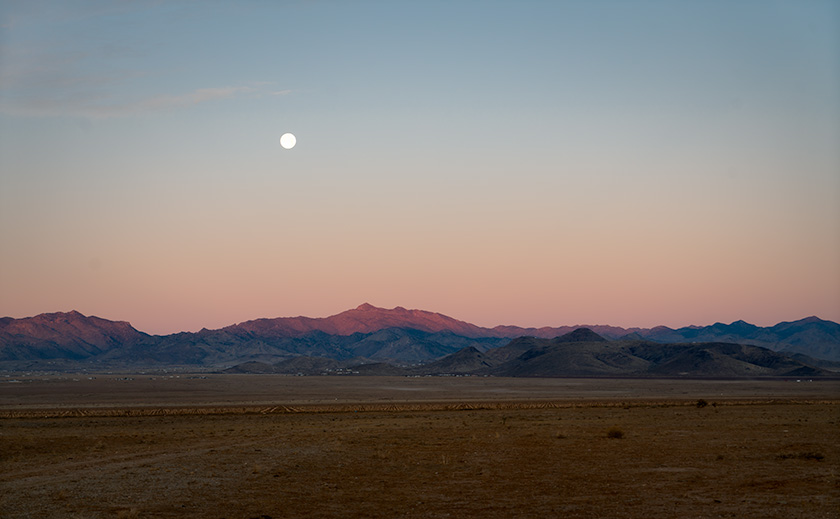
A full moon setting over the Cerbat Mountains at dawn, with pastel desert hues, captured from Route 66 near Kingman, Arizona.
Kingman’s Desert Dawn – Moonset Over the Cerbat Range – As we left on historic Route 66, the full moon slowly descended behind the rugged Cerbat Mountains, casting a soft glow over the pastel-colored desert. Sub-freezing temperatures couldn’t stop me from capturing this serene moment after walking a quarter mile to avoid power lines.

Last month, we wrapped up a late shoot in Chloride, and instead of making the long haul home, I had a brilliant idea: stay in Kingman and take the scenic route back through Hackberry, Truxton, and Seligman. That way, we’d get two stories for the price of one—and a night in a classic Route 66 motel. The neon glow of the old motor court signs flickered against the desert sky, whispering echoes of a bygone era when weary travelers pulled off the Mother Road for a night’s rest.

A second advantage to a night in Kingman was more selfish. I love Chinese food and’ll go out of my way for even a mediocre plate of Moo Shu Pork. Since Queen Anne agrees to accompany me on these shoots if I dine with her, I figured the two places in Kingman were better than what we have at home. Although the food was good and plentiful, she was miffed that they didn’t have her wine. She wouldn’t be able to have her guilt-free, cut-loose-on-the-bar kind of evening. But that’s alright because, unbeknownst to her, we had an early morning ahead—and you can’t Go-go dance to Chinese music.

The Great Hackberry Jewelry Heist (That Never Happened)


I wanted to shoot Hackberry in the rising sun, and since the famous Route 66 stop was a 30-minute drive from Kingman, I planned for us to leave in the dark. But convincing Anne to wake up before dawn takes either divine intervention or a well-crafted lie. I went with the latter.

“Did you know the Hackberry General Store has a hidden estate jewelry section?” I asked. “And the best deals are right when they open?”

The bait was set.

We were up before sunrise. Anne may never trust me again, but sacrifices must be made. She mumbled something about the unholiness of pre-dawn hours as she sleepwalked to the car, clutching her Diet Coke like a life preserver.

Beakfast Burritos and a Moonset


We left so early that even the motel’s complimentary continental breakfast wasn’t awake yet. So, we made a pit stop at Maverik because nothing says “fuel for adventure” like a gas station, breakfast burrito, or coffee strong enough to remove paint.

The scent of sizzling eggs and chorizo mingled with gasoline fumes as I fueled up the Turd (our trusty RAV4). The heater started working around the Kingman Airport, just after Andy Devine Avenue fades into Old Route 66. That’s also when the dashboard began flashing “Icy Road Warning.” The ever-dramatic car decided to alert us that we had ventured into the Arctic. It was in the 20s, and we were suddenly on an expedition neither of us signed up for.

Then I saw it—a full moon setting over the Cerbat Range. The lunar glow bathed the craggy peaks in an ethereal silver light. It was the kind of scene that makes photographers pull over on a whim. But there were power lines. Ugly, unavoidable power lines. I fought with myself about stopping, but in the end, I found a gate and stopped the truck. Walking up to it, I bent over and shoved my body through the opening as gracefully as a fat man wearing two sweaters and an insulated jacket could, then walked another eighth of a mile to get the shot. Anne, meanwhile, stayed in the car, watching me with a smirk.

“I was just waiting for you to get stuck,” she admitted.

“Why, did you think you’d need to go get help?”

“No, I was going to head back to the motel and finish my night’s sleep.”

Freedom on the Open Road


There’s a reason I prefer taking back roads. It’s not about getting there faster but about being free to drive the way you want. Out here, the road stretches for miles, uninterrupted. There is no wall of semis, no impatient tailgaters, and no high-speed herd mentality.

I was reminded of this on the Alcan Highway in the Yukon, driving my old Mercedes ML 350 diesel. On those endless roads, you didn’t just have a passing lane—you had the whole countryside. You could gradually pull into the other lane, ease past a slower car, and merge back without drama.
That’s the beauty of this section of Route 66—one of the few long, well-maintained stretches left. The others have faded into history, lost to time and neglect. You’re not in a rush—you’re just enjoying the drive.

A Golden Sunrise and a Locked Door in Hackberry


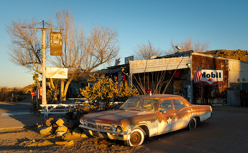
Rustic Hackberry General Store at sunrise with a weathered patrol car and classic gas station signs, capturing Route 66 nostalgia in Arizona.
Rust and History: Sunrise at Hackberry General Store – Arriving at sunrise, we caught Hackberry General Store bathed in golden light, its rusted cop car gleaming like a relic from a bygone era of Route 66. Trading shopping for perfect lighting, we captured this slice of Americana before the world woke up.

We arrived in Hackberry just as the sun cleared the horizon, spilling golden light over the cracked pavement and rusted relics. The timing was perfect. The store, however, was closed for another three hours. Anne was less than pleased.

Anne scowled at the locked door.

“Oh, honey,” I consoled, trying to sound convincing, “I wanted you to see all their fabulous antique jewelry. I’m so sorry. We’ll have to come back another time.”

Her silence was deafening.

Meanwhile, I got my shots—rusted gas pumps, vintage signs, an old patrol car straight out of a noir film. Hackberry General Store isn’t just a shop; it’s a time capsule of Route 66, stuffed to the rafters with kitsch. Route 66 place mats, belt buckles, neon clocks, and car posters—most likely all made in China. If you ever needed a flaming skull ashtray or a bottle opener shaped like a ’57 Chevy, this would be the place to find it.

Racing a Freight Train Across the Desert


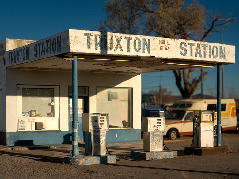
Vintage gas station with faded signage and classic Route 66 fuel pumps in Truxton, Arizona, bathed in morning sunlight.
Timeless Gas Stop – Truxton Service Station in Morning Light – The Truxton Service Station still stands on the south side of Route 66, a rare remnant of a bygone era where travelers stopped for fuel and conversation. The sun casts warm morning light on its weathered sign and vintage gas pumps, keeping history alive in the Arizona desert.

As we rolled east, we picked up a new travel companion—an eastbound freight train. It became a game of leapfrog. We’d catch up to the lead engine, pass it, stop ahead to grab another shot, then watch as it rumbled by again—only to start the chase all over. Wash, rinse, repeat, like having John Henry as a sidekick. Anne was convinced she knew the engineer’s kids’ names when we reached Ash Fork. Probably their dog’s name, too. Any longer, and we’d have been invited to Thanksgiving.

Lost History Along Route 66: Truxton to Peach Springs


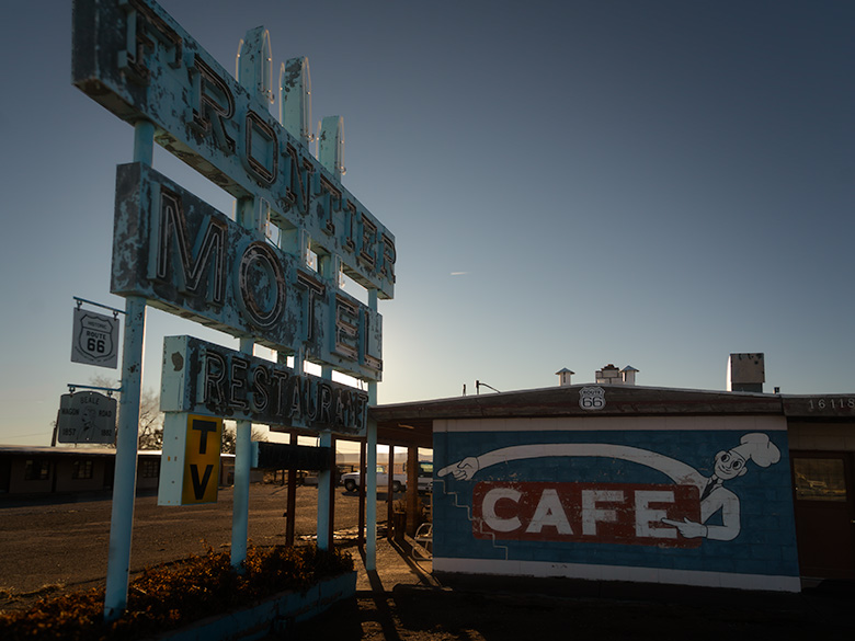
Faded blue Frontier Motel sign with peeling paint and a vintage café mural in Truxton, Arizona, along Route 66.
Neon Nostalgia – Frontier Motel’s Faded Glory on Route 66 – The weathered Frontier Motel sign is a faded reminder of Truxton’s Route 66 heyday, its peeling blue paint a testament to decades of sun and wind. A small sign nearby marks the Beale Wagon Road—an unexpected historical twist I never knew existed, but now I want one for myself.
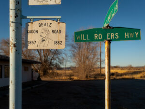
Beale Wagon Road sign with Route 66 and Will Rogers Highway street signs in a rural Arizona setting
Tracing the Old West: Beale Wagon Road’s Legacy

Next up, Truxton. We shot the Truxton Gas Station (still open occasionally) and the Frontier Motel, one of the larger lodgings from Route 66’s heyday. A smaller placard marking the Beale Wagon Road was hanging below the motel’s sign. I had written about Edward Beale’s adventures before, but I never knew there were actual signs marking his route. And now that I do? I want one.

We continued east, hoping to photograph two buildings listed on the National Register of Historic Places—the Indian school west of Peach Springs and the historic Shell Station in Peach Springs with its distinct rock-wall façade. The school, a stark reminder of an era when Native children were removed from their families, stands as an important, if painful, piece of history. The Hualapai Tribe recently received grant money to restore both sites, but when we arrived, they were surrounded by construction equipment—not exactly photogenic. Oddly, there wasn’t a worker in sight. Whether it was a funding delay, a supply chain holdup, or just the usual bureaucratic red tape, we couldn’t say. We know that it gives us another excuse to return to the Mother Road (as if we need one).

Between Peach Springs and Seligman, we passed a stretch of restored Burma Shave signs, their playful rhymes adding a touch of nostalgia to the drive. We couldn’t resist reading them aloud in unison as we came across them, like a couple of hopeless jerks, laughing at every corny punchline.

Why You Should Take This Route 66 Road Trip


If you’ve never driven this stretch of Route 66, you should. And if you need an excuse, there’s no better time than the annual Hot Rod show. This rolling event brings classic cars to Seligman, Kingman, Oatman, and Needles, turning each town into a pop-up car show. (The Route 66 Fun Run will occur May 2–4, 2025. This 35th annual event covers a 140-mile drive from Seligman to Topock/Golden Shores, featuring events in nearly every community along the way, a car show in downtown Kingman on Saturday, and an award ceremony in Topock/Golden Shores. More details can be found on the Historic Route 66 Association of Arizona’s website: Route 66 Fun Run.

Even if you don’t go for the cars, go for the drive. Route 66 is a road worth slowing down for.

Final Thoughts


Thanks for riding along with us on this Route 66 adventure! As always, larger versions of these photos are in the New Work collection on our website: www.jimwitkowski.com/newWork.

We’d love to hear your thoughts, so feel free to leave a comment—but be quick, as comments close after five days (thanks to the bad guys).

Be sure to join us next month when we dash to the coast for another adventure—you won’t want to miss it!

Until then, keep your spirits high and your humor dry.
jw

Backroad Gold: The Art and Abandoned Mines of Chloride Pictures of the Month - Chloride, Arizona

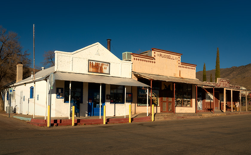
Chloride Downtown Historic Buildings Post Office and Antique Store
Chloride’s Last Standing Originals: A Post Office and Antique Store – Three historic survivors of Chloride’s fiery past mark the heart of the small town’s original downtown. The white structure serves as the town’s active post office, while the other two—an antique store and an unused building—stand as quiet reminders of a resilient history.

We’re always looking for fresh material to share with you, so I turned to my trusty wall map and noticed a glaring gap in our travels—Mohave County. Curious, I paired my map-gazing with a quick Google search and a nudge from my AI brainstorming partner, ChatGPT.

“Besides Bullhead City—which, let’s face it, is mostly about gambling—what’s worth exploring in Mohave County?” I asked.

The response? “Chloride.”

“Chloride? Why Chloride?” I countered.

The answer? “Get off your duff and go find out yourself.”

Suddenly, it felt like I was stuck between two Queen Annes, demanding action and sass in equal measure. With that, the adventure began.

The Road to Chloride.

Thinking about the journey to Chloride made me shudder. Traffic at the I-40 and US 93 junction is always a nightmare, with semis and cars lined up for miles waiting to transition. And there’s always that one clown in a big rig who turns right onto 93, then immediately swings left to reach the Flying J. It’s like a slow-motion ballet of bad decisions.

Surprisingly, when I braced for the worst, the roadwork wasn’t as bad as I’d imagined. They’re already building a bypass around town, going to Coyote Pass, where the freeway picks up north of Kingman. For once, progress felt like it was helping.

Back then, US 93 was a rutted, narrow, two-lane road where only the brave dared pass. Now, it’s a rutted, crowded four-lane highway with so many potholes that you must dodge; you’d be foolish to speed down it. Even my trusty Turd struggles to keep up with the mad rush to throw money away in Vegas. Semi-trucks blink their headlights at me as if to say, “Move it, grandpa!”

US 93 cuts through a vast desert basin known as Golden Valley, flanked by the Cerbat Mountains to the east and one of Arizona’s many Black Ranges to the west. The valley’s name hints at riches, but today, it’s primarily low-density sprawl—cheap land attracting slow but steady growth. However, this is still the Mohave Desert, and with limited rainfall, water is a growing concern for the area’s future.

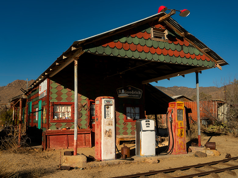
An alpine-style gas station in Chloride, Arizona, with vintage gas pumps, narrow-gauge tracks, and nostalgic yard art under a decorative portico.
Alpine Gas Pumps: A Nostalgic Stop in Chloride’s History—This alpine-style gas station in Chloride, Arizona, is staged with nostalgic yard art and vintage gas pumps to recreate its historic glory. Narrow-gauge tracks circle the building, possibly repurposed from ore cars, adding to the building’s unique character and charm.

Chloride the Town.

Chloride proudly claims to be Arizona’s oldest continuously inhabited mining town, with roots dating back to 1863. However, mining didn’t boom until the 1870s, when a treaty was signed with the Hualapai Indians, allowing for more significant expansion. By 1917, the town’s population peaked at around 2,000, but by 1944, mining had declined, and Chloride teetered on the edge of becoming a ghost town.

Not that the current residents see it that way. Unlike places like Jerome or Oatman, which fully embrace their ghost town status, Chloride’s locals still treat it as a living, breathing community—even if it’s quieter these days.

Chloride gets its name from the chloride compounds mined here, which have historically been used in chemical warfare, medical applications, and industrial processing. Various chloride forms have been used for everything from hospital disinfectants and intravenous solutions to de-icing roads and manufacturing plastics. The US military even experimented with chloride-based compounds for early chemical warfare research.

When the first mine played out, a more extensive operation opened several miles south, and many of the original miners commuted rather than relocated. Today, the new mine still creates rush-hour traffic jams during shift changes.

Much like my hometown of Congress, the town’s population is aging, and there’s no new construction. The nearest grocery store is 35 miles away in Kingman, and the closest Costco requires a road trip to Las Vegas. Local businesses include a restaurant, a B&B, and a gas station, where the prices are as inflated as a carnival balloon.

Antique stores dot the town, though most wares are old mining relics rather than fine china. And while the air is fresh, thanks to constant winds, the lack of rainfall in this part of the Mohave Desert makes long-term growth challenging.

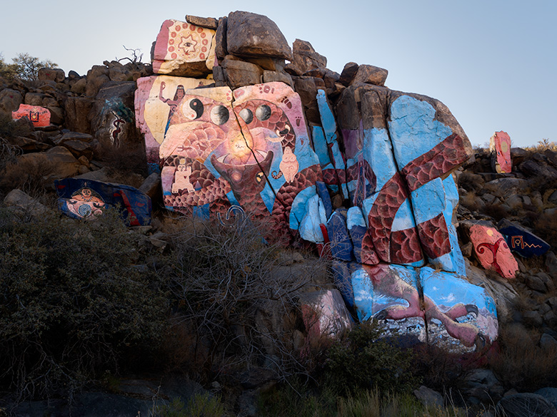
Overview of Roy Purcell’s murals in Chloride, Arizona, showcasing a central cosmic-themed mural surrounded by smaller painted rocks in the Cerbat foothills.
Roy Purcell’s Milky Way of Art: Chloride’s Largest Mural Panel – An expansive overview of Roy Purcell’s murals in the Cerbat Mountain foothills near Chloride, Arizona. The central mural, bursting with vibrant colors and cosmic imagery, is surrounded by smaller painted rocks, creating a visual galaxy that echoes Purcell’s vision of interconnectedness between humanity, nature, and the cosmos.

The Murals: The Secret Reason to Visit Chloride.

The murals are the real reason to detour off the highway and visit Chloride. Yet, the locals don’t seem to market them at all. There’s no sign on US 93 pointing the way, and if it weren’t for a few boulders painted with rough directions, you might never find them.

Just before stepping into the Chloride visitor center—which also happens to be the town store—we crossed paths with a man straight out of a ZZ Top album cover.

He had a grizzled white beard that tumbled past his chest, sunglasses that hid whatever stories his eyes might tell, and a dusty black cowboy hat that had seen some miles. His Dickies overalls were well-worn, and his plaid shirt looked like it had survived a hundred desert suns. He leaned against the store’s porch railing like he had all the time in the world.

We asked about the murals.

“Oh, yeah. Those things,” he said, shifting his toothpick from one side of his mouth to the other. “Just go up this road until it turns to dirt. Follow it through the wash if it ain’t flooded, then head up the hill.”

Not exactly GPS coordinates, but we made do.

The murals were first painted in 1966 by Roy Purcell, an artist working in the mines while taking a break from his MFA studies. With little more than house paint and a grand vision, he covered massive boulders with bold colors, cosmic symbols, and surreal imagery, turning the desolate mountainside into an outdoor gallery. In 2006, Purcell returned to restore the murals, brightening them back to their original vibrancy.

After almost 20 years of exposure to the brutal desert sun, wind, and sand, the colors remain as vivid as if they were painted yesterday—a testament to Purcell’s craftsmanship and the enduring magic of this hidden treasure.

The first thing that goes through your mind when you see them is: How did he get up there? Was this guy part goat? The murals span multiple rock faces, tied together by a serpent winding its way up the mountainside. Around the central panels, smaller satellite paintings orbit like star clusters hanging at the edge of the Milky Way.

You can’t stand in one place and take it all in simultaneously. The murals demand movement—walking the viewing area reveals new details from every angle, unfolding like a slow-motion kaleidoscope of color and meaning. In that way, Purcell’s work feels almost Dali-esque; its surreal and shifting forms reveal something different depending on where you stand. Like Picasso’s cubist portraits, each fragment works as part of a greater whole, forcing you to engage with it rather than passively observe.

Roy Purcell described his work as a visual philosophy, blending Eastern and Western ideas into something profoundly personal and universal. In his own words:

“I painted these images as an expression of self-discovery, a synthesis of my studies in Eastern philosophy and Jungian psychology, and an exploration of humankind’s place in the vast order of things.”

A word of warning: Wear good shoes. Trying to scramble over the rocks in Top-Siders, like I did, is a bad idea. Those slick-soled boat shoes might be great for gripping a yacht deck, but they turn you into a human tumbleweed out here. The terrain is steep, uneven, and unforgiving—so unless you have goat-like climbing skills or an excellent sense of balance, plan accordingly.

If rusty yard art and ghost towns are your thing, visit Chloride.
If art and hidden gems are your thing, visit the murals—you’ll be one of Arizona’s insiders.

And if you’re the kind of person who ignores all advice and climbs rocks in boat shoes? Well… at least you’ll have a good story to tell.

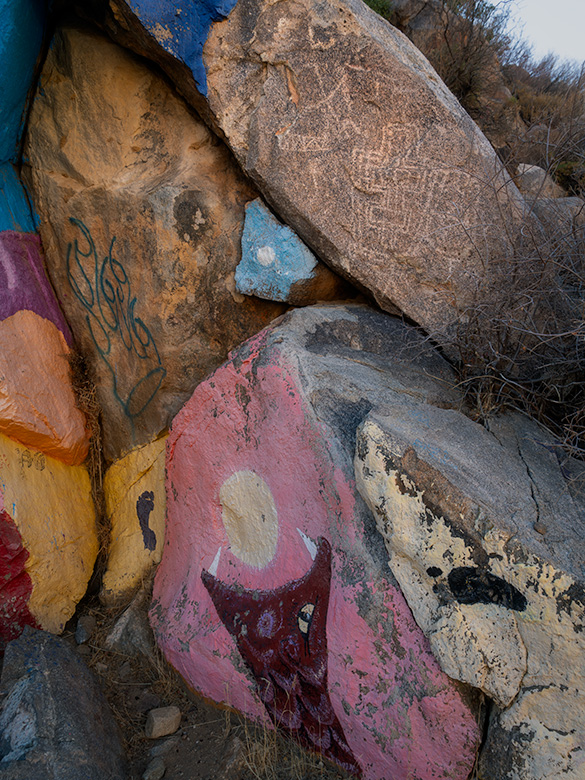
Close-up of Roy Purcell’s mural in the Cerbat Mountain foothills, painted adjacent to ancient petroglyphs, respecting historical rock art in Chloride, Arizona.
Respecting History: Roy Purcell’s Mural Adjacent to Ancient Petroglyphs—This is a close-up of Roy Purcell’s mural in the Cerbat Mountain foothills, carefully painted adjacent to ancient petroglyphs. This juxtaposition highlights contemporary artists like Purcell’s respect for historical art, creating a fascinating intersection of cultural expression spanning centuries.

Final Thoughts.

Thanks for joining us on this mountainside adventure and enjoying this two-for-one special on ghost towns and hidden art. If you’d like a closer look at the murals and the town, larger versions of these photos are now posted in my New Work portfolio. They’ll stay there for three months—until something better comes along.

We’d love to hear your thoughts on Chloride, Roy Purcell’s murals, or anything near and dear to your heart—so drop a comment below. But do it soon! We close comments after five days, or we’ll be buried in Cyrillic spam up to our eyeballs.

Come back next month when we take another back road home.

Until then, keep your eyes on the road and your humor dry.
jw

Hot Springs, Dusty Trails, and Desert Tales: The Story of Agua Caliente Pictures of the Month - Agua Caliente, Arizona

1940s vintage gas station in Agua Caliente, now operating as an ice cream shop under a clear blue sky.
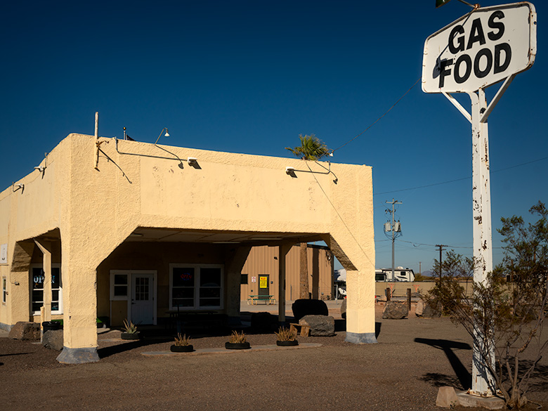
Historic Stop: Old Gas Station Turned Ice Cream Store – Perched near the edge of a dormant shield volcano’s western plain, this charming 1940s gas station is a window into Agua Caliente’s storied past. Once serving travelers as a vital fueling point, the “Sentinel Station” now delights visitors with sweet treats as an ice cream shop. Though replaced by a modern Chevron station nearby, its enduring presence marks the starting point for our journey to the historic resort town of Agua Caliente.

If you thought Arizona’s summer heat this year was terrible, you should have been here a couple of epochs ago. In the Miocene epoch, around 20 million years ago, molten lava wasn’t just rolling—it was stampeding across this landscape like spilled coffee on a countertop, much hotter and far less forgiving. Why? Because this corner of the Earth sat atop one of the most geologically active regions on the planet. Tectonic plates jitterbugged and collided, cracking the Earth’s crust like a fragile eggshell. Faults yawned open, releasing fiery rivers of lava, and the Earth wasn’t just warm—it was downright boiling.


Arizona’s Volcanic Past

Volcanoes were breaking out all over Arizona like pimples on a teenager’s face—a geological puberty that stretched for millions of years. It all started in the Miocene Epoch, about 20 million years ago, when the Earth’s crust stretched like an old pair of jeans across the Basin and Range Province. Magma bubbled through the cracks, spilling to form shield volcanoes and sprawling lava fields. One of the grandest results was the White Mountains, whose towering peaks and vast basalt flows gave the landscape a bold, volcanic makeover.

Arizona’s volcanic party got going by the Pleistocene Epoch around 2.8 million years ago. In the San Francisco Volcanic Field, stratovolcanoes like Humphreys Peak erupted with flair, spewing ash and lava while smaller cinder cones popped up like freckles across the northern plains. Bill Williams Mountain joined the festivities later, its viscous dome adding another dramatic feature to the state’s volcanic portfolio.

The evidence of all this geological chaos is still visible today. Any hill, mountain, or plain covered in black basalt is a telltale sign of volcanic activity. You can spot these dark, rocky remnants from your car as you cruise Arizona’s desert highways, head toward California, or explore the state’s backroads. These basaltic leftovers aren’t just eye-catching—like a giant road map to the state’s fiery past.

All this volcanic activity didn’t just leave behind rugged peaks and lava fields; it also created geothermal hotspots. When groundwater seeps deep into the Earth, it brushes against rocks still warm from ancient magma chambers and rises to the surface as hot springs. While Arizona isn’t as famous for these thermal features as neighboring Nevada, it still boasts a few noteworthy examples. Tonopah and Castle Hot Springs offer glimpses of this natural phenomenon. Still, one of the most intriguing is the spring at Agua Caliente—a warm oasis that once lured travelers seeking rest and rejuvenation in the heart of the desert.


Indigenous and Early History

Long before stagecoaches rattled across Arizona’s rugged terrain or settlers carved dusty trails, the hot springs at Agua Caliente were a haven for Indigenous peoples. Tribes such as the Hohokam and later the Tohono O’odham and Apache revered the springs as sacred ground. Their mineral-rich waters weren’t just warm—they were believed to heal both body and spirit, offering relief from ailments and a deeper connection to the land. The springs were more than just a practical resource for these early inhabitants—they were a spiritual touchstone, humming with the Earth’s energy.

When Spanish explorers ventured into the region in the 16th and 17th centuries, they encountered these springs and called them Agua Caliente—”hot water.” To the Indigenous peoples, however, the springs were simply part of a greater whole called Tonopah, meaning “hot water place.” Though the Spanish expeditions were brief, their naming left a lasting imprint on the area’s history.

By the mid-19th century, Agua Caliente was at the crossroads of history as westward expansion swept through the region. The Butterfield Overland Mail stage line, operating from 1858 to 1861, threaded its way across the Arizona desert, linking the eastern United States with the golden promises of California. While Agua Caliente may not have been an official stop, its reputation as a reliable water source made it a lifeline for travelers braving the relentless sun and parched soil. To a stagecoach driver, spotting those steaming springs must have been like finding an oasis in a sea of dust.

Later, the Oatman Route brought settlers, traders, and wagons rolling through the area, further cementing Agua Caliente’s importance. Named after the harrowing story of the Oatman family’s capture by the Yavapai, the trail became a crucial passage for pioneers navigating Arizona’s unforgiving wilderness. Even the Yavapai and Apache, who knew this land better than anyone, often stopped at the springs during their movements. Agua Caliente stood where cultures intersected—a desert crossroads where survival trumped divisions.

Before the railroads ironed their way through Arizona’s vast deserts, Agua Caliente was a beacon for anyone bold enough to journey through southern Arizona. From Indigenous healers seeking spiritual renewal to stagecoach passengers desperate for a drink, its waters sustained weary travelers across centuries. Every ripple in its springs carried a story, each as rich as the minerals bubbling up from the depths.

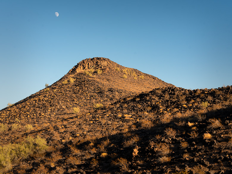
Basalt-covered mountain peak in Agua Caliente, likely formed by volcanic fissure eruptions, with the moon rising above.
Volcanic Legacy: The Basalt-Covered Mountains of Agua Caliente – This rugged peak in the Agua Caliente mountain cluster offers a glimpse into the region’s volcanic past. Likely formed by a fissure eruption, the hill is cloaked in black basalt, and the cooled remains of the ancient lava flow. These mountains once served as the underground furnace that heated the famous hot springs, drawing settlers and visitors to the area. With the moon overhead, this image highlights the geological forces that shaped the desert landscape.

Agua Caliente’s Heyday

By the late 19th and early 20th centuries, Agua Caliente had transformed from a dusty desert waypoint into a sought-after retreat. The adobe guest quarters, built in the 1870s and expanded over the following decades, were simple yet inviting, nestled among the desert plains. Their charm matched the bubbling pools of mineral-rich water, which promised relief from aching joints to mysterious ailments doctors couldn’t quite name. Agua Caliente was Arizona’s answer to high society’s spas for a taste of rustic charm with the allure of healing waters.

The Southern Pacific Railroad played a crucial role in the resort’s rise, mainly after Arizona achieved statehood in 1912. Railcars carried passengers from the soot-stained cities of the East, eager to trade Wall Street stress for desert serenity. Lured by tales of magical waters, visitors—many dismissive of Indigenous traditions—were quick to embrace the springs’ purported healing powers. After all, if hot water could fix a stiff back, gout, or “nerves,” it was worth a shot.

Agua Caliente thrived in a world that was rapidly modernizing. As Arizona became the nation’s youngest state, the resort became a beacon for weary travelers and health seekers. The adobe lodges buzzed with activity. Guests soaked in the steaming pools daily, claiming the mineral waters melted away ailments and sour moods. By evening, laughter spilled from the adobe walls as card games and tall tales of desert adventures echoed into the night. It was a perfect mix of elegance and frontier spirit—where boots met parasols, and everyone left with a story.

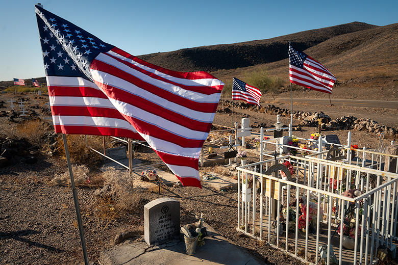
Agua Caliente Pioneer Cemetery with American flags flying over graves on Veterans Day, restored with white crosses for unidentified graves.
Flags of Honor: Agua Caliente Pioneer Cemetery on Veterans Day – As you approach Agua Caliente, the Pioneer Cemetery comes into view, a poignant reminder of the lives that once thrived here. Visiting on Veterans Day, I found flags proudly waving over the graves of veterans, paying tribute to their service. Once neglected, with missing headstones and anonymous graves, this cemetery has been given new dignity by an anonymous caretaker who placed white crosses on each grave, ensuring no one rests unremembered in the desert sun.

Agricultural Development and Water Table Decline

As the 20th century progressed, the once-thriving oasis of Agua Caliente began to wither—fade from neglect but from the insatiable demands of agriculture. For much of the early 1900s, Arizona’s deserts were seen as vast, useless expanses. But farmers soon discovered a transformative truth: add water, and the barren soil could burst into life. With the promise of productivity on the horizon, the surrounding plains transformed into a patchwork of cotton fields and other thirsty crops stretching to the horizon. Wells were drilled, pumps roared, and groundwater flowed like there was no tomorrow—all to sustain an agricultural empire that would help feed the growing demands of a nation.

The boom wasn’t just about local ambition. As the country mobilized for two World Wars, cotton and other desert crops became vital resources for military use, from clothing to tents and more. The fields didn’t just symbolize progress—they represented patriotism and the belief that even the desert could serve a higher purpose. But with this progress came a cost.

Farmers likely dismissed the first murmurs of trouble. After all, how could a few wells harm a spring bubbling faithfully for centuries? To them, the water table was like the change jar on the kitchen counter—always there when you needed it. But the Earth, it turned out, had a different balance sheet. As the water table sank lower and lower, the hot springs that had sustained Agua Caliente faltered. Once-vibrant pools turned to muddy trickles, and the resort’s lifeblood evaporated into the desert air.

The decline of the springs was more than just a geological shift—it marked the end of an era. Without the water, the allure of Agua Caliente faded, leaving the adobe walls to stand as silent witnesses to what was lost. The same farmers who benefited from the booming fields likely drove past the resort ruins, perhaps scratching their heads and wondering what went wrong. Few, if any, ever connected the dots between their pumps and the death of the springs, a quiet casualty of human ambition.

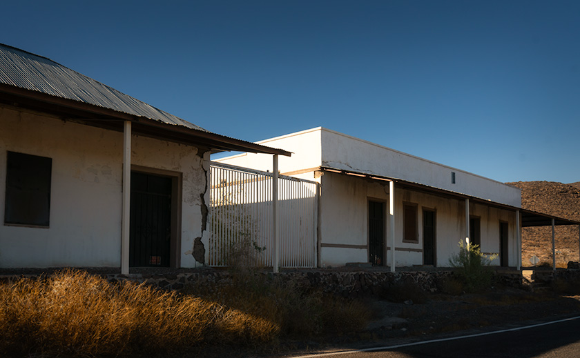
Plaster-covered adobe buildings in Agua Caliente, the former reception and guest quarters of a hot springs resort, with basalt ruins nearby.
Resort Ruins: Adobe Structures of Agua Caliente – Standing as silent witnesses to the past, these adobe buildings once served as the Agua Caliente Resort’s reception area and guest quarters. Their plaster-covered walls hint at a time when visitors came to enjoy the region’s therapeutic hot springs. Behind these two main structures lies a cluster of unmarked buildings, their purpose lost to time. North of the complex, basalt stone ruins crumbles in isolation, with decay more pronounced the farther they sit from the heart of the resort. These remnants evoke a haunting beauty, narrating the gradual fading of a once-thriving retreat.

Decay and Urgency to Visit

Once a bustling oasis, the Agua Caliente resort now teeters on the edge of oblivion. The adobe structures, including the reception area and guest quarters, slowly succumb to time, their plaster peeling like sunburnt skin and walls crumbling into dusty heaps. Surrounding buildings, some made from rugged black basalt, are in various states of disrepair—especially those farther from the leading club central, where collapse seems not just likely but inevitable.

Ownership of the site remains a mystery, shrouded as much in obscurity as the ruins themselves. Nearby, a covered structure housing hay and equipment hints at a private owner, though specifics are hard to come by. What is clear, however, is the lack of preservation efforts. With no markers, informational signs, or protective measures, Agua Caliente’s historical significance seems to hang by a thread, leaving the remaining structures at the mercy of the relentless desert sun.

For those intrigued by its haunting beauty, visiting Agua Caliente sooner rather than later is not just a suggestion—it’s a ticking clock. The adobe walls and basalt stones are steadily losing their battle against gravity and heat, while the surrounding grounds are a minefield of rusted roof timbers, ancient nails, and the odd relic of its former life. Add to that the possibility of encountering a rattlesnake seeking shade during summer, and it becomes clear: caution is your best companion.

But tread lightly, both literally and figuratively. These ruins are more than just crumbling buildings; they are fragile echoes of Arizona’s past. The desert reclaims a little more sand each year, and time erases what remains. If you’re tempted to take a souvenir or leave your marks, resist the urge. Respecting the past means preserving it for others to experience its quiet, crumbling beauty—just as you have.

Agua Caliente is a place where history whispers, not shouts. Visit while you still can. Move carefully, look closely, and honor the stories etched into the adobe and basalt. They won’t linger forever.


Final Thoughts

Thank you for joining me on this journey through time to the once-thriving resort of Agua Caliente. From its fiery volcanic beginnings to its heyday as a desert retreat and, finally, to its quiet decline, this place stands as a testament to the resilience of nature and history. It’s a story of survival, ambition, and the delicate balance between progress and preservation. I hope you’ve enjoyed exploring its layers as much as I’ve enjoyed sharing them.

Be sure to visit the gallery on my website for larger photos of the ruins and the surrounding desert landscape. These images, featured in the New Work portfolio for the next three months, capture this unforgettable place’s haunting beauty, quiet mystery, and inevitable decay—and they might inspire your own adventures.

Next month, we’ll hit the road again to uncover another abandoned spot steeped in history and intrigue. Where will the road take us? That’s a story for another time—you must stay tuned to find out!

Until then, keep exploring, respect the places you visit, and remember to bring water—especially if your journey takes you to Agua Caliente.

jw

Suspended in Time: Adventures Beyond the Petrified Forest Picture of the Month - Petrified Forest National Park

Colorful petrified wood logs under a dramatic sky at Petrified Forest's Rainbow Room with the White Mountains on the horizon
Clouds Over Color: A Journey Through Time: The Petrified Forest’s Rainbow Room captivates with its rich hues of fossilized logs, set against a backdrop of the White Mountains and a dramatic sky.

We were parked on Blue Mesa in Petrified Forest National Park under a new moon when something strange happened. One moment, it was a quiet desert night—just me, Queen Anne snoozing in the truck, and a few restless coyotes yipping in the distance. The next second, everything went dead silent.

Then, as if the universe was playing a cosmic joke, the planets aligned in perfect alphabetical order across the sky. I didn’t even know that was possible. Maybe Jupiter bribed Mars to cut in line. Either way, it felt like the kind of thing that shouldn’t happen unless reality had a glitch.

And then, out of nowhere, a weird blue light appeared. It wasn’t headlights or a flashlight beam—this thing swirled like a dust devil but didn’t kick up dust. Instead, it glowed like the inside of a plasma ball at a science museum. Anne told me to stay in the truck. Naturally, I didn’t listen.

I edged closer. The light wasn’t just floating—it was a hole—a hole in the universe, a hole that swallowed the stars behind it. The sheer impossibility of its physics beckoned me closer yet filled me with an instinctual dread.

Retreating momentarily, I fetched a new tee shirt from our recent gift shop visit, wadded it into a makeshift projectile, and lobbed it at the spectral phenomenon. On contact, the light flared like a campfire doused in brandy, the tee shirt evaporating into a blaze of unknown physics. In its place, a window appeared—one that looked out onto another world.

Except it wasn’t another world. It was this world—just a couple hundred million years earlier.

Two vibrant red petrified logs in the middle of Petrified Forest National Park against a desert backdrop
Timeless Twins: Petrified Logs Standing Sentinel in Arizona’s Heartland—Red Remnants of Prehistory: Twin logs of petrified wood stand in stark contrast to the barren terrain of Petrified Forest’s central expanse.

The contrast was striking. Below me, the landscape stretched out at a significantly lower elevation, nowhere near the mile-high expanse of the modern Colorado Plateau. The sun blazed directly overhead, a stark reminder that this land had once been closer to the equator. What had been a blue-gray dust bowl moments ago was now lush and green—forests of towering Norfolk Island Pines lined the banks of a river fed by distant volcanoes.

A sense of awe welled inside me. I was witnessing the Triassic Period—the dawn of the dinosaurs. This was the initial deposition of what would one day become the Chinle Formation. I recalled from my readings that this geological stratum could reach staggering thicknesses of up to 1,000 feet, layering mud, volcanic ash, and silt into a colorful geological record. Each layer was a story in minerals left behind by cataclysmic floods—floods that had entombed trees, animals, and entire ecosystems in time.

I turned to tell Anne, but she was out cold—head propped against the window, breathing fogging up the glass with every snore. Occasionally, one got loud enough to jolt her awake, only for her to blink in confusion and drift right back off. The coyotes had gone silent, probably unnerved by the glowing vortex, but Anne’s snores carried on, oblivious to time travel unfolding just outside her window.

As I turned back to the portal, movement along the tree line caught my attention. A herd of dinosaurs grazed contentedly on the lush ferns, their stocky bodies covered in what looked like prehistoric leather armor. They had the build of a hippo, the tusks of a walrus, and the personality of a slightly confused cow. Upon later research (a.k.a. Wikipedia), I learned these were Placerias, some of the last big herbivores before the actual dinosaurs took over.

I watched in fascination—until I noticed two of them playing with an orange Frisbee. No, seriously. One scooped it up with his tusks and flung it across the meadow. The other caught it, twirled it, and then sent it flying back with an expert head flick—a prehistoric game of fetch.

That’s when I saw it. One of them was wearing my tee shirt.

Several large pieces of petrified wood clustered together in Petrified Forest's agate section
Agate Assembly: Petrified Logs in Nature’s Mosaic at Petrified Forest – Scattered Legacy: A cluster of petrified logs in the agate-rich grounds of Petrified Forest, each piece a fragment of prehistoric life frozen in time.

Reality teetered. Somehow, the vortex wasn’t just a window—it was a two-way door. My gift shop souvenir had traveled through time, and now, a pair of Placerias named (in my mind) Gonzo and Norm were engaged in a high-stakes game of Triassic Ultimate Frisbee.

Their game was a peculiar sight—half-fetch, half-soccer, with all the earnestness of Olympic competitors. It was a scene of sporting prowess that would have baffled even the most imaginative sports commentator. Amid my amusement and disbelief, a part of me couldn’t help but feel a touch envious of their uninhibited joy—a stark contrast to my usual self-deprecation and haplessness, which at that moment seemed confined to the sidelines of time.

It was a bizarre sight—part football scrimmage, part comedy routine. Norm, the bulkier of the two, lined up his shots while Gonzo made wild, dramatic leaps for the disc. The game might have gone on forever without a sudden, ominous shift in the air.

Dark clouds swelled over the distant volcanoes. A deep rumble rolled through the valley. The river that had seemed so tranquil moments ago was now choked with debris, swelling at an alarming rate. It wasn’t just a storm—it was a flood—a Triassic monsoon.

The realization hit me—this is how the fossils formed. This was the very moment when entire forests were buried, trees transformed into stone, and creatures like Gonzo and Norm were swallowed by history.

The Frisbee dropped. Gonzo and Norm turned, finally sensing the danger. They ran. Well, they tried to. Norm’s stubby legs churned in slow motion while Gonzo, the optimist, still attempted one last throw. The roar of the flood drowned out their squeals. Within seconds, a massive wave of mud and debris swallowed them whole.

The portal flickered. The colors blurred. And then, it was gone.

The coyotes started howling again. Anne stirred. “You ready to return to the motel?” she mumbled sleepily.

I nodded, glancing at the now-empty desert. The past was the past again.

Before leaving Holbrook the following day, we stopped at the park’s gift shop. I searched for a replacement T-shirt but found nothing. Then, as if on cue, the cashier said, “Funny thing—rangers found one like that near a dig site. It’s in lost and found. Want to see it?”

She handed me a stretched, dirt-crusted shirt—with a punctured orange Frisbee sitting underneath it.

I stared. I laughed. And I took it. Because sometimes, the universe has a way of letting you keep the souvenirs that really matter.

Deep erosional textures of the Chinle Formation seen from Blue Mesa walkway in Petrified Forest National Park
Blue Mesa’s Eroded Wonders: Textures of Time in Petrified Forest—Nature’s Sculpture: Blue Mesa’s eroded beauty unveils the Chinle Formation’s intricate textures, a testament to the relentless artistry of natural forces.

Thank you for joining me on this incredible Petrified Forest National Park journey. Suppose you’ve enjoyed this tale of prehistoric whimsy and modern-day mystery. In that case, I invite you to explore larger versions of this month’s images on my New Work Portfolio. These photos will be displayed there for three months before being rotated.

As the echoes of the ancient past slowly fade, let’s turn our gaze to a different historical exploration. Next month, join me for a night among the neon and nostalgia of Gallup’s abandoned motels. We’ll explore the haunting beauty of old motel signs, capturing the stories they whisper to the desert winds. Don’t miss this eerie yet visually captivating journey—subscribe now to get a reminder as soon as we go live.

Until then, keep exploring the layers of history around you, and perhaps you’ll discover your own story woven into the fabric of time.
jw

Desert Dichotomy: Prickly Pear and Snow Peaks in the Weavers Picture of the Week - Congress, Arizona

Snow-capped peaks of the Weaver Mountains in the background with desert vegetation in the foreground on a sunny morning.
Desert Dichotomy: Prickly Pear and Snow Peaks in the Weavers – Early morning light bathes the Weaver Mountains, revealing a rare sight as winter’s frosty blanket contrasts sharply with the resilient desert flora of Arizona.

Greetings again from the heart of what’s suddenly become the Arctic Circle’s kissing cousin, our own Weaver’s Winter Wonderland. This week’s spotlight, Desert Dichotomy, is yet another snapshot from that astonishing February storm that dared to blanket the Weavers in snow. This time, I’ve dared to pair the icy peaks with the sopping-wet desert flora upfront, striking a contrast that even a snowbird might find chillingly beautiful.

It’s been a month heavy with winter portraits, an oddity for us desert dwellers, and an outright betrayal for the snowbirds who come here seeking sanctuary from their shovel-laden driveways. Bookmark your favorite image, friends, because the mercury is on an upward trajectory. Soon, as you fan yourself on a patio sweltering under a 115° sun, these images might be the only breeze you’ll feel. You’ll find larger copies on my website <Jim’s Page> and Fine Art Americas <FAA Link>.


Decisions, Decisions

There I was, knee-deep in mud, the cold nipping at my every extremity, and it hit me—I was actually having fun. A realization dawned, brighter than the sun glinting off the snow: Photography, with its promise of eternalizing a moment, is the lifeblood of my existence. It’s not the accolades or the Instagram likes; it’s the mud, the cold, and the hunt for the perfect shot.

Background and Evolution

In 2002, this website was a digital photo album devoid of captions, context, or care. As all things do, it evolved into a monthly newsletter recounting the high-stakes drama of our lives—Queen Anne and I versus the Wild. The Alaska expedition of 2016 demanded daily updates, transforming the newsletter into a casualty of efficiency. After returning to our home in Arizona, we switched to weekly posts, turning my Sunday mornings into a spirited race against my verbosity.

Feedback from you, dear readers, nudged me towards improvement. Books on writing, a thesaurus thick enough to serve as a murder weapon, online classes, and software soon became my weapons of choice in a battle against mediocrity. The downside? What once was a quick jaunt through my thoughts now takes days of meticulous crafting. In my quest to hone the written word, I nearly forgot the joy of wrestling with alligators—metaphorically speaking.

Frequency Insights

Buried in an internet rabbit hole, I unearthed a nugget of wisdom: The best newsletter frequency is once or twice a month. My inbox, swollen with the daily messages from overzealous websites, confirmed this truth. Too much of a good thing, and I’m out in the garage, hunting down the unsubscribe mallet.

Looking Ahead

Hence, we pivot. The weekly parade will cease, creating a monthly spectacle beginning in April. ‘The Picture of the Month’ will emerge, promising less inbox clutter and more breathing room for storytelling and photography. Imagine—more comprehensive tales, less repetition, and an inbox as unburdened as a desert sky.

Your seat on this journey is reserved; your input is invaluable. In the comments below, let us know your thoughts on our impending metamorphosis. With this shift on the horizon, we’re poised to dive deeper, travel further, and share the essence of our adventures with renewed vigor.

To more unhurried adventures and the promise of untold stories waiting just beyond the lens. Here’s to less time spent with the thesaurus and more pressing the shutter button.

Until our trails cross again;
jw