Gunfighters The Town Too Tough To Die

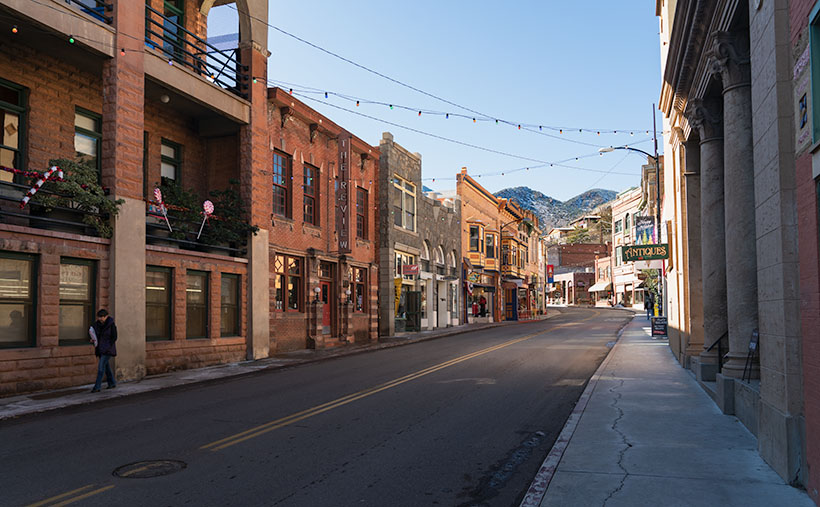
Gunfighters - Actors dressed in Earp costumes try to stay warm on Allen Street while they coax visitors to come see the 3:00 pm show.
Gunfighters – Actors dressed in Earp costumes try to stay warm on Allen Street while coaxing visitors to see the 3:00 pm show.

Ghost towns in Arizona are a dime a dozen. There are enough of them to fill a book. I know because I currently have five of them sitting on my shelves. The morphing of a city into a ghost town follows a familiar pattern. It starts with some loony prospector finding a valuable mineral—gold, silver, copper, diamonds, or another precious stone. News of the bonanza spreads quickly and lures a gaggle of opportunistic people. Half of them want to get rich by picking nuggets from the ground, and the rest want to pick them from someone’s pockets.

A new town springs from the ground like a children’s pop-up book. More people settled in the town and either got jobs at the mine or open shops that every mining community needed, like bars, gambling halls, and whore houses. Eventually—in a year, a decade, or a century—the gold (or whatever) pans out. The excitement of living in a mining town slowly dies, and its residents move on to the next boom town. Mother Nature reclaims the land without caretakers; all that remains is a pile of rotting wood, some foundations, and the eerie spirit of ghosts.

Of course, there are exceptions to my rule. In a handful of cases, when the mine goes bust, its residents look around and say to themselves, “This is a great place to live.” They find other sources of income. I call these places amusement communities. Examples that come to mind include Oatman, Jerome, Bisbee, Bagdad, Clifton, and Tombstone.

Of those locations, Tombstone is the odd duck. There are no gaping open pits to gawk at, historic hotels, or James Beard-worthy restaurants. I suspect that most of its visitors don’t even know about the silver mine. That’s because the silver vein wasn’t gigantic, and that’s how it got the name Goodenough Silver Mine. A gunfight between the Earps and the Clantons secured Tombstone’s historical spot. If it weren’t for that singular gang fight, Tombstone—’The town too tough to die’—would be a pile of splinters by now.

Don’t get me wrong; there is a list of exciting things to see in Tombstone. It was the Cochise County seat for a while, so there’s the old courthouse (with its gallows patio), the Crystal Palace back bar, the world’s largest dead rose bush, and the Birdcage theater should be on everyone’s checklist. Of course, if you have the time and money, you should see the show at the OK Coral, but realize that the actual gunfight was on Highway 80—behind the Coral.

I took this week’s photo on a cold, windy December afternoon. We had checked into our motel and started into town before the light faded. Standing in the middle of Allen Street (dirt, then paved until the street department poured dirt over it again—for authenticity) were four gunfighters dressed in black wearing badges. They tried to stay warm while they hawked visitors to the 3:00 pm show. I don’t know how successful they were because the streets were empty as people sheltered inside the bars. I titled this shot Gunfighters.

You can see a larger version of Gunfighters on its Webpage by clicking here. I hope you’ll join Queen Anne and me throughout January as we show some of the exciting Tombstone scenes we found.

Till next time
jw

BTW:

Queen Anne and I are working on our calendar for the year. We’re putting together a list of places we’d like to visit and this year’s book topics. If you have any requests, let us know in the comments section.

Ancient Door Picture of the Week

Ancient Door - A mysterious door between Lomaki rooms beckons you to see what's on the other side.
Ancient Door – A mysterious door between Lomaki rooms beckons you to see what’s on the other side.

When I photograph a place like Lomaki (the Hopi word meaning Beautiful House), I try to walk its perimeter, looking at how the light falls on it. Then I look at details that help fill in its story. As I move around, I’ll stop and take shots of things that intrigue me. My photos are more intuitive than systematic. I look for contrasts and shadow patterns that place the subject in a specific moment.

I was doing that when I entered the Lomaki ruin and came across the door in this week’s picture. I saw the door and thought, “This looks interesting.” I framed the shot and snapped the shutter. Typically, an image with a busy pattern in a uniform light doesn’t work because it looks like a Where’s-Waldo puzzle. However, the dagger of light on the room floor commands your eye to go through the opening. It’s a walk-towards-the-light moment.

As a younger man, I was six-foot tall, but gravity has taken its toll, and now my diminished stature is only 5 foot 11½ inches. Even in my current dwarf state, I had to do a full Asian bow to fit through the doorway. That means that the Pueblo people that built this structure were short. Otherwise, they would constantly bang their heads on the lentil when they came home Saturday nights drunk from the bar. Believe me, that gets old fast.

As I walked through the complex, I got to another room with a low window. Through it, I saw a creature with five legs. It gave me a fright. Was it a centaur with an extra appendage or a giant arachnid with three legs missing? On closer inspection, I saw three legs were carbon fiber, and the other pair wore shorts. The creature turned out to be a fellow photographer. She was a coed from ASU working on a YouTube video about Wupatki.

It’s funny how photographers behave when they bump into one another out in the field. After seeing another camera, they let down any guards. They stop being solitary wanderers and suddenly become highly social as they compare notes. “Did you see this?” You should go there.” In the age of digital photography, it’s gotten worse because now they can compare their shots on the back of their cameras and go into full chimpanzee mode, “Look at this one—ooh ooh ooh ah.”

After our pleasantry exchanges, we parted ways, and she returned to the parking lot. Of course, I didn’t ask for her name or YouTube channel. Queen Anne would kill me on the spot if she knew I talked to a college-aged woman in the field without her chaperoning. After I finished shooting, I hiked back to the parking lot, where Her Majesty was waiting in the car. If I was lucky, her nose was buried in her Kindle reader, and she didn’t notice anything. Before I could say a thing, she blurted out, “I asked that girl if I had to go rescue you.”

“What did she say?”

“She said you were happily wandering around snapping pictures, and you’d be there until you ran out of film.”

It was only then that I realized I was a bit hot, so I started the Jeep and guzzled some water in the cool air conditioning before driving back to Flagstaff. So far, there are no new YouTube Wupatki videos, but I’ll keep looking while I dream of mermaids.

You can see a larger version of Ancient Door on its Webpage by clicking here. Next week, I’ll show my last shot from Lomaki, so be sure to come back and see what we find.

Till next time
Jw

BTW:

It’s Thanksgiving week, so Queen Anne and I wish you a happy and safe turkey day.

Lomaki Picuter of the Week

Lomaki - The crooked walls look as if the fierce Northern Arizona winds will blow them over.
Lomaki – The crooked walls look like the fierce Northern Arizona winds will blow them over.

In the half-century that I’ve called Arizona home, I can’t count the times that I’ve traveled thru Flagstaff and then north on Highway U.S. 89. I travel that route to get to the Grand Canyon, Lee’s Ferry, Lake Powell, Monument Valley, Utah, or Colorado. My best guess would be once a year on average. Sometimes I even stop to take pictures along the way.

With that many trips, you’d think I’d pay no mind to the scenery, but that’s not true. There’s always something new. There’s one location that makes my jaw drop, no matter how many times I see it. I’m talking about the view at Sunset Crater Pass I wrote about last month. It’s an in-your-face example of something I learned in a college geography course: mountains affect climate.

The climate on the south side of the San Francisco Peaks is the polar opposite of that on the north. As you travel to Flagstaff from Phoenix, you climb into the pines, and the temperature can drop as much as 30° along the way. As fronts move north from the Gulf in the summer or west from the coast in winter, the mountains wring moisture from the air as it climbs the slopes. After passing over the mountains, the air is dry and picks up pressure on the way down. Dry air heats faster than humid air. The phenomenon creates a rain shadow on the mountain’s leeward side. The next time you travel north of Flagstaff, stop your car at the pass and take a look back—trees. Then turn to the north again—trees kept away.

Now that you know how mountains work, it’s easy to understand why the early Pueblo Tribes living at Wupatki lived in rock dwellings instead of log cabins. Amazingly, the Indians still used timbers to span the walls and hold up a roof. That means they had to drag lumber off the mountains by hand. They built their structures before the Spanish arrived, so they didn’t have horses.

This week we’re looking at one of the bigger pueblos in the National Monument—Lomaki. That’s a Hopi word that translates into English as “Beautiful House.” Anthropologists have partially restored its two-story walls. As you walk through the ruins, you begin to appreciate the ancient people’s masonry skills and tenacity. They must have had to rent scaffolding for walls that size at A-Z Rentals in town. It was either that or standing on one another’s shoulders. You’d do the same thing.

In this week’s picture, titled Lomaki, you get a good idea of the wall height. The windows are at eye level. A peculiar thing you notice in this shot is the walls are leaning. I’m not sure if the scientist put that feature in on purpose or if they weren’t as skilled as the original Pueblo builders. As a photographer, I have a thing about lines that aren’t level or square. Oceans don’t run downhill, so I wince whenever I see a seascape with a crooked horizon. On my first visit to Lomaki decades ago, its tilted walls jumped out at me. They look like a good wind will blow them over—and this area of Arizona is exceptionally windy. However, on this year’s visit, the walls were still standing and didn’t seem any worse, so maybe they’ll remain long after I’ve gone.

You can see a larger version of Lomaki on its Webpage by clicking here. Next week, we’ll walk around Lomaki and see its details. Come back then and see what we find.

Till next time
Jw

BTW:

The calendar cut-off day is Tuesday, so if you are interested, place your order.

Box Canyon Picture of the Week

A pair of Pueblo ruins adorn the cliff tops on either side of Box Canyon in Wupatki National Monument.

It’s November already. Time passes so fast that the remaining hair on my head flutters behind me like a streamer in the wind. To make things worse, the landlord turned off the heat. Here in the foothills, we had a couple of mornings in the high 30s, and Queen Anne insisted on sleeping with the bedroom window open. When I got up, I was invisible, standing in front of the blue accent wall—nothing but a pair of whitey tighties and chattering teeth floating through space. This cold front is supposed to move out later this week, so I’ve resisted turning on the heater. Instead, we throw back the curtains, put on heavier sweaters, and shiver till noon.

With the new month, we started a new project and didn’t have to travel far to get to it. It’s the housing development across the street. The street is Highway U.S. 89, and the development is Wupatki National Monument. Wupatki shares the access road and visitor’s center with Sunset Crater National Monument—they’re conjoined twins. During this year’s fire season, the fires closed the 35-mile park road at the crater, but Wupatki remained open because it’s north and out of danger.

Wupatki is at the base of one of the Navajo’s four sacred mountains: Flagstaff’s San Francisco Peaks, Mount Taylor in New Mexico, Hesperus Mountain near Durango, and Blanca Peak outside of Alamosa. The Dine’ considers the area with these mountains their home. But, long before the tribe moved from central Canada, Pueblo Indians lived here. They left behind stone homes along the Colorado Plateau: from Wupatki to Chaco Canyon and Mesa Verde south to Walnut Canyon.

Most Americans consider Mesa Verde National Park the most extensive collection of pueblo ruins, but Wupatki is its match. In some areas, our National Monument exceeds the Colorado Park in the number of dwellings per square mile. When you visit the monument, the maps direct you to displays unearthed and restored by archeologists that you can walk through and hear thousand-year-old ghosts. As you drive to these exhibits, keep your eyes peeled because you’ll see piles of rocks in the fields and on hilltops. These are not natural clumps of stones but more ruins that the scientists haven’t yet examined. These areas are set aside for future paleontologists to examine using more advanced tools.

There are so many ruins in Wupatki to enjoy I can’t cover them all in one month. For November, we’re only covering a half-mile hike called Box Canyon. In that short distance, you pass three ruins along the way to the main exhibit—Lomaki. This week’s picture is of a pair of stone buildings standing on the cliffs of Box Canyon. As I walked along the paved trail on a warm summer afternoon, I stopped at each ruin, photographing what I saw. The path led up a gentle slope from the parking area, past the first ruin. From there, I could see the second dwelling on the other side of the canyon, so I continued along the trail. I could have spent the rest of my time shooting these two, but when I reached this spot, I could see Lomaki, which is more prominent with even more rooms. I quickly framed this scene and moved on to the big show.

I chose this image to start this month’s project because it shows the proximity of the two ruins along the canyon walls and how they rise above the grasslands. I assume different families occupied them. There’s enough space for privacy, but they’re close enough to provide mutual protection and borrow the neighbor’s lawn mower.

You can see a larger version of Box Canyon on its Webpage by clicking here. Next week, we’ll walk up to Lomaki and spend some time there. Come back then for another episode of This Old House. I’ll leave the light on for you.

Till next time
Jw

BTW:

Don’t forget to get your calendar order in before the cut-off on the 15th.

Secret Passage Picture of the Month

Secret Passage - The only door between units that I noticed was this one.
Secret Passage – The only door between units that I noticed was this one.

I’m going to shake the box and change the format of this week’s post because I want your advice on something. This is the last photo from Walnut Canyon, and I’m sure you’re tired of my bellyaching about stairs, so I’ll start with the background of this week’s picture, and then we can go into the conference room for the other thing.

This week’s picture shows a doorway between dwellings at Walnut Canyon. Since it’s hidden in plain sight, you probably wonder, “What’s the secret?” Well, as I hiked past ruin after ruin, this was the only inter-unit doorway I noticed. We may never know the secret— why weren’t there more of them.? Sinagua built their dwellings with shared walls, like our present apartments. I wonder if neighbors were extended family or strangers. The door suggests that family shared these homes—but it could also mean that the Sinagua Rockefellers lived here, and this unit was their equivalent of a south-facing Manhattan penthouse overlooking Central Park. As usual, there’s a larger version on its Webpage that you can get to by clicking here.

“Now, for something completely different” – Monty Python

I use my favorite coffee cup religiously in the mornings, and when I can’t find it, I panic. I search everywhere until I see it in the microwave. It was in there because I was heating yesterday morning’s dregs and forgot about it. I had it custom printed with one of my photos, but the picture is worn after six years of use. Reluctantly, I ordered a new one.

New Cup - On the front of my new coffee cup, I printed my photo of Dos Cabezas Mountain.
New Cup – On the front of my new coffee cup, I printed my photo of Dos Cabezas Mountain. Now that I’ve used it several times, I won’t order the black trim again. In the early morning, it’s hard to see where the coffee is with sleep in my eyes.
Coffee Cup Back - On the back, I put the title and some advertising.
Coffee Cup Back – I put the title and some advertising on the back.

When it arrived, I thought, “These could be great little contest prizes.” In the past, Queen Anne and I sponsored contests and gave away a photo as a prize. That’s how we got a name for Anne’s Mazda and our famous campfire treats. Now my brain is nagging me to work on another idea.

The second component is my annual calendar. As some of you know, I assemble pictures into my calendar and offer them for sale at cost. Because I usually print less than a dozen, their price is much higher than a Costco calendar, but I typically get a few subscribers that want one. After several years, I’ve figured out a system to make them come out as planned.

The next ingredient is these weekly posts. Over the years, my articles have evolved into a dependable format. Each month I pick a location, shoot pictures, and then publish the best photo each week. As Emeril Lagasse used to say, “I think I can kick it up a notch; Bam!

My idea is: What if I added a picture of the month (POM) to the mix, and you helped choose them? Let me explain. At the close of each monthly project, I include a survey (like the example below), and you choose the picture you most liked. Of course, I could be the Supreme Leader and pick what I want and be done with it, but over the years, I’ve learned that my taste isn’t the same as the public’s. So a poll makes it more like the People’s Choice Awards instead of the Oscars. After three days(?), we tally the survey; I’ll lay out a design and print the winner on a mug—like a trophy. Then when calendar time rolls around, I will already have a dozen winning images selected.

What’s in it for you? I already have too many coffee cups, so I’d like to give them to you. The problem is that I don’t know how to give them away equitably. Each computer (or phone) gets one recorded vote with this survey app. The polls are anonymous, with no tracking, so I don’t know who’s voting. I can’t say, “The fifth voter wins the cup.” I’ve been racking my brain trying to figure out a solution, but it pulled a synapse and passed out. I need your ideas.

Another question that I have is how limited the cups edition should be. I can’t imagine that any of you would pay $12 plus shipping for a $5.00 Walmart mug, but who knows? I am inclined to print one and be done, but I could limit it to a low number—such as five—if you prove me wrong.

I’m looking forward to reading your thoughts. Does this concept interest you? Should I grow messy white hair like Einstein’s or shave it off like Curly’s? Would you vote for a cup? What’s an excellent way to pick a winner? You can share your opinions by leaving a comment below, or if you want privacy, then use my Contact Form (the answer to the robot question is “5” if you can’t figure it out). I’ve included a poll so you can see how simple this is. Pick your favorite and click the Vote button. There’s no cup this month, but see if you can break the survey in beta testing.

Till next time
jw

Corner Unit Picture of the Week

Corner Unit - I found this unit at the end of a row of homes. It shows all four walls inside and out, so you get and idea of how large these home were.
Corner Unit – I found this unit at the end of a row of homes. It shows all four walls inside and out, so you get an idea of how large these homes were.

“283 steps” were the first words out of the park ranger’s mouth when I asked about the Island Trail. “It’s 283 steps down to the loop, and there are 67 steps around the island,” (that number could be wrong—I stopped listening after 283), “and then back up those sane 283 steps.” I thought, “It’s the cool of the morning, it’s cloudy, I’ve got water, I need pictures from the trail, so let’s do this.” Then I walked over to the top of the staircase.

Although the Island Trail is less than a mile, it’s the harder of the two in Walnut Canyon National Monument. You’d be correct to believe it went down to the creek with that name. Instead, it drops 185′ to a land bridge where you cross to an unnamed promontory that you circle counterclockwise. The trail is asphalt paved except for the sandstone steps.

The path is on a shelf where the limestone sits above white sandstone, like found in Zion National Park. The limestone erodes faster than its foundation, and like an ice-cream scooper, that erosion has gouged shallow caves into the white stone. Here is where the Sinagua built their homes. While descending the stairs, I could see dwellings on the opposite side of the creek. They’re spaced apart, so I thought that I get to shoot one or two of the rock dwellings. I was wrong. The canyon’s far side faces north—not the ideal winter location. On the island, the homes were south-facing, which helps keep them warm. As soon as I rounded the first bend, rows of rock dwellings were there for me to explore and photograph. But, I had to sit down first and rest a while—I was still shaking from coming down the stairs.

Before I got to the pictures, I had another interesting observation. I thought that since I had made it a third of the way down the canyon’s bottom, I would be able to catch a glimpse of the creek. With the heavy monsoon we’ve enjoyed this summer (yey), the foliage growing on the canyon floor was so thick it completely obscured the creek bed.

I took this week’s picture—that I call Corner Unit—at the end of several homes. Since they run into one another, they usually share a common wall—like our modern apartments. So, this one has two exterior walls, which is unusual for this neighborhood. Since the Park Service didn’t fully restore the walls, you can see the cave’s overhang and back wall. With it being open to the outside, you can get an idea of its area. The Sinagua people must have felt comfortable with this size because it’s representative of them all. If you think about it, this is a perfect size for a man cave. There’s room for a corner TV, and you can grab a brewski without getting out of the Barkalounger. Once again, however, you’d be stuck at home all day waiting for Larry to show up.

The problem with the man-cave theory is that the women built them and were primarily concerned with keeping in the warmth. In the second image, you can see where they left a vent near the ceiling. These vents allowed them to have small fires inside and let the smoke out. They were their chimneys. The families could survive the high-altitude winters by draping an animal skin or rug over the door and building a small fire.

Fire Vent and Clay Finish - The Sinagua People built vents into the walls so they could enjoy a fire and not suffocate. They also stuffed clay into the rocks to seal the rooms from drafts.
Fire Vent and Clay Finish – The Sinagua People built vents into the walls so they could enjoy a fire and not suffocate. They also stuffed clay into the rocks to seal the rooms from drafts.

The second picture also shows another innovation the women used to make winter life bearable. They hiked to a place up the creek where they could dig gold-colored clay (the color’s not essential—this isn’t The Real Housewives of Beverly Hills), then they packed it in baskets, lugged it back, and smeared it over the rock walls—inside and outside. Like caulk, the clay sealed the wall gaps and stopped drafts. The women put a lot of thought and work into their homes—the men were too lazy to take down the Christmas decorations.

After I finished my tour of the loop and got the needed photos, I was back at the foot of the stairs leading to the visitor’s center. I found out that the ranger lied. Somehow while I was out of sight exploring ruins and taking pictures, the park service snuck in and doubled the stair count. How do I know; math, simple math. I knew I would have a tough time with the climb, so I devised a system where I would climb 50 stairs at a time—then stop for water and catch my breath. Instead of five rest stops, I made 10, and I drank both of my water bottles dry. Near the top, where I could finally see the building, I made one last effort; one, two, three, four, twelve, fifteen, thirty-five, fifty. I need another rest.

I hope you enjoy seeing the ruins in Walnut Canyon. You can view the Web version of Corner Unit on its page by clicking here. Next week, I’ll have another shot from the Island Trail for you to see, but please don’t make me go down there again.

Till next time
jw

Sinagua Pueblo Picture of the Week

Sinagua Pueblo - A two room stacked-stone ruin that the Sinagua people used for ceremonial purposes.
Sinagua Pueblo – A two-room stacked-stone ruin that the Sinagua people used for ceremonial purposes.

When Queen Anne and I married, we lived most of a decade in a second-floor condo. Besides living in cramped quarters, the thing we most disdained was lugging groceries from the parking lot and up those stairs. My right knee cracked with each step. We swore then that we’d never live in a two-story house.

The Sinagua people would’ve considered us Snowflakes. Imagine your family living in a small cave with a plastered rock façade built on the side of Walnut Canyon. They scaled the canyon walls (without stairs) to get to work. Once on top, the men tended small patches of fertile soil along the edge. They grew drought-resistant crops because their name means Without Water. At least, the Spanish called them that when they first visited the canyon. For protein, they hunted deer, elk, and big horn sheep. After butchering the game, they stuffed the meat into Safeway plastic bags and lowered it on ropes.

Given my extreme age, my most significant anxiety would be getting up in the middle of the night for a glass of Water. As it is, I struggle to find our kitchen in the dark, much less climb down to the creek and back. Of course, their local wise man was in his thirties, and he knew when to stand up and declare, “Today is a good day to die.” Then as he tossed his blanket over his shoulder, he’d tromp out of the camp to the nearest mountaintop, where he’d sit for weeks until dying of starvation. Once again, I’ve proved that exercise is unsuitable for you.

There are many disadvantages to living on a cliff-side cubby hole, but for me, it’s the TV reception. It’s lousy down there. You’d need to get cable or a satellite dish. Then you’d waste time waiting for the cable guy to show up.

There are two trails for you to explore when you visit Walnut Canyon National Monument. Both are under a mile long. The Island Trail is a loop that drops into the canyon, past several dwellings, and then climbs back to the rim. We’ll explore it next week. The Rim Trail stays on top of the mesa and is easier to hike. It goes past some old crop fields and a couple of ruins. I took this week’s picture on the Rim Trail.

The image that I call Sinagua Pueblo shows a two-room stone building of generous size. This structure was probably a communal building for ceremonies and grain storage, like your condo’s community center. Here is where the Sinagua unloaded their trucks after a Costco run. Surely you realize that I’m joking. Flagstaff doesn’t have a Costco. Recovered artifacts show that the Sinagua traded with the villages at Eldon Mountain, Wupatki, and Homolovi—after a short train ride to Winslow.

As you quietly stand and admire the pueblo’s stonework, you can hear Sinagua ghosts laughing, smoking peyote, and chanting with the rhythm of deerskin drums late into the night—until the neighbors come by and yell, “turn down those damn drums.” More cowbell.

I hope you enjoy seeing the pueblo at Walnut Canyon. You can view the Web version of Sinagua Pueblo on its page by clicking here. Next week, we’ll explore the Island Trail and show those photos—if I can only make it up this last flight of stairs.

Till next time
jw