Fading Echoes: Vulture City’s Cantina After Dark Picture of the Week - Vulture City, Arizona

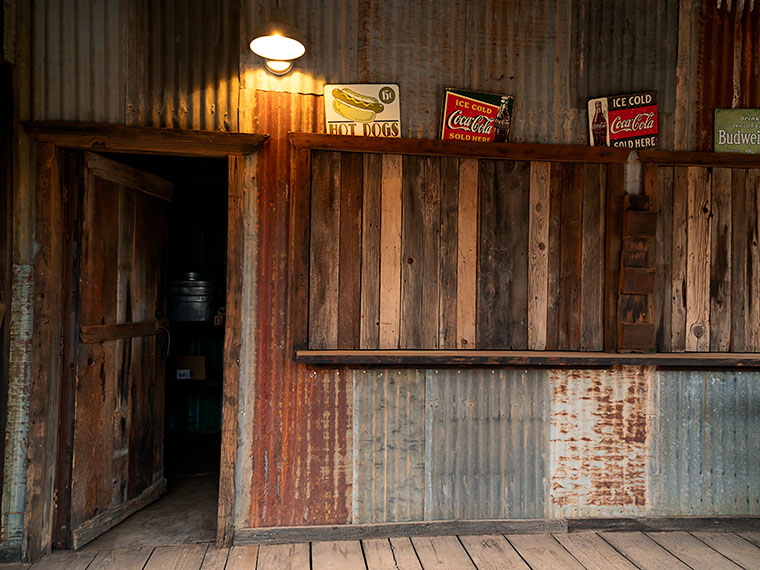
Weathered metal exterior of Vulture City's Cantina featuring vintage food and drink signs, captured in dim light after sunset.
The weathered metal exterior of Vulture City’s Cantina features vintage food and drink signs captured in dim light after sunset.

October has finally graced us with its presence. That’s significant for us desert dwellers for a couple of reasons. Most importantly, summer’s relentless grip has finally loosened. It’s still hot during the day and will be for several more weeks, but we can go out on the back deck, enjoy a cup of java, and watch the doves run for their lives in the cool mornings. The other nice thing about October is that it’s the beginning of the festive gauntlet, where celebrations stack up on one another. If the calendar were a wheel, we’d have to take it to the tire shop to balance it.

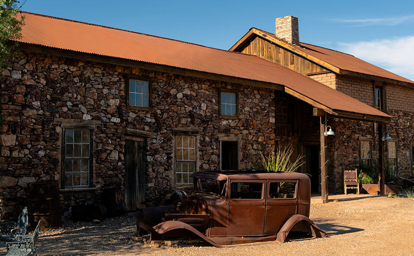
Queen Anne’s favorite holiday is Halloween, of course. What else would you expect from a woman who wears a black pointed hat and always has a broom at arm’s length? All through the month, she buys bags of miniature Heath Bars at Safeway—not to give to kids trick-or-treating at the door (they don’t grow out here), but so she has plenty of stock when she watches Spaced Invaders looping constantly. So, what better way to celebrate Halloween than to spend the month in a ghost town? It’s one we haven’t visited before and is at the bottom of Vulture Mine Road. Of course, I’m talking about Vulture City, the mine that gave birth to Wickenburg.

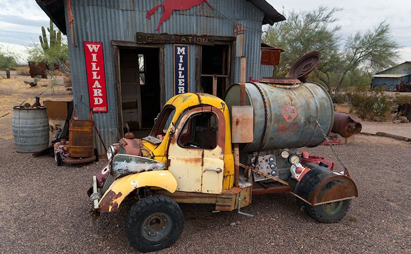
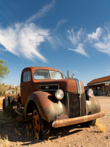
A rusted, vintage Ford truck stands in a ghost town, framed by timeworn buildings and a sky punctuated by twisted arrowhead-shaped cirrus clouds.
Iron Beauty: Aging Gracefully in Vulture City – his Ford’s not going anywhere fast, but its enduring character keeps it forever at home in the forgotten corners of Vulture City.

Vulture City’s history starts long before any crusty prospectors unstrapped a pick from their burro. Judging from the mix of rocks you can see along Vulture Mine Road, the Vulture Mountains formed through a symphony of molten eruptions and earth-shattering shifts over millions of years. The evidence is the basalt layers and limestone blocks you see along the road. The area is rich in gold because hydrothermal activities carried gold from the Earth’s mantle to the crust. Like Queen Anne, Mother Nature has a flair for flaunting her geological bling.

Before European settlement, the Hohokam primarily inhabited this region and later the Apache—specifically the feared Yavapai Apache. While there is no definitive evidence, native tribes did engage in rudimentary mining and likely found semi-precious stones, but gold was not their primary focus. The natives considered many of the natural formations sacred, adding an extra layer of mysticism to the area. It was as if the land crooned a mystical siren’s song long before tourist-hot-spot was even in the lexicon. And then came the white man, which we’ll get into next week.

This week’s photo is of the mining town’s cantina, mess hall, cafeteria, or whatever they called the place where they fed workers. Ho ho! Staring at a sleeping princess may feed the soul, but you need sustenance to swing a pick all day in a dark mineshaft. When I took this image, it was well after sunset on a cloudy evening, so the lights were on, and I was captivated by the geometric dance of perpendicular rectangles. The porch light infuses a golden glow to the otherwise cold and dusty scene. Although the food signs jammed into the window frame add color, I don’t believe they’re authentic to the period. I mean, 15 cents for a hot dog would have been a lot of money back then—besides, I don’t think Costco yet invented the little sausages of mystery meat.

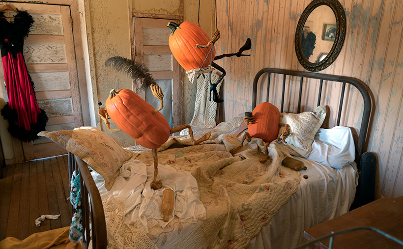
I’m pleased that you joined us on this month’s spooky adventure. Stick close together unless you fancy being spirited away by one of Vulture City’s resident phantoms who takes on pumpkins’ color and shape. We’ll return next week with stories of the mine’s beginnings and how one man was responsible for a town’s creation. If you want to search this week’s image closely for ghostly apparitions, visit my website (Jim’s web link) or the Fine Art America page I made for it (FAA link). Don’t go near the pumpkins—they’re cute, but bite your face off.

Till next time
jw

Techniques: The Soft Glow of Overcast Skies—A Detail Photographer’s Dream

Capturing minute details in photography often feels like trying to corral a greased pig—you think you’ve snagged the perfect shot, only for the little nuances to elude you. But here’s where the misunderstood overcast sky swoops in like a caped crusader. Acting as nature’s softbox, it scatters sunlight to tone down harsh shadows and even out contrast, setting the stage for those intricate details to take the limelight—from the weather-worn wood of a rustic barn door to the delicate veins of an autumn leaf. However, be warned: while overcast light is your friend for showcasing detail, it can sometimes render textures like corrugated metal or rocky surfaces a bit flat. For those, a dash of direct sunlight might be the secret sauce to elevate the texture to center stage.

Think of overcast light as the sotto voce of the photographic world. It’s the quiet, unassuming tone that lets the content shine. Where bright, direct sunlight is the boastful tenor, belting out high notes and obscuring the subtler instruments, an overcast sky gently elevates the bassoons and cellos—the intricate details that offer richness and depth. This makes your subject the show’s star, allowing viewers to appreciate complexities they might otherwise overlook.

Of course, while overcast light provides a naturally diffused glow, you’ll still need to stay vigilant about your exposure settings. Cloudy skies can occasionally trick your camera’s metering system into underexposing the shot, making it appear gloomier than intended. A quick tweak to the exposure compensation can often rectify this, ensuring your details stand out crisply without veering into the realm of the overblown or washed-out.

BTW:

If you’re curious about our previous adventures, my new YouTube video on the Colorado Portfolio just went live. Feel free to take a gander.

Marble Memories: Tale of the Gadsden Hotel’s graceful stairs Picture of the Week - Douglas, Arizona

Marble Memories - Immerse yourself in the timeless elegance of the Gadsden Hotel's grand marble staircase, inviting you to step into a world of architectural splendor.
Marble Memories – Immerse yourself in the timeless elegance of the Gadsden Hotel’s grand marble staircase, inviting you to enter a world of architectural splendor.

Welcome to our wrap-up of May’s Orphan Photo Project. I hope you’ve been enjoying the show so far. This week’s episode takes us back to Cochise County and the border town of Douglas. Like several towns along our southern border, it has only a quarter of the population of its southern sibling—Agua Prieta. Unless you’re on a mission to score some cheap Kahlua, mescal, or prescription drugs, there are not many reasons to go to Douglas, but a stop at the iconic Gadsden Hotel is one of them.

Yes, I have uncovered another grand hotel from Arizona’s mining days—so indulge me. It was built at the turn of the 20th Century by mining corporations to satisfy old fat cats that traveled here to inspect the books. They couldn’t be expected to sleep in tents like the commoners they paid. These tycoons needed a place to smoke cigars and sip cognac while stuck in the wild.

The Gadsden Hotel’s architecture reflects the elegance and grandeur of the time, with its ornate facade and intricate details. It was designed to provide a luxurious experience for its guests, offering luxury accommodations, fine dining, and entertainment. It was among the first to provide in-room toilets, fresh air ventilation (yes, that sounds like open windows to me, too), and an elevator that stopped on each of its floors. Today, I’m not going to waste time gushing over this fabulous hotel; I’d rather gossip about some of its guests. That’s where all the fun is.

In the early 1900s, during the tumultuous Mexican Revolution, battles often spilled over into the border towns of Arizona. Douglas was no exception. One day, as the sounds of gunfire echoed through the streets, the guests of the Gadsden Hotel sought refuge on the rooftop to witness the spectacle. Among them was the notorious revolutionary leader, Pancho Villa.

In an audacious display of bravado, Villa rode his horse into the hotel and galloped up and down the magnificent staircase that graces the lobby. The clatter of hooves and the cheers of onlookers reverberated throughout the grand halls, creating an unforgettable moment in the hotel’s history.

Legend has it that the spirited Villa, with his characteristic wide-brimmed hat and commanding presence, left a lasting impression on the staff and guests who witnessed this daring act. It became a story that would be told and retold, forever etching Villa’s name into the annals of the Gadsden Hotel. Today’s Gadsden visitors still search for a legendary chip in the white marble.

You want to know what I think. I think Pancho got bored fighting with the Federalies in Agua Prieta and decided to take a break. He rode across the border to enjoy a frozen Margarita at the Gadsden bar—after all; it was May 5th. When the bartender tried to explain that the Margarita hadn’t been invented yet, Pancho went ballistic. He went outside and untied his horse— Siete Leguas—from the parking meter and road back inside in an attempt to trash the place. You know, rock stars. That’s what they do.

In the 1920s, famed radio evangelist Amy Semple McPherson captured the nation’s attention with her charismatic preaching and healing services. However, her life changed dramatically when she mysteriously disappeared from Los Angeles. Authorities launched a widespread search, and the public anxiously awaited any news of her whereabouts. Eventually, Amy reappeared in Douglas—of all places.

There were conflicting accounts and rumors surrounding Amy’s disappearance and reappearance. Some sources suggested that she was kidnapped and held for ransom, while others speculated that she had run off with a lover to a secluded location. According to her account, she claimed to have been abducted and held captive. My legal staff told me there is no historical evidence to put Amy inside the Gadsden, but after being released from the local hospital, where else would someone with all that wealth and fame stay—it certainly wasn’t the YWCA.

The Gadsden Hotel has welcomed several less controversial personalities throughout its history. Among them, aviator Amelia Earhart graced the hotel with her presence during her visits to Douglas in the 1930s. The iconic actor John Wayne frequented the Gadsden Hotel in Arizona. Presidents Franklin D. Roosevelt and Lyndon B. Johnson also left their mark on the hotel during their travels in the Southwest. These visits, spanning different eras, have contributed to the Gadsden’s rich history and enduring allure.

A Glimpse of Grandeur: The Gadsden Hotel's Captivating Facade - Behold the captivating exterior of the Gadsden Hotel, a timeless landmark that exudes elegance and preserves the rich history of Douglas, Arizona.
A Glimpse of Grandeur: The Gadsden Hotel’s Captivating Facade – Behold the captivating exterior of the Gadsden Hotel. This timeless landmark exudes elegance and preserves the rich history of Douglas, Arizona.

We hope you’ve enjoyed hearing the fascinating Arizona stories as we end our journey through May’s Orphan Photo Project. As usual, you can see the larger version of Marble Memories by following this link to the web page: (). As we bid farewell to the Gadsden Hotel, we invite you to join us next week when we embark on a new adventure. Until then, thank you for joining us on this journey, and Queen Anne and I can’t wait to share more with you soon.

Until next time
jw

Technique

Capturing the essence of Gadsden’s famous staircase presented a unique challenge. Instead of the typical head-on view, I wanted to emphasize the polished marble steps and the potential hazard they posed to Pancho Villa’s horse, Siete Leguas. To achieve this, I opted for a wide-angle lens and positioned myself low at the left side of the marble waterfall, shooting upwards towards the bank of stained glass windows. The dim lighting inside the Gadsden lobby required a higher ISO of 2500, and I stopped down the lens to f/6.3 to ensure everything was in focus. I captured a handheld shot at 1/15th of a second in the low light conditions. Remember to hold your breath to minimize camera shake in challenging situations like this.

Lowell Theater Lowell, Arizona

Lowell Theater - A Chevy flatbed truck parked at the Lowell Theater in southern Arizona.
Lowell Theater – A Chevy flatbed truck is parked outside the Lowell Theater in southern Arizona.

It was already well past lunch as we drove up Highway 80. Queen Anne’s all too familiar whining had begun, “I only had one meal today.” We were heading to Bisbee’s Copper Queen Hotel, where we could satiate our hunger. As we approached the Lavender Pit, I noticed an old Shell gas station in my peripheral vision. When I looked in the mirror, I saw that—not only was it real, but an old car was parked outside. That was enough catnip for me to slow the Buick and make a U-turn across four lanes of traffic. Lunch could wait.

When I turned onto Erie Street, I was surprised to see an entire block of old buildings with vehicles of the same period parked out front. Was I on a movie set, or had I died and gone to some photographer’s idea of heaven? I decided it had to be the former because I still heard Anne’s food grumbling in my ear. I was further confused by a wall sign saying, “Welcome to Lowell, Arizona.” I turned to Anne and announced, “We’re not in Bisbee anymore.”

Lowell is to Bisbee as Tempe is to Phoenix—a cling-on. Bisbee and Lowell were founded in the late 1800s as mining claims—Bisbee in the 1870s and Lowell in 1899. As the mines grew, they needed men to work them. Like every other mining town, the population lived first in tents, shacks, and finally, proper homes. Unlike the Tombstone mine, the ore at the Copper Queen Mine and Lowell Mine was so abundant that it supported the towns for over fifty years. That’s why these southern Arizona towns have masonry buildings instead of the rickety shanties of most ghost towns. Bisbee reminds me of the coal-mine towns in Pennsylvania or West Virginia.

As time passed, the Copper Queen (and Phelps Dodge) took over the operation of the Lowell Company. Underground mines are inherently dangerous, and there was so much copper ore still buried there that during the World Wars, it became economically feasible to build giant machines to scrape away mountains and dig big pits to extract the copper. Bisbee’s renowned scab in the ground is called the Lavender Pit—named for Harrison Horton Lavender (the mine superintendent). As the abyss grew, it took parts of Lowell with it. All that remains of Lowell today is Erie Street which runs from the traffic circle in the south and the pit’s edge on the north side.

Lavender Pit - The famous Lavender Pit mine where tons of copper ore was dug from the ground. The pit is so vast I couldn't fit it all in the frame, even with my wide angle lens.
Lavender Pit – The famous Lavender Pit mine where Phelps-Dodge dug tons of copper ore from the ground. The pit is so vast I couldn’t fit it all in the frame, even with my wide-angle lens.

A group of volunteers banded together and formed the Lowell Americana Project. They worked hard to restore and enhance the quarter-mile street and transform it into an open-air museum. Their hard work got them international attention for their cultural preservation. They have turned Erie street into one of the most photographed streets in the West. Like me, you’ve probably seen some of those pictures in magazines and films without knowing the location.

We’ll explore Lowell’s Erie Street in February, hopefully, to delight my car friends. I consider this week’s photo the foundation shot. It was taken at the north-end parking lot where I left Anne to starve while I skipped up and down the street taking pictures. In this shot, I wanted to show the theater marquee, the Gulf, and the Lowell welcome sign. As an additional no-extra-cost bonus, the town thru in a Chevrolet flatbed truck. I don’t know what year it is, so perhaps one of you gearheads can tell us. I also have no idea about the flying saucers. I didn’t find a reference to any abductions in the area, although more aliens visit Arizona than any other place. They like the weather here—especially at Bisbee’s mile-high altitude. Maybe the spaceships are a warning that you’re about to enter The Twilight Zone.

You can see a larger version of Lowell Theater on its Webpage by clicking here. We’ll begin our walk down Erie Street next week to see what we can find. Be sure to come back then.

Till next time
jw

BTW:

No Queen Annes were harmed in the making of this article. She finally got her lunch and a glass of wine before she fell asleep as we drove back to the motel.

Courthouse Yard The Town Too Tough to Die

Courthouse Yard - The tall brick wall surrounding the Tombstone Courthouse yard conceal the gallows within them
Courthouse Yard – The tall brick wall surrounding the Tombstone Courthouse yard conceals the gallows within them

Whenever I visit Tombstone, it takes me a while to get oriented. But when I see a town map, I understand why. Unlike most communities established in the Mormon Territory of Deseret, the streets aren’t aligned to the compass points and aren’t centered on an intersection named Central and Main. Instead, the town is 45° off the compass; there’s no Central Avenue, and Allen Street substitutes for Main Street. Given Tombstone’s distance from Salt Lake City and its rough and tumble history, I don’t suspect its citizens weren’t concerned about religions.

When I visit the “Town Too Tough to Die,” I consider the OK Corral its social and geographical heart. As I stand on the corner of 3rd Street and Allen and look the town over, I see the streets lined with one and two-story old wooden buildings. They’re either painted in bright colors or left in their natural dull brown finish. The only exception is a block southwest on 3rd Street. There you’ll see a large two-story brick building trimmed on each of its angles with white stones. On top is a cupola festooned with a widows-walk. The first time you see this pearl before the swine, you instantly know it must be important. It was—is. It’s the original Cochise County Courthouse.

It only took five years from the silver find to the OK Corral gunfight. In that brief time, the population swelled to 7,000, and robberies and lawlessness ran rampant. Wikipedia notes, “Except for the Earp–Clanton feud, which gave Tombstone an extremely bad press—from which it has no interest in recovering—citizens gladly accepted the proffered alternative.” The townspeople wanted a change. More importantly, miners had to make a two-day journey to Tucson to file a new claim. In 1881 two historical events happened; the shootout and the state legislature carved Cochise County out of Pima and made Tombstone its seat. The irony of those events and building the courthouse a block away from the Corral the next year isn’t lost on me.

By 1929 the silver played out, and Bisbee became the next boom town. The copper strike there required more men to work the mine. With a larger population, Bisbee won the county seat in an election, and the government offices moved 25 miles down the road. The old courthouse sat empty between 1931 and 1955. That’s when the local historical society took an interest in it. They began restoring and lobbying using local contributions until the Arizona legislature declared it an Arizona State Park.

In this week’s featured image, I call Courthouse Yard, I tried to capture the gingerbread and grandeur of the red-brick building, but I wanted to emphasize the wall surrounding the side yard. Inside those enclosures is where convicted murderers met justice at the gallows. The first hangings were the perpetrators of the Bisbee Massacre in 1883, while the last was the two men that killed a sheriff and deputy at the Wilson Ranch Shootout in 1899. The tall brick walls were designed to shield the gentle public from the gruesome hangings, but most of the town went inside and watched through the second-floor windows anyway. Incidentally, I like the foreboding clouds hanging above the courthouse.

You can see a larger version of Courthouse Yard on its Webpage by clicking here. I hope you’ll join us next week when we tell another thrilling tale from yesteryear in Tombstone.

Till next time
jw

BTW:

We’re planning to visit Temecula, California, wine country, in the upcoming weeks. I hope to bring home a bottle or two along with the pictures and stories we gather.

Gunfighters The Town Too Tough To Die

Gunfighters - Actors dressed in Earp costumes try to stay warm on Allen Street while they coax visitors to come see the 3:00 pm show.
Gunfighters – Actors dressed in Earp costumes try to stay warm on Allen Street while coaxing visitors to see the 3:00 pm show.

Ghost towns in Arizona are a dime a dozen. There are enough of them to fill a book. I know because I currently have five of them sitting on my shelves. The morphing of a city into a ghost town follows a familiar pattern. It starts with some loony prospector finding a valuable mineral—gold, silver, copper, diamonds, or another precious stone. News of the bonanza spreads quickly and lures a gaggle of opportunistic people. Half of them want to get rich by picking nuggets from the ground, and the rest want to pick them from someone’s pockets.

A new town springs from the ground like a children’s pop-up book. More people settled in the town and either got jobs at the mine or open shops that every mining community needed, like bars, gambling halls, and whore houses. Eventually—in a year, a decade, or a century—the gold (or whatever) pans out. The excitement of living in a mining town slowly dies, and its residents move on to the next boom town. Mother Nature reclaims the land without caretakers; all that remains is a pile of rotting wood, some foundations, and the eerie spirit of ghosts.

Of course, there are exceptions to my rule. In a handful of cases, when the mine goes bust, its residents look around and say to themselves, “This is a great place to live.” They find other sources of income. I call these places amusement communities. Examples that come to mind include Oatman, Jerome, Bisbee, Bagdad, Clifton, and Tombstone.

Of those locations, Tombstone is the odd duck. There are no gaping open pits to gawk at, historic hotels, or James Beard-worthy restaurants. I suspect that most of its visitors don’t even know about the silver mine. That’s because the silver vein wasn’t gigantic, and that’s how it got the name Goodenough Silver Mine. A gunfight between the Earps and the Clantons secured Tombstone’s historical spot. If it weren’t for that singular gang fight, Tombstone—’The town too tough to die’—would be a pile of splinters by now.

Don’t get me wrong; there is a list of exciting things to see in Tombstone. It was the Cochise County seat for a while, so there’s the old courthouse (with its gallows patio), the Crystal Palace back bar, the world’s largest dead rose bush, and the Birdcage theater should be on everyone’s checklist. Of course, if you have the time and money, you should see the show at the OK Coral, but realize that the actual gunfight was on Highway 80—behind the Coral.

I took this week’s photo on a cold, windy December afternoon. We had checked into our motel and started into town before the light faded. Standing in the middle of Allen Street (dirt, then paved until the street department poured dirt over it again—for authenticity) were four gunfighters dressed in black wearing badges. They tried to stay warm while they hawked visitors to the 3:00 pm show. I don’t know how successful they were because the streets were empty as people sheltered inside the bars. I titled this shot Gunfighters.

You can see a larger version of Gunfighters on its Webpage by clicking here. I hope you’ll join Queen Anne and me throughout January as we show some of the exciting Tombstone scenes we found.

Till next time
jw

BTW:

Queen Anne and I are working on our calendar for the year. We’re putting together a list of places we’d like to visit and this year’s book topics. If you have any requests, let us know in the comments section.

Adobe Ruin Picture of the Week

Adobe Ruins - In the ghost town of Dos Cabezas, most of the remaining buildings are severely decayed.
Adobe Ruins – In the ghost town of Dos Cabezas, most of the remaining buildings are in a severe state of decay.

Roughly midway between Willcox and the Chiricahua National Monument, the county highway’s speed limit drops to 45 mph. At first, there’s no clue about the slowdown until a small sign announces that you’re entering the town of Dos Cabezas. Only three of its dozen or so buildings are worthy of occupancy. The rest are in various states of decay. It’s only a city block long, and you soon return to an empty country road, where you can reset the cruise control.

After driving through Dos Cabezas three times, I insisted on stopping on our fourth pass. As regular readers know, I’m a sucker for historic buildings, whether they’re restored or about to be blown down by the wind. I’m glad that I did, and this week’s featured shot is one of several that I captured during that afternoon.

As with most Arizona ghost towns, Dos Cabezas’s history is a flash of glory followed by a long decay period. The town is located at the southeastern reach of the mountain range, which shares the same name. When word came out that prospectors discovered gold and silver on the mountain, miners swooped in like hungry vultures to feed on a carcass. The Feds opened a Post Office in 1878, which served a population of 300 that eventually swelled to over 4000. They found little gold in the Elma mine, but there were some copper deposits. Investment capital dried up when investors discovered that the mine was a scam and part of stock fraud. People left to find work elsewhere. As the town dwindled, the Post Office finally closed its branch in 1960. I guess that you could count today’s Dos Cabezas citizens on one of your hands.

In this picture that I call Adobe Ruin, you see the remains of a large building constructed using adobe bricks and stucco. The town once had a hotel, and these sections may be all that’s left of it. Adobe was a common building material throughout the old southwest because it was simple to make. All you need is to combine mud and straw and let it dry in the sun. The thick bricks provide plenty of protection from the desert heat and cold winters, but they quickly erode once water enters them.

I took several variations of the building, but I favored this one because I liked the mud stains streaking down the wall, and I liked the wall’s placement before the background’s two-headed mountain. The desert willow and hackberry show how soon nature reclaims her own. Ashes to ashes, as it were.

You can see a larger version of Adobe Ruin on its Web Page by clicking here. Next week, we’ll walk down the street to look at another of the Dos Cabezas ruins. Come back then and have a look.

Till Next Time
jw

Verde Limestone Picture of the Week

For centuries the Verde River Valley has been a peaceful home for many peoples. It makes sense because the Verde River flows year-round, even in times of drought—as we have now. The green waters of the Verde—Spanish for green—flow between the Black Hills (Mingus Mountain) on its south-west flank and the Mogollon Rim to the north-east. The river runs from Chino Valley to Fountain Hills—170 miles. It collects the runoff water from the rim via its tributaries like Sycamore Creek, Oak Creek, Beaver Creek, and West Clear Creek. Although the river bottom is a dense cottonwood forest, its flood plains are perfect for growing corn and squash.

There are many sites of early inhabitants along its length, but the best known is the pueblo of Tuzigoot—built by the Sinagua people in the 10th century. They only lived there for a couple of centuries before moving on. The next settlers to arrive were Apaches—Canadian migrants that were chased off the plains by the Sioux. The various bands of Apache established homes along the transition zones across Arizona and New Mexico. They weren’t aware that their new landlords were the Spanish, who were mostly interested in saving their souls and stealing their gold. For the next 300 years, life in the Verde River Valley was peaceful.

Then one day, in 1821, there was a knock on the door—er, teepee flap. It was a government man. He was there to inform one and all that they were Mexican citizens now and, by the way, do you have money to chip in for our new country?

After that, things began to happen fast, and life seemed to go downhill quickly. A mere 30 years went by when another man rode up on a horse, shook a bunch of hands, handed out flyers, and declared, “Welcome to America.” The very next year, Californians discovered gold, and easterners clogged up the trails rushing to get to it. Some got rich, but most of them didn’t get to the Golden State in time, so they made their way back and decided that our valley would be an excellent spot for a farm. There was a civil war going on back home anyway, so they moved into the neighborhood. The Apache’s homeland began to shrink.

In 1864, the Americans stuck a flag in the ground and called it Fort Whipple—the Arizona Territorial capital. The next year they moved the flag from Chino Valley to a mining camp on Granite Creek. The Army stationed cavalry troops to protect the miners, and that later became the town of Prescott.

Life was tense, but there was an uneasy truce between the tribes and the new settlers until those mangy miners started working the Verde Valley. They picked at the rocks, piled dirt everywhere, muddied the water, ate all the food, and drank all the whiskey. It was the straw that broke the Gila monster’s back, and the Apache tribes declared war—Yavapai War (1871-1875). That’s the precursor of General George Crook’s assignment to Fort Whipple and his trail to Fort Apache that we began exploring last week.

Verde Limestone - A limestone ledge in the Verde River Valley in the lovely light of the evening sun.
Verde Limestone – A limestone ledge in the Verde River Valley shines in the lovely light of the evening sun.

This week, we traveled east along the Verde River for a few miles and stopped near Dry Beaver Creek to photograph a limestone formation. They’re found throughout the valley and are most evident on the river’s north side. As you travel Interstate 17 towards Flagstaff, it’s the white layer between the Verde River and Sedona. Limestone forms in shallow seas from dead shells and bones. It’s a great place to look for fossils, and coincidently one of our planned stops was to be Fossil Creek, but it was closed due to COVID 19.

This week’s featured image—called Verde Limestone—shows a ledge exposed by years of erosion. For balance, I included the lower mound of the same compound shining in the lovely evening sunlight.

You can see a larger version of Verde Limestone on its Web Page by clicking here. Be sure to come back next week as we climb out of the Verde Valley and see what we found along the General Crook Trail.

Until next time — jw