It’s November already. Time passes so fast that the remaining hair on my head flutters behind me like a streamer in the wind. To make things worse, the landlord turned off the heat. Here in the foothills, we had a couple of mornings in the high 30s, and Queen Anne insisted on sleeping with the bedroom window open. When I got up, I was invisible, standing in front of the blue accent wall—nothing but a pair of whitey tighties and chattering teeth floating through space. This cold front is supposed to move out later this week, so I’ve resisted turning on the heater. Instead, we throw back the curtains, put on heavier sweaters, and shiver till noon.
With the new month, we started a new project and didn’t have to travel far to get to it. It’s the housing development across the street. The street is Highway U.S. 89, and the development is Wupatki National Monument. Wupatki shares the access road and visitor’s center with Sunset Crater National Monument—they’re conjoined twins. During this year’s fire season, the fires closed the 35-mile park road at the crater, but Wupatki remained open because it’s north and out of danger.
Wupatki is at the base of one of the Navajo’s four sacred mountains: Flagstaff’s San Francisco Peaks, Mount Taylor in New Mexico, Hesperus Mountain near Durango, and Blanca Peak outside of Alamosa. The Dine’ considers the area with these mountains their home. But, long before the tribe moved from central Canada, Pueblo Indians lived here. They left behind stone homes along the Colorado Plateau: from Wupatki to Chaco Canyon and Mesa Verde south to Walnut Canyon.
Most Americans consider Mesa Verde National Park the most extensive collection of pueblo ruins, but Wupatki is its match. In some areas, our National Monument exceeds the Colorado Park in the number of dwellings per square mile. When you visit the monument, the maps direct you to displays unearthed and restored by archeologists that you can walk through and hear thousand-year-old ghosts. As you drive to these exhibits, keep your eyes peeled because you’ll see piles of rocks in the fields and on hilltops. These are not natural clumps of stones but more ruins that the scientists haven’t yet examined. These areas are set aside for future paleontologists to examine using more advanced tools.
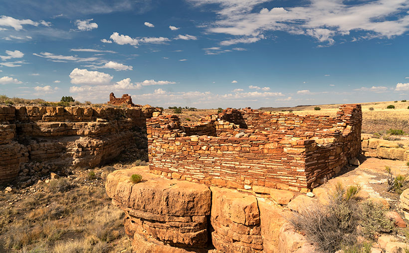
There are so many ruins in Wupatki to enjoy I can’t cover them all in one month. For November, we’re only covering a half-mile hike called Box Canyon. In that short distance, you pass three ruins along the way to the main exhibit—Lomaki. This week’s picture is of a pair of stone buildings standing on the cliffs of Box Canyon. As I walked along the paved trail on a warm summer afternoon, I stopped at each ruin, photographing what I saw. The path led up a gentle slope from the parking area, past the first ruin. From there, I could see the second dwelling on the other side of the canyon, so I continued along the trail. I could have spent the rest of my time shooting these two, but when I reached this spot, I could see Lomaki, which is more prominent with even more rooms. I quickly framed this scene and moved on to the big show.
I chose this image to start this month’s project because it shows the proximity of the two ruins along the canyon walls and how they rise above the grasslands. I assume different families occupied them. There’s enough space for privacy, but they’re close enough to provide mutual protection and borrow the neighbor’s lawn mower.
You can see a larger version of Box Canyon on its Webpage by clicking here. Next week, we’ll walk up to Lomaki and spend some time there. Come back then for another episode of This Old House. I’ll leave the light on for you.
Till next time
Jw
BTW:
Don’t forget to get your calendar order in before the cut-off on the 15th.

Looking forward to more of these shots!
4 calendars please.
OK, you’re on my list – jw