Dawson Creek – British Columbia

We’ve been on the road seventeen days with 2600 miles on the odometer when we arrived at Dawson Creek yesterday (Friday; it’s scotch night). Dawson Creek is an important stop on our trip.

  • It’s our first stop in British Columbia.
  • The weather is warmer than we’ve had the last few days.
  • This completes the first section of Fred’s itinerary.

The most important reason though, is that Dawson Creek is where we pick up the famous Alaska Highway. As Fred said this afternoon, “We’ve come all this way just to get to the start.”  If you want to drive to Alaska, this is the road that will get you there. Fairbanks is at the other end of this road, only 1500 miles away.

Gang under ALCAN Highway sign,
Fred, Sally, Deb, Anne and Jim take a moment to pose for photos under the highway banner.

The Army Corps of Engineers built the road in 1942 in eight months for military purposes during the second world war. The public didn’t have access to the road until 1948 and it wasn’t paved until the Alaska pipeline was built. Now the road’s covered with RVs. There’s a thriving cottage industry shepherding caravans of RVs on the same route that we’re taking.

Class A motoromes from a guided caravan.
A small part of a RV Caravan sharing the same campsite with us. Our paths cross often as we move from park to park.

A couple of days ago, I was afraid that we wouldn’t get into Dawson Creek. Last week they had torrential rains that dumped over four inches of rain in the area. The creek that runs through the middle of town (surprise, it’s also called Dawson Creek) cut the town in half by washing out the main road. Within three days, crews patched the roads enough to get traffic flowing again.

Damage on the Dawson Creek Broidge.
Only a couple of days before we arrived in Dawson Creek, over four inches of rain caused flooding on Dawson Creek and closed the major road through town.

We’ve now cleared the Canadian Rockies and the countryside is flatter, with farms and lots of timber. The towns are further apart, but they have all the franchises you’d expect at home. We even passed a Costco yesterday in Grand Prairie, which is something that we rarely do.

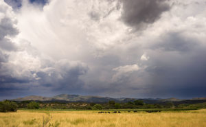
The geography of our route has changed from mountains to prairie as we pick up the ALCAN Highway.

Tomorrow morning we strike out for Fort Nelson. A leg that’s close to three hundred miles or 450km. Although the road is famous, it gets bad reviews for its condition. We’ll batten down the hatches and suffer through it, because now we’ve made a turn and are on our way to Alaska.

jw

Hinton – Alberta

At the end of each day, we normally relax around the campfire to unwind, review the day’s adventures and plan tomorrow’s events. So, what happens when the Alberta winds drive you inside? Simple . . . we gather five people into a trailer meant for two and have a happy hour. A candle is the token campfire.

The gang discusses pans durning happy hour.
Sally, Fred, Jim and Deb (Anne’s behind the camera) convene around the candle campfire to review tomorrow’s plans.

jw

Jasper National Park – Alberta

After a day of driving through Canada’s Jasper National Park, we’ve made camp at the edge of Alberta’s windy prairie. We’re in the little town of Hinton where we will spend an extra day so we can restock, do laundry and a little maintenance. Tomorrow we will continue our trek north to Dawson Creek (no, I don’t think it’s the TV show one).

Yesterday’s journey was a cold one. A weather front moving through was supposed to clear but didn’t. So we were blessed with low clouds, rain and even a bit of snow. We left Lake Louise in near freezing temperatures which never rose much until we came down from the mountains.

Highway 93 traverses the park and is called The Icefield Parkway, and for good reason. On a clear day the drive must be breath-taking judging from the limited visibility of the low clouds we experienced. The road along glacial valleys connected by a couple of 6,500 ft passes. Each side of the road is lined with 9-12 thousand foot mountains which we only saw their massive feet lined up one after another.

People on the Bow Summit overlook
Dozens of visitors jockey for a spot to take pictures along the rail at Bow Summit.

At the first pass, Bow Summit, we stopped for the roadside exhibition and walked up the trail to the overlook. I’ve already used the term ‘breathtaking’ in this post, but there isn’t another word for this hike. Starting from the 6500 ft elevation at the parking lot, the trail went straight up another 500 feet. Halfway through we were both panting and considered blowing off the hike, but we were encouraged on by returning hikers. Finally at the summit platform, several dozen people jockeyed for space at the rail to snap a shot of Peyto Lake below, followed by a selfie and then a video. Giving up all attempts at being polite, I had to fight for my turn at the rail. You would have thought it was Macy’s the day after Christmas. Even that spot wasn’t good enough for some, because there were people over the rail stacked at the cliff face taking pictures.

Peyto Lake from Bow Summit
The azure waters of Peyto Lake are beautiful, even on a cloudy day.

After recovering from the madhouse, we continued the drive until we reached the second pass and the Columbia Icefield Center where we stopped for lunch. Again, I think half the world had left home to congregate in that building. There were three lunch choices. The empty buffet room that was reserved for incoming tour buses, the cafeteria with a line out the door and down the stairs, or the snack bar, which we chose for a bowl of chicken noodle soup (industrial Progreso) and a cold sandwich.

Anne in front of a stuffed bear.
Queen Anne always has a special place for men in a uniform.

The Icefield Center has the usual shops, food, displays, and information booths, but here, for $80 (CDN), you can buy a bus ticket for a trip onto the Athabasca Glacier. The buses are special all wheel drive with six axles and people were lining up by the hundreds to give away their money. It was like people wanted a chance to touch a glacier before they all disappeared.

Athabasca Glacier on a snowy day.
Tourist pay to ride ‘the special bus’ (the boxes visible on the glacier) onto the Athabasca Glacier at the Columbia Icefield Center.

By the time we finished lunch, we were tired of the crowds and decided to just make a bee line for our destination. But we first had to stop to fill the tank on Baby; Sally’s motor-home, so we made a stop in the town of Jasper. As it turns out, Jasper is on a major railroad route and we had to wait for a train at the crossing. Canadian trains are very long and before the first on passed, a second came along going the other way. It was twenty minutes before the crossing guards let us through.

Finally, we were coming down off the mountain when we saw our first heard of bighorn sheep crossing the road. There were two small females accompanied by as many lambs. That was followed shortly by Fred spotting our first roadside moose, but not telling everyone because his Walkie-Talkie died. Then Fred (who is the wagon master of the trip) suddenly pulled to the road side and we all spotted two black bears at the edge of the trees. After being warned by my friend Jeff, I didn’t want to run over to get close-ups, but I was so excited that I forgot to get out my long zoom lens.

Two black bears along the road side.
Two black bears sighted along the road side in Jasper National Park.

In all, it was a long day for a relative short distance. Our normal travel days don’t have as many stops, but we didn’t want to miss the chance of enjoying Jasper National Park. At the end of the day, we gathered in our trailer and enjoyed a meal of brats and grilled onions with some grilled cantaloupe tossed in. But, that’s another post.

jw

Lake Louise – Alberta

Arriving at Lake Louise in Canada’s Banff National Park, we’ve now traveled north of the 51st parallel. In our first few camps, the first chore we did was to get the air conditioner going. At this camp, we’ve fired up the heater because of the night’s sub-freezing temperatures. To be fair, our camp elevation is above 5100 feet, so not all the drop in temperature is due to our northward migration.

Gang at the Lake View Lounge.
Anne, Deb, Fred and Sally stopped in the Lake View lounge for a glass of wine. One of Anne’s bucket list items as been fulfilled.

Lake Louise in Banff is spectacular. Although there are many larger lakes in the park, Louise’s size emphasizes how a glacier creates and then feeds the lake’s water system. With ten-thousand foot mountains towering above each side, the u-shaped valley is anchored by the aqua colored lake. Opposite the glacier sits the world-famous Fairmont Chateau Lake Louise Hotel. It has expensive rooms, expensive restaurants and expensive shops. Surrounding the hotel, thousands of tourist have come from around the world to snap selfies along the lakeside. A casino or two would make the scene perfect.

Red canoes in front of hotel.
Canoes are one of many way to explore Lake Louise.

This is the second Canadian National Park that we’ve visited so far and it seems that Canada manages them as luxury resorts and not a chance to commune with nature. Don’t get me wrong, there are plenty of trails into the back country and you’re free to climb the mountains, but you have to offer the initiative to do so. I’m glad that we got to experience the Canadian Rockies. They’re an awesome subject for a photographer.

Clouds on mountain tops.
After an afternoon shower, the clouds cover the mountain tops surrounding Lake Louise.

We’ll be spending another day here. Fred and I are going to throw fly lines at the Bow river this morning. Then since it’s Fred and Deb’s nineteenth anniversary, they’re going to try for a romantic window side table at the Fairmont’s swankiest restaurant. I’m sure that you’ll join us in wishing them congratulations. Meanwhile, the rest of us will be dining at Mickey D’s.

Tomorrow we head thru Jasper National Park on the Ice Field road before heading back down on the plains and a little town called Hinton. They have WiFi there and I won’t have to sit in the visitor’s center as I’m doing now. I’ll post more from there.

jw

Waterton Lakes NP, Alberta

I wanted to get off a short note this morning before we get on the road to Banff and show a couple of shots of yesterday’s park visit.

Waterton Lake and Rockies
From the Prince of Wales Hotel lawn, this is the view you enjoy of Waterton Lake and Canadian Rockies.

If you’ve never heard of the Alberta winds, here is your notice. The wind blows here most of the time. And I’m not talking puffy little breezes. The winds come down off of the mountains and on to the prairie and they really batter you. The last two nights in the Ritz felt like sleeping in a Lowe’s paint shaker. I’d compare them to our summer monsoons, but they last all day and night.

Lake Waterton and Mountains
This is the scenic view looking east from the Prince of Whales Hotel.

It’s time to start packing now, so I’ll close. As I said, we don’t expect WiFi for a couple of days, but I’ll post news if I’m wrong. On to Banff and Lake Louise.

jw

Oh Canada

We made the Canadian crossing after driving forty-five minutes from our last camp. Going through the Glacier/Waterton customs was an ordeal. We pulled our vehicles in line and waited to be summoned to the officer’s booth. Fred, being funny, told the guy to watch out for the tricky geezer behind him. He looked at our passports, asked us about guns and alcohol, why we were coming, and where we were coming from. Then he said, “You’re from Arizona! Where are your guns?” I told him that we must have left them in the bar.

After passing through customs we pulled over in the parking lot to take the obligatory pictures in front of signs. We shot one in front of the Waterton Lakes Park sign, one in front of the flags and then we walked back passed the customs booth to the roadside monument. We stood there chatting about how nicely they had mowed the border when a Canadian customs officer came out of the building to talk with us. He told us that the US Customs people called him to complain about the people wandering back and forth across the line. You’re not supposed to do that without going through customs. Then he asked if we’d like him to take our picture. After he did, he remarked that Canadians aren’t as anal as the US Customs people and we all had a good laugh.

Gang posing at the border
The gang lines up for a pose at the US/Canada border. The shot was taken by a Canadian Border Officer after scolding us about wander back and forth across the line.

After another twenty miles (I guess I should start reporting this in kilometers) we made it to a lovely little park at the north border of Waterton Lakes National Park. Our hostess, Kristin explained all about the park and what to do about the bears should they happen by. I told her to stop teasing us about that because there are no bears here . . . well as far as we could tell. Then I complemented her on her English. She laughed and said that she was from Tennessee.

Fred poses in waders.
Fred poses for the cameras in his new Wall-Mart waders.

After setting up camp, we drove north to the little town of Pincher Creek to get supplies at the Wall-Mart. Once you drive away from the Rockies, the countryside reminds me of eastern Kansas with low rolling green hills and red barn farms. In Wall-Mart Fred and I checked out waders. He found a set, but there weren’t any in my size. Anne asked a clerk where the wine was and the woman said, “Oh honey, you’re not from Canada are you dear?”  So off we went to find one of the two liquor stores and in the process lost Fred and Deb. Don’t worry, they found their way back to camp.

Today we plan on exploring Waterton Lakes Park. Maybe we may see some bears there. We plan on leaving for three days in Banff National Park 200 miles north of here. The campground we picked out doesn’t have WiFi so the Blog may be dark for a while. If I can’t find a way to publish, I’ll save the good stories for when we’re back on-line.

jw

St Mary, Montana

It’s the beginning of our second week of travel and today was the first time we didn’t have clear skies. In Columbia Falls yesterday, the temperature was in the high 90s before afternoon thunderstorms dropped some light rain. Today the storms have been building all day.

We made the drive around the south flank of Glacier Park and got to St Mary in the early afternoon, and that’s even stopping at the goat lick and lunch (it’s not the name of a restaurant, they’re different places). We had to move so we could see Glacier’s east side. As I wrote earlier, the Going to the Sun Road is still covered in snow.

Goats at the salt lick
Mountain goats migrate from the high cliffs down to a salt deposit along the Flathead River.

The goat lick is kind of cool. There is a turn out near the south-west corner of the park where you can see mountain goats if you’re lucky. They come down from the high mountains to a spot above a fork of the Flathead River where there are salt deposits. The last time Anne and I stopped, there were about a dozen, but there were only three today. Since they’re on the other side of the river, they’re over a mile away in the shot I made with my telephoto lens.

Storm over St Mary Lake
Afternoon thunderstorms create a dark mood in Glacier National Park.

After setting up camp, we piled in the car and drove up the east side of the Going to the Sun Road. That’s when the thunderstorms really developed. As moist air moves in from the west, the Rockies wring a lot of that water out before moving out to the dry prairie. With thunder echoing off of the mountains while rain and hail bounced off of Fritz, the park was showing off a different face.

Two mountain peaks in rain clouds
Behind a grove of burnt evergreens, two Glacier peaks are obscured by rain clouds.

We’re going to stay here for another day then move across the border to Waterton Lakes National Park in Canada. It’s part of the Glacier Eco system and is called the International Peace Park. Besides, Fred and I have to see if we can catch something that moves.

jw