I woke this morning with the lyrics of a thirty-nine-year-old song running through my head:
Just like the white-winged dove
Sings a song
Sounds like she’s singing
Who who who
Just like the white-winged dove
Sings a song
Sounds like she’s singing
Oh baby oh said oh
Edge of Seventeen—Stevie Nicks
When I opened my eyes, I knew why. Perched on the trellis outside of our bedroom window was an African Dove trying to entice some lady dove—any lady dove—to have sex with him in our bedroom. I know it’s true because his caterwauling went on for a while before he flew right into the window, leaving a dust print of his body on the glass. “Oh crap, I just cleaned that,” I griped. Anne replied, “Zzzzzznxxx,” so I got up.
I miss the mourning doves. They were the ones you most saw in Arizona. Around the turn of the millennia, these invasive replacements started showing up and pushed out our natives. They’re slightly bigger with a black collar on their neck. I admired the colors of the native doves so much that I tried to match the blue-brown taupe hues on my office walls. These foreigners are just Army-Jacket brown. Their songs aren’t right either. The mourning doves song (ooo-ahh, oo, oo, oo) had a profound sadness to it, whereas the outsider seems rushed. And what’s with their Kamikaze dive-bombing scream? They sound like Ninja Stukas attacking every female passing through his territory. It’s no wonder that the women fly off so quickly. It’s like men slapping their car sides and yelling, “Hey babe, wanna’ ride?” (Not that I know anything about that, but it never worked for me either.)
I know that my criticisms are the literary equivalent of running out on the porch and yelling, “Get off my lawn,” to no one in particular. Maybe I’ve reached a new milestone, and I’ve become Old Uncle Jim, who starts every sentence with, “Back in my day …” I doubt it. I think it’s just spring, and like everybody else, I want to get out and enjoy the world without feeling guilty. I hate spring fever this year.
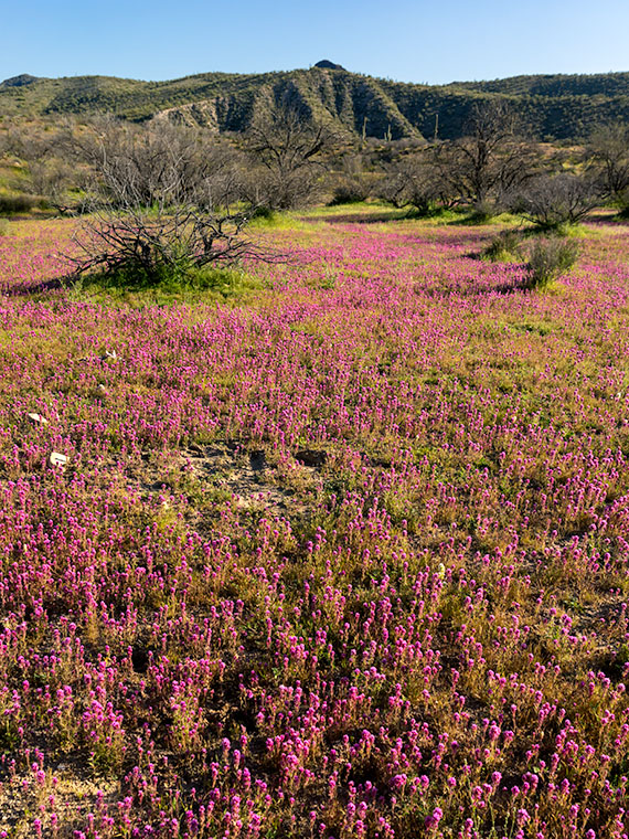
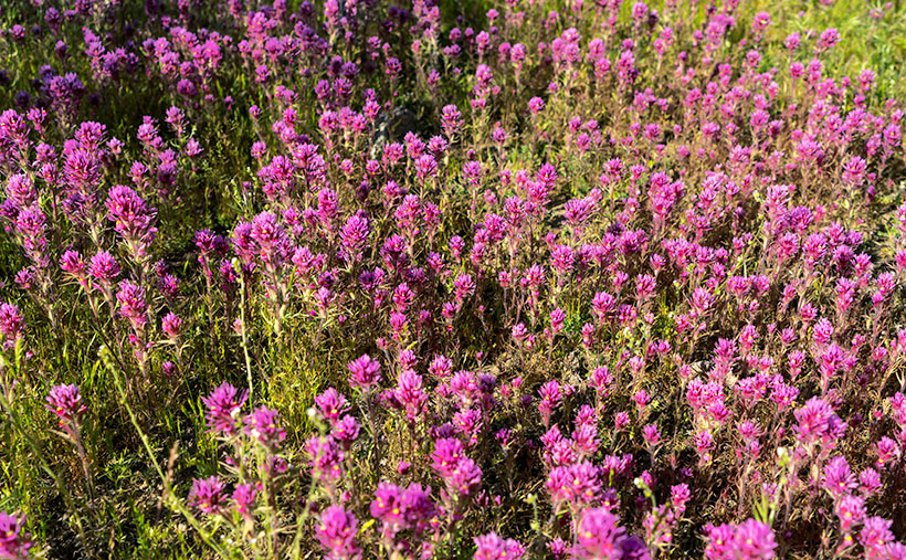
Speaking of spring, how about this week’s picture? I call it Box Canyon Spring. I took this down at the Hassayampa River Box Canyon area. That’s where the river, which generally runs beneath its sandy bottom, has cut a path through a gorge. On our outing this month, I noticed this scene on our way out and stopped on our return because the light was better. I also had to hike a mile down a convenient old mine road to get a better composition—and you thought there was no exercise in photography. Anne stayed in the car while I enjoyed the colors and sounds of the late afternoon. On my return—as I got close to the truck—Anne yelled out the window, “Hey babe, you wanna ride?”
You can see a larger version of Box Canyon Spring on its Web Page by clicking here. I hope you enjoy it. Come back next week when we continue with our illicit trip to Wickenburg’s Scenic Loop.
Until next time — jw