This month’s photo topic is Castle Hot Springs Road—part of my long-term project of getting off the highways to explore Arizona’s back roads. My only restriction is that the roads are accessible by regular passenger cars. That’s because I don’t want to buy some dune buggy for the project (Actual Read: Queen Anne won’t let me buy one).
Since I live on its west, Castle Hot Springs Road starts in Morristown at its junction with U.S. Highway 60—Grand Avenue. It loops northeast from Arizona State Route 74—which we always called Carefree Highway, but I see that it’s officially listed as Morristown-New River Highway—past the Wickenburg Mountains into the Buckhorn Range before it returns to SR 74 via the bed of Castle Creek through the Hieroglyphic Mountains. Its length is less than thirty-five miles, and you can use a pick-up truck because most of it is well-graded and broad. Its roughest section is on the east side, the several miles between Lake Pleasant and the resort, because it travels in the creek bottom. So, if you want to drive your Lamborghini to the Castle Hot Springs resort, take the clockwise direction from Morristown.
As I’ve said through the years, people build highways from roads, roads on trails, and trails from paths, so you shouldn’t be surprised that some of the Castle Hot Springs Road originated from the Wickenburg stagecoach route. “Why travel through the mountains when there’s a straight shot across the desert floor?” you may ask. Remember, stages needed water for both passengers and horses. The trip took all day at best. On the west side, some parts of the original stagecoach road remain, and you can drive them, but you need an ATV or Jeep for that.

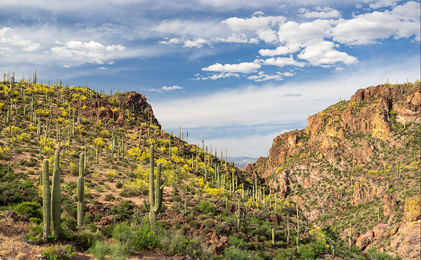
This week’s image comes from the road’s west section, a mile up the road from last week’s photo. On the north side of the mountain seen in that photo, Rincon Spring feeds a runoff called AD Wash—there’s no reference to what the name means, even in my trusty Arizona Place Names. The wash drains the local mountain and feeds the Layton tank before it turns and flows through a canyon between the hills. On the other side, AD Wash drops a couple hundred feet into Castle Creek.
When I shot this photo, I wanted to capture the saguaro grove against the canyon’s jagged edges in the late afternoon light. When I saw it on my computer, I was pleased with the paloverde in bloom and the blue streak running through the cloudy sky. For those unfamiliar with our Sonoran Desert, the saguaros in this photo range from 40 to 60 feet tall, and that should help set a sense of scale to what you’re viewing.
You can see a larger version of AD Wash Gap on its Web Page by clicking here. Be sure to return next week when we see another beautiful stop I made on my Castle Hot Spring Road outing.
Until next time — jw
